The Mountains of Arizona
• www.surgent.net
|
| Woolsey Peak |
• Highpoint: Gila Bend Mountains • Woolsey Peak Wilderness • Maricopa County |
|
Date: December 5, 2007
• Elevation: 3,171 feet
• Prominence: 2,081 feet
• Distance: 6 miles
• Time: 4 hours and 30 minutes
• Gain: 1,990 feet
• Conditions: Cold and humid with low ground fog and misty skies
Arizona
•
Main
•
AZ P1K
•
PB
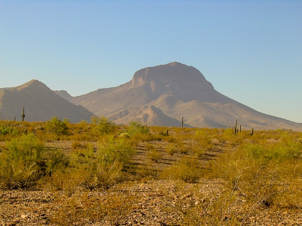
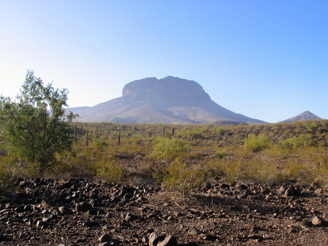
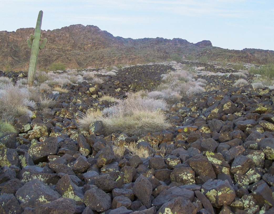
Woolsey Peak is an imposing dome-shaped summit in the Gila Bend Mountains north of Gila Bend. Viewed up close, the summit is surrounded by cliffs on nearly all sides, and below that, an apron of black basaltic rocks set at its angle of repose. It looks like a tough mountain to scale, but some low-class-3 routes exist that thread through the cliffs. Still, it's an exciting, slightly intimidating mountain to contemplate.
Woolsey Peak is the centerpiece of the Woolsey Peak Wilderness, which covers 64,000 acres. The roads to it are primitive and require 4-wheel drive, and relatively few people come here, given its proximity to Phoenix. I was here a year ago, trying my luck with Woolsey Peak. However, on that attempt, I spent more time battling bad roads than actual hiking. Behind on time, I bailed and chalked this effort up as a learning experience. Being so close to home, I was not too disappointed.
I had a day open from teaching, so I decided to drive back and attempt Woolsey Peak again. Wiser now regarding the route, I knew what to do and what not to do. I left home before sunrise and drove to Gila Bend via Maricopa and State Route AZ-238, arriving at dawn. I then followed Old US-80 north, driving across an old relic truss bridge spanning the Gila River at the Gillespie Dam. Soon after, I left pavement, turning left onto Agua Caliente Road.
A year ago, I aimed more for the south, intending to hike the peak from the east via a long ridge from that way, but the roads were brutal. This time, I aimed more to the southwest, and intended to climb the peak from a northwest angle. The roads to the Wilderness were rough, including one nasty stretch through an arroyo that definitely need 4-wheel drive and involved some uncomfortable leans. I parked at a point north of the peak, where a secondary road veers south. The map shows a spot elevation of 1,180 feet here, and I had driven 6.8 miles from Agua Caliente Road.
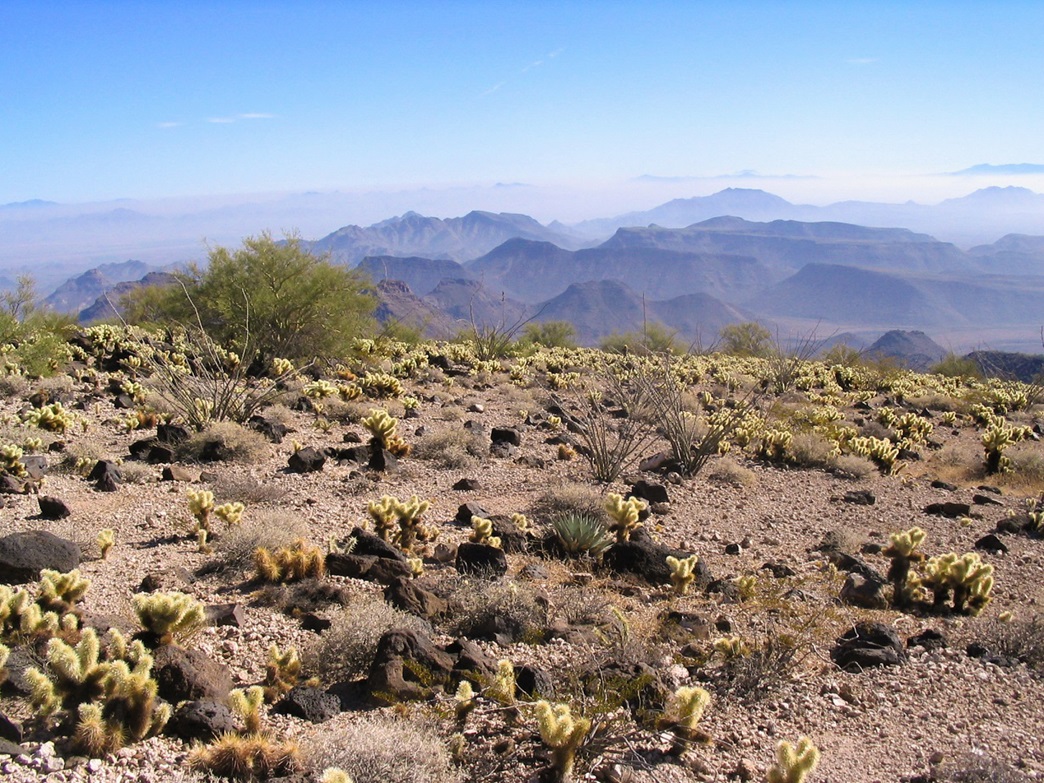
The morning was cool and humid, even foggy, which is rare for the desert. I parked and sized up my task. All I could see was steep slopes of basketball-sized basalt boulders, saguaro cactus, and a pallisade of cliffs. I started walking south on this secondary road, not entirely sure I had even a sporting chance at success. I figured I would get part way up, then hit a wall. I hoped for the best and kept walking.
I walked to the end of the road near spot elevation 1,366, then veered off-road on a slight southwest bearing, aiming for the slope and a saddle formed between Woolsey Peak and its lower neighbor, a pointed 2,030-foot peak to the northwest. By now I was on the rocks, and tending each step carefully. The rocks were usually solid, but a few moved. I also had to descend into one large drainage. I followed my nose and hiked the path of least resistance until I was now above the saddle and on the proper slopes directly below Woolsey Peak.
I took a break here and assessed the situation. Looking up, the black rocks seemed to naturally constrain toward a point below the cliffs, where I could make out openings. This was promising. I moved carefully up the rocks, then gradually transitioned onto the lower cliffs and ledges. The climbing to here was steep, but it went fast. Every time I turned around, that 2,030-foot peak was lower down, which made me feel good. I took a break at about the 2,700-foot level.
Moving again, I found a very scant trail, but definitely a trail. It was helpful in the general sense, in that there really was no other sensible route, but at least it suggested others have been this way. Sections were covered in loose foot-long boulders so I moved across these portions carefully. I didn't look down much, but when I did, I was surprised how steep and visually exposed this had all become, although the actual hiking and scrambling so far was safe. Exposure to a fall was minimal. I was also trying to memorize landmarks for the descent.
Still low in the cliffs, I came upon rocks that had been splashed with white paint (?). When I got to them it looked like a dried caked-on powder. It didn't look natural. Was this a past visitor's way of marking the route? It was very curious. As I continued to climb upward, I'd see a rock with a "splash" of the same paint on it. Occasionally, I would scamper into a dead end. On one occasion, one such "painted" rock helped me, as it showed a passage that looked illogical from below but was actually the best way to go once above it. At that point the whitish rocks seemed to give out. Looking down, I could see these rocks below which would help keep me on route on the descent.
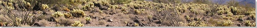
I was making good progress and so far, the worst I had encountered were short cliff bands that always had some way above them. Hand and footholds were everywhere. So was the cholla cactus. Nearer the top, I emerged into a small alcove hemmed in by 30-foot cliffs, but toward the right was a ramp, which I followed. This put me essentially above the gullies and close to the summit.
I made a hard left, and came to one last obstacle, a five-foot cliff to scramble up and over. I was busy watching my foot placement so that when I hoisted myself up, I headbutted a cholla. Fortunately, my hat caught most of the spines, but when I knocked them off, one landed flush on my leg and another onto my left hand. It took a lot of careful surgical work to get the little bastards off of me and to remove, one by one, the barbs from my skin. This took about five minutes.
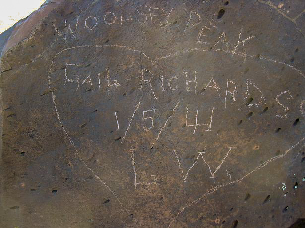
After this, there was a small amount of easy rock scrambling still to go, and in moments, I was at the top. I didn't know I was this close, but I could see a metal post sticking up and a large scratched-in graffiti from "Gail Richardson" from 1941 (photo at left). I had made it. I hoisted myself up onto the rocks and that was that. I was quite thrilled.
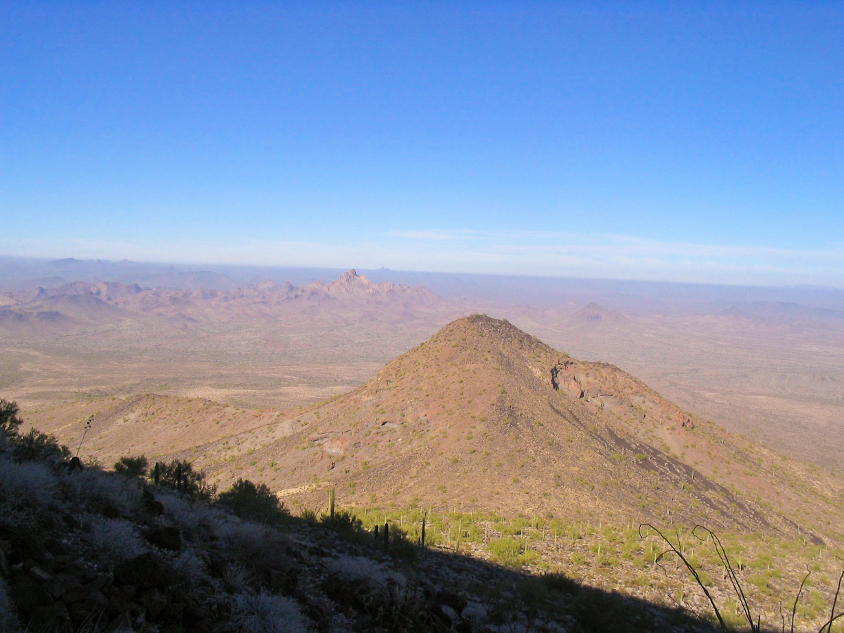
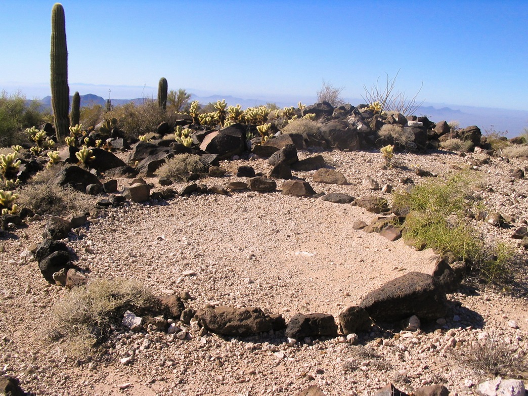
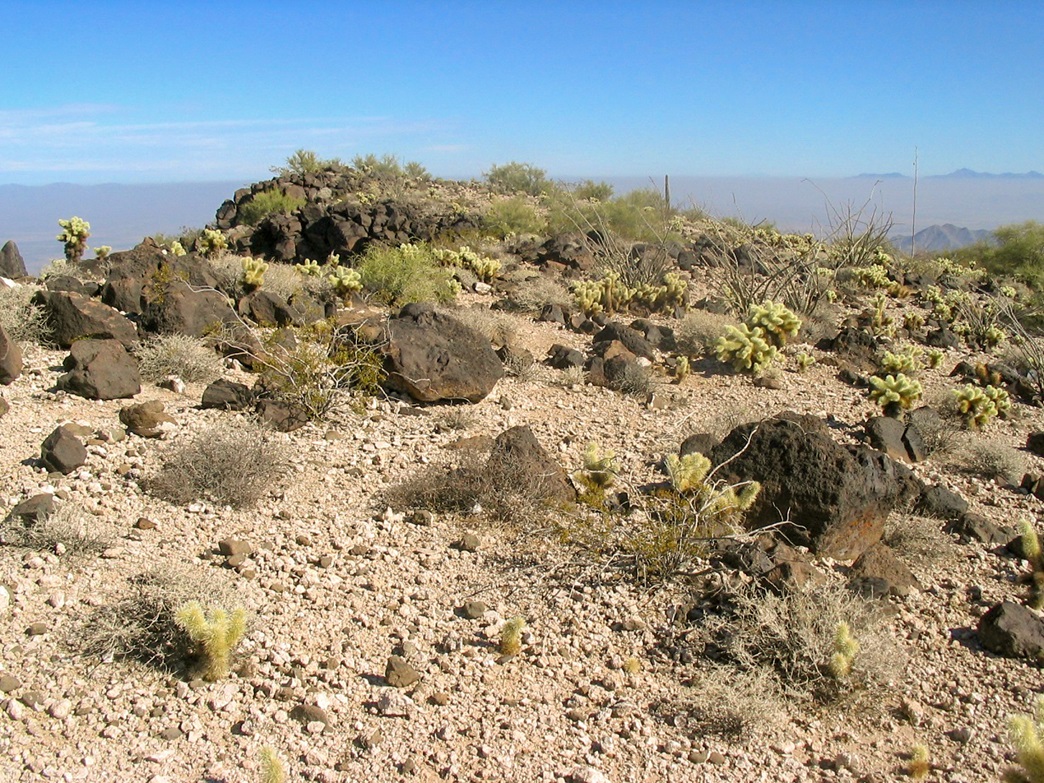
Woolsey Peak's summit is gorgeous, a little eden of teddybear cholla and scattered black lava rock. Past visitors had formed stone-lined walking paths up here, like a little garden. The summit is a sloping plateau covering a couple of acres, with the highest points along its west rim, where I had come up. Looking east, the rest of the Gila Bend Mountains poked up above the haze on the desert floor. Most of the low-elevation terrain was underneath the haze, and the surrounding peaks jutted above the haze like islands. For the highpoint itself, one candidate was the pile of rocks on which I had just come up.
The probable actual highpoint (if by no more than a foot) was a 100-foot stroll through the cholla to another set of rocks, one area cleared into a circle. Here I found the benchmark and the register. I was the first to sign in since this past January. A quick scan of the logs showed about a dozen people climb the peak yearly. I called my wife to let her know I was fine and that I was successful (so far). It was 11:50 a.m.. It had taken me 2 hours, 20 minutes to get up. I rested for about 10 minutes. I wanted to get down past the steep sections before I started to relax too much.
I was skittish about going down some of the sections I had come up, but it all went well, and I had no trouble whatsoever. Actually, the downclimbing went easier. Just a couple of sections required me to think some moves through. I did have one minor incident, when I grabbed onto a small rock that was loose, I knocked a couple others loose, one bashing into my right ring finger. At first I thought it might be busted. It was scratched and bleeding heavily, but it was straight and I could move it, so I wrapped tissue around it to quell the bleeding, and continued down.
The descent through the cliffs took me no more than 30 minutes. Now onto the black apron of lava rock, this section went slow too, because each rock needed to be tested for sturdiness. This downhill segment took another 30 minutes, and was very tedious and tiring, given that every step needed to be tested. Finally, I could tell the grade was much less severe and that I was, for all intents, back onto the lower desert flats, or at least the transitional slopes getting to them. Whenever I looked back up I was amazed that I had just come down all that. It still looked intimidating, even afterwards.
The remainder of the hike went leisurely. I walked cross-country across the desert back to the road then back to my truck, a total of two hours exactly to descend, arriving back to my truck at 2:00 p.m. I changed into dry clothes and assessed my finger owie, plus all the other cactus scratches I had picked up along the way. I had plenty. The drive out to pavement took about 30 minutes, and I stopped in Gila Bend for snacks before driving home that afternoon. It was the fifth anniversary of our first date, so Beth and I went for a nice dinner at the restaurant, where we met that first time.
In retrospect, Woolsey Peak is quite a peak to climb. I had much more of a thrill than usual given the inherent challenge of the peak, and when I set out for this one earlier in the day I was not exactly brimming in confidence I would make it. I am happy that I did, and happy that I did it safely. This surely ranks as one of the sweeter desert summits I have ever climbed.
|

|