The Mountains of New Mexico
www.surgent.net |
| Elk Mountain |
• Highpoint: San Miguel County • Santa Fe National Forest • Sangre de Cristo Mountains |
 Getting small on Elk Mountain
|
Date: September 21, 2003
• Elevation: 11,661 feet
• Prominence: 581 feet
• Distance: Drive up
• Time: 2 hours
• Gain: None
• Conditions: Beautiful
New Mexico
•
PB
Elk Mountain is in the Santa Fe National Forest, east of the city of Santa Fe, overlooking the Pecos River drainages. A decent forest road meanders to the summit, allowing access by vehicle. βð and I were in the state for a weekend of hiking and sightseeing, using Santa Fe as our base of operations. The previous day we had an enjoyably strenuous hike up Little Costilla Peak. We returned to Santa Fe that evening and spent the night at our hotel. On the agenda for today was more sightseeing, including a bumpy ride to the top of Elk Mountain.
Admittedly, the whole point of visiting Elk Mountain was to claim it for my county highpoint project. We had no interest in a long hike, and viewed this journey as a "sight-seeing" adventure and some practice driving high mountain roads. Ironically, the only challenge would be the erroneous topographical maps, which made tracking our progress confusing. I go into detail about this lower down.
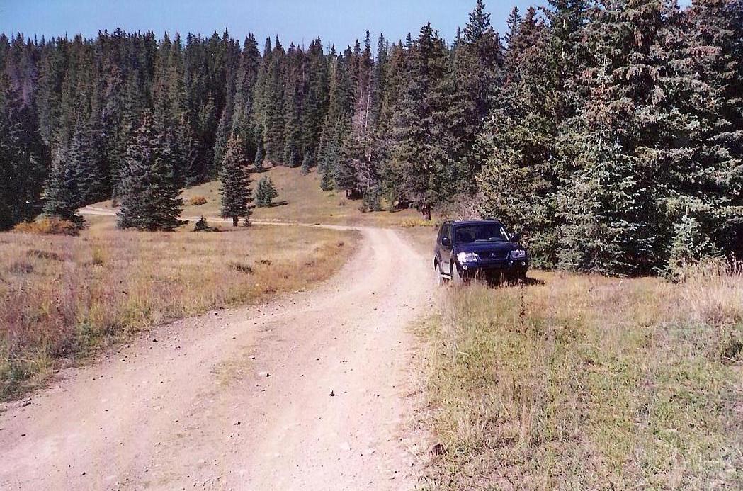
From Santa Fe, we got on northbound Interstate-25 (actually heading east for this section), and 19 miles later, exited at Glorieta Road, taking a scenic backway into the town of Pecos. In Pecos we turned left onto highway NM-63 and travelled about 14 miles north to the town of Terrero. Just past Terrero is the entrance to Forest Road 646, our road to the top. In June I was in the same area, hiking Truchas Peak, whose trailhead is about another twenty miles up NM-63 in the town of Cowles. I did not have time (nor the correct vehicle) to attempt Elk Mountain at that time, so I passed. This time, we had a sturdy Mitsubishi Montero SUV. It was expensive, but at least it assured us a good chance of getting to the top. It was 10 a.m. when we made the turn onto FR-646.
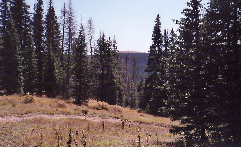
For the first 8 miles, the road is good and reasonably wide. There are many camping areas along the road and we saw a number of small passenger vehicles parked in the sites. At 8.1 miles, according to my odometer, the road comes to a Y-junction. I stayed right and followed the road as it gained steeply up the hillside. The next two miles were the steepest but never too bad. Parts were very narrow, though, and I had to be careful when meeting vehicles coming the other way. Finally, at 9.8 miles, we came to a 3-pronged junction.
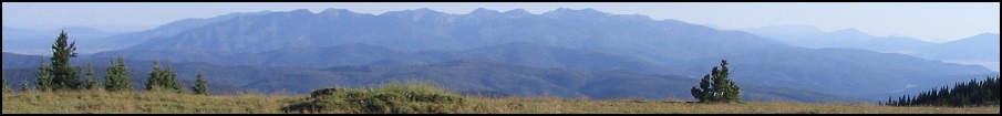
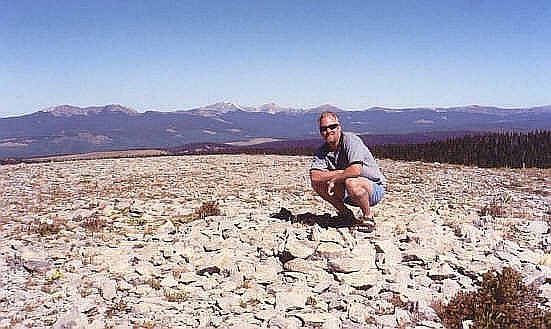
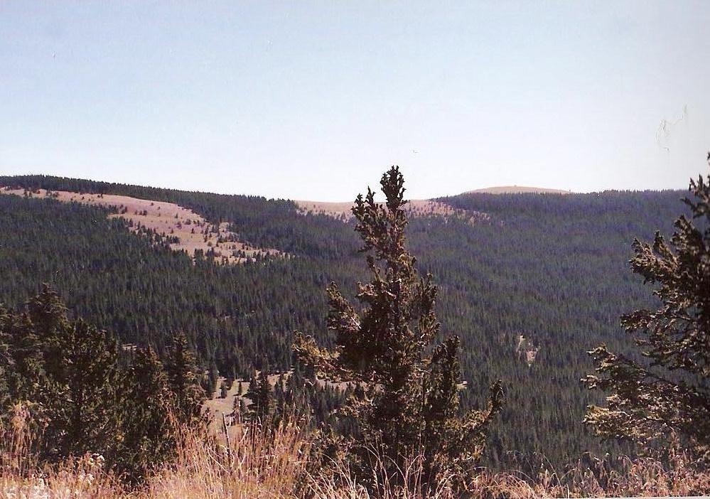
I took a GPS reading to place myself on the Elk Mountain USGS map, and followed the left fork, as instructed by previous reports. The road was now high on the main ridges and stayed flat, including some small downhill sections. At 12.5 miles, we took a right turn at another fork. The road became rough at 13.5 miles, but the SUV did fine, and we reached the top at mile 14.3, roughly 11 a.m., in gorgeous cool, clear and dry conditions. The summit is broad and very gently rounded. A shelter and some towers sit atop the bare peak, while forested sub-peaks spread out in all directions. We spent 20 minutes at the top, and I took the opportunity to view the route I followed in June when climbing Truchas Peak, which was clearly visible to the north.
The drive out went well as we waved hi to about a dozen hunters on their ATVs. This being fall, hunting season was either going on now or coming very near. We were back out onto pavement at noon and back in Santa Fe by 1, where we spent a couple hours touring downtown. Later that afternoon as we headed back to Albuquerque, we visited Sandia Crest, then flew home that night.
• The Map Situation. Elk Mountain is found on the USGS 7.5-minute Elk Mountain quad, which shows a warren of roads within this region. One road goes to the north of the summit, and backtracking, there are many junctions and steep, convoluted sections representing the switchbacks. The rest of the route is on the adjoining Cowles Map, which is incorrect, as I have discovered (and as have many others).
The Cowles map shows a road leading up Willow Creek from NM-63, and is apparently numbered FR-645. This road is shut. There is another road shown on the Cowles map just south of the Willow Creek Road, but according to the map, this road ends on the Rosilla Peak map (the one that adjoins Elk Mountain to the south).
Here's what I think is the case: I believe this second road is FR-646 because it's located in the right place and seems to travel in the directions we did. At some point here, there has been a change and I believe that the two roads become one, because when I took my GPS reading at the 3-way fork (mile 9.8), I found myself on the Elk Mountain quad. I had obviously come up the switchbacks shown on the quad to the west (left). So now I knew I was on the map and could peg my location with confidence. Secondly, the final junction, the one I took at mile 12.5, is not shown on the map at all. This unshown road heads south and then switchbacks up to the top of the peak, achieving the saddle just north of Elk Mountain and south of its 11,528-foot sub-peak. For those (like me) who like to trace their location on the map, it can be a little frustrating at first. But everything turned out well and I was happy to figure out our route as it ran along the map.
• Hike or Drive? I think hiking this peak from the west (the way we came up) would be a tedious, uninteresting endeavor. As opposed to most of the high summits in this part of the state, Elk Mountain and its surrounding peaks are huge, broad, gently-sloped rounded summits. It's as though they are merely little hills on a high plateau, instead of big mountainous masses. In any case, the area is socked with forest roads and is very popular with campers and hunters (as we saw). As we poked along the road it just seemed logical to push on with the vehicle. We entered this journey fully intending to drive as much of it as we could. I understand there is a good hiking trail that comes up from the east and requires about 15 miles round trip, but I did not explore that option, and probably never will. Once is enough for this peak.
• The Road: 4 Wheel Drive or Not? The road was in good shape all along and was dry. In these conditions I believe 4-wheel drive is not necessary. In fact, a skillfully driven passenger vehicle might be driven to within the last mile of the top. Good clearance is a minimum requirement. In wet weather, all bets are off. We saw dried ruts in places, suggesting run-off is slow and that the roads get soft and slick when wet. I do not know if the road is plowed during the winter. I would assume not. Having a 4-wheel drive vehicle gave us an extra comfort margin.
|

|