The Mountains of New Mexico
www.surgent.net |
| Little Costilla Peak |
• Highpoint: Colfax County • Carson National Forest • Culebra Mountains |
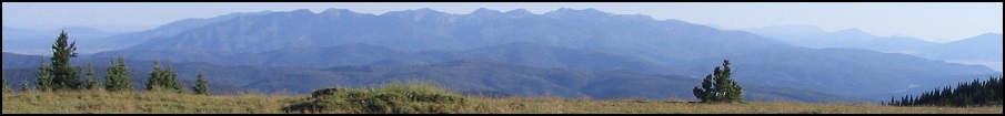
 Looking toward the peak from the high ridge (The actual summit is behind the foreground peak)
|
Date: September 20, 2003
• Elevation: 12,584 feet
• Prominence: 2,424 feet
• Distance: 6 miles
• Time: 4 hours
• Gain: 2,600 feet
• Conditions: Blustery with puffy clouds, but nice
New Mexico
•
PB
βð and I took advantage of cheap air-fares to Albuquerque, and with the monsoon over for the year, headed to New Mexico for a hiking weekend in clear, spectacular weather. In my opinion, the best time for hiking the southwest peaks is September-October, during the few weeks after the humid monsoon falls apart, and before the cold and snowy weather descends from the north. On the agenda for this weekend was Little Costilla Peak in the Carson National Forest near the Colorado boundary, and a drive-up of Elk Mountain in San Miguel County to the south.
We arrived in Albuquerque about 4 p.m. on Friday afternoon, then piled into our rental SUV, a Mitsubishi Montero, and headed north. We had traffic in Albuquerque, some traffic in Santa Fe and Espanola, and a lot of it in Taos. We stayed in a decent, older motel in Questa, arriving about 8 p.m.
The next morning, we drove to the town of Costilla, then turned east on state route NM-196 into the mountains. We passed the town of Amalia, then stayed straight on a lesser paved road for a couple more miles, passing farms, until the pavement ended. The next few miles afterwards was decent, sometimes washboarded dirt road, with many signs pointing to the "Rio Costilla Park". Finally, we came to the National Forest boundary and stayed straight on the main road, now marked as FR-1950. We turned right at a junction at about 21 miles, then followed this good road (still FR-1950) about another 9 miles amid high open valleys and meadows to our trailhead. A good trail led into the trees, and we could see a meadow behind the trees. We decided to start from here.
There is no trail to the summit, but the top is only three miles away, with the hardest part coming first. The hike breaks into two parts: first, a steep haul for the first mile through heavy forest to a ridgepoint at 11,645 feet, then a less-intense two-mile stroll on high open ridges to the summit. From our vehicle, we walked the short path into the trees and immediately out into the meadow, where the trail ended. Looking at the map, I opted to take a bearing slightly east of north, essentially staying high on the southern ridge emanating from ridgepoint 11,645, keeping the Grassy Creek drainage below us to our right (as we walked).
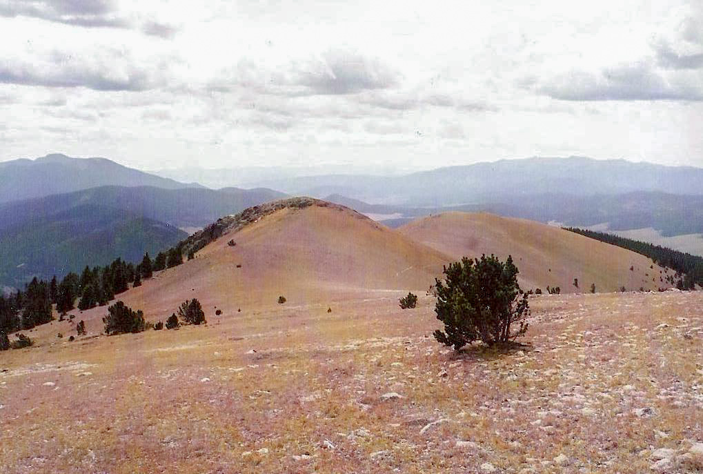
We soon entered the forest and found a series of use trails, some good and some poor, which we followed for roughly a mile. Finally, a GPS reading put us at about 11,200 feet, just east of the 11,645-foot ridgepoint. Here, the forest was very thick, and we barged up the steep slope, which at times was loose with scree and organic crud. This little section tired us out, and we took an extended break once we reached the desired ridgepoint. We found a very old barbed-wire fence running north-south here, and we could spy the upper reaches of this ridge, with the summit still hidden behind foreground peaks.
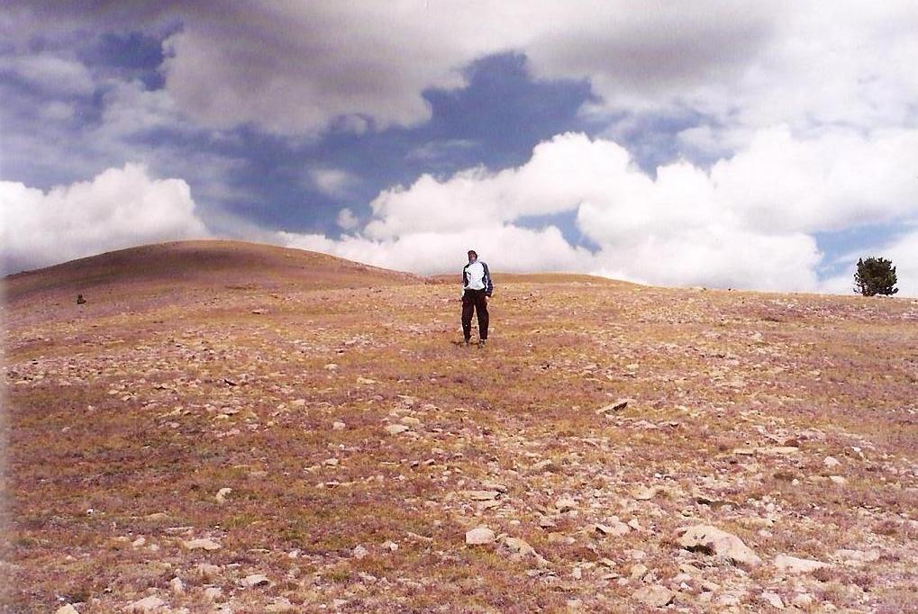
After 20 minutes, we started the second leg of the hike. The terrain was mostly open, and the fence served as a good navigation helper. We played hide and seek with a deer for a hundred feet or so: she'd run ahead, then stop and watch us as we came up to her, then she'd run off again. She did this about four times. The fence line ends on the western slopes of one of the many ridge bumps. We were now above tree line, and we hiked by reckoning up the open slopes and found a good trail that ran for 500 yards. This trail petered out on the ridge spine, and put us below the last of the false summits before the true summit.
Above the trees, the wind was noticeable, with 40 m.p.h. gusts and sustained 20 m.p.h., but we mitigated that by staying on the lee side of the ridge whenever possible. βð was about 50 feet ahead of me. She surmounted a summit, and I could see her drop her arms in frustration, realizing the true summit was still a short walk away. But that was good news: it wasn't far at all. We both reached the top about 12:30 p.m.. Some clouds had congregated near the peaks but it was clear on the horizons, so we weren't too concerned.
It was cold and windy, though, so once we snapped our summit photos, we took cover in a windbreak a few feet on the lee side of the summit. As usual, the views were awesome, and we relaxed and enjoyed having the peak all to ourselves. It had taken us roughly 3.5 hours, including stops, to gain the top, with about 2,600 feet of gain. We kept each other warm and congratulated one another. But soon, the cold breeze became too uncomfortable and we got moving.
The walk down went fast. We found the fence, and followed it back to the 11,645-foot ridgepoint, where we stopped again to relax. Instead of going down the way we came up, we decided to follow the fence down the slope. Mostly the fence was lying on its side and good paths intertwined with the fence. About half-way down, we found some substantial paths, which steeply descended, coming out to the lower meadow at a corner where our fence meets with another coming in a different way.
We hiked by sight down the steep meadow grasses and were back to our vehicle at 3 p.m. In retrospect, it may have been quicker for us to ascend the way we came down, as it is all trail (good and bad). We were quite happy to be out, safe and warm. We changed into drier clothes and started the drive out, highlighted by viewing two snakes locked in a mating coil alongside the road. We spent the evening in Santa Fe, soothing our sore leg muscles with an evening at the Ten Thousand Waves Japanese Spa near town.
The next morning we visited Elk Mountain, the highpoint of San Miguel County. This would be all driving, giving our sore legs a day to rest.
|


|