
The Mountains of New Mexico
www.surgent.net |
| Truchas Peak |
• Highpoint: Santa Fe Mountains • Pecos Wilderness • Highpoint: Mora & Rio Arriba Counties |
 The Pecos Baldy Peaks as seen from the meadow below Round Mountain. This photo happens to be one of my favorites now, for melan- cholic reasons. Adam and Edward passed away within 6 months of one another in 2015, and I miss them dearly
'
|
Date: June 21, 2003
• Elevation: 13,102 feet
• Prominence: 4,001 feet
• Distance: 24 miles
• Time: 28 hours (includes overnight camp)
• Gain: 5,300 feet
• Conditions: Clear and breezy
• Teammates: Adam Helman & Edward Earl
New Mexico
•
PB
Truchas Peak is the highest peak in the Pecos Wilderness of Northern New Mexico, rising just over 13,100 feet elevation. The peak has two neighboring summits that break the 13,000-foot barrier: Middle Truchas at 13,066 feet, and North Truchas at 13,024 feet. Thus, Truchas Peak is sometimes called South Truchas Peak. The Pecos Wilderness covers about a quarter-million acres, with no road access into the interior. Instead, hiking trails span the region. My partners were Adam Helman and Edward Earl, and we would tackle Truchas Peak as an overnight backpack, coming up from the south.
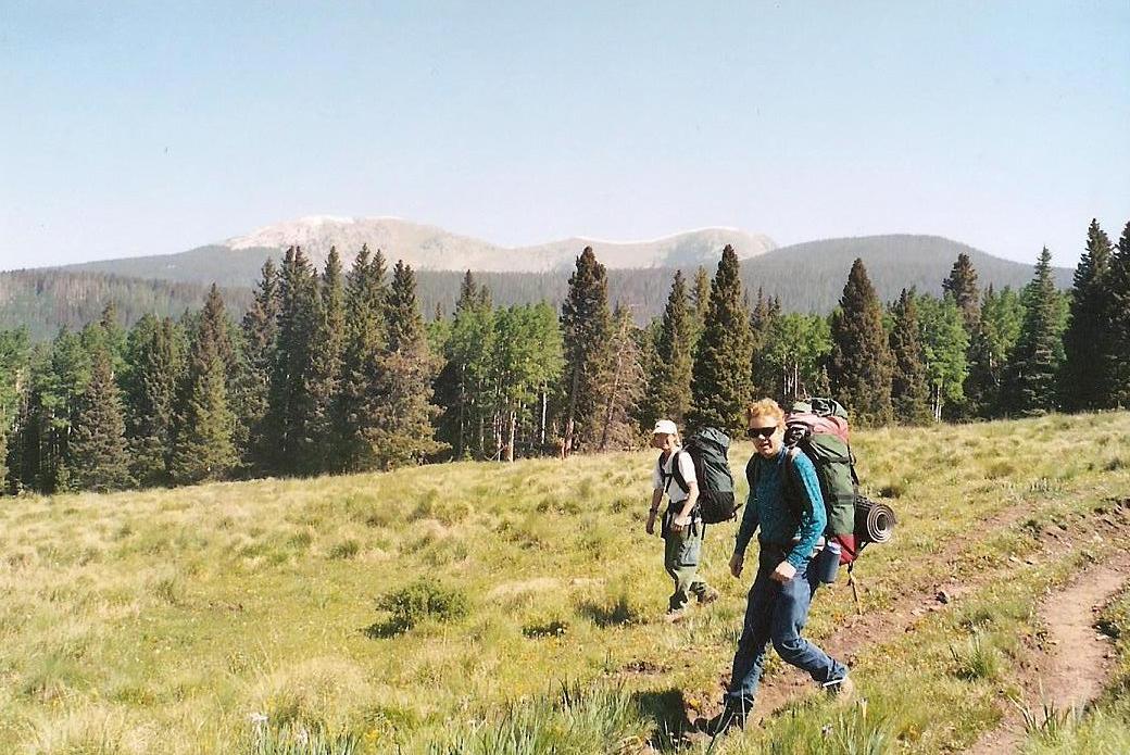
I was interested in this mountain for awhile but avoided it due to the length of the hike, plus its distance from my home. When I learned that Adam and Edward were including Truchas Peak in their week-long sojourn to New Mexico, I thought this would be a good chance to go with others to avoid the tedium of hiking alone, to help divide the gear for the backpack to high camp, plus an excuse to talk mathematics with the fellers.
I flew to Albuquerque on Friday the 20th, and drove to the Pecos River Canyon, arriving at the end of the paved road at Jacks Canyon Campground, where I found Adam and Edward already set up for the night. I arrived around 8 p.m., but on the day before the summer solstice, there was still ambient daylight, and true nightfall did not happen until almost 9 p.m. We chatted, discussed the route and our options, made jokes and did our best to get some sleep. I somehow managed to sleep in my Oldsmobile Alero passenger car. The next day, we woke early, got situated, and started up the trail at 6 a.m.
The trail is not shown on the latest topographical map, nor is the road or the campground for that matter. Much of this appears to be relatively new. Nevertheless, we could pinpoint our starting position at a point at 8,800 feet elevation, on the west facing slopes of a ridge emanating south of Round Mountain. Our initial trail was the Jack's Creek Trail, #257.
Jack's Creek Trail makes six long switchbacks to the ridge top, where it crests the ridge and traverses the east side before rising sharply in a meadow, meeting with trail #25. It had taken us 90 minutes, covering 2.5 miles, moving at a good pace. The weather was cool and dry, and the gradients were gentle so as not to tire us. We had dense forest the whole way up except for the final segment at the meadow. We rested for about 20 minutes.
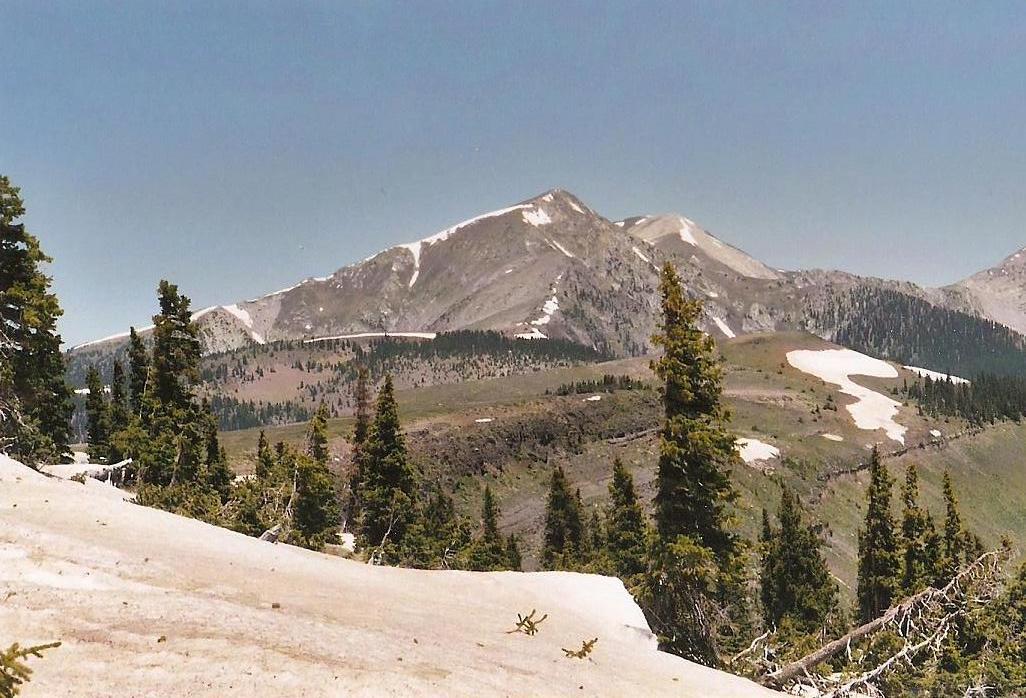
We continued north on Trail #257, through a small copse of trees, then into an enormous, beautiful meadow. The trail traverses the south and west slopes of Round Mountain, and from this vantage we could make out the two Pecos Baldy Peaks to the north, Pecos Baldy on the left, East Pecos Baldy on the right. These peaks were still far away and gave us an idea of how far we still had to go to Truchas, as our camp would be at the base of East Pecos Baldy near a small lake, whereas Truchas Peak was still another 5 miles north.
We made good time up this gently-sloping trail, entering small stands of trees and crossing more meadow. Soon, the summit of Round Mountain was to the south of us, and the trail entered the forest and dropped about 200 feet to a trail junction and a point at which we crossed Jack's Creek itself. The signs were useful, and we took our second break in a small meadow about 200 yards north of the creek crossing. We were making excellent time, having covered nearly 5 miles to this point in under 3 hours.
The next portion of our hike was another gently-sloping segment of trail toward Pecos Baldy Lake, which sits at the base of East Pecos Baldy. This stretch covered another two miles, and we arrived at the lake at about 10:15 a.m., having covered 7 miles and 2,600 feet of vertical gain. The forest was less dense than down below, as we were near 11,400 feet elevation. We set up camp in a pleasant glade of trees, within view of a couple other tents.
We relaxed here for two hours, eating lunch and catching a nap. Our plan had been to get as far in as possible as long as the weather held, and then make a decision as to whether to go for the summit today or the next day. We waited until noon to make the decision. When noon arrived and there was absolutely no hint of clouds, we decided to go for the top.
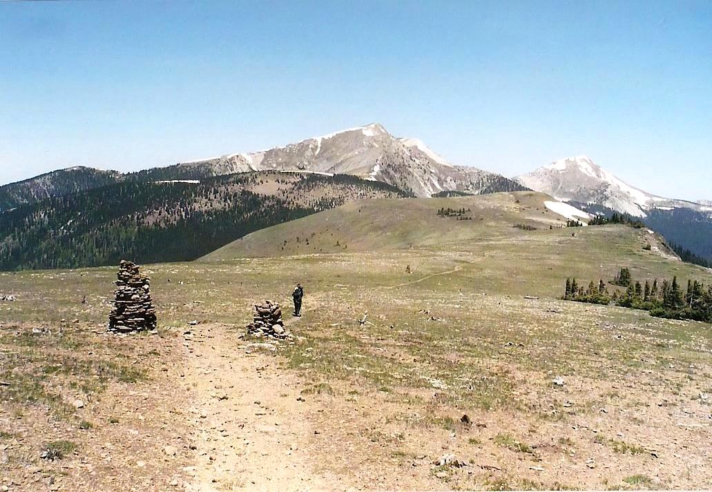
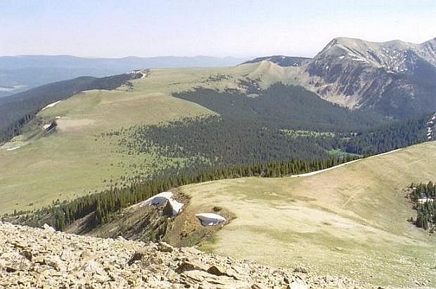
At noon we set out, now following trail #251, the Skyline Trail. The trail meanders through shady woodland then quickly gains elevation to a prominent ridge called the Trailriders Wall. In less than a mile, we topped out on this grassy ridge at nearly 11,920 feet, battling our first snow drifts along the way. On this ridge, we had our first view of Truchas Peak. We followed the well-maintained trail up and down Trailriders Wall, losing about 120 feet to bottom out at a low point, then regaining the same 120 feet to top out again.
This ridge was nearly treeless, and the wind was fierce, which may explain why the trees can't catch a break here. The highpoint along this ridge is a gentle mound with spot elevation 11,979 feet. It has no name, so we dubbed it Sugarloaf, since it looked like one (Peakbagger calls it "Trailriders Wall"). We took refuge behind a berm to rest and noted the "forest" of dead and wind-scoured trees that sprinkled Sugarloaf's slopes.
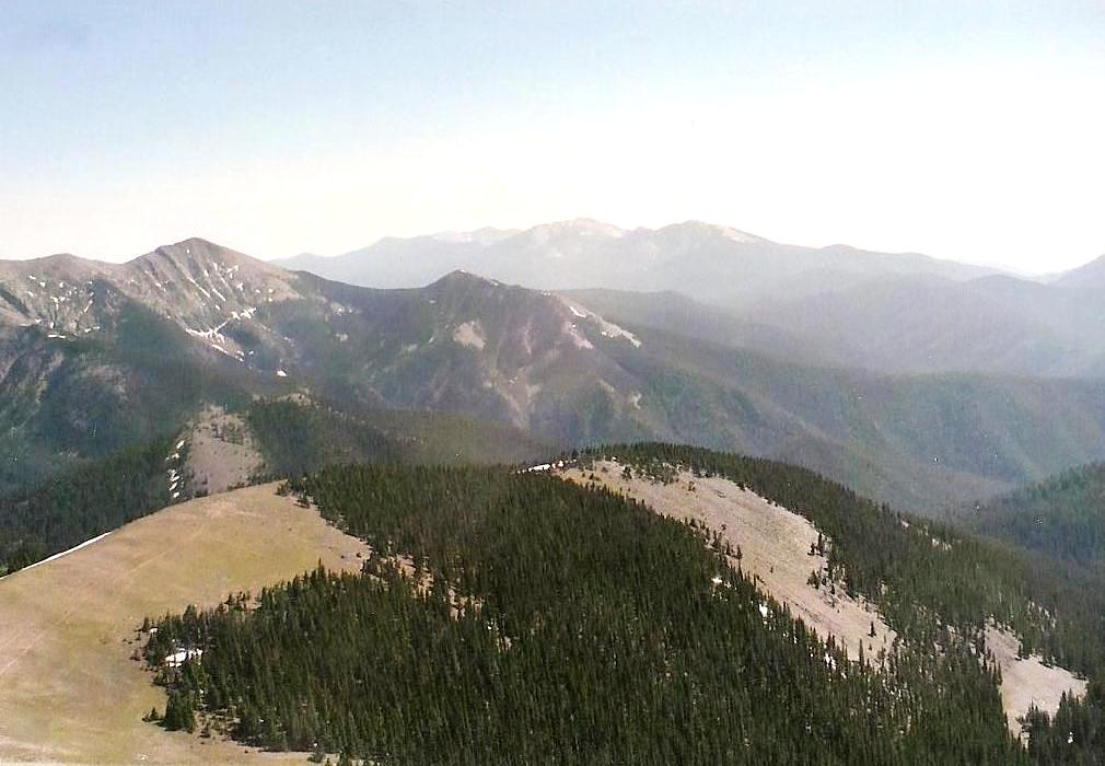
After our break, we descended 300 feet to the last low point on the ridge, approximately 11,620 feet, at a trail junction. The Skyline goes right and down the slopes to the trees below, and there is no more official trail to follow to the summit. We were about one mile from Truchas Peak's summit, with 1,500 feet of elevation to gain. It was now 2 p.m. and the skies remained cloudless, although the wind was strong and consistent.
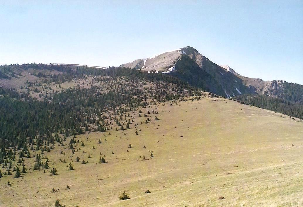
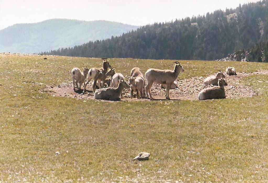
From this lowpoint, we ambled up a pleasant meadow, past one large cairn, before coming to the base of a glade of trees. We could see what looked like a rudimentary path, so we followed it. On this rocky ground, the path sometimes faded, but we were able to stay on it without too many errors. The gradient grew steeper, and we took another break beside an old log at the top of the glade, elevation roughly 12,000 feet. After a few minutes, we left the footpath and walked up a slope to attain a ridge, where we encountered a group of about 10 mountain goats milling about one area, watching us as we walked by. Roughly 500 feet of horizontal walking brought us to the base of the talus fields and the start of the final push to the summit.
The first segment is a steep trudge up large, solidly-set talus blocks, quickly gaining about 400 feet to top out on a knob at 12,580 feet. This was followed by a drop of 200 feet to the saddle below the summit. We descended to this saddle and picked up what appeared to be a path. From this point, the last 700 feet to the top looks steep and intimidating, but I found every step on the way up this slope to be solid: either a large granite block or a solid tuft of vegetation to step on. Adam was ahead of Edward and me, both of us lagging a little by this time. We had hiked nearly 12 miles with over a vertical mile of elevation gain today.
The slope moderated about 300 feet below the summit, then came to a snowfield. It was short, level and mushy, so we crossed it with no problems. From there, it was a quick scamper up the final blocks to the top, and there we were. Edward and I arrived at 3:25 p.m., and the three of us simultaneously tagged the top rock, then gave handshakes all around. The weather had remained clear but windy. As a result, I didn't stay long. A photo and some looking around, and I was on my way down. I left Edward and Adam to revel on the top, whereas I wanted to get some distance put in, and to keep moving as much as possible in this stiff wind (30-40 mph sustained for minutes at a time).
I descended the 700 feet to the high saddle, then up and down the 12,580-foot knob, and down the other side to the grassy ridge where we had encountered the mountain goats, who were still there. I hiked back into the glade of trees and the log at which we had taken a break, laid down on the soft ground and dozed for about 10 minutes. I was shielded in the wind, although I could still hear it through the trees. I rested, admired the amazing views and tried to make a cell-phone call to my fiance, but couldn't get a signal. Adam and Edward soon came upon me, Adam stopping a bit to rest, with Edward continuing on ahead. Adam and I then started down through the trees and down to the low point on the ridge and back up to the high area near Sugarloaf and the shielded berm, at which point we all reconvened.
The last two miles back to camp went fast. We arrived at camp about 6:15 p.m., the culmination of 17 miles of hiking and just over 12 hours since starting our day. I was bushed, and I immediately conked out in my sleeping bag for an hour, then arose to join Adam and Edward for some company as the day grew into evening. However, I was in bed for good by 8 p.m., and Adam and Edward weren't far behind. The three of us were cramped into my tent, but out of sheer exhaustion we all slept rather well, partly aided by a mild night where temperatures stayed in the 40s.
We slept in a little the next day, then hiked the 7 miles back to our cars, coming out about 11:15 a.m. We convoyed into Santa Fe and had a celebratory lunch at a Carrows, where Adam split with us to head north and tackle Little Costilla Peak the next day. I drove Edward into Albuquerque where he had a motel room waiting for him. I cleaned up there, then flew out that evening, arriving home to Arizona about 11 p.m.
In 2008, a new plant was discovered, Heil's Alpine Whitlowgrass (Draba heilii). This plant apparently only is found high on the slopes of Truchas Peak, and one of my photos (10th one down) is used on the Rare Plants of New Mexico webpage. Heck, if I would have known to look down more, I might have discovered it. But congratulations to those who did find it and figure out it was an undiscovered plant.
|


|