The Mountains of New Mexico
www.surgent.net |
| Burro Peak |
• Highpoint: Big Burro Mountains • Gila National Forest • Grant County |
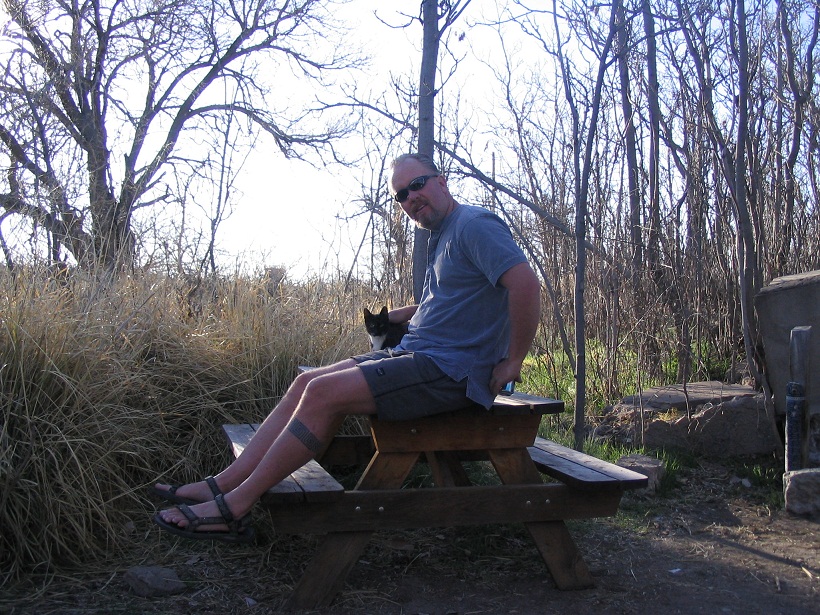 Friendly Hot Springs Kitty (and soon-to-be mommy kitty)
|
Date: March 15, 2007
• Elevation: 8,035 feet
• Prominence: 2,100 feet
• Distance: 10 miles
• Time: 7 hours
• Gain: 2,100 feet
• Conditions: Sunny and very warm
New Mexico
•
PB
•
LoJ
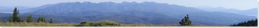
Burro Peak is a gentle hump of a mountain in the high desert between Lordsburg and Silver City. This low range, called the Big Burro Mountains, straddles the Continental Divide, and the Continental Divide Trail (CDT) passes over the summit. As is often the case with these desert ranges, what looks to be dull and uninteresting from afar is a lovely wilderness of high-desert scrub, pinon and juniper woodlands and stands of fir and pine when seen up close.
βð and I were here this past November, celebrating Thanksgiving up in Silver City with a hike of Black Mountain in the Pinos Altos Range. We also visited the nearby Faywood Hot Springs, and had plans to drive up the service road to nearby Jacks Peak, from where Burro Peak is just a short hike away. However, we encountered soft sand where the map said the road should be. Not wanting to chance getting stuck, we abandoned this attempt and resolved to come back another time.
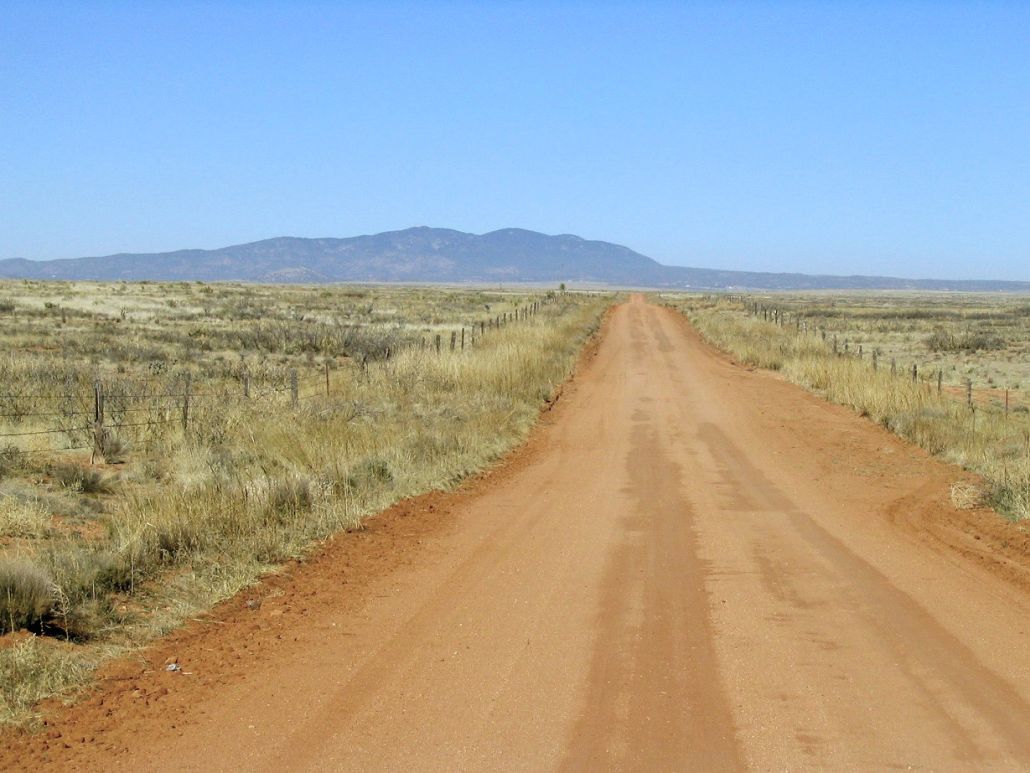
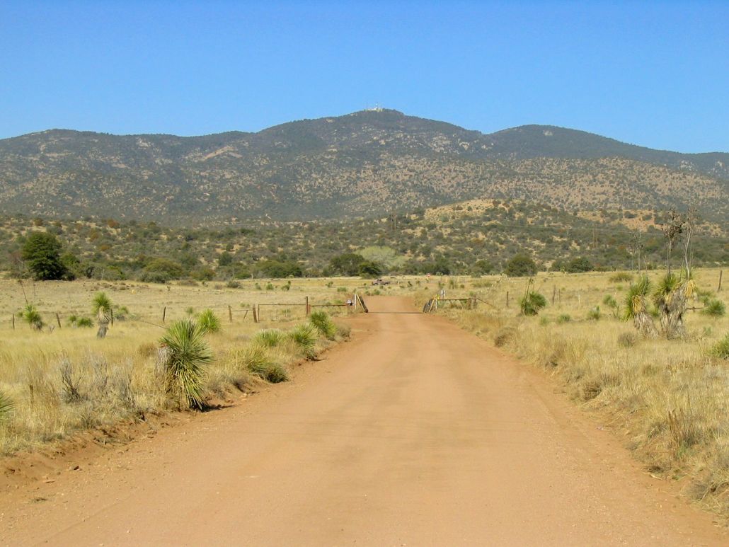
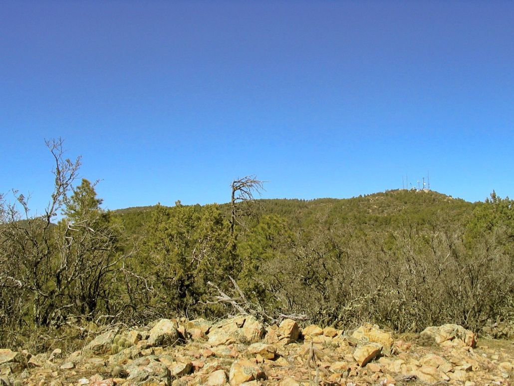
So here we are now, a few months later, taking a few days to do a couple hikes and soak in the hot springs. We started with a hike of Hachita Peak, then a couple days at Faywood Hot Springs, which was a blast, including a batch of playful cats that roam the area. From Faywood, we took a dirt road called White Signal Road that cuts across from Faywood to state route NM-90 near the Burro Mountains. This drive was scenic, and saved us about 30 miles by not having to go through Silver City. Burro Peak and its subsidiary peaks, Ferguson and Jacks, stood ahead of us as we drove (Jacks has the towers).
After a short drive along NM-90, we eased onto Gila Forest Road 828 near a pass, found the trailhead for the CDT, parking amid sparse trees that would keep our truck hidden a little better. We were at 6,400 feet elevation, and it was already warm, much more than one would expect for this time of year. A fluke heatwave had built and would raise temperatures into the 90s in the deserts. We'd have warm 70s and 80s here on the mountain. We started our hike around 11 a.m.
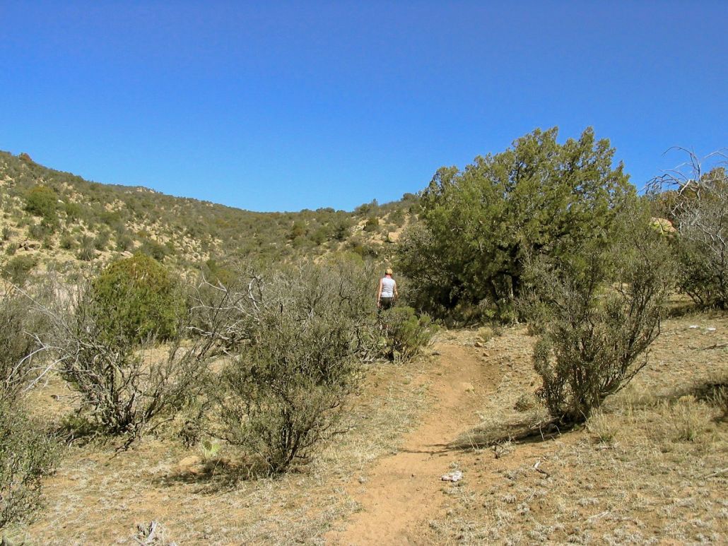
The temperature as we started was in the mid-70s, but the day was clear and dry, with humidities in the single percents. The lower trail is high desert scrubland transitioning into juniper woodland, but the open terrain and radiating heat warmed us quickly. It was evident the trail did not go as shown on the map. It actually trended west and went around a small hill at 6,848 feet, going clock-wise, then up and on its north side, bending east again, to connect up with the trail as shown on the map. We took a couple GPS readings to be sure. We took breaks often to combat the heat and stillness. Shade was scant at first but more plentiful as we hiked higher. And there were bugs.
We worked our way up the only moderately steep portion of the hike, a 300-foot section that put us on a high ridge west of point 7,651. Jacks Peak and its towers were in view, while Burro's summit rose behind as a gently-shaped hilltop, not too prominent above the intervening peaks. However, βð's back was simply not going to allow her to push on. We stopped in a clearing and took a long break to figure out what to do. She was rightfully frustrated.
After a while, βð prompted me to go on and tag the top, while she would stay put. I had mixed feelings: I naturally want her to feel good and would prefer her to be with me, but where we were was safe, and we were clearly the only people on the mountain that afternoon. I had packed a small blanket and reading material, so we set her up on this spot, and I took off to go to the top. I figured 90 minutes round trip. To lighten my load, I left the pack with her, too, and just took water and the camera with me.
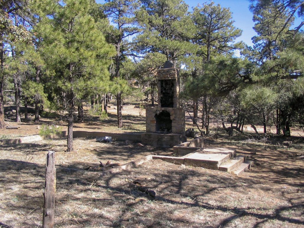
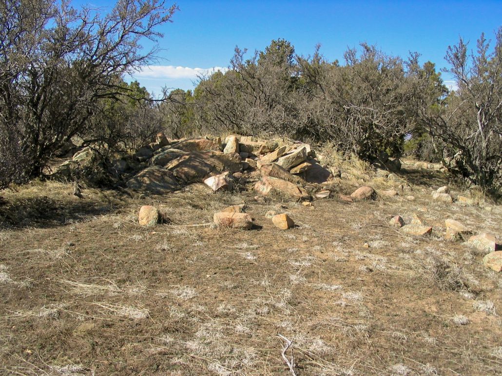
By the map, I figured about a mile to the service road and another half-mile to the top. I took off on a fast walk, reaching point 7,651 quickly, where to my surprise on this warm afternoon, I found remnant patches of snow clinging to the ground. The trail swung north and started a series of small ups and downs over little ridge-line bumps. This went on for about 15 minutes, then I was out to the service road. The road leveled off near old building foundations, including one with a still-intact chimney. By now, Burro Peak was in view.
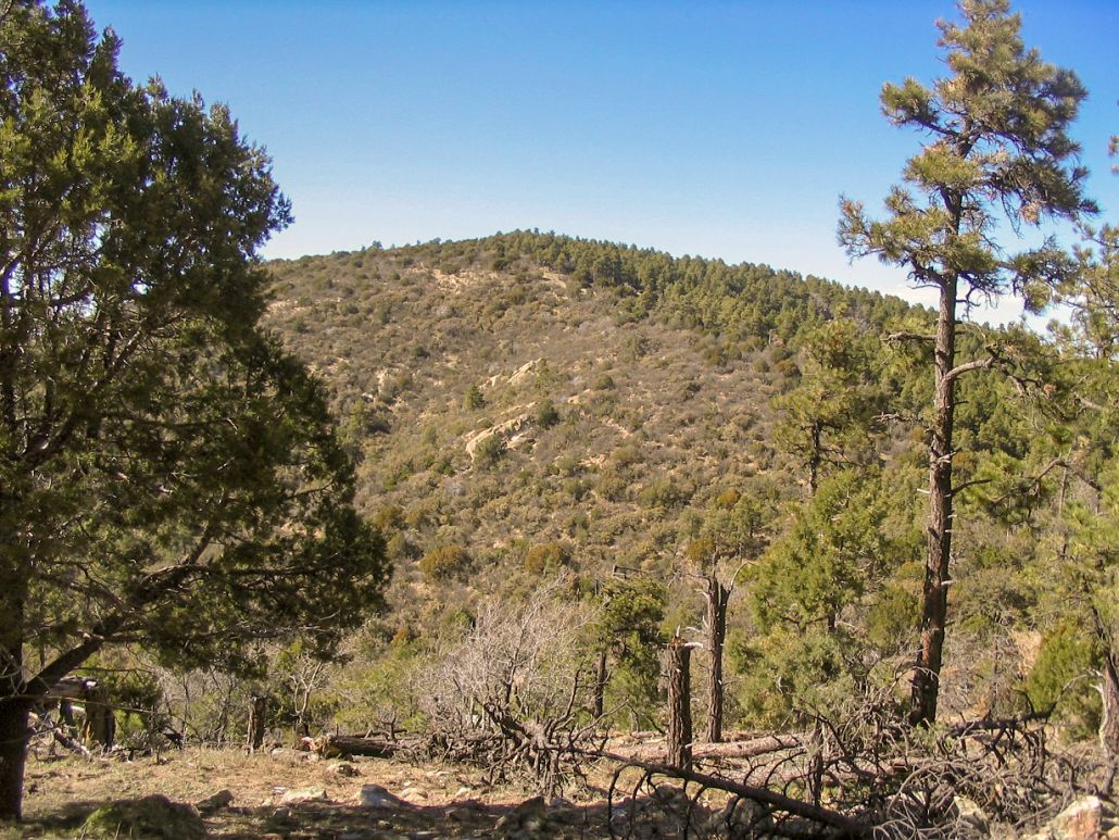
I took off cross-country, dropping into the saddle between Jack and Burro, where I re-found the trail. The drop here was about 150 feet, then a gain of 250 feet to the top of Burro Peak. This section was rockier than before, but soon it let off onto open grassy slopes, shaded in the pines. The summit is long and broad, so I stayed on the trail until it started to drop again. When it did so, I left the trail and with a little luck, found the benchmark in a clump of rocks on my first try. I signed in to the register, amused to see one other visitor was here this day (who presumably came in from the north). To be sure, I visited and tagged two other rock outcrops that had a little probability of being the true highpoint. Satisfied, I hightailed it back down to βð. I had said 90 minutes, and when I arrived back, I still had 10 minutes to spare. She was laid out, enjoying the sun, reading and soaking up the rays. The long rest had helped her back, which was good. It was now about 3 p.m. so we got moving.
We took the hike down slowly, passing a small herd of cattle. βð's back and neck started to give her trouble again, but she was determined to push on, stopping only when the pain grew unbearable. We took a few breaks and took the actual hiking slowly. By now the sun was low in the sky and the temperatures cooler but still very comfortable. Since the sun was setting, we took a break to watch it actually set.
We had dim dusky light as we walked out to our truck, where we changed out of our hiking clothes and got moving. We had a 25-mile drive to Lordsburg, then an 80-mile journey back into Arizona and our campground at the Essence of Tranquility hot springs in Safford. We rolled into the campground in darkness and set up the tent, and crashed. The dips in the hot water helped both our aches and pains, and it was the perfect tonic for βð's back and neck muscles. We were home the next afternoon ... in record setting heat. It was 99 that day in Phoenix (100 in Tempe said the news), and this was just mid-March.
Burro Peak's stats are just an educated guess on my part. The signs were not helpful, but based on our usual rate, I figured the hike to Burro was a total of 5 miles from the truck to the top. As for the gain, the net would be about 1,640 feet, but this ignores the 150-foot drop and regain between Jack and Burro, so add on 300 feet. I also added on some more elevation to the gross gain figure to account for the numerous ups and downs we experienced. The 2,100 feet gross gain is a conservative figure, in my opinion. If none of this interests you, the hike itself is very nice and worth it regardless of the nibbly arithmetic presented here.
I'm actually glad we abandoned our attempt from November. The day-hike was much more pleasurable than driving the road, and one I would suggest for a nice easy outing in a very un-traveled part of the state.
|
|