The Mountains of New Mexico
www.surgent.net |
| Hachita Peak |
• Highpoint: Little Hachita Mountains • Hidalgo County |
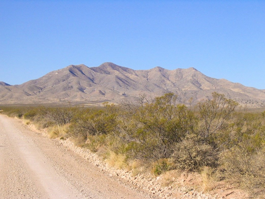 The Little Hachita Mountains with Hachita Peak visible as the rounded highpeak, center-left
|
Date: March 13, 2007
• Elevation: 6,639 feet
• Prominence: 2,139 feet
• Distance: 4.5 miles
• Time: 4 hours and 30 minutes
• Gain: 1,700 feet
• Conditions: Sunny and warm with stiff winds
New Mexico
•
PB
Hachita Peak is a remote mountain in southern New Mexico, the highest point of the Little Hachita Mountains, not far from the more well-known Big Hatchet Mountain. The word "Hachita" is the diminutive form of the Spanish word for "hatchet". Thus, the Little Hachita Mountains translate as "Little Little Hatchet Mountains." Whereas Big Hatchet Peak really does look like a hatchet, the Hachita Mountains are more rounded and un-hatchet-like.
βð and I were here touring southwest New Mexico, including time at the Faywood Hot Springs. We loaded the truck with our camping gear and left home on Monday the 12th, aiming for Lordsburg, New Mexico. We took the "back way", a more direct route through Globe and Safford via US highways 60 and 70, directly into Lordsburg. We pulled in around 6 p.m. and stayed the night at the Super-8 Motel. It was convenient to nearby fast food places and mini-marts. This is as high-falutin as Lordsburg gets.
Hachita Peak was our first objective for the next morning. From Lordsburg, we followed Interstate-10 to the Playas exit, then south 20 miles to state route NM-9, and fifteen miles east toward the little community of Hachita. We found Little Hachita Mountain Road about 2 miles west of the town of Hachita, and followed it 7 miles southwest across dusty rangeland into the mountains.
Approaching the heart of the mountains, we unexpectedly encountered a brand-new gate spanning the road. The land here is public, run by the BLM. The gate was unlocked, and we sensed we were within our rights to pass through it. There were no signs against trespassing on the gate itself. We drove in another two miles to a small rise, then took a sketchy road south about a quarter-mile and parked within a small arroyo to stay (mostly) hidden. It was close to 9 a.m. The Border Patrol helicopters were up and around, buzzing the range. We were certain they'd seen us (or our dust cloud) and would want to check us out. The range is about 15 miles from the Mexican Border. We stuck around, figuring that a Border Patrol vehicle would roll up behind us any moment now. But no one did, surprisingly.
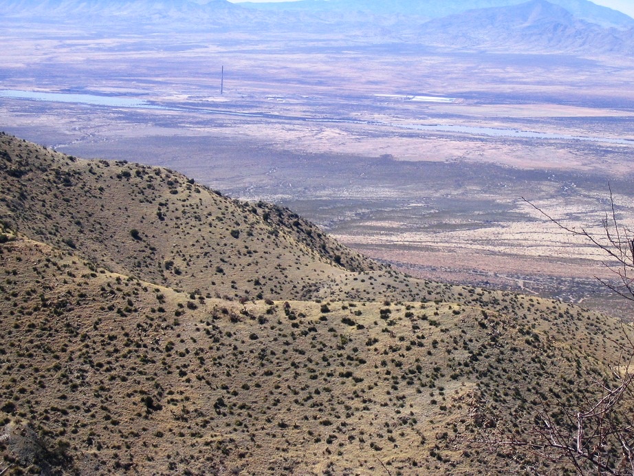
By 10 a.m. we were ready to start our hike. I left a note in the truck window explaining our presence just in case. We started hiking the old road, which leads onto a small grassy bench with a windmill and a stock tank. There were a few beefs milling around, eating the grass and watching us. They would scamper off as we got near. The road soon gains onto the foothills and contours left, coming to an old mine. After this, the road gained a little more, then we could see it lose elevation as it went behind a ridge.
We debated our plan. Above us we could see the road higher on the ridge. We decided to go outlaw and cut the switchback. We followed cattle paths through the open terrain, hiking by sight toward one of the few trees anywhere on the hillside, from which we could see part of the road. This little stretch gained about 60 feet vertically but likely saved us 20 minutes of time had we stayed on the road. Now back on the road, we followed it upward. After a few more minutes, we took our first break, finding relief from the winds in the lee of a small ridge bump. We brought out the maps and GPS and laid out our plan from here.
We hiked the road to its end at a big loop high up on the ridge. The road to here was rough and rocky, and probably last saw a vehicle during the Eisenhower administration. For hiking, it was dandy, and we made good time. We took a break at the loop, having gained 850 vertical feet.
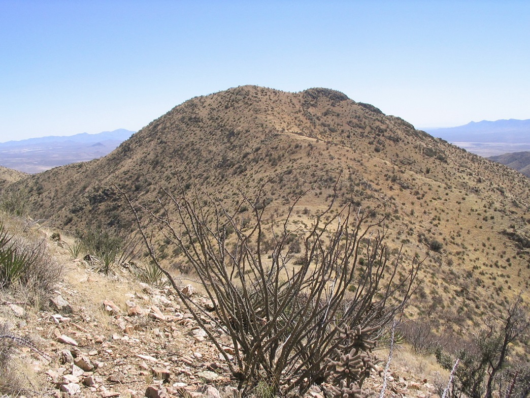
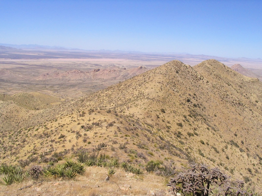
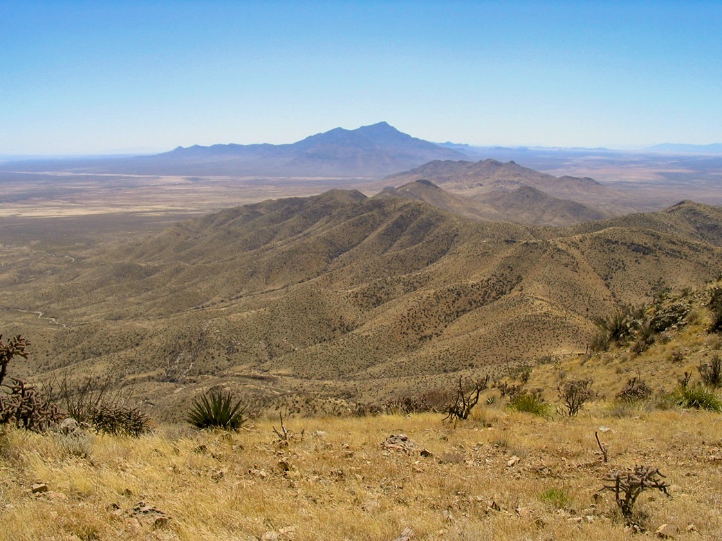
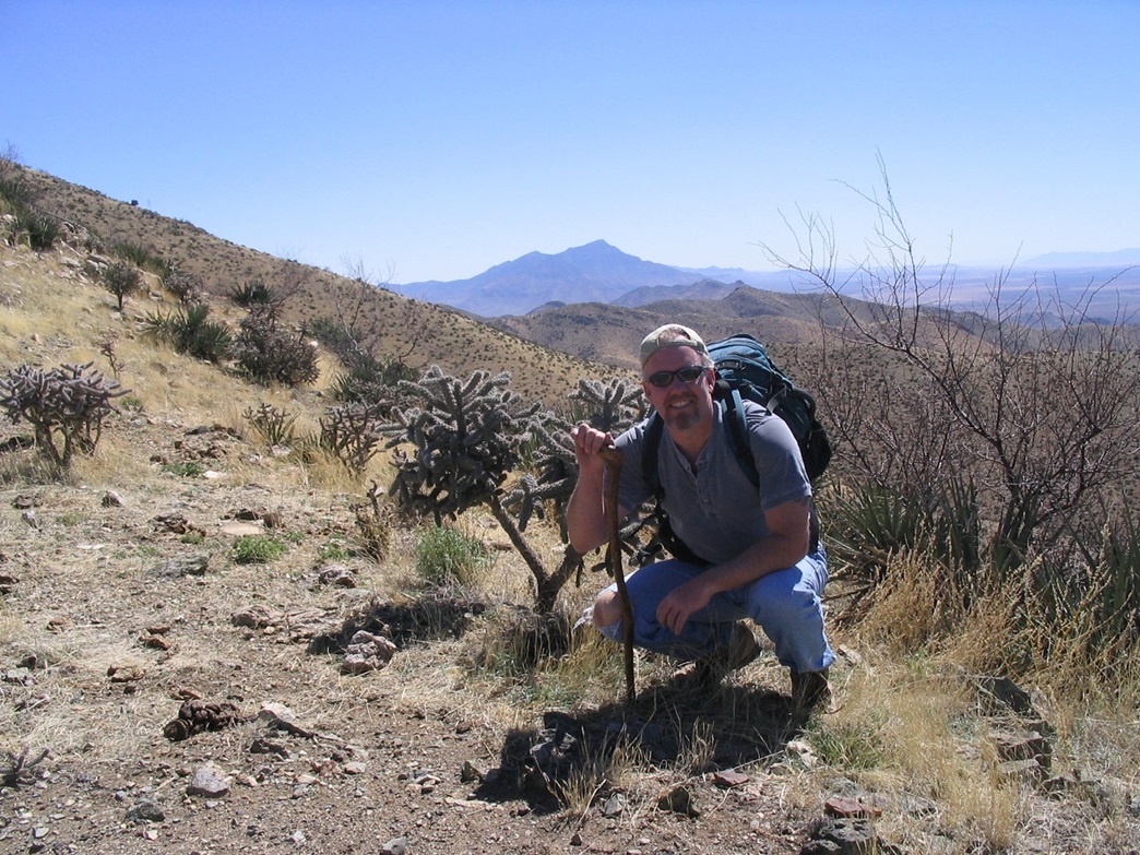
Above us was more slope and a well-defined footpath that angled up these slopes to surmount a ridge, now placing us on a long ridge below a 6,572-foot peak. We came onto a saddle and took another break. Alas, βð's back and neck started to give her trouble, and she opted to skip the remainder of the hike, and wait for me while I went on to tag the top. We had planned for this contingency with a picnic blanket and books, so I set her up and she had an enjoyable hour laying out in the sun. All around us we had clear skies and hundred-mile views. Animas Peak was to the west, while Big Hatchet Peak rose high to the south. The weather was warm and comfortable.
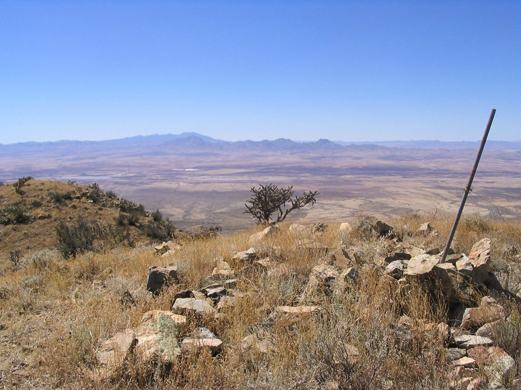
I found the continuation of the path, and went on my way. I gained the slope to near the top of a false summit, Peak 6,579 as shown on the map. The path grew sketchy, but the land was open enough so that I could navigate by line-of-sight. North of Peak 6,579, I dropped about a hundred feet to a saddle, then climbed the remaining 240 feet to the summit of Hachita Peak. The summit is marked by a post stuck in the rocks. I found a register and signed in, then took a few photographs of the surrounding peaks. It's a pretty place, and the views were stunning in all directions. However, I didn't stay long, as I wanted to return to βð and get out of the ever-increasing wind. The hike back went quickly, and I retraced my steps as best I could, periodically getting "lost" and then working my way back onto the paths. I was back in exactly an hour, as promised.
βð was having a fine time where she was, reading and writing, enjoying the quiet and solitude, but not so much the wind. It had really kicked up in the last hour and was becoming quite strong and very annoying. We bunched all her stuff together and into my pack, and we started down. The downhill hike went well, save for the wind which was sustained at least 30 mph, gusts up to 45. Fortunately the whole hike itself isn't very long and we made good time back down to our truck, arriving about 2:30 p.m. So far as we could tell, no one had ever come by, which was good. We changed quickly and drove out to the highway.
We had a leisurely drive along NM-9 through Hachita and then through Columbus, where we stopped for cold drinks and a potty break. Columbus sits near the Mexican border, and is one of very few places in the United States to be temporarily occupied by an invading force, that of Pancho Villa during the early 1900s. In fact, one of βð's ancestors was part of the force that fought Villa, even venturing into Mexico to track him down.
Then we drove to Deming for groceries and then to the Faywood Springs, where a couple hot tubs with our names on it were waiting for us. We had a wonderful two nights and one day here, enjoying the soaks and the kitties who came by to visit us. The hot water was just what we needed for the leg muscles. Two days later we went onto our next objective, Burro Peak.
|
|