The Mountains of Arizona
www.surgent.net |
|
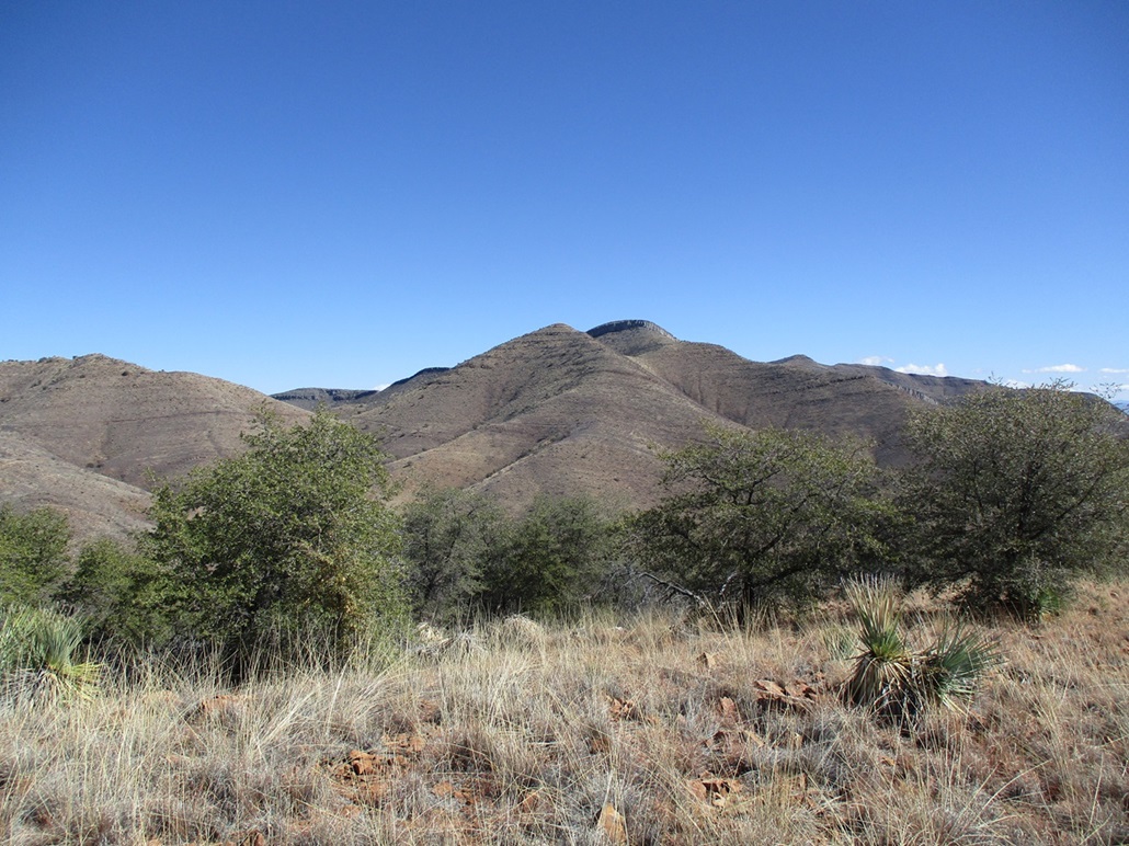
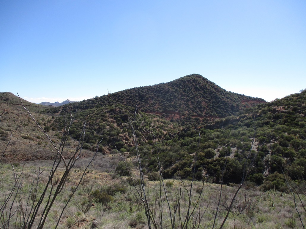
Peak 6436 • Jones Hill Today I would be sticking close to home, my objective being Peak 6436, a trapezoidal-shaped peak that rises on the west end of a ridge overlooking Bisbee, north of the city. Mural Hill, which I hiked in 2018, is the more noticeable peak on this ridge, with a band of limestone cliffs that are easily visible from below. Peak 6436 rises about a mile and a half west. I would tack on a shorter hike up Jones Hill on the hike out. We had a few days of rain and cold weather, then wind and clearing skies. Today started cold (low 30s) and did not expect to break 50, but it was cloudless and clear, a sunny and calm day. I didn't have far to drive. From my home, I drove a couple miles into Old Town, and parked in one of the lots. I was already dressed and ready to go. I locked the car and started walking, the time about 8:10 a.m..
Date: February 8, 2024
• Elevation: 6,436 feet
• Prominence: 482 feet
• Distance: 5.8 miles
• Time: 3 hours, 30 minutes entire hike
• Gain: 1,360 feet (gross)
• Conditions: Sunny, clear and very cold
Arizona
•
Main
•
PB
•
LoJ
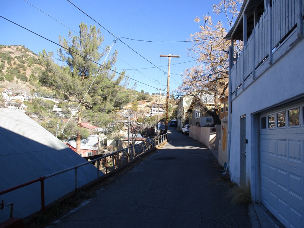
I followed OK Street northbound. This narrow street overlooks Brewery Gulch, the "downtown" part of Old Town, and features a couple of old-style hotels, one where my wife and I stayed many years ago. I walk OK Street regularly as part of my wanderings when in town. Houses are built precariously close to the street, often requiring steep hikes up stairs to access. On the "downslope" side, the roofs of houses are about street level. The street itself is narrow, about one car-width wide.
At the end of OK Street, I walked up a concrete driveway toward the let-in point where trails access the shrines atop Youngblood Hill, or the big "B" on the hillside below Chihuahua Hill. Just a couple feet in from this let-in point, the trail splits. A right leads steeply uphill to a saddle connecting Youngblood and Chihuahua Hills. A left follows a trail that curls around the northern slopes of Youngblood Hill.
On my 2018 Mural Hill hike, I took the right branch up to the saddle, then dropped over 400 feet into the adjacent canyon below Jones Hill, then regained that 400 feet to place me on a trail — actually a very old vehicle track — north of Jones Hill, this road leading toward the higher ridges and peaks along this ridge. I was not eager to have to redo it this way. Looking online at satellite images, I saw the left branch, which I had been unaware of previously. This trail appeared to connect to the old vehicle track.
Now, actually on this trail, it was an excellent, well-maintained trail that gained gently and cut around the north slopes, leading to a saddle that connected to the higher hills. I stayed on the trail as it cut east, and dropped into and out of a couple small canyons, the drops each time about 60 to 80 feet. I crossed one ancient barbed-wire fence along the way. According to land-ownership maps, this segment is on private land, but it is unfenced and unposted, likely mine-owned with a de-facto policy of allowing access as long as one behaves (no camping, shooting, dumping, the usual common sense things).
I kept to the trail and it took me right to the old track north of Jones Hill. It was well defined the whole way and I was pleased how easy this segment went. I am sure it was here in 2018, but I just didn't know it. It saved a lot of hassle of losing then regaining over 400 feet.
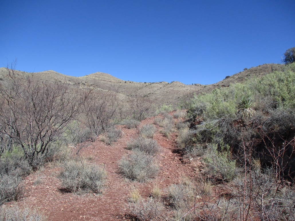
I then proceeded north along this track. These days, the track is overgrown with ocotillo, mesquite and cat-claw and acacia scrub. But many people hike back here and a good trail has been cut through the brush. I followed the trail northward about ten minutes to a junction where a right heads to Mural Hill. I stayed straight, now on virgin trail for me.
I just kept to the trail, sometimes wiggling around denser brush or ocotillo, at times the open trail right on the lip of the old road bed. On one side, the road bed itself was completely taken over by brush, while on the other side, a steep drop downslope. I walked the paths until I ran out of path, but by now I was very close to the peak, less than a quarter mile distant. The satellite images showed the trail to here, then disappearing, so this was not a surprise. I was pleased to get this close as it was. I had hiked a little over two miles from my car to here.
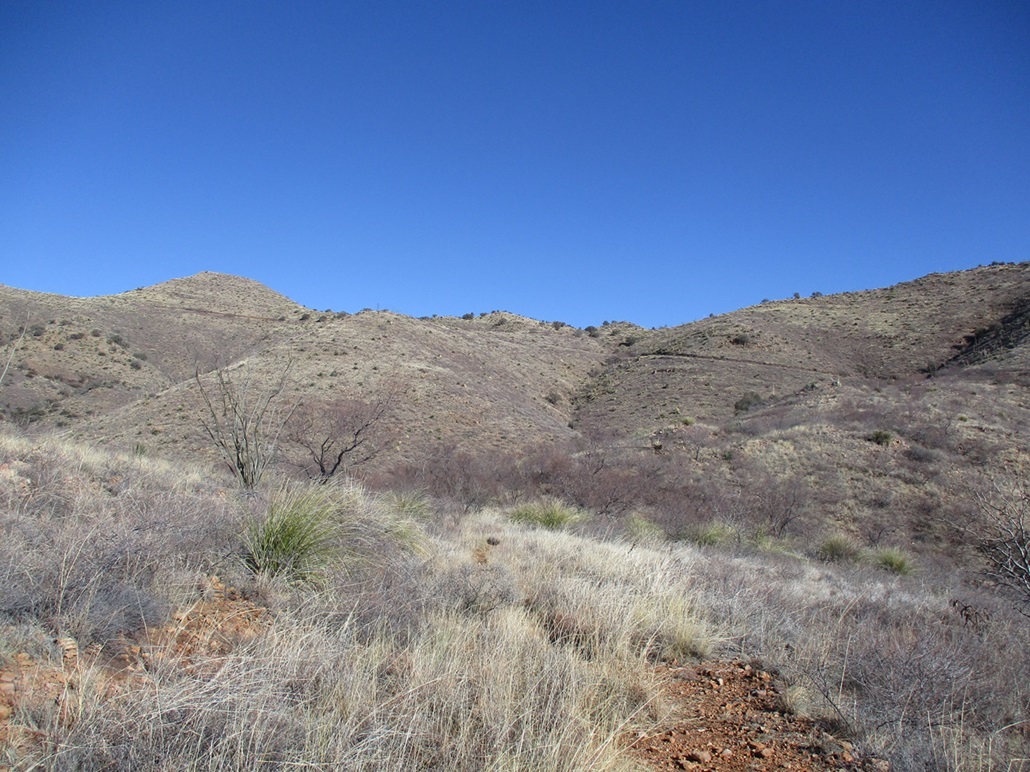
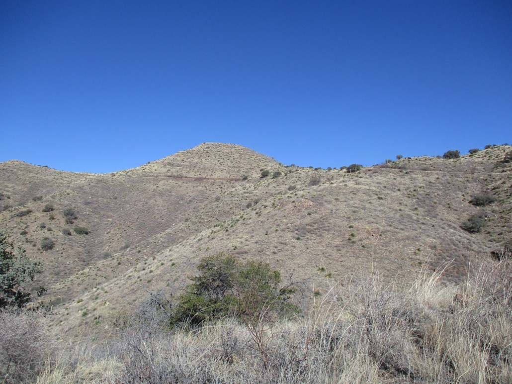
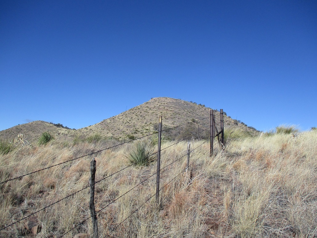
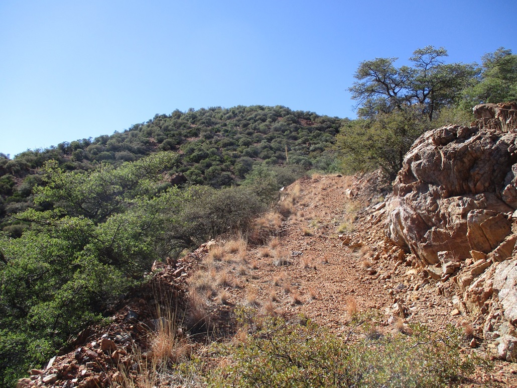
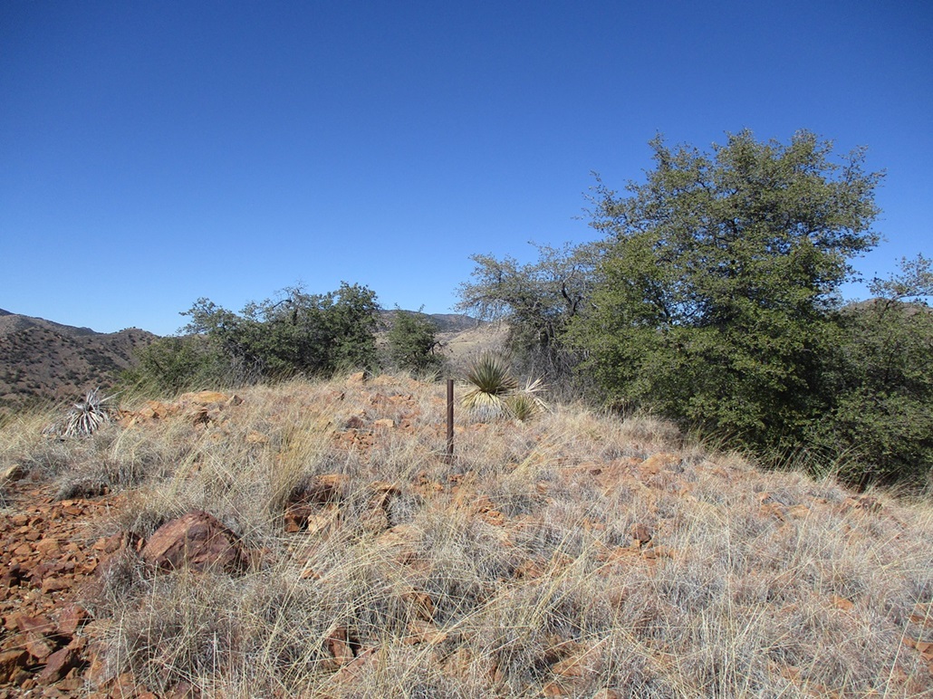
I left the trail and started up an easy slope, aiming for the ridge crest, which I gained quickly, then dropped down a few feet to pick up the old track again. It was hard to see where it had disappeared in that short segment, but it didn't matter as the off-trail hiking was very easy. I continued on the track a few more yards, then when it felt right, left the track and followed a narrow path uphill to a fence line, where I was able to cross it by going underneath, then up to the high ridge. I could see Peak 6436 again, now right in front of me.
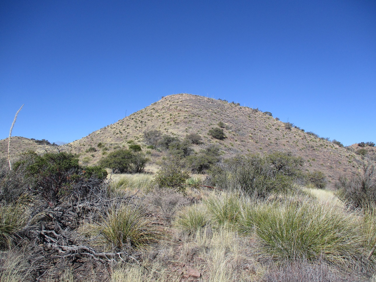
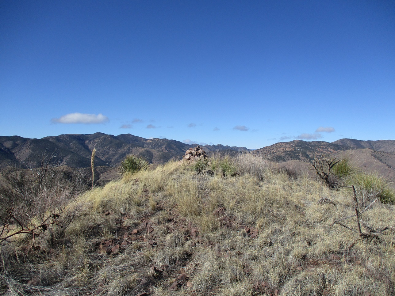
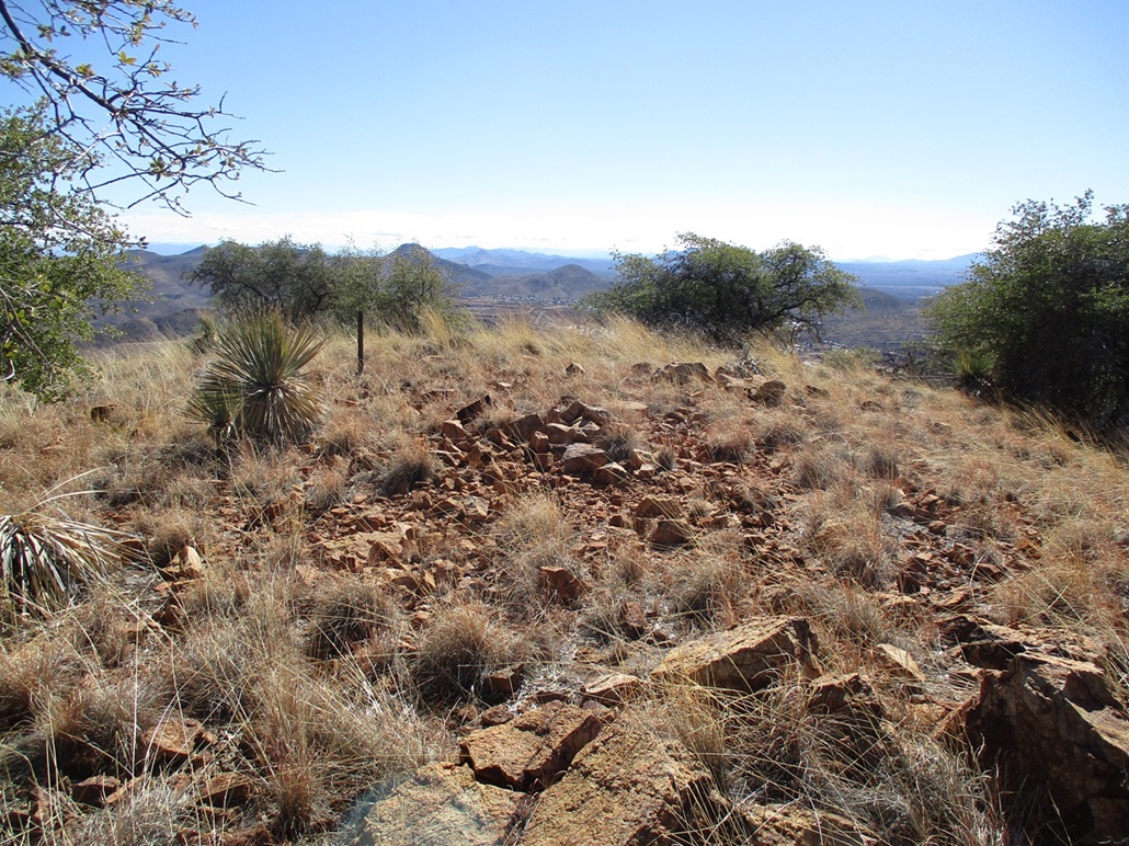
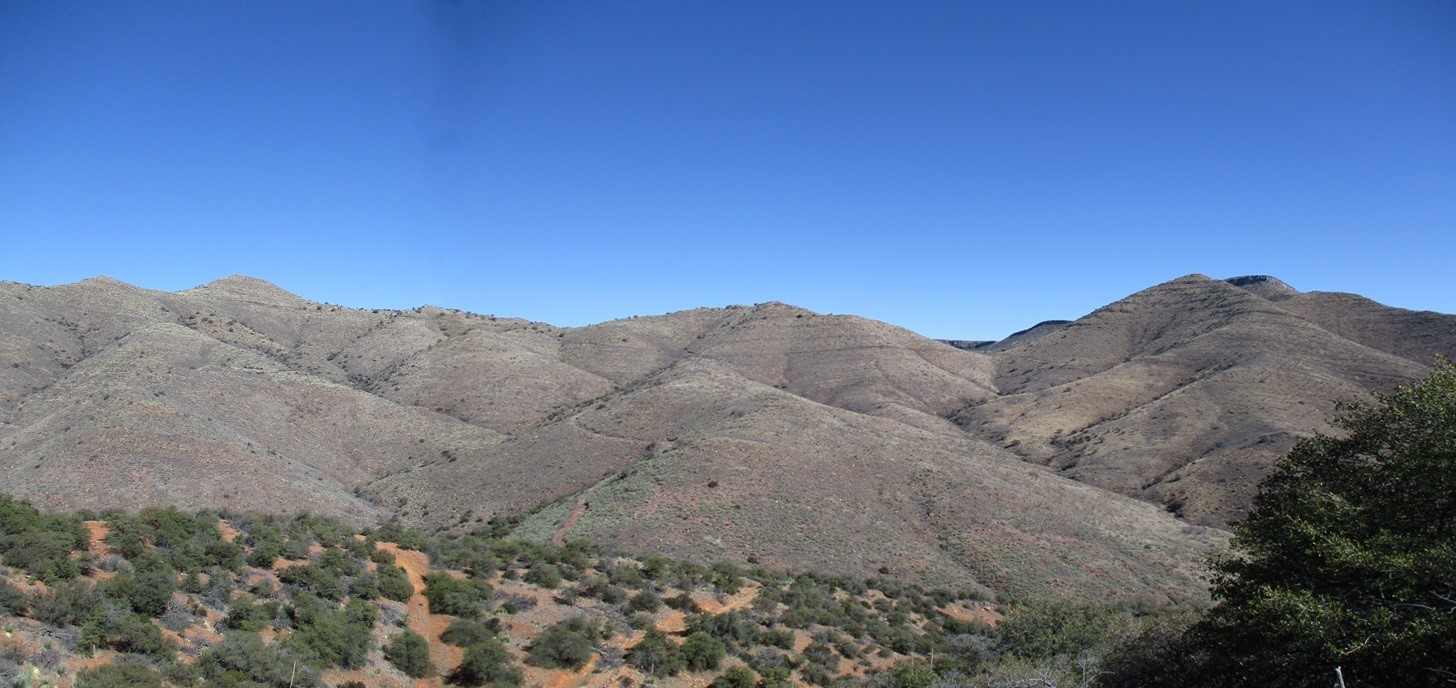
There was a weak path that cut through here so I followed it. I had to cross another fence along the way, now on the steeper slopes. The top 200 feet was steep but not complicated, just grassy, thorny and some rocks that wanted to move. I was on top the peak at 10:40, a 90-minute hike with about a net 1,050 feet of gain. The top is open and features a substantial blocky cairn about three feet high.
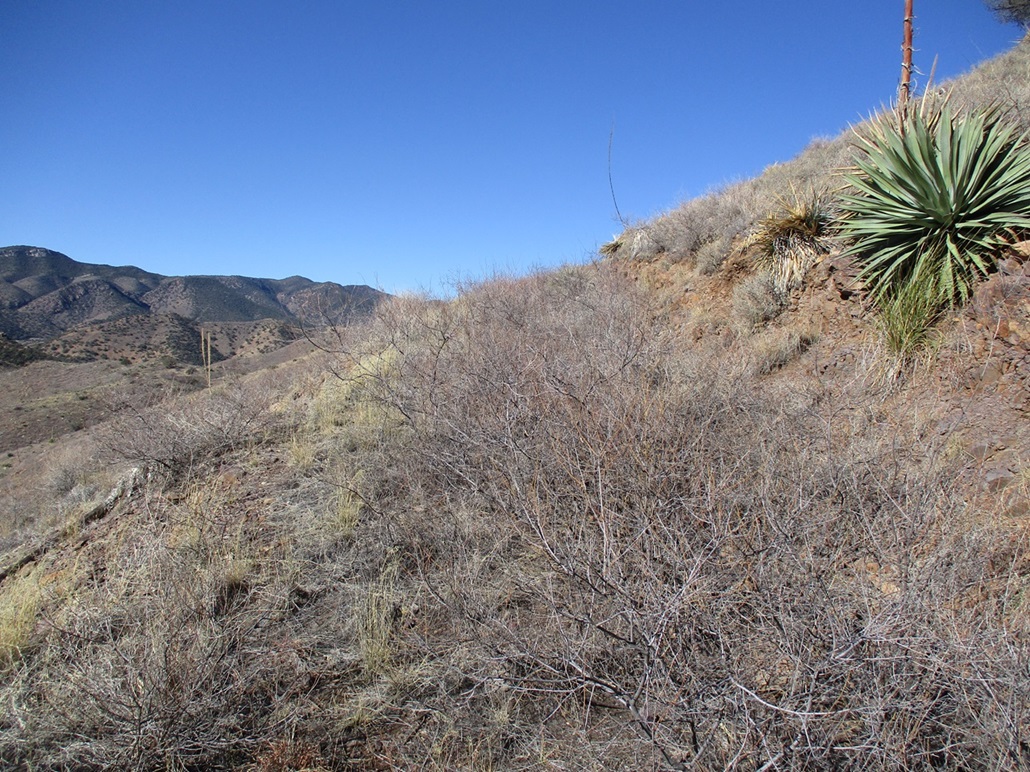
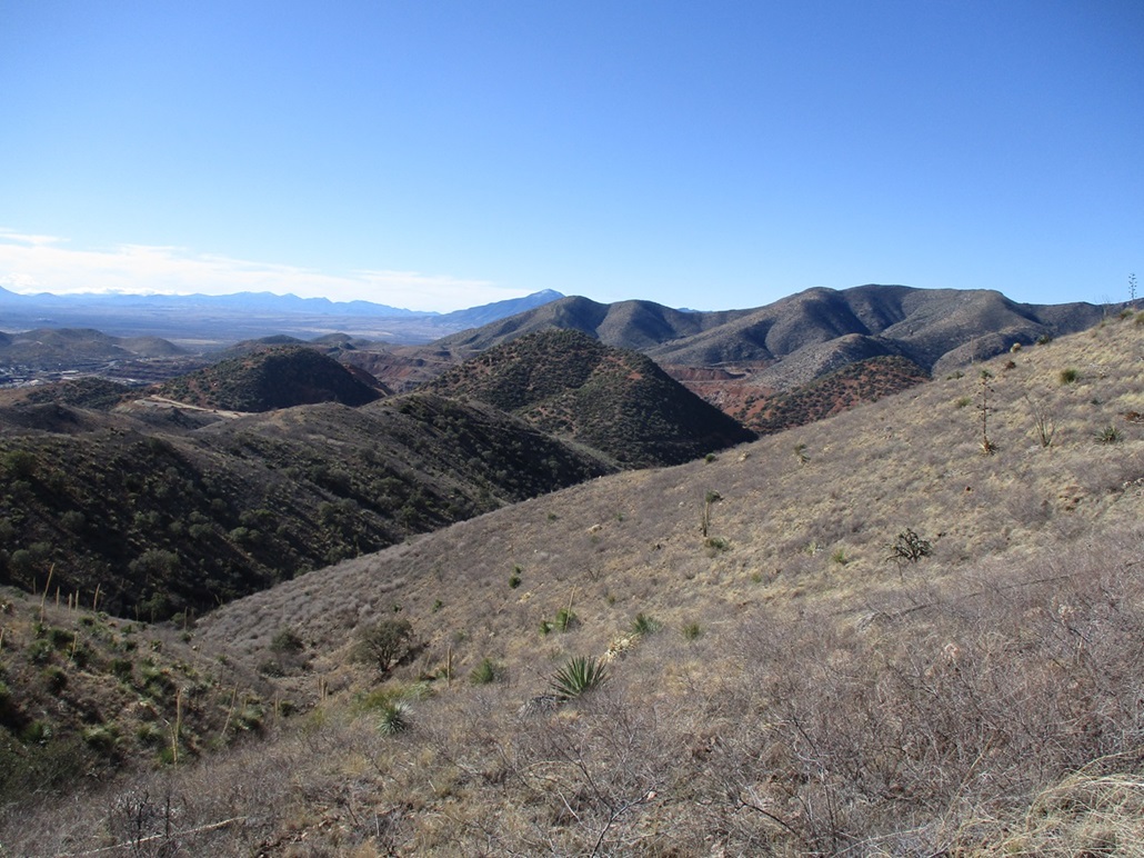
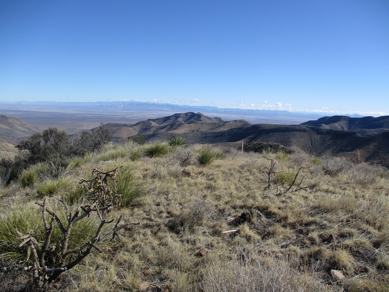
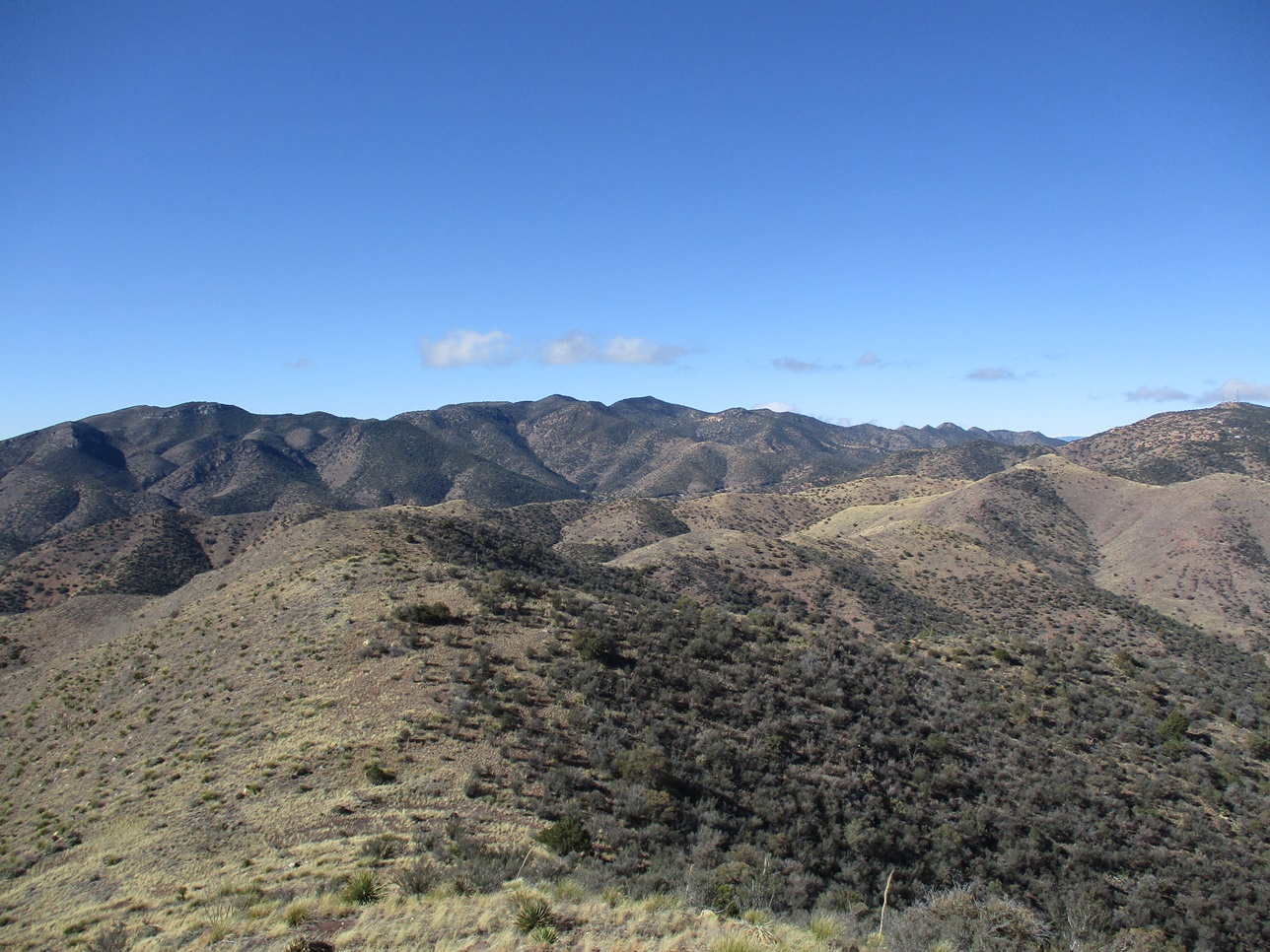
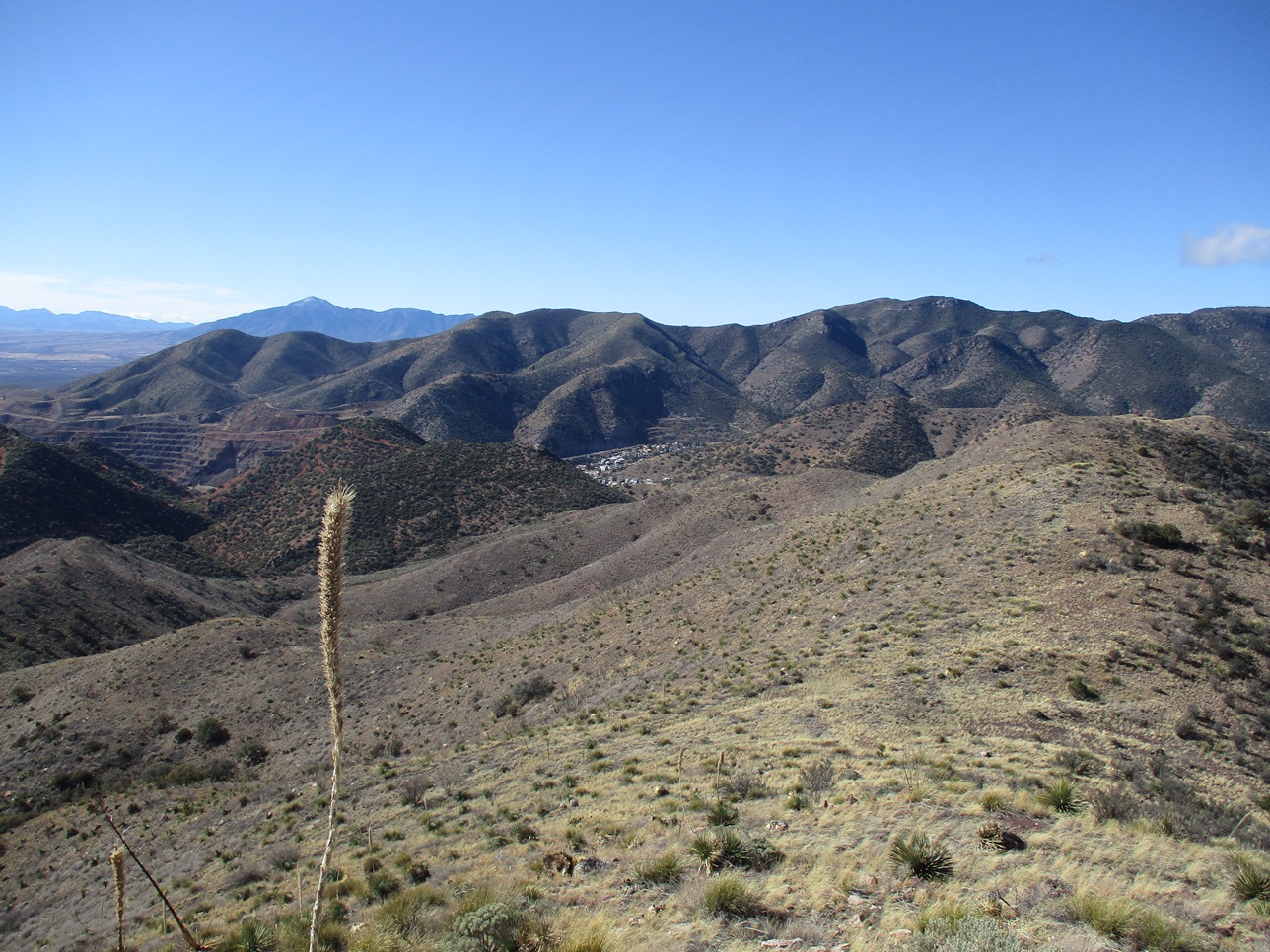
I inspected the cairn for a register but found nothing. There were no signs or benchmarks or things like that to be found. I had fantastic views in all directions so I snapped some photos, then rested a bit on a nice blocky sitting rock. I could see parts of Old Town below me, then the big Lavender Pit, and behind that, a hill blocked a view of where I live. The conditions were lovely, but it was colder up here, and breezy enough to chill me. I spent about ten minutes up here.
I hiked down the same way, back to where the trail had fed me onto the track just north of Jones Hill. Since I was so close to Jones Hill, I would hike it as my bonus peak for the day.
Elevation: 5,962 feet
• Prominence: 343 feet
• Distance: 0.8 mile
• Time: 25 minutes
• Gain: 372 feet
PB
•
LoJ
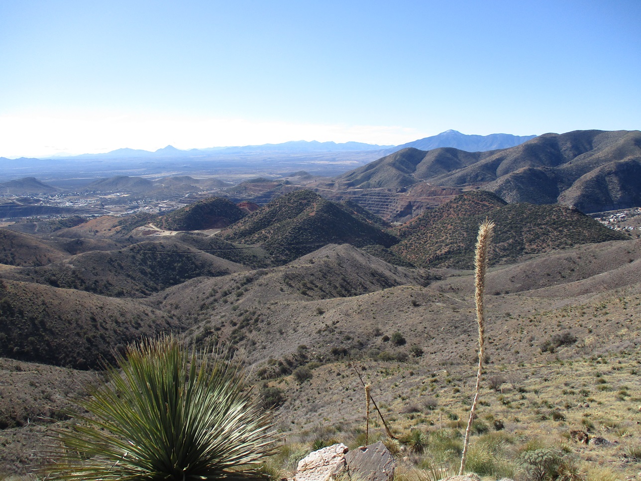
Jones Hill is one of the three "red" hills that rise above highway AZ-80 across from the Lavender Pit. The western hill consists of Youngblood and Chihuahua Hills, then Jones Hill is the middle one, then Copper King to the east. These hills stand out because they are so much redder in color than the surrounding mountains.
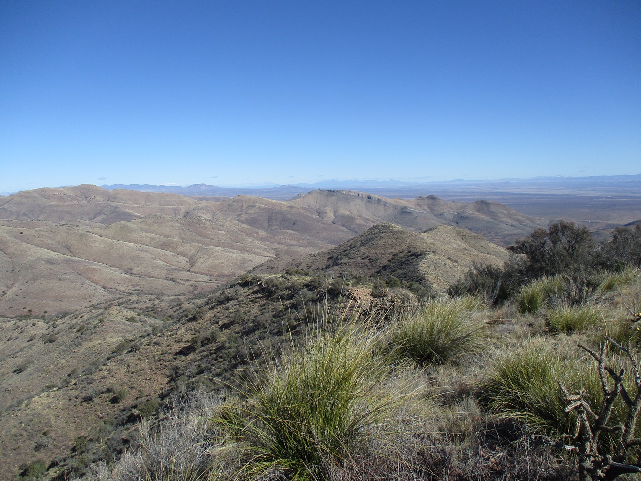
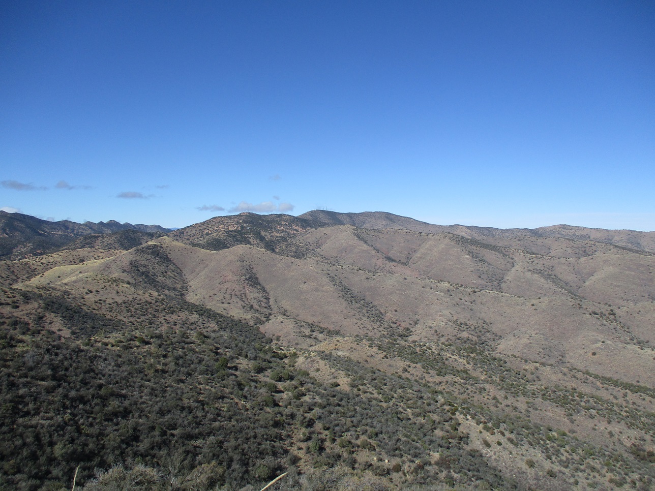
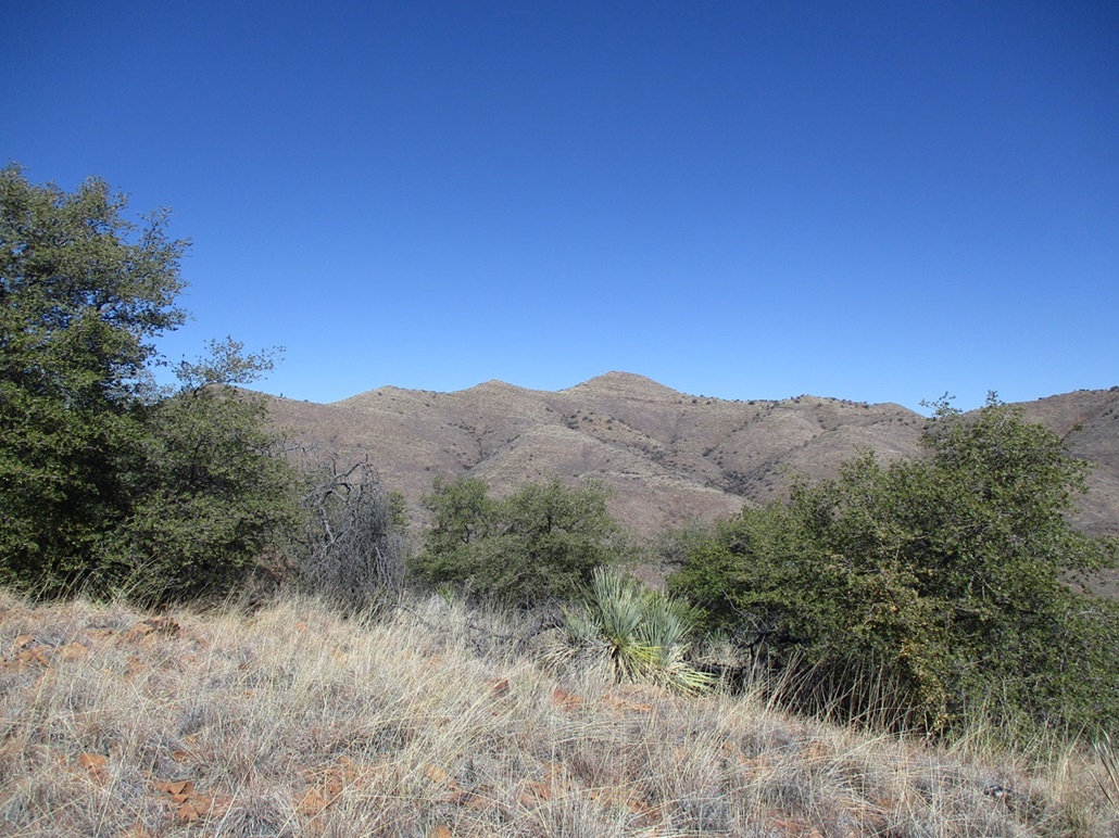
I followed a rough road uphill as it switchbacked a couple times. It ends below the summit, forming a cliff where the road was cut in. I walked up a small slope at the near end of this cliff, and this fed me on to more slopes that in turn led me right to the top, about a fifty-foot gain from the road. The top was open with a metal pole roughly centered, while the highest point was one of three large rocks toward the north end. I had good views of Peak 6436 and Mural Hill, so I snapped a couple images, but I did not stop. There was no register to be found and I was back to the track, this side trip taking less than a half hour.
So I get back onto the connector trail that will swing around Youngblood Hill, and I hear a low droning buzz, then suddenly a helicopter appears over a nearby ridge, not more than a couple hundred feet above the ground. I stopped to watch it. By the colors, I think it was a Sheriff's copter. It flew by me, but not very fast. It continued on its way, then made a wide turn and came back my way, now lower.
I'm naturally wondering what's going on. Are they searching for someone? I thought so. Did they take me for the person they were searching for? Probably, at first. Seeing any human was probably a lead for them. When they came back, they stopped short and made another wide turn to proceed in the opposite direction. I wasn't worried, but I was relieved they had moved on. They flew about a mile west and generally hovered over that area.
I got back to OK Street and walked it back down to where I had parked, arriving to my car a little before noon. This had been a hearty hike with over 1,700 feet of gross elevation gain when all the drops and regains are figured in, and along mostly-easy trails and tracks, and some off-trail segments.
I am still learning the history and the place names here in Bisbee, many of which do not appear on maps or are inconsistent when they do. Brewery Gulch actually runs for quite a way, over a mile, snaking northwesterly up a canyon that progressively gets steeper and rugged before meeting a saddle west of Peak 6436. This upper canyon (apparently) is called Zacatecas Canyon, named for a shanty town erected here by Mexican migrant miners and laborers in the early 1900s. No traces of this camp exist.
There are good trails all over the hills here, encircling Bisbee to the north. Much of the land is private but mine-owned. Hikers are welcome but are expected to behave, and a few hiking clubs exist in town and walk these trails often. I've barely scratched the surface. On my hike, I mentioned the lower segment was private/mine. The middle segment, roughly north of Jones Hill, was on BLM land, while the highest ridge and summit were on State Trust land.
As of 2024, only three people, including me, have logged a visit to Mural Hill and the same three people to Peak 6436 at Listsofjohn. I'm the only one to have logged visits to these peaks on Peakbagger. But this is very misleading. I've been able to find a few trip reports of visitors to these peaks on HikeArizona, and in talking with locals, if they mention they hike, they almost all have been up to Mural Hill, some "many times". That one will likely draw the visitors as it is more visually prominent. I have no real idea how often these peaks are visited, but it's likely a dozen or more times a year. One of the hiking clubs comes up here often, and there are trails and tracks that allow for loop options. Is Bisbee really that far off people's radar?
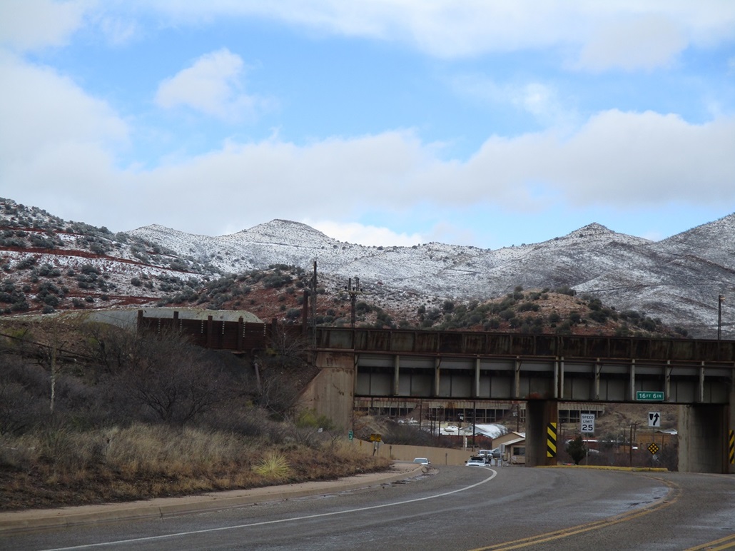
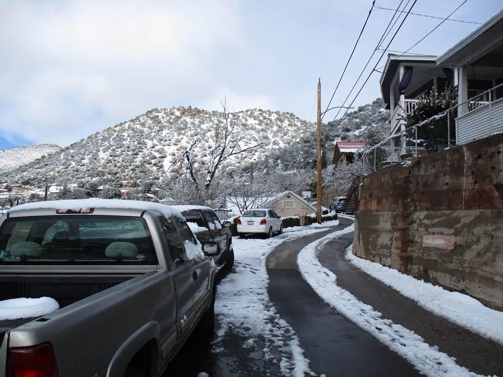
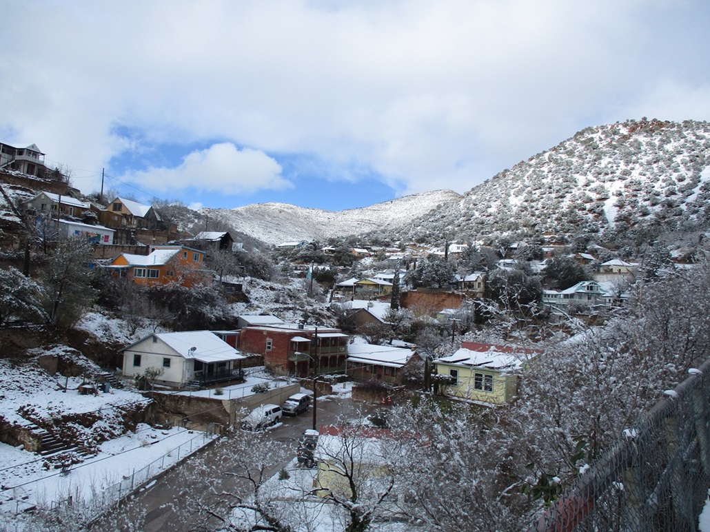
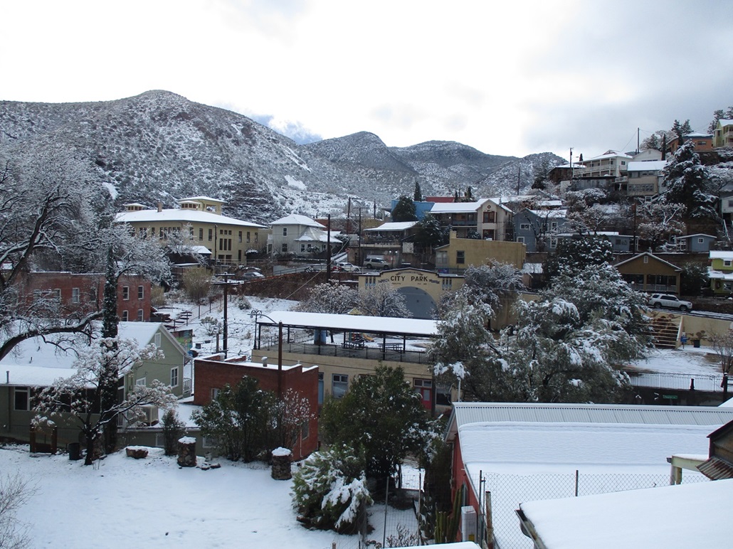
Two days later, a storm came in and dropped a couple inches of snow, covering everything down to about 4,500 feet in elevation in snow. I walked around the city after the snowing had ceased and snapped a few images showing the sudden change in character.
|