
The Mountains of Arizona
• www.surgent.net
|
| Skull Mesa |
• Spur Cross Ranch Conservation Area (part) • Tonto National Forest • Maricopa County |
|
Date: February 7, 2021
• Elevation: 4,595 feet
• Prominence: 555 feet
• Distance: 9.2 miles
• Time: 7 hours
• Gain: 2,750 feet
• Conditions: Sunny and clear, cold at first, warm as I exited
Arizona
•
Main
•
PB
•
LoJ
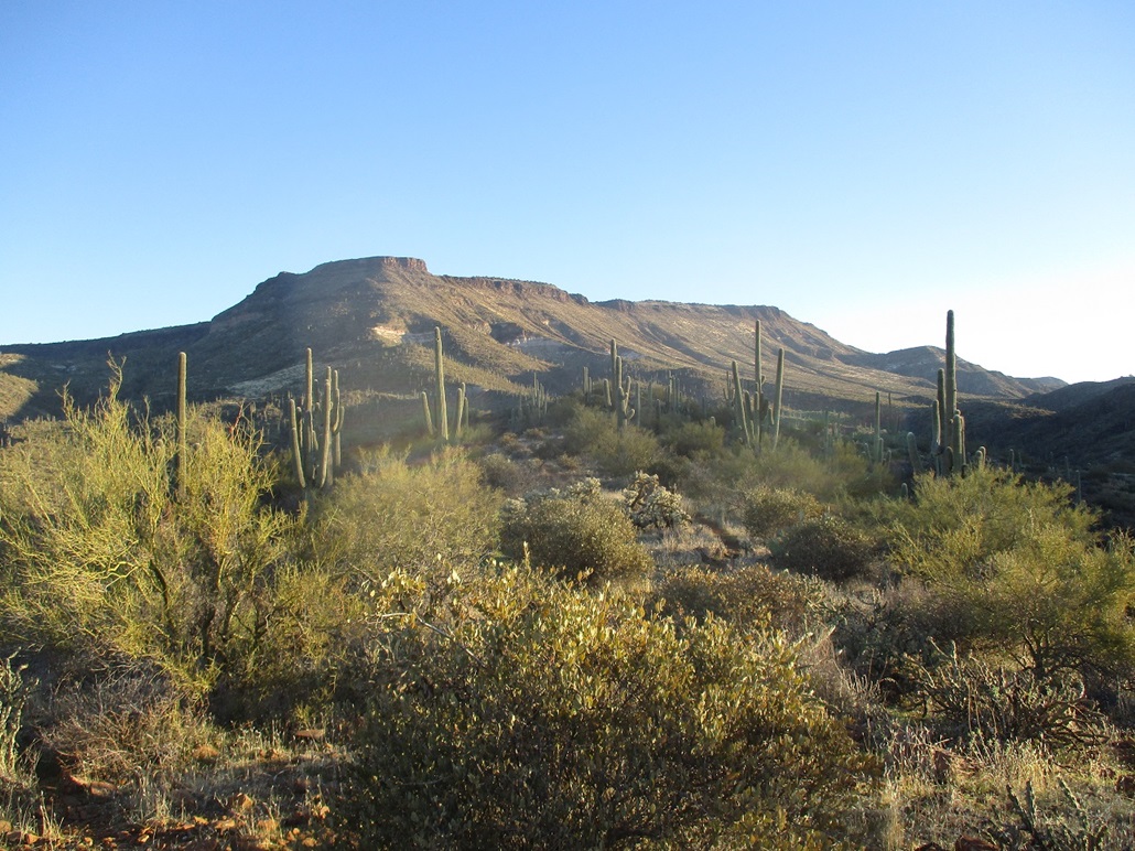
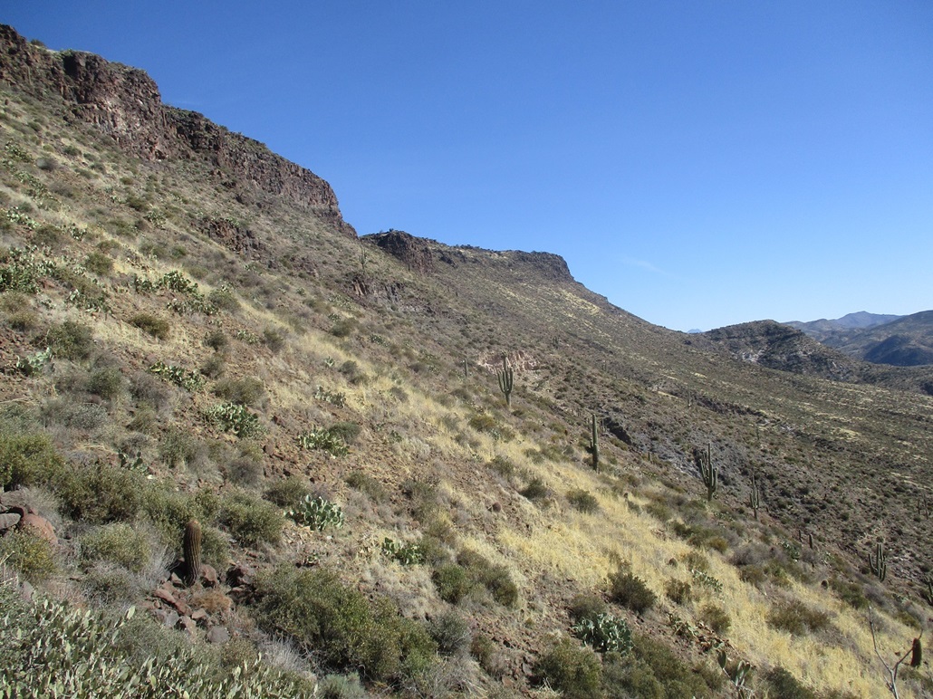
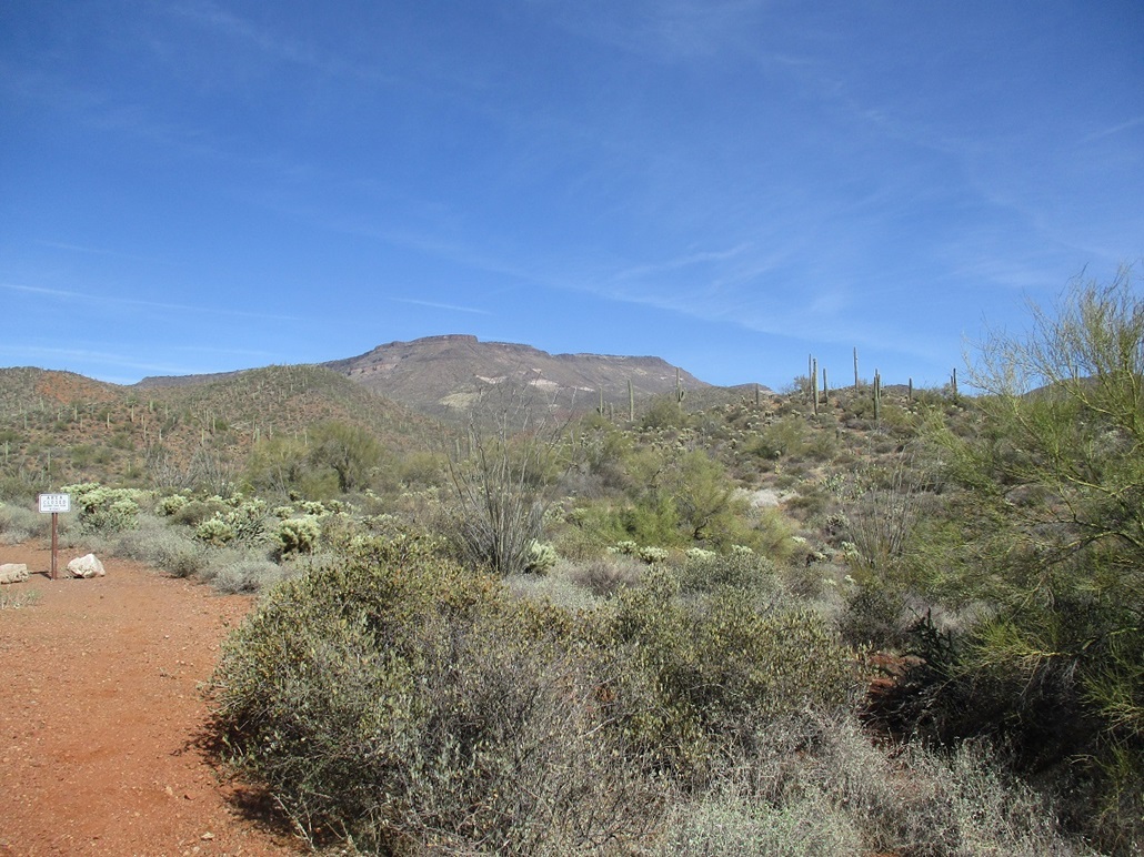
Skull Mesa is north of Cave Creek, in the southern foothills of the New River Mountains. It lies west of Quien Sabe Peak and south of the New River Mesa and Skunk Ridge. The mesas are volcanic, with flat tops and cliffs on the edges, then steep slopes down to the various canyons that separate the mesas and hills. The hike to its mesa top is an Arizona classic, although relatively few people seek out the highest point.
I approached Skull Mesa from the southwest, via the Spur Cross Recreational Area. This was my second time at Spur Cross, the first since 2012. I left Payson at 4:15 a.m., and was in the Phoenix area about 75 minutes later. I followed Shea Boulevard to the Loop-101 to Scottsdale Road north to Cave Creek, then Cave Creek Road to a Circle K where I got gas, snacks and a Tonto Forest day pass. Still dark, I found Spur Cross Road and drove it four miles to the parking area, arriving about 6:15, still mostly dark. I was about the fifth car here. I got myself dressed for the hike and my pack prepared, waiting for the Sun to rise a little more. I started walking at 6:35 a.m.., just enough light to see my way properly.
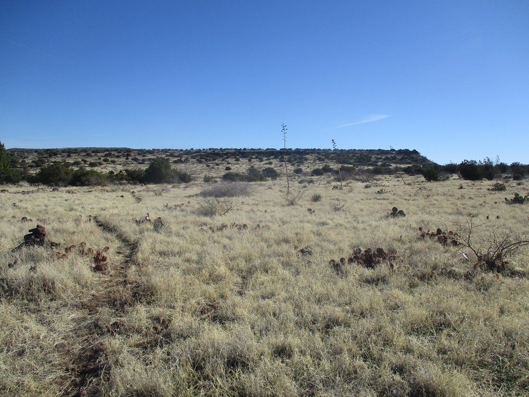
Some other people had already pulled in and were out walking, most walking their dogs. The initial hike follows the road to a gate. Here, I paid my $3 Spur Cross access day fee, walked up the road (the Spur Cross Trail) some more to a Y junction (and a ramada and porta-potties) and went right, walking the road on a slight north-northeast bearing. I passed a couple dog walkers along the way. It was still mostly dark and very cold, near freezing, so I walked quickly to stay warm. In about 10 minutes, I had covered about three-quarters of a mile, coming to the Mariposa Hill Trail.
The normal route is to stay straight (north) and follow the Spur Cross trail another mile-plus to its junction with trails that head east toward Skull Mesa. Studying the satellite images last night shows a fine trail that heads northeast from the Mariposa Hill Trail that meets up with the Cottonwood Trail (#247), which is what I wanted. Then I found some references about this trail on HikeArizona. It's not an official trail. It does not have a number or name, but it is an excellent trail. For purposes of this page, I call it the Mariposa-Cottonwood Connector (MCC).
This trail would save me about a mile and a half each way, and avoid having to cross Cave Creek, which was flowing today. Had I stayed north on the Spur Cross Trail, I would have had to cross Cave Creek three or four times. So now on the MCC, I moved quickly, still very cold, not stopping at all. It went mostly up and sidehilled past low hills along the way, sometimes steeply. This connector only runs a little over a mile (1.1 miles by my rough reckoning). I was close to its junction with the Cottonwood Trail, and the sun was high enough to provide beautiful lighting for photos, plus a chance for me to stop and rest. I had covered a little under two miles in about 45 minutes. After a five-minute break, I was on the Cottonwood Trail itself.
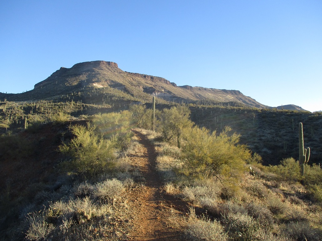
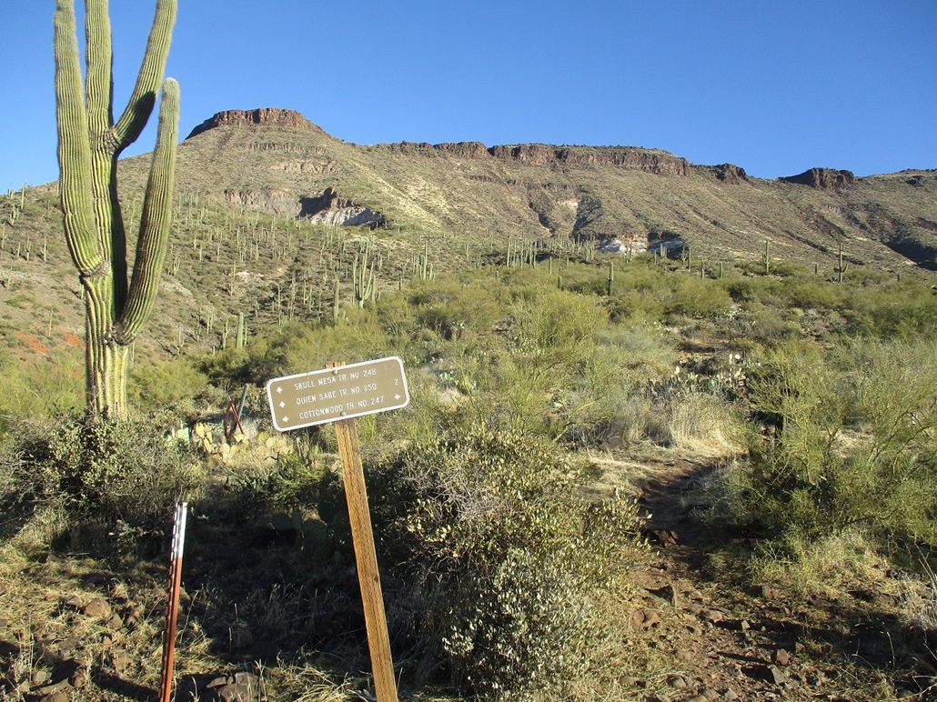
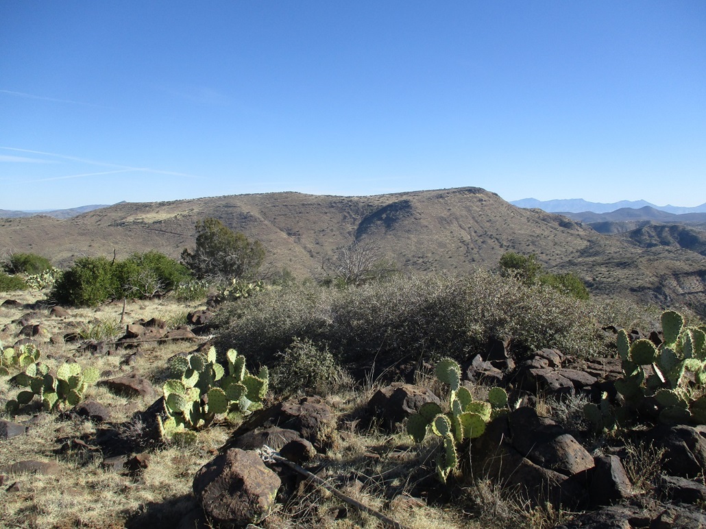
I followed the Cottonwood Trail northerly, then east, up a steep slope to a ridge, then down its other side. I was below the western face of Skull Mesa by now, the trail going east "against the grain" of the ridges emanating off the mesa. This meant the trail would angle south, then east, then drop into and out of small arroyos (and some larger ones), adding some distance and elevation drop and regain. The trail dropped into one last arroyo, then gained steeply up the slope behind it, achieving its ridge-top at a gate where the Skull Mesa Trail (#248) heads north up the mesa, and the Cottonwood Trail goes right/southeast, on its merry way. There is a gate here, tensioned closed with a very clever tensioning system that I won't describe here. I want future visitors to be sublimely charmed by it. The wonders you can do with a metal post, a chain and a weight.
I took a longer break here, psyching myself up for the big grind, a 1,100-foot gain up the trail to the mesa rim. Then a guy bicycled up, the first person I'd seen since the dog walkers earlier. He stopped and we chatted. He gave me some good information on the trail and what to expect. I appreciated his willingness to share information. He then went on his way, and I started slogging up the hill. I got about a third of the way up, then another hiker comes literally running up behind me. We chatted briefly, and he continued upward, jogging up the damn trail. When I got about two-thirds the way up, two other guys were coming down from the top. Suddenly, this was a popular trail. The trail itself was steep and narrow, but solid the whole way up. As I neared the top, two other people were below me, coming upward. Then that runner guy comes down! He'd already surmounted the rim. I wish I had a third lung sometimes.
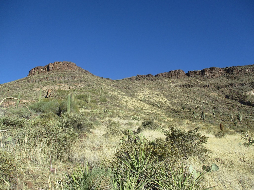
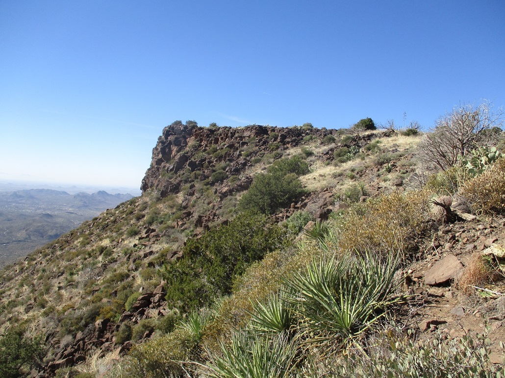
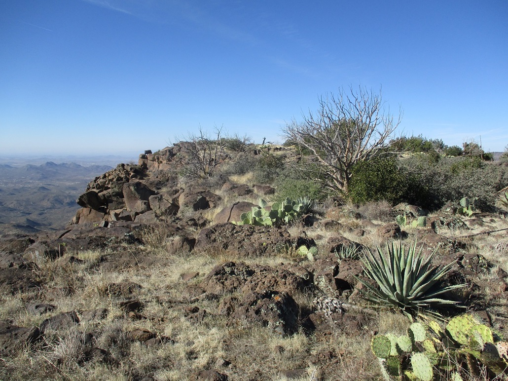
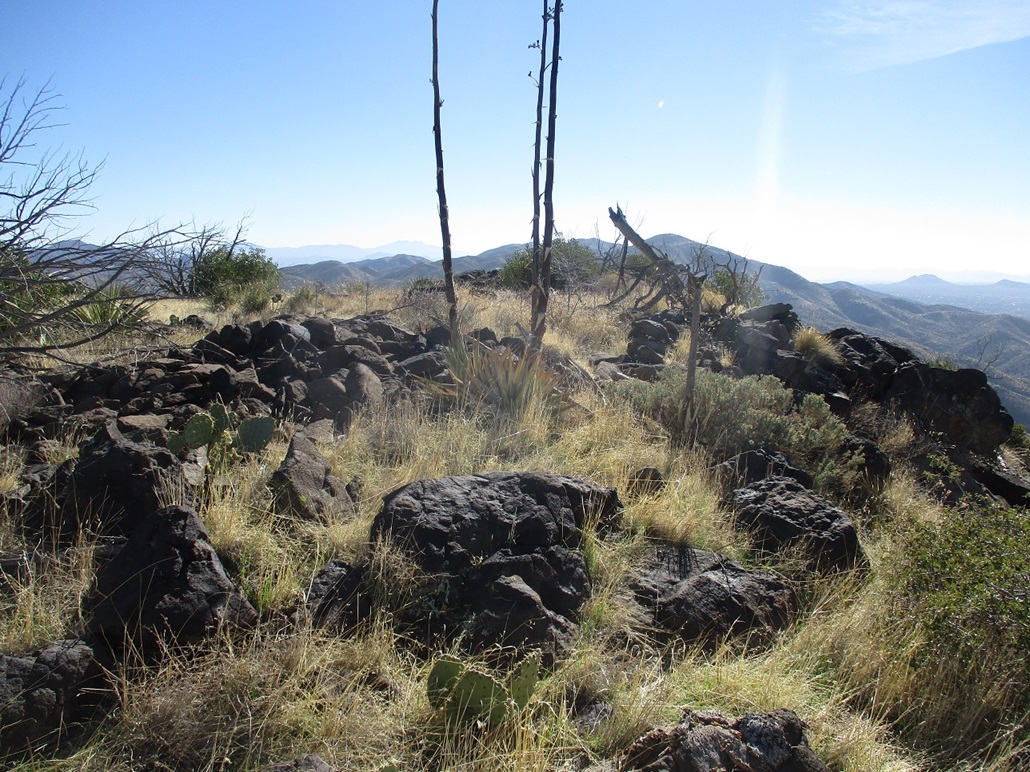
The trail surmounts the mesa near a prominent western promontory, elevation about 4,300 feet. It appears most people who hike up to the mesa rim then turn and hike out to this promontory since it's so close and with great views. I certainly don't blame most people for not going farther. The mesa top is shaped like a triangle, with the western promontory being one vertex, and the highpoint, elevation 4,595 feet, being the eastern vertex. The third vertex is a northern promontory on which Indian ruins are located, although I did not go that way to explore.
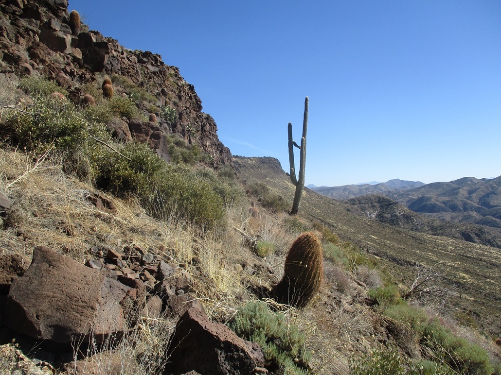
I wanted the real top, so I found a fine trail that angled northeast and followed it, going up one small sloping "cliff" band, then across a broad meadow dotted in pinon and juniper. The trail started to grow less distinct, but large cairns helped keep me on some semblance of a path. Eventually, the trail disappeared (or I lost it), and the cairns also stopped. By now, I was close enough to eyeball my way to the top. At 10:30, just under four hours after starting, I was "on top" Skull Mesa. Now to rest.
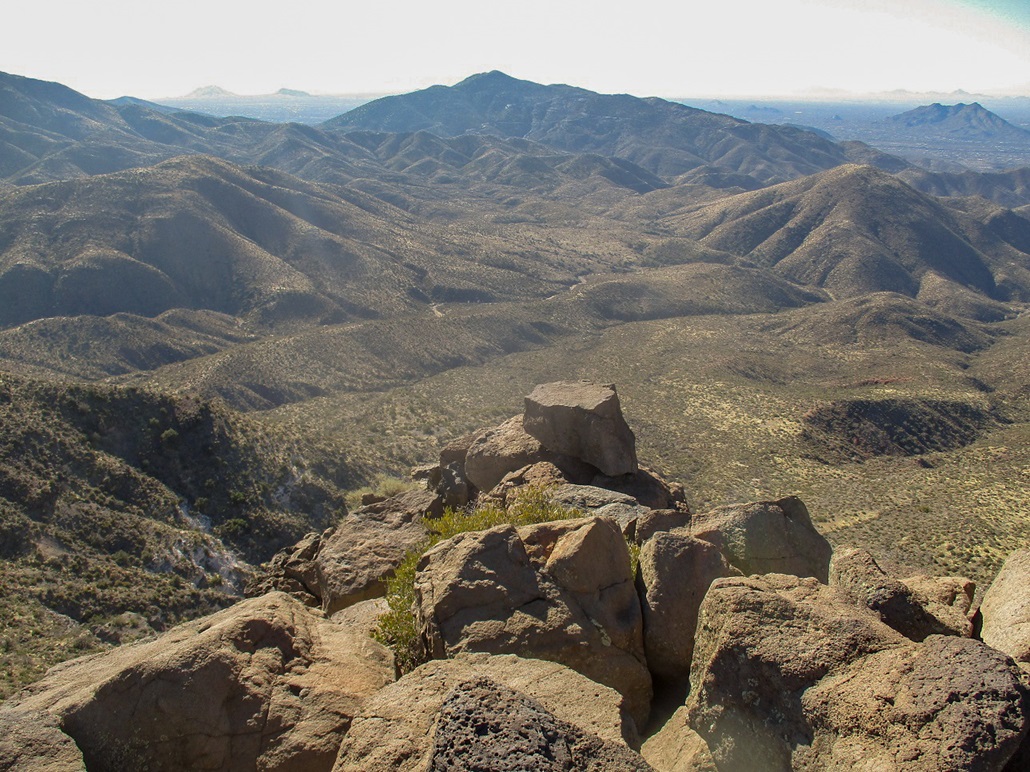
I ambled up to the highest rocks on the edge of the rim, looking out over the other hills and canyons. I looked around for a register and any benchmarks, but found neither. I then found a good flat sitting rock for an extended break. The top is rocky, a bunch of basaltic boulders either heaped into piles or sprinkled amid the grassy ground (which was somewhat muddy, by the way). I spent about 20 minutes sitting, doing not much except looking around and enjoying the quiet and the views. The day had warmed into the 60s and sunny, with a few high clouds and a breeze.
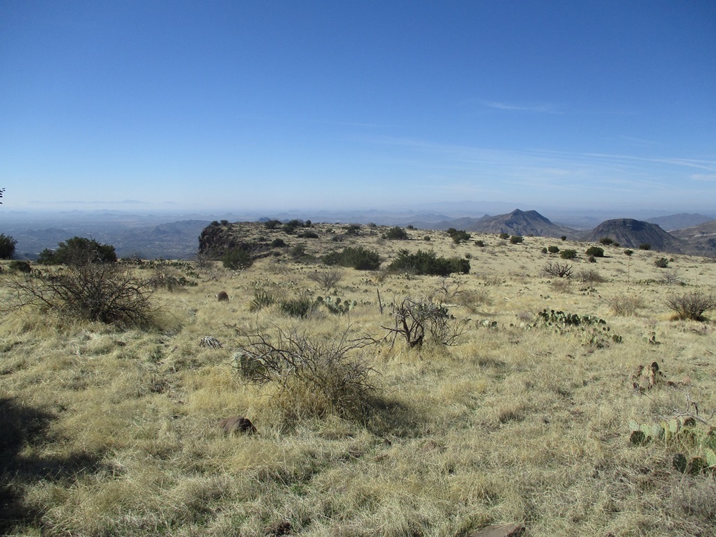
This was a lovely summit. The top is broad and flat, as one would expect for a mesa top. The immediate area was low rounded rocks and scattered pinon and juniper. From the rim edge, I had million-dollar views of the surrounding mountains, and of the buildings way off in Phoenix. There was some slight haze in the air, mushing out the longest views slightly. But closer in, everything was crystal clear. I can see why this is such a popular and classic hike.
Before my leg muscles tightened up, I started the walk out. I did not try to retrace my steps. I just aimed northwest and followed open lanes and random game paths, descending down to where the trail meets the rim near the western promontory. I never saw anyone once I was past this point, and there was no one here now. As I descended down the mesa, I went slow and carefully, making decent time, but not seeing anyone. I guess the mesa hikers all came in the morning. I was a little tired by now, but kept a consistent pace all the way out, and did not see anyone until I was back to the initial road, where I saw a number of hikers, families, dogs and kids. The day had warmed into the 70s and was lovely. I was back to my car at 1:35, the lot now completely filled with about 50 cars.
The MCC trail was a godsend, shaving off about three miles, three or four creek crossings and a number of up and downs, and probably 90 minutes, from the round-trip hike. My mileage came to about 9.2, which is probably a low figure. Without the MCC, I was looking at over 12 miles. The net elevation gain was 2,300 feet, but the handful of ridge crossings added a few hundred feet to that figure. The trails were all excellent so I could make good time. This turned out to be a tiring but enjoyable hike.
I sat for about 20 minutes in my car, slowly changing and also just doing nothing. People were still pulling up in their cars looking for spots. It was crowded immediately here, but not too bad even just a half-mile away. When I was here in 2012, I don't recall it being so popular. The Spur Cross Recreational Area was developed in the late 2000s (I think) so over time it has become very popular. It is a beautiful area and even with the crowds, an enjoyable place to visit.
I headed home, avoiding the traffic of the freeways (and the big Waste Management Phoenix Open going on nearby) by following Dynamite to Rio Verde, then Fountain Hills Road to Shea Boulevard and to the Beeline. I was home about an hour later. Today being Super Bowl Sunday, I was home just in time to watch the contest between two teams I don't care about. I was happy for Bruce Arians, the former Cards coach, who won his first Super Bowl ring.
Skull Mesa was a great hike in a beautiful environment. I have some unfinished business here, from when I was last here in 2012 and got turned back on a climb of Elephant Mountain, so I'll be back but I'm not on any timeline (Update: I came back in late October 2021 and hiked up Elephant Mountain). I understand that most people will be content to get up to the mesa top, then just relax on the western promontory. Only a few will want the actual highpoint.
|


|