The Mountains of Arizona
www.surgent.net |
|
San Luis Mountains Highpoint • Black Mesa The San Luis Mountains are a small range of peaks southwest of Arivaca in southern Arizona, just a few miles from the Mexican border. The biggest nearby peak is Fraguita Peak, which I climbed almost exactly one year ago (364 days to be exact). I wanted to visit the little border town of Sasabe and hike the nearby highpoint of the Pozo Verde Mountains, Pozora Benchmark. I knew that hike would not take too long, so I looked at this peak, the unnamed highpoint of the San Luis Mountains, as my second adventure of the day. This would allow me to drive two routes I've never driven before — state route AZ-286 down to Sasabe, and the western half of Arivaca Road, into the town of Arivaca. My hike up Pozora Benchmark went well. I was off that peak a little before 10 a.m.. I drove into Sasabe and spent about a half hour visiting the little village and wandering the interesting Sasabe Store, buying a colorful Mexican rug. From Sasabe, it's about a 25-mile drive to Arivaca. I followed the same roads I took a year ago to Fraguita Peak, being Coronado Forest Road 216, then turning off onto FR-4119.
Date: January 27, 2024
• Elevation: 4,797 feet
• Prominence: 597 feet
• Distance: 3.2 miles
• Time: 1 hour and 45 minutes
• Gain: 810 feet
• Conditions: Cool, sunny and clear, sometimes heavy breeze
Arizona
•
Main
•
PB
•
LoJ
My one main memory of this road, FR-216, was that once it passes over a pass north of Fraguita Peak, it drops into a valley and crosses through Fraguita Creek multiple times. The creek was flowing as usual, the crossings ranging for a couple feet to about twenty feet across and maybe ten inches deep. But the road was gravel and solid, mud not being a concern, so it was easy to drive through each crossing. My undercarriage got a good cleaning today.
Forest Road 4119 was not as well maintained but still a decent road. It was narrower, had more dips and rises and a softer tread. It also crossed (or was crossed by) a smaller creek multiple times. I had no idea how far in I would get, but I was pleased to get to "Upper Windmill" as shown on the map, roughly two miles in from FR-216. A storm had passed through a few days ago, and although it was dry today, I could see ruts and places where water had pooled, suggesting this road would get rough when newly wet.
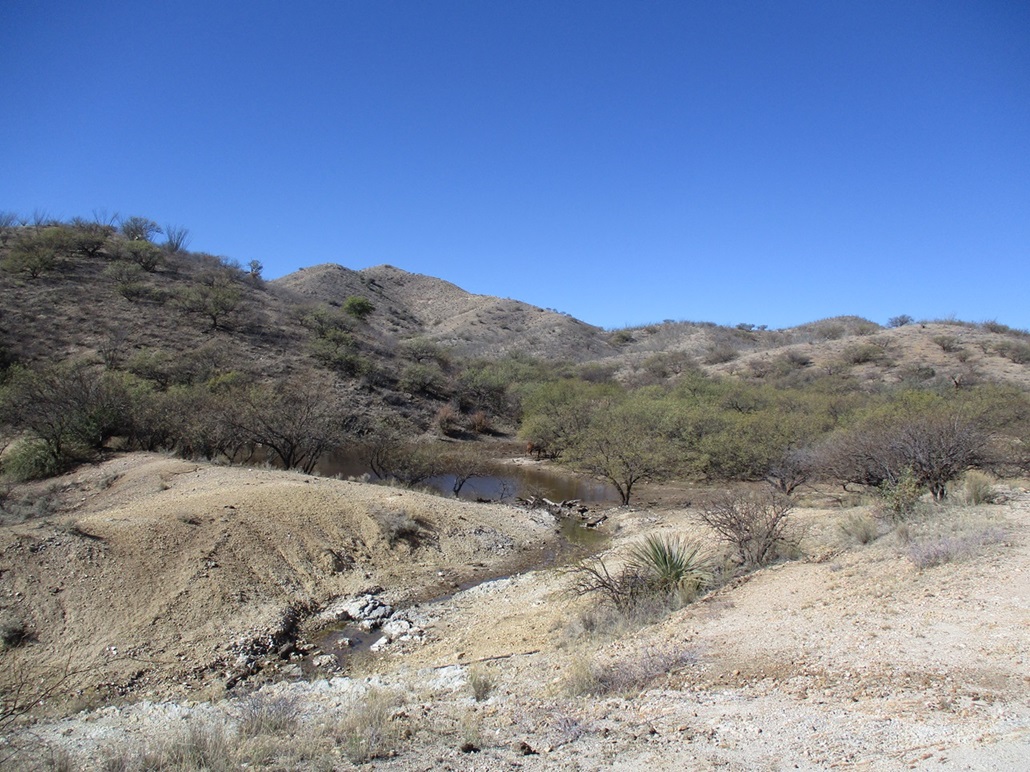
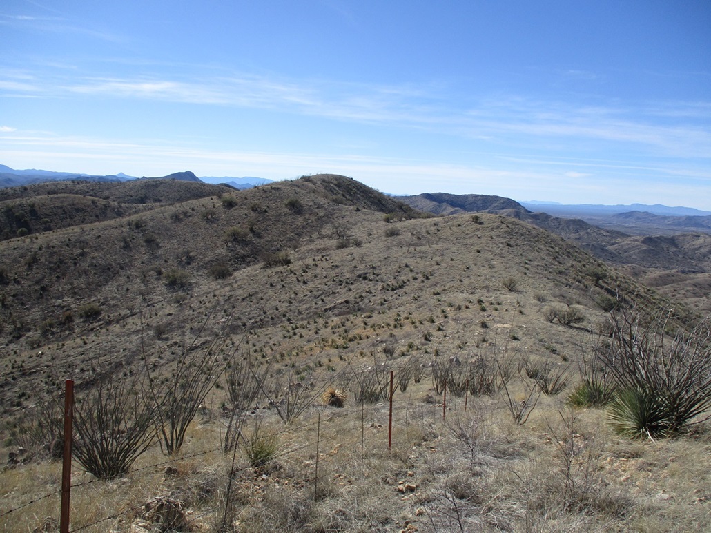
I turned left (south) onto FR-4877, which runs south up San Luis Wash, which abuts the San Luis Mountains about two miles away. I was happy to get this far, but hoped I could inch in a little farther in on this rod. This road was much rockier but still passable if I went slow. I passed through a couple more creek crossings (I lost count after awhile, I think I crossed water about 15 times overall). I finally parked when I found a good spot at yet another creek crossing. I was within an air-mile of the summit anyway, close enough to walk.
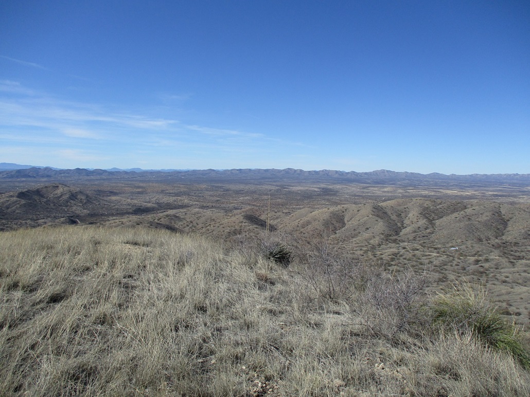
I started walking around 11:20 a.m., the day having warmed nicely, about 60°. It was still sunny and cloudless, and the heavy breezes I had on Pozora Benchmark were still present here, but since I was in a canyon for now, it was mostly calm.
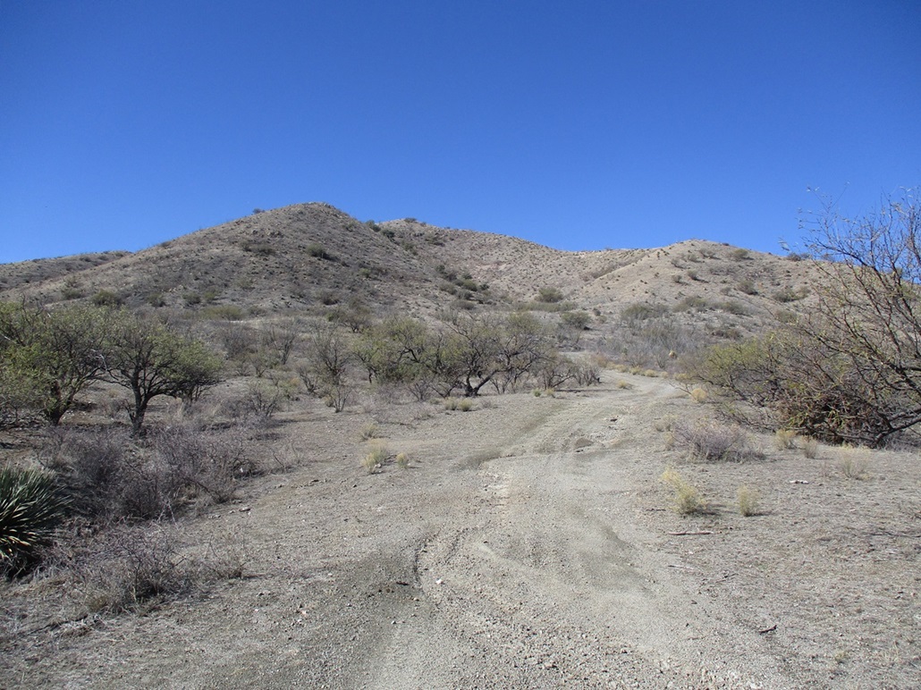
The road walk went quickly. I passed some cattle at Encinas Tank, and in about twenty minutes had covered roughly a mile to where the road comes to a T-junction, where a right goes to a saddle below the peak. Walking the road, it looked marginal had I tried to push the Subaru on it. It would have been slow going. But the road after the T-junction definitely would need higher-clearance 4-wheel drive, there being some bad erosion ruts in the road.
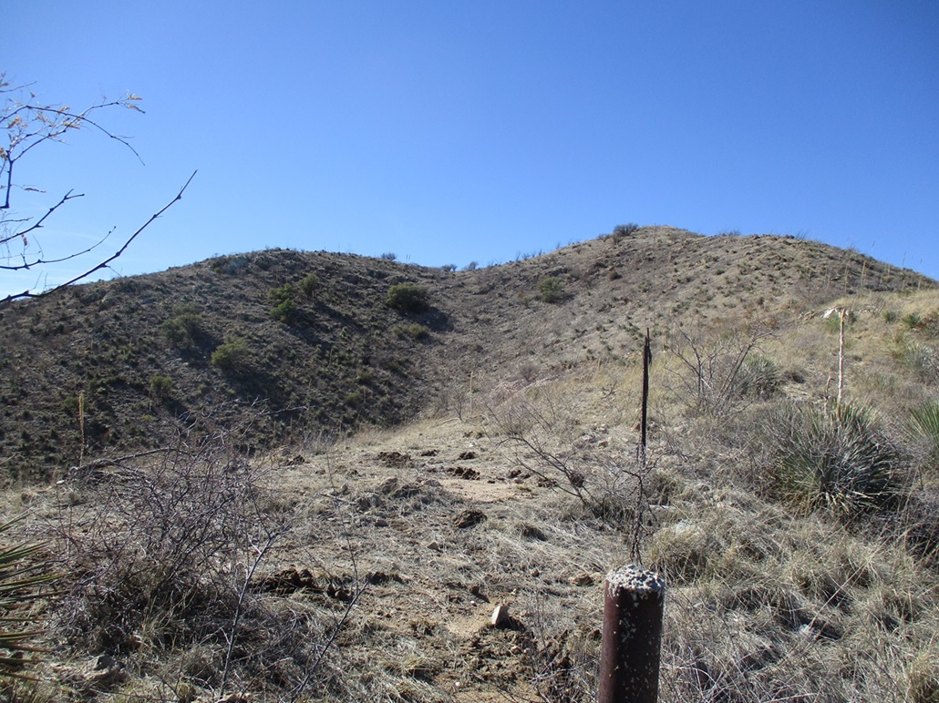
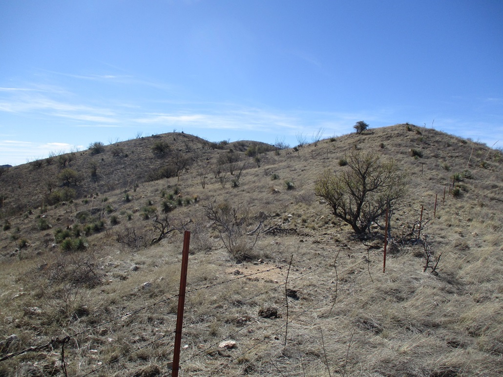
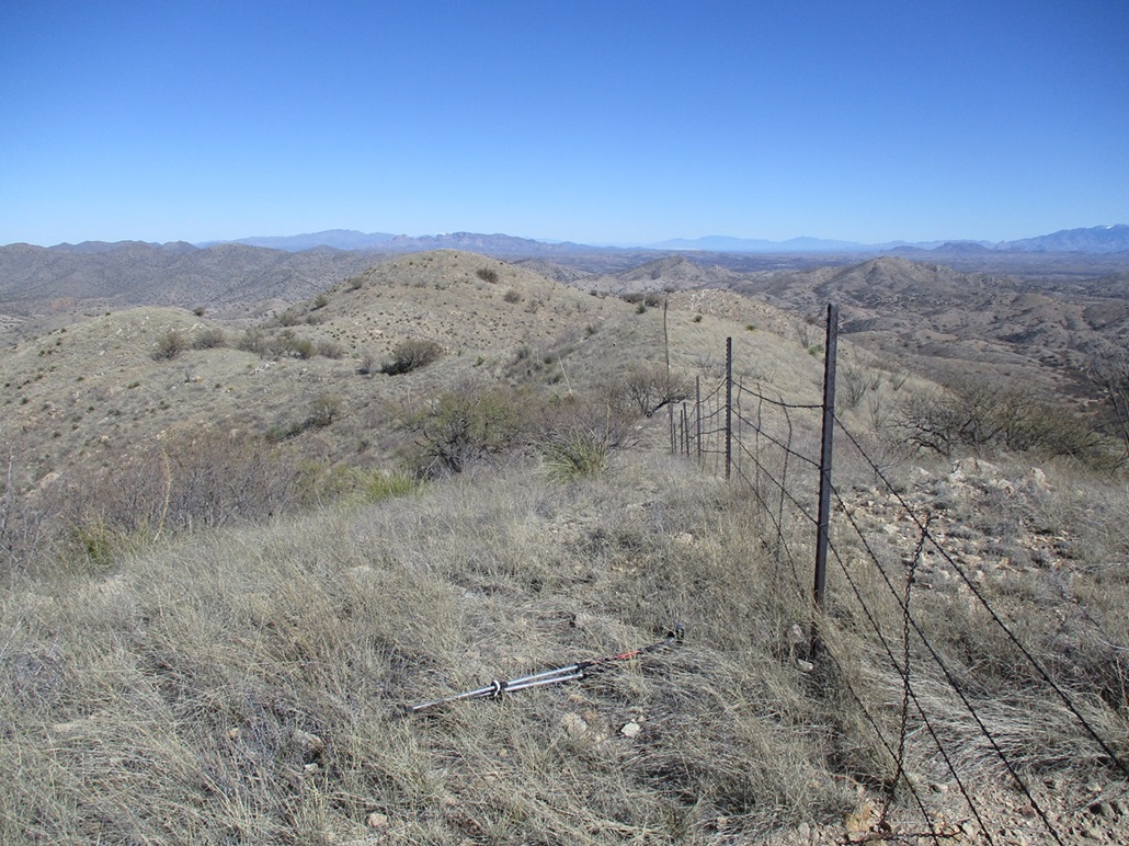
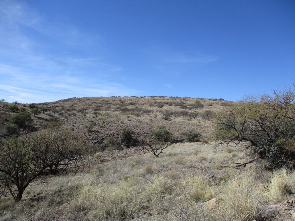
At the pass, there is a fence that crosses over, running along the spine of the ridge. Two cows were sitting on the other side of the fence, looking at me. I followed a beaten path steeply uphill, the tread full of hoof prints and lined with cow poop. I was impressed that they could get up this slope.
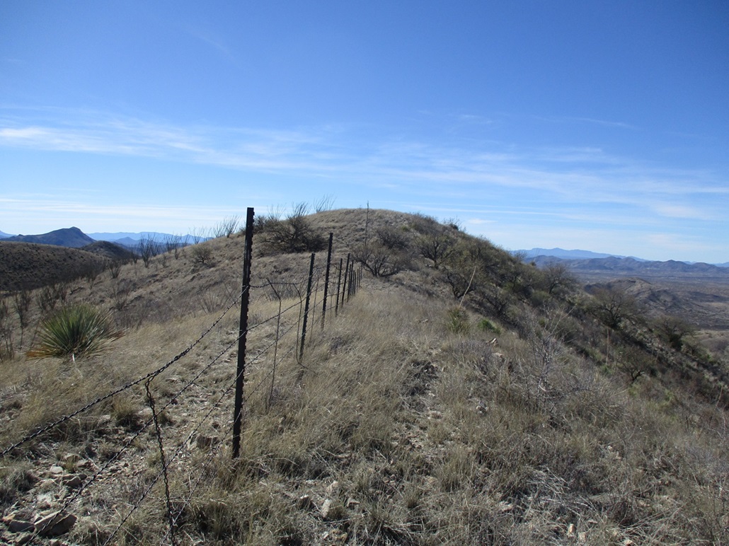
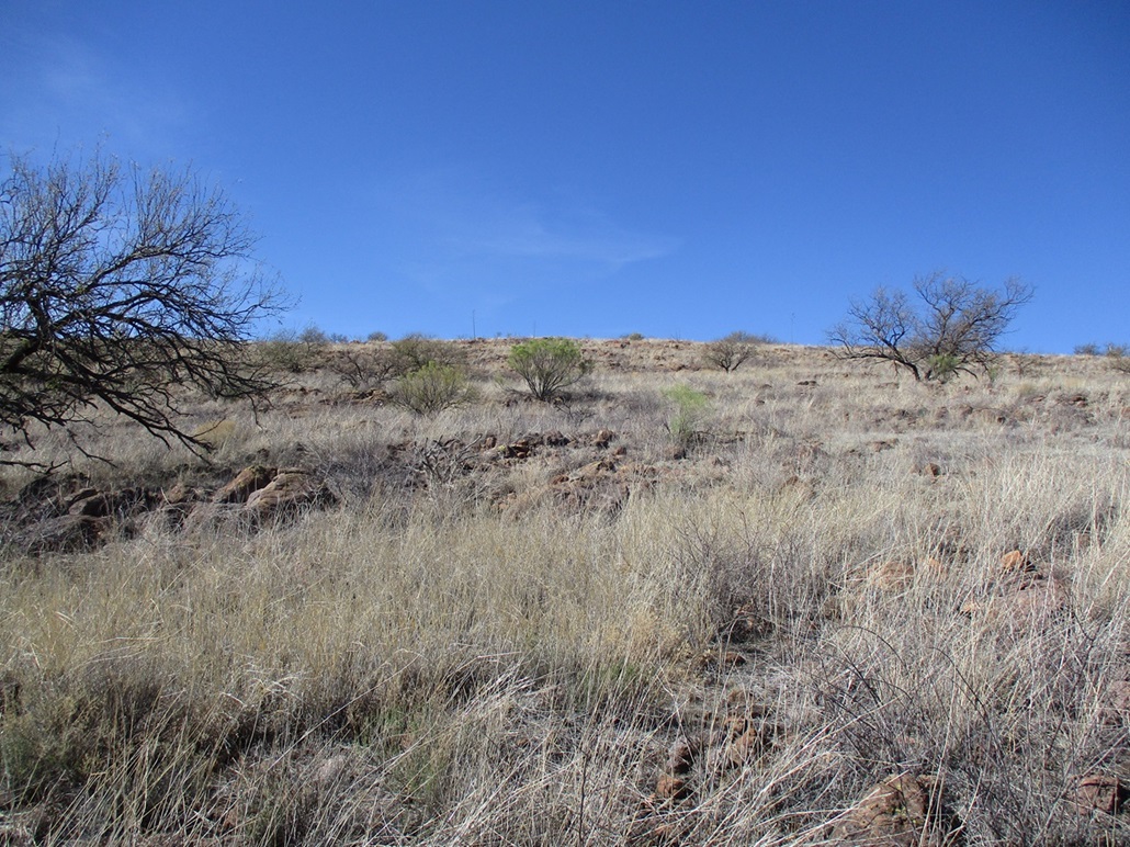
The slope was steep for a little bit, then levelled a little near some trees (and more cows). Up ahead was a pointy summit which I assumed to be the highpoint. I crossed the fenceline because there was a better-looking path on the other side, a probable migrant path. I grunted up one more steep slope to this pointy summit, all proud of myself that I got here so fast, only to see the real summit about a quarter-mile south.
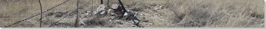
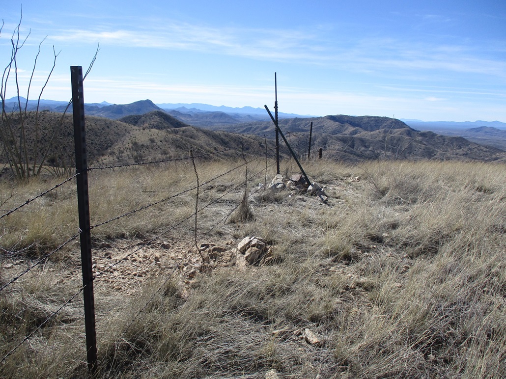
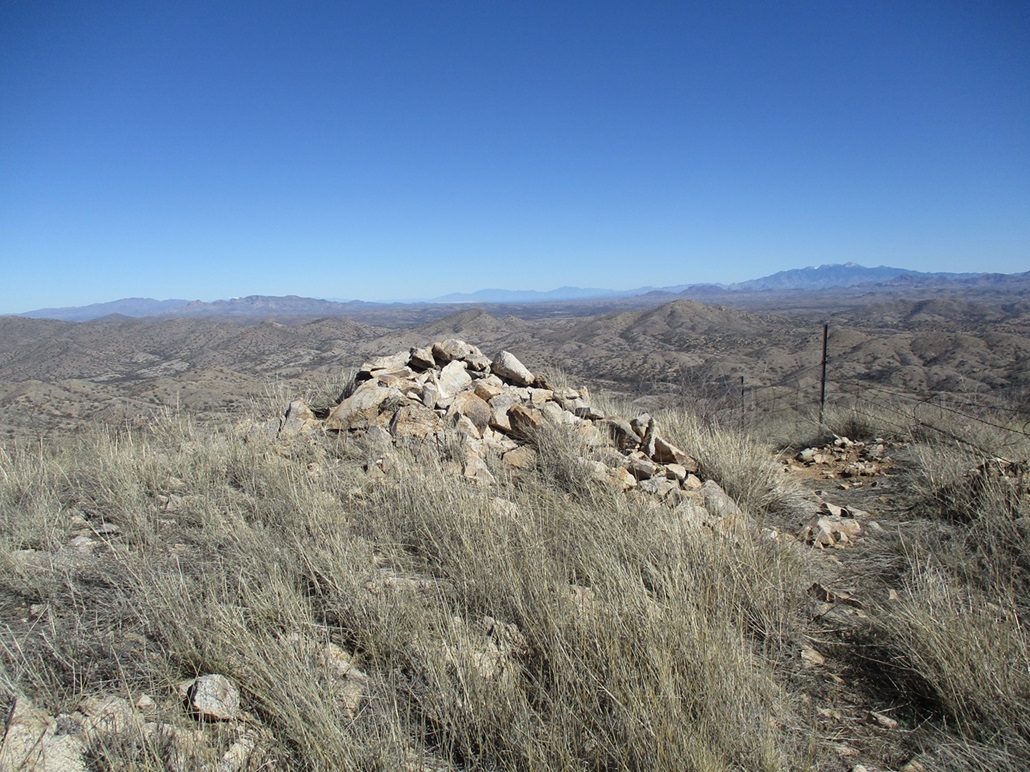
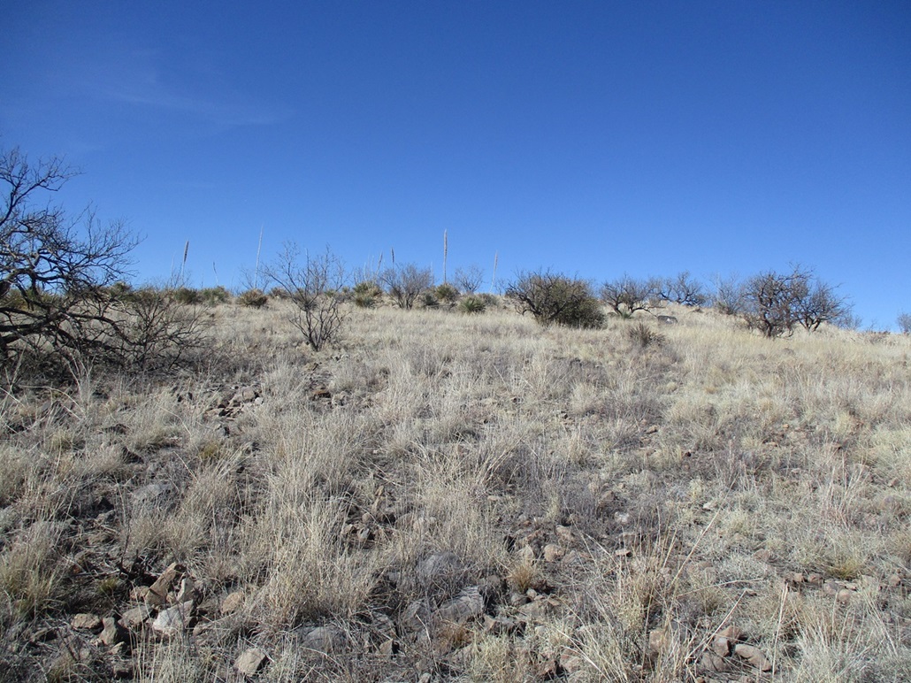
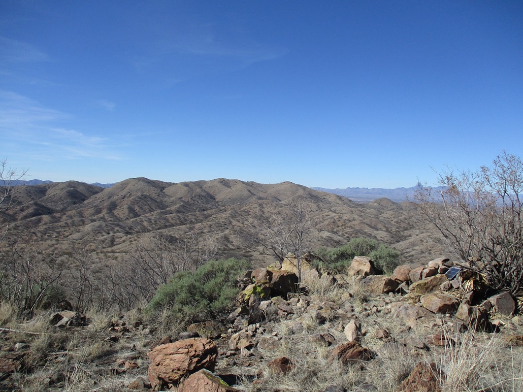
I dropped about a hundred feet, and just followed the path and the fence line. From the first pointy summit to the real top took just ten minutes, all easy walking. I got to the top, which was bare and stark, the fence running over the top. A small rock pile marks the top, with an antenna and solar panel. I could not find a register.
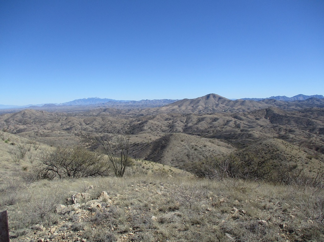
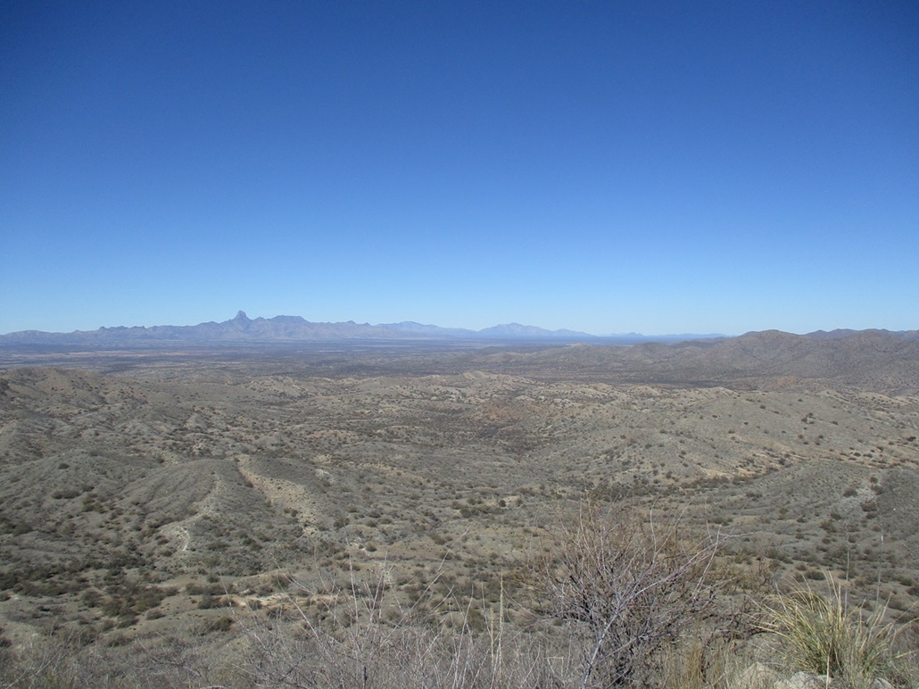
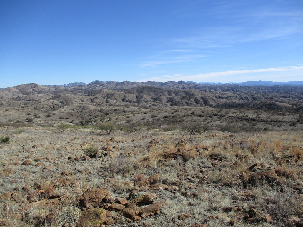
It was breezy up here but pleasant, so I sat down on another rock outcrop and had a break, having a snack and drink, shooting photos. With the clear skies, views were good: Baboquivari, Kitt and Coyote Peaks to the northwest, the Pozo Verde Mountains to the southwest, Fraguita Peak to the northeast, and the Santa Rita Mountains covered in snow farther northeast. I did not see a single item of evidence from the border crossers. This was a clean summit and trail.
The hike out was easy, just needing to mind some of the looser steep slope down low where the cattle have bashed it in. Once back on the road, it was a fast walk back to my car, a round trip time of just under two hours. I thought about heading home, but there was an easy bonus peak just a mile away...
Elevation: 4,651 feet
• Prominence: 391 feet
• Distance: 0.5 mile
• Time: 20 minutes
• Gain: 270 feet
• Conditions: Pleasant
PB
•
LoJ
This simple hill lies about three miles southwest of Fraguita Peak and once I was back on FR-216, about a mile and a half of actual driving to situate myself on the road's apex east of the summit.
A lot of thought likely went into this name, being that it's not black and probably not a mesa. It has gentle east-facing slopes of grass, agave, tiers of volcanic rock, while facing west, the slopes are steeper but not quite cliff. Maybe from looking that way, the peak looks like a mesa. The topographic map write the name twice on it, hence for the super-literal, it's Black Mesa Black Mesa.
The road to it, FR-216, was solid all the way. I parked off the road in a clearing and started walking. The hike was extremely simple, almost trivial. I waked into the grass and rocks, up one easy tier, then a long gentle sloping straight-away to the top. Ten minutes later, I was on top the thing.
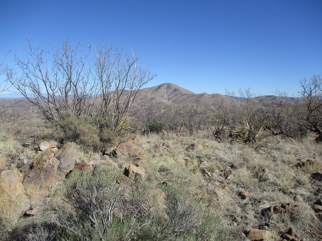
While not much of a mountaineering challenge, the views up here were worth the effort. I got a nice profile view of the San Luis Mountain Ridge I was just on. Fraguita Peak stood high to the northeast. Looking south were more mountains, ridges and canyons well into Mexico.
One rock outrcop hosts a solar panel and antenna, but it is likely not the highpoint. Another rock outcrop nearby looked a foot or two higher. I tagged both and had no luck finding a register. I snapped a few photos but never stopped. I was back to my car quickly, a twenty-minute hike covering a half-mile, a perfect peak to add on for the day.
What range does it belong to? The Coches Ridge runs south from the peak but is separated from it by a small canyon. The Cobre Ridge, which includes Fraguita Peak, runs east but is physically set apart, while the San Luis Mountains run west about the same distance. I'd consider it to not be part of any of these ranges or variants.
Now, it was 2 p.m. and I was pleased with the day's effort. Time now to return to Bisbee. I folowed FR-216 back to Arivaca. I counted twelve creek crossings along FR-216. A couple were narrow, just a couple feet a cross, and a couple were pretty large, including one about thirty feet wide. I went through each fast enough to kick up the water, having stupid fun in the process. I then drove back into Arivaca, then followed Arivaca Road for 23 miles back to the town of Amado near where it connects with Interstate-19. I got in behind two vehicles, the lead vehicle driving slowly, ten miles an hour below the speed limit and often drifting. The guy in front of me would not pass him, and the road is too windy to pass two vehicles at once — and there is a steady stream of cars coming the other way. So I held back (there were a few cars behind me too) and finally had the chance to pass this joker. I am certain he was drunk, and that truly angered me. To me, drunk drivers are contemptible people.
I drive the 19 into Nogales. The Interstate-19 is the only interstate that counts off its distance in kilometers. The numbers fly by, one after another. It was about 30 miles into Nogales, or 47 kilometers. But the speed limits are posted in miles per hour. A good thing too, because a speed limit of 100 kph (about 60 mph) would mean every fool going 100 miles per hour because that's what the sign said.
In Nogales, I wanted state route AZ-82 which starts somewhere in town and is the main route to Tombstone via Patagonia and Sonoita. I assumed it connected to the interstate, but it did not. I took the interstate to its end which fed me into the line of cars looking to cross into Mexico. I got out of that and ended up doing some unplanned tourism of the side streets of Nogales until I finally found where AZ-82 starts. The drive home was uneventful, and I was back to my home a little after 5 p.m..
|


|