The Mountains of Arizona
• www.surgent.net
|
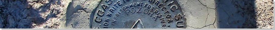
| Pozora Benchmark |
• Highpoint: Pozo Verde Mountains • Arizona State Trust Land • Pima County |
|
Date: January 27, 2024
• Elevation: 4,701 feet
• Prominence: 741 feet
• Distance: 2.8 miles
• Time: 1 hour and 40 minutes
• Gain: 871 feet
• Conditions: Sunny, clear, chilly and very windy
• Wildlife: Deer, javelina
Arizona
•
Main
•
PB
•
LoJ
•
USGS BM Datasheet
Pozora Benchmark is the highest point of the Pozo Verde (Spanish for Green Well) Mountains in southern Arizona, near the border community of Sasabe. The summit lies about two miles on a straight line from the border, with good road access so that the actual hike does not take very long.
Sasabe is one of those towns split by the border. The Mexican town of Sasabe numbers in the low hundreds to about a thousand people, depending on what source you may be reading. The American side numbers just a few dozen people, and even that is debatable. The Mexican Sasabe is a jumping-off point for border crossers, as this is very remote unpopulated desert. Violence on the Mexican side has affected the Mexican Sasabe which explains why the population there can be so low — many people have just up and left.
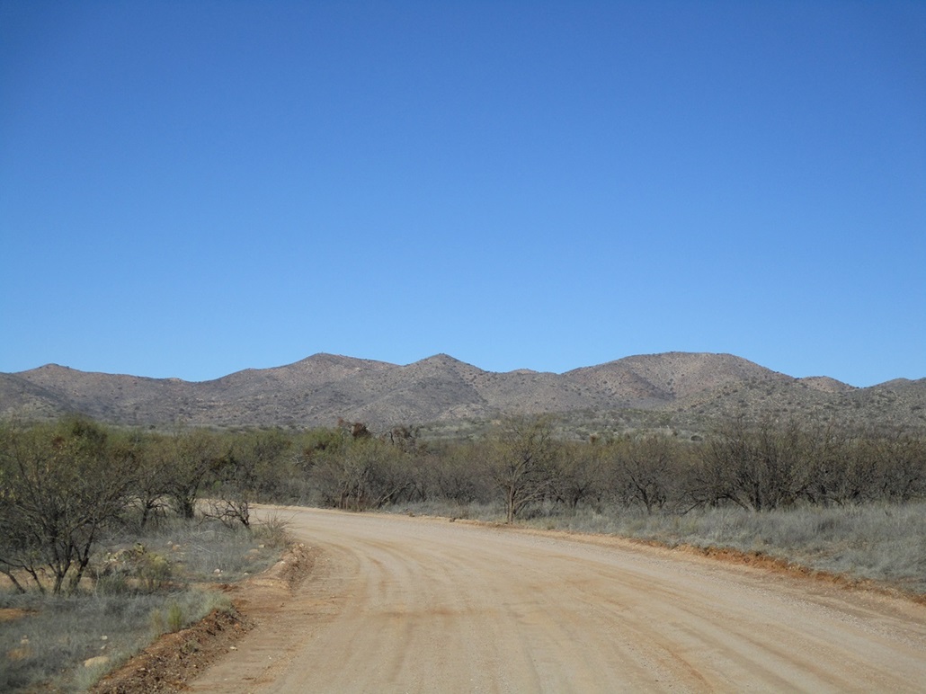
I have never been to Sasabe, nor have ever driven any of the 45-mile long highway, AZ-286, that goes there. I wanted to drive this highway down the Altar Valley and enjoy the sights and solitude. Climbing Pozora Benchmark was the excuse I needed. I knew that the hike wouldn't take long, so I looked into another peak in the region to make it a full day
I left Bisbee a little before 5 a.m. and took route AZ-80 to AZ-90 to Benson, where I topped the gas, then Interstate-10 through Tucson, onto the Ajo Highway (AZ-86), and westbound until I was back into the open desert. I was arriving into the "town" of Robles Junction, where AZ-286 branches south off of AZ-86, just as the sun was rising.
As expected, there was little traffic on this highway. It runs 45 miles to Sasabe and the border, there being no other towns along the way. As the sun rose, the sky was clear, with a setting full moon. It was cold, ranging between 35° and 45°, and breezy. I stopped to snap an image of the full moon setting over Baboquivari Peak. In less than an hour, I was nearing Sasabe.
I wanted to climb the peak first, then I'd formally visit the town. What few buildings I saw suggested a very old, ragged, haggard little village, small block-shaped homes, a church, and other structures in disrepair. I found La Osa Road, which leads to the La Osa Ranch, a famous guest ranch nearby that has been in business for over a century and has had some famous dignitaries stay there.
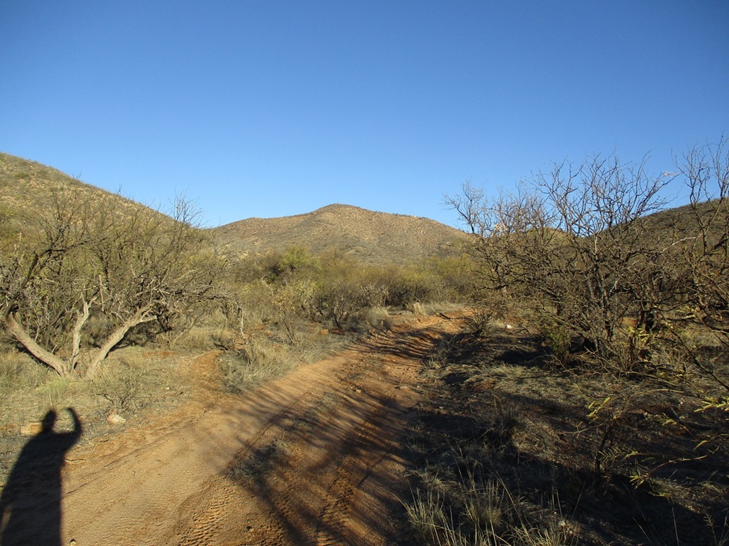
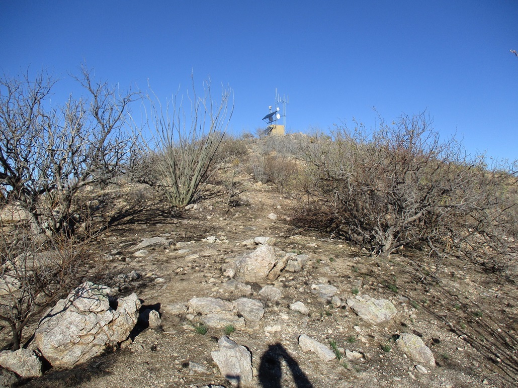
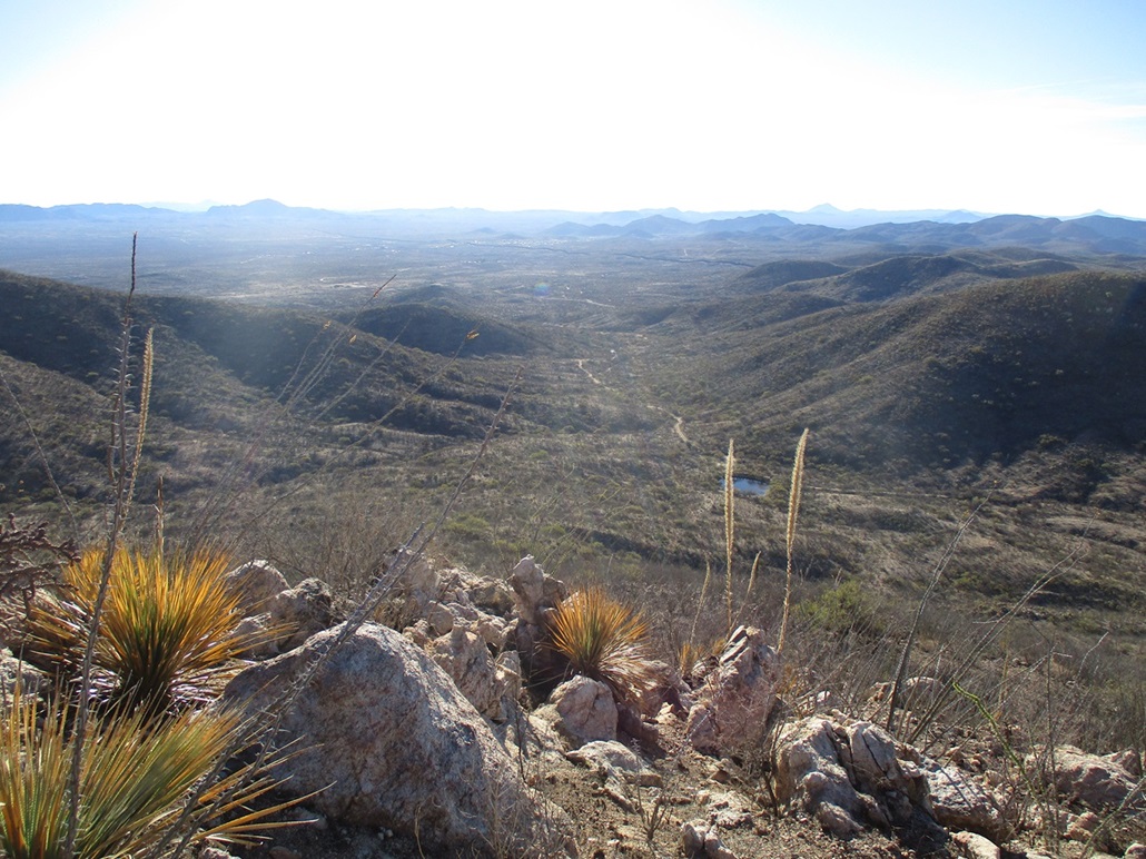
La Osa Road was hardpack and good, a little rutted from the storm we had a few days ago where water had run laterally across it. Less than a mile later, I went right at a Y-junction, now on El Mirador Road (said the map, there is no such street sign here). This was also a good road, wide and graded. It runs a couple miles to what looks to be a ranch. Just before I recahed its gate, another road branched north. I followed it about a quarter mile past La Osa Dam. A scanter track then branches west, paralleling La Osa Creek. Pozora Benchmark Hill rises above, a little under two miles distant, topped by a tall structure of some sort.
I eased onto this track, and was able to cover another quarter mile before being stopped by a rough patch. I found a tiny space just off the road and pushed the car into it, barely off the road. By now, it was just past 8 a.m., the sun now up, temperature about 40°. As soon as I stepped out of the car, the breeze was noticeably strong, the kind that either forces the car door to stay shut, or pulls it from you abruptly.
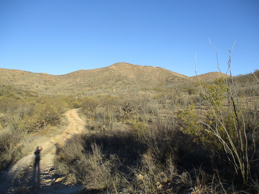
I got my stuff together and started walking at 8:07 a.m., following the track west in as far as it would go, which for me was a little under a mile. It parallels the creek, which was flowing and had some pools in spots. I had to jump over it a couple times. Quickly, I was at the end of the track. The peak was visible the entire way, and where the track ended, it made most sense to just start barging up hill from there, all slopes looking about the same. Past reports mention it not being a complicated hike but the slopes being covered in ocotillo.
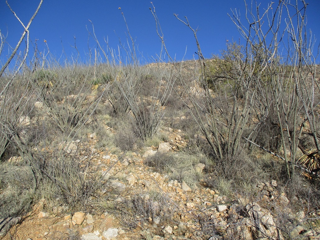
I followed a path to a stock tank, then around it, down into a draw, then up the other side, now on a slope at the base of a ridge. Mesquite trees were down low, but as I gained elevation, the ocotillo took over, growing together thickly. I was able to stay on faint tracks most of the way but often would have to duck through or somehow ease past the ocotillo stalks. Their thorns aren't so sharp like a cholla, they tend to scratch more than poke, but they can be painful if you hit one flush, which I did a few times. The main problem was having my clothes or pack catch on to the thorns.
The slope was steep but easily manageable, and the footing was solid. There wasn't much grass, and the other main plant was agave. Higher up, the slope meets the base of a rocky prow, but once on it, the slope laid back well and there was an easy walking way through the rocks, which formed little steps and tiers. I never actually used my hands to scramble.
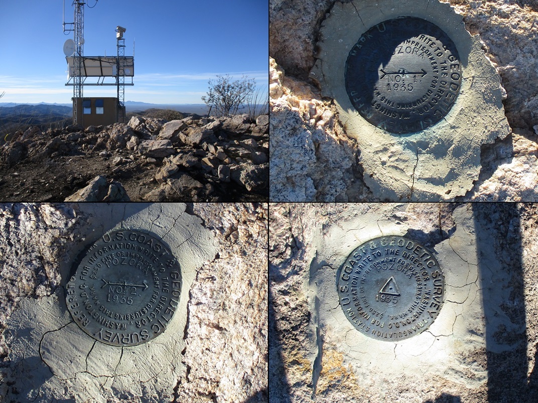
Once above the rocky segment, the slope lessened and I could see the structure and the summit up ahead. I was on top the peak about 45 minutes after starting. The structure appears to be a big antenna and adjoining room, about eight feet to a side. The summit itself is a rocky mound with the benchmark, and the two reference marks located nearby. I could not find a register and wasn't expecting one.
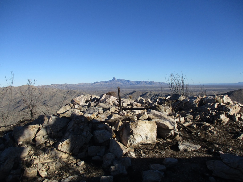
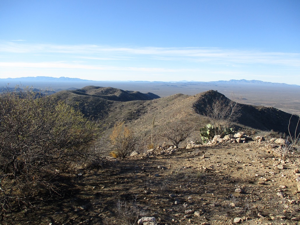
Views were excellent. I had a good south-facing view of Baboquivari, its pillar much more impressive from this angle. I could see peaks in all directions and the border wall snaking through the hills, following the lay of the land. However, the breeze was very strong up here, gusts in the 40-50 m.p.h. range. I had to stand in a slight squat to keep a low center of gravity, otherwise I would get pushed by the wind. I snapped a few images, but spent just a few minutes here. The wind and the cold was not comfortable.
Hiking down, I followed the same route, following lanes and openings as I found them. There were a few paths that might be migrant paths but these would run just a few dozen feet before fading. Some may be game trails and some might be for the Border Patrol, if they ever send some guys in to run the range. I did not see a single item of evidence of border crossers except for a sweatshirt tied to a stick near the summit.
The hike out took about the same amount of time, and I was back to my car a little before 10 a.m.. The hike had gone extremely efficiently and was a lot of fun. The scenery back here is quite pretty. Hikers are somewhat common, but hunters also come here too. I saw a deer on the hike up, and spooked a javelina on the way down.
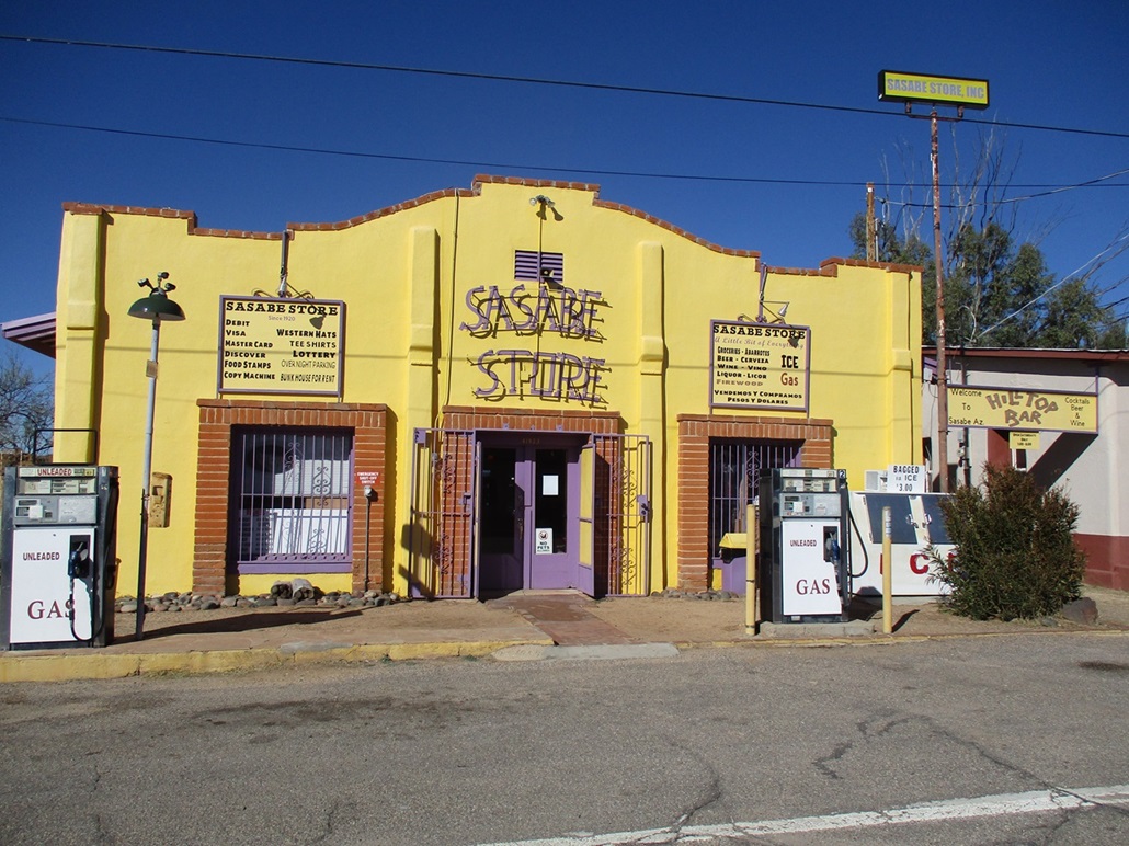
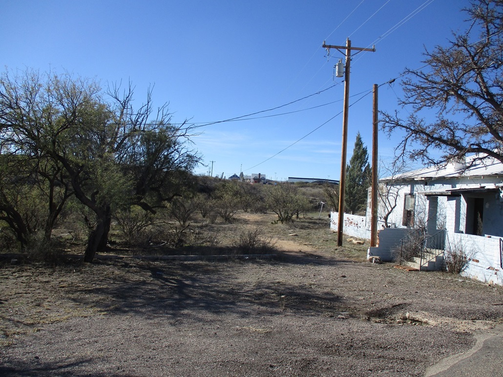
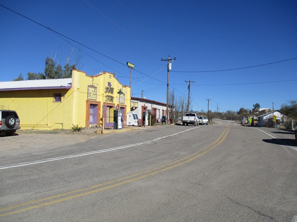
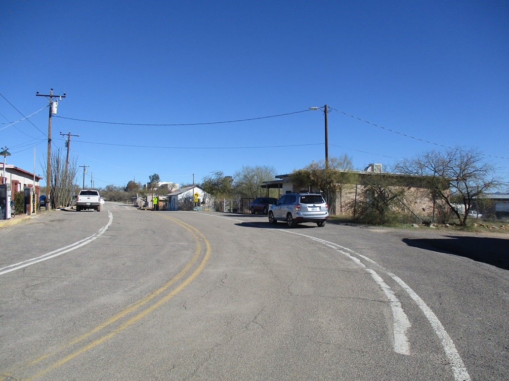
I exited back onto the highway and drove the mile or so into Sasabe proper. I did not drive to the border crossing, stopping short of it by about a quarter mile. I could see the wall and the buildings at the crossing. I stopped along the main street and walked into the Sasabe Store, painted a bright yellow. It has old-style gas pumps on the sidewalk like they used to do in the old days, and they still function.
I didn't know what to expect, but the store was well stocked, clean and large. It was a true general store: food items, hats, clothes, basic tools, grills, camping supplies, sundries, some homemade foodstuffs, and so on. The woman at the counter was super kind with a big smile. I bought a snack and a colorful hand-woven colorful wool blanket made in Mexico.
I asked the woman how big Sasabe in Arizona is and she said 9 people live here full time, and another 1,800 on the Mexican side. But there's no shortage of visitors. The gate sees a small but regular stream of vehicle crossings, the Border Patrol have a base of operations here, and the Buenos Aires National Wildlife Refuge is nearby that attracts visitors. The area is popular with deer hunters. I liked the vibe here. I was expecting a trashed-out semi-ghost-town, but it's not like that at all. Its tiny main steet is actually kept up. It's not a tourist attraction, but it was fun to visit.
Later, I looked up Sasabe online to learn more about its history. For starters, most sites give a population in the 50s, but that likely includes some of the far-flung ranch properties, and I am apt to believe the woman's figure as accurate, she would likely know the best. Habitation and exploration in the area goes back centuries, with the Tohono O'odham Indians and missionaies going back over 300 years. The American Sasabe is apparently all privately-owned by one individual who resides in Mexico, and looked after by presumably some of those 9 people. I am glad I finally drove this far to visit the little town. It is unlikely I will come back, but once was enough and I recommend it.
I left by travelling north on AZ-286, then hanging a right onto Arivaca Road, where I would aim for my second main hike of the day, San Luis Mountains Highpoint. |

|