The Mountains of Arizona
www.surgent.net |
|
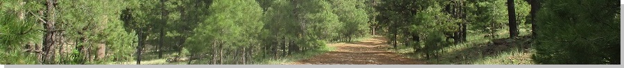
Reneke Knoll • Jackass Knoll • Dutch Kid Knoll The weather has been very mild statewide, considering it's mid-June when temperatures are usually at their hottest. It's been pleasant in relative terms in the deserts (low 100s in the day at most), and in the higher elevations, highs in the high 70s and low 80s, with blue skies and no chance for storms. This surely won't last for long, so I took advantage of this lovely weather for another long day up on the plateau bagging peaks. I had in mind three knolls in and around Bill Williams Mountain, on the west edge of the San Francisco Volcanic Field. I was interested in Reneke Knoll, which lies east of Wounded Ranger Knoll, which Matthias, Peavy and I hiked last month. The other two, Jackass and Dutch Kid Knolls, lie south of Bill Williams Mountain. They were supposed to be part of our agenda last month before we got chased off by a flukish May thunderstorm. I was up super early, and on the road at 2:45 a.m.. There was no traffic on the freeways, but every few minutes or so some guy would race by at a hundred miles per hour. Other drivers drifted within their lanes. Being so close to the 2 a.m. closing time after a Saturday night, it was not unexpected to see drunks. And not a single DPS trooper anywhere. Once out of Phoenix, the drive up Interstate-17 went well. The sun was just rising when I was up on the plateau south of Flagstaff. There was a trooper vehicle on the right shoulder with its lights on, so I slowed. It was about this very moment I see the body of an elk on the left shoulder. The trooper was there to make sure the tow truck guy was loading a vehicle onto it safely, this one presumably the one hitting the elk. I hope the driver was okay. So I slowed and became hyper-focused, and sure enough, for the next mile or two, saw nothing but big elk on the side of the interstate, eating the grass. I slammed into one two years ago, lucky that I glanced it and didn't kill it, or me. These are massive animals. You hit one square, you're likely a goner. I cannot overstate this enough: drive slowly and carefully in the early dawn hours up on the plateau. It is almost certain you'll see a herd and they have an amazing ability to not be seen until it's almost too late.
Date: June 18, 2023
• Elevation: 7,675 feet
• Prominence: 315 feet
• Distance: 5 miles
• Time: 2 hours & 15 minutes
• Gain: 575 feet
• Conditions: Cool and sunny
Arizona
•
Main
•
PB
•
LoJ
•
Interactive map
I drove to Williams, where I stopped for gas, snacks and drinks for the day. I went south through town on Perkinsville Road and parked alongs side the road near where a dirt track drops down a slope and into the hills to the east. On the map this is FR-104 or 105. There were no physical markers here. A big puddle about thirty feet wide, a foot deep and with heavy mud suggested to me that I better not chance it. So I parked on the main road. I don't like to leave a car along a busy road, but it was a Sunday morning and not yet 6 a.m..
I was able to get across the water and mud. I walked up the road, which angles southeast before swinging left, gaining a slope and no up on a higher mini-plateau, the main road heading due east. I followed it as it descended to Hill Tank, then cut across the north slopes of Peak 7405. So far so good. A second road branches off north from the road I was on, but I ignored it because it looked so scraggly. I walked about another quarter-mile east before realizing that the scraggly road was the one I wanted. So I walked back to it. This cost me about 15 minutes of extra time.
Now on this second road, it seemed to agree with the map at first. It wiggled north a short ways, then angled east. I was looking for another track that branched off to the north. I walked by one but it didn't look right. Its number posted on the plastic stick did not agree with what was on the map. But then again, in the Kaibab National Forest, all road numbers on the topographical maps differ from their actual numbers in the field, if or when you actually see one.
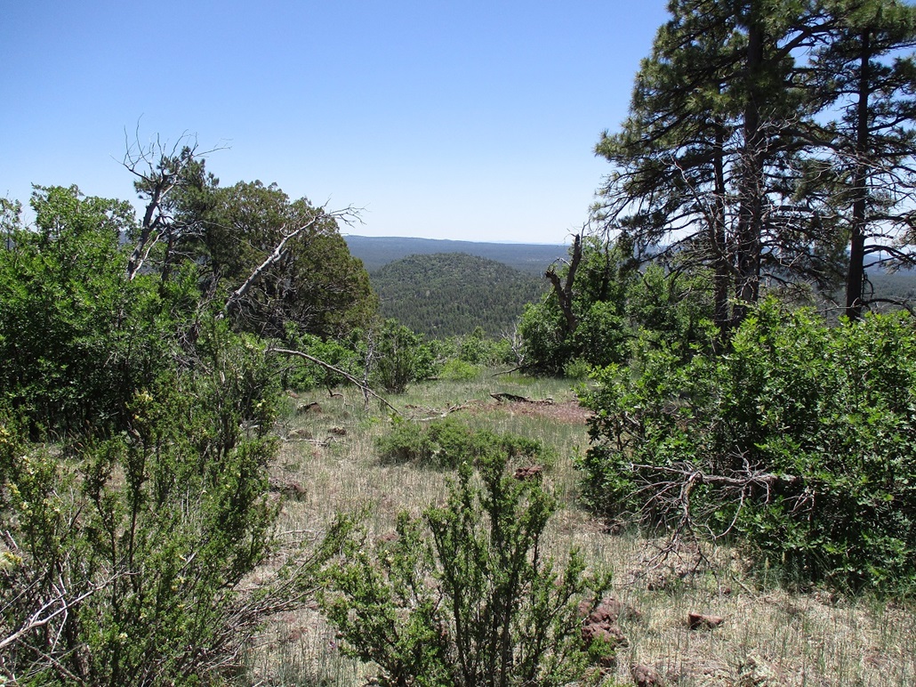
All this time I had no long-distance views. I could not see any of the hills to where I could get a bearing. It was just me on roads in the trees. When I did get a glance of Reneke Knoll, I realized I was a little too southeast of it. Ugh. I apparently had missed another road, and it was probably that one I mentioned.
Just then a guy comes running up, out for his morning jog with his two dogs. He slowed and we chatted and I asked him about the roads. He said the one I wanted was the one "back aways", being the one I mentioned. He said he runs these roads every day and knows them by heart. He is aware they do not match with the maps and says the off-roaders have put in too many unofficial roads too. This guy was really helpful.
He continued on his way while I hung back. One of his dogs kept running back to me. I'd tell it to go back to his daddy, but it would just hang with me. He was looking out for me. Finally, he ran off to be with his proper master.
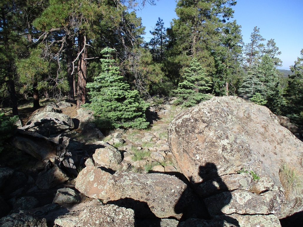
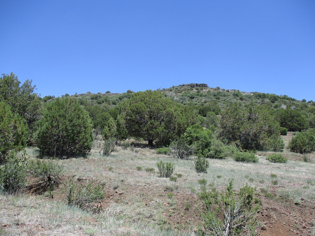
Now on the right road, I followed it uphill, where it petered out on the high ridge west of the summit. I walked up through the grasses to the higher ridge, then through the trees, could see higher trees. I walked down to a saddle, weaving around downed trees, then started uphill, now on a big rock jumble, the final few dozen feet to the top.
I happened upon a glass jar, just laying there. Then I see a pencil beside it, and the screw-lid a couple feet away. But no papers. So I picked it up and walked up the remaining slope of rocks and logs to the top. The summit is rocky, with one large boulder about chest high to me being the highest point. I did not keep close track, but it had taken me a little over an hour to get here, my extra wanderings taken into account.
There was an obvious cairn beside this highest rock that someone had taken apart. I had some paper in my pack so I stuffed a couple sheets into the jar, and re-assembled it all into the cairn, rebuilding it too. I stuck around for about five minutes to have a snack. Views were limited to just the hills to the north. Once in a while I could see Bill Williams Mountain through a clearing in the trees to the west.
I still wonder why some people take apart registers or cairns, or sometimes just leave them in the open. I doubt it was someone looking to clean the place up. Otherwise, they would not have just left it all on the ground about fifty feet from where it was originally.
My hike out went well, and now knowing what to do, am proud to say I didn't make any wrong turns at all. I was back to my car a little after 8 a.m., the round trip covering about 5 miles and a little over 2 hours. I was happy to be done with this peak. It was more work that it was worth.
Elevation: 7,114 feet
• Prominence: 394 feet
• Distance: 3.5 miles
• Time: 2 hours
• Gain: 514 feet
• Conditions: Sunny, warmer
PB
•
LoJ
Back on Perkinsville Road, I drove south a few miles to the Bill Williams Mountain Loop Road, Forest Road 108, which circles around the southern and western foothills of Bill Williams Mountain. A sign said Interstate-40 was 18 miles away. I followed this road a few miles ... I did not track mileage ... until I was south of Jackass Knoll. As was typical, I could not see it at all, due to the trees. But I knew what road to look for.
To my surprise, the forest road I wanted was numbered the same as is on the map! I drove in on FR-420 about a mile, the road in good shape. This far in, the number of campers was near zero. There was one mid-sized RV back here, the whole place to themselves. The road splits, numbered FR-422 on the map. I went left until it came to a gravel quarry on the north flank of Hill 6738. The road to here was good, suitable for most vehicles. I parked here.
I started walking at 8:35, the day warmer now, into the 70s. I followed the continuation of the road for another mile, gaining about 200 feet, to a saddle west of the peak. Occasionally, I could see the peak through breaks in the trees, but never anything substantive.
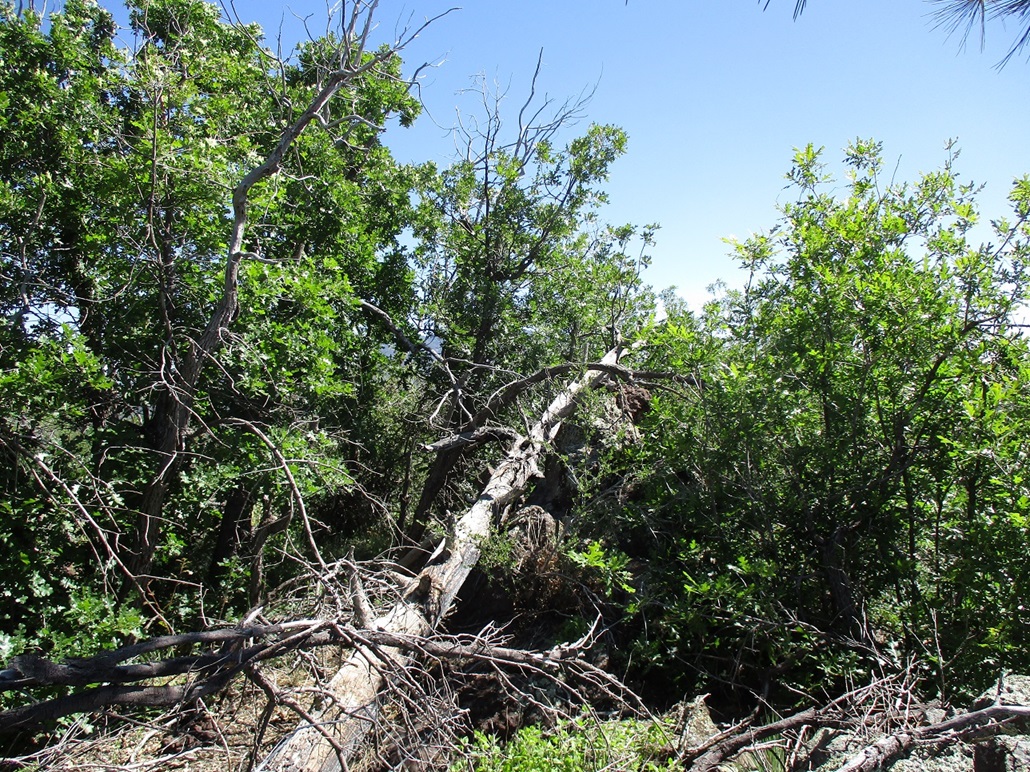
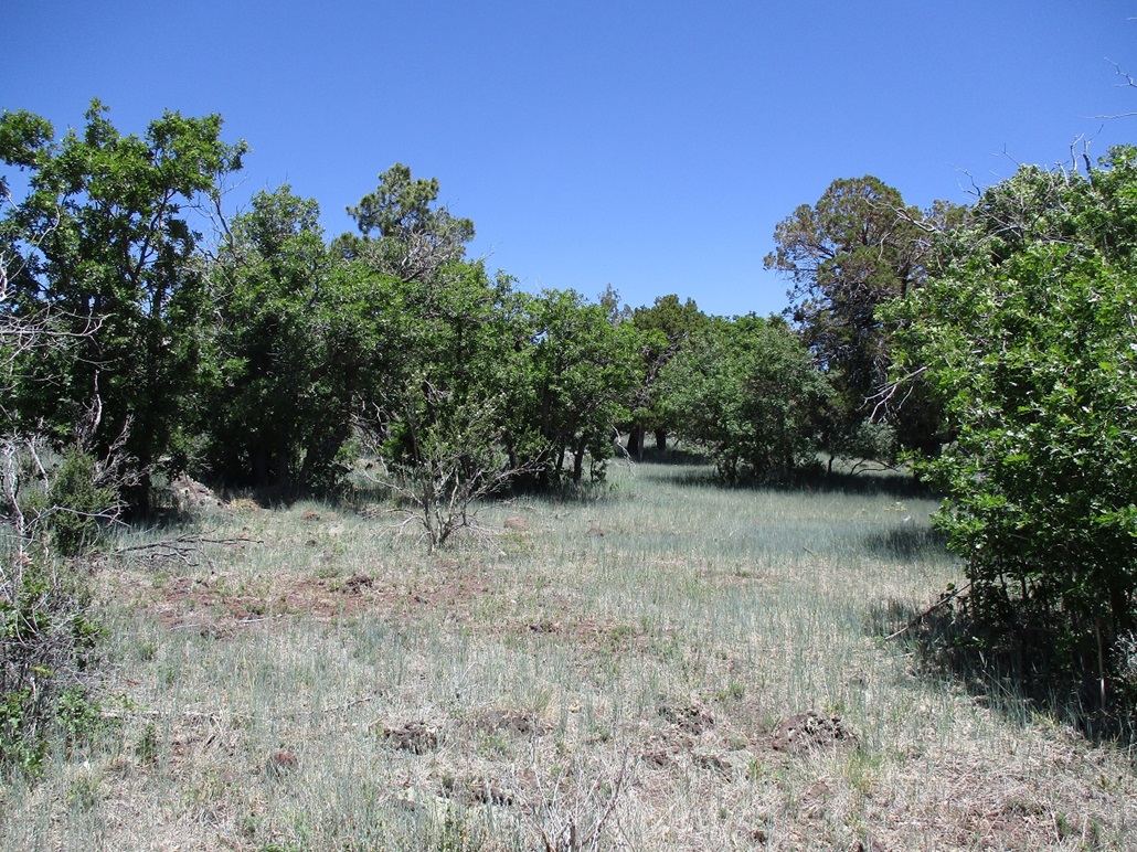
At the saddle, I angled into the forest, heading east, the summit about a half-mile distant and about 300 feet higher. Even up here, I couldn't really see it. The forest was just thick enough to block any distance views, but spread out enough to permit easy hiking, although I often had to zig and zag to get around fallen trees or brushy thickets.
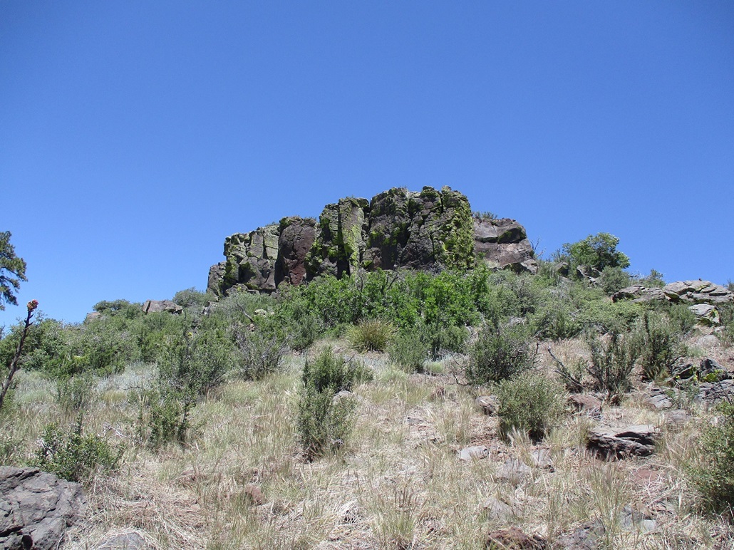
Unable to really get a good bearing and sensing I could easily go down a wrong slope, I ribboned a lot of my route so I could find my way out. The actual hiking was quite easy. But I had to tie ribbons onto strategic branches, which took up some time. Half way up, it becomes rockier, forming small rounded cliffs and tiers, but easy to travel on ... easier than the slopes in some cases. I kept going up until I was on the top ridge. It was more open up here, and rockier, too.
I angled south and walked up the gentle slope, passing a couple large rock outcrops. I got to what seemed to be the highest point, then saw a big boulder about 6 feet tall hidden in the trees. I had to circle around and gently ease through some brush and a fallen log to get to it, and it was in fact the highpoint. I found the register tucked into a cairn and signed in. I was at the lip of the peak, but it was brushy and limited most views. I had no compulsion to stick around.
I exited the same way, going point to point, ribbon to ribbon, until I was back to my car. This round trip also took a couple hours and wasn't difficult, but not memorable either. It was just a lot of trees to look at. A couple times I had a good view of my next peak, Dutch Kid Knoll, located just a couple miles west.
Elevation: 7,277 feet
• Prominence: 617 feet
• Distance: 2 miles
• Time: 90 minutes
• Gain: 670 feet
• Conditions: Very warm and suddenly breezy
PB
•
LoJ
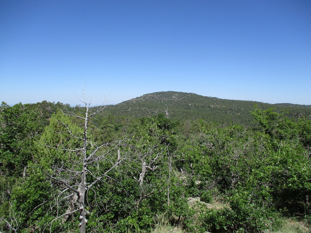
I didn't have far to drive, maybe three miles, to place me near Dutch Kid Knoll. The road reaches an apex south of the peak, north of a smaller hill called Deadman Knoll. From here, I had a good view of the peak. It has a long mesa-like profile with a gentle slope to the west, and cliffs to the south and east. But the fact that I could see all this was significant.
I was going to follow Matthias' route, in which he hiked up an old closed road starting near Dutch Kid Tank to the southwest. On the map, it makes sense: this track would gain the ridge, then from there, it would be an easy incline to the top with no cliffs. I found this road, drove in a little ways, and parked when the road got rough.
I hiked this road, which started to angle more northeast and more up than was expected. Then, it simply ended. I hadn't got very far, maybe a quarter mile. I was nowhere near the ridge and had zero interest to hike to it in the trees with no long distance views. So I backed off and walked back to my car.
I decided to return to the rise in the road near Deadman Knoll. I parked in a clearing and started on a beeline toward the peak. At first, I hiked through the trees but soon, I was in the open again, with a better view of what was ahead of me.
From my vantage, the south-facing aspect was a mush of low cliff walls, trees and brush, but also with some open slopes too. I followed a lower ridge northwesterly a little bit, then when it felt right, angled north and started up through the trees and brush mix.
The going was not difficult. I always found a lane through the brush, although in some cases, the lane might have been just 8 inches wide. But any thick segments only went on for a few feet, and the brush itself was woody but not nasty. I could usually push through it, and only got a couple scratches.
I was soon at the base of the main band of upper cliffs. In some places the walls were thirty feet high and sheer, but move a few feet over and there would be a brushy and rocky alternative to get through. The scrambling was minimal, and I only used my hands for balance.
Once above the cliff wall, I was essentially on top, but the top was flat and broad and more forested. I continued to walk northerly, always going up, until I found the highpoint. There was a cairn and register, so I signed in, and took a break. It was warm now, pushing 80 degrees, and much breezier, too. The wind came up suddenly, as it had been calm on the other two peaks. My sinuses got a workout. There were no good views from up here either.
I returned the same way, mostly. I did not mark where I had come up over the cliff, so going down, I had to find another breach, which I did. Once below the main cliff, I walked on a direct bearing to my car, which I could see as I had parked it in the open near the road. I was able to keep to a line that was mostly open, just a few short segments of brush. The terrain was loose and every other rock wanted to roll from under me. I did the splits more than once and other forms of fancy maneuvering, but surprisingly, I never once fell today, not even a controlled sit-down butt fall. I was proud of myself.
I was back to my car after 90 minutes, the time nearing 1 p.m. now. I was successful on the three peaks on my agenda. None were particularly memorable, all being forested with only Dutch Kid having any views. But I was pleased anyway. I was tired and hot and hungry too. Now what to do.
I got back on the loop road and followed it all the way to Interstate-40 at the Devil Dog exit. I enjoyed the leisurely drive. I had a very weak notion that I might just go hike up Bixler Peak since it was close by, but Matthias and Peavy both said it was a heavy bushwhack. I'll come back for it when it's cooler.
Once at the interstate, I debated whether to go home via Ash Fork, or just go back via Flagstaff. I chose the latter. In Flagstaff, I got onto southbound Interstate-17, and just a mile or two later, there was one of those mobile signs saying "Traffic closed, use both lanes". What the hell did that mean? Use both lanes to get stopped? I exited immediately and returned to Flagstaff and camped for an hour at a Cafe Rio, eating tacos and looking at my phone. The AZ511 website had no information except for some long-term closures due to repaving.
I got back on the interstate. Traffic seemed to be moving just fine. I assumed there'd be some massive backup by now. So I got a few more miles and bam, everything stopped. This was at the Kelly Canyon exit. I got into the left lane so I could bail if necessary. I was willing to gut this out, but we were moving so slowly. After fifteen minutes, I'd moved about 500 feet. So when I came upon one of those turnaround lanes in the median the troopers use to watch people, I took it, got onto the northbound lanes and exited at the airport/Fort Tuthill exit. This was starting to royally suck.
I had two choices: take Lake Mary Road down through Payson, or take the congested route through Oak Creek Canyon and Sedona. The route through Payson on a Sunday is bad. It's full of people pulling massive RVs and a number of drunks, all on two-lane roads in the forest. So I chose the route through Oak Creek Canyon and Sedona.
This route is incredibly scenic. But it was congested. Other people were doing the same as me, bypassing the interstate. But at least we were moving, usually at 20 miles per hour. It's better than 0.025 miles per hour. Sedona was a zoo of cars and people. I followed state route AZ-179 out of Sedona back to the interstate. So did many dozens of other people. So it was slow, but we were moving. This ate up an extra hour, but at least it was scenic. I had no idea where the stoppage on the interstate was, if it was one mile ahead or twenty, and I'll be damned if I was going to sit there idling forward for two hours to find out. There was no information later on AZ511.
The remaining drive went well. I was hot and thirsty. I stopped to top the gas at Cordes Junction, then drove into Phoenix and back to Tempe. It was heavy with traffic, but there were no accidents, and we were all able to move between 40 and 60 miles per hour. I was glad to be back to my place, very tired and dirty. But it had been a good day.
|


|