The Mountains of Arizona
• www.surgent.net
|
| White Mountain |
• East Verde River Valley • Tonto National Forest • Gila County |
|
Date: April 26, 2021
• Elevation: 4,884 feet
• Prominence: 364 feet
• Distance: 7 miles
• Time: 3 hours
• Gain: 1,720 feet
• Conditions: Hazy skies, mostly cloudy and breezy
Arizona
•
Main
•
PB
•
LoJ
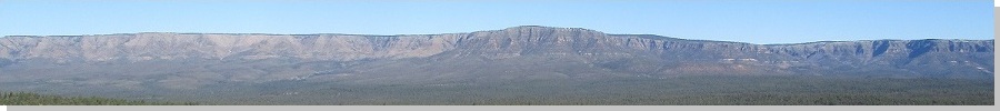
White Mountain is a hill lying within the East Fork of the Verde River valley directly east of Payson. The hill is well-hidden, as the mesas that line the valley have elevations about 300-500 feet higher than the summit of this lonesome hill. It is a ranked peak, which is the main reason I even knew about it to begin with. Jeep tracks get close to the base of the hill. I was not that interested in the hill itself, but kept it in mind if other plans fell through and I wanted something to hike without too much planning.
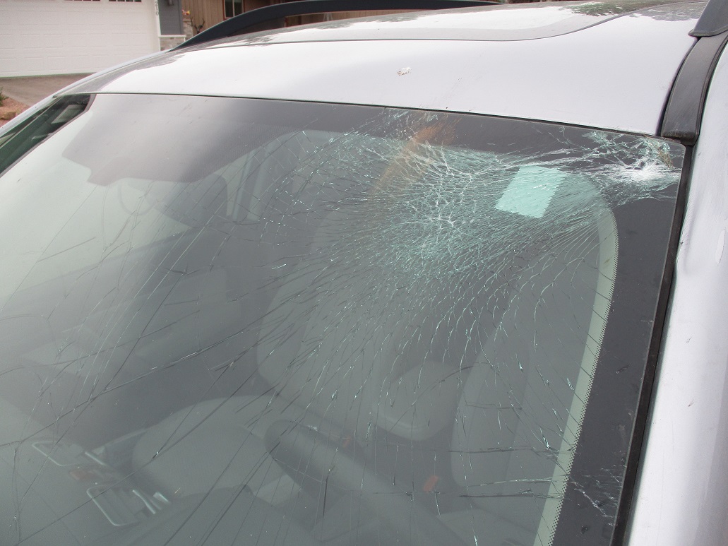
Yesterday (Sunday) morning, I set out from Payson to hike a couple peaks in the Flagstaff area. As I was entering the town of Pine, still kind of shadowy-dark in the early morning, I hit an elk in the road. I saw it too late to brake or evade. I was able to steer right and avoid a direct hit, but I hit it anyway. The collision with the elk sheared off my rear-view mirror and smashed in the windshield, plus added a couple dents to the body. I pulled to the side, put on my hazards and got my head together.
First thing, I made sure I was fine. I was. I then walked back to where I hit the animal, expecting to find its body in the road, but it was not there, just debris from my car. I walked back to my car and gave it a thorough inspection. The front end was completely fine. The side was fine too. I must have glanced it just right, hitting it on its fore-chest. It looked like a female, not as massive as a male. I assume its head is what bashed in my windshield. I also assume it ran off, possibly just dazed. I was relieved I did not kill it, and that I did not have to hassle with the police to get the body moved. I was relieved my car just suffered some cosmetic damage, and I was (and am) grateful that it was not more serious and that I got out of this with no injuries or scratches. Had I hit it more directly, it could have been much worse.
I stayed on the scene for about 20 minutes, mainly to be sure all was well, including myself, and to let the adrenaline wear off. Obviously, I had to cancel my Flagstaff plans. I turned around and drove home, able to see the road through the spider-web of cracks in the windshield. I spent the rest of yesterday and the start of today arranging for a new windshield and repairs for my rear-view mirror.
I have lived here in Payson now for 15 months, and have driven the roads to Flagstaff now about a dozen times. I cannot stress this enough: elk are everywhere up here, especially thick up on the plateau and seemingly along Lake Mary Road, although this big herd was down in Pine. They tend to wander at night and at dawn, when lighting is poor. I have almost hit a few previously, and today, I finally hit one. I got damn lucky and I know it. I'll have to be more attentive, moreso than I thought I was already.
I spent this morning doing car-related phone calls, plus my usual work duties. But I had no big plans or meetings and really wanted a hike, after getting shutout yesterday and also to work off some of the stress and tension I got from yesterday's collision. Suddenly, White Mountain looked interesting. It is close to town, has roads almost all the way to the summit, and was something I could do in a few hours. I did not get moving from our home until about 11:30 in the morning. The drive to the trailhead covered about 5 or 6 miles. I drove to the Graff Road Trailhead west of the airport, at the city limits and the Tonto Forest boundary. I drove in on the road a few hundred feet, then turned right and found a spot in the trees to stash the car. I was driving our old 2001 Subaru Outback, which we keep as our third car. This was my wife's car before we met, and is still in great condition.
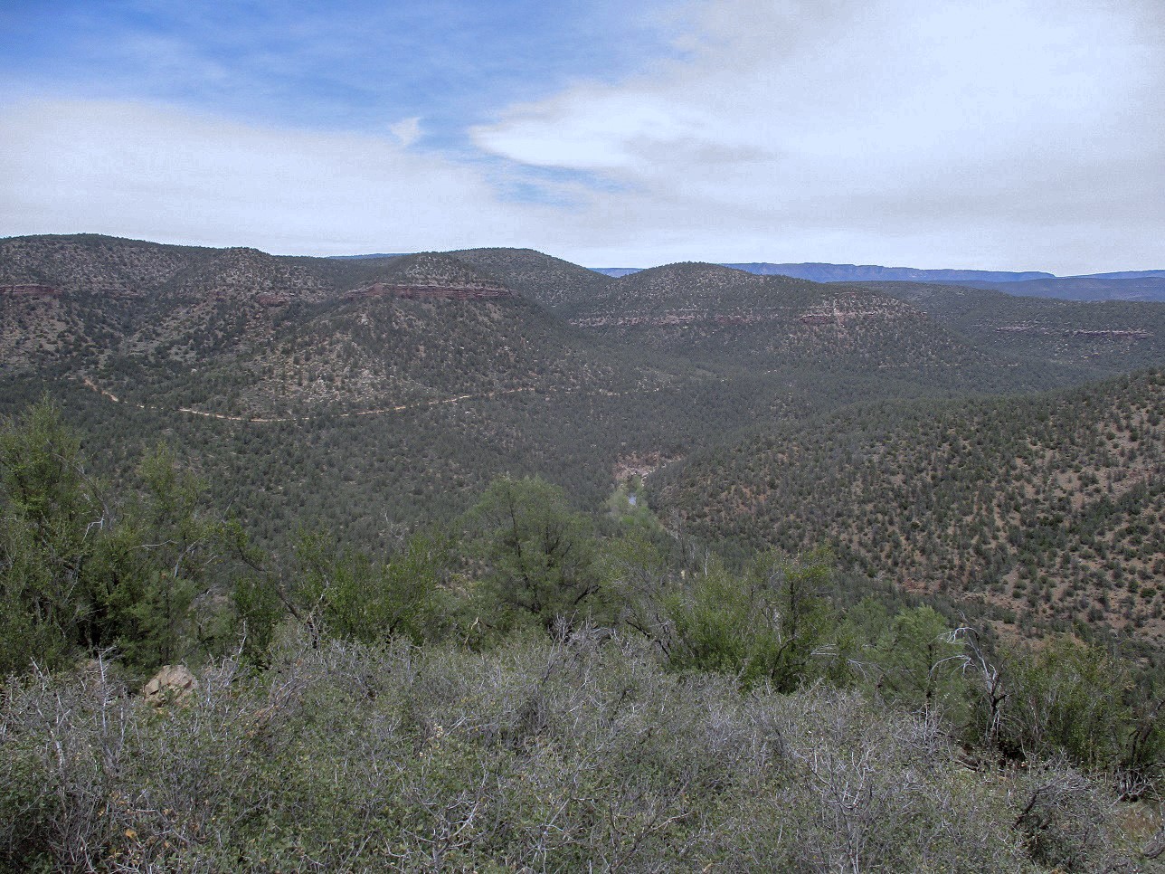
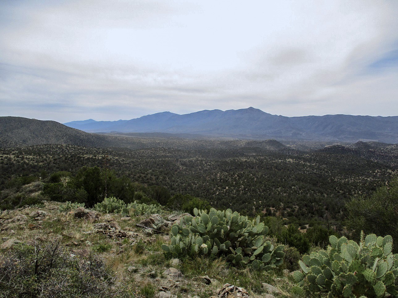
The day was cool but not chilly, with hazy high clouds and a steady breeze. A storm would move in the next day, and this was the leading front. Occasionally the sun broke through the haze, but for most of the hike, the sun was muted. I was at 5,120 feet elevation. I was on top of Birch Mesa, which is the big landform on which the airport sits, and forms the eastern boundary (and cliffs) to the East Fork Verde River valley. From river to cliff rim is about a difference of 1,200 vertical feet.
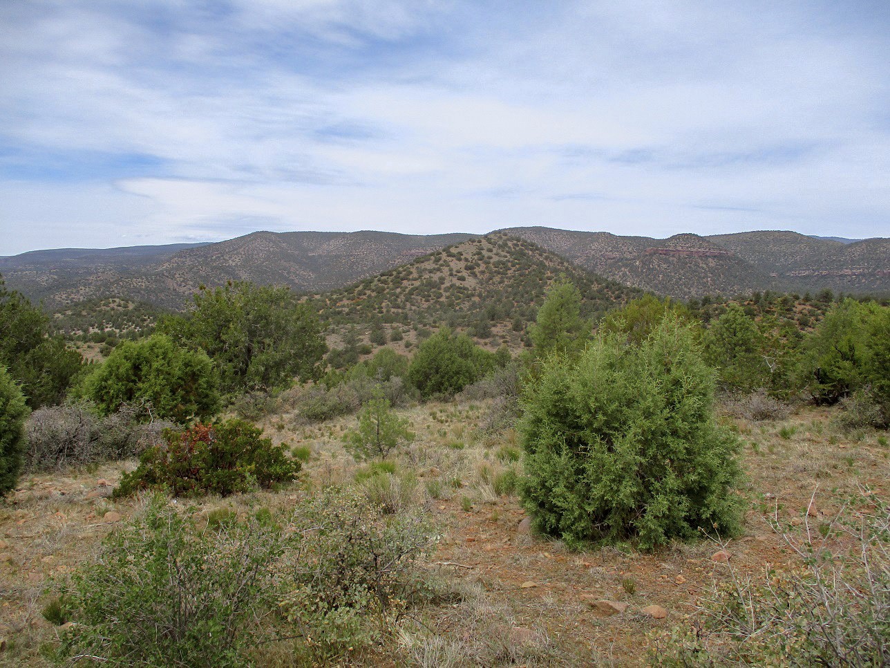
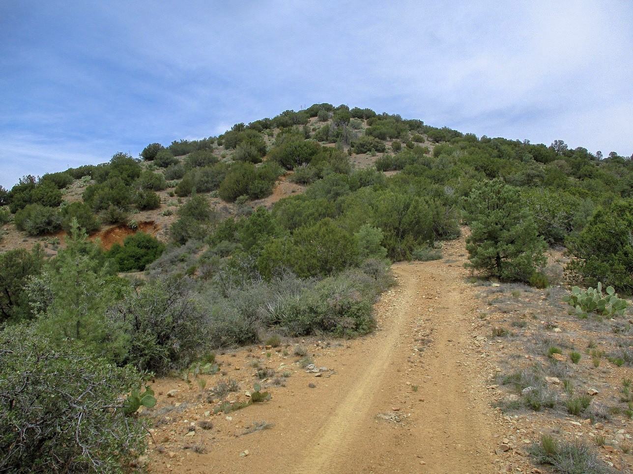
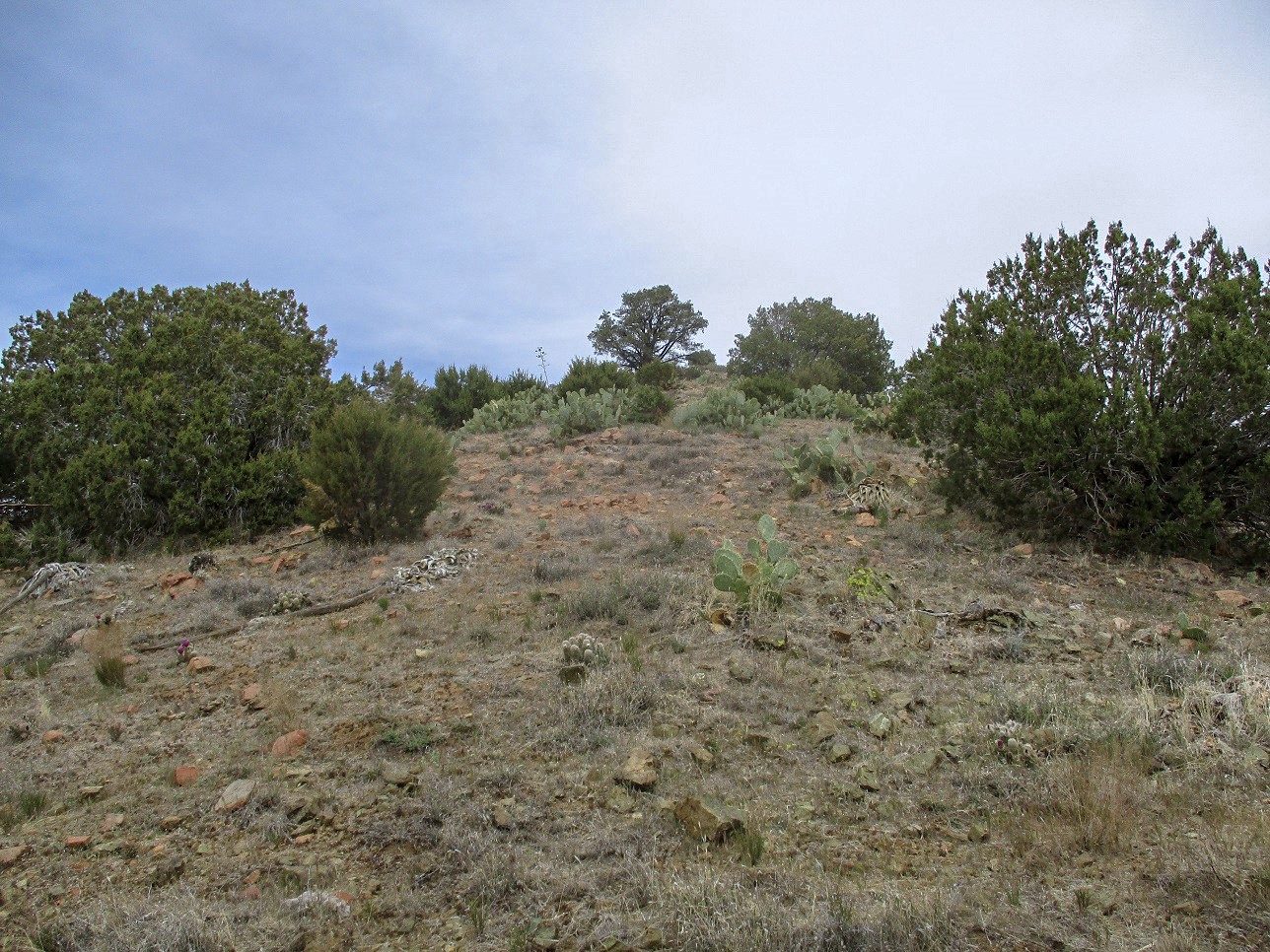
I hiked along FR-67, which trended northwest, gaining about 150 feet to top out on one high area of Birch Mesa. The road then dropped and hung a left, coming to a wire-stick gate at the rim's edge, elevation 5,200 feet and a mile from where I had started. Passing through the gate, I began a long downhill off the plateau and into the Verde River valley. The initial half mile was the steepest, rubbliest and loosest part of the road. Going down was not easy as every rock wanted to roll. After dropping 400 feet, the road's grade lessened, became a shade smoother, and I started to get my first views of the peak, its summit roughly abeam of my elevation currently. I still had a long way to drop.
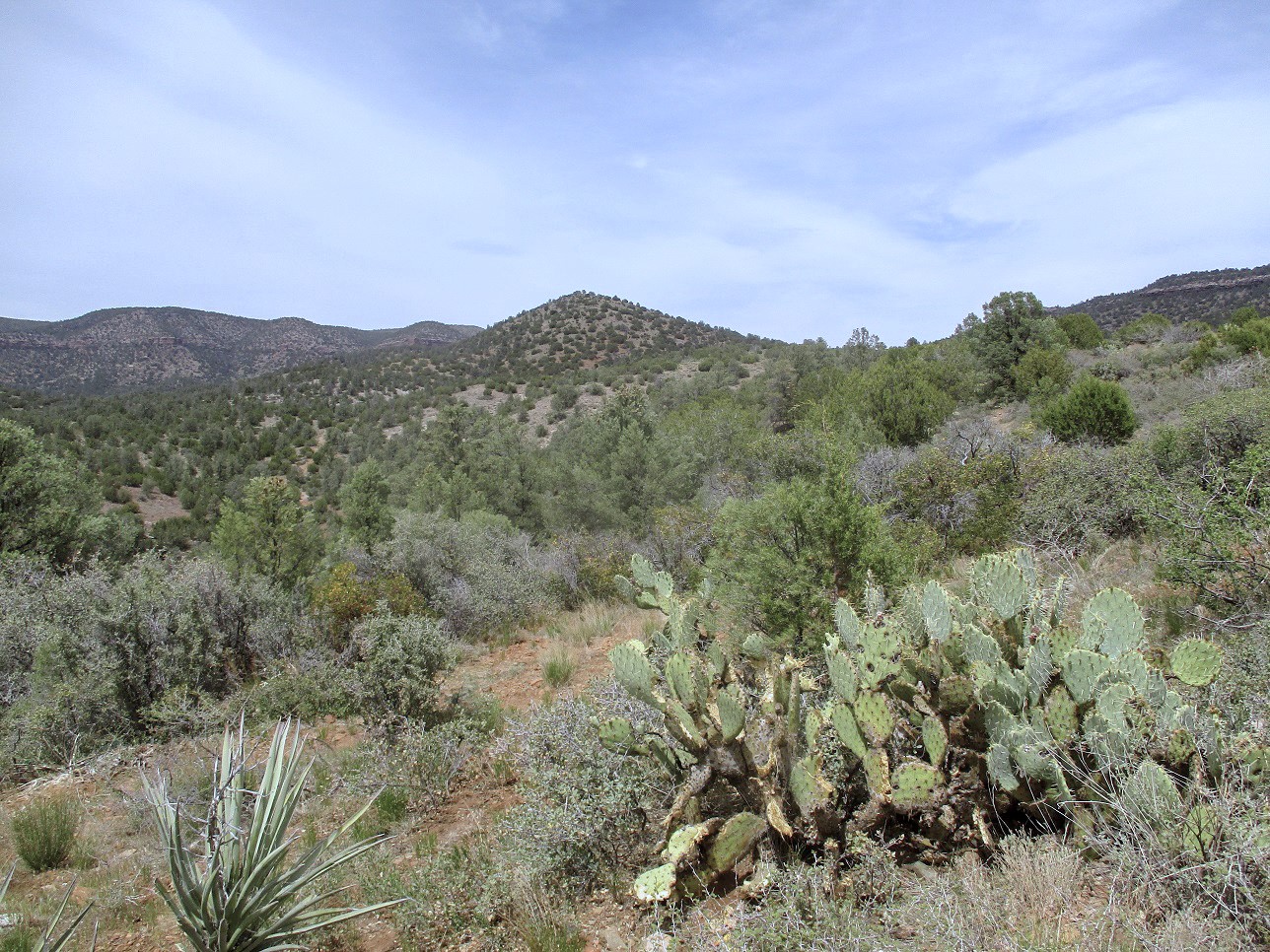
The remainig downhill walk went well. I passed through another wire-stick gate, then came upon a couple low-set water tanks near where FR-643 veers off of FR-67 (the map does not show FR-67 continuing west, but it does). I got onto FR-643 and followed it downhill, eventually reaching a lowpoint at 4,300 feet, a total drop of about 990 feet from the highpoint of Birch Mesa. I had hiked a little over 2.5 miles to here. Having dropped nearly a thousand feet, it was noticeably warmer, about 10 degrees, now into the 70s. It was warm but comfortable.
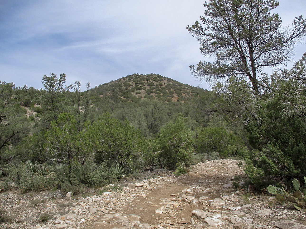
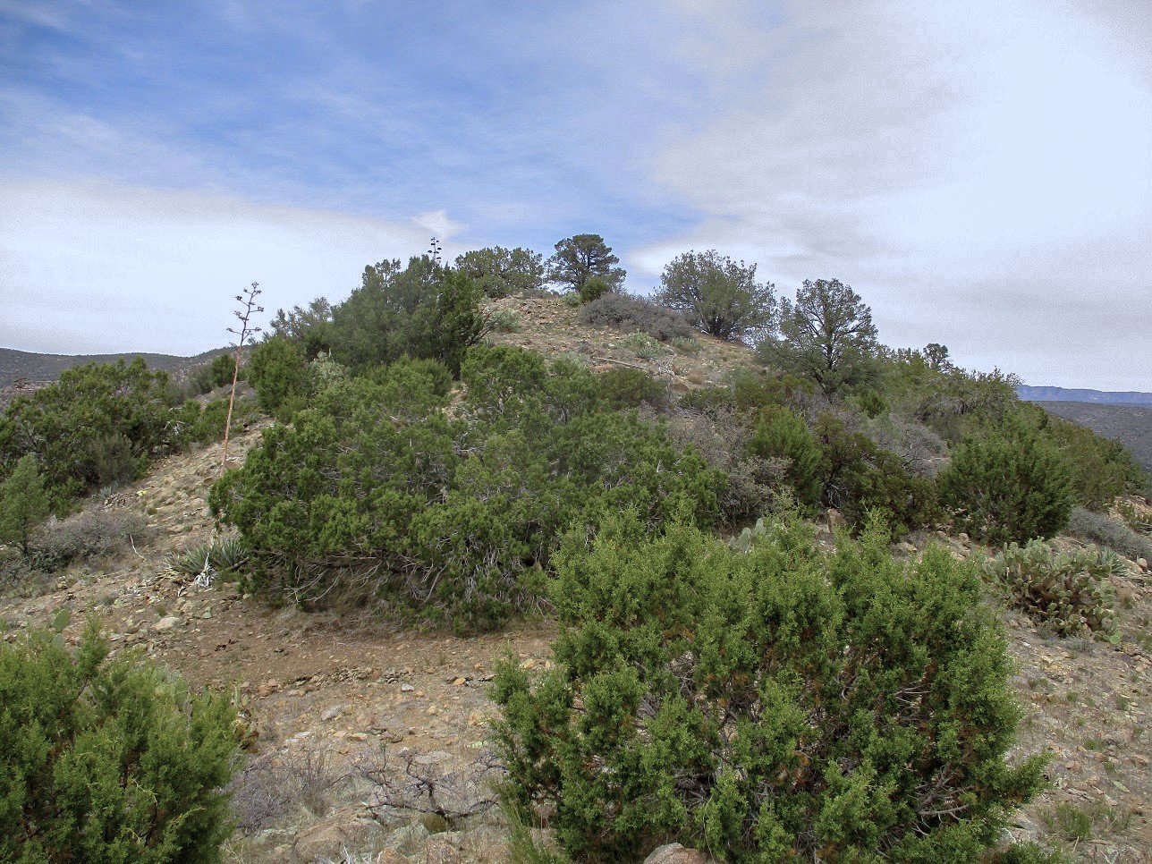
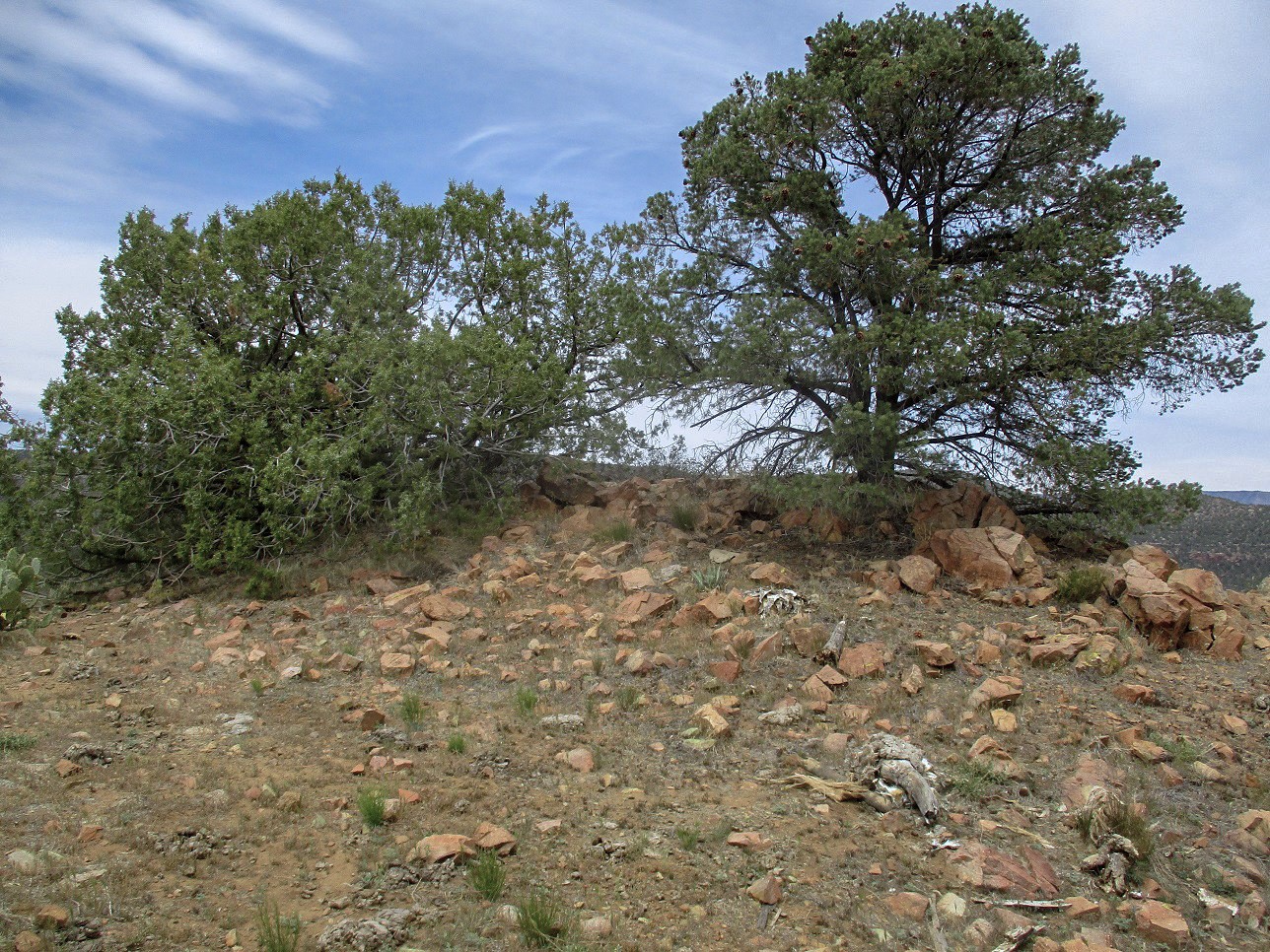
I followed FR-643 north, soon coming to the base of White Mountain. I left the road at a small clearing and trudged up the steep open slopes, fooled that the highpoint ahead of me was the top. After being fooled twice more, I finally arrived on top the little peak. The one-way hike had taken a little under 90 minutes, covering 3.5 miles. The views were okay, due to the sun being muted. I snapped a few images and took a one-minute water break, but did not delay. I was not looking forward to rehiking that 990-foot gain back to my vehicle.
Hiking down the hill, I got to a clearing and found a measly track and followed it, going left. It clearly was not correct but I followed it a few hundred feet to gain a high spot to survey my surroundings. I knew what I had done: I had veered just slightly more east than I should have. I retraced my way back on that track back to the clearing. And not more than twenty feet later was the correct road. I had made a wrong turn so close to what I should have done. I was minorly frustrated with myself for the moment.
Back on the main track, I just put one foot in front of the other, regaining the elevation slowly and steadily. The lower slopes were gentle and I made good time. I took a longer break at the 4,800-foot elevation, where the rubbly road started up again. This was the ugly part I was not looking forward to. I took it slow and carefully, sliding a couple times. This segment was a chore but took just twenty minutes. Once back on top of Birch Mesa, I had an easy and fast walk back to the car. I arrived back at 3 p.m.., cooler now than where I had just been. I changed into more comfortable clothes and made a shopping run on the way back home.
My elevation gain statistics break down as follows: from where I parked at 5,120 feet, I topped out at 5,290 feet (170 feet of gain), then bottomed out to 4,300 feet, then hiked up to White Mountain's top, a gain of 584 feet, for a total gain of 754 feet for the ascent. For the hike out, I had to go from 4,300 feet to 5,290 feet, or roughly a 990-foot gain. Add them up, that's 1,744 feet of gross elevation gain. I round that figure down slightly due to a couple places where I had to estimate the elevations.
There are other ways to approach the peak, such as from down below. Jeeps would be necessary for these roads. The higher road I hiked is pretty rough, but a typical Jeep and experienced driver should be okay on it. Anything less would not be advised.
"I have friends who have hiked far more than you have, who are far more accomplished than you are. And they hike for one reason: the fun of it." --- pep speech by BAC.
|


|