
The Mountains of Arizona
www.surgent.net |
|
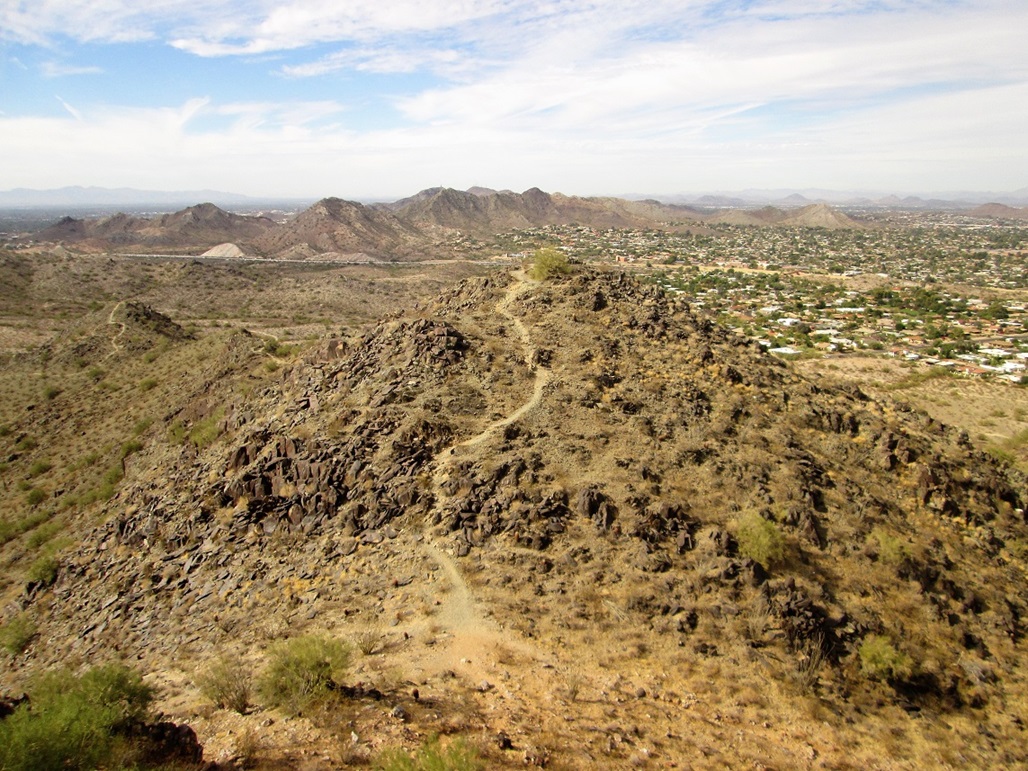
40th Street Trailhead Dixie/Two Bit Peak • Peak 1987 • Peak 1955 These three peaks lie in the Phoenix Mountains Preserve and are best reached by the 40th Street Trailhead in north-central Phoenix. They could be done in one moderate day hike or as three quickies, which is what I did. The trailhead usually has limited parking, so coming at an off time like on a Tuesday morning usually is best. There are many trails criss-crossing the whole area, so there are loop options and many other hills and bumps and hideouts one can hike to, if these peaks aren't on your radar. Expect to see the usual mix of people, dogs, kids and so on, but it's never as packed as it is on Piestewa Peak.
Date: January 1, 2015
• Elevation: 2,429 feet
• Prominence: 699 feet
• Distance: 3 miles
• Time: 1 hour and 15 minutes
• Gain: 930 feet
• Conditions: Cloudy and very cold
Arizona
•
Main
•
PB
•
City HPs of Maricopa County
I wanted to hike somewhere locally for New Year's Day, and found this peak to fit my needs. It is close to home, has good trailhead access, a good trail, and the peak itself is a highpoint, that of the Town of Paradise Valley. More on that at the end.
On the maps, the peak is identified only by its elevation, 2,429 feet. It is located about a mile east of Piestewa Peak in the Phoenix Mountains Preserve. Piestewa, I have hiked well over a hundred times over the years. Until today, I had not hiked this particular peak, for reasons I cannot explain. I have made a conscious effort in recent months to climb the myriad of local peaks, hills and bumps in the Phoenix metro area.
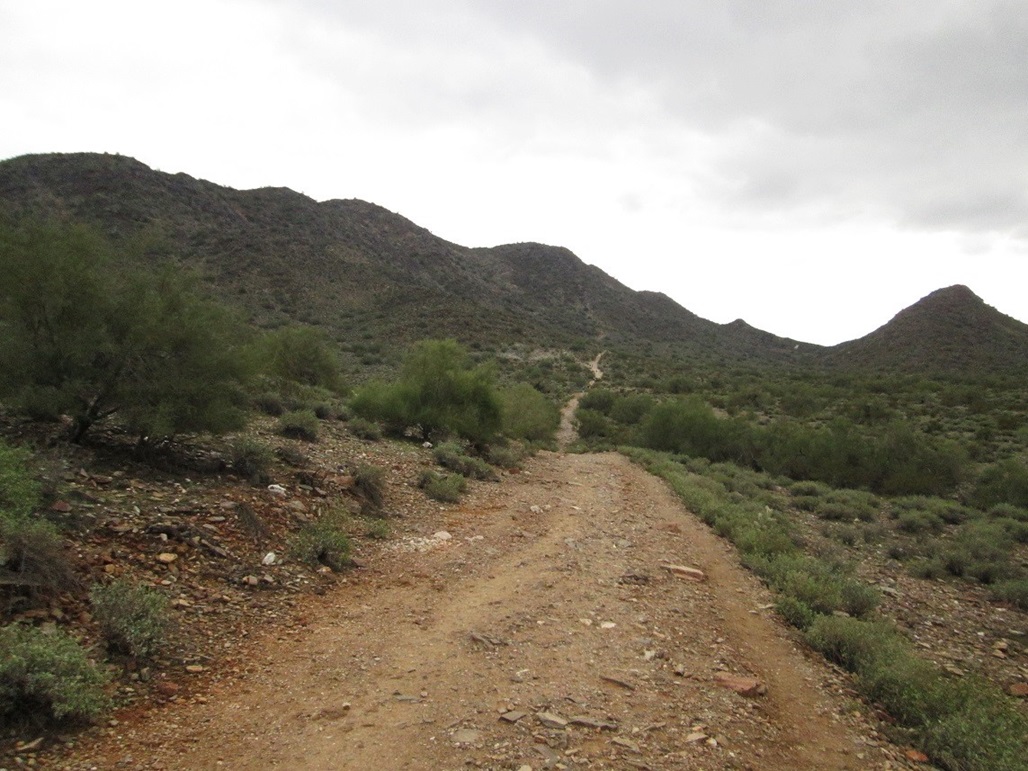
The trailhead is at the south end of 40th Street in North Phoenix. I drove in from Scottsdale via Cactus, Tatum and Shea Boulevards, arriving about noon. The trailhead parking lot can hold about thirty vehicles, and not surprisingly, it was filled today. But just as I rolled in, a car was backing out, so I was able to score a spot with no wait. There were a lot of people, some on mountain bikes, some with their dogs, some with little kids. Being New Year's Day, I suspect many people had the same idea as I did, to ring in the new year doing something healthy.
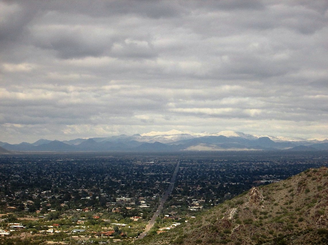
Yesterday, New Year's Eve, had been rainy and very cold. The high temperature never got out of the 40s, which is rare for us, and snow levels had dropped as low as 2,000 feet. Today was also quite chilly, the temperature about 40 degrees at noon. The sky was cloudy, but there was no chance of rain. Despite the cold, conditions were nice.
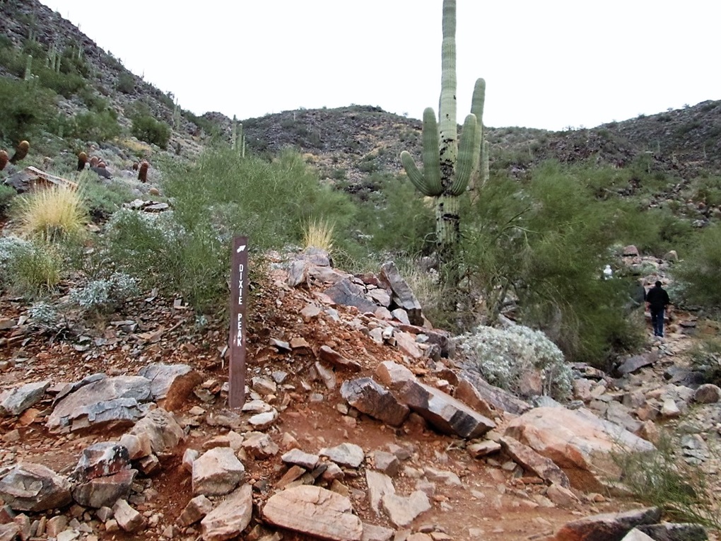
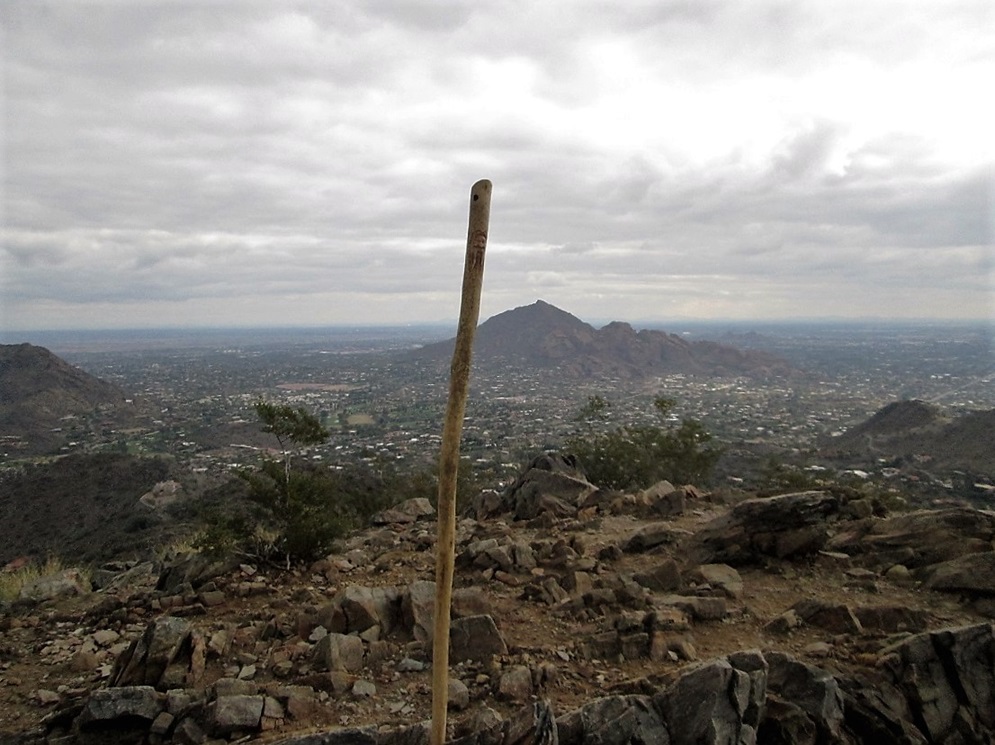
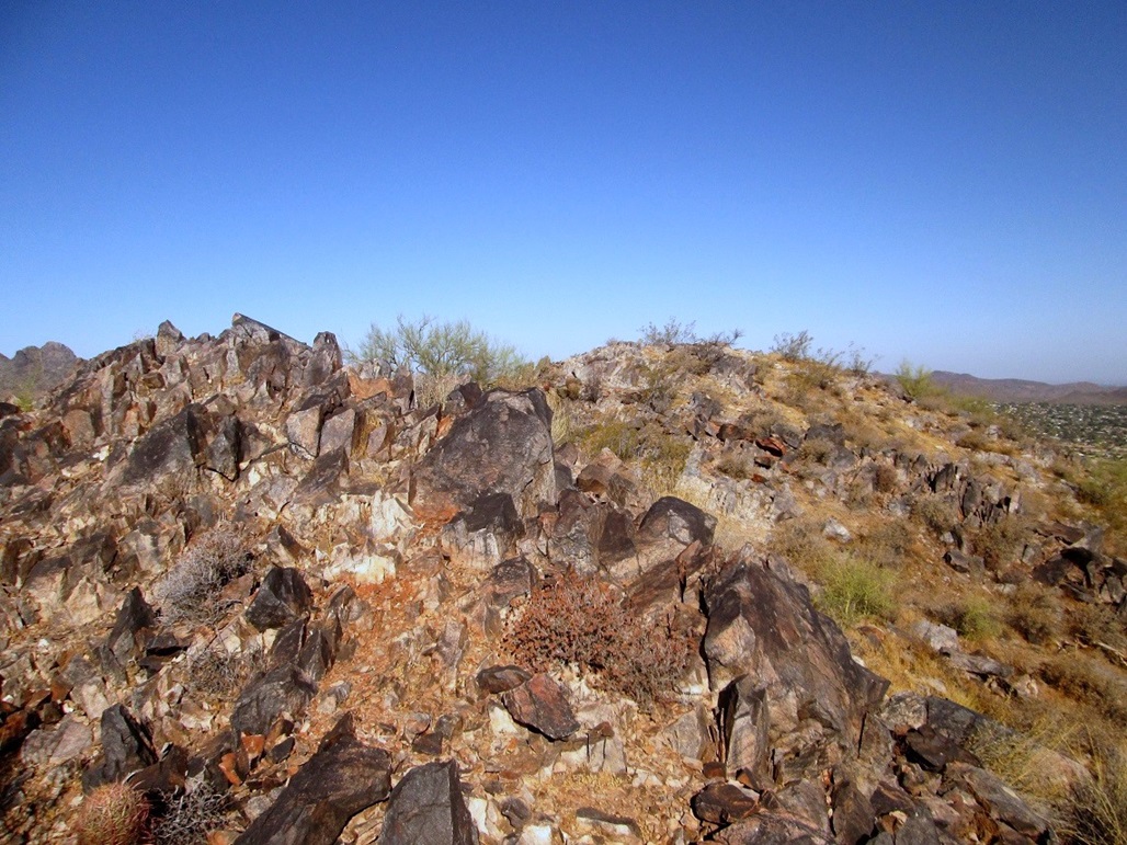
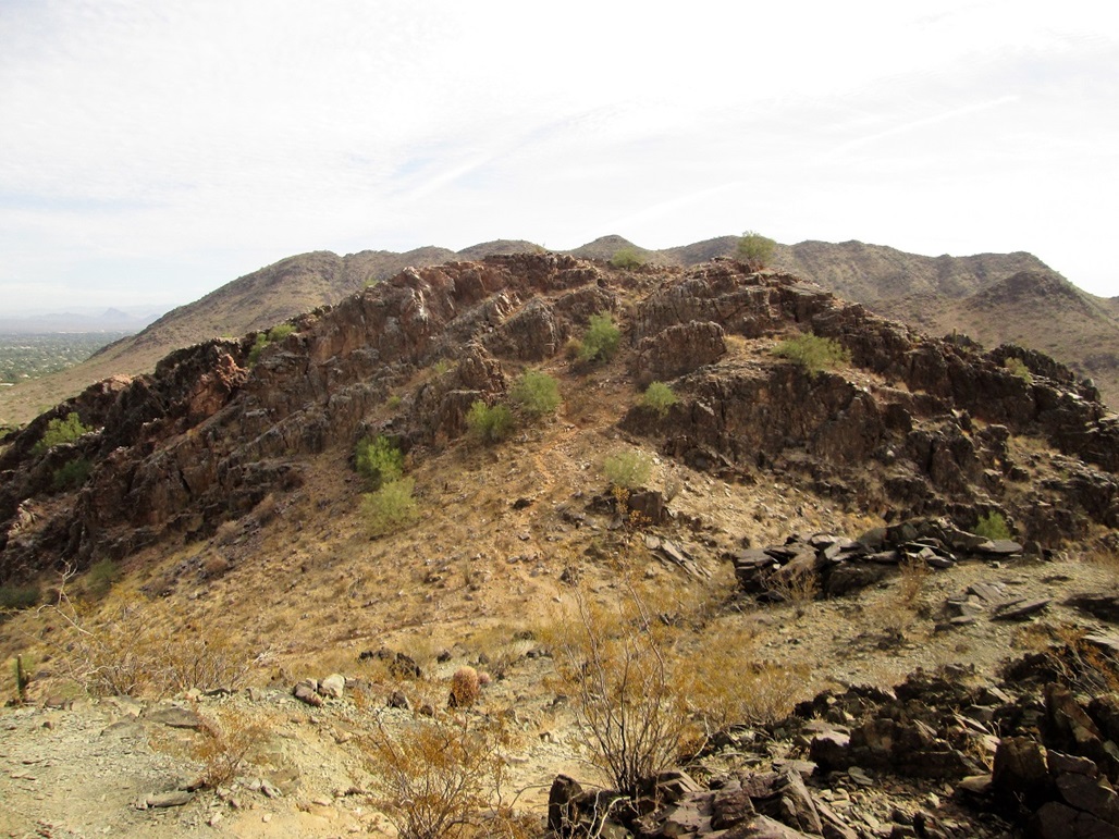
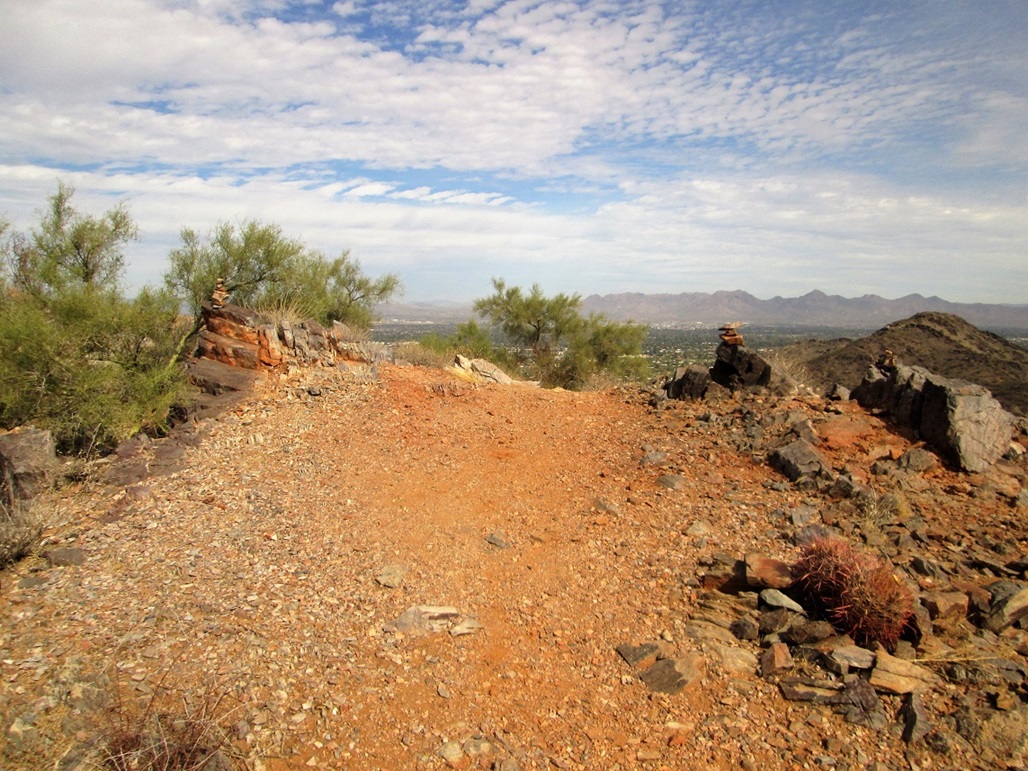
I followed a dirt road that heads south, this being the alignment for 40th Street. The road has been left to decay and is covered over in rocks in many places. For hiking, it offered a good, wide path through the desert. In about a mile, the road started to steepen slightly, now closer to the base of the actual mountains. Here, a signpost marked "Dixie Peak" with an arrow points the correct way. This was the first time I found out the peak had a name, even if it was unofficial.
Past this signpost, the route was now along trail, and it switchbacked steeply up the hillside. The going was straightforward, but a little choppy in places demanding that I watch where I put my feet. In not too long, I had arrived into the main ridge. Here, I went left and followed a trio of women up to the top. In moments, about five other people had come up. Although there was a steady stream of hikers, it was nowhere near as crowded as on Piestewa Peak.
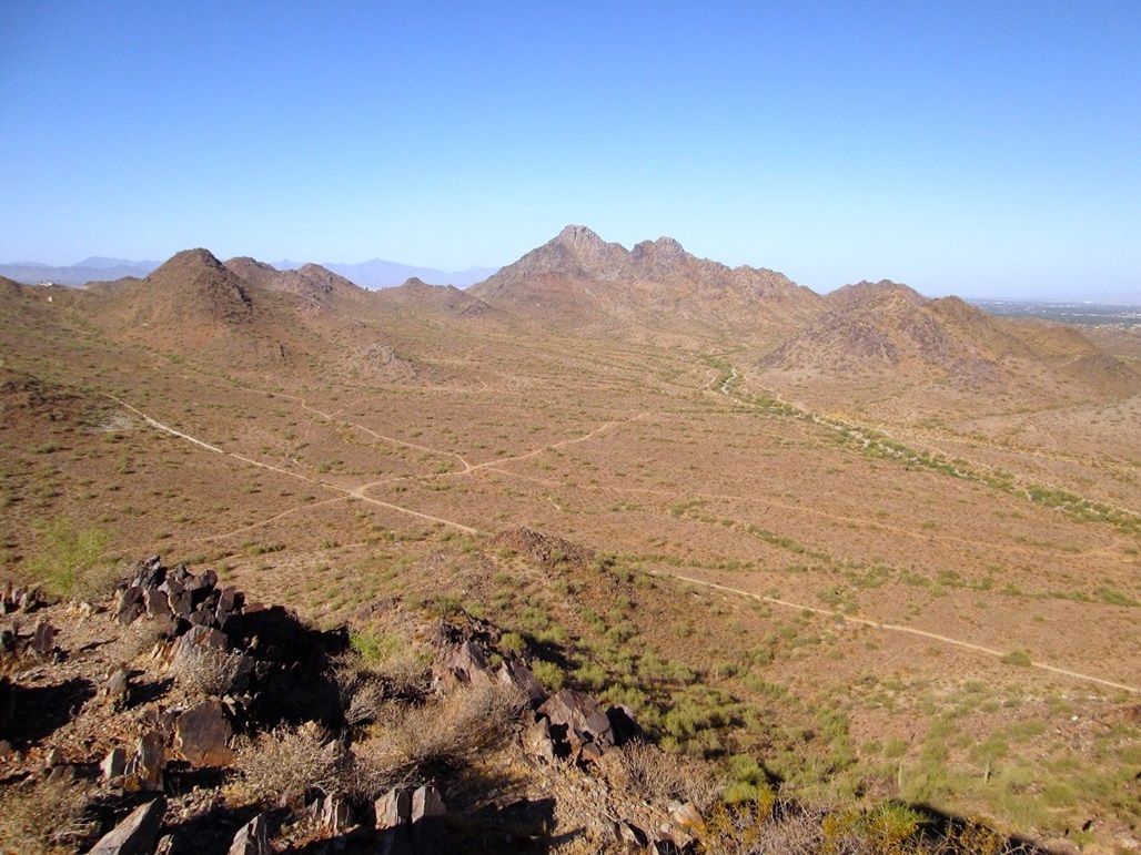
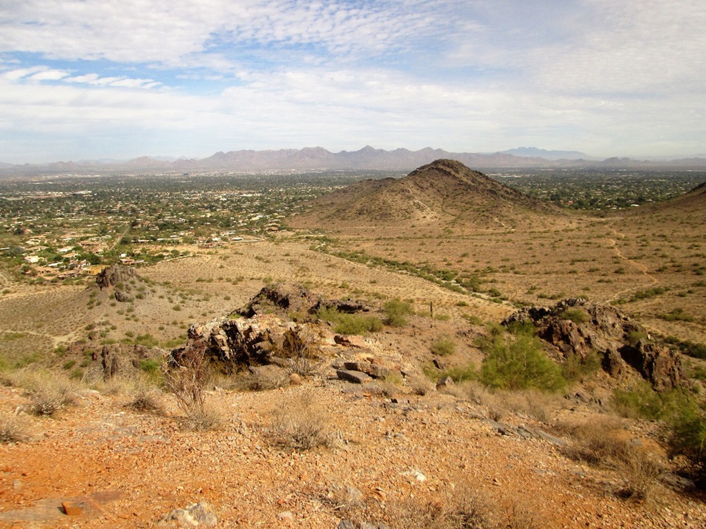
I spent about ten minutes on top, taking a few images with my camera. The surrounding mountain ranges were all covered in snow, a rare sight for Phoenix. I watched as the people descended another trail, so I followed them. This trail zig-zags down back to the main saddle, meeting it at a slightly unobvious junction. It was nice to have a little loop to follow. The hike down went fast and I was back to my truck soon, my whole round trip costing me 75 minutes of my life.
I found this to be a fun hike. It was about 1.5 miles each way with 930 feet of gain, so it's a good workout. Why I hadn't hiked it until now is beyond me. I will certainly come back.
The name, Dixie Peak, is unofficial, but it gets repeated on some websites so it may become the official unofficial name in the near future. It is one of the peaks commonly climbed as part of the Phoenix Seven Summits Challenge. Other sources call it "Two Bit" Peak.
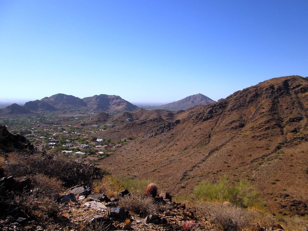
It just so happens that the city limits of Paradise Valley run immediately north of the summit, placing the summit barely within Paradise Valley. A careful study of the topographical maps along with up-to-date maps of the city limits shows that this peak is the highest point within Paradise Valley.
Camelback Mountain, about two miles to the south, lies along the southern city limits. There, the city limits run up to and just nick a 2,420-foot contour on the peak's steep north-facing slopes. Thus, it is a close call between these two points, but Dixie Peak (Peak 2429) wins out.
Date: June 12, 2017
• Elevation: 1,987 feet
• Prominence: 437 feet
• Distance: 2 miles
• Time: 1 hour, 15 minutes
• Gain: 490 feet
• Conditions: Clear and warm, but pleasant for June
The high temperature today was only going to be in the low 90s, with morning lows in the 60s. For mid-June in Phoenix, these are way below normal. I decided last minute to go hike something, knowing full well this will be it for decent hiking weather in the deserts for another four months.
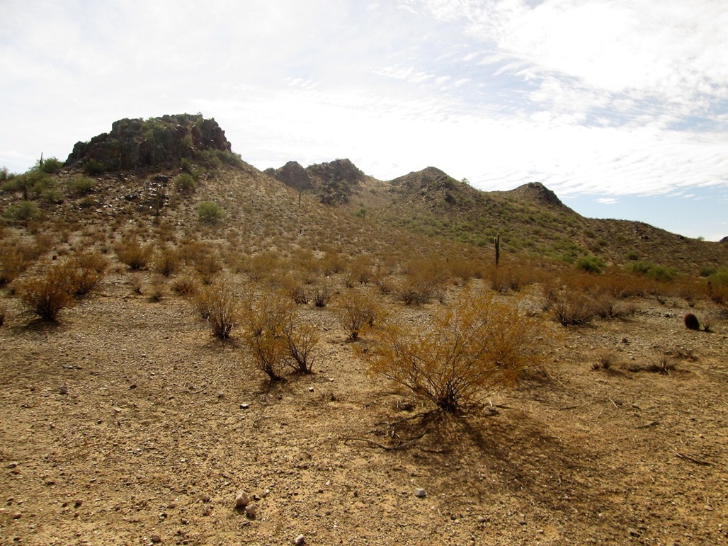
I chose to hike Peak 1987, which lies in the Phoenix Mountains Preserve south of Shea Boulevard, roughly at the end of 44th Street. It's north of Dixie Peak/Two Bit and northeast of Piestewa Peak. This peak has no name and does not stand out much, but it does have decent prominence, plus a trail to the top. It would be fast and easy.
I left home and arrived at the parking lot at the south end of 40th Street at 7 a.m., the lot half full. I got my shoes on, threw on a simple pack, and started hiking not long after, the day sunny but the air temperature still only in the high 70s. It was comfortable, and I still had morning shadows that helped keep things cool.
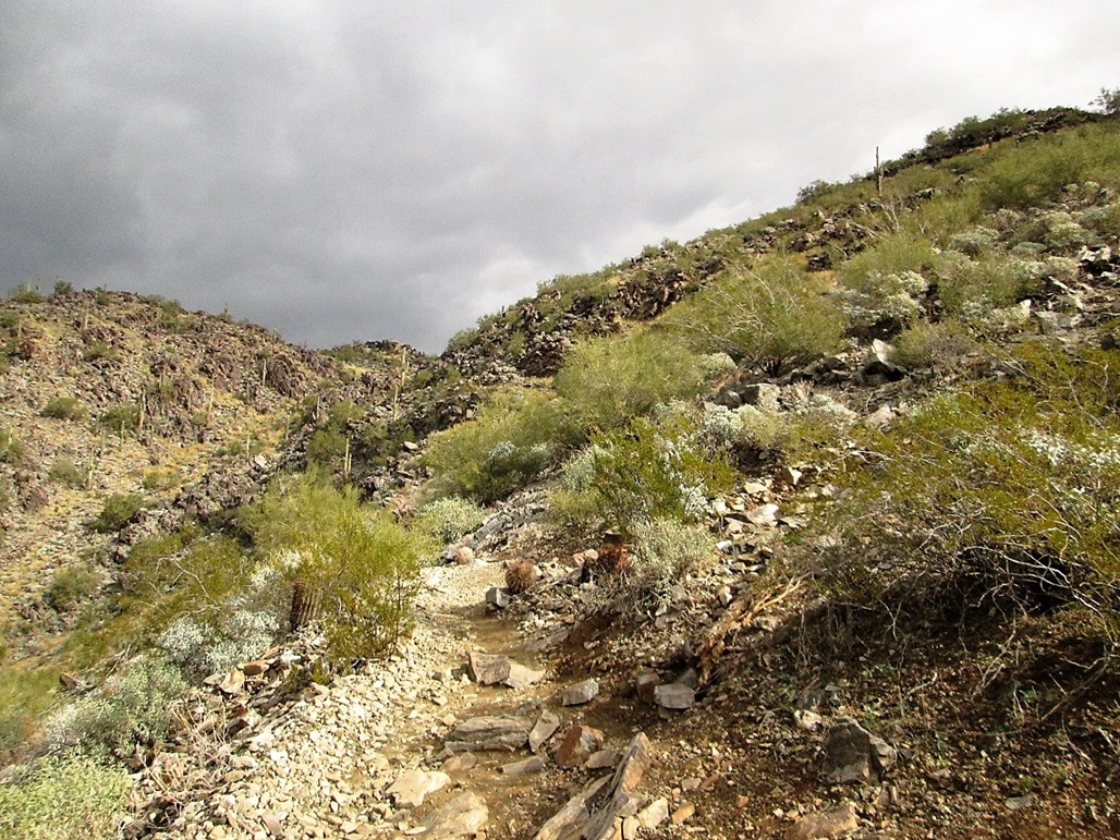
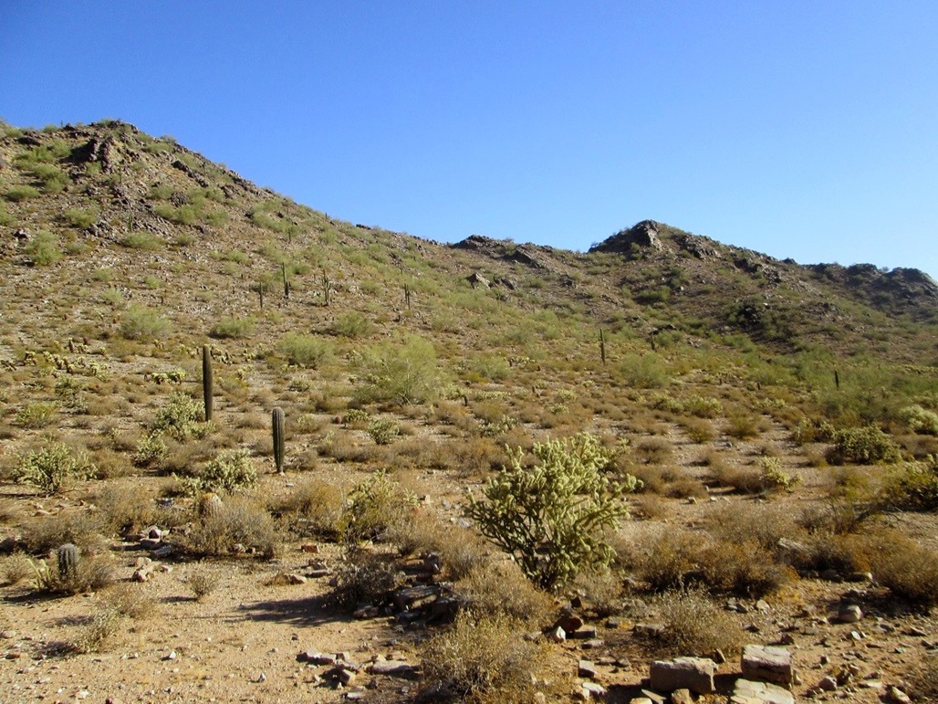
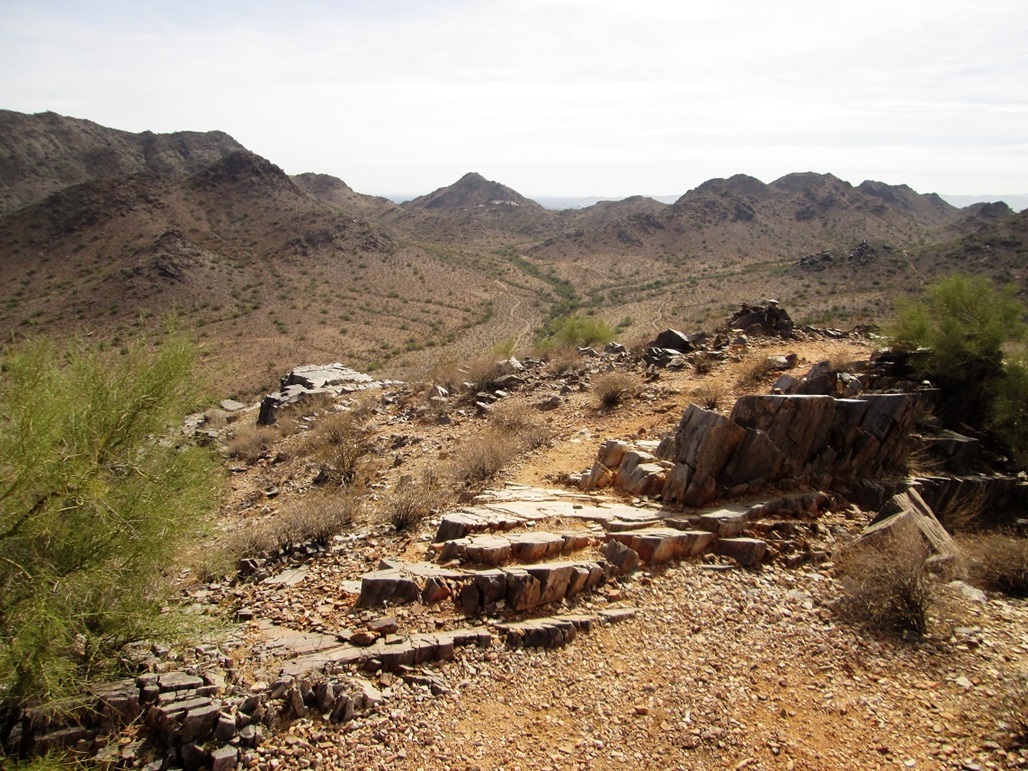
I followed the continuation of the 40th Street alignment south. This was an old road, but now is a hiking path, although it is as wide as a road. Peak 1987 rises immediately to the east of the road. It would be tempting to try to barge up its slopes right there, but there are cliff bands on this side.
Soon, I hung a left onto Trail 100, and followed it eastbound for about a third of a mile. Then I stayed left at another trail junction, then a few hundred yards later, another hard left near a two-foot high cairn. This last left was the summit trail. These last two trails do not appear on the official trail maps, but are visible on the satellite images. They are good trails and obviously see consistent traffic. Today, not many people were out. Most people were joggers and bicyclists who stayed to the main trails.
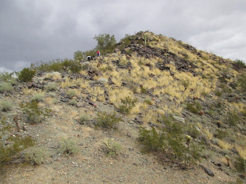
Now on the uphill, I marched forward and kept a slow, steady pace. With the sun directly on me, I got warm fast, so I stopped to rest more often than usual. But then a breeze would come by and cool me down. After a 300-foot gain, I was now on the ridge at a saddle northeast of the summit.
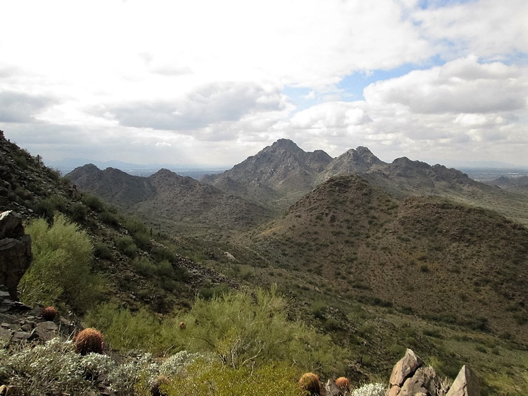
Here, I took a hard left and stayed on the path as it wound through rock outcrops, gaining another hundred feet to top out on the summit. A large rock windbreak lies on a lower bump, while the real top is just a bare rock hump. The views were nice in all directions, and I took a small break here to hydrate.
The downhill hike went fast, and I was back to my car after an hour and fifteen minutes on the hike. The temperatures were still nice, about 85, but I got what I came for. I drove home, stopped at the store for goods, rested and spent the day getting my head right for a planned move in two weeks.
Date: November 12, 2017
• Elevation: 1,955 feet
• Prominence: 335 feet
• Distance: 2.2 miles
• Time: 1 hour
• Gain: 525 feet
• Conditions: Warm, high clouds
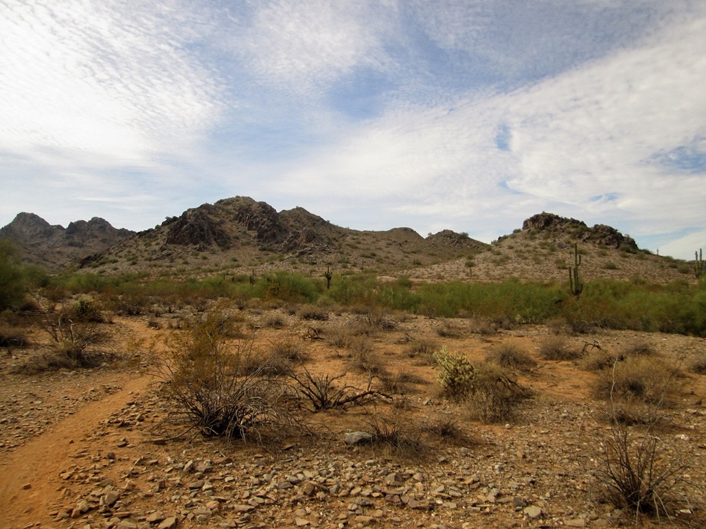
This peak lies about a mile northeast of Piestewa Peak, west of the 40th Street parking area and trailhead. As usual for such peaks, it has no name, and does not stand out much. It was something I could hike on a whim.
I spent the morning with my wife watching the Brazil Formula-1 auto race. She's into F-1, and I am slowly picking up on the sport, learning as I watch the races with her. The race was over about 11 a.m.. I had the rest of the day open and not many chores to do, so I got my stuff together for a quick hike.
I parked at the 40th Street lot, arriving here about noon. The day was warm with high clouds, temperature about 80 degrees. The peak I was after was right there, less than a mile away.
There are trails everywhere, so I picked one and started walking, taking any fork I came upon that went "toward" the peak. I followed Trail 8 to Trail 100, then some other trails without any signposts. I was on a lesser trail, much rockier than the others. This led up into the hilly parts north of the summit.
The trail I was following grew scant, and I could see a better one across the way, about 150 feet to the west. I dropped into a gully, then up through the brush to meet this better trail.
This trail headed up to Peak 1920, the small bump west of the main peak. I followed it up and over this bump, the trail being quite steep and loose in sections. From here, it was an easy drop of about 70 feet to a saddle, then up more trail through rocks to the real summit.
The top is rocky, with cliffs facing east. People have built small delicately-balanced cairns atop this peak. I spent a few minutes here snapping images and looking around. It took me about 40 minutes to get here, partly due to my meandering approach path.
For the hike down, I went north to where the trail meets a perimeter trail that abuts the back fence of some homes. I was back to my car in about 20 minutes, thirsty and pleasantly tired.
|


|