
The Mountains of Arizona
• www.surgent.net
|
| Peak 2555 |
• Silver Bell Mountains • Ironwood National Monument • Pima County |
|
Date: January 28, 2025
• Elevation: 2,555 feet
• Prominence: 335 feet
• Distance: 0.6 mile
• Time: 40 minutes
• Gain: 375 feet
• Conditions: Cool and cloudy, some nearby storm clouds
Arizona
•
Main
•
PB
•
LoJ
Today's adventure would be small and humble: just one easy peak on the agenda. This past weekend I battled the flu for a couple of days. While I was feeling better now, I was not ready for any multi-hour epics.
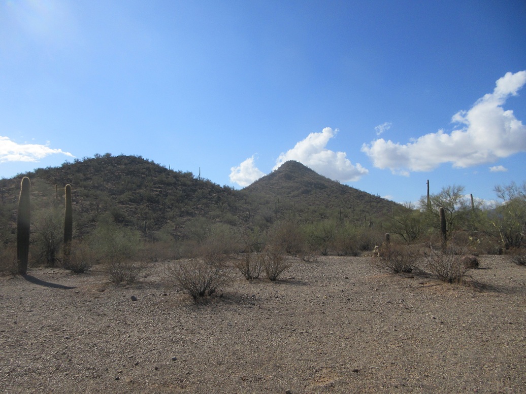
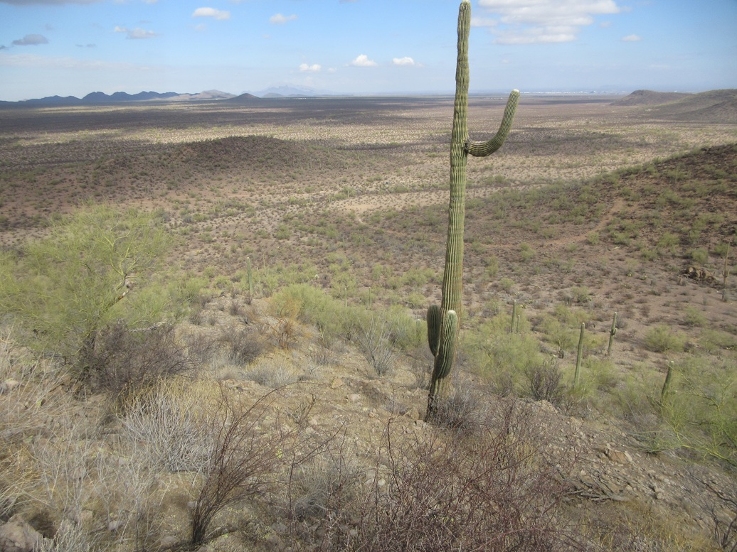
I was also on my Tuesday Tempe drive, and had not left Bisbee until past 9 a.m.. I was in Tucson by 11 and onto Avra Valley Road, heading west. Fifteen or so miles later, I was within the Ironwood National Monument boundaries, little Peak 2555 jutting up all by itself.
This peak is a foothill of the Silver Bell Mountains. It rises north of Avra Valley Road and north of Waterman Peak. A gas line road runs diagonally from the southeast to the northwest and looked like a better bet to get close to the peak.
The gas line road was in decent shape. I drove on it for about two miles. It got a little choppy and uneven where it crossed through arroyos. High clearance would be necessary, but not 4-wheel drive.
Past a cattle grate and a fence, now northeast of the peak, I turned onto a lesser track that parallelled the fence, now aiming right for the mountain. This track was also in good shape, but it was rockier in a few spots, so I took it slow and carefully. I parked northeast in a clearing.
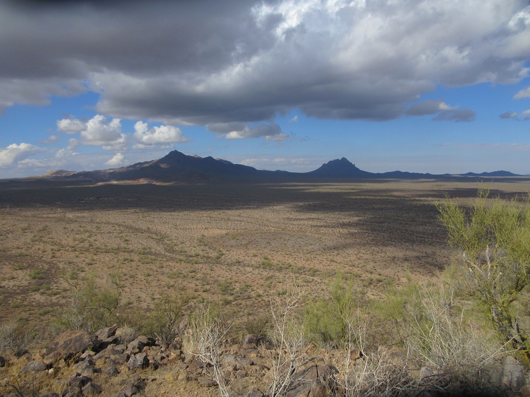
The day had been cloudy with some scattered rain storms. It had been mostly sunny and bright in Bisbee, but in Tucson, much of the city was shrouded in low clouds. As I drove along Avra Valley Road, a little rain fell. It was cool outside, but not uncomfortable. The clouds seemed to be tracking to the south. It looked clear with some puffy clouds where I was.
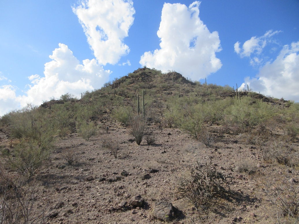
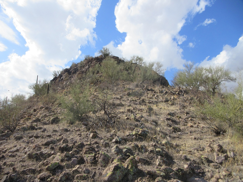
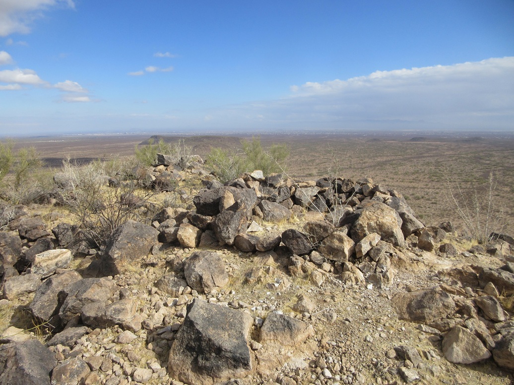
The hike was very short and quick. I walked up a gentle open slope to the saddle below the peak and its lower eastern bump, then up the steeper slopes toward the top. The upper-most 60 feet was a heap of rocks forming messy cliffs and chutes. I walked most of it, using my hands just in a couple spots.
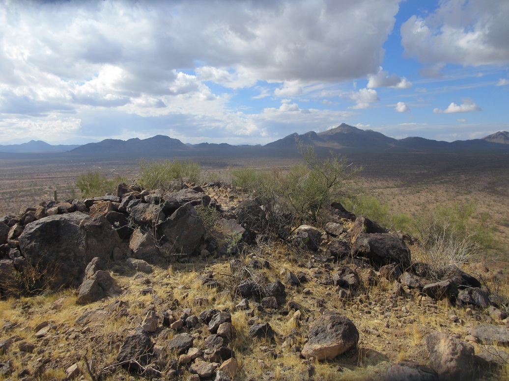
The summit is open with some rock outcrops and piles, but no cairn and no register. It was breezy up here. Views were good, the clouds sometimes muting the sun and other times enhancing the sun's effects. Toward the northwest, the clouds all had dark underbellies and were heading my way.
I walked down the same route, and was back to my car quickly, a 40-minute hike covering just over a half mile. And I was perfectly happy with this short outing. I felt good, I did not feel winded or weak, but I did not want to push myself either. I still had a lingering cough.
The drive out went well, too. I stopped for gas in Marana, then again in Eloy for some snacks, before locating myself in the big city. I had a hotel room arranged and got in about 3 for a shower and time to go to my day job.
Tomorrow, I would hike Peak 3820 near Picketpost Mountain in dark and gloomy weather.
|


|