The Mountains of Arizona
• www.surgent.net
|
| Peacock Peak |
• Highpoint: Peacock Mountains • Arizona State Trust Lands (part) • Mohave County |
|
Date: April 3, 2011
• Elevation: 6,292 feet
• Prominence: 2,092 feet
• Distance: 3 miles
• Time: 3 hours and 30 minutes
• Gain: 1,700 feet
• Conditions: Windy and brisk
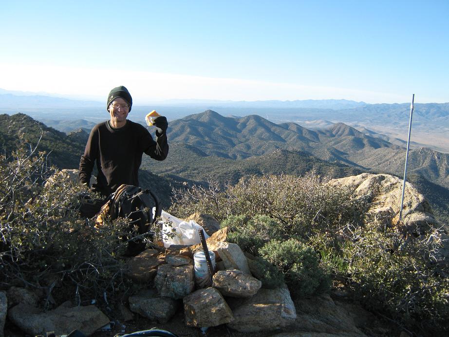
• Teammates: Adam Helman
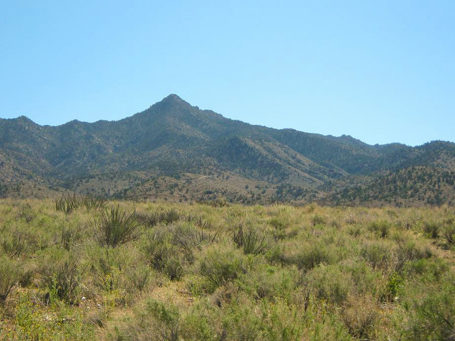
The Peacock Mountains lie about 20 miles northeast of Kingman, surrounded by the Hualapai Mountains to the south, the Cerbats to the west, and the Grand Wash Cliffs to the north. The immediate area is a patchwork of State Trust and private lands. From a distance, the Peacocks don't look as impressive as the other ranges, and it's not that clear how to get near it. As a result, few people hike or explore in the Peacock Mountains.
The a-priori easier approach would appear to be from the east, since roads get close to the base of the mountain. Scott Casterlin and John Hamann were the only two people I knew who'd been up and they told me the east-side approach was brushy and grueling. Nevertheless, in May of last year, I drove around the area, scouting the roads. Most of the land here is posted against trespassing, and the slopes from this side looked unbelievably brushy. I dismissed any notion of hiking the peak from the east.
I exited onto AZ-66 (Old Route 66) and drove back to Kingman, looking for ways to scout the west side toward the range. However, a railroad track parallels the highway the whole way with no apparent way in. I never got off the highway, and came away with no idea what to do. I'd need to do more homework, apparently.
In February, Adam Helman and I were discussing plans for this part of Arizona, with Mount Tipton the primary objective. I did a Google-search on Peacock Peak and found a scant report from the Las Vegas Mountaineering Club (LVMC) who came up the west side earlier in the month. More importantly, it included directions to get onto the west-side roads, and also mentioned that the hike was relatively short. This was great news, and we set this hike as the last for both of us on this trip.
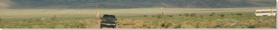
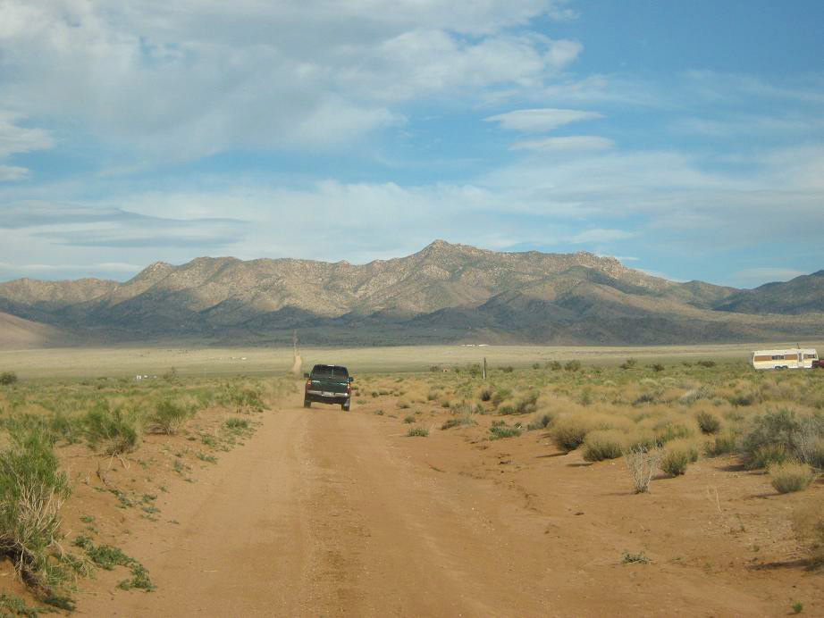
After our success on Mount Tipton, we drove into Kingman for food and rest before heading to the Peacocks to camp for the night. From the Andy Devine Exit off of Interstate-40, we went north on AZ-66 for 4.5 miles to Mohave Airport Drive, then right for a half-mile to Shipping Lane, turning left (north). After about 1.2 miles the pavement ends and the road doglegs left, now called Bruce Road. Another mile or so, it doglegs right, now called Topeka Road and paralleling the railroad tracks. We stayed on Topeka for about two more miles to Jan Road, then went right (east) on Jan Road for 7 miles as it gained into the foothills.
The area north of the airport has to be some of the ugliest, dreariest land in the state. It is non-descript high-desert scrubland with few trees. At some point in the past, someone got the idea to blade a bunch of roads and sell homestead lots. It seems few people bothered. We saw a few derelict homes or piles of construction trash.
Jan Road ends at a T-junction, with an abandoned residence to the north. We followed the road to the right (Hensz Way), climbing steeply up a foothill, switchbacking a few times, rubbly and steep (and loose) enough to warrant 4-wheel drive. About a mile in, we were about 400 feet above the plains. We parked in a pullout with plenty of room for our two trucks.
We arrived late in the day in windy conditions. We relaxed until night fell, and turned in early given our tiredness after hiking Mount Tipton. I observed that not one of the homesteads below us had any lights on during the night. Not one. We saw no vehicles, no headlights, heard no dogs, nothing. I suspect that this entire area must be abandoned. It was bizarre and a little eerie.
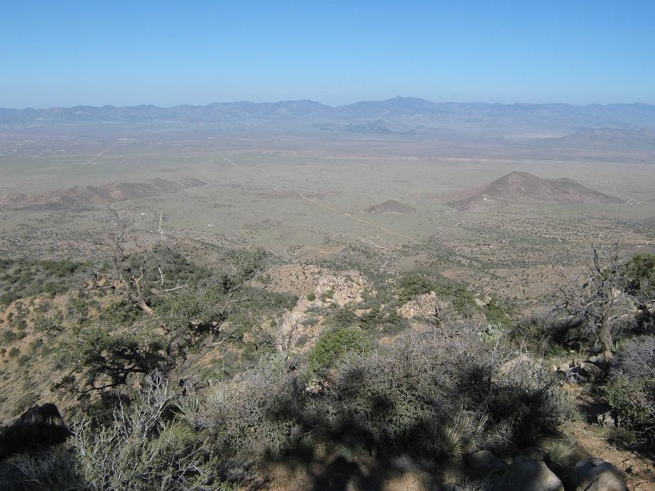
We rose early the next morning, intending to be on the move at sun-up. It was breezy and about 10 degrees cooler than yesterday. We walked to the end of the road, going left at the only junction, then charged up a hillside to gain a small rock knob, spot elevation 4,928. We could see nearly our entire route, with the pointed summit of Peacock Peak directly ahead of us, a mile as the crow flies, and about 1,600 feet higher. It looked straightforward. The final hundred feet looked rocky and cliffy, so we hoped we'd find a way through the maze once we got there.
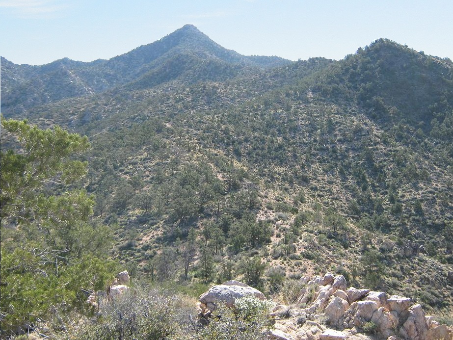
From Knob 4,928, we descended about 60 feet, crossed an open saddle, bent slightly right (southeast) and gained a steep, forested hillside, topping out at another knob, elevation 5,320 feet. Once at this vantage point, we could see the next waypoints we'd need to get to. The brush was light and mostly open, and we made good time up the slopes. A few beaten paths helped in spots. This was much nicer than expected.
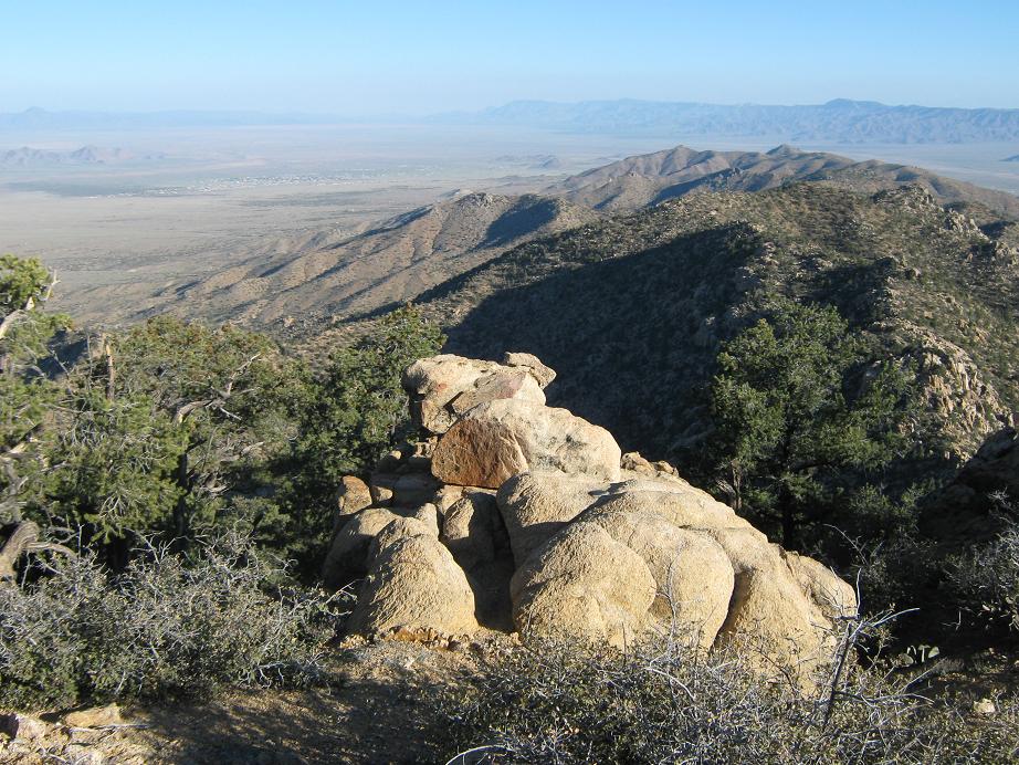
In time, we'd climbed to the last of the ridgepoints, now directly below the summit, which was still 500 feet higher. We ambled up the slopes, which became progressively rockier with loose sections, but we could always see a way through the brush or around the rock obstacles. We kept at this, following natural constrictions ever higher until we were essentially at the summit. The final 100 vertical feet was not too bad but we did have to pay attention to landmarks to be sure to come down the same way.
We came upon what we believed to be the summit blocks, and I climbed up the small cliff band, gaining about 10 feet, only to discover the true summit still a few dozen yards farther to the east. So we skirted below this cliff band and worked our way to a saddle, then the easy last few feet to the top. It was 7:40 a.m., a one-hour, forty-minute ascent. We took an extended breakfast break up here, enjoying the views in all directions.
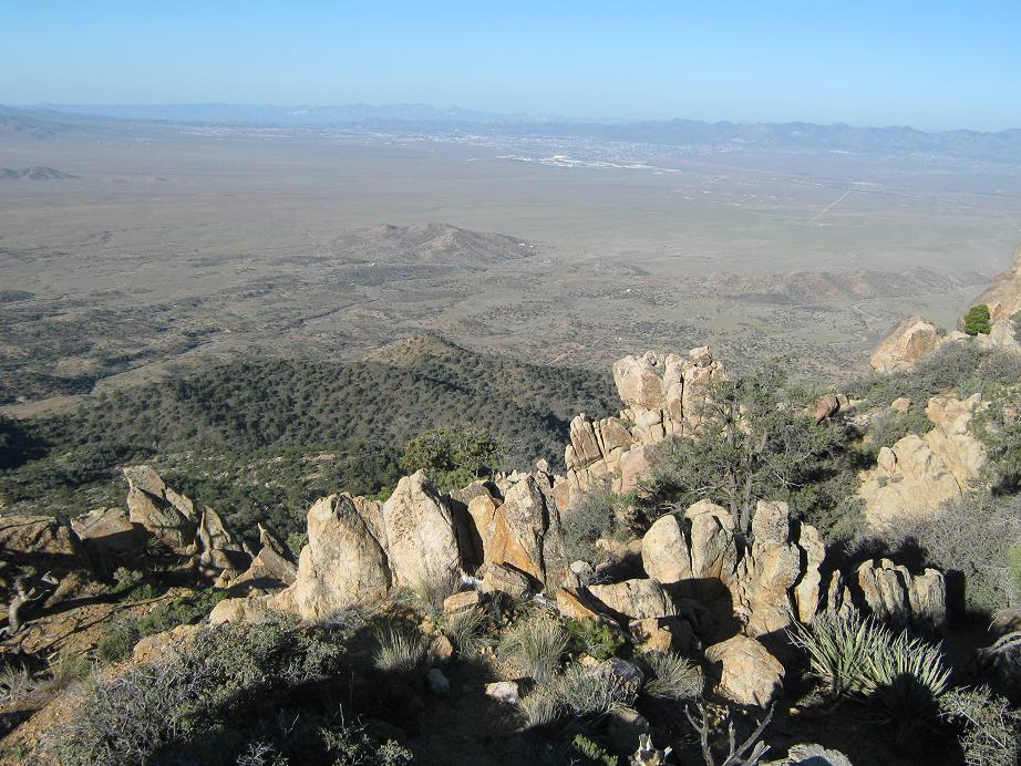
The Peacocks are a surprisingly pretty range, and the north and south views were of its main range crest and subsidiary peaks. Kingman sprawled out to the southwest, and the Hualapais (with late-season patches of snow) to the south. Remote Mohon Mountain was visible to the southeast. Yesterday's peak, Mount Tipton, was off to the northeast, kind of tricky to identify it from so far away.
The log book held just a handful of names going back about 15 years. Most years only one or two parties would sign in, some years seeing no one. A few had come up the brushier east side. One guy said it was miserable and "hoped we'd come up a different way". A brother-sister team from just the weekend before (!) spent 6 hours climbing the summit from the east. There were a few sign-ins from the LVMC ascent in February, and another from about a month ago, meaning four groups had ascended the peak in 2011 alone, probably as many as had come up in the previous 5 years.
The descent went quickly and with no mishaps. The hike back took just under an hour and a half, and including our summit break and other rest stops, we had been gone for three and a half hours. A very pleasant and unexpectedly simple hike, given the horror stories (or none at all) that I'd heard about this peak. I was tickled to get this one along with yesterday's big fish, Tipton. After we got our stuff sorted out, we descended back onto the highway, with Adam heading home to San Diego and me to Scottsdale. I took the scenic route along AZ-66 into Seligman, Interstate-40 a little bit, then AZ-89 into Prescott and home. A productive and fun weekend for me, and as always, thanks to Adam for his company, math skills and good camp food.
As for the legalities of this peak, the roads are all public right-of-way and we saw not a single sign against trespassing. We saw no life at all. The summit might be on state land. I don't think anyone comes up here ever. The Peacocks are an odd, forgotten segment of Arizona.
|

|