
The Mountains of Arizona
• www.surgent.net
|
| Mica Mountain |
• Highpoint: Rincon Mountains • Highpoint: Saguaro National Park • Pima County |
|
Date: April 25, 2010
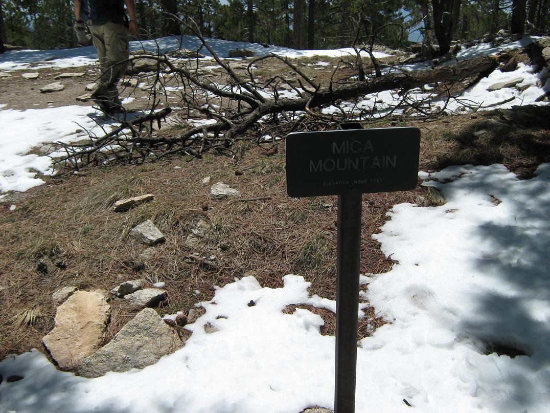
• Elevation: 8,666 feet
• Prominence: 4,610 feet
• Distance: 17.2 miles
• Time: 10 hours and 40 minutes
• Gain: 4,200 feet
• Conditions: Clear with wind
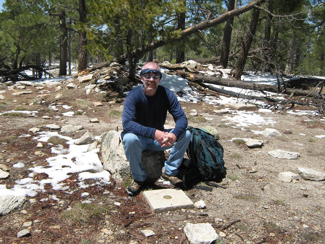
• Teammates: Scott Casterlin (entire), Carl (partways)
Mica Mountain is the highest point of the Rincon Mountains, which loom 6,000 vertical feet above Tucson to the east of the city. The most noticeable peak is the pointed Rincon Peak, while Mica Mountain is a gently rounded hump north of Rincon Peak. Both peaks and most of the range lie within the Saguaro National Park.
The Rincon Mountains are the last remaining "large" roadless mountain range in the state, which throttles visitation to the upper elevations to a very few fit hikers, and helps leave the range in as pristine state as possible. Miles of excellent trails criss-cross the Rincon Mountains, and are most popular with multi-day backpackers.
A variety of hiking routes exist to both Rincon Peak and Mica Mountain, but they are long. I hiked Rincon Peak in 2007, taking nearly 11 hours to cover 16 miles and over 4,000 feet of elevation gain. This gave me an idea of what to expect when I got around to hiking to Mica Mountain. While strenuous, the scenery was superb and I definitely was inspired to come back.
There are three main options to hike Mica Mountain. The most popular starts at Speedway Boulevard in Tucson, and requires 26 miles round trip. Most people who come this way do it as an overnighter. A second option starts from the north off of Redington Road, but I was told this road, and the spur to the trailhead, were very rough. That left the southwest approach via Happy Valley along Turkey Creek Trail as the only viable option if we were to hike to Mica and back in one day.
Scott Casterlin of Tucson was willing to venture back up into the high country of the Rincon Mountains again for my sake, but actually setting a date and a route took some time. We settled on Turkey Creek when Scott's friend Carl was willing to join us and drive us to the trailhead. We set a late-April date for the hike, banking on warm weather down low, cool weather up high, clear and stable conditions overall, and maybe some remnant snow to feed the creeks and springs. I drove out to Scott's place the night before, then Carl met us at 4:30 the next morning. We piled into his vehicle and drove east on Interstate-10 to the Mescal Road Exit, and north into Happy Valley.
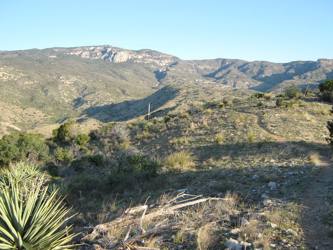
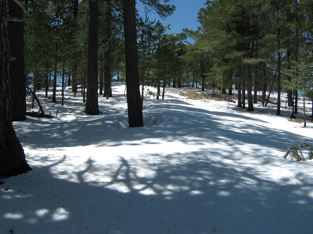
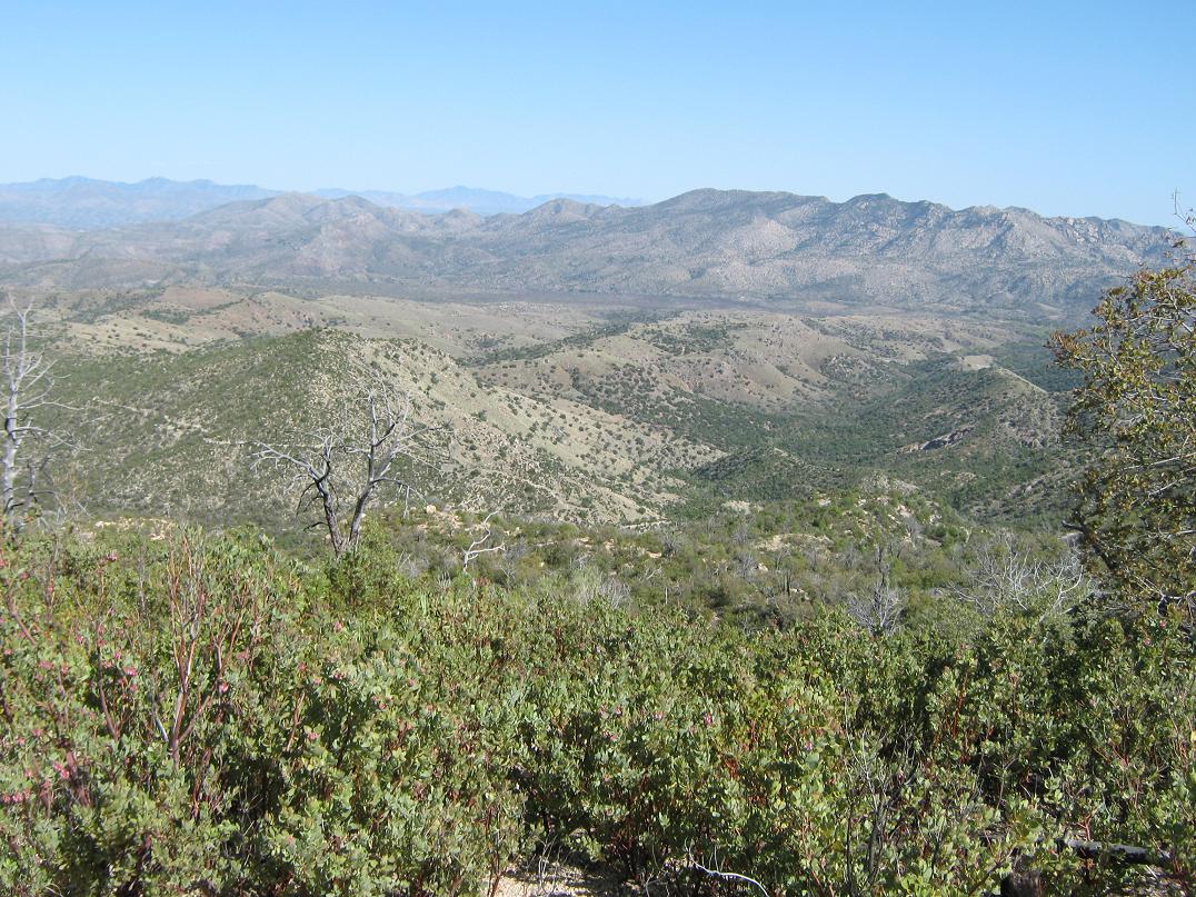
When I hiked Rincon Peak in 2007, I drove here in the dark so I don't remember much. Today in the light, it was very pretty. The dirt road ran in and out of about 10 large "puddle" crossings. A storm a few days ago dropped some snow, so this was a good omen, as it meant water up high. Happy Valley is a lovely place, surrounded by the giant cliffs of the eastern Rincons, and the nearby Little Rincons.
We drove to the Turkey Creek spur road, passed through the camp area, then up the remaining 1.5 miles of rough road to the trailhead. This last road is rough in places, with erosion gullies and large stones, plus a couple steep sections. Carl did a fine job getting to the trailhead. We started hiking at 6:15 a.m. in clear, sunny conditions. The trailhead's elevation here is a shade above 4,600 feet.
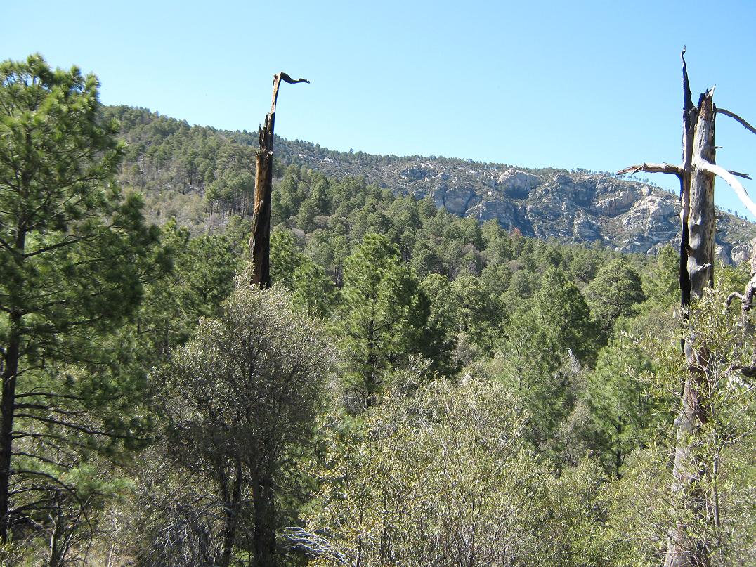
I decided to go on ahead, knowing they'd catch up to me soon. The initial segment of the hike runs north along some foothills that I call Turkey Creek Ridge. The trail is often level and well constructed with easy grades for about 2 miles. Sections are grassy and green, and other sections are rockier, with hardier desert scrub. After two miles the trail comes to the Saguaro National Park gate, then a quarter-mile later, drops to a saddle at a sign-in kiosk, elevation 4,980 feet.
Although the hike to here had been easy, I was hankering to start gaining elevation, as we still had over 3,700 feet of gain ahead. After the sign-in log, the trail drops one more time, then starts the steady climb upward. We could see the range crest way above us, heavily forested sections cut here and there by big rock cliffs and formations. But that stuff was still hours away.
Down low, the hillsides were more desert-like, with tufty grasses, sawgrass, woody hip-high brush and lots of madrone and mountain oak. After an hour, I stopped to rest and that's when Carl and Scott caught up to me. After some rest they went on ahead, and I resumed my slow grunt up the trail.
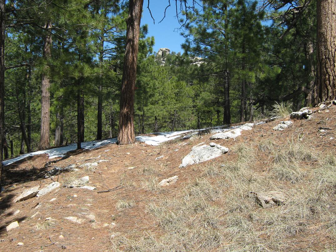
We met again after another 40 minutes at Mud Hole Spring, a small seep about 6,000 feet elevation, and 3.3 miles from the trailhead. The flora was transitioning from desert to subalpine, a mix of larger juniper and some pine, but still kind of open and with that edgy desert feel to it. After starting again, Carl and Scott strung out ahead of me, but by now I was in a good rhythm, my breathing matching my pace. The higher I hiked, the bigger and denser the forest became, the ambient temperature cooled, and the gradients lessened.
Scott and Carl were still way ahead of me, but the navigation was very simple. Some metal markers are nailed into trees along the trail in places where the trail itself might become faint. The ground even became softer, more dirt than stone, with a soft bed of pine needles. The smells were more montane than desert, that lovely pine scent. We met once again at Deer Head Spring, elevation 7,100 feet, 4.5 miles in from the trailhead. Here, we had an extended break and a powwow to discuss plans, since Carl wasn't going to the summit. Although I didn't check the time, my guess it was pushing 10 a.m. when we convened here.
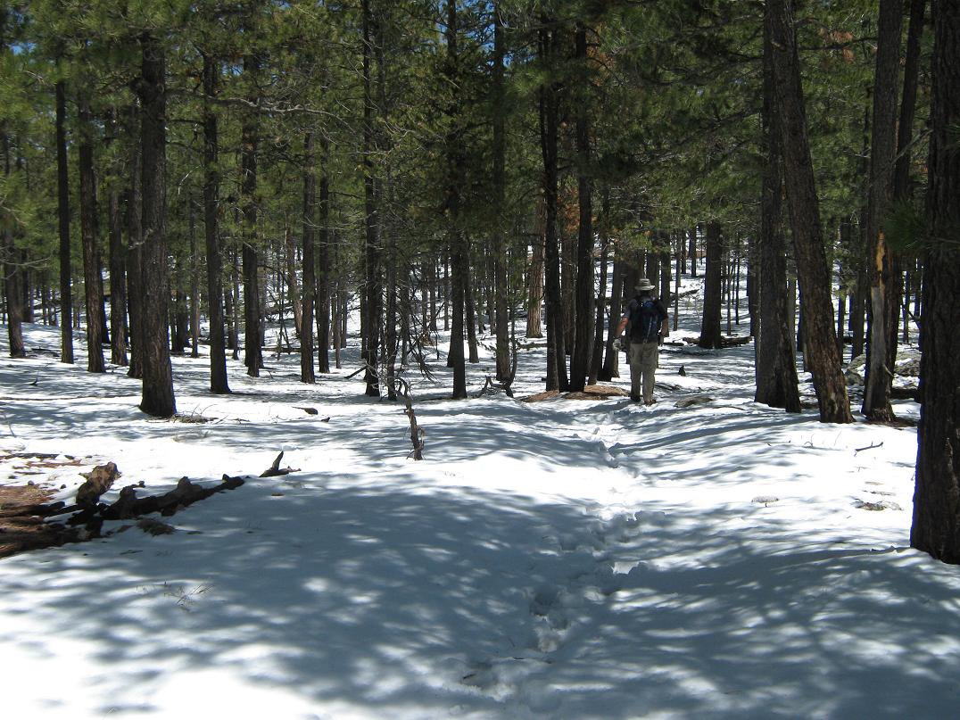
After Deer Head Springs, we continued to the East Side trail and Spud Rock Camp, then followed a switchback to the Switchback Trail (its actual name). Carl left us here to continue south, while Scott and I went west up the Switchback Trail, quickly gaining the top and emerging onto the actual range crest, elevation 7,800 feet. From Spud Rock Camp to here we had come across a few snow patches and a few places where we had to walk through some small drifts. The weather was very cool and pleasant, and we took another break here. According to the map, the summit was another 2.5 miles away, but with only 800 feet of gain. It was a moral victory to be on the range crest and to have about 80% of the uphill done.
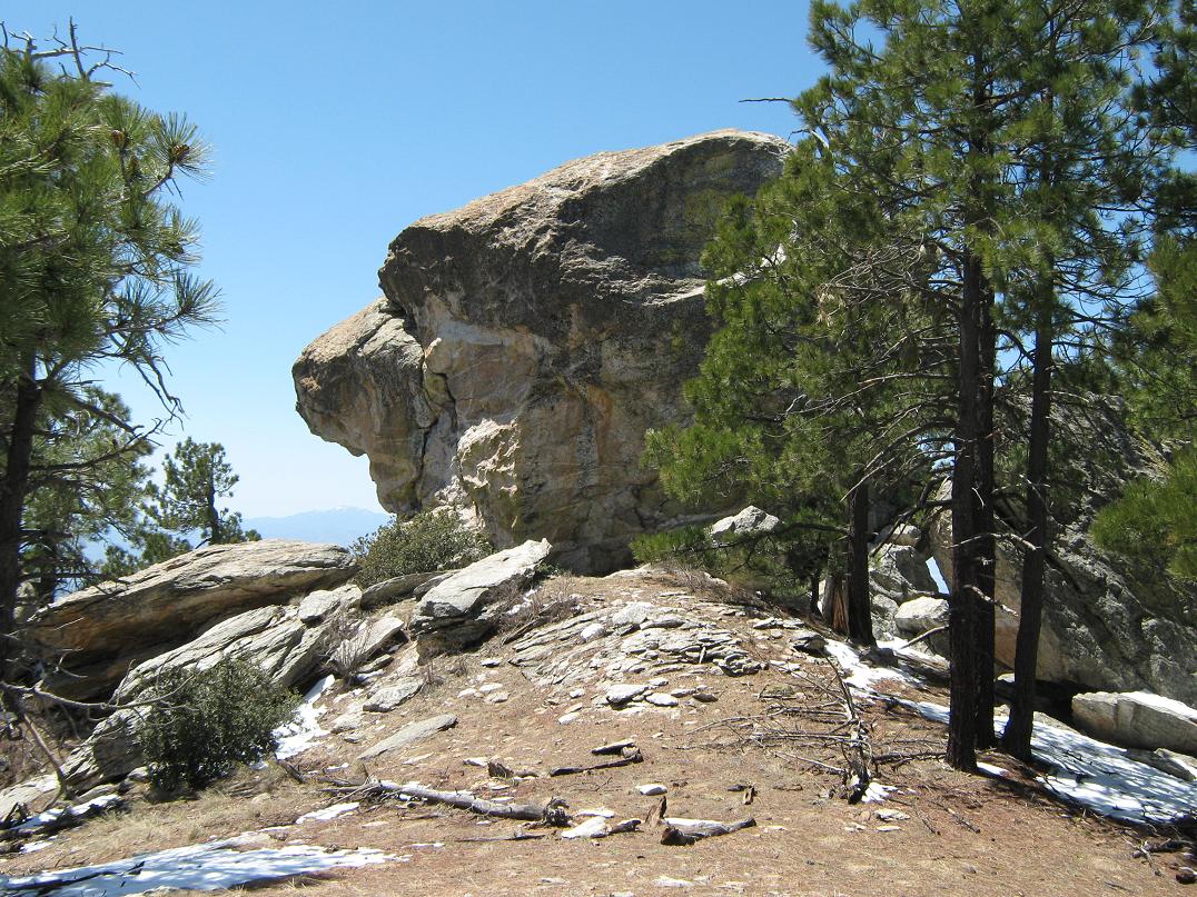
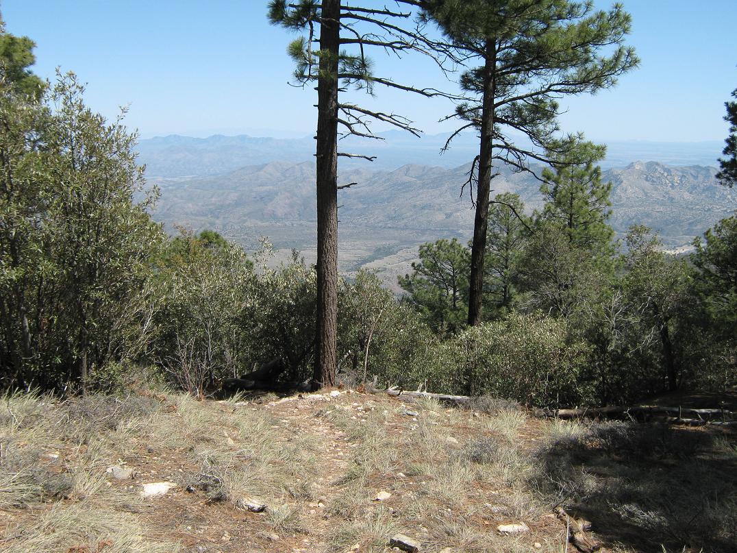
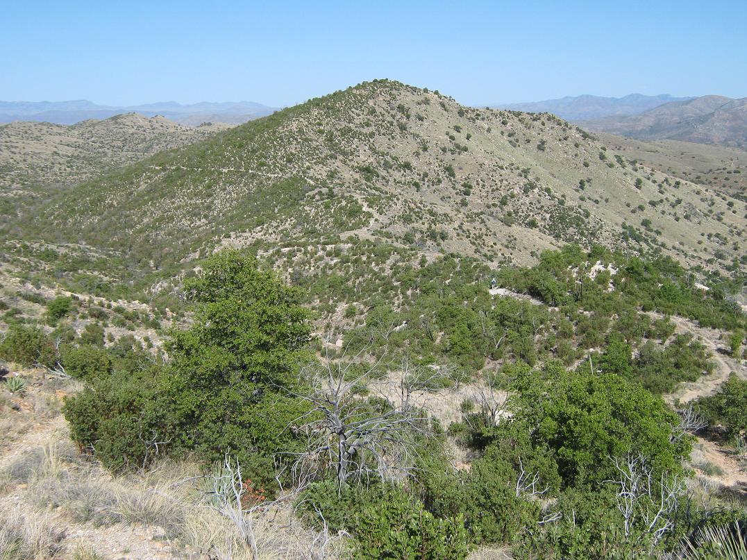
We continued uphill along the Heartbreak Ridge Trail, gaining 200 feet into increasingly bigger snow patches and trickling streams. The trail bent in and out of many drainages, including one with a strong flow to it, Scott saying this is fastest he's ever seen it flow. The trail from here went up another slope and finally connected to the Fire Loop Trail, where we went right, following a short but slightly steep incline to come to Man Head rock, a ridgeline formation we'd seen coming up. We sat at Man Head for another break, it offering the best views we'd have for the day. Rincon Peak was directly south. To Mica Mountain, we still had a mile with 300 vertical feet to go.
From Man Head, we walked along the trail to the Mica Meadow Trail junction, then shortly, to the Bonita Trail (this is not shown on the map for some reason). We followed Bonita Trail north for 0.8 mile through a mix of meadow and forest with snow on the ground. The Bonita Trail ended at the Fire Loop North Trail, just 0.2 mile from the summit.
We eased onto the Mica Mountain Trail, and followed it the remaining few yards to the top, arriving a shade after noon, nearly 6 hours after starting the hike. As advertised, there are no views, and the summit is a rounded hump of forest, but it was still a very nice place to be. I took the usual photographs and we spent 30 minutes relaxing. I sat on the footings of the old lookout tower near the benchmark.
Although tired, I felt fantastic and much better than I thought I would after such a long grind. We had talked about taking the trail west about a half-mile to Spud Rock (located nowhere near the aforementioned camping area, by the way), but the snow suggested it would be more of a hassle than it was worth, and besides, we had a lot of getting back down to do. We were moving again at 12:35.
The hike off the plateau went very quickly. We retraced our route and made good time, arriving back to the Deer Head Spring at just after 2 p.m. Here, we waited for Carl to arrive, having agreed to be here no later than 3 p.m. Fortunately, Carl showed early, and by 2:30, we were moving again. But in the time sitting at the spring, my legs grew tight, so it took me awhile to get into a rhythm again. The segment down to Mud Hole Spring took 30 minutes, but we were descending down from the cooler pines onto the warmer, more open transition zones. After another short stop at Mud Hole, we continued. As good as I felt today, I finally hit my wall coming down from Mud Hole.
As we hiked, Carl and Scott would be up ahead, always within sight. There was no urgency to stay as one group, but at the very least I'd be sure I could see them up ahead, or vice versa. The last couple of miles along the low ridge was easy, but boring. It felt fantastic to see the trailhead again. Carl and Scott had been there 10 minutes. I walked in at 4:50 p.m., meaning a 10 hour, 40 minute hike for me. We sat around, having some food and a celebratory beer, before driving out to the highway and to Tucson. After parting ways in Tucson, I got my stuff back in the truck and drove on home to Scottsdale, arriving at 9:30 p.m.
I was beat, but very happy to have hiked Mica Mountain. The overall hike had gone far better than I was mentally preparing myself for. The trail was in great shape the whole way, and my sedentary ways of recent weeks proved not to be as much a negative as I feared. I would love to come back for some more exploration, and I just may have to backpack in for at least one night of sleep. I would love to explore the western slopes and the Tanque Verde Ridge. But that's for another day. My thanks to Carl and to Scott.
|

|