The Mountains of Arizona
www.surgent.net |
|
North Sheba Crater • South Sheba Crater I was up on the Coconino Plateau, looking at four peaks on the Eastern San Francisco Volcanic Field, along Leupp Road to the Navajo Nation boundary. The two Sheba Craters lie south of Leupp Road, south of Merriam Crater. I hiked North Sheba first, then hiked another pair of mounds before returning to hike South Sheba Crater.
Date: May 9, 2020
• Elevation: 6,407 feet
• Prominence: 647 feet
• Distance: 2 miles
• Time: 55 minutes
• Gain: 730 feet
• Conditions: Cool
Arizona
•
Main
•
PB
•
LoJ
•
Interactive map
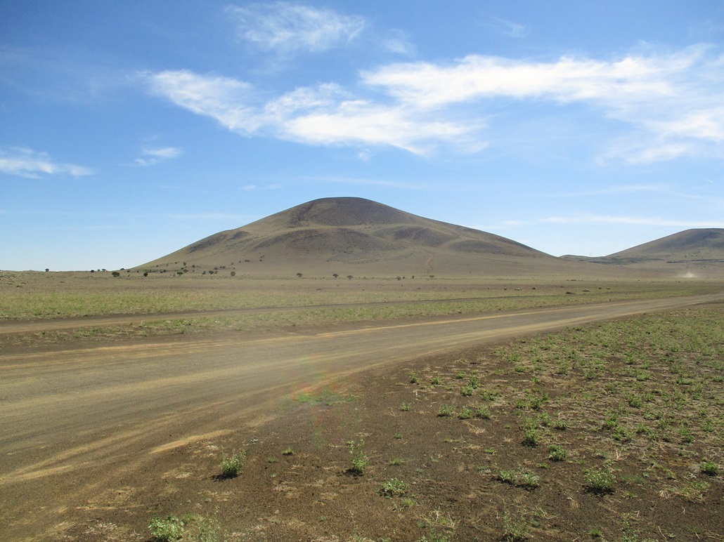
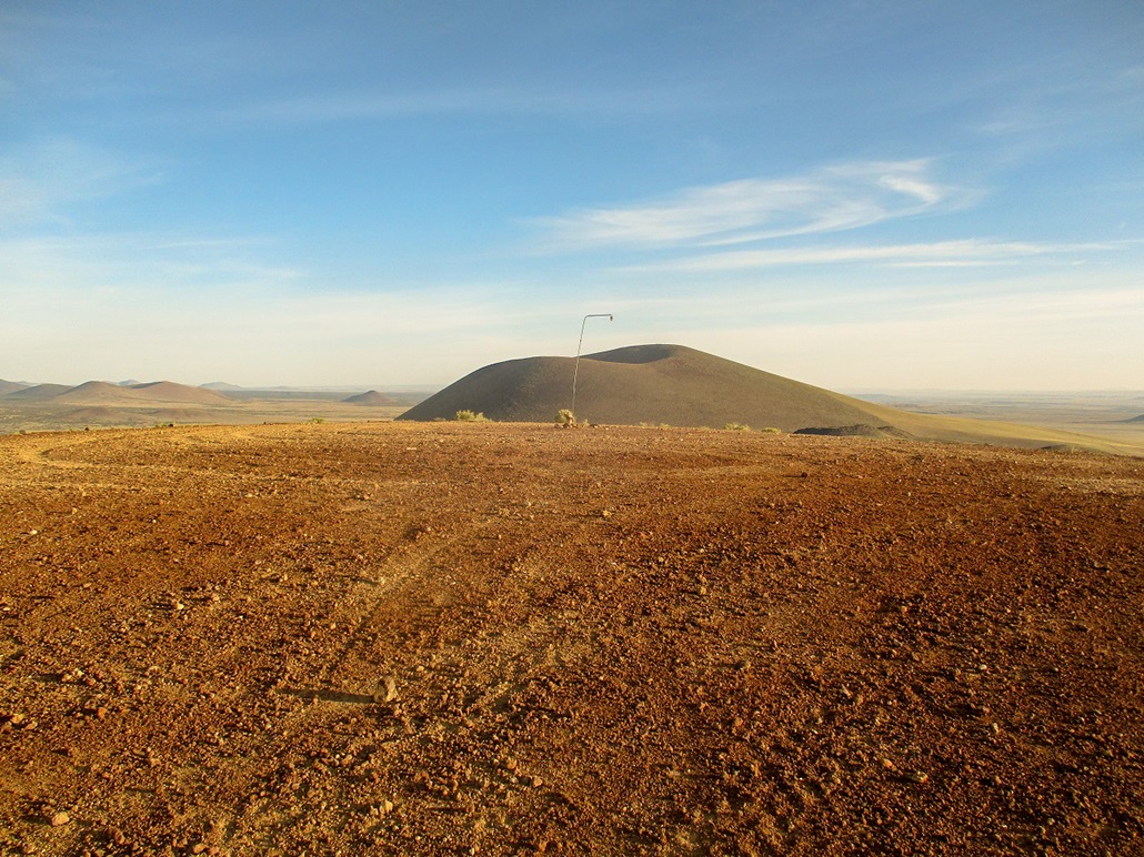
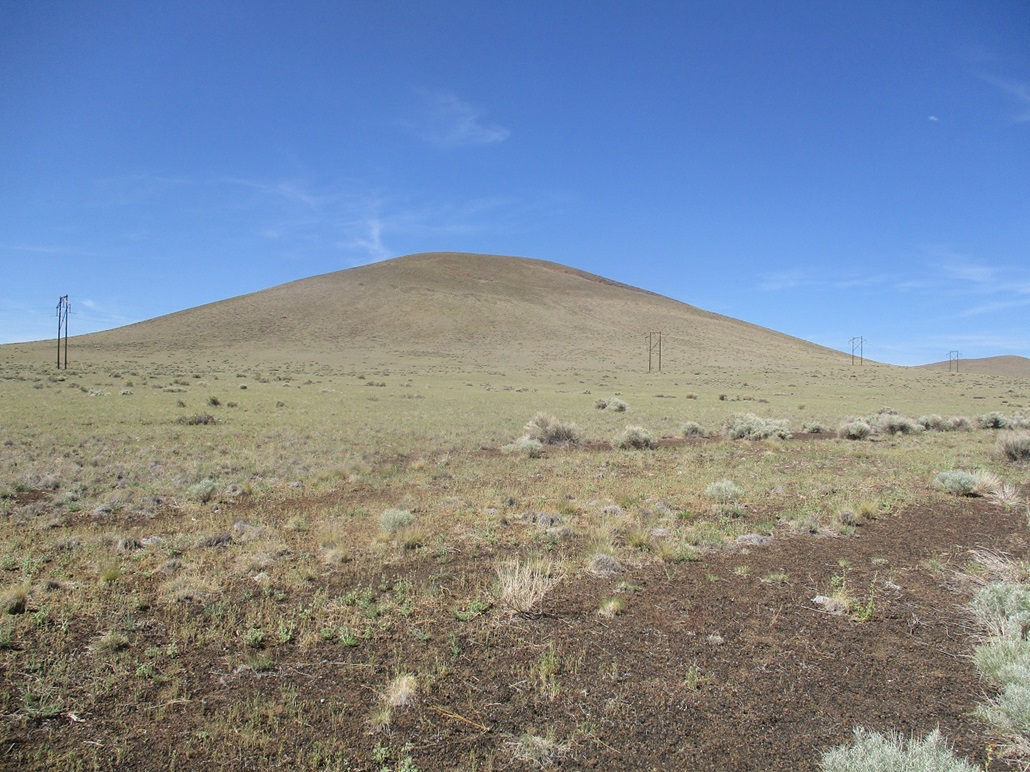
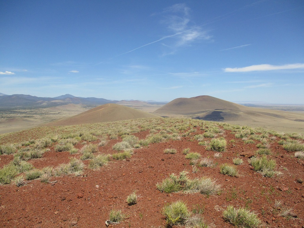
North Sheba Crater is a mound of volcanic cinder at the east edge of the San Francisco Volcanic Field, about twenty miles east of Flagstaff. The last time I was here was when I hiked Merriam Crater back in 2010. North and South Sheba Craters are to the south of Merriam. To the west are more craters, while to the east, that's it for the hills as the land flattens out toward the Navajo Indian Reservation, whose boundary is just a couple miles away.
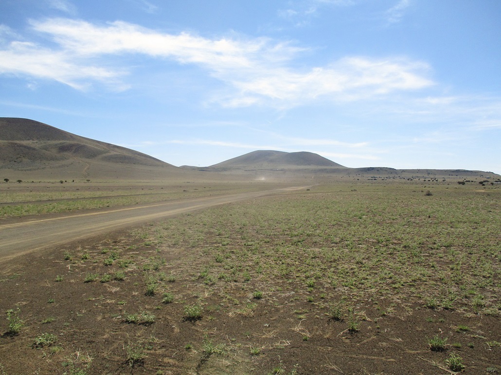
I wanted to hike a few of these cinder hills, so I collected maps and plotted out a strategy to visit three or four over half a day. Some have jeep tracks to the top (such as North Sheba), the rest do not. Some are near the main road, Leupp Road, while others are set farther back with uncertain road access. To be safe, I had maps for some hills closer in to Flagstaff in case I was shut out of some of the hills this way. My itinerary was North and South Sheba Craters, and Cochrane Hill and Junction Crater, which lie about ten miles west near one another.
I wanted to be hiking as close to dawn as possible. For one thing, it's getting warm now. None of the hills have summits higher than 7,000 feet, so it can be very warm even at these elevations. Second, the Sheba Craters lie on a mix of State Trust and private sections, which sometimes means someone's property may be in the way. I was not too concerned about North Sheba because it is close to Leupp Road and has a network of lesser tracks that approach and surround the hill. South Sheba was a different matter and would require some exploration.
I left home in Payson at 3:15 a.m., driving up AZ-87 above the Mogollon Rim, then following Lake Mary Road into Flagstaff, a 90-mile drive. There was no one out at this early hour. I would go twenty minutes between seeing a car coming the other way and no one ever came my way, nor did I come upon anyone ahead of me (except for a street sweeper, of all things). I drove carefully, usually 45-50 m.p.h., because of the curvy roads and the abundance of elk and deer. And sure enough, I saw about two dozen of the creatures at various times, some crossing ahead of me, some at the side, and in one case, one just standing in the road. That was the only time I needed to brake hard.
In Flag, I got snacks, then went north through town, catching Winona Road eastbound, then Leupp Road. Traffic was still light, it was still only 5:30 a.m.. My plan was to hike North Sheba first, then proceed west, then figure things out as I went along. Once abeam of North Sheba, I exited onto Horn Road which runs due east, passing North Sheba to its south. I then followed a gas-line track trending northeast, at the perfect angle to have the rising sun in my eyes. The track was in good shape. I parked where the "main" track heads upslope to the top. Here, the ground was a softer volcanic sand. I parked off the road and started walking at 5:55 a.m..
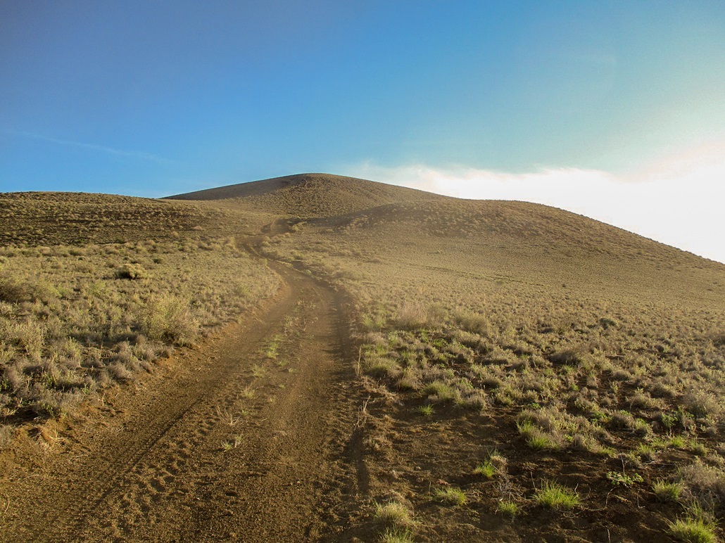
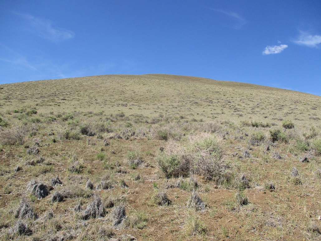
The sun was momentarily behind a small sub-hill and it was cool but not cold, in the 50s. I hiked up the track which steepened and became more loose. Each step up came with a little backslide down hill. However, this steep portion ended and I had a gentler slope as the road bent right. This segment led up to a ridge south of the top. As I neared it, the slope steepened and the tread became rubblier, so that back-sliding was unavoidable. Once on this ridge, I had the full sun and it was warming quickly.
The track bends north again and runs straight uphill to the top. This went fast but was tiring. Some parts were solid but mostly, I had to battle the back-slide effect. The grade lessened and levelled as I neared the top. The summit is bare, a big open area with concrete parking curbs and a metal pole of some sort propped up in the middle. It was not a pretty summit, but the views were good. There were high clouds creating a hazy effect, muting the colors. I did not stay long, never really taking a rest. I walked around the top a couple times, then started down.
Going down was fairly easy, as I could now take advantage of the rubble. Each step down included an extra foot due to the rubble sliding along with me. But I had to be careful not to slip. The hiking poles were vital. I was down to my car at 6:50 a.m.. I did not linger. I piled in and drove out.
North Sheba Crater is used by hang gliders and radio-control airplane hobbyists, so I wanted be here before any of them showed up. The roads in did not pass by any residences and it appears access is not restricted. I had my State Lands permit with me, just to be safe. I was not expecting any issues on this hill, and I encountered none. I even saw a car and a tent on another nearby road.
The next logical peak to hike would have been South Sheba, just a couple miles away. But it appeared the roads I was on were not the best ones to get close to that peak. I wanted to drive over to Cochrane Hill next. That hill has a shooter's area and I wanted to be there before they started showing up. I saved South Sheba for later, as I headed out eastbound towards home.
Elevation: 6,475 feet
• Prominence: 855 feet
• Distance: 2 miles
• Time: 1 hour
• Gain: 800 feet
• Conditions: Sunny and warm with a pleasant breeze
Arizona
•
Main
•
PB
•
LoJ
Earlier in the day, I hiked North Sheba Crater, but did not immediately return to hike South Sheba, even though they're next to one another. Instead, I drove a few miles west and hiked Cochrane Hill and Junction Crater. Neither hike took long and it was still in the late morning when I was done with Junction Crater.
My next ostensible objective was Maroon Crater, which lies to the north of Junction. I did not have a map for it and was going by instinct, which is a nice way to say I was winging it. I found a couple forest tracks north of Leupp Road that I followed, but none got me closer than a mile of the peak. The terrain between me and the peak looked like a scape of lava ridges, volcanic rubble and sand, and brush. I chose to pass for now and do some better homework and return at a later date.
I did not want to return to Flagstaff, so I got back onto Leupp Road and went east, back to the Sheba Craters. I stopped again at Horn Road and took some images now that the sun was higher in the sky. South Sheba was close but there were homesteads scattered on its slopes and I was not sure what roads to follow and how friendly the locals would be, or not.
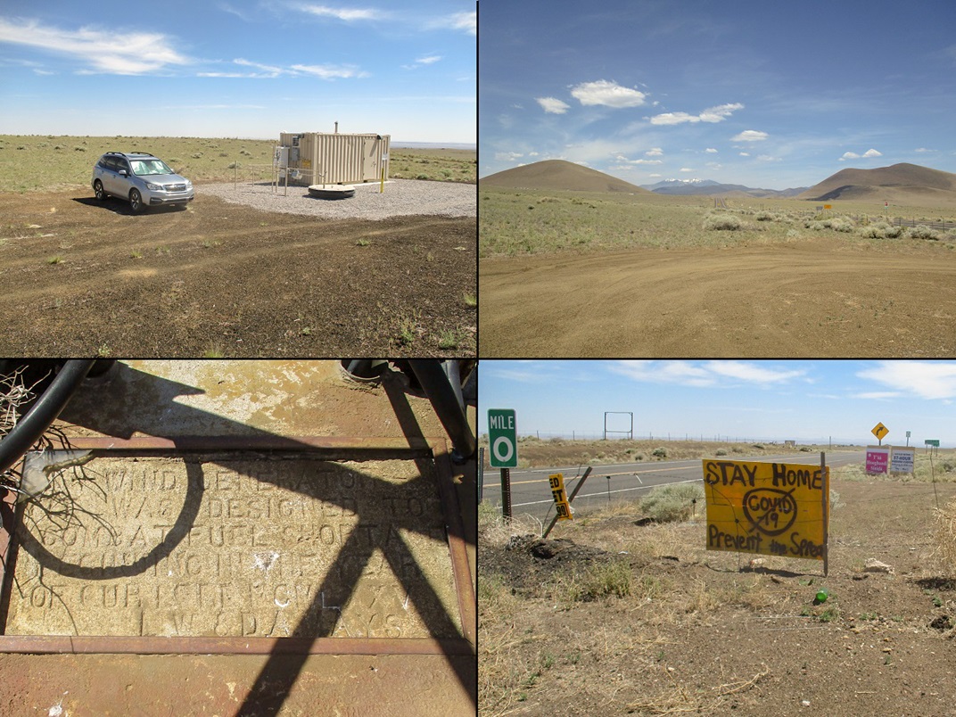
Instead, I drove on Leupp Road until I was at the Navajo Nation boundary. Here, a dirt road heads south, on the non-reservation side of the fence. I drove a little under a mile to the gas line road, the same one I'd been dealing with all day. Here, there was a small steel shed with some pipes and a whirring fan. Whatever it is, it does something important for the gas line. The good news was that surrounding the shed was absolutely nothing: no homes, ratty cars, fences, nothing. It was just open slope up to South Sheba, staring me in the face. This was a perfect setting, so I parked behind the shed and started walking. It was about 10:15 a.m. and warm, but with a steady cooling breeze.
I walked southwest, aiming for the northeast slope of South Sheba. I had to cover about a half mile of flat ground, then the slope started to increase, ever so incrementally. The brush was ankle high and open and I could always find a lane through the patchy grass and woody scrub. There were no trees or anything even waist high.
I just kept hiking uphill. Periodically I would turn around and look around. When I was about half way up, some work truck drove slowly by where I was parked, then he drove along a set of power lines then into the open field below where I was. I have no idea if he was checking me out or what. In any case, I wasn't about to go running down to find out. He stayed parked in the field for about ten minutes, then got moving.
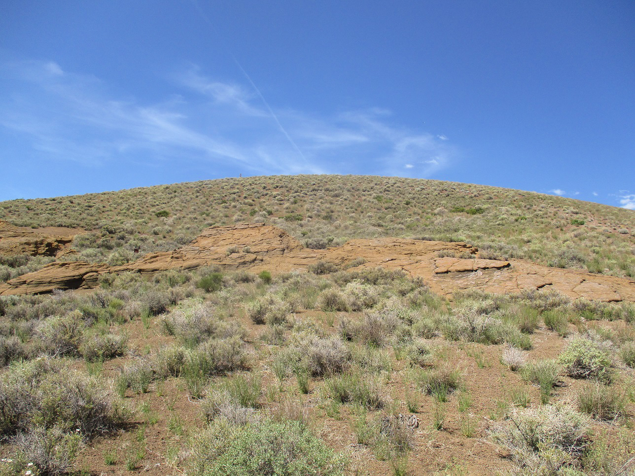
About 200 feet below the top, I came upon some exposed rock, leaning too far back to be cliffs. This rock had rough texture and looked like welded ash and tuff. It was easy to walk on and offered me solid footing for the brief time I was on it. Up ahead was the rounded top and some tower apparatus sticking up. I huffed and puffed up the remaining slope and was soon on top the hill.
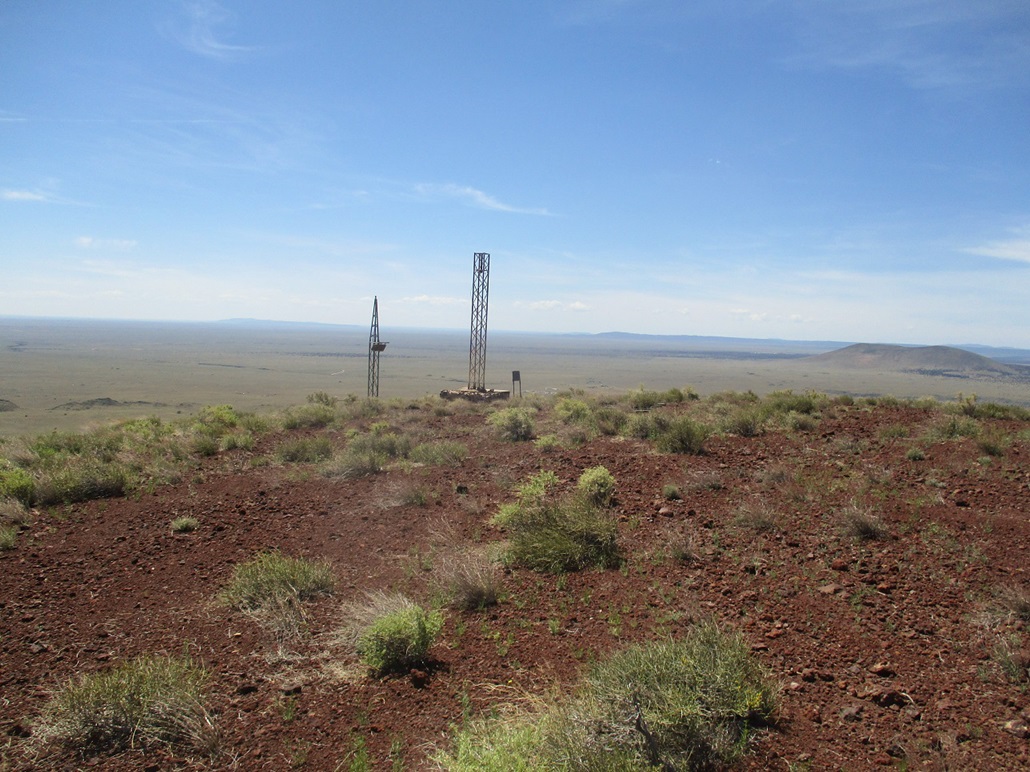
I was pleased that I was at the top, that it wasn't around the other side of a caldera rim. The top is marked by a huge cairn and a wind-break. A register was tucked into a well-hidden crevice near the top of the cairn. I was the first to sign in since 2014, but I know people have been up here since then. The register may have been too well hidden.
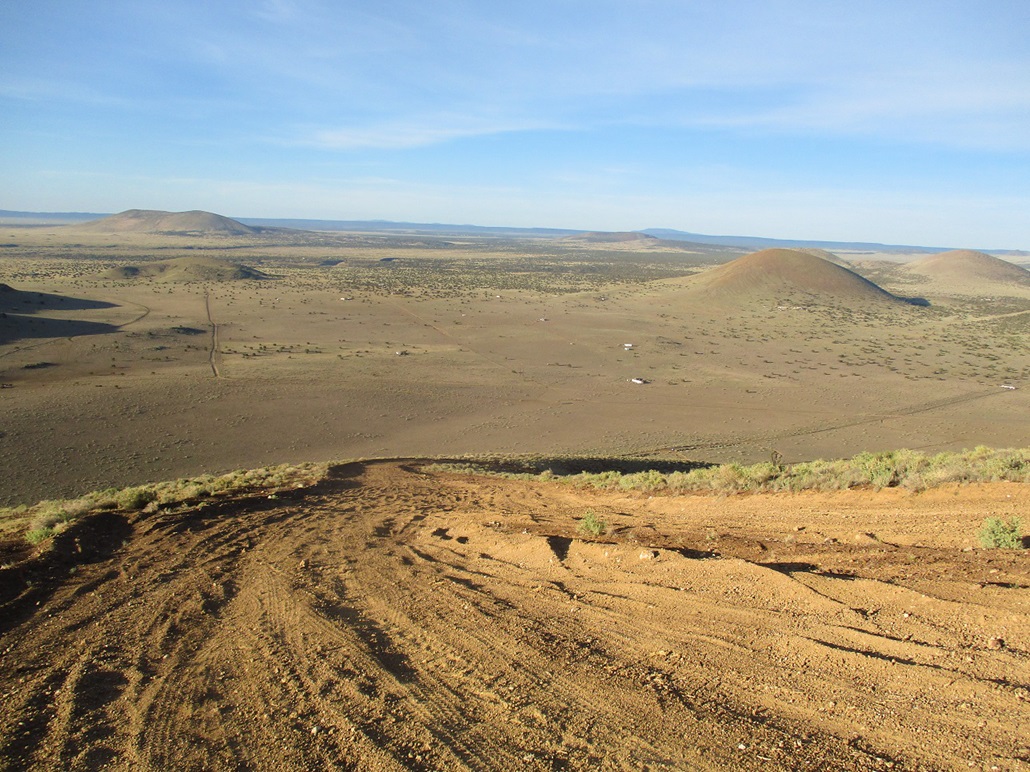
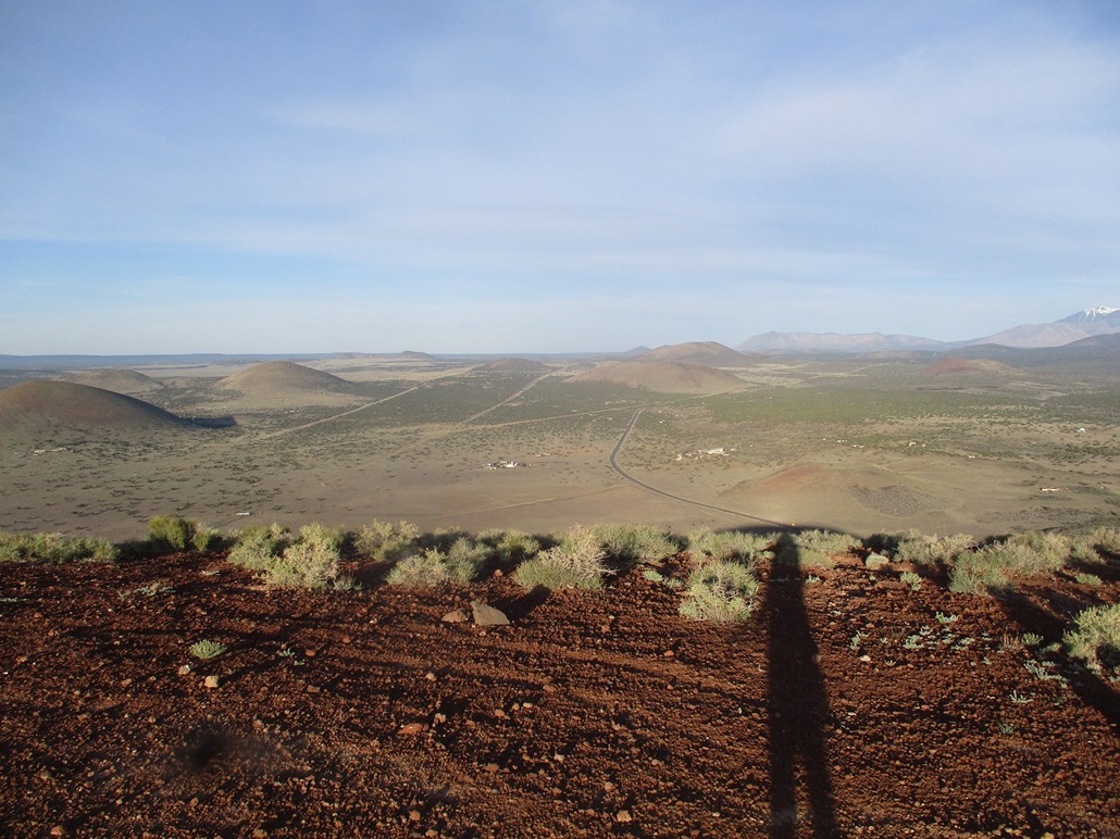
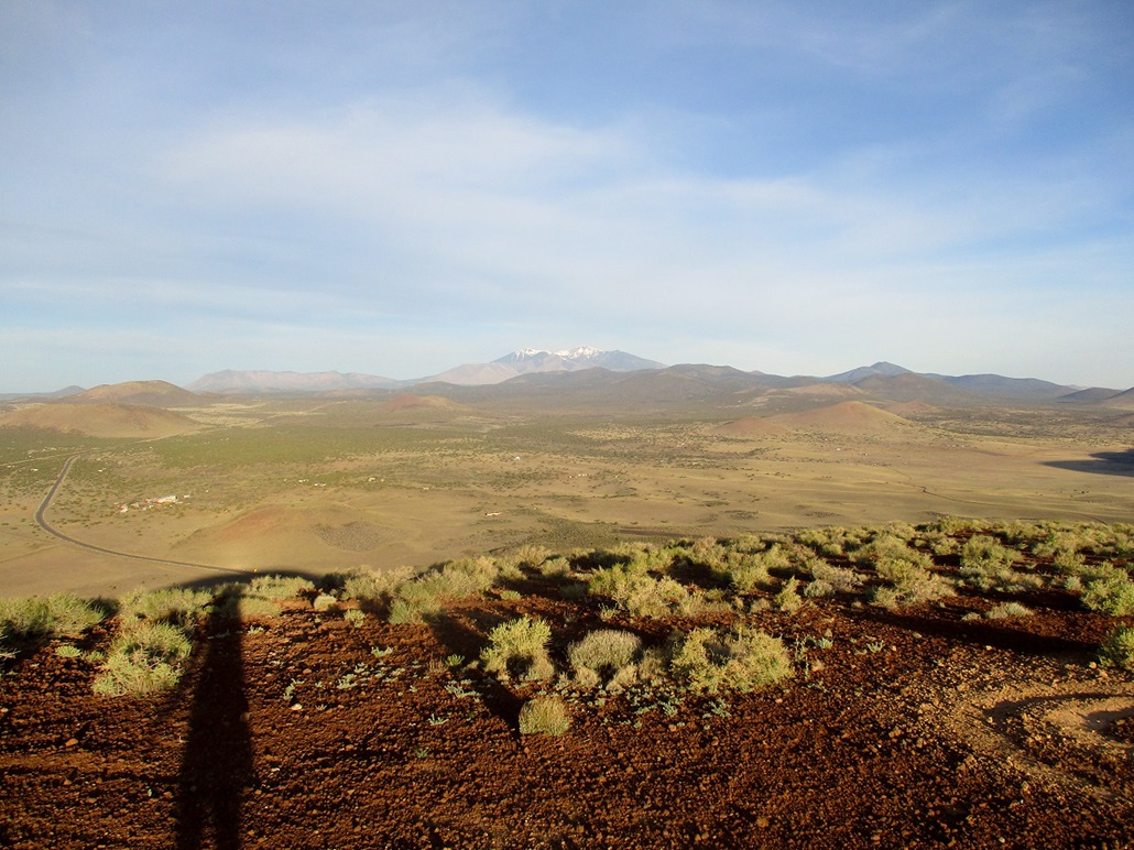
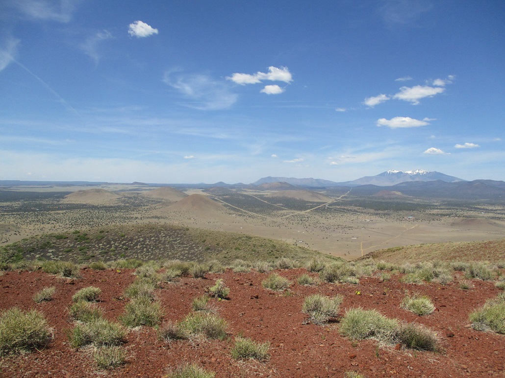
The views were excellent, and I snapped more photos of the surrounding cinder hills and open plateau. I also walked over to the towers ... there were two, one about 20 feet tall, the other about ten feet tall, both offset from the summit by about 30 feet. They were in disrepair and one creaked in the wind. In fact, it seemed to share a resonation with the wind and made a deep moaning, buzzing sound ... a very interesting effect.
The tall tower was apparently a wind-turbine to generate electricity. The base is a large stone and concrete block in which is embedded a concrete plaque reading "Wind Generator Was Designed to Combat Fuel Shortage Beginning in the Year of Our Lord MCMLXXV, L.V. and D.A. Mays". The year would be 1975, and I assume the Mays are the locals who installed it and/or owned the land. The plaque was encased in this glass, too, although just a tiny bit at the corner remained. This begs a couple questions: one, how long did this generator last and did it actually help?, and two, were they expecting people to hike up to the top to read the plaque?
For the downhill hike, I followed a direct line back to my car. The grade was almost perfect: not too steep, not too shallow, and with decent footing. I was able to jog-walk the whole way down, covering the downhill in less than ten minutes, plus another ten walking across the flats to my car. The round trip had taken an hour and it was still early, about 11:15 a.m.. I had picked up about a pound of gravel in my shoes by the time I was finished, but that was some of the best fun I've ever had on a descent. I had climbed four cinder peaks today and was especially pleased to get South Sheba, since I was unsure of its access until I drove in to see for myself.
It was warm by now and although I had hiked a cumulative 8 miles, I had put in over 2,500 feet of elevation gain and I could feel it. I was done hiking for the day. I was looking forward to a scenic drive home via Leupp and Winslow.
There were hand-made signs at the border about Covid-19 and "Turn back" and "Stay Home". I completely respect that desire but knew I would be holed up in my car, just passing through, so I posed no threat. There was a light stream of traffic on Leupp Road, being one way to get between Flagstaff and Winslow.
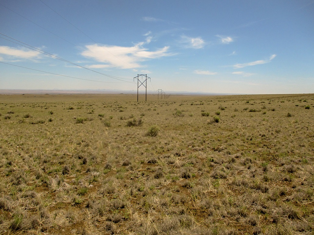
The land here is very pretty. It is flat, in that there are no hills to speak of. But the land is cut by innumerable small canyons and bluffs that may rise just twenty feet at most, but with broken rock all around its base and slopes. It is a rugged land. I got to thinking that to walk in a straight line here would be difficult. Even though it is flat, those bluffs would pose a challenge as they are everywhere. I saw a Navajo cowboy on his horse tending his herd.
I entered Leupp, the town, which is 15 miles from the border. Leupp is not exciting, just about as I remembered it from 2010, which is barely. It is home to a boarding school and is a regional administrative center for the Navajo government. Just east of Leupp, highway AZ-99 hangs a right and runs another 20 miles southeast through more land of a similar theme. There was no one on this road and I drove slowly, about 50 m.p.h.. The road meets with Interstate-40. I got on, then of a few miles later in Winslow where I got some cold drinks and snacks. I also drove past that "cona" mentioned in the Take it Easy song that rhymes with Arizona.
I got on to AZ-87, which leads to Payson. The sign said it was 88 miles away. Again, no one drives these roads. I saw perhaps ten vehicles for 40 miles until I was high up in the tall trees. This is another drive I have done but not in many years. I inspected the Sunset Mountains and need to do a lot of homework on how to access those.
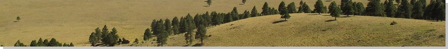
Once in the trees, I had more traffic but not much. This is about as far north as people go to camp if coming up from Phoenix. I was home a little before 2 p.m., a productive and enjoyable afternoon. I will return to those hills off of Leupp Road, and should mention that Leupp Road between Flagstaff and Winslow is one of Arizona's best unknown scenic drives.
|


|