
The Mountains of Arizona
• www.surgent.net
|
|
Ma Ha Tauk Ridge Highpoint a.k.a. Maricopa Peak or Salt Benchmark |
• South Mountains • City of Phoenix • Maricopa County |
|
Date: November 27, 2015
• Elevation: 2,557 feet
• Prominence: 932 feet
• Distance: 5.5 miles
• Time: 3 hours
• Gain: 1,100 feet
• Conditions: Sunny and cool
Arizona
•
Main
•
PB
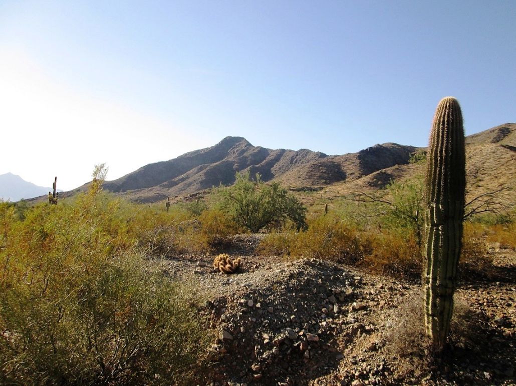
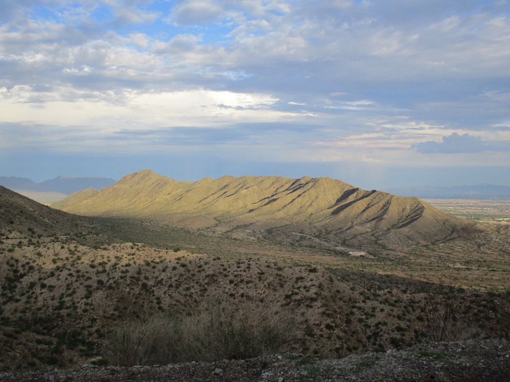
I was back to the South Mountains in Phoenix for the second time in two weeks, after having hiked Goat Hill earlier in the month. My goal this time was Maricopa Peak (or Salt Benchmark, see below), the highest point of the Ma Ha Tauk Ridge, which is the secondary ridge that parallels the range's main ridge. From most viewpoints in Phoenix, you can easily see this ridge, but it's hard to differentiate it from the higher ridgeline behind it.
I've been interested in this particular peak for awhile. The Alta Trail runs along most of the Ma Ha Tauk Ridge, connecting to San Juan Road at two points. Way back in 1995 or so, I drove all the way to the end of San Juan Road and hiked the Alta Trail. I hiked about a mile, but to no summit, then turned back. I came back a few times during that time period, but not since then.
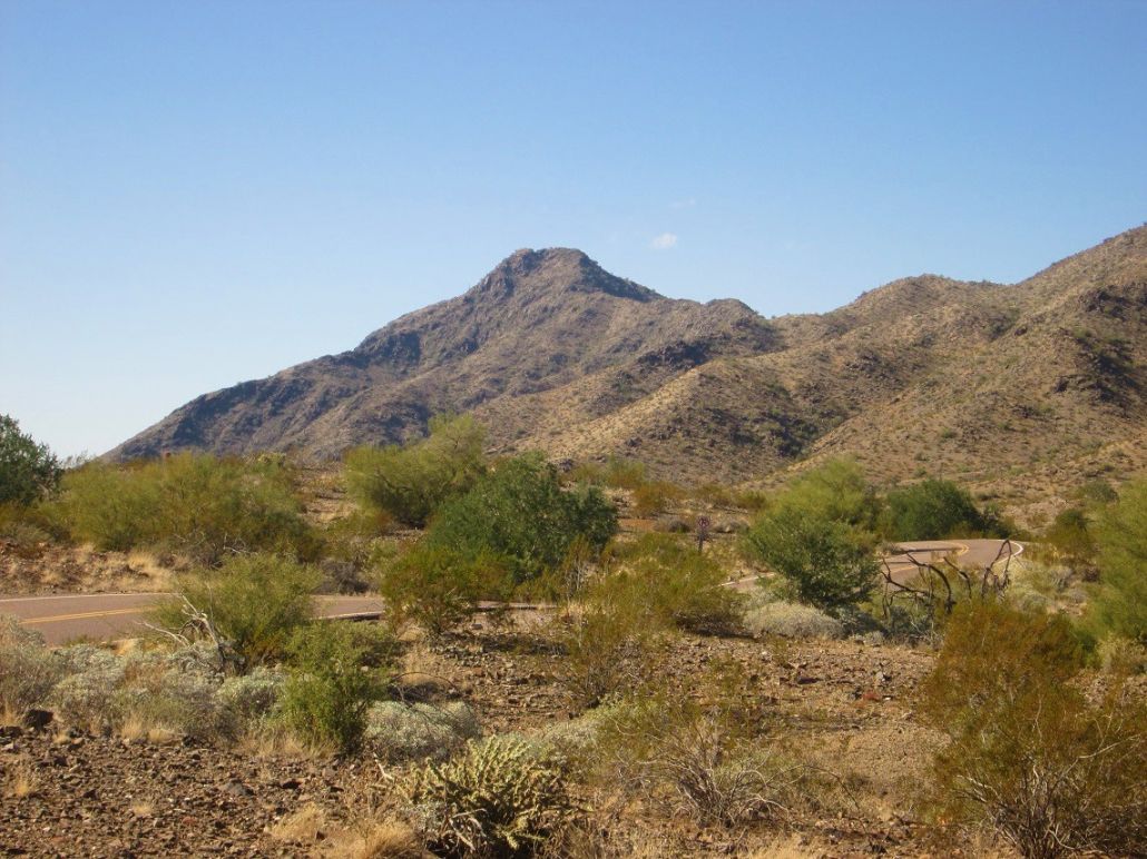
In recent years, the road to the end of San Juan Road has been shut, supposedly for flood damage or to allow plants to grow, or whatever reason seems convenient. I suspect it stays closed as a way to keep patrol costs down. The road is gated at the main junction within the park, where Summit Road veers left to the towers, about two miles past the entrance. Here, an ad-hoc parking area is formed by a painted triangle in the asphalt. I arrived here about noon, and squeezed my truck in among the other vehicles. There are no lines, so you park where you can.
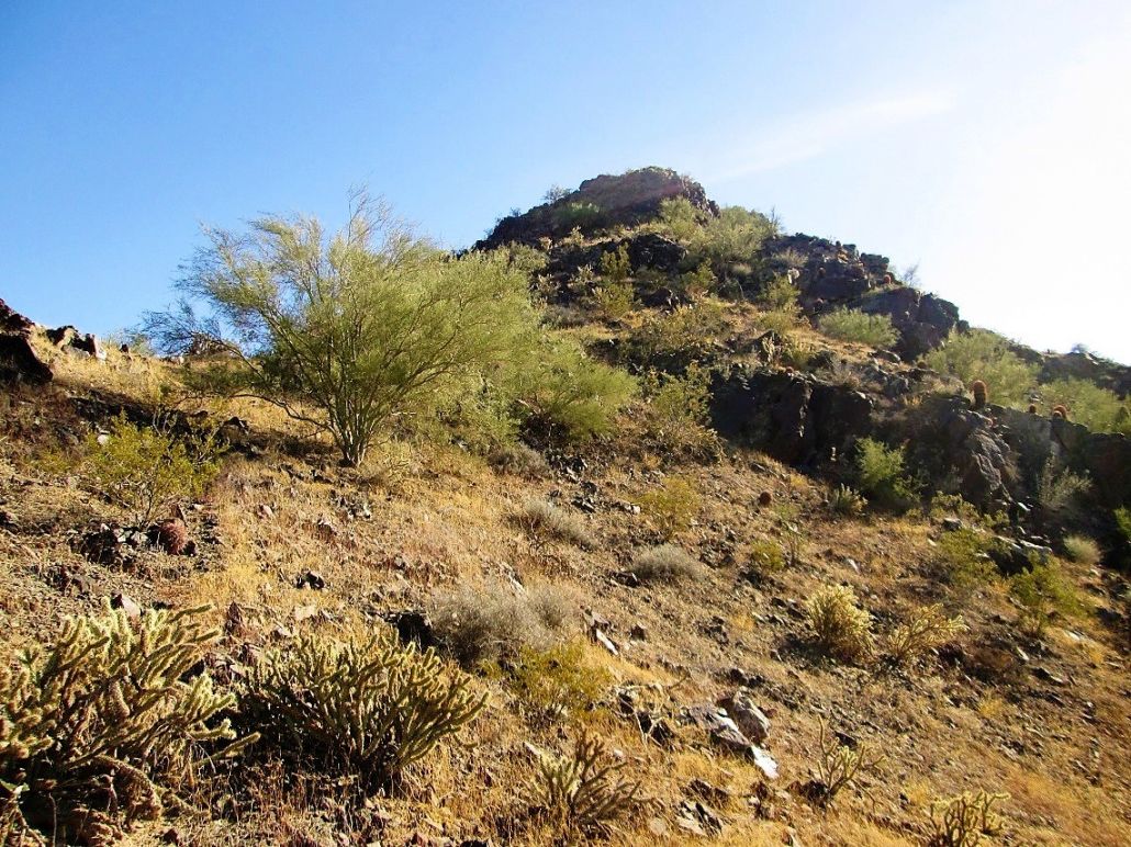
I went light, carrying my stick, a couple drinks in my new fleece vest, and my camera. The day was sunny but cool, highs in the low 60s. Maricopa Peak's summit was visible in the distance. I followed San Juan Road for a half-mile, dropping about 50 feet in elevation, to where the Alta Trail meets it. Then on the Alta Trail, I walked across a short stretch of desert flats before meeting the base of the slopes.
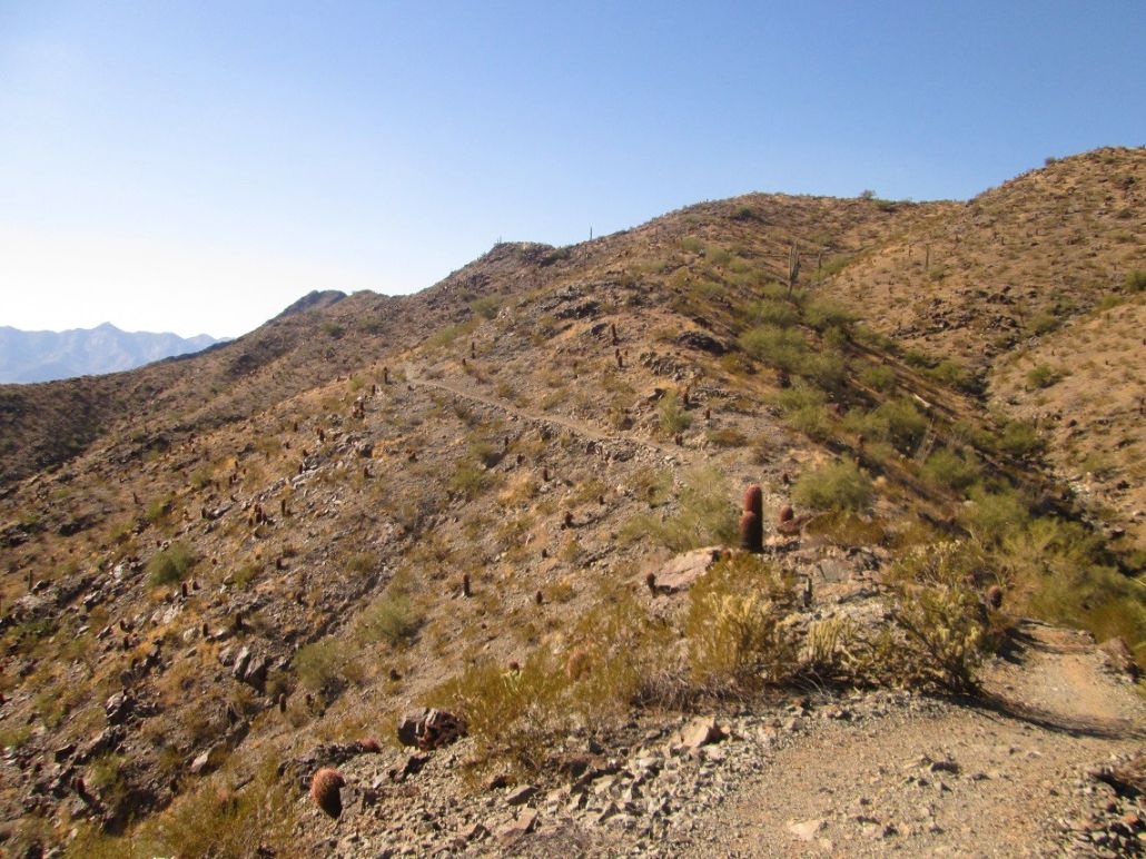
The trail then works up these slopes, often making long sweeps across the slopes with many switchbacks to lessen the gradient. The trail is wide and well maintained. A few people were coming down, and up ahead were a couple large groups. I made good time, gaining about 900 vertical feet to place me on the main ridge. The groups ahead of me stopped here. My job was only half done, however.
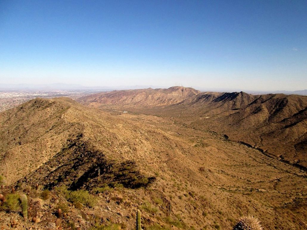
I followed the trail westward, gaining and dropping elevation along with the contours of the ridge. The trail wiggles past a couple smaller bumps, then the views open wide, where all of Maricopa Peak was visible. The trail drops a fair amount of elevation, about a hundred feet. I could make out the trail as it dropped, then gained up the north-facing slopes of Maricopa Peak.
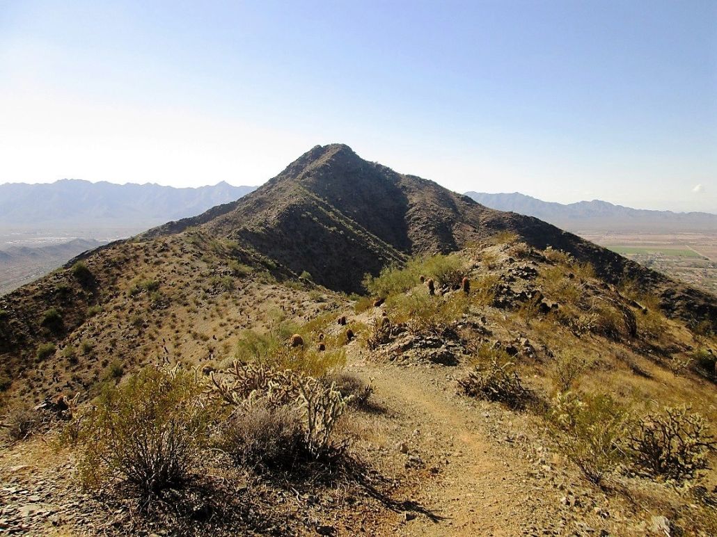
I was moving quickly, and was soon on these slopes below the peak. Here, the trail gets narrow in spots and is noticeably rockier. I met a few more people here, as well as a dog. I kept on the trail as it gained elevation, going wherever it took me. I knew I would have to leave it at some point, but was not sure if there was a side-path to the top I could follow, or if there was, if it would be practical for me.
I reached a highpoint on the trail, now north of the summit and a little west of one north-trending ridge. The trail then dropped steeply about 50 feet. I didn’t want to drop this elevation again, so I gambled and started up the slopes here. The first segment was steep but manageable. The brush was light and the rocks laid back, but I had to be careful as they broke apart easily. About 70 feet of gain later, the slopes became much friendlier. I angled right and achieved a small saddle, now directly north and below the peak’s north-facing cliffs. I found very scant paths here, possibly dating back many decades before the main Alta Trail was put in.
I still have about 60 vertical feet to gain, and it looked like a bunch of cliffs. I was able to thread the needle, so to speak, by following ledges that angled up in some spots, and minor scrambling in other spots. In this manner, I was able to gain the summit without having anything worse than scrambly Class-2. I was relieved to see that I was on the top, and that it wasn’t four bumps over.
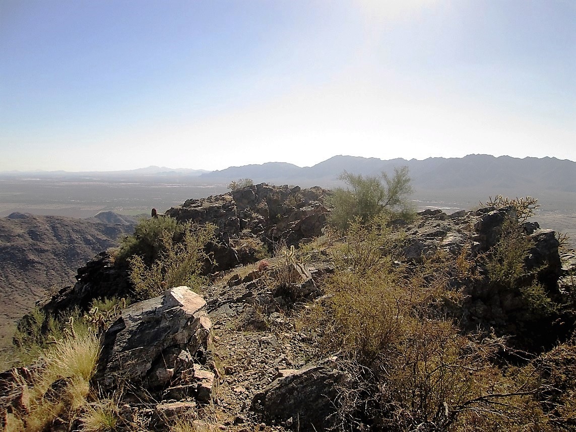
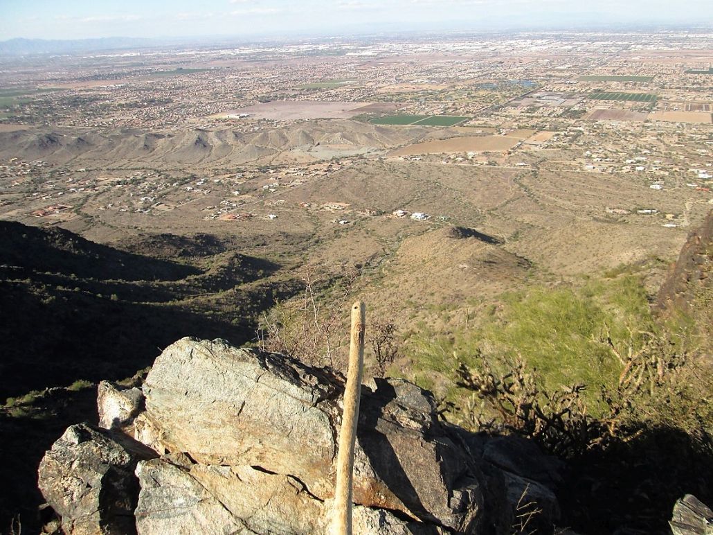
The summit contains two parts, separated by a ten or fifteen-foot cleft which is visible as one approaches the peak from the East, as I did (this cleft is visible in my photos). The north part, where I was on now, is higher by a foot or two. I found what I felt was the top-most rock and sighted to the south part, and it was fairly definitive to me. I leaned Stick Scott against this rock and snapped his image, plus that of other views from atop the peak. There is a use-path, but it starts farther west and comes up through that cleft.
The hike down went well. It took me ten minutes to carefully scoot down the rocks back to the trail. Once on the trail, I walked quickly back to my truck. The hike up had taken me 90 minutes, with a ten minute break on top. The hike down took me 80 minutes. There were still a few groups of people heading up, but most seemed to be stopping at the ridge, which is a shame. When will people ever learn that the whole point of hiking is to tag a summit?
The round-trip mileage is an educated guess on my part. Going by my usual rates and studying the map, I surmise the one-way distance to be about 2.75 miles, and a gross elevation gain to be about 1,100 feet when drops and regains are taken into account.
The drive out was slow. South Mountain is a very popular gathering place. There were hikers, bicyclists, picnickers, people on horseback, runners, photographers, sight-seers, and even a whole bunch of kids on go-karts at a small oval put in for such things. I still have a couple more peaks in the range I’d like to tag, so I’ll be back.
Re: the name. There is apparently a benchmark atop this summit. The map shows the benchmark icon, but no name, and I never saw one. According to the link, it's called Salt, and is buried about 6 inches deep. I would not have known to dig down six inches to find the benchmark, nor where to actually dig.
The Tohono O'odham name for the mountain is Muhadagi Do'ag. It is reasonable to infer that "Ma Ha Tauk" is a phonetic simplification of this name. Of the various names for this peak, I like Ma Ha Tauk the best just because it sounds cool, not something boring and generic like Maricopa or Salt. So I'm using that name for this peak and hope it catches on.
|


|