The Mountains of Arizona
• www.surgent.net
|
| Little Buckskin Mountain |
• Highpoint: Little Buckskin Mountains • Butler Valley • La Paz County |
|
Date: February 18, 2023
• Elevation: 2,820 +/- feet
• Prominence: 610 feet
• Distance: 4.8 miles
• Time: 2 hours, 45 minutes
• Gain: 870 feet
• Conditions: High clouds then clearing, cool but not cold
Arizona
•
Main
•
PB
•
LoJ
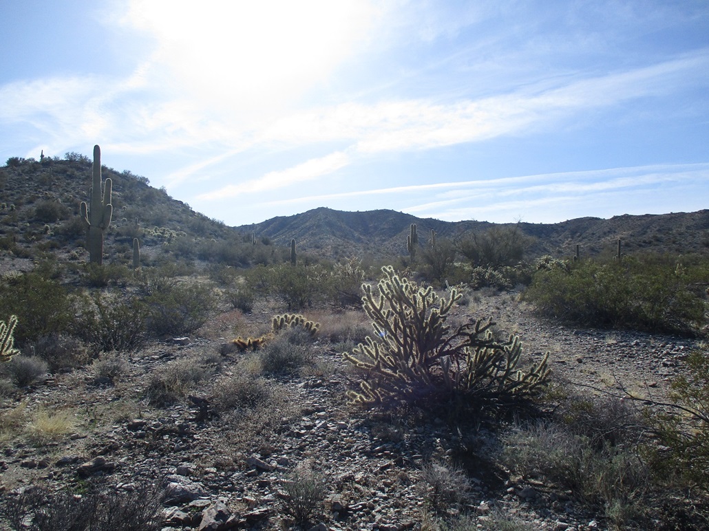
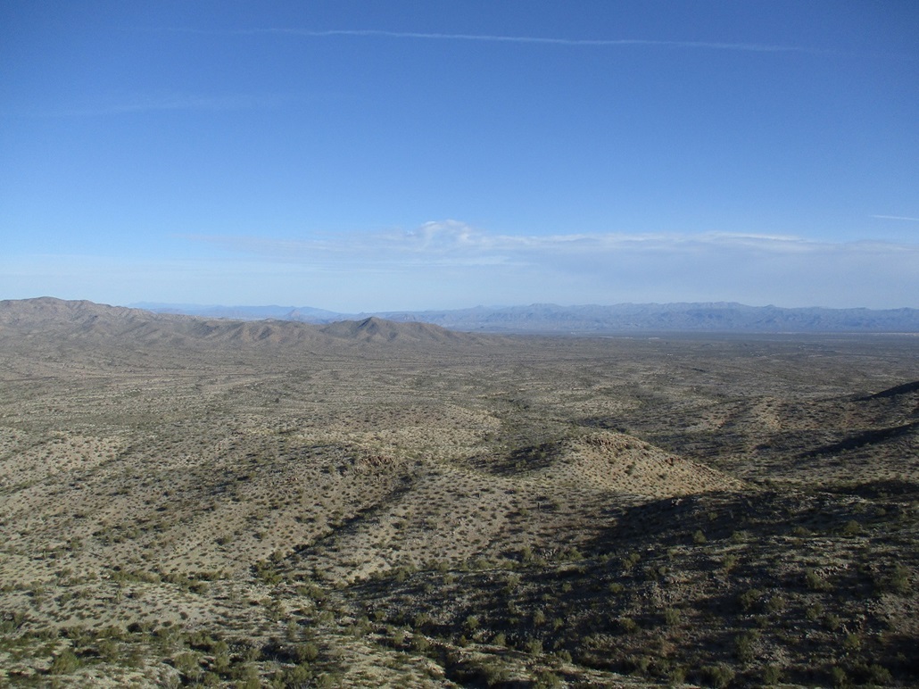
The Little Buckskin Mountains are an isolated range in the Butler Valley in La Paz County. They lie south of the Buckskin Mountains, north of the Harcuvar Mountains along Alamo Road, which connects Wenden to Alamo Lake. These mountains are just a low band of hills, its highest point having no official name, and just about 600 feet of prominence.
I wanted a no-fuss peak today, just an easy hike with no undue barriers, brush, loose rocks or annoying cliff bands. This peak has none of that. I wanted to drive on Alamo Road again. My wife and I drove this road once, about 2004 or so, to Alamo Lake, then followed the east-bound Alamo Road to where it connects with US-93 northwest of Wickenburg.
I was on the road about 5:30 a.m., into Salome as the sun was rising, then to Wenden then north on Alamo Road for 22 miles. The road bends northeast, the Little Buckskins parallel to the road here, set back about two miles to the southeast. I had no traffic and no issues. It was cool, in the 50s, but not cold. I pulled into a cleared area where Alamo Road makes a soft dogleg bend left, and where an older dirt track continues on the same bearing. It was about 7:30 a.m.
The highlight of the drive was watching some light aircraft flying low over the valley. These things looked like a notch below a Cessna, and a notch above an ultralight, the kind of airplanes that a crop-duster would use, but there aren't any crops out here. There were about four such planes, and I'm guessing this was for practice. As I drove Alamo Road, I heard a whoosh above me, and then saw one of the planes flying low over the road, about 50 feet high. Was he looking to land on the road? I thought so, but then he just stayed level then raised up again. They probably had fun buzzing that guy in the car.
I was dressed and packed and walking at 7:45 a.m., entering into the brush and soon catching a good track that leads most of the way toward the base of the hills. This track allowed me to hike quickly and was a good track. If I could have gotten my car on it, I think I could have driven most of it.
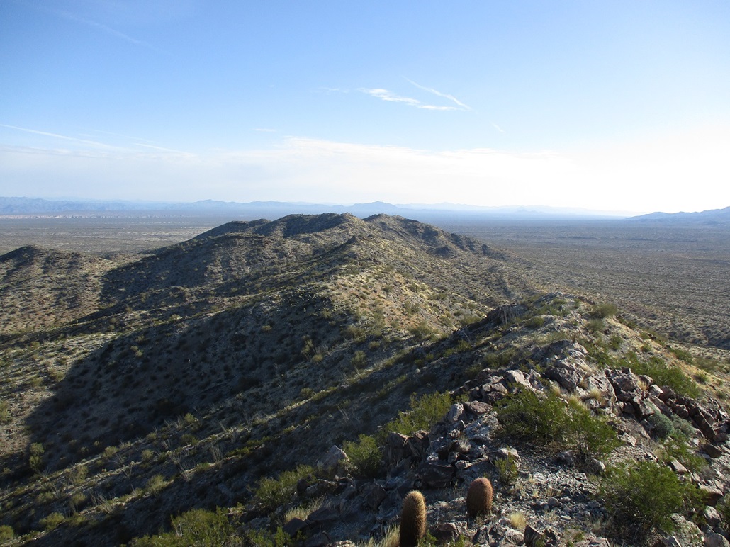
The track ends on a gentle knoll and from there, a well-defined game path continues, so I followed it. I was now in the ridge-arroyo system, and the peak was right in front of me, a half mile on a straight line. A ridge leads right up to it. I wasn't particularly compelled to be on that ridge. I figured any ridge would do; they all lead up to the crest and it all looked friendly. I'd just follow what looked good as I gained elevation.
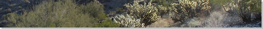
I dropped into one arroyo, then out of it, then into one more and out of it, now on some high ground with a noticeable upward slope. I hiked up to the hilltop in front of me, and one atop it, saw the remainder of this side ridge. I was pleased, as it all looked simple and a lot of fun. Footing was good everywhere, and the brush was spread out. The worst were mildly-thick patches of cholla.
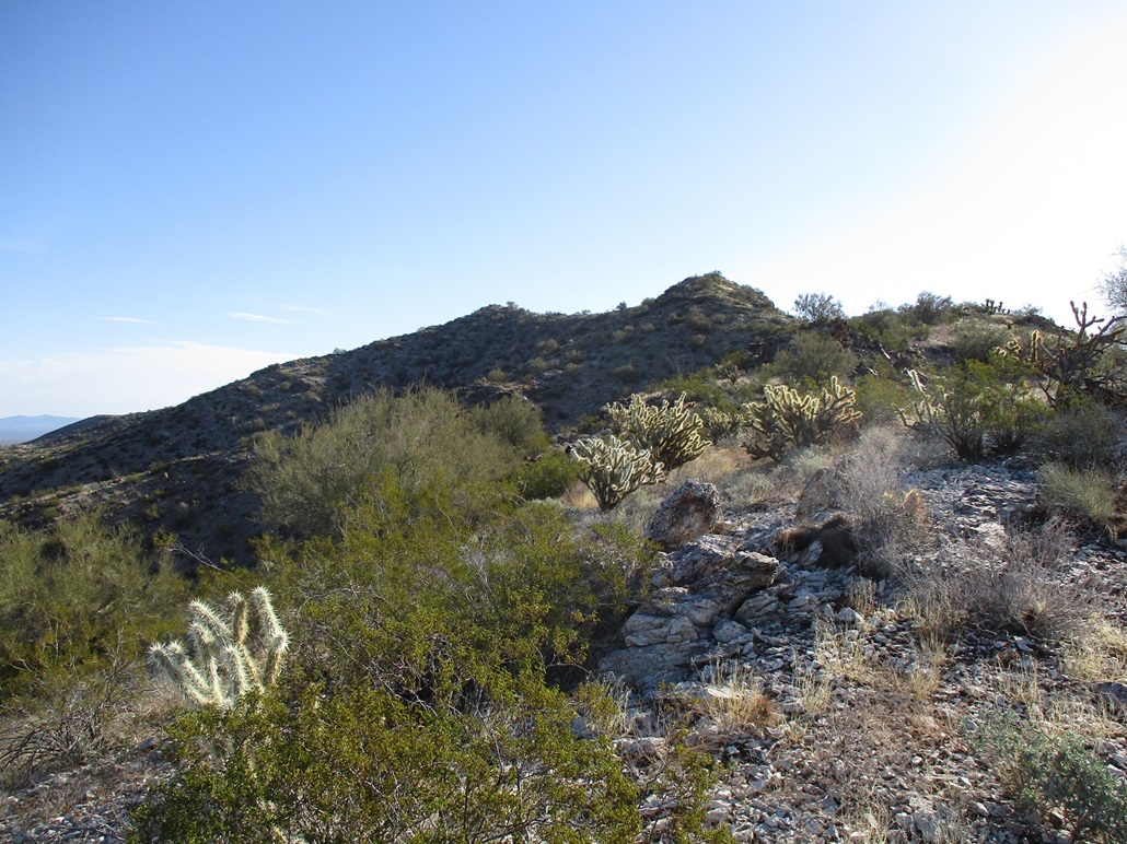
I gained one more hill, then down off it (about a 40-foot drop) then one more slope to place me on the range crest. I was about a quarter-mile southwest of the peak. The slopes on the crest were also gentle, with light brush. I just walked uphill until there weren't no more uphill to walk. The route leads to a spot elevation of 2804 feet, but the highpoint is the next knob northeast, about 15-20 feet higher. I was on top of it, about a 90 minute hike covering 2.4 miles.
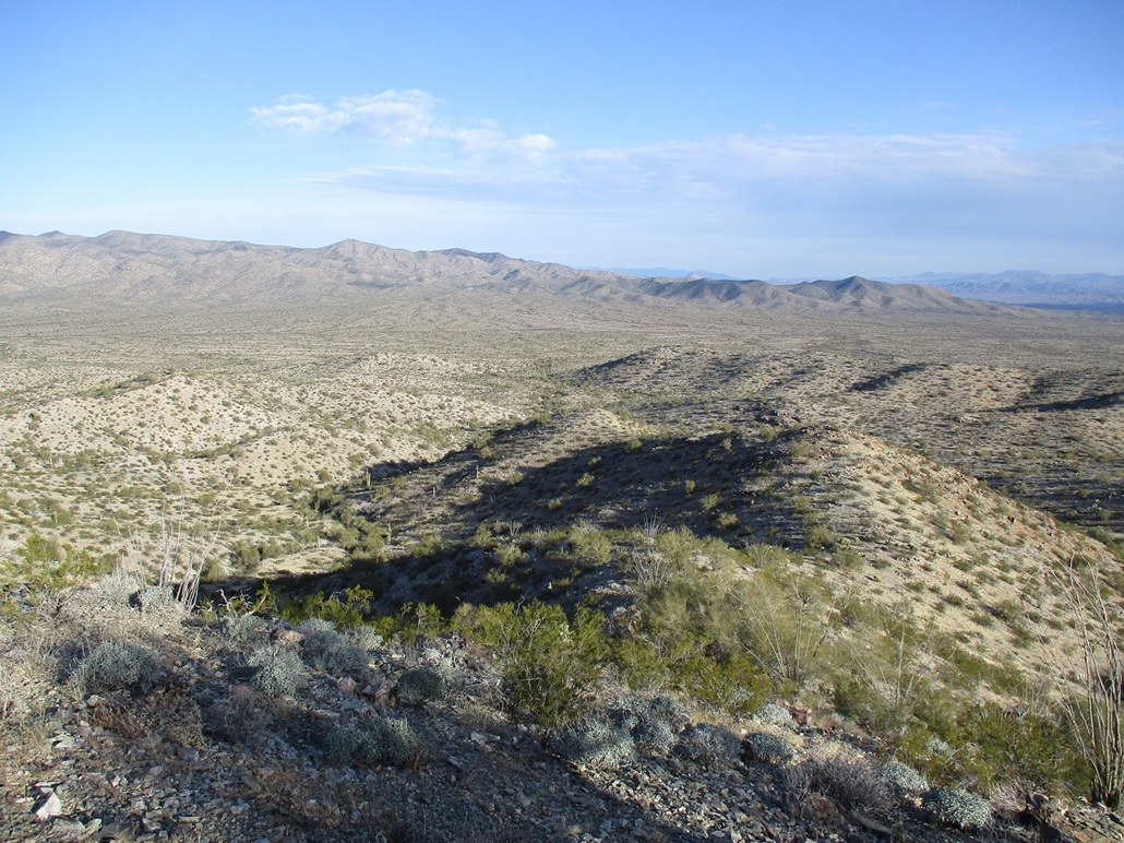
The hike had gone extremely well, absolutely no trouble at all. These kinds of hikes are welcome, a chance to turn off the brain and just enjoy the experience and not roll a rock every third step or pull out spikes from my feet and shins. The top was rocky with good seating and great views. The general cloudiness I had on the hike up had now cleared, and I had good sun for photographs.
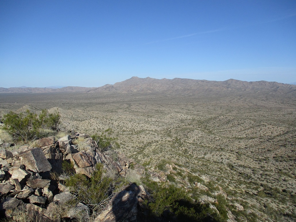
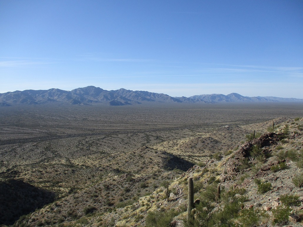
To the northwest was Buckskin Mountain. I studied its slopes, but felt I'd rather not do that one by myself. To the southwest was the anvil-shaped Harcuvar Mountain, and to the southeast, the towers atop Smith Peak. I stayed up top about 20 minutes, I was enjoying it so much. It was still early and there was no urge to run back down.
Soon, I started down, retracing my route almost exactly. I went "fast" because the terrain and gravity made it easy to do so, and the hike out took about an hour. I was back to my car at a shade about 10:30. Ah, that was fun. I sat in my car for a spell, by now a consistent (as in one every couple minutes) stream of cars pulling boats and Polari heading to Alamo Lake. Me, I had no plan now, other than return to Phoenix by nightfall. I debated a couple route options, and decided to stay on US-60 and return via Wickenburg. Along the way, I hiked Eagle Eye Mountain near Aguila, which went well too.
I was the first person in over three years to sign into the summit log on the summit, so imagine my surprise when I saw another person also signed in this very day! It was DixieFlyer from HikeArizona. I never saw anyone so clearly, he came here well after I had departed. Now that's a coincidence. It would not surprise me if the peak goes another year or two before the next visitor. This is a remote valley and not on most people's radar.
|


|