
The Mountains of Arizona
• www.surgent.net
|
| Juniper Flats Peak |
• Mule Mountains • Cochise County |
|
Date: March 24, 2012
• Elevation: 7,161 feet
• Prominence: 1,121 feet
• Distance: 2 miles
• Time: 1 hour
• Gain: 470 feet
• Conditions: Sunny but cool
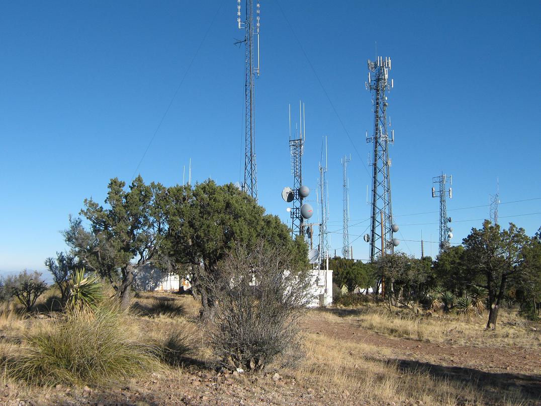
This peak has no official name, but it is sometimes called Juniper Flats Peak because of its location near the Juniper Flats, a small plateau of juniper scrub in the Mule Mountains, north from the range highpoints at Fissure and Ballard Peaks. Really, the only thing going for this peak is an easy road access and its status as the range's second-most prominent mountain, with just over 1,100 feet of prominence. The top is covered in towers. Need I say more?
We were spending three days in Bisbee, and yesterday I had hiked to both Ballard and Fissure Peaks, which didn't take long. After that hike, I went back into Bisbee and walked around the place plus relax back at the hotel. My plan was to hike Juniper Flats Peak the next day, being today.
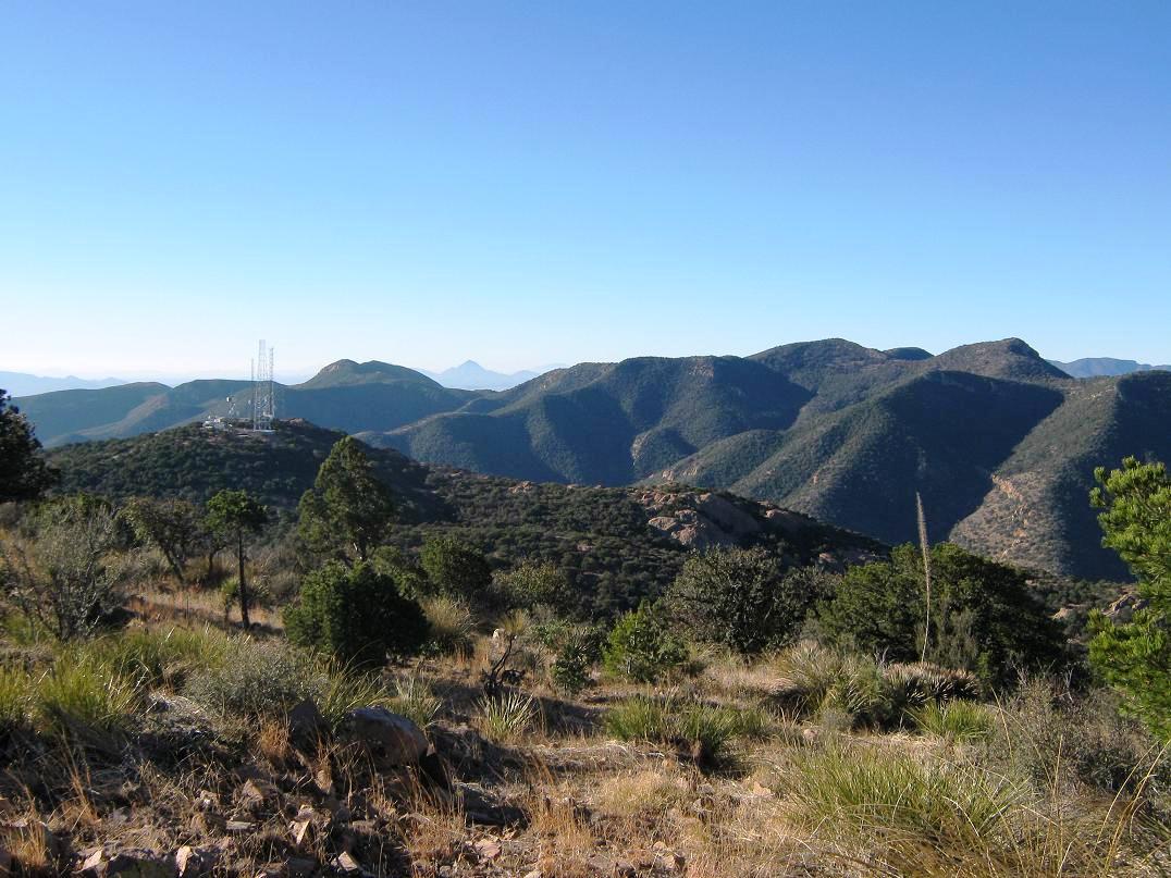
While atop the ridges near Ballard and Fissure Peaks, I was able to eyeball the road and the general lay of the land around Juniper Flats. The road actually looked pretty good, although steep. I wasn't really interested in a long road hike and hoped to be able to drive as much of it as I could. So I felt pretty good that the road was not a chunk-fest as these roads usually are. It gets graded and maintained due to the multitude of towers and the need for workers to go there.
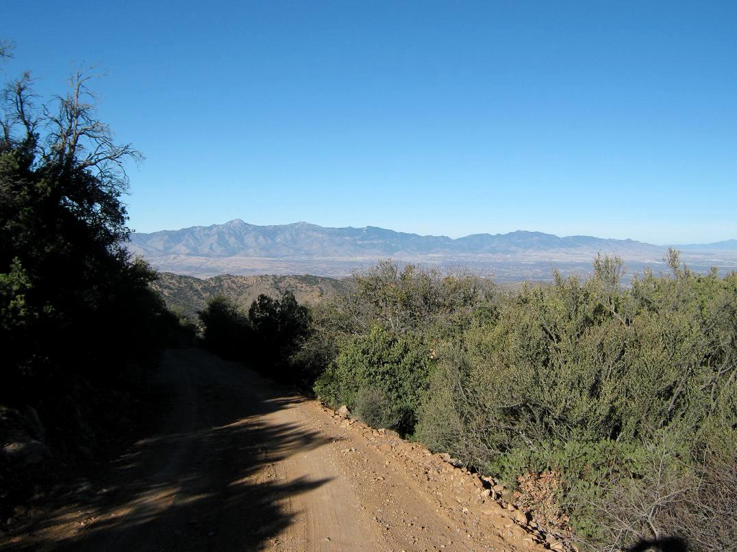
I started in Bisbee, leaving the hotel around 7:15 in the morning for the few miles west through the tunnel, then catching Old Divide Road just west of the tunnel. I drove this to Mule Pass and to Juniper Flats Road (its actual name). Due to the steepness, I chose to use 4-wheel drive, although it probably is not a requirement. But I hate any sort of wheel-spinning and yawing on steep roads, and having positive traction on all fours is always preferable. So in I went.
The drive up is rather nice, and steep, as expected. The road winds steadily upward and after about a mile, surprise, comes to a somewhat substantial home perched at the edge of the upper plateau. The home looked pretty big but also kind of rough around the edges. Numerous vehicles were parked everywhere, and a little farther ahead, more vehicles and an assortment of hovels, lean-tos, tents and general junk. The vehicles looked good, not abandoned. What's the deal, I wondered.
Anyway, I drove another mile (two miles total) and parked where the main road bends left to the first set of towers, while another road goes straight and slightly downhill to a saddle below the summit. Although the road looked good, I chose to park and make a sporting hike of a mile each way. The weather was very calm, bright blue and dry. But it wasn't quiet, as all sorts of generators were buzzing atop this first hill, and what sounded like power saws or other heavy equipment.
My walk went well. The road goes west, then at a three-way split, I went up and right, as the road curls around to gain the top from the north. A small chain-link gate bars vehicles, but I walked on past and inspected the towers. The highest point was at the far end, beyond the towers, the top any one of a small pile of rocks. So I tagged any contenders and got some nice photos of the range. The one-way hike had taken me about 20 minutes.
Coming down, I had great views of the Dragoons to the north and the Huachucas to the west, and of course, the main spine of peaks here in the Mules. Despite the towers and roads, the whole area is pretty and worthy of a short day-hike. I was back to my truck and had been gone from it for about 45 minutes. The drive down went well, but I had to take it very slow in a couple spots where the grade was above 20%. I was back to the hotel momentarily and had been gone less than two hours total. Hey, not a bad second peak for the weekend, one to pad my totals.
Later, the proprietors at the Bisbee Inn filled me in on some of the details about the house. It’s owned by a local "famous" architect who specializes in reusing materials, which explains the rough look to some of the structures. He is also known for allowing squatters to encamp on his land as long as they wish. This explains the many vehicles and structures. It's a veritable hobo camp. It was very interesting, and explains much of what I saw.
|


|