
The Mountains of Arizona
• www.surgent.net
|
| Guadu Benchmark |
• Highpoint: Cipriano Hills • Organ Pipe Cactus National Monument • Pima County |
|
Date: January 17, 2016
• Elevation: 2,604 feet
• Prominence: 1,104 feet
• Distance: 4 miles
• Time: 3 hours
• Gain: 1,200 feet
• Conditions: Clear and cool, warm in the sun
• Teammates: John Vitz, Ben Sheets (both turned back)
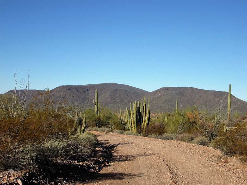
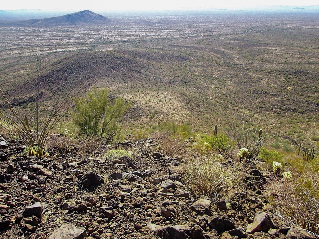
Guadu Benchmark is the de-facto name of the highpoint of the Cipriano Hills in the Organ Pipe Cactus National Monument. The range appears to be an old lava flow, with flat plateau tops and uniform slopes surrounding it. Blackened basalt boulders cover nearly every square foot of the range and surrounding desert flats.
The only practical way to get close to the peak is along Puerto Blanco Road, which is a 36-mile loop road that begins near the Organ Pipe Visitor's Center, then ends back at highway AZ-85 near the town of Lukeville on the Mexican Border. After a park ranger was shot and killed by Mexican drug smugglers in 2002, this road was closed for nearly a dozen years. This closure essentially shut access to the Cipriano Hills or any place in the western part of the Monument. With better security in place, the road re-opened in 2014.
I was here for the weekend, arriving yesterday to participate in Doug Kasian's historic hike up Peak 2306, then another hike with Scott Peavy and Matthias Stender up to the Sonoyta Mountain's highpoint. Scott drove me back to the Twin Peaks campground where I had stashed my truck, and everyone went home, while I camped for the night.
Given the peak's remote location, I thought it would be wise to have strength in numbers. When I found out that John Vitz and Bill Sheets, both participants on Doug's hike, would be hiking Guadu Benchmark, we agreed to go as a team of three.
I left the campground early, since I wanted to scout a few things along the drive. I zeroed my odometer at the Y-split in the road near the visitor's center, the left going to the campground, the right being the start of Puerto Blanco Road.
The first 4.8 miles are smooth gravel and some pavement, and I was able to average 25-30 miles per hour. The good road ends east of Pinkley Peak, a big cliffy peak that defeated me a couple months ago. I wanted to slow down here and study its routes more carefully. There is a day-use parking area here, with ramadas and restrooms. Puerto Blanco Road continues from the far end of the parking area, now narrower, slightly rougher, and marked as one-way.
I drove the road, now averaging no higher than 15 miles per hour and rarely out of second gear. Other than a few rocky segments and places where the road dropped into and out of arroyos, the road was pretty good. I never needed four-wheel drive. The road bent west now, and when I was now north of Pinkley Peak, I stopped again and studied the ridges, doing this a few times from different spots along the road.
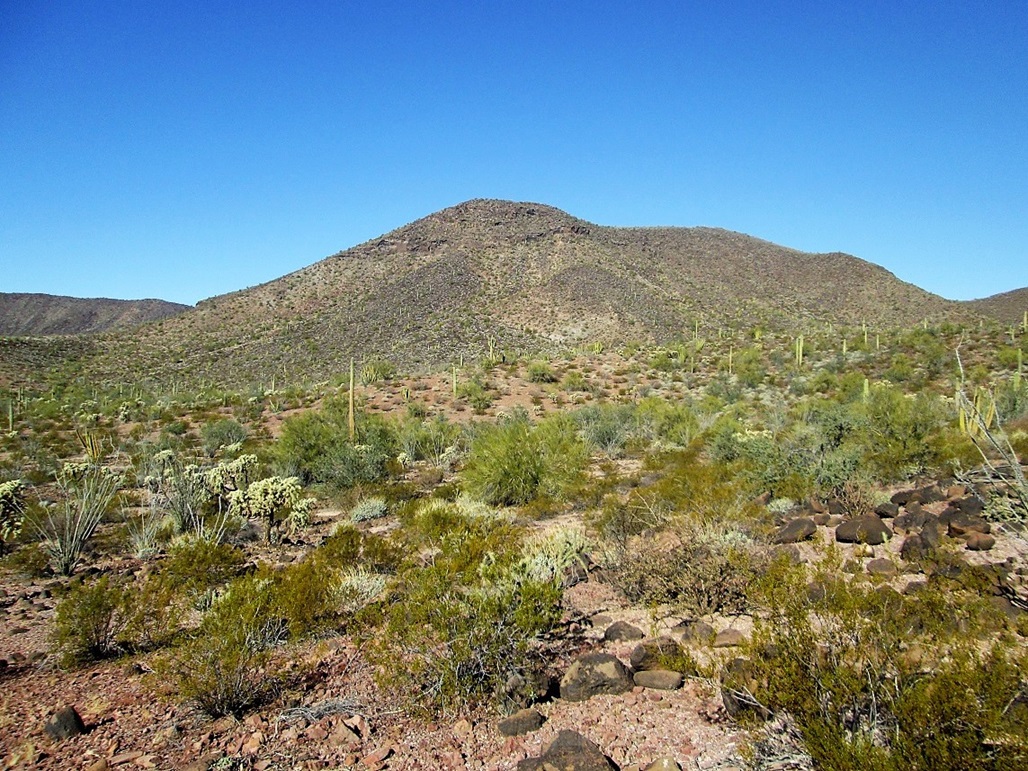
Once done with my observations of Pinkley Peak, I continued my drive. The smoother profile of the Cipriano Hills came into view after about a dozen miles (all mileages are cumulative). Now the road started to bend south, and I was now abeam of the summit. Here, I found a wide spot in the road and parked, waiting for John and Bill to arrive. I walked into the desert and took a few photographs. The day was clear, cool and calm. I enjoyed the silence and solitude.
About 20 minutes later, John and Bill rolled up, and then we drove into an arroyo where we parked. We got our packs on, locked up the trucks, and started hiking at 10:15 a.m. My original plan was to hike to a saddle north of the highpoint, then cut south up the ridges to the top. John preferred the steeper south ridge, which appeared to go straight to the highpoint. Both options looked promising, so I agreed to follow John's route.
We aimed for the lowpoint of the south ridge, about a mile slightly southwest of our position. The land here drains to the south, so we had to drop into and out of about five arroyos along the way. The terrain above the arroyos was covered in basalt rocks, but we were able to weave through the rocks and brush with no issues. As we gained elevation to the ridge, the rocks were more plentiful as was the brush.
I was about 100 feet ahead of Bill and John when John called to me, saying he had twisted his ankle. It wasn't dire, but he would not be able to continue with the climb. Instead, Bill and John walked back to the trucks. They encouraged me to go on alone.
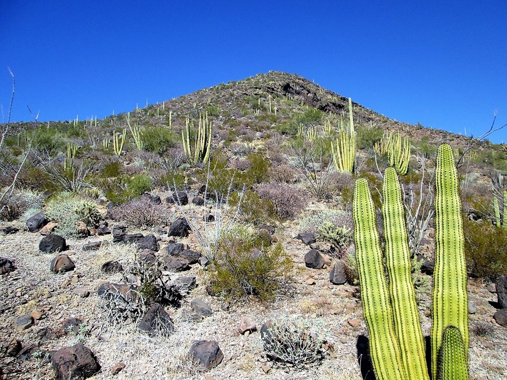
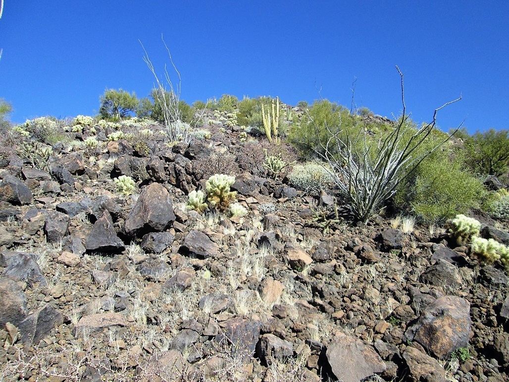
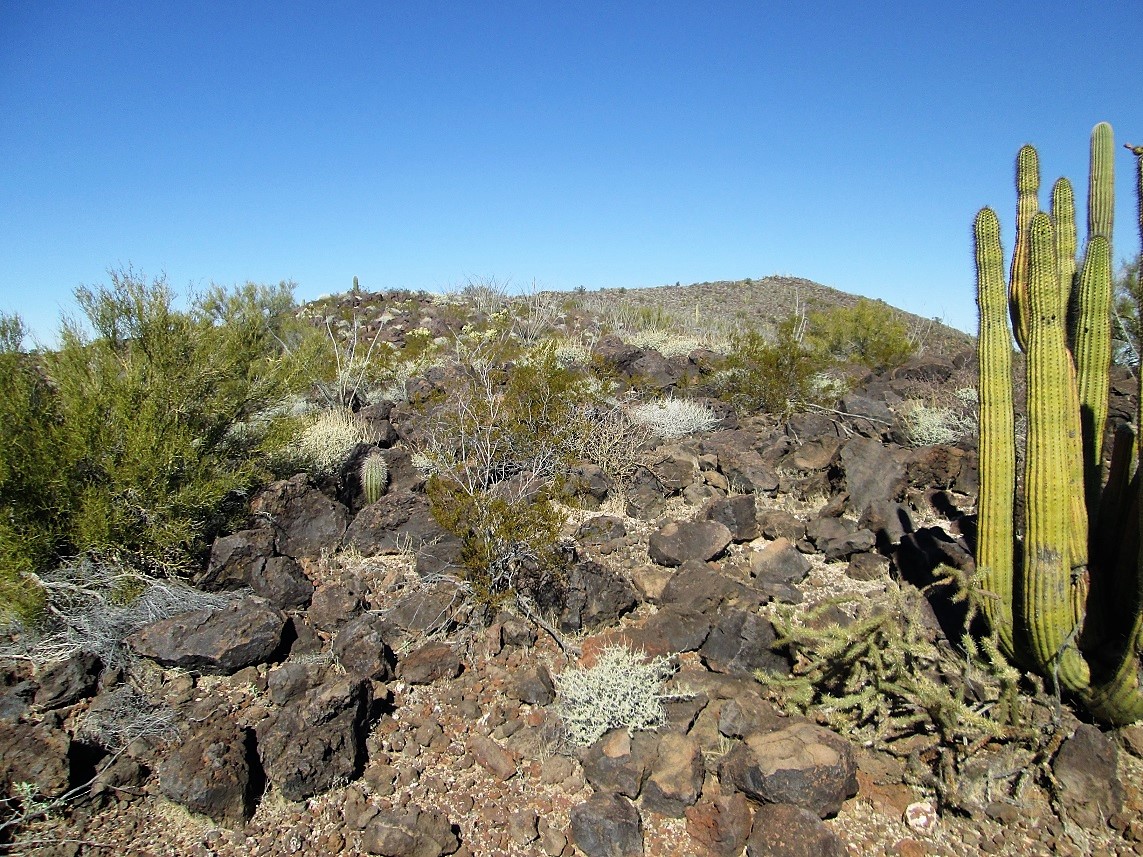
Shortly, I was at the base of the south slope, looking up at 800 vertical feet of steeply-sloping ridge. But there were no cliffs or obvious impediments. I would walk up 50 vertical feet, then stop and catch my breath, then repeat. Lower down, the basalt boulders were spread out, but soon, they closed in so that virtually every step of the way was on a boulder, or fist-sized scree formed from these rocks. The brush was moderate. There was the usual plants: palo verde, ocotillo and creosote, and patches of cholla cactus, which would sometimes get thick.
After about thirty minutes of this grind, I had arrived to the top of the steep slope. The summit was visible to the northwest, less than a half mile away. I was now on the top ridges where the slopes were very gentle. However, the rocks were still plentiful and this slowed me, as I needed to watch each step and zig-zag around the bigger piles.
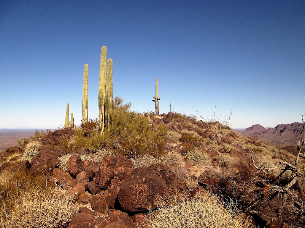
I arrived onto the summit after about 90 minutes from starting (I didn't closely check my time). I was relieved to see no one there. The whole way, I had been closely watching it, looking for sentries. However, the summit itself wouldn't be ideal as a viewpoint. If there were sentries, they'd more likely be on one of the southern points overlooking the steep slopes, where they could have unfettered views of the desert below.
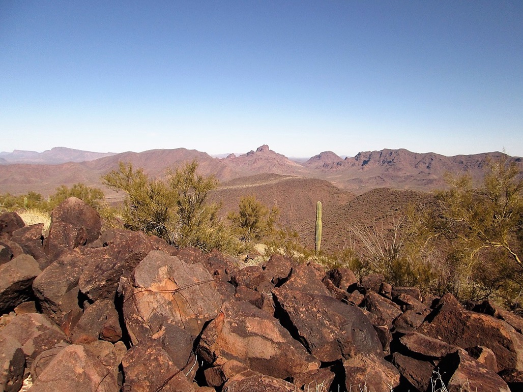
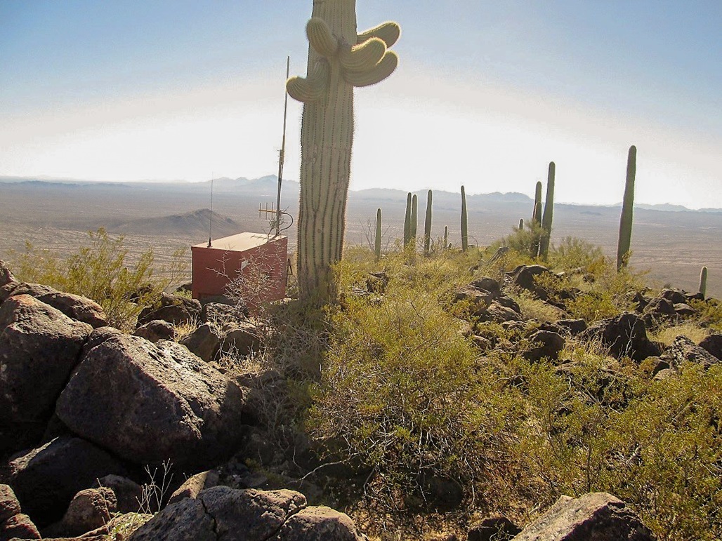
The summit features a small solar collector and antenna, a big saguaro growing very near the highest point, and great views in all directions, especially on a day like today with no clouds and low humidity. I could see peaks such as Kino Peak, Mount Ajo, Pinkley Peak, Sonoyta Mountain (now that I knew where to look for it), and in Mexico, the Cerro Cucapa and the wonderful Volcan Santa Clara (Pinacate Peak). To the west were the Agua Dulce Mountains, plus other ranges whose names I don't know. The register was old and soggy. I saw one entry for 2015. I think I was the first for 2016. I didn't stay long, and started down almost immediately.
I was also able to find Guadu Benchmark, which looks like it was placed there last week, although it said "1962". The name is kind of odd. My best guess is that it's short for "Guadalupe".
The hike out took me about an hour and fifteen minutes. Once on the flats below the mountain, I aimed generally east, and was pleasantly surprised that I emerged almost exactly back to the vehicles. I had figured I would encounter the road, then walk back to the cars from there. Anyway, Bill and John were doing well, and John's ankle was sore but not a serious injury. I was gone exactly 3 hours.
We hung around for a few minutes, but then we all wanted to get moving. I shook their hands and said goodbye, then they took off, and I followed. I wanted to be trailing as I intended to go slow and stop occasionally. It felt like I had the whole road to myself.
I continued south on Puerto Blanco Road to where it meets the Pozo Nuevo Road at a T-junction. Here, the one-way restriction ends. A right turn eventually leads to the Camino Del Diablo. I went left and a couple more miles came to the Quitobaquito Springs spur road, which I followed for less than a mile. There was a couple on a motorcycle there, and John and Bill, too.
The Springs are natural and form a large pond with cottonwoods and other trees, and reeds, and in the water, ducks! The main pond is about an acre in area, quite the unexpected sight for such a remote desert location. Here, the Mexican border is just a few dozen feet to the south. I couldn't resist, so I walked to it, took a couple photos, then stuck my arm into Mexico.
By the time I left, the others were gone. Now, I had about another dozen miles of Puerto Blanco Road to drive, east to where it meets at highway AZ-85. For most of this stretch, the road parallels the border fence, often to within feet of it. Immediately south of the fence is a major Mexican highway, Federal Route 2. It was odd to be driving on a "remote" desert track, then look south and see a big bus or truck whiz by, just a hundred feet away. I stopped briefly near a truck stop that abutted the fence. There were old cars from the 1950s just sitting there, probably worth money to a collector.
I emerged back onto AZ-85, my odometer showing 37.5 miles, which means the Puerto Blanco Road portion of the loop was more like 36 miles if I subtract off my little side journeys. From here, I drove home, stopping for a late lunch in Gila Bend. I arrived back to our home a little after 6 p.m.
|


|