The Mountains of Arizona
• www.surgent.net
|
| Peak 2021 |
• Deem Hills • City of Phoenix • Maricopa County |
|
Date: May 21, 2023
• Elevation: 2,021 feet
• Prominence: 461 feet
• Distance: 6 miles
• Time: 3 hours
• Gain: 710 feet
• Conditions: Very nice, warm toward the end
• Wildlife: Whipsnake, rattlesnake
Arizona
•
Main
•
PB
•
LoJ
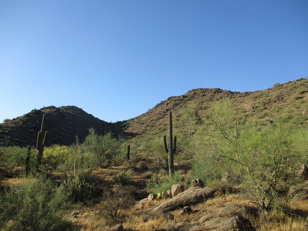
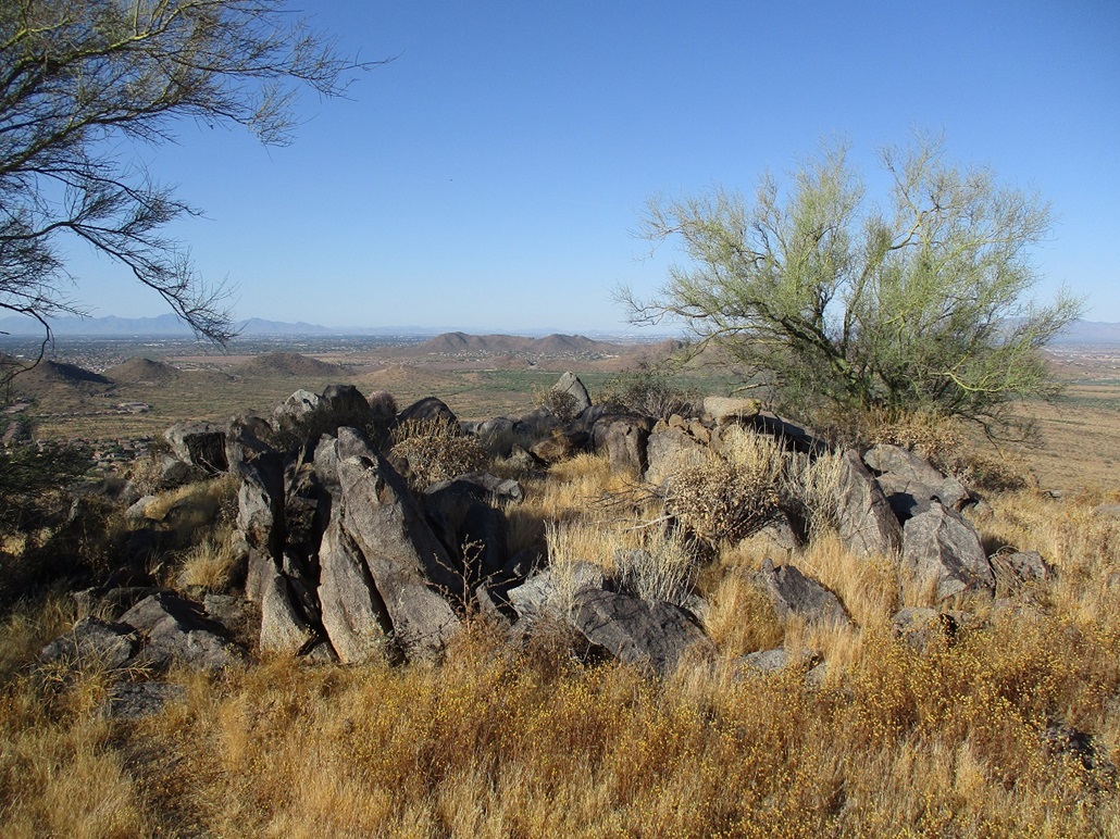
This unnamed peak goes by its spot elevation, thus it is Peak 2021. It is located at the northwest tip of the Deem Hills, a band of rocky summits in northwest Phoenix and Peoria, generally bounded by Happy Valley Road to the south, AZ-Loop 303 to the north, Interstate-17 to the east, and Lake Pleasant Parkway to the west. The Central Arizona Project (CAP) Canal runs through here, roughly cleaving the range down the middle on an east-west line. To the south is developed suburbs, and to the north is "open" state trust land. Peak 2021 lies on the state trust land portion.
Before there was a Loop 303, this was open desert with rough desert tracks that led into the hills from the north. Since Loop 303 was built out about 15 years ago, it has shut off easy access into the state trust lands from the north. It is still accessible, just not as easily. The state trust portion is covered in roads and tracks, put in over the decades by vehicles, ATVs, dirtbikes, mountain bikes, horses and hikers. A rough footpath leads to the summit of Peak 2021. Now that it's warm, a path is critical. Hiking off trail in the brush and rocks this time of year is asking for trouble. In fact, I would have a rattlesnake encounter on the descent. They're out there and they are never very happy to see anyone.
I've hiked most of the ranked peaks in the Deem Hills except for this one and one other "soft ranked" peak. I wanted to access the peak from the north since it appeared it would be a short hike if I could drive in close, but try as I might, I could never reverse-engineer a route, when studying the satellite images, that led back to an access point. Everything is blocked by the Loop 303 freeway. I'm sure there is some way people get back in there but I couldn't figure it out. I chose to deal with the extra distance and start from a city park located to the south. It would mean extra hiking distance, but almost entirely on roads and tracks.
I was up early to take advantage of the cool morning temperatures. These days, the highs have been about 100 F, lows about 70. It's been pleasant. The higher heat doesn't set in until late morning. I figured if I could be done by 9 a.m., I should be okay. I followed the Loop-202 freeway north and west, exiting onto 67th Avenue, then followed that north into a housing development. I followed the main road (I lost track of its name) going northwest, then turned onto Chaffen Road and then into a small city park at the corner of Chaffen and Miner. I was here once before, when I climbed East Wing Mountain so I had some idea where to go. Online maps help.
I was the first person in the lot. I got my boots on and pack prepared, and started walking at 5:45 a.m.. The sun was up but still blocked by the hills to the east. It was pleasant now, about 70 degrees, calm with no clouds. I walked to a large circular trailhead at the northwest tip of the park. This is a let-in point to a patch of open desert set aside for hiking and mainly mountain-biking.
I followed a track north, then northwest, always staying on the main track as numerous smaller paths cross it or branch off. I walked north almost two miles, mostly in the shade of Peak 2021. This leads to where the canal goes uderground for a little bit, so I could cross over it easily. I had a satellite image of the area here because I wanted a very specific track. Had I missed it, I probably would have been fine, but this track went exactly where I wanted to go. I didn't want to add extra distance.
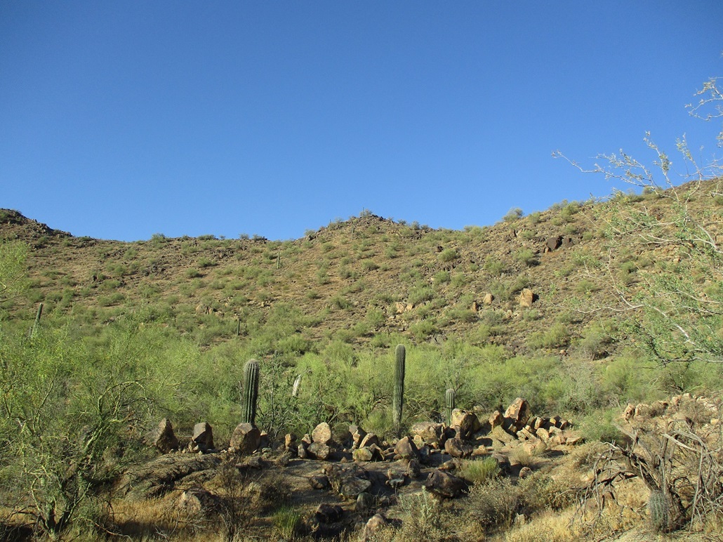
The track gains a small ridge, then drops a little bit, then gains another ridge, each time about a 40-50 foot gain and drop. This put me in a nook abutting the peak, which I could see directly above me. I was able to keep to the tracks without any problems. The track enters a drainage and charges uphill to gain the main crest of the peak. There were more rocks in this drainage, sometimes confusing me as I would have to look for the continuation of the track.
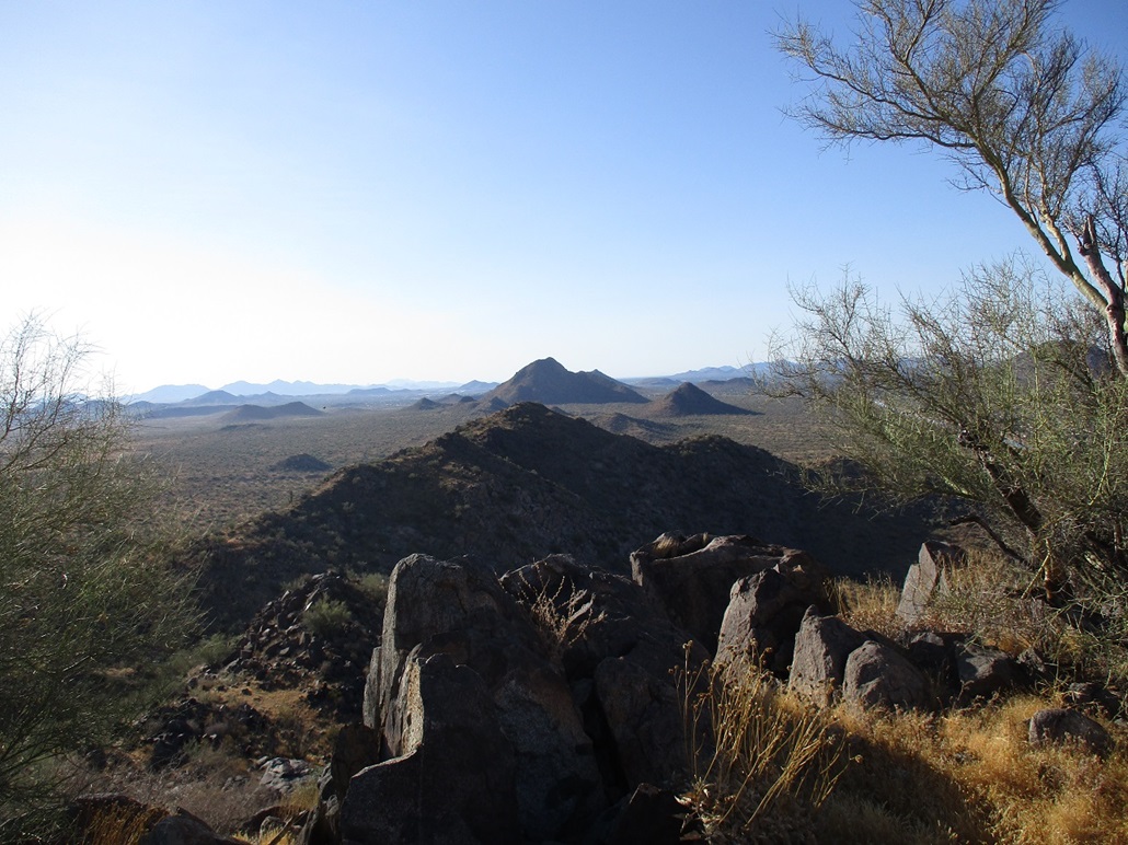
I gained the main ridge, and followed the track as it curled around, then up, toward the summit. It is much rockier here, and the track at times was a meager pad of dirt through the rocks, more eroded and haggard, and sometimes very steep. I moved slowly and used my hands a few times to scramble past a few easy rock heaps. The summit is a dome of rocks in a big pile, and the track essentially ended about 20 feet below it, which was fine since it was obvious where to go. I gained the top about 75 minutes after starting. It is a little flat pad of grass and rocks. At one end is a plastic tub serving as an anchor for what I assume is a flag pole. There was a pole lying there, but no flag. I could not locate a register. Why there is a path to this peak's top is anyone's guess. I suspect it may have been put in when they were building the CAP Canal, and this peak would be a perfect vantage point for survey purposes. It was actually a pretty good track almost the entire way. Someone or some people went through a lot of trouble to build it.
I stayed up top just for a few minutes. I was in the sun and it was warming now, but still comfortable, probably 80-ish. Bees and other insects were bopping into me. I took a handful of images, looked around, then started down. To be safe, I followed my ascent route down for the descent. There appears to be other tracks that may drop down other ridges, but I didn't want to take any chances.
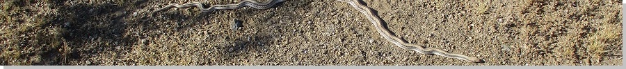
I was descending the drainage part when I spooked a rattlesnake. It was tucked between two rocks on the trail. I only saw it briefly as it pulled itself in when it saw me. I was maybe three feet from it. Then it rattled and would not cease its rattle for many minutes. I didn't want to walk over its little hide-out for fear it may strike at me, so I detoured into the brush for a few feet until I was below the snake. I took a look for it, but it was too deep in its crevice to be seen. But it rattled on and on. That rattle is a sound you never forget. I had a little adrenaline going, plus now looking out for more snakes.
The remaining hike out took awhile. Once back on the main tracks used by the mountain bikers, I started seeing more people, inclduing one person in a SUV. I wanted to ask him how he got in, but he was driving in a different direction. However, his dog barked at me out the window. A mountain biker came rolling up and spotted a snake in his track. It was just a thin lyresnake sunning itself. I shot an image of it. I had no more snake encounters for the rest of the hike.
I was back to my car at 8:45, a three hour hike. I gauge my round trip distance as 6 miles but this is likely an underestimate. The path essentially corkscrews around the peak, adding distance, not to mention all the little wiggles the paths make. I was surprisingly beat after I exited. It was warm now, 90 degrees going by my car's temperature gauge. I went straight back to my Tempe place. I ran a few errands but also napped. I think I dehydrated myself on the hike, although I had plenty of water and I drank a lot. But once the body is dehydrated, it takes time to rehydrate.
This was a good hike, but probably not one I would recommend since there are better options nearby with easier access. For me, it was the last main peak of this grouping I needed, and I had kept putting it off. I'm glad I hiked it, I had fun, I got a workout, I nearly stepped on a snake, and this will probably be it for my desert peaks for a few months.
|


|