The Mountains of Arizona
• www.surgent.net
|
| Chavez Mountain |
• Mogollon Plateau • Coconino National Forest • Coconino County |
|
Date: September 18, 2021
• Elevation: 6,908 feet
• Prominence: 390 feet
• Distance: 3.1 miles
• Time: 2 hours, 20 minutes
• Gain: 388 feet
• Conditions: Sunny and clear at first, clouds developing as the day wore on
• Teammate: Matthias Stender
Arizona
•
Main
•
PB
•
LoJ
•
USGS BM Datasheet
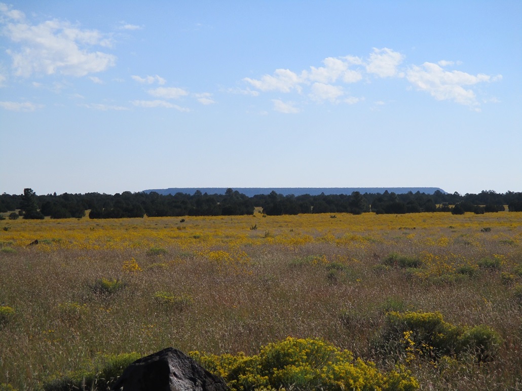
Chavez Mountain is a flat-topped mesa that lies on the east edge of the Mogollon Plateau, facing north and eastward overlooking the flatter plains and rangelands of the Colorado Plateau. Chavez Mountain itself appears to be an appendage of the Mogollon Plateau that got separated through erosion so that it is now a stand-alone feature. The pass that connects Chavez Mountain to the Mogollon Plateau is called Chavez Pass.
Many years ago, βð and I visited the Meteor Crater site, then followed a good dirt road south from there toward the Mogollon Plateau. We would have driven to Chavez Pass. After that, I don't remember exactly what we did. The shortest distance from the pass to a paved road (Highway AZ-87) would be to hang a left once down from the pass and follow a forest track southeast about four more miles to the highway. Otherwise, one can go right once below the pass, and ascend a gentle canyon westward to top out on the Mogollon Plateau, then follow decent forest roads for about another dozen miles to meet the highway.
It turns out this general path was once part of an old overland route first established by the Native Americans, then absorbed into what is now called the Chavez Trail, which in the 19th Century, was a route from Winslow to Prescott. The route was put in by Col. J. Francisco Chaves, and the peak was named for him, albeit with the "z" at the end. The Benchmark on the peak is stamped "Chaves". You can read a little bit by clicking here. I didn't know about this historic trail either until I googled it moments ago.
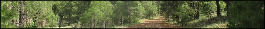
About a month ago, I drove up onto the Mogollon Plateau to hike two peaks, Chavez Mountain and Turkey Mountain. I followed AZ-87 about 15 miles northbound from Clints Well, looking for Coconino Forest Road 82, which would be the shortest road from the highway to the mountain. I found it, but it was in abysmal shape, heavily eroded to where the underlying rocks jutted upward, and big mudholes. I got in just a few hundred feet and bailed. If we followed this road way back when, I don't remember it being so nasty. It may have been better maintained in the past. In any case, I wasn't going to mess with this road at all.
I backtracked to Forest Road 211, and drove in a couple miles to catch FR-82 on its west end. I went north on FR-82 about two miles but encountered more mud. It had been a wet month and there was still a lot of standing water. Parts of the road were just long shallow ponds. I backed off this road too, and had to give up on both peaks as a result. I salvaged the afternoon by heading to Flagstaff and hiking a couple peaks up there. These roads would need time to dry.
Matthias and I teamed up today to drive to and hike these two peaks, plus Jaycox Mountain. It has been dry now most of the past few weeks and hopefully the roads would be better. He drove as his vehicle was better suited for these roads. We were in the general area about 8 a.m., and we followed FR-211 to FR-82, and I was happy to see the roads in much better condition. The big ponds and mudpits were gone. The day was sunny with spotty clouds, and pleasant, temperatures in the 60s.
Our plan was to hike Chavez Mountain first, then double back and hike Jaycox and Turkey Mountains as we drove out. The drive from the paved highway covered about a dozen miles and the roads were in pretty good shape, just a few rocky segments but nothing any high-clearance vehicle couldn't handle. We descended off the main plateau on FR-82, then eased left and up to Chavez Pass, the time now close to 9 a.m.. The drive had taken about an hour from the highway.
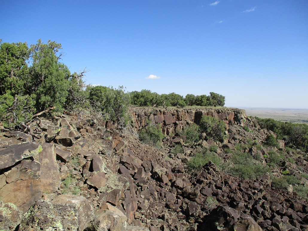
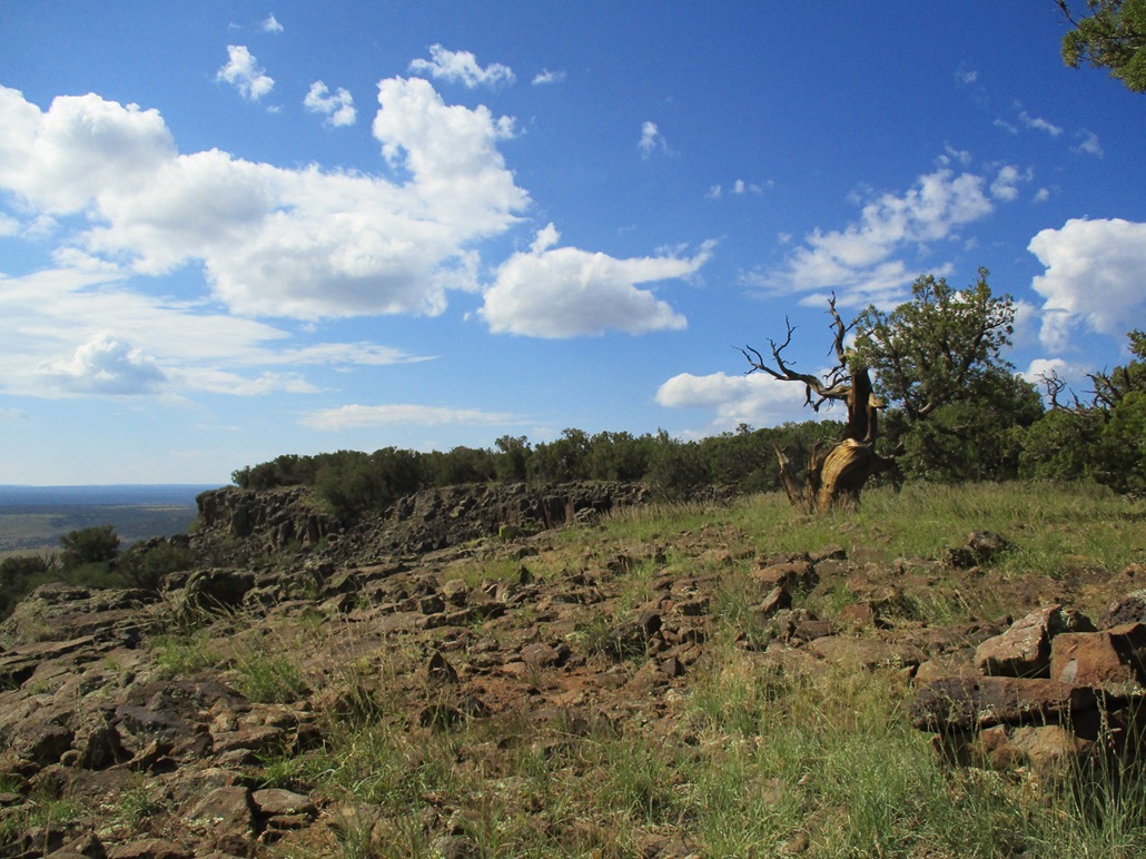
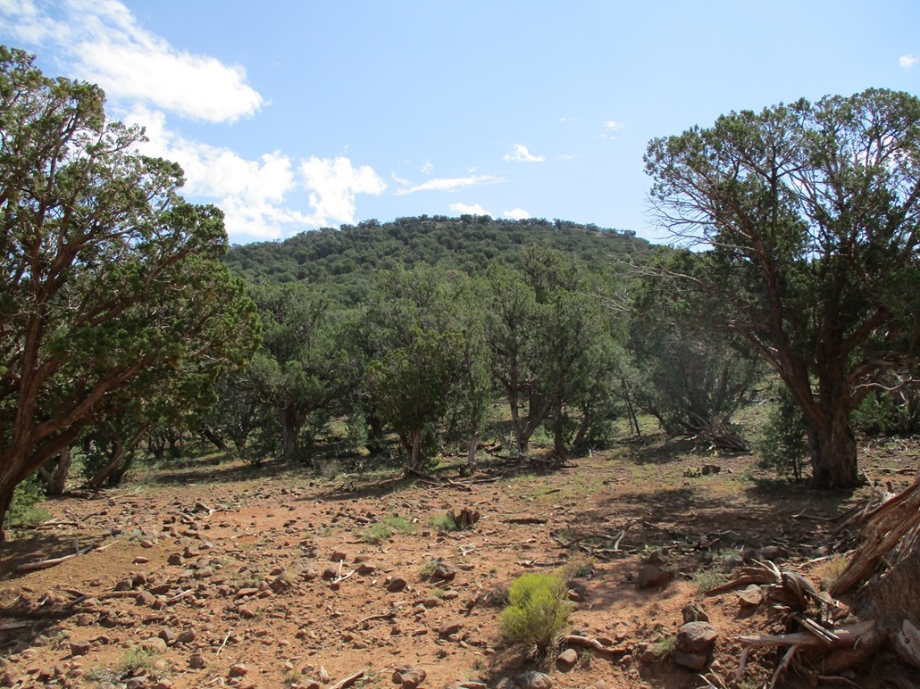
The slopes of Chavez Mountain looked tolerable from here. Low trees such as juniper covered much of the slopes, and there was a weak band of rocks along the top rim. However, the slope laid back well and appeared to have a lot of lanes to follow. We hiked directly uphill, zigging and zagging to stay on open lanes. The top rocks were more of a heap than a true cliff. We easily walked up the rocks and were on the west rim of the mesa top after about twenty minutes.
The presumed highpoint is a benchmark on the east rim, about a mile away. The mesa top itself was more of the same forest of juniper and pinon, and very flat. We tried to walk such that we walked over one spot elevation of 6,902 feet. In about another twenty minutes, we were at the east rim.
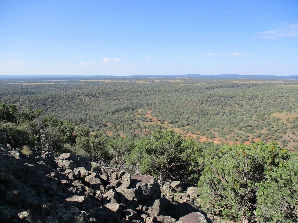
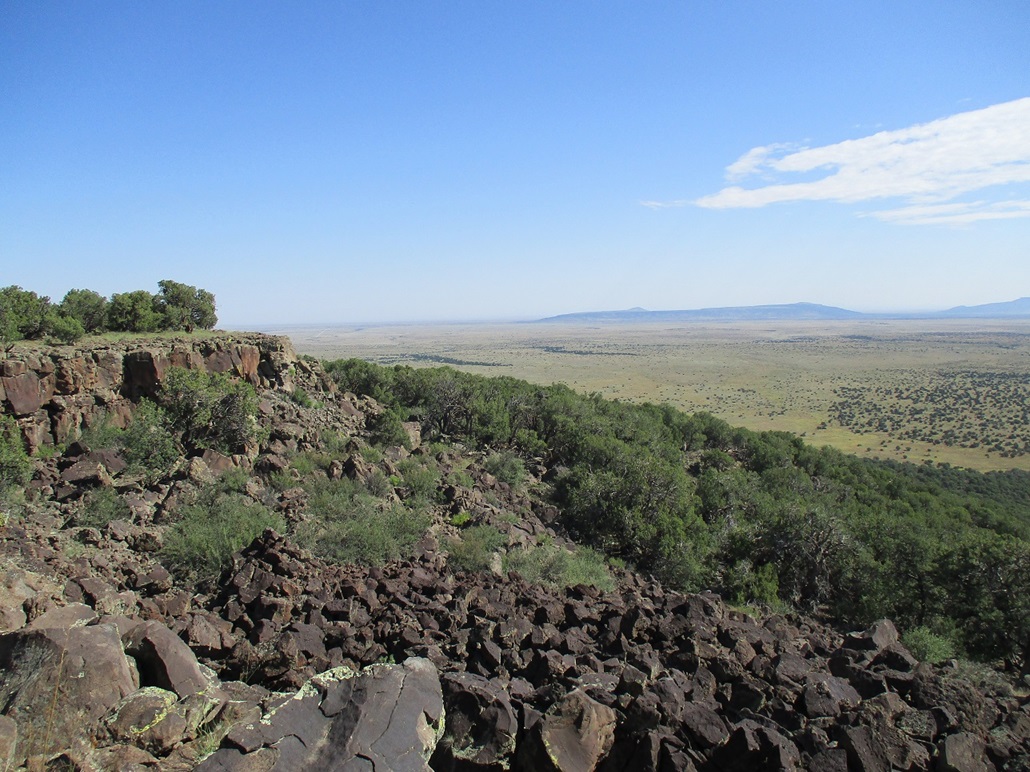
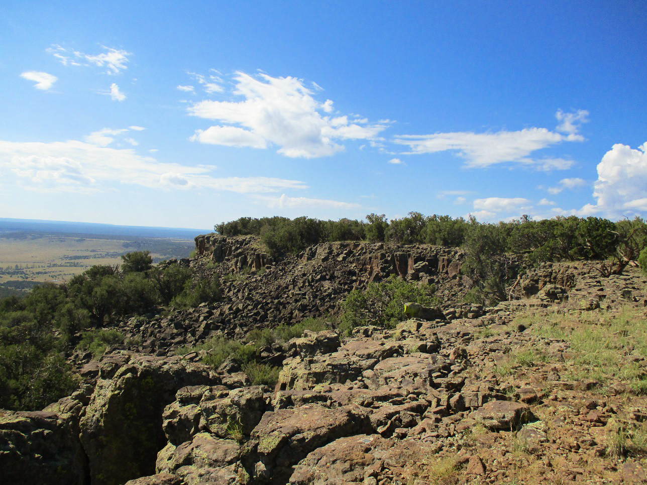
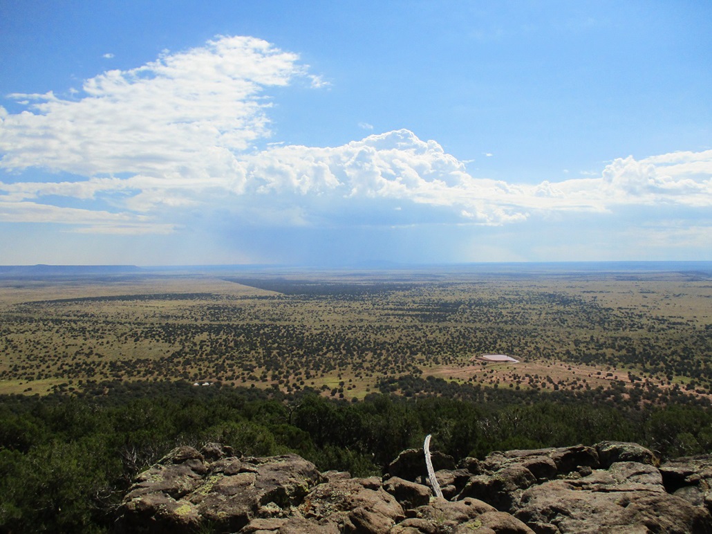
The east rim has more pronounced cliffs. We were overlooking a portion of the rim that seemed to have collapsed into a massive heap of blocks, forming a "cirque"-like indentation in the rim. We were on the south lip of this feature. We stopped and looked out over the rocks and surrounding countryside. The views were fanstastic looking northeast to southeast, with the Sunset Mountains and Chevelon Butte visible, and a rogue storm cloud dropping rain on Chevelon.
We sought the benchmark. We first hiked a little more south but saw nothing, then we walked north, placing us now on the north lip of the cirque. We found the benchmark in a rock flush to the ground, and one witness marker nearby. A couple cairns were close by too. We stopped here to take a long break. Looking south at the south lip where we'd been, it looked higher by a few feet. While the surveyors in 1936 intended to place the benchmark at the highest possible location on the mesa, they probably weren't too concerned if they missed it by a few feet, and being 1936, didn't have fancy GPS to help them. Thus, the highest point on the mesa itself is anyone's guess.
We spent about a half hour here. We watched the big storm move over Chevelon Butte and track north. Where we were was sunny with some clouds, about 75 degrees. The views northeast to southeast were much better than we were expecting, and we were in no particular hurry to get moving. We looked for a register but found nothing. We also walked the area to see if there were any rock outcrops to tag. We both agreed the south lip was higher than the benchmark area, perhaps by five feet.
For the hike out, we followed a general westward line and were soon back to the west rim. We may not have been on our exact inbound route but it didn't matter. We found a spot off the rim that looked safe to descend, and carefully eased down the jumble of rocks onto firmer sloping dirt and forest. We emerged onto the road about 200 feet north of Matthias' car. We had covered a little over 3 miles in a little over 2 hours; it was a little past 11 a.m. now.
When we got back to his car, the rear passenger-side tire was flat. Suddenly, that took precedence. We got out all his tire-changing gear and were able to put on the spare. This took about twenty minutes too, as we were fiddling with these items for the first time. Fortunately, his set-up was similar to what I had with my old truck so I knew what to do. However, we felt it wise to not test fate and instead drove slowly back to pavement, ignoring the other two peaks we had planned. We got into Payson to the Big-O in town, right at they were closing for the day. He was able to get it patched later down in Fountain Hills. I had a flat last week, and had another one back in early August. I think I'm starting to become bad-mojo for flat tires.
The day had started out so calm and pleasant, but that rogue storm we watched over Chevelon Butte portended a more active day than we expected. As we drove into Phoenix, the skies clouded up and especially to the southeast, it was gray and black and a distinct dust cloud on the ground --- a haboob. I hadn't been in one for a few years. However, it petered out by the time it got to where I was. But it rained heavily and the streets had flooded, with some downed tree limbs in the road.
So we only got one peak for all the driving we did, but given the circumstances, we were grateful for that, and grateful that the flat tire was just an inconvenience and nothing more. We'll come back soon for the other two summits. Matthias told me later it wasn't a nail, but likely a very sharp rock in the road. Given the volcanic nature of the rock on the plateau, that is not surprising. It still was a good day to be out of town and in the trees.
Lastly, it has come to my attention that many of you read my trip reports with no interest in the actual hills we climb, but to know what obscure prog-rock bands Matthias had on in the car. It was Brainticket, then a Belgian band called Weidorje, then an Italian band called D.F.A.. I liked all three but I liked the last one the most. Glad to see that prog rock is still going on in other parts of the world.
|


|