The Mountains of Arizona
• www.surgent.net
|
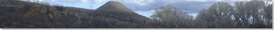
| Brunckow Hill |
• San Pedro River Riparian Area • Tombstone Hills • Cochise County |
|
Date: January 4, 2024
• Elevation: 4,470 feet
• Prominence: 310 feet
• Distance: 2.4 miles
• Time: 90 minutes
• Gain: 470 feet
• Conditions: Cold and blustery
Arizona
•
Main
•
PB
•
LoJ
•
Interactive map
Brunckow Hill lies south of Charleston Road, about halfway between Tombstone and Sierra Vista. In the past two weeks, I had been here twice to climb a batch of four ranked peaks that lie north of Charleston Road, two over here and another pair up that way. Brunckow Hill would be the fifth and last peak of this batch of five that I would climb.
The day was a cold and blustery one. Overnight, it had rained and even snowed a little. When I awoke, the clouds were breaking up but it was windy and brisk, temperatures still in the mid 30s. I had some duties to attend to in the morning and one zoom meeting that ended at noon. For some reason, I wanted to out and hiking in this weather. Brunckow Hill is nearby, easy to get to, with uncomplicated access, so that's where I headed.
I followed the usual route, which means this was the third time following this route: Highway AZ-92 west to Palominas Road north to Hereford Road west to Moson Road north to Charleston Road, where I headed northeast. There were still abundant clouds. The Huachucas were socked in and being snowed on, as when the clouds moved aside about an hour later, the whole mountain range was covered in a light layer of white.
I parked in the parking lot on the south side of Charleston Road, east of the San Pedro River, near an old bridge spanning the river now used as a footpath. The land here is administered by the BLM, with trails along the river and some going farther north to the old Charleston and Millville townsites. Surprisingly, there was one other car in the lot, and as I pulled in, the occupants, three young women, were just emerging and getting ready to leave.
Outside, it was sunny but with thick puffy clouds that would move through quickly, so it would alternate between gloomy gray and sunny blue skies, but the temperature stayed chilly, in the low 40s at 1 p.m.. Some clouds looked really dark and I was minorly concerned I'd get rained on. I bundled up, but did not carry a pack. I just put my stuff in my jacket pockets, which was sufficient.
Brunckow Hill is named for Frederick Brunckow, a German-born and educated mining engineer who came to the United States in 1850, and by 1858, was working a mine of his own along the San Pedro River. This was ten years before Ed Schieffelin would discover silver ore that begat a boom and the founding of the town of Tombstone. In the 1850s, being out here was asking for trouble as the Apache were aggressive in defending their land and killing those on it. This was still just a couple years after the Gadsden Purchase. The United States military had a presence at what was then Camp Huachuca, but for the most part, this was a lawless land de-facto run by the Apache.
Brunckow built a cabin that would, over a thirty-year period, be the site of over 20 murders, including that of Brunckow, who was killed by his Mexican laborers who later escaped to Mexico. Over the years, many others owned or inhabited the cabin, many of which were killed. The cabin these days barely exists (I did not visit it today) but is still a popular destination for people who like this kind of "haunted" history.
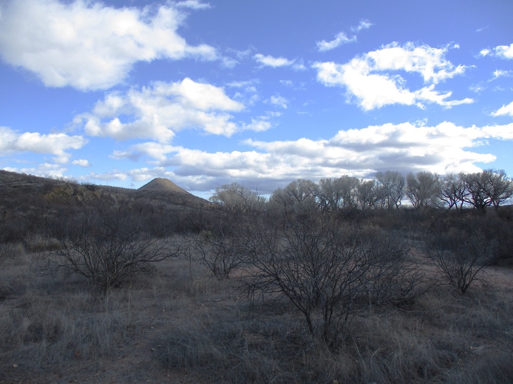
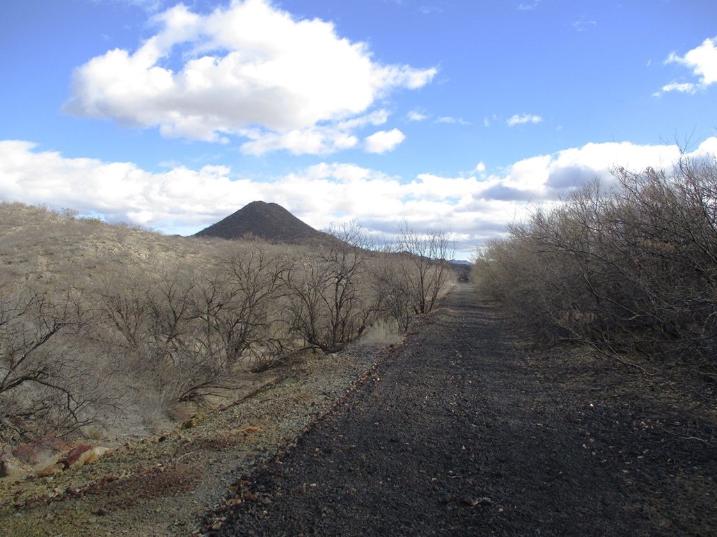
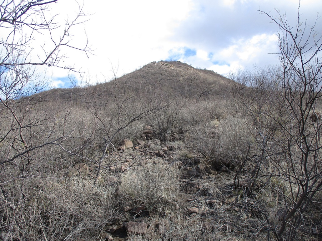
From the parking lot, an old railroad bed runs south, and would serve as a natural "trail" to follow to the peak, which lies about a mile away. I started walking, and immediately got stopped by a fence and a sign proscribing access to the railroad bed. So I angled more toward the river itself and followed a path south for a few hundred yards until the terrain became more hilly and brushy. This forced me uphill away from the river. I found a meager path that led right to the railroad bed.
At this point, I went outlaw and followed the railroad bed. It was too tempting to not to, and I highly doubt it is ever patrolled. The railroad itself has been removed. No rails or ties remain, just the mound of track ballast, colored black. It was a perfect trail, cutting a clean path through the hills and rocks. I stayed on it for about a half mile until I was abeam of the hill.
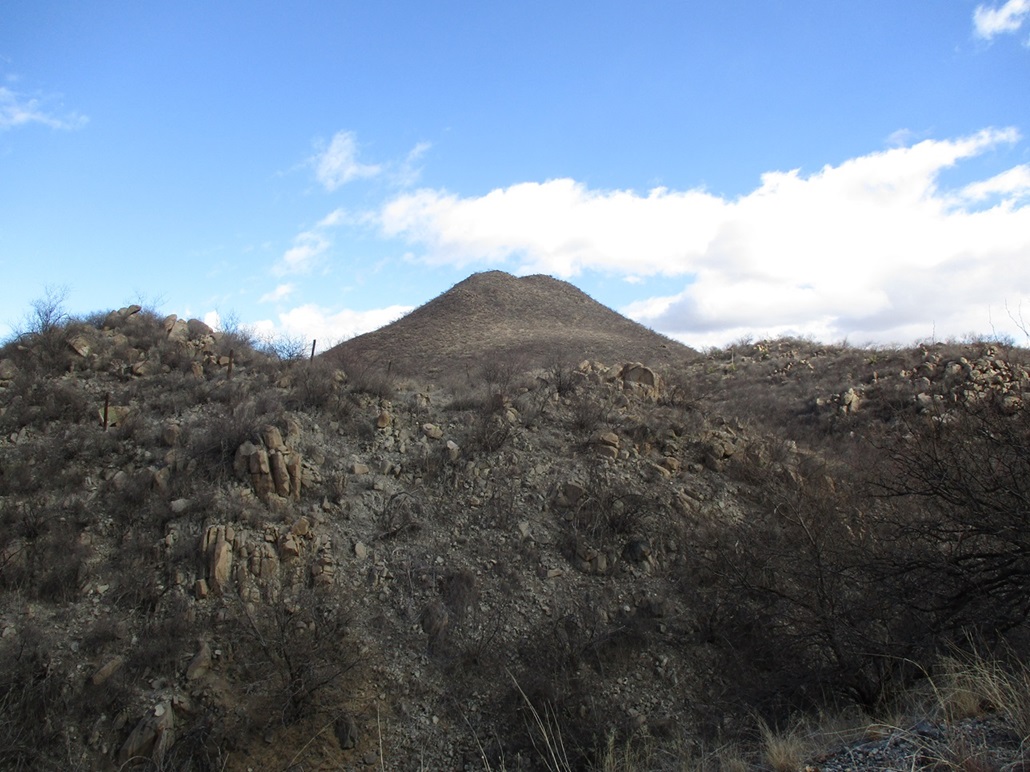
When it seemed right, I left the railroad bed and started pushing through the brush toward the peak. It wasn't terribly dense, but it was pointy and scratchy. I was soon on the lower slopes of the hill. The rocks usually held, but because of last night's rain and snow, they didn't stay fixed in the wet ground. A couple bigger ones just pulled away when I placed weight on them.
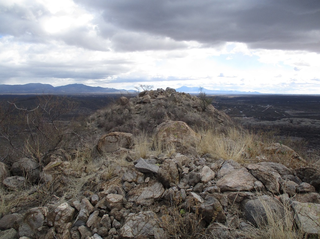
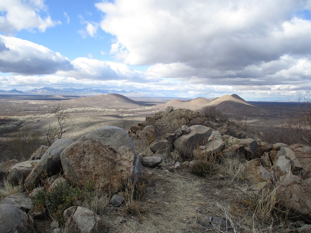
I moved slow and did well, finding lanes and paths almost all the way up. The top fifty feet was very steep but not unsafe. I was soon atop the short summit ridge, surmounting one rock pile, then walking about fifty feet to a second rock pile, this being the highpoint.
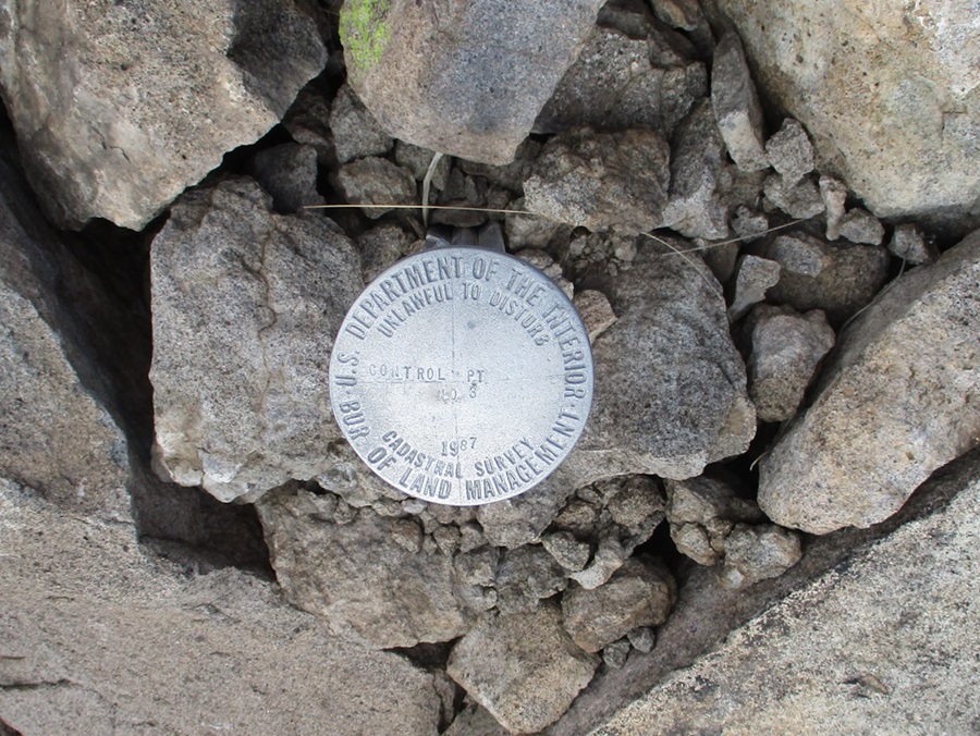
Up here I could feel a steady breeze which was chilling. The top was small and rocky. I did not find a register, but I did find a "control" disk put in by the BLM in 1987 as part of a cadastral survey, presumably when they were mapping out the boundaries of the San Pedro River Riparian corridor. That's my best guess.
I did not stay up top for long, desiring to keep moving to stay warm. I crept downhill along mostly the same route, and was soon back to the railroad bed, which I walked all the way out to the parking lot. The round trip covered a little over two miles and took me almost 90 minutes. I just piled into my car and got moving. I decided not to visit the cabin. It was just too cold and by now, I was chilled. I returned to Bisbee following the same route and was back home within the hour.
This hill, like the others, was steep, rocky and covered in pointy, woody scrub. It wasn't as thick as I encountered on the other peaks and I was able to move quickly. But it wasn't very scenic either. This completes the batch of five peaks in this San Pedro Riparian Area grouping. I'm glad I hiked them all. The next time I return will be when the cottonwoods along the San Pedro River are in color. Right now, everything is gray.
|

|