
The Mountains of Arizona
• www.surgent.net
|
| Black Mesa • North Mesa |
• Mazatzal Mountains • Tonto National Forest • Maricopa County |
|
Date: February 18, 2021
• Elevation: 3,832 feet
• Prominence: 472 feet
• Distance: 4.5 miles
• Time: 3 hours
• Gain: 1,530 feet (gross)
• Conditions: Sunny, cold at first then warming
Arizona
•
Main
•
PB
•
LoJ
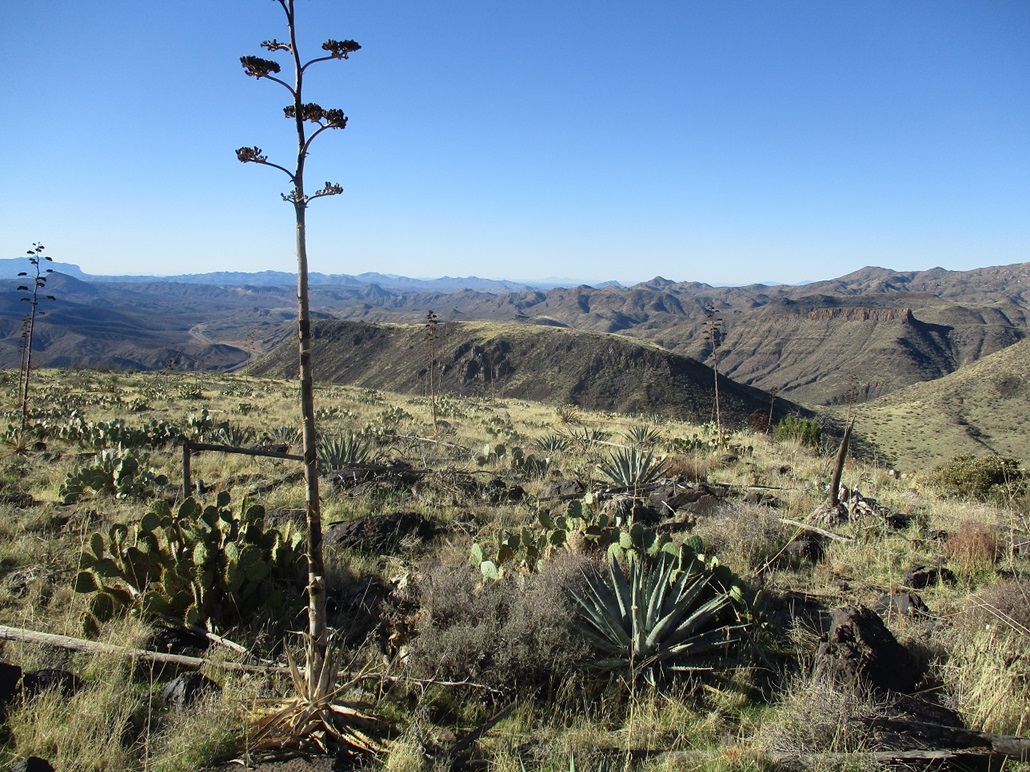
Black Mesa lies astride the Beeline Highway (AZ-87) south of Sunflower. A year ago, I hiked the unnamed mesa to the south which I call Black Mesa South, while I call this one "Black Mesa North". When viewed from the south along the Beeline Highway (AZ-87), the two mesas are clearly a common feature, just split in the middle by a small canyon.
Today, I had most of the morning free, the weather was sunny, cool and stable, and it was a weekday, which was important as this area is popular with shooters. I figured being a Thursday, no one would be here. I left Payson as the sun was rising, timing my drive to arrive at the general area when the sun was just high enough to poke over the larger mountains (e.g. Mount Ord) to the east.
Fom my home, it is a 33-mile drive to Sunflower, then less than a mile south to Tonto Forest Road 1705 on the right (west) side, which I almost overran. I eased onto it, then followed FR-1705 a little under a mile to a sharp right turn. There was a fantastic open area where I parked, a little south of an old gravel pit. The whole area is used by the shooters, and their trash was everywhere. I got situated, packed my pack, and locked everything up, hiking at 7:40 a.m.. It was cold in the shade, about 35 degrees F, with a breeze. I was the only one here, no shooters or anyone. I was at roughly 3,670 feet elevation to start.
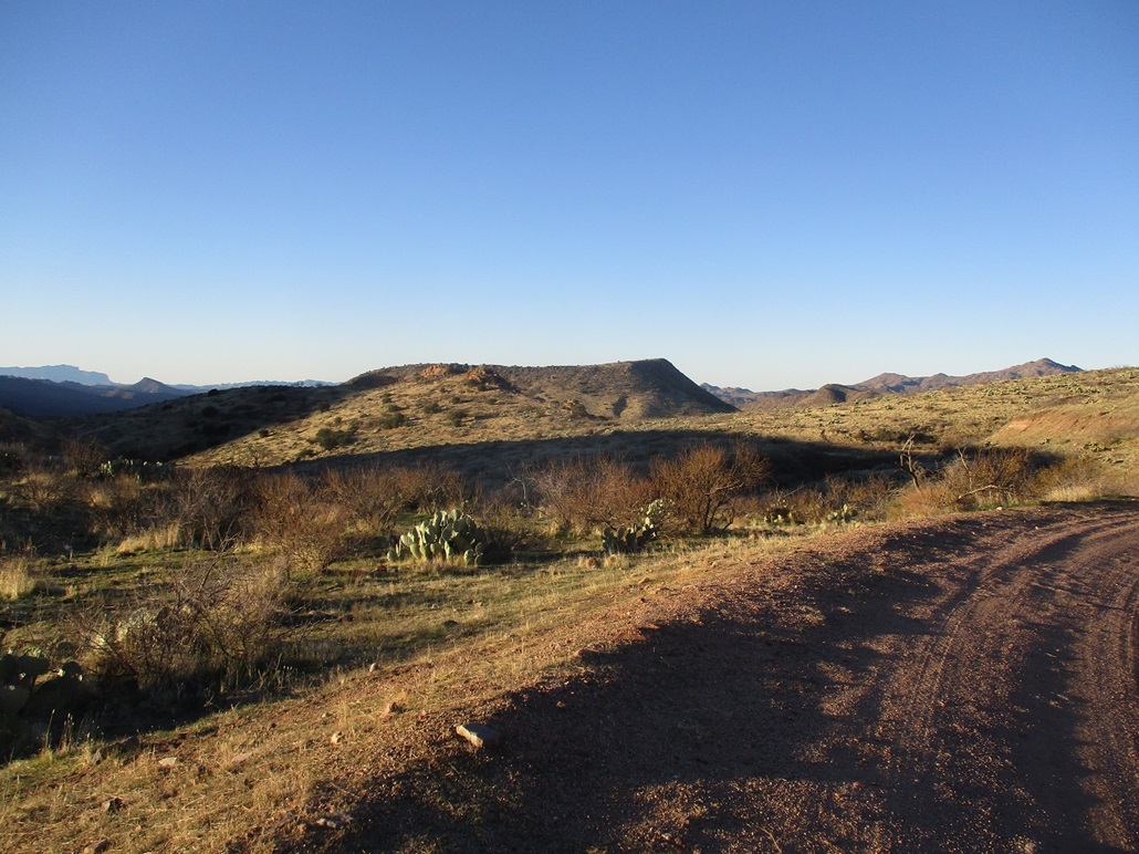
The hike follows FR-1705, and other forest tracks. The initial segment along FR-1705 dropped a little in elevation, and here the breezes funneled into a steady wind. I walked quickly to get back into the sun. I walked about a quarter-mile, topping out on a soft saddle north of Hill 3733, the saddle's elevation about 3,650 feet.
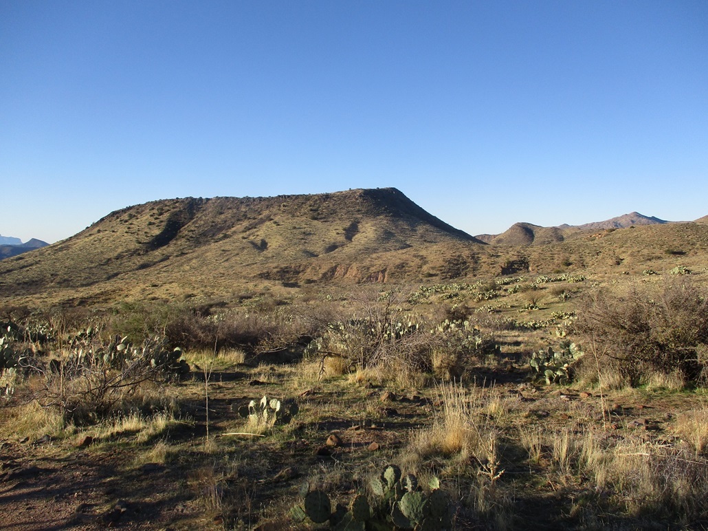
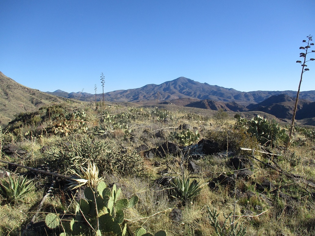
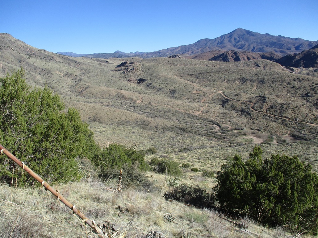
Soon, I came to a split, with FR-1705 going left and FR-1697 going to the right, more southwesterly now. I walked along FR-1697 for a mile, dropping 410 feet in elevation, bottoming out near Rincon Tank. The whole way I had Black Mesa's mass ahead of me and I studied the slopes for what looked friendliest. Typical of these mesas, the apron of slopes were steep, grassy with areas of brush and low forest, then a caprock with weaknesses. My initial plan had been to follow FR-1700 northwest, which would then bend back south to a saddle north of the mesa.
However, at Rincon Tank, I had doubts about this plan. The road meandered too much for my liking and there were cows. I'm not afraid of them but I don't like dealing with them on trails because they just stand there getting agitated. Instead, I bailed off the road and walked up a slope to a small ridge, then down about 40 feet to an arroyo, then up another slope, now on the northern tip of the mesa, the summit directly above. From Rincon Tank, this slope looked open and there was an obvious breach in the rock walls on the mesa rim where I could surmount the mesa easily.
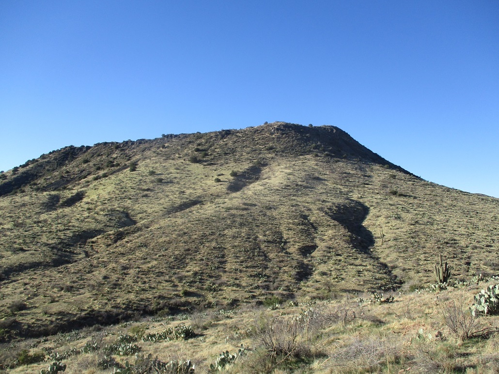
I started up the slope, which was angled leniently at first, and mostly open. Slowly, the grade steepened and I entered into the brush. I was able to get through the brush without too many scratches, aided by a good game path that cut through the brush nicely. I was on top fairly fast. I then angled right and uphill, aiming for the highpoint. I was soon at the highest area on the north lip of the mesa. The highest point could have been any of about a half-dozen boulders, but the log and cairn is located on the northeast tip of this lip. I signed in, the first one here in a year. Up here, the wind was stronger, and cool. Other than a brief stop to sign in the log, I did not sit still much. The views were fantastic on this clear and dry morning.
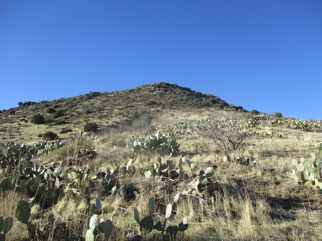
Next, I wanted to seek the "Blacky" benchmark, which I knew was located farther down the mesa-top, where it lowers in elevation overlooking the Beeline Highway. I figured I'd find it in an "obvious" rock outcrop. Problem was, there were many such outcrops and I spent about a half-hour inspecting each one, never finding the disk. So I gave up. But one good thing was I found a slope downhill that looked far better than the one I had come up. This slope was less brushy and went straight down to Big Rincon Tank (spelled "Ricon" on the map). Once at the tank, I found a sitting rock under a tree and took my first long break, drinking and relaxing.
I started walking back to my car, having to regain 400 feet along the way. The grade was barely noticeable, and I was back to my car at 10:39, a two-hour, 59-minute journey. I changed into more comfortable clothes and drove home, ready to do whatever it is I do for work. I'm always happy to get in a hike and was pleased this hike went well with no mishaps.
Forest Road 1705 looked decent to me, and I could have driven it carefully to where it split with FR-1697. FR-1697 was in choppy shape, needing a Jeep or equivalent. When I was at Big Rincon Tank, where FR-1705 comes around again to meet it, it still looked pretty good, but I cannot comment on the parts I didn't hike. But I suspect it's a better-than-average road that a stock truck with 4-wheel drive could manage. If so, then I would recommend to climb the slope above Big Rincon Tank and not do what I did, although my way worked.
|


|