|
|
|
Date: December 1, 2019
• Elevation: 2,788 feet
• Prominence: 748 feet
• Distance: 6 miles
• Time: 3 hours, 15 minutes
• Gain: 1,450 feet
• Conditions: Mostly clear skies, chilly and breezy up high
Arizona
•
Main
•
PB
•
LoJ
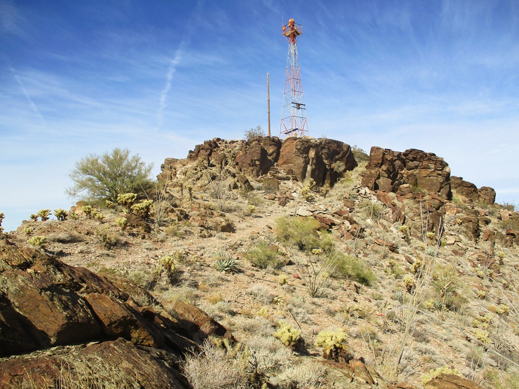
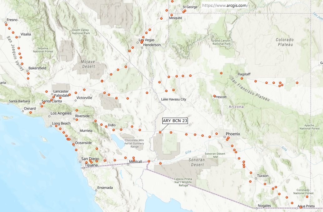
This peak is located in the Dome Rock Mountains in western Arizona. It is the next main peak in the range north of the highest point, Cunningham Mountain. It probably does not have an official name, but it goes by Airway Beacon Peak because there's an old beacon atop the summit. I found out about the peak at The Grand Gulch Hiking blog, and was intrigued by the fact it had a trail to its top, as well as the beacon itself. These things tend to be relics from the early days of airflight, and not all of them are still standing.
Yesterday, I drove west from Scottsdale and hiked the Bear Hills Highpoint, then spent the night in Quartzsite. I've passed through the town hundreds of times, but never stayed the night until last night. The town caters to RVs, but there are a couple hotels: the chain Super-8, and a local outfit called the Stagecoach. I stayed at the Stagecoach and found it to be clean and well done. It's small (less than ten units) and they sell out fast. I had called ahead to reserve a spot.
Today started very cold, in the high 30s, so I let the sun rise more before leaving. I crossed the bridge near the Love's Truck Stop (Exit 19) and topped the gas, plus got snacks. The place was absolutely packed, with lines for the gas pumps and people everywhere. I'm thinking lots of people were on the road going home after the Thanksgiving holiday.
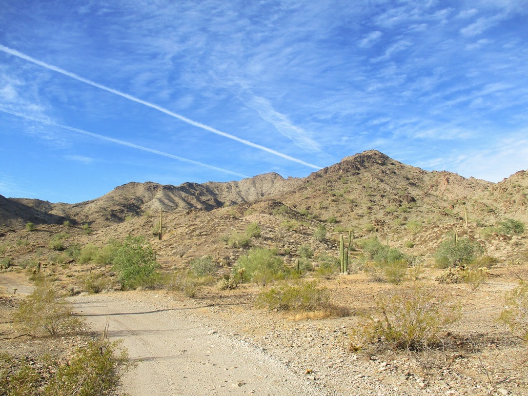
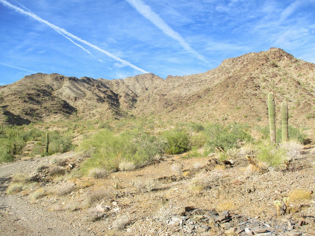
I followed a frontage road west (Dome Rock Road) to Cholla Road heading south. I followed the directions from the Grand Gulch blog to the letter and was able to find my way toward the peak without getting lost on the maze of mine roads out this way. The road conditions slowly deteriorated and I parked in a clearing near an arroyo crossing that I did not feel comfortable taking. However, I was over a mile farther in than I thought I would get, so I was happy with my progress. I was at approximately 1,300 feet elevation.
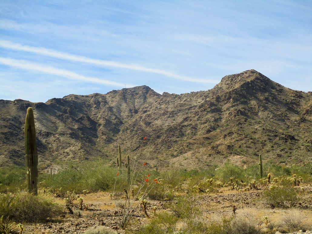
I got things packed, locked up the car and started walking at 9 a.m. sharp, the temperatures now a little more pleasant (low 50s). The day was clear with some high clouds. I just so happened to park where I could see the beacon up on the highest summit, southwest of my position. However, for most of the hike in, the beacon would not be visible, blocked by slightly-lower foreground peaks.
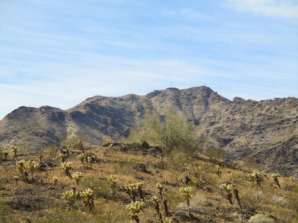
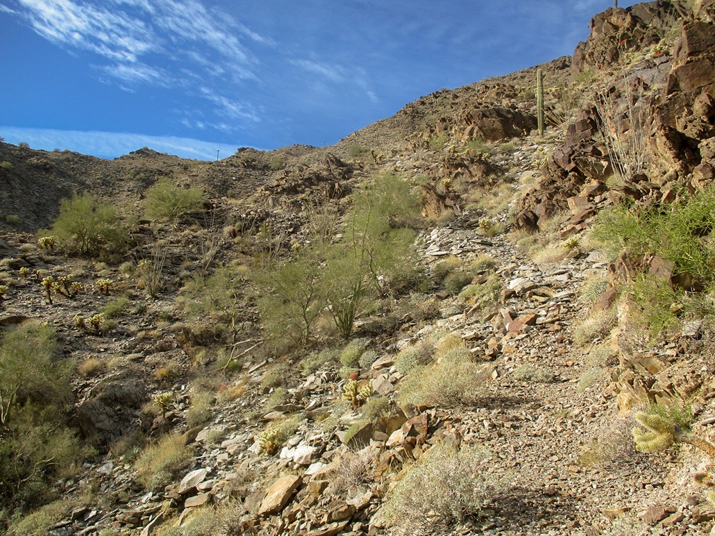
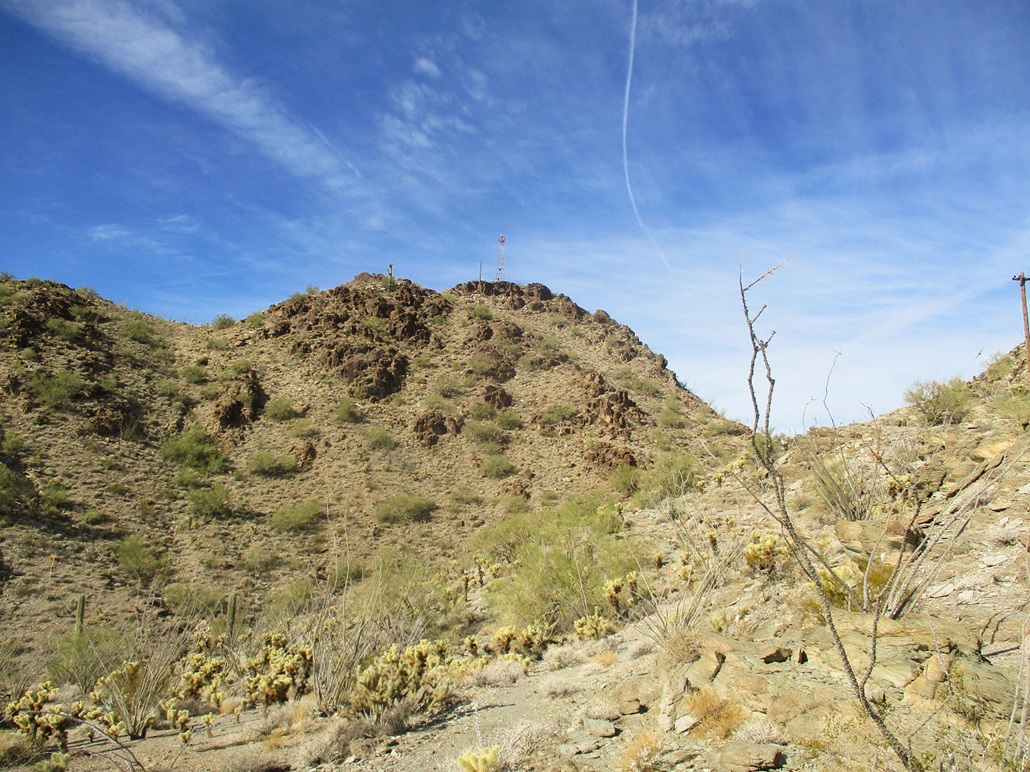
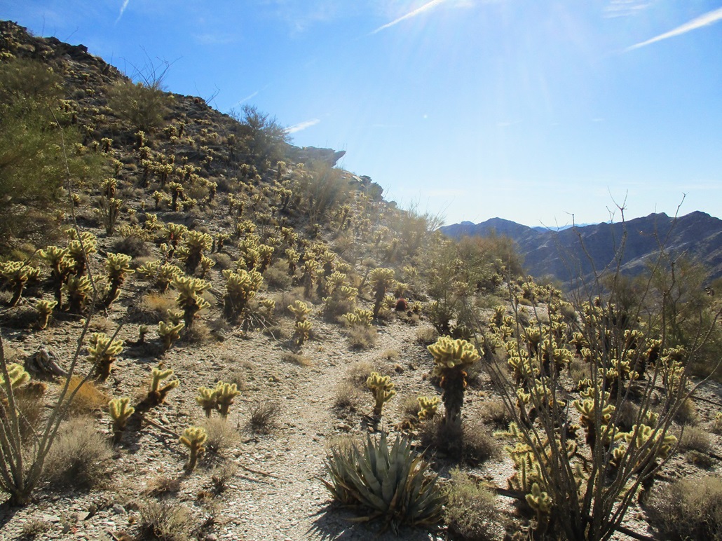
I walked the roads, following the directions carefully. The road heading southwest up the canyon devolved into a narrower track where a Jeep would be necessary, ending in a small loop. Here, a much rockier and narrower ATV track continues, angling right, then up steeply, for another quarter-mile until itself ends on top of a small nubbin, barely enough room for one ATV. I was at 1,800 feet elevation. Up on the highest ridge, I could see an old-style power-line pole (basically, a wooden pole and a small cross-beam at the top).
The trail continues from this ATV "parking" area, going steeply up to the right. I was unsure what to expect given the steep terrain and how often it is maintained. I assume (without proof) that it was put in to help service the beacon, but that was decades ago and who knows what kind of deterioration it might have by now. However, at first, the trail was surprisingly good. It was consistently steep, but wide, with an even foot-tread, covered in a uniform layer of rock shards and natural gravel. It was not covered in loose rock or with erosion channels deep enough to park a Buick in.
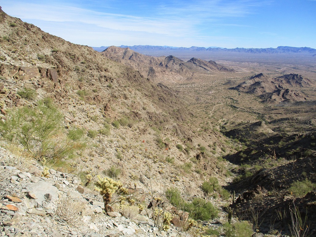
The trail is literally hewn into the steep hillsides, no small feat of engineering. In places, the lovely two-foot wide path was flanked by steep cliffs on one side, big drops on the other. I still had to move carefully as a fall could be very bad news. A few hundred feet higher, the trail reaches a promontory and makes a hard right. Here, one can see the trail make a long, steep sweep up the amphitheater of cliffs, aiming for a whitish-colored rock cliff up on the skyline near one of the power poles.
It is in this segment that the trail loses a couple points in quality. It narrows down to about a foot in places, gets rockier, and in a couple spots, was covered in scree creating unpleasant outward cambers and loose footing. One ten-foot segment seemed to have sloughed downhill entirely. I moved very slow here, sometimes inching across the sloppiest parts using all fives. Where the trail meets the lighter-colored rock, it makes two long switchbacks, then angles up to the power pole, then past it and up to the main ridge a few feet higher.
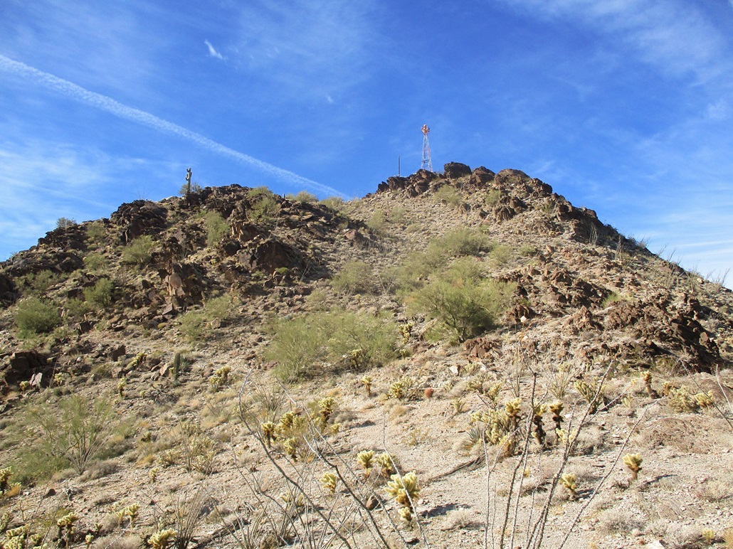
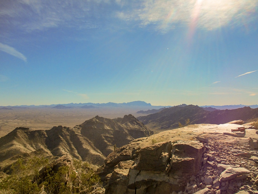
At the ridge, I could now see the summit again, with its big beacon. The terrain here was much friendlier with wider paths and not-so-severe drops to worry about. The trail swings west, crosses an easy saddle amid cholla cactus, then sweeps southerly across one last rock face before angling up and making one final turn to the summit. The last few feet was up a natural opening in the rock, forming a perfect ramp.
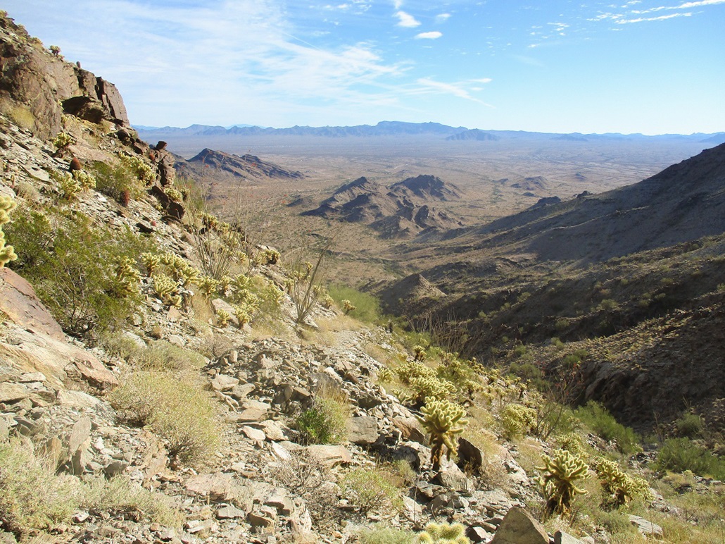
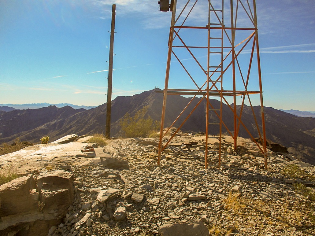
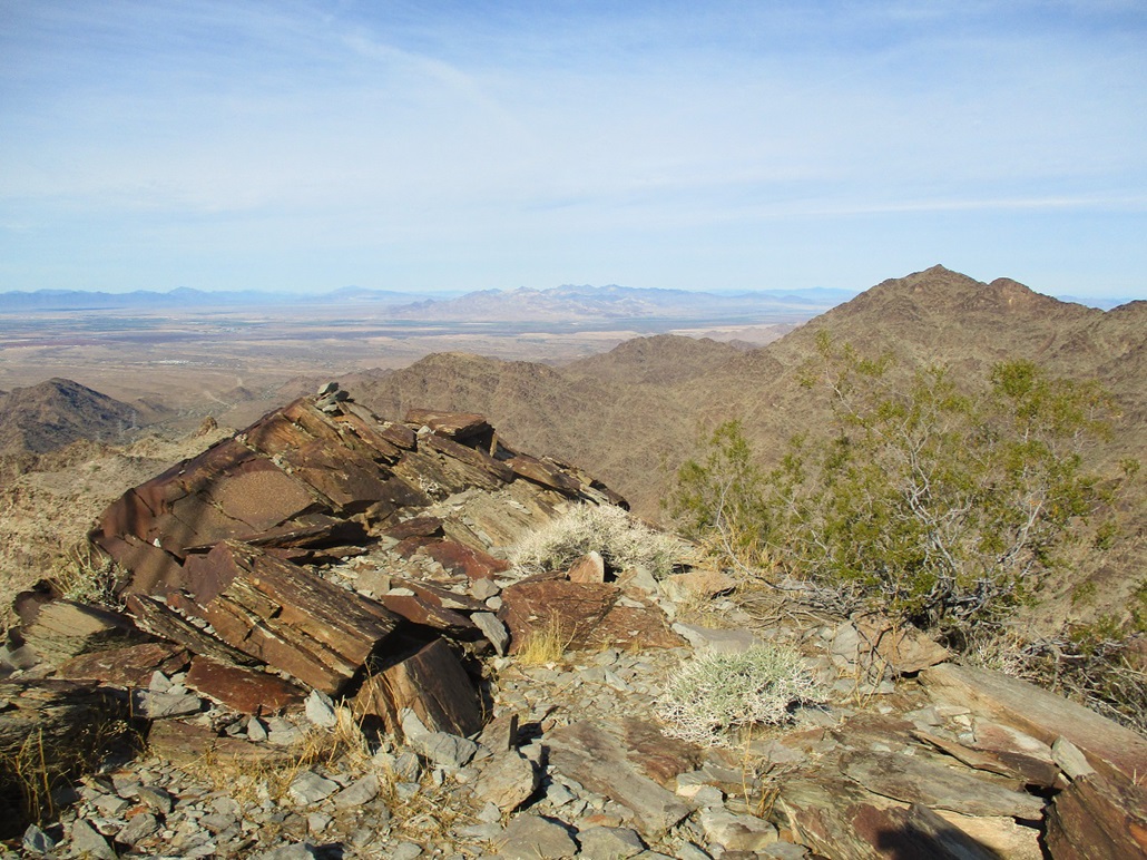
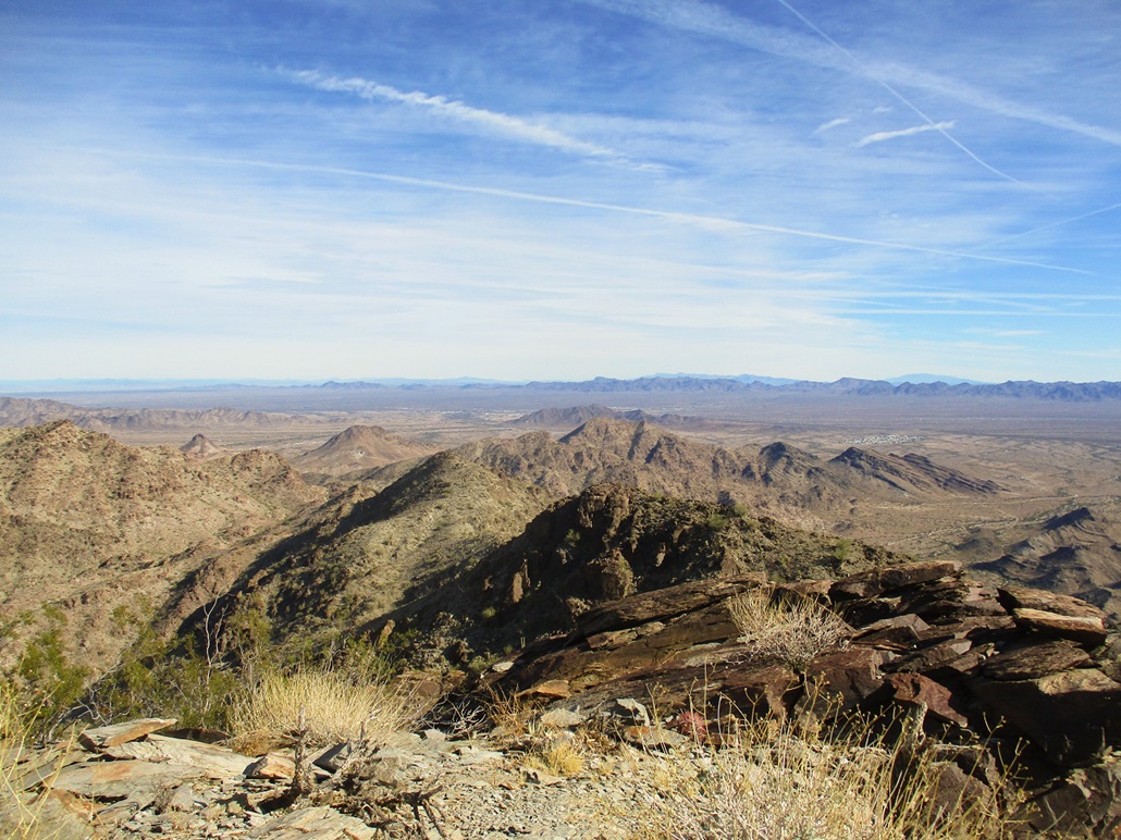
I arrived on top at about 10:30 a.m.. Up here, the breeze was stronger and chillier, but I had fantastic views all around, looking down into the deserts around Quartzsite and Blythe, across at peaks like Cunningham, Signal and Castle Dome, and other hills and peaks here in the Dome Rock Mountains. The beacon itself looks still in good shape. It is much bigger than I was expecting, probably 40 feet tall, probably more. I did not dare climb its ladder. I found a register in a rockpile nearby, set here about two years ago. I was the fourth person to sign in.
I spent about ten minutes up here, resting and enjoying the views. I looked for any other markers up top, but found nothing, and surprisingly little junk. It seems no one comes up here, certainly too much effort for the bums who like to spray paint and dismantle things. When I started to chill, I got moving downward.
I followed the same trail down, of course. In the narrow spots, I just watched my foot placement and nothing else, creeping down the trail at a slow but steady pace. I will admit it was easy to get a little vertigo looking up at the surrounding cliffs and slopes and the big drops below. But I moved carefully and had no issues at all. However, I moved about the same pace going downhill as I had coming up, at least until I was back to the ATV track. Once there, I could fast-walk the roads back to my car. I returned at 12:15, a three-hour and fifteen-minute round trip hike.
I stuck around to change into looser clothing for the drive out. Once back in Quartzsite, the area around the Love's Truck Stop was jammed, even worse than this morning. Lines of cars for the pumps extended into the main road, and it took awhile for me to get through the stop sign, thankful that one person waved me through since he knew I was stuck otherwise.
(This phenomenon always amuses me. It seems that people get gas at the closest gas station to an interstate, regardless of how crowded it is or the extra they pay in price. There are many other stations in Quartzsite, and driving an extra half mile would result in no lines and cheaper gas. For example, at Exit 1 on Interstate-10 just inside Arizona, there is a Flying-J that is always jam-packed, since gas in Arizona is usually considerably cheaper than in California. Yet, just five miles up the highway at the Tom Wells Exit is a Chevron that never has long lines. I never stop at the Flying J, and always stop in at the Chevron on Tom Wells.)
I took the scenic route home. The traffic was kind of heavy on the interstate, and I could sense it would get nastier once closer to Phoenix. Thus, I exited onto the US-60 and took that home through Wickenburg, then State Route AZ-74 and the Carefree Highway to Scottsdale Road and back south to home. I added some extra miles but probably saved two hours of traffic.
I looked up some information about these Airway Beacons, and they seem to have some followers who seek these out. This particular beacon is called the LOS ANGELES PHOENIX AWY BCN 23 and even has its own datasheet page. The beacons were established along major flight routes around the 1920s, lit up so that pilots had something to navigate by in the days before radios and certainly before GPS. These beacons became obsolete by the 1950s and most were dismantled, or have naturally fallen apart. But this one, here in the hot and dry desert, still stands. I am pretty sure the trail was put in to service the beacon and the power lines that supplied it, and probably was built with pack animals in mind. It is a trail that clearly took some time and effort (and a few sticks of dynamite) to put in.
|