Highpoints of South Dakota
www.surgent.net |
| Harney Peak aka Black Elk Peak |
• Highpoint: State of South Dakota • Highpoint: Pennington County • Highpoint: Black Hills |
 Bell Hill (Oglala Lakota County)
|
Date: May 24, 1996 • Elevation: 7,242 feet • Prominence: 2,922 feet • Distance: 6 miles • Time: 3 hours • Gain: 1,200 feet • Conditions: Heavy fog and spotty rain
Main
•
PB
The highest peak in South Dakota is known today as Black Elk Peak, but was called Harney Peak when I climbed it in 1996. I was in the Black Hills not by design, but because massive thunderstorms and twister weather had chased me away from Nebraska. The weather was not much better up here, but it wasn't nearly as bad as it was down south. Suddenly, Harney Peak was on my agenda. I stayed the night in Hot Springs.
Early the next morning, I drove to the trailhead parking lot, arriving early. The day was cool and foggy, and I was the first car in the lot, other than a lone work truck. However, there was no rain. I started hiking soon after arriving. The trail is easy to follow, well constructed and pitched at a lenient grade, so I made excellent time and arrived to the summit in slightly over an hour.
There was a guy there doing some welding repair. He was the guy from the work truck I had seen. He had to lug his welding gear up there, which wasn't easy. I had no views as a result of the dense fog. After a small break, I started my hike down, coming back to my car in about an hour. Including breaks, the hike had taken three hours, covering six miles.
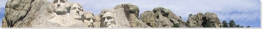
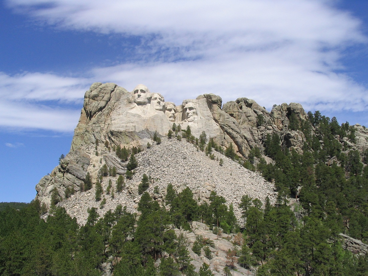
Since I was in the area, I wanted to visit other attractions. However, the fog shrouded everything. I drove to the Mount Rushmore site, and they let me in for free, which was awful kind of them. However, the joke was on me as I couldn't see the sculpted images through the fog.
I then began driving south, aiming to be somewhere near Kansas by sundown. The drive took me most of the day and was quite an adventure, which you can read about on my Kansas page.
Date: May 20, 2004 • Elevation: 3,718 feet • Prominence: 303 feet • Distance: 0.3 miles • Time: 10 minutes • Gain: 90 feet • Conditions: Cloudy but nice
PB
I was back in the northern High Plains, centering around the Sand Hills of Nebraska. I popped into South Dakota for a handful of county highpoints in the Black Hills around Sturgis and Lead.
Today had been a long day in Nebraska, so it was late in the afternoon when I entered South Dakota. I drove north through an awful town called Whiteclay, which sits on the Nebraska side of the state border. On the South Dakota side is the Pine Ridge Indian Reservation. The rez is dry (no alcohol), so Whiteclay exists solely to sell booze to the Indians. There's about a four-mile stretch of highway between Pine Ridge (the town) and Whiteclay. Numerous locals were walking this segment, some south to Whiteclay, some north with bags of booze in hand, and the rest just sprawled out wherever they fell. (Update: the liquor stores all lost their licenses in 2017, so Whiteclay is now dry. Bravo.)
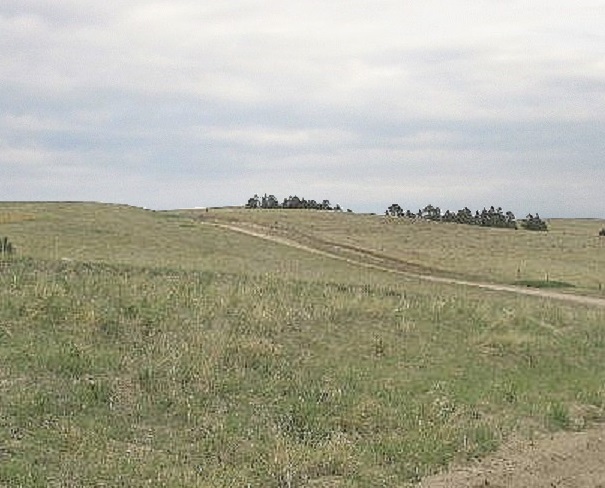
I drove through Pine Ridge, then north on US-18 to a dirt road going east. I drove in four miles and parked near a cattle grate not far from the presumed highpoint hill. The area is pretty, with rolling hills and grasses, spotted by a few trees. But trash is everywhere, as are burned-out cars. I didn't push my luck. I got out, ran to the top, looked around, and ran back. I didn't want to stick around. The whole place has an unpleasant vibe. I stayed the night in Hot Springs. A few storms kicked up and dropped rain as I drove.
Technically, Oglala Lakota County has five highpoint areas, but four are tiny blips nearby Bell Hill and sighted to be lower. Thus, I did not visit them. The county does not have a county seat. It was unorganized up until 1982, but it is so poor, it still contracts all county services to neighboring Fall River County. It is just one of two (I believe) counties outside of Alaska that lack a county seat.
Name change: In November 2014, voters in Shannon County elected to drop the name in favor of Oglala Lakota County. It became official May 1, 2015.
Date: May 20, 2004 • Elevation: 7,000 feet • Prominence: 763 feet • Distance: 6 miles • Time: 3 hours • Gain: 800 feet • Conditions: Fog, then pleasant
PB
I stayed at a small hotel in Hot Springs, and ate at the Elk Cafe in town, where I met an Australian couple enjoying their "holiday" in America. I lived in Canberra (in 1987) so it was nice to practice my Strine again with native speakers.
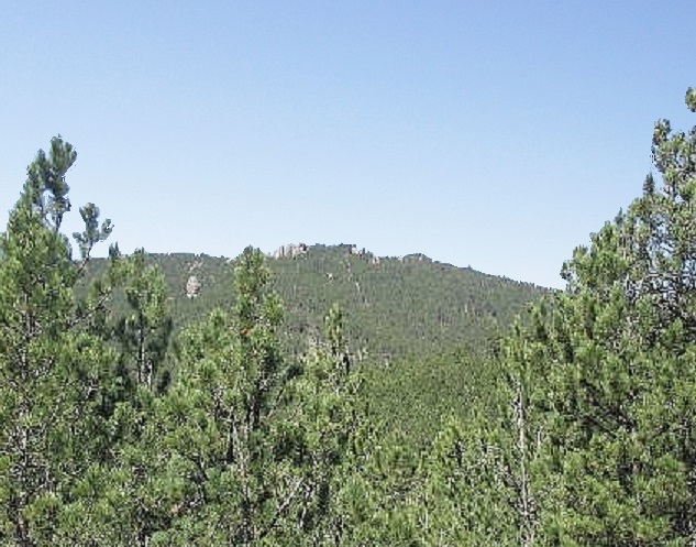
First on the agenda today was Sylvan Peak, located a few miles west of Harney Peak. Back in 1996, I had lots of fog. Today, I had lots of ... fog. Slightly bummed, I found the parking pullout southeast of the summit and set in for what was supposed to be a quick two-mile, one-hour hike through the trees to the peak and back. All I had was a poor copy of a map with no lat-long tick marks on it.
I started the hike at 7:30 a.m.. I followed a service road that switchbacks up the southeast ridge of the peak, ending at a small utility box. From here, I started up the steep hillside, heading north, and following white-painted blazes on the trees to remain on the "route". I did this and had no trouble at all. It was foggy, and in some places I had to search for the next blaze even though it may have only been about 20 feet away. Quickly, the route gains high on the ridge and passes directly below massive stone outcrops. Farther on, the route gained into a crook of these rocks and then periodically mingled with the rocks and trees.
All was well until about three-quarters of a mile in where I lost the white-painted blazed route. There were lots of downed trees here. I descended about 50 feet, crossed the cleared area and then, without any blazes to help me, figured I should go back up high to the ridge. This worked out well as I found the blazes again. After a couple more false summits I came upon the real summit, marked by a cairn and a small rock outcrop (nothing like those massive ones along the way). It had taken me 50 minutes to get here, with 800 feet of gain. The fog lifted and I stayed at the top for awhile for the views and a rest.
After a few minutes at the summit, I started down. I followed the blazed route for the few hundred feet it took to get me back to where the blazes had disappeared on my ascent. I spent about 15 minutes looking for the continuation of the blazed trees. No luck. I was starting to get a little concerned, and a bit annoyed that I was having trouble doing something that shouldn't be so difficult. But nothing looked familiar where I was. Finally, I made a command decision to start moving. I knew the main ridge went north and south, and with the sun still low I had a good marker for east.
I decided to proceed south. I kept walking, never finding those blazed trees again. As I descended, I got low enough to see the road below me. The descent went through moderate forest and rock formations. I descended low enough to hear traffic, and to where I could see a power line. Shortly, I was out to a dirt road underneath the power lines. I had a funny feeling of knowing exactly where I was, and not knowing where I was at all. But fortunately, my poor quality map showed a creek and drainage that seemed to agree with my reality, so I now could locate myself on the map.
I had actually hiked out almost two miles south from the summit, and put myself over a mile southwest of my vehicle. I was up on the highway's shoulder, still not 100% sure of where I was. I walked one way a few hundred feet and saw a sign for the city of Custer. Well, I knew I shouldn't go that way, and I now knew exactly where I was. I had a circuitous two mile walk along the highway to get back to my vehicle. The hike back to my vehicle went reasonably fast, and I had plenty of time to think about how I'd messed up. I arrived back to my vehicle at 10:30 a.m., exactly three hours after I'd started. I was fortunate that I brought along an extra water bottle. The hike came out to about six miles round trip instead of the two I had planned for.
I took an extended break at the vehicle to change and relax. I was actually really relieved to be back, and out of the forest. My next highpoint for the day was over in Meade County, amid worsening weather.
Date: May 20, 2004 • Elevation: 5,460 feet • Prominence: 160 feet • Distance: 2 miles • Time: 1 hour • Gain: 650 feet • Conditions: Storm building with lightning and thunder
PB
The weather so far today had been rainy and foggy, then clear and nice, but now, around noon, it was getting cloudy again: the big puffy kind that forms over the peaks, potential thunderstorms. I was eyeballing an unnamed peak, the highest point of Meade County. Still a little dazed from this morning's adventure, I wanted to jump right back in the saddle and hike something.
The highpoint hill is not obvious. Nearby Flagstaff Peak is the most well known peak in the immediate area, while higher peaks are nearby but in neighboring Lawrence County. Other than its status as the Meade County highpoint, it doesn't do a whole lot to attract attention to itself. The access to this peak is along paved Forest Road-26 north of Nemo and accessible south out of Sturgis. I parked at a large pullout that is northeast of the peak and beside a stream. I arrived at 1 p.m., in weather that was mostly sunny but definitely getting more threatening.
I descended the grassy banks off the highway, scooted under a fence and crossed the small stream. Climbing up the other side, I came to a thick mesh of downed trees, grasses, doghair thickets and lots of undergrowth. Going mainly on instinct, I started up a ridge and bashed my way up the steep slope until after 50 vertical feet, the forest became less thick, which was a relief. The gradient was still steep, but now navigation was easier.
The peak is crescent shaped, and the route I was following goes up one of its main ridges. Shortly, the grade moderated and became flatter. I was near the top, but I had to make a right turn and walk west about 300 feet in thick forest to cover the top sufficiently. I found a large tree with a pink surveyor's ribbon tied around it that seemed to indicate the top. After a few minutes, I started back down. The hike down went fast, and I had no trouble with route-finding. Along the way I was treated to thundering booms and some lightning. A storm was building.
The round trip covered two miles and 650 feet of gain in an hour. I named this peak after a prominent gulch at its base, Virkula Gulch. I was forced to lay low by heavy thunderstorms with big hail for a few hours. Later this afternoon, I visited one more county highpoint, in Lawrence County.
Date: May 20, 2004 • Elevation: 7,137 feet • Prominence: 517 feet • Distance: 2.5 miles • Time: 90 minutes • Gain: 50 feet • Conditions: Clear with hail pellets everywhere
PB
The storm really kicked up, dropping baseball-size hail, so said the radio reports. I was not in that specific area, but it was just as bad where I was, and I was happy to see it break up and move along. There was still a few hours of usable daylight left, and I figured I may just get lucky enough to visit Crooks Tower in Lawrence County.
Crooks Tower is a small set of rocky spires, grouped close by one another, accessible via vehicle from their backside, which is the way I approached. A sketchy forest road leaves the main road and climbs to these knobs. The storm had soaked all the roads but traction was good, until it immediately became slick, so not wanting to chance anything, I parked and walked to the highpoint areas. I had actually driven to near the Crooks Tower hills, on (supposedly) the highest street-legal road in South Dakota. The hike to the top went quickly, and I visited two hilltops of near-equal height. This journey took just a few minutes and wasn't very interesting, but the views down into the meadows and forest below were lovely.
A third area is about one mile southwest along the main road. Normally I'd have driven the road and then walked out into the forest to visit the last area. However, this road had also become a muddy mess. I was able to drive down from the first two areas but I did a lot of slipping and sliding and spinning of wheels to do it. I decided not to chance fate and parked, meaning I'd have to walk.
I walked beside the road south and west, often forced onto the muddy road by the heavy brush. Finally, I was at a point east of the last area. I entered the forest and walked about 0.3 mile. The ground continued to rise ever so consistently, so I went pretty far, almost to the west edge of the contour area, to be sure I found the highest area. Hail balls from the storm were still in the grass, looking like patches of snow. The weather was clear and cool and rather nice, all things considered. I returned to my vehicle and got back to the main highway (US-85), where I had enough daylight to visit one more easy highpoint in Wyoming before settling in for the night in Lead.
|


|