The County Highpoints of Nebraska
www.surgent.net |
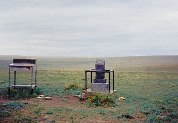 The Nebraska State Highpoint marker. Kimball County, 1996
|
I visited Nebraska's state highpoint in 1996, two steps ahead of the twisters. I returned in 2004 to concentrate on the Sand Hills in western Nebraska. I was pleasantly surprised how scenic and how challenging some of these hikes were. Weather mostly held together, as I had no twisters to run from.
Date: May 23, 1996 • Elevation: 5,424 feet • Distance: 0.1 mile • Time: 10 minutes • Gain: negligible • Conditions: Ominous black skies, tornado warning in effect
Main
•
PB
My goal on this trip were the state highpoints that border eastern Colorado, those being Nebraska, Kansas and Oklahoma. I flew into Colorado Springs, got my rental car and followed Interstate-25 into Wyoming. The weather was unsettled and by the time I arrive into Cheyenne, the clouds had built into ominous thunderstorms. I bided my time in Pine Bluff, on the Wyoming-Nebraska boundary, having lunch and listening to the radio for weather reports.
About noon, I decided to make a run for the highpoint of Nebraska, a rise in a pasture, near where Wyoming, Nebraska and Colorado meet. I followed local roads to get to the small parking area set aside for the highpoint, dubbed Panorama Point. The sky was black with storms, but the rain was barely above a light sprinkle. It was breezy and dark, as if the clouds were still amassing for the upcoming fight.
I didn't spend much time here, just enough to tag the marker, snap lousy photographs, and hustle my butt back to paved roads, fearing the rains may strand me on the muddy farm routes. I rolled into the town of Kimball, Nebraska. The weather was still menacing: reports indicated tornado warnings in effect for Kansas and east Colorado, which is where I was heading next. Not anymore I wasn't. I decided to head north to the Black Hills of South Dakota, and let the bad weather pass.
The drive to and from the Black Hills of South Dakota was spectacular, and I was thoroughly impressed by the Sand Hills. I noted I'd like to come back here some day in the future, which brings us eight years later, to 2004...
Date: May 18, 2004 • Elevation: 3,760 feet • Prominence: 100 feet • Distance: 1 mile • Time: 20 minutes • Gain: 160 feet • Conditions: Cloudy and cool
PB
I started this trip with a handful of easy Colorado and Kansas plains county highpoints. By mid-morning, I entered into Nebraska in Dundy County, near the Kansas-Colorado-Nebraska state tri-corner.
In Haigler, Nebraska, I drove west on US-34, and slowly, the land changed character, from flat grassy pastureland to low rolling hills. This is the southernmost appendage of the Sand Hills. The highest point in Dundy County is atop one such sand hill, located near the Colorado boundary. I had to re-enter Colorado, and most of the approach driving was from Colorado.
From the junctions of (Yuma County CO) County Roads RR and 46, I drove east, re-entering Nebraska, the line marked by "Dundy County" written on an old tire. The road became sandy and I was able to ease in another couple miles, parking south of the highpoint hill. There were no fences or signs against trespassing, so I parked and started my hike.
I hiked a straight-shot up the scrub-covered slopes, a mix of low grass, cactus and woody scrub no higher than my shin. I was on top in moments, looked around, but couldn't see much in the foggy mist. I returned to my car, gone a total of 20 minutes.
Elevation: 3,742 feet • Prominence: 162 feet • Distance: 3 miles • Time: 1 hour • Gain: 250 feet • Conditions: Cloudy
PB
From Dundy County, I drove north into Chase County, using roads inside Colorado. Re-entering Nebraska near US-6, I followed Chase County Roads 739 and Avenue 312 to a point along Avenue 312's alignment that ended inside a fence on the far end of a farm field. I could see no buildings and there were no signs against trespassing, so again, I felt good about being here. Nevertheless, I left a note in my windshield in case anyone came by.
The highest point is Lamar Hill, a big dune located 1.5 miles south. To get there meant a hike across fallow pastureland, crossing a couple fences, and up-and-down hiking through the lower sand hills. In time, I had come upon the summit and its benchmark, but the foggy mist shrouded any views I might have enjoyed. I tagged the top and immediately started my return hike.
Back to my car, I was gone for an hour. So far, Nebraska was treating me well, and despite the gloominess of the weather, I was enjoying these sandy hills.
Elevation: 3,645 feet • Distance: 0.1 mile • Time: 30 minutes (drive) • Gain: negligible • Conditions: fair
PB
Perkins County comes next, north of Chase County near the crook where the northeast corner of Colorado juts into Nebraska. Unlike Dundy and Chase counties, the sand hills take a break here. The county is flat and featureless. Its highpoint(s) are along its western boundary, and handful of 3,645-foot contours spaced along the dirt road separating the two states.
From the town of Venango inside Nebraska, I followed NE-23 north, then west, and at the state line, turned right (north) onto the dirt road. The first area is six miles up this road, two more come at 12.2 miles, and the last area at 14.8 miles. In each case, I got out, looked around, stepped on the Nebraska side of the road, and tried in vain to sense any rises. Truthfully, it all looked the same to me.
Elevation: 3,900 feet • Prominence: 140 feet • Distance: 1 mile • Time: 1 hour • Gain: 200 feet • Conditions: Cloudy
PB
From Perkins County, I drove to the town of Big Springs. I topped the gas and had lunch. Next on my agenda were the highest point(s) of Keith County, two areas located near McConaughy Lake. I followed US-138 to US-30, then a local road called Day Road to US-26, and east to the Keith county line. The land here was broad grassy hills. I don't think these were sand hills, though.
The first (eastern) area was easy, a short walk across a fallow field to the edge of the bluffs. From here, I could see the second area about a half-mile away along a ridge. Parking and fencing proved to be a small issue, but I was able to find a clearing where I could park off the road and where the fence opened for a rudimentary two-track road. I walked in, then veered line-of-sight to the high area, traversing up steep slopes to get there. Once on top, I paced the grounds and then started the hike out.
Rather than retrace my route, I bee-lined for the road, and while scaling the barb-wire fence, fell awkwardly onto the other side, conking my head rather hard. For the next day or two, my neck was sore and jaw was tight. I might have had a small concussion. In any case, I was back to my car and on my way.
Elevation: 4,060 feet • Distance: 0.6 mile • Time: 15 minutes • Gain: 30 feet • Conditions: still cloudy
PB
From Keith County, I drove west to neighboring Deuel County. The highpoints are two hills in the southwest corner, about nine miles southwest of the town of Chappell. South of Chappell, I followed County Road 10 west for seven miles to the county line, and the junction with County Road 151. The first hill is a short drive south on CR-151, and the road tops out near the highest spot. I parked and walked into the field.
The second hill is about a mile southwest. I drove around to the western side and noted the open access, but then tried the eastern side where it would be much closer. A sign near the road seemed to indicate that public access along the section road was allowed. I walked west along a two track for 0.3 mile, then walked up the hill, which sits on a public hunting parcel. The southern hill seemed to be more pronounced than the northern one.
At this point, I re-rentered into Colorado, with enough daylight for two more highpoints in that state. This was it for today. I fell asleep at a hotel in Sterling, Colorado, utterly spent. I visited eleven county highpoints today in Colorado, Kansas and Nebraska.
Date: May 19, 2004 • Elevation: 4,721 feet • Distance: 3 miles • Time: 50 minutes • Gain: 30 feet • Conditions: Pleasant
PB
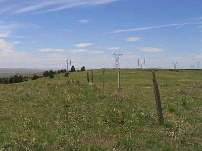
Today started sunny with blue skies, different from yesterday's misty gloom. I had more hills to explore, so I started early and was driving by 7 a.m., with Cheyenne County's highpoint first on the list. From Peetz (CO), I followed county roads and parked at the junction of Logan County (CO) Roads 21 and 78, putting me six-tenths of a mile south of the Nebraska boundary.
I walked north on a dirt track to a fence line, being the state boundary. I stayed straight, then followed another fence east, then north again. Going by the map and my GPS, I was near the Cheyenne County highpoint, a soft rise in a field straddling the Kimball and Cheyenne county line. I walked around to be sure I had given the area sufficient coverage. The relief was slight but noticeable.
I left the same way, the walk totalling 2.2 miles and taking less than an hour. I returned to my car, then visited the highpoint of Logan County, Colorado, before returning into Nebraska.
Elevation: 5,340 feet • Distance: 0.8 mile • Time: 1 hour • Gain: 50 feet • Conditions: Nice, some cloudiness
PB
Banner County is a curious place, consisting of one tiny town (Harrisburg, population about 60), a bunch of far-flung ranch properties, and a total population in the hundreds. During the Cold War from the 1940s through the 1980s, it was home to a number of missile silos housing ICBMs.
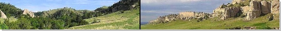
The land is a mix of grassy pasture and eroded sandstone formations, some of which are quite impressive and beautiful. The county highpoints are spaced along the western boundary with Wyoming. Two areas lie atop one bluff, and another on a low, long hill near a farm.
From Logan County in Colorado, I drove north to Kimball on Interstate-80, then west into Pine Bluff, Wyoming, then north on Wyoming state route WY-215, which included a 15-minute forced break as I waited out a slow-moving train crossing the highway. I drove to the small bluff sitting along the Wyoming-Nebraska border. Hiking to the two highpoint areas was easy and took just a few minutes.
From here I drove north 4 miles, following County Roads 1 and 16, parking north of the gentle hill that sits on the Malm property. I walked an open, unfenced and unposted grassy slope to the top, then back down. This hill (to me) is probably the actual county highpoint.
I stayed on the local road net, heading east through the canyon country of Banner County. Soon, I entered into Harrisburg, and just as fast, exited. Now on state route NE-71, I continued northbound toward Scotts Bluff.
Elevation: 4,930 feet • Prominence: 200 feet • Distance: 0.1 mile • Time: 10 minutes • Gain: 40 feet • Conditions: Pleasant
PB
Entering into Scotts Bluff County, the land became noticeably more varied. There are hills, sandstone monoliths, bluffs and canyons, intermixed with grass rangeland and sections of forest. During the 19th-Century, west-bound travelers passed through the area, using its unique formations as landmarks. These days, Scotts Bluff is the biggest city in western Nebraska.
The highest point(s) are seven separate 4,930-foot contours spread out along the broad ridges of the Wildcat Hills, south of Scotts Bluff. From route NE-71, I drove Carter Canyon Road west past ranches and homes, gaining onto the highlands. Once past a big ranch spread, I parked near an unlocked gate, centrally located among the seven areas.
The areas are clumped closely so that it's easy to narrow the field to one or two, and previous visitors had deemed one particular area as the highpoint. I got my boots on for the short walk, and at that moment, a guy rolls up in a county truck. He was the county surveyor, doing some work in the area. Naturally, I asked him about the county highpoint. Not only was he aware these were the county highpoints, he verified the one area I was interested in was in fact the true county highpoint. We talked briefly, then parted ways as he had business to attend to.
It's rare to get in-the-field confirmation from the county surveyor, so I felt lucky. The hike itself was easy, covering a few hundred feet and less than 15 minutes. The top held a small cairn and sign-in log. Next on my agenda was another county highpoint in the same Wildcat Hills, over in neighboring Morrill County.
Elevation: 4,600 feet • Prominence: 40 feet • Distance: 7 miles • Time: 3 hours • Gain: 800 feet • Conditions: Good, with some clouds and a sprinkle of rain
PB
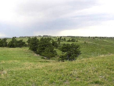
Traveling east, I followed county roads into the Flying Bee Beefmaster Ranch, north of the long spine of the Wildcat Hills. The nine separate areas comprising the Morrill County highpoint lie atop the hills. This journey was going to require some actual work, starting with getting permission to enter the hills.
I parked in an open area and started looking around for the landowners. I heard activity in a barn, and walking in, found some people working on the cattle, doing medical checks (so far as I could tell. Not that I actually know anything about ranching other than I like steaks and prime rib). I met Ms. Kinnaman, and she was kind enough to grant me permission to enter into the hills behind their property. The Kinnamans allow visitors and even have a small camping area set aside. The area is especially popular with horse-riders. I paid her a fee, and told her my intentions. Their property sits inside Banner County, while the Morrill County highpoints lie just east of the county line. She gave me the number of that landowner. I called her up, got the okay, and I was all set. From the ranch headquarters I went east a half-mile then south a half-mile to a cabin and campground area, the entryway into the backcountry.
At the end of the road near the camping area, there is a cattle grate and a vehicle track that leads into the hills. I drove in about a mile and parked at another fence-line and gate, starting my hike at 3 p.m. I walked another three-quarters of a mile to where the road dipped into a draw. The main road, called "Road 1", goes to the top of the hills, but not in the direction I wanted. Instead, I found a scanter track and followed it, but it petered out amid knee-high grass. I then hiked directly up-slope until I was on top the crest of the hills. To here I had walked about 1.5 miles, and was still over a mile west of the Morrill County line.
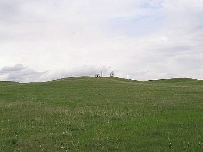
Up here, the road meandered, dipping into and out of many small ridges. The scenery is astounding, a park-like setting of gentle hills, grass, occasional trees and shrubs. I moved quickly east, with a small concern about the time, and the fact that the nine candidate areas were spread out all over the place. Two areas come first, and ascending one small rise, confirmed that the other area slightly north was lower. I wouldn't need to bother with it.
The remaining seven areas were about another mile east. Once there, I ascended hilltops and sighted to nearby hilltops, systematically removing some from consideration while strengthening the cases for the ones I ascended. I left the area convinced I had covered all bets. From my vehicle I had hiked 3.5 miles, and the consistent up-and-down terrain tired me. I was moving fast for a couple other reasons: it was getting late and some very light rain was starting to fall.
The hike out took a little over an hour, and I was back to my vehicle at 6 p.m.. I had not expected the hike to be this lengthy. However, I am happy I made the effort, as these hills proved to be the prettiest hike of my whole trip, and I had a wonderful time. My thanks to the Kinnamans for their hospitality.
Done for the day, I drove east into the heart of the Sand Hills, and stayed a night at a hotel.
Date: May 20, 2004 • Elevation: 4,170 feet • Prominence: 280 feet • Distance: 3.5 miles total • Time: 3 hours exploring • Gain: 500 feet total Conditions: Pleasant
PB
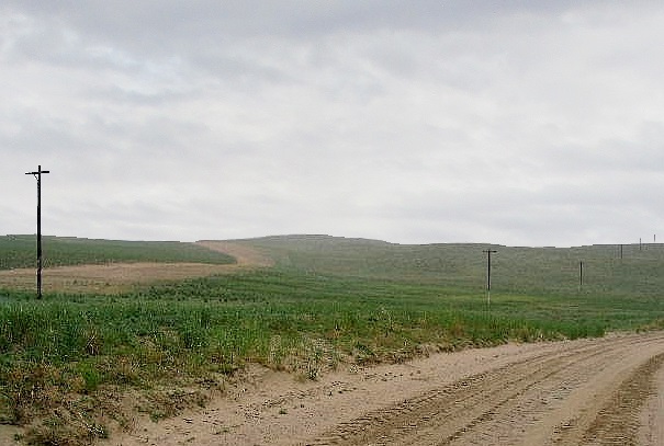
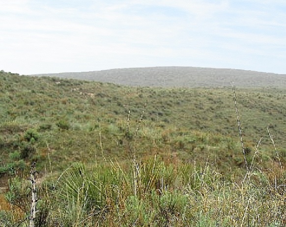
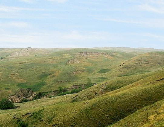
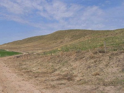
Fresh as a daisy after a night's sleep, I was ready for real Sand Hills hiking, something I'd been looking forward to all trip. Alliance is a big city (10,000 people), built on a patch of flat ground like an island amid the wildly convoluted Sand Hills that surround it. The Sand Hills can sometimes be long smooth hills or abrupt pointy dunes, which from afar has the effect of being in a stormy ocean of sand waves.
A number of counties (and ergo, county highpoints) lie within the Sand Hills Complex. The occasional town is usually a tiny place, a few old homes, a tiny business district, and services vital to the area ranchers. Some county highpoints out here are on private lands, a few have good public access, and others are uncertain. I kept to mainly those I knew had good public access, although I cannot guarantee I was always on "public" land. There are few fences, few signs and fewer people. Each was a calculated gamble.
First up were the two contending hills for highpoint honors of Garden County, east of Alliance. I drove 45 miles along highway NE-2, the main thoroughfare through the Sand Hills. I drove until I came to the Sheridan and Grant county boundary, then right (south) immediately thereafter, a sign mentioning the Rex Ranch.
This local road is paved but only one car-width wide, and the pavement was torn up, too. Thus, the five-mile drive to the first hill took awhile. I drove onto a track toward a hill overlooking Longfellow Lake. I had to pass one gate early on (unlocked, no signs) and another single-strand wire gate. Using my GPS, I pegged my location, and ascertained that the hill I thought was the county highpoint is actually the correct hill. Everything looks the same.
I hiked south along a track, then hopped a fence and then had to cross a wet bog. I could see no easy way around it, so I walked through it, soaking my shoes and pants to about the knees. It was very uncomfortable. I crossed another fence then hiked up the hill, scaring cattle along the way. The stupid beasts wouldn't run away. They kept running a few feet ahead of me, as though they knew of my intended path already. This went on for awhile, but finally, as I neared the top, they went to the side. The top was lovely, as were the views of the sea of green-covered Sand Hills.
Looking down from where I came, I saw that if I followed a west bearing, I could cross the small stream and bog where it narrowed. This worked well and in a matter of minutes I was back to my car. This hike had taken about an hour and covered 2.5 miles. The wetlands support many bird species including hawks, geese, ducks and cranes.
Momentarily, I was back onto that narrow paved road, I proceeded south another six miles to the other highpoint hill. The pavement ends but the road was hardpack and easy to handle. Fortunately, the southern hill is along the road, so the hike was faster, although steep and sandy. Here, the ground was more scrubby, less grassy, and more barren. Once on top, I tagged all the little hilltops and then returned to my car, "sand-skiing" down the steep slope.
Together, these two hikes encompassed 3.5 miles and about 25 miles of driving, to and from state route NE-2. Back at the highway, Grant County's highpoint was conveniently right there across the highway.
Elevation: 4,223 feet • Prominence: 317 feet • Distance: 2 miles • Time: 1 hour • Gain: 250 feet • Conditions: Rather nice
PB
I parked near a utility hut just a few feet off of NE-2. Ashby Hill, the highest point of Grant County, is north of the highway. There are about 8 or 9 separate areas that reach 4,200 feet on top of this hill inside Grant County, but previous visitors suggested the hill with the short tower may be the highest. With that in mind, I chose to beeline toward that hill first and assess from there.
I crossed the highway, then shimmied under a fence, then ... carefully downclimed a steep sand bank that led to two pair of train tracks. These tracks see regular use, as they parallel the highway, and on my drive in this morning I'd seen some trains hauling coal ore rumbling along. As I descended I could hear a train whistle so they were close by. But it only took me a few seconds to cross both tracks. I climbed the other sand bank, shimmied under another fence, and began the relaxing portion of the hike.
The easiest route seemed to lead me up to a noticeable hill east of the tall radio tower and west of the short one. Once on top of this hill, it was plainly obvious I was higher than the hill with the tall tower but lower than the hill with the short tower. I followed a gravel road and walked to the short tower's hill, where I found the "Ashby" benchmark nearby. No doubt about it, I was higher than the other nearby hills. After a few minutes of looking at other hills, I walked down, retracing my steps. The round trip covered about 2 miles, gained about 250 feet and took less than an hour. From here I headed north and west to the Sheridan County highpoint.
Note: a later visitor repeating my route got himself in trouble by the local police. Crossing the railroad tracks is legally forbidden. The cop happened to see his vehicle and wondered what was going on. Hikers to this part of the state are rare, so he had some extra explaining to do. In any case, use your judgement. As I qualified myself earlier, I cannot vouch that all these hills have public access.
Elevation: 4,300 feet • Prominence: 400 feet • Distance: 3.5 miles • Time: 75 minutes • Gain: 500 feet • Conditions: No complaints
PB
After descending Ashby Hill, I drove west on NE-2 to the town of Ellsworth and the junction of highway NE-27. Ellsworth is notable as the "company town" of the Spade Ranch, one of the biggest spreads in Nebraska during the late 19th-Century. The Spade Ranch had a habit of fencing off public lands and declaring them their own before President Teddy Roosevelt put a stop to that practice. The Spade Ranch is still in existence, and Ellsworth features some historical markers and an old general store from that era.
Sixteen miles north of Ellsworth along NE-27, I spied Morton Hill, the highpoint of Sheridan County. It's a big and broad hill, covered in low grass and few trees. I drove to where the highway crested near the hill, and parked. I started the trek at noon, the weather calm and pleasant. I hiked a slope, crossed a fence, then disappeared down the other side of the slope. A fence runs east-west along the spine of Morton Hill, and I followed it up and down the hills, moving from the south side to the north side. I kept at this, hiking into and out of many gulches, going with the lay of the land.
After 30 minutes, I was near the west edge of the hill, nearing the summit. A previous report had indicated that the highpoint won't be obvious until the very end, which was true. I tracked myself carefully on the map, and when near the top, it became obvious. I had to squirm through the fence, then run the hundred feet to the top. I tagged the top and returned back to the north side of the fence. On the hike out, I spooked some cattle, and once past them, I took a rest amid the grass in a saddle between two small hills Then, shortly, back to my vehicle.
The round trip hike was nearly 3.5 miles with a net gain of about 300 feet but close to 500 gross feet when the drops and gains are considered. From here, I doubled back into Alliance for lunch, a rest, a call home, and a visit to Carhenge. I was beat, having hiked over ten miles today. The remaining highpoints were all simple affairs up near the South Dakota border.
Update (2024): It appears that (via Lidar) another hill in the area is higher by about three feet, so Morton Hill may no longer be the county highpoint. Apparently, the landowner of Morton Hill is not very welcoming of hikers, so this may be for the general good. My report above was written in 2004 and should be read for its historical aspect only. It may be a good idea to give this hill a miss if in the area.
Elevation: 4,630 feet • Distance: drive up • Time: 2 minutes • Gain: Mere inches • Conditions: Fair
PB
After Carhenge, I drove north and west towards South Dakota, but along the way I wanted to visit two easy highpoints, a welcome respite from the tiring hikes I had imposed on myself so far today.
Box Butte County's highpoint is along its western boundary south of state route NE-71. It's nothing more than a rise along a farm road. I drove to the two candidate areas, walked them both for a few moments, and that was it. The name of this highpoint is based on the nearby "Posvar" Benchmark, located west in Sioux County.
Elevation: 4,820 feet • Distance: 0.2 miles • Time: 10 minutes • Gain: 30 feet • Conditions: Cooling with a breeze
PB
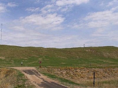
Next, I drove north into Dawes County via NE-71 and NE-2, passing by the tiny community of Marsland. Shortly after passing the county line, I followed River Road and Diehl Road to West Belmont Road west and north to the Dawes-Sioux County line, where I went north on an unnamed road into a set of pine-covered hills. The Dawes County highpoint is a mile up this road, where it tops out near an official-looking antenna complex. I walked east past a fence and jogged up a small hill to the top where a telephone pole stood. Although there are five candidate areas, this area is undoubtedly the highest. A cairn was also at the highpoint.
I kept my visit short. The wind was blowing hard and getting cold, and I was in shorts and sandals. I jogged back to my vehicle and got moving, heading north into South Dakota where I visited one more highpoint in Oglala Lakota (Shannon) County before getting a hotel for the night in Hot Springs. The next two days were spent seeking highpoints in South Dakota and Wyoming, and avoiding big hailstones. On my way back south, I visited one more Nebraska county highpoint, in Sioux County.
Date: May 22, 2004 • Elevation: 5,255 feet • Prominence: 235 feet • Distance: 2.5 miles • Time: 1 hour • Gain: 200 feet • Conditions: Cool
PB
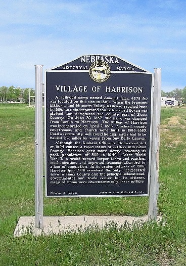
I was returning to Colorado from South Dakota, so I entered Nebraska one more time to visit the highpoint(s) of Sioux County, a series of hilltops informally known as the Kennedy Bluffs. It had already been a long day for me, starting in Lead (SD), then a long drive to Lusk (WY), then east to Harrison, county seat for Sioux County. Sioux County is a large county in area, but with barely a thousand people total, of which half live in Harrison. The skies were unsettled with heavy clouds and developing storms.
The Kennedy Bluffs lie north of Harrison a few miles. I followed local roads northwest to the Kennedy Bluffs, which form into a big U-shape about a mile from the nearest roads. While scouting the area, I happened upon a man in his truck, so I approached him and explained my intentions. He had no problem with me being there, but explained that the land on which the Bluffs stood belonged to another person. He gave me his name and where he could be found. I thanked the man and went back into town to get permission.
Back in Harrison, I found the landowner working at the local hardware store. He was friendly and seemed to have no problem with my request. He granted me permission and drew me a little map of some of the lesser roads I could follow. I thanked him sincerely, and went on my way. I re-drove the roads from Harrison to the Bluffs.
Following the landowner's directions, I entered his property via a gate, then drove a two-track etched into the grasslands about a mile to a point south of the eastern hill. The road was getting rutted and I didn't want to chance going any farther. I was close to the hills and started my hike soon after parking.
There are 27 separate areas that reach above 5,240 feet. Two are located a mile to the west and are conclusively lower than any of the 25 other potential highpoints grouped in the Kennedy Bluffs. Thus, I could keep to these Bluffs and not bother visiting the western bumps. Twenty-five candidates sounds like a lot, but in truth, most were immediately excluded by sight-leveling from atop the various hills. What I did was climb to the first hill, then immediately climb to any higher hill nearby. Each time, I would look around and exclude the lower hilltops, while bee-lining to the next obvious higher (or nearly-as-high hill). In this manner, I hike the whole "U" shape, from east to west, from hill to hill, systematically excluding some from consideration and stepping on any one that might have been a contender.
This routine worked well. Some of the hilltops had small sheds or other buildings on them. The views were nice, but the breeze was chilly. I didn't stop much, making the big looping hike in an hour, covering 2.5 miles. I exited feeling nearly certain that I had at some point stepped on the true highpoint, although I can't say exactly where or when.
From here, I drove back to Harrison then into Lusk, where I had lunch. It was nearing 3 p.m., and I wanted to visit one more county highpoint, this one near an FAA radar dome in the Rawhide Hills of Goshen County, Wyoming. The weather was cloudy with some rain, but nothing serious to concern me. I was successful on my later hike, and eventually ended the day in Laramie, Wyoming.
In sum, I visited 15 Nebraska county highpoints, some of which gave me a good workout, and I had a lot of fun. This is a pretty area of the state. I'd like to go back for some in the center of the state but it's not high on my priority list right now.
|


|
(c) 2019 Scott Surgent. For entertainment purposes only. This report is not meant to replace maps, compass, gps and other common sense hiking/navigation items. Neither I nor the webhost can be held responsible for unfortunate situations that may arise based on these trip reports. Conditions (physical and legal) change over time! Some of these hikes are major mountaineering or backpacking endeavors that require skill, proper gear, proper fitness and general experience. |