Highpoints of Kansas
• www.surgent.net
|
. . . . . . Trego County
. . . . . . Gove County
|
Prologue: I visited the highpoint of Kansas in 1996. The weather was awful, with late-Spring thunderstorms and twister weather. I assumed this would be my only time here, so I went with it and figured I can't win them all.
Fast forward 24 years. We were driving back west from Maryland along Interstate-70. If things worked out, I wanted to revisit this highpoint in hopefully better weather. And things did work out, to my delight.
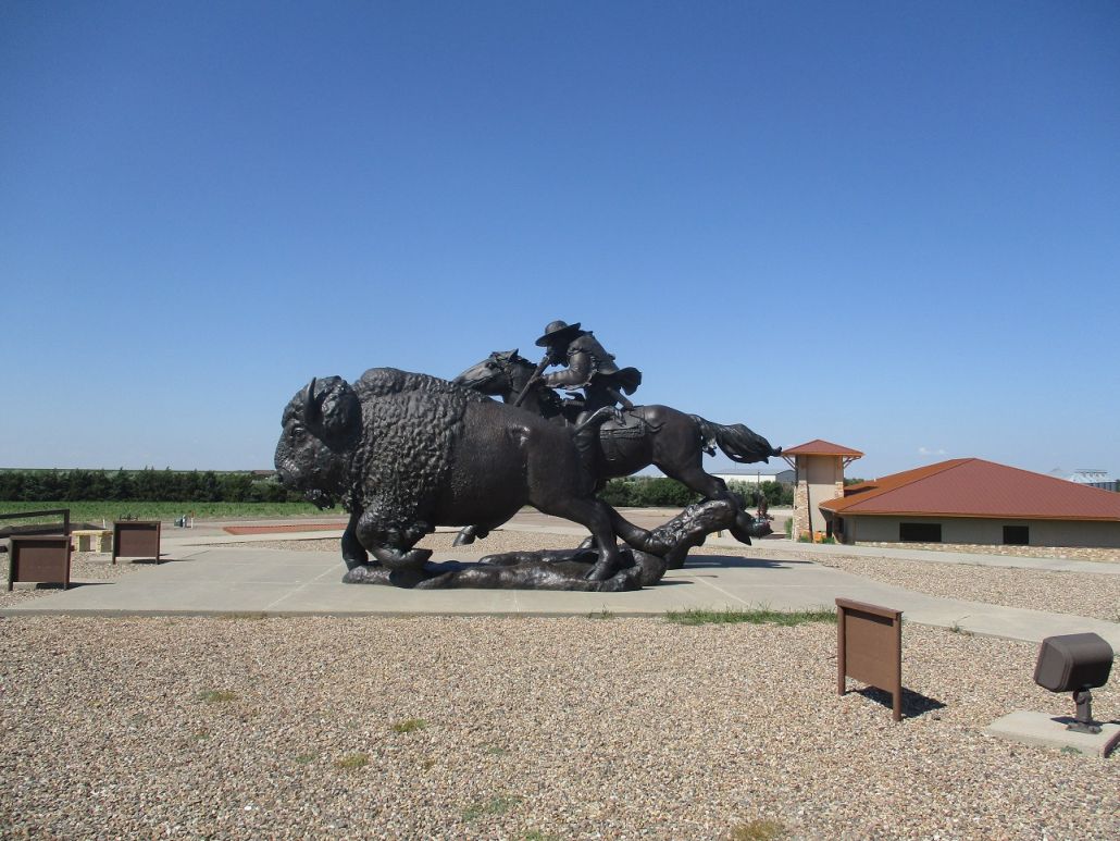
I also tagged a couple easy county highpoints nearby, plus visited the Buffalo Bill statue atop a 20-foot hill in Oakley. Ironically, this 20-foot hill would be the most climbing I'd do today.
Date: (1) May 25, 1996; (2) July 6, 2020 • Elevation: 4,039 feet • Distance: 0.1 mile • Time: 10 minutes • Gain: 2 feet • Conditions: Abysmal in 1996, lovely in 2020
Main
•
PB
First visit, May 1996: I spent Memorial Day weekend of 1996 visiting the highpoints of the states on Colorado's eastern border: Nebraska, Kansas and Oklahoma. I figured I could visit all three over a couple days of driving and none require much hiking. But the weather was dreadful, with black skies, heavy rain, thunder and lightning, and the constant threat of tornadoes.
I visited the highpoint of Nebraska two days ago, then headed north to South Dakota, mainly to avoid some supercells down here in Kansas. I hiked South Dakota's highest point yesterday morning, what was then known as Harney Peak (it is now called Black Elk Peak).
I spent the rest of yesterday driving south through Nebraska's Sand Hills to situate myself in Burlington, Colorado, which is on the border with Kansas. The drive was eventful. First, I followed a paved secondary highway south from the Black Hills, only to discover the pavement just ends. Not wanting to backtrack to a main highway, I followed a dirt road east into Badlands National Park.
This road was slick and muddy due to the rains and I had a small passenger vehicle with insufficient tires and tread. I slid and yawed the whole time, white-knuckling it across the Badlands and finally getting back onto pavement, now somewhere on the Pine Ridge Indian Reservation. It was still cold, gray and gloomy.
Now on the Pine Ridge Rez, I drove the poor roads through the area, a smattering of derelict homes and sad villages. This is one of the nation's poorest reservations and it is evident everywhere you look. The roads were in bad shape with sections just gone, the pavement having disappeared ages ago.
I had on the radio, the Pine Ridge's main reservation radio station. They mainly talked. You could hear doors slamming shut in the background and chairs creaking. The radio serves a vital function out here. Few people have phones, so messages are sent to people via the radio. For example, the person on the radio might say "Jim on Mudpit Road, contact your sister." This is how they get messages out to the people. I also spent a short time at the Wounded Knee Memorial. The weather was still awful.
Next, I drove south through the Sand Hills. I was fascinated by these landforms. They are sand dunes covered over in grass. They have very abrupt shapes, and some are quite tall. You'd never expect something like this in Nebraska. Few people live out this way, some counties have populations just in the hundreds. I took advantage of one long stretch of straight road and no one around to get that thing in the thing that tells speed to go past 100. The weather was gray but not as gloomy.
Then I got into the eastern parts of Colorado and eventually into Burlington, where I ate at the truck stop and stayed in a local hotel. It was rainier now. I recall two things: the waitress at the truck stop pronounced "potato" as "buh-day-duh", and that I watched the Stanley Cup finals game on TV.
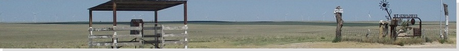
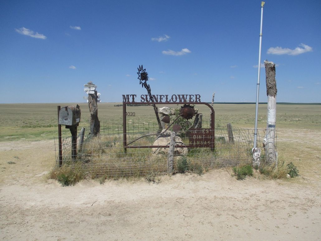
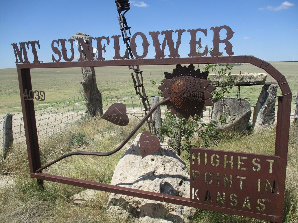
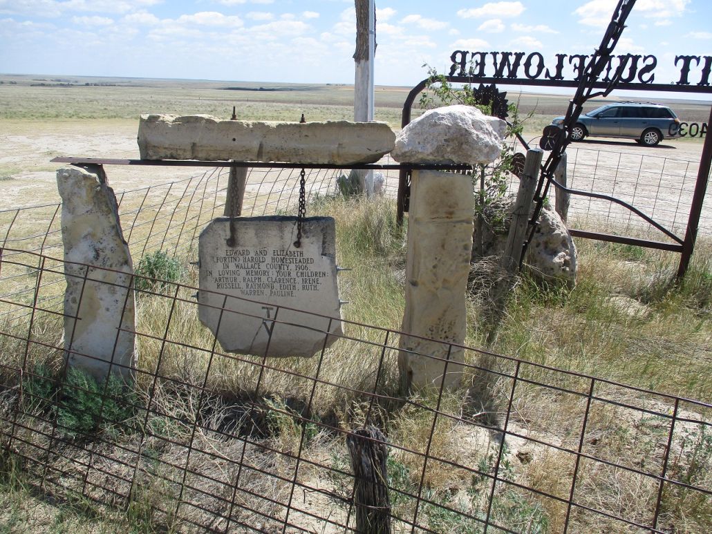
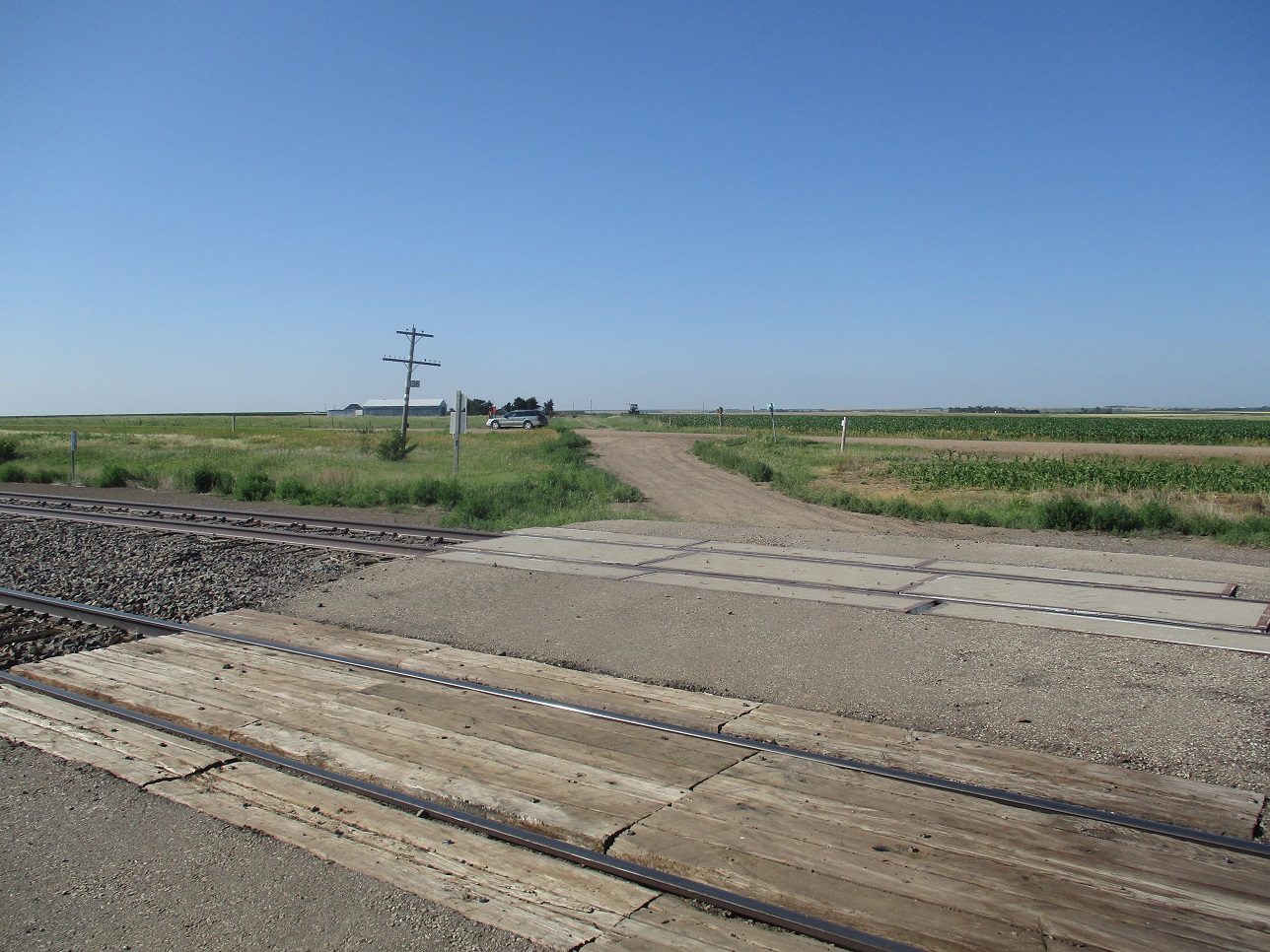
The next morning, the weather was just as bad as yesterday. Mount Sunflower, the highest point in Kansas, was "in the area" and along mostly good roads, weather non-withstanding. The last few miles were along gravel country roads, nearly 80 miles overall from Burlington. I finally arrived to Mount Sunflower. Don't let names fool you: there is no "mount" of any sort to be seen here.
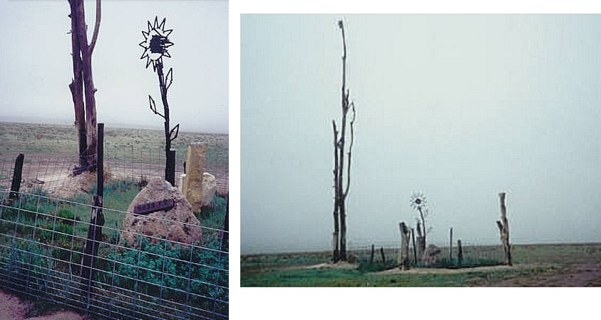
The Great Plains tilt downward ever so slightly, west to east, so that the highpoint of Kansas is along its western border with Colorado. However, much to my delight, the highpoint was decorated with a couple of railroad-spike sculptures and a plaque, so that there is actually something to see here. The land is private, but the owners have set aside this small patch of land for our visiting pleasure. I didn't spend a whole lot of time here, since the weather was so bad.
I enjoyed my visit here, insofar as the weather was awful. I might have stayed longer had it been sunnier. I was growing weary of the darkness and gloom. Back on pavement, I started the drive south to visit Black Mesa in Oklahoma, and to battle more bad weather. It never let up at all.
Second visit, July 2020: From Oakley (see below), I continued westbound in US-40. After about 1,700 miles on Interstate-70 over a week, originating in Frederick, Maryland, I now left the trucks and bustle of the interstate for the quieter US-40. Beth was ahead of me and we already had a hotel reserved in Limon, Colorado. US-40 would reconnect to Interstate-70 near Limon, and cover about ten extra miles overall.
The drive was easy and enjoyable, there being no trucks and virtually no one else, either. The highway curves in and out and around the low gentle hills. The towns --- Monument, Page City, Winona, McAlester and Wallace --- are spaced about every ten miles, each about a mile long with a giant grain elevator in the middle and a smattering of homes on the fringes. About 55 miles from Oakley, I passed through the biggest of the towns along this stretch, Sharon Springs, population about 750. It is the county seat of Wallace County. I would have passed through here in 1996, but have no memory of it whatsoever.
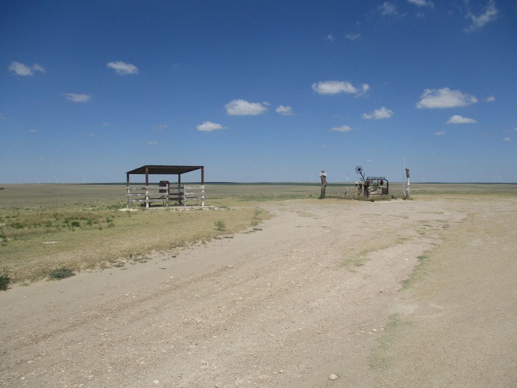
I went another dozen miles, past the town of Weskan, to Wallace County Road 3 (or 2, I don't remember). It is signed for Mount Sunflower. I drove north for 11 miles (said a sign) and west a mile. The road is gravel but in great shape, passing a couple ranch-steads and open grass rangeland. I followed the signs and was soon at the highpoint, 24 years and a month later.
Today was fantastic, with sunny skies, a few clouds, about 80 degrees, and calm ... about as diametrically opposite as what I encountered here in 1996. The sculptures at the top have been improved since I was last here. Whatever super-tall thing was here in 1996 is gone, but newer sculptures now sit here. Off to the side is a picnic table inside a ramada, with a small "free library" box on the table. That was not here 24 years ago.
I deliberately took my time here, enjoying the views and the absurdity of being on a highpoint in the remote high plains of western Kansas. It was about 11 a.m., and I was amused to discover I was already the 6th or 7th "group" to visit today. Some had mentioned about lack of views but I disagree. You have to come here knowing you're in the high plains and have reasonable expectations. There is enough height here to be able to look all around and take in the vastness of the plains.
I returned to US-40, this side-trip taking about an hour and covering 25 miles. I was very happy to have a positive experience here, so much better than my 1996 visit. I then continued west on US-40 into Colorado, passing through the towns of Cheyenne Wells, Kit Carson and Hugo, meeting up with Interstate-70 just east of Limon. βð was already there (she stayed on I-70), and we spent the remainder of the day relaxing in our hotel room and watching a couple late-afternoon thunderstorms roll through and dump rain on everything.
Date: July 6, 2020 • Elevation: 2,615 feet • Distance: 0.2 mile • Time: 15 minutes • Gain: 2 feet • Conditions: Sunny and pleasant
PB
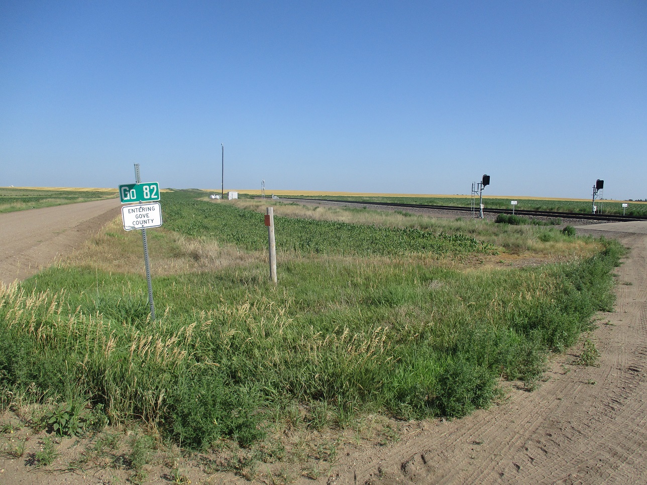
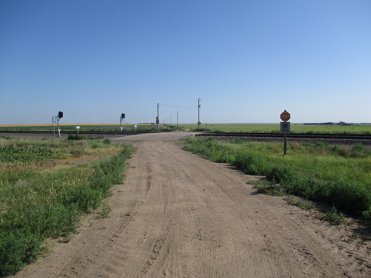
Driving from Hays, Kansas, to Limon, Colorado, I exited Interstate-70 at the small town of Collyer. I went north, then west, then eased onto a gravelly road heading southwest that parallels railroad tracks. The town of Collyer is small, with a big church as its main centerpiece.
The gravelly road is apparently old US-40, and bits and pieces of original asphalt were still in the roadbed, creating a cobblestone effect. I drove about a mile and a half as the road slowly turned to the northwest. I drove past Gove County Road 82 an up a rise in the distance, placing me within Gove County. I then returned and found a place to park, in a dirt area at the CR-82 intersection.
The land here is flat, with the barest of undulations. The map shows a 2,165-foot benchmark at this intersection, but I could not locate it. To the north slightly are the railroad tracks. I walked to these, gaining about three feet. I walked back to the car, then wandered along the main road. The map shows a 2,160-foot contour wiggling both north and south of the main road (Old US-40), but nothing north of the road looked high, while the south side looked more natural but only as high as the road.
Online maps show the county line slightly west of Gove Road 82, but I went with the signs on the ground, and tried to make the best determination of a highpoint based on maps and what I saw. I spent about 15 minutes here, wandering about a thousand feet in all. The day was sunny and pleasant, and I enjoyed the break from driving. Including drive times, I was off the interstate about a half hour.
Elevation: 3,040 feet • Distance: 0.1 mile • Time: 20 minutes • Gain: 20 feet • Conditions: Pleasant
PB
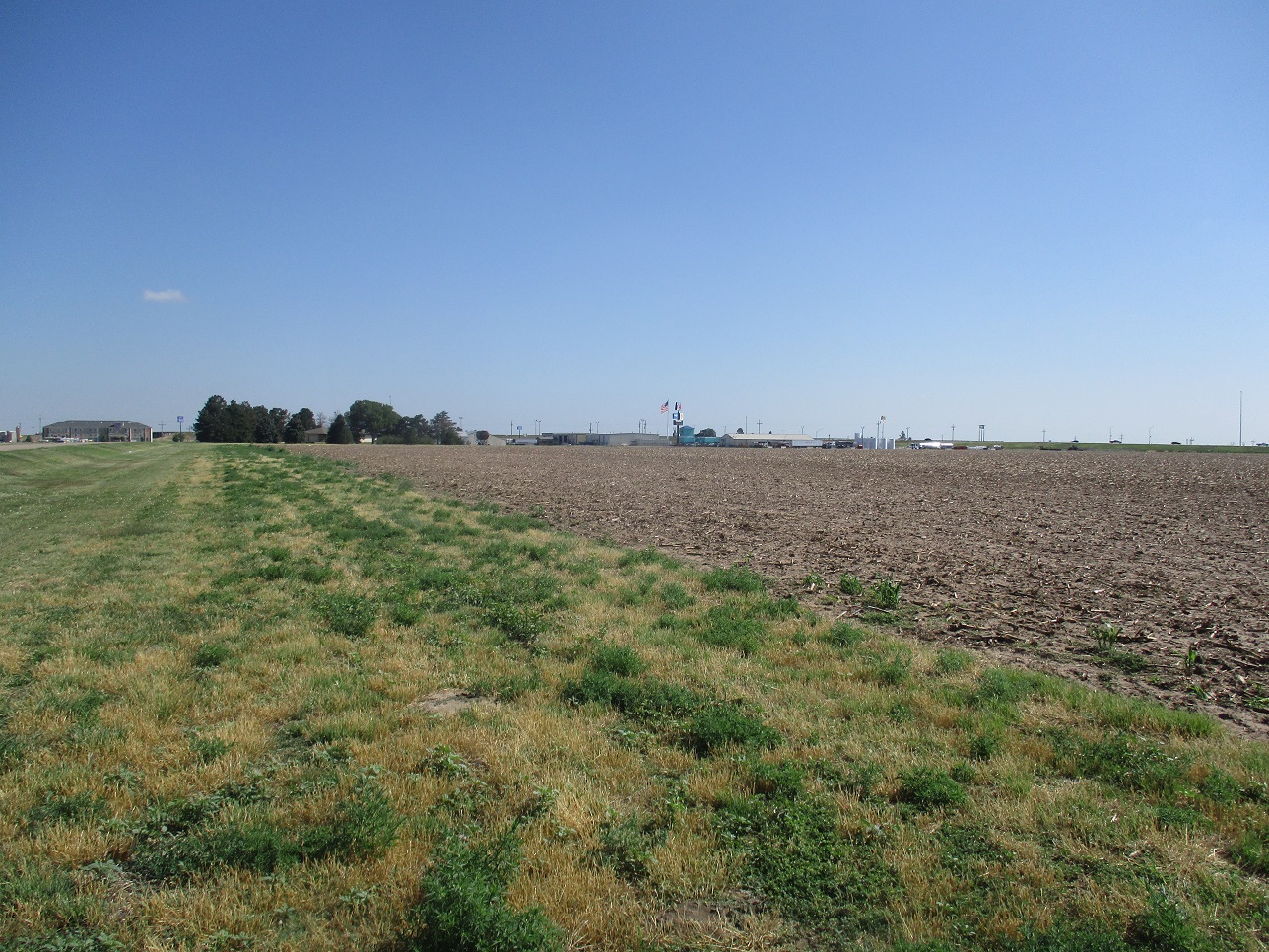
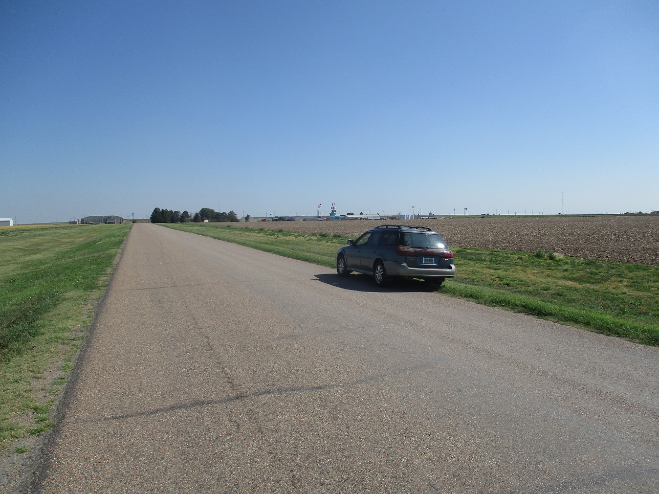
About 45 minutes later, I exited Interstate-70 at the town of Oakley, where US-40 splits from Interstate-70 (For most of the way through Kansas, Interstate-70 was concurrent with US-40). US-40 heads west and the first road on the left fronts the Oakley Municipal Airport. The road is also the west county line of Gove County. The airport and the town of Oakley lie on the other side of the county line.
The highpoint of Gove County is a single 3,040-foot contour about a half mile south on this road. So I drove to "it", but the rise was so gentle that I could not ne sure I had topped out on anything. I stepped out and walked the immediate area, then drove back to US-40 and parked at the Mittens Truck Stop.
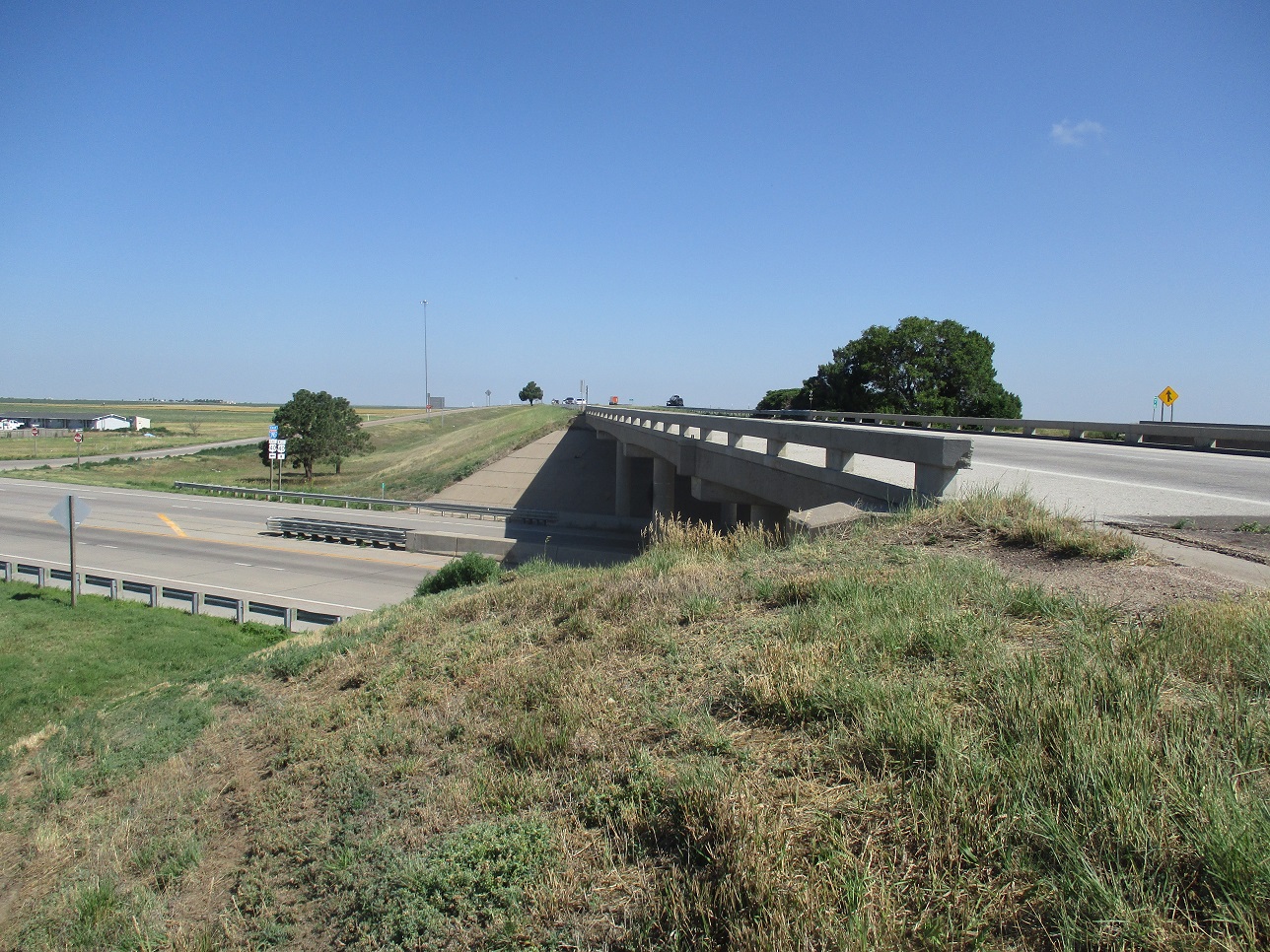
Interstate-70 is built up on abutments, where the interstate passes over roads. These abutments are man-made, but clearly the highest ground in Gove County. So I walked to the nearest one and scampered up the hill, now feet from the fast-moving cars on the interstate. I did not linger here, and returned to my car, this little side trip taking 10 minutes.
Back at my car, I had a snack and read my maps. As I left, I decided to go back down that frontage road again. This time, I drove it south about a mile to some big industrial outfit. There are hills here, covered in tarps and old tires. These could also be "highpoints", but I did not bother with these. I stopped again at the presumptive rise in the road and walked around some more. I felt no sense of satisfaction in "completing" this highpoint.
Rather than get back on Interstate-70, I continued west on US-40 a mile or so through Oakley, then followed signs to the Buffalo Bill Memorial. Afterwards, I continued westbound on US-40 and revisited Mount Sunflower (scroll up).
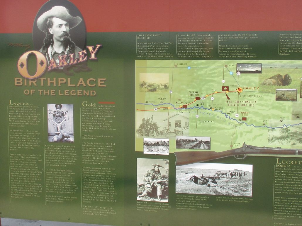
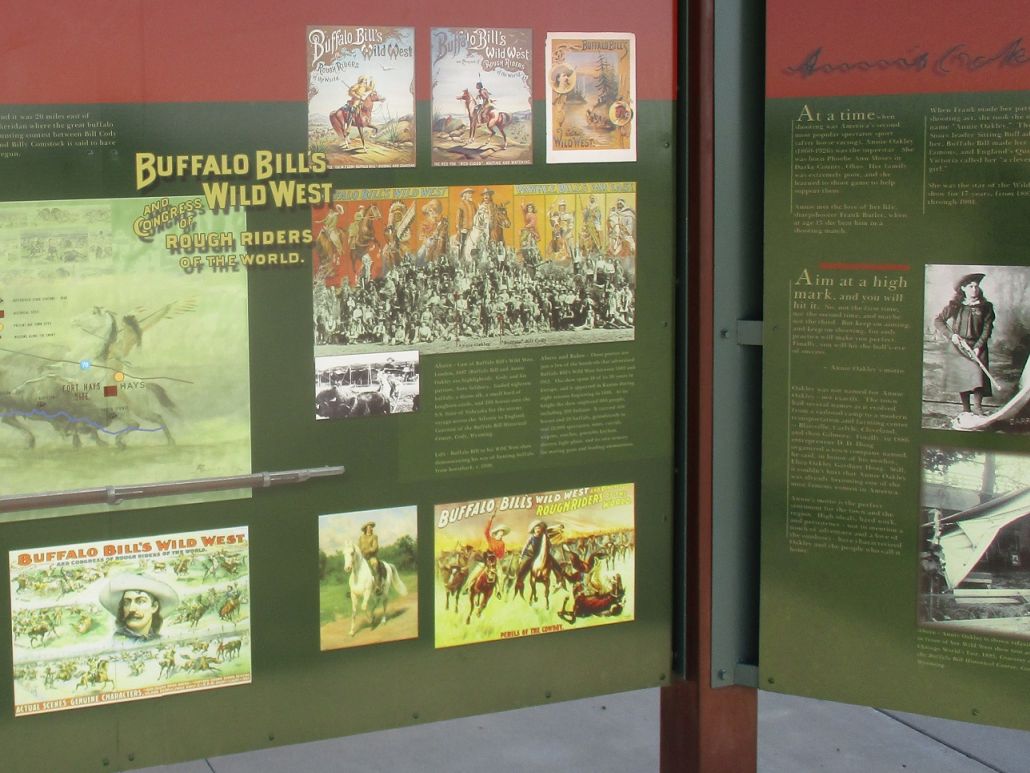
A couple miles west of Oakley is the Buffalo Bill Statue and Monument. The statue sits atop a small hill, and the 20-foot uphill hike would be the most energy I would expend today. The statue is large and well done. I studied the information kiosks too. I did not know he hailed from Oakley. This side trip took just a few minutes.
|


|
(c) 2020 Scott Surgent. For entertainment purposes only. This report is not meant to replace maps, compass, gps and other common sense hiking/navigation items. Neither I nor the webhost can be held responsible for unfortunate situations that may arise based on these trip reports. Conditions (physical and legal) change over time! Some of these hikes are major mountaineering or backpacking endeavors that require skill, proper gear, proper fitness and general experience. |