The Mountains of New Mexico
www.surgent.net |
| Redondo Peak |
• Highpoint: Sandoval County • Valles Calderas National Preserve • Jemez Mountains |
 Redondo Peak
|
Date: September 26, 2004
• Elevation: 11,254 feet
• Prominence: 2,454 feet
• Distance: 12 miles
• Time: 9 hours
• Gain: 3,600 feet
• Conditions: Surreal, ground fog, frost, clear skies
• Teammates: E. & M.
New Mexico
•
PB
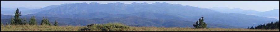
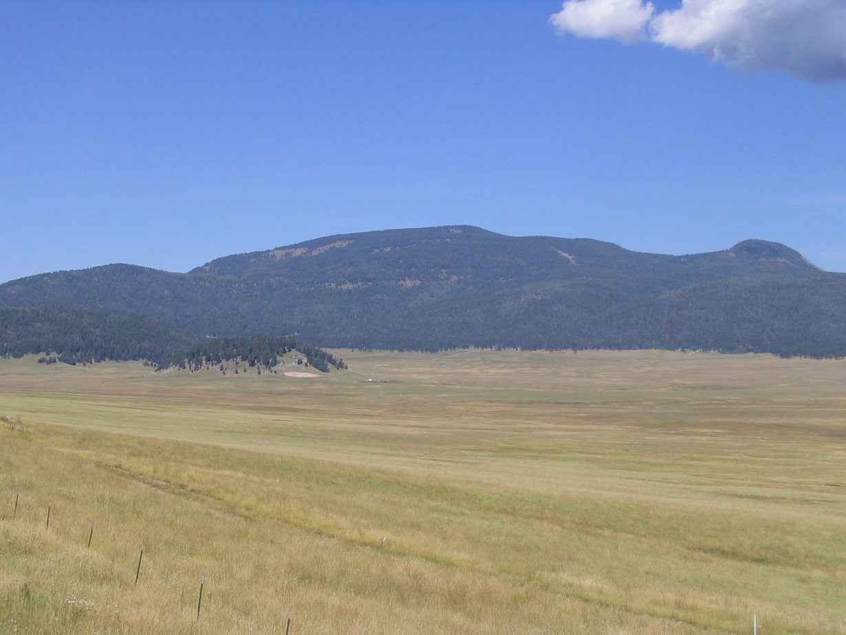
Redondo Peak is in the Jemez Mountains in north-central New Mexico, about an hour west of Los Alamos. It lies within the Valles Calderas National Preserve, and for many years, it has been closed to the public due to the surrounding land's unique historical status. The Valles Calderas is the caldera of an ancient volcano whose ridges now comprise the current-day Jemez Mountains. Redondo Peak is itself a "resurgent" volcano, a blob of cooled magma that formed long after the original volcanism had ceased. It lies dead-center in the caldera, a huge, hulking mountain covered in grasses and mature forest.
The Valles Calderas National Preserve is a square of land, roughly 12 miles on each side. It is a "float", spinning off of an 1823 land grant from the Spanish government to Don Luis Maria Cabeza de Vaca in appreciation for his family's historical roles in helping Spain defeat the Moors many centuries earlier. The original land grant was closer to current-day Las Vegas, New Mexico. When some of that land was taken over by the United States, five non-contiguous pieces of land ("floats") were given to the family in return, this being one of them.
Since that time, from about the mid-19th Century to 2000, this particular float was bought and sold a few times and always kept in private hands. The United States Federal Government purchased the property in 2000 and renamed it the Valles Calderas National Preserve. It was given a unique management status, a trust composed of locals from the area including the Jemez Indian Tribe.
Everyone wanted a piece of this land. It had tremendous potential for tourism (skiing, hiking, horseback, and so on), grazing and logging. So the solution, it seemed, was that no one got to do anything with it. During the early years (2000-2005), the trust offered basic hikes that were nothing more than nature walks on ranch roads. Actual hikes to Redondo Peak were never offered.
I contacted the trust a number of times inquiring about access to Redondo Peak. I usually got no reply, or a canned reply they send to everyone. In other words, no reply. It seemed that someone new was in charge every time I inquired. I was particularly interested in Redondo Peak as part of my plan to climb each of the state's 33 county highpoints, this being the highest point in Sandoval County. I bided my time for a couple years while I tried to get any sort of meaningful answer from the trust.
In September 2004, I was nearing completion of my New Mexico County Highpoints project. I was down to three: Redondo Peak, and nearby Caballo Mountain in Los Alamos County and Santa Fe Baldy in Santa Fe County. I decided to press the issue. Beth and I planned a trip to Santa Fe in October at which time we would climb Santa Fe Baldy. Prior to that trip, I planned a trip to the area in which I would climb Caballo Mountain. I also left a whole day open to scout Redondo Peak. I was not encouraged by my chances, but I did as much homework as I could and knew exactly what I was up against. If I didn't hike it, then so be it. But at least I wanted to try.
I flew to Albuquerque on a Friday and met with "E" for our planned Saturday hike of Caballo Mountain. He was in on the scheme with me in regards to Redondo Peak. A third climber, "M", who lives in Los Alamos, also would join us for our sortie on Redondo Peak. After our Caballo Mountain hike, E and I drove around to the Preserve's west boundary and situated ourselves for Sunday's adventure. M joined us at 4 a.m. Sunday morning at our campsite. We knew full well what we were doing and that we were taking a chance. The three of us started hiking at 4:20 a.m. in clear but very cool conditions. Within minutes we had come to the fence and stepped over it onto the Valles Calderas property.
Redondo Peak is centered in the preserve and not close to any of the boundaries, so we had to walk two miles to get to the base of the mountain. We walked east through forest in the dark (no moon tonight), aided only by a red-filtered flashlight that we used sparingly. Otherwise we let our eyes get used to what little light we had. Soon, we were on a ridge above Redondo Meadow. We dropped down the steep slopes of this ridge, losing about 150 feet, to put us in the meadow itself. We caught a break, as the ground was shrouded in fog. In this fog we had 30 feet of visibility, and to make it especially surreal, we were surrounded by elk with their other-worldly bugling. We'd be walking in the black fog, then hear some commotion followed by that bugling. I never saw any elk, but they were right there among us.
The land was open, grassy and occasionally rocky, with some small streams to cross. We had a route programmed into a GPS, and we also were able to find a road that helped our progress. We had crossed the meadow and were now on the southwest base of Redondo Peak, now just a shade after 6 a.m. The sun was barely rising, and the blackness segued into morning purpleness. We scampered up the slopes a few dozen feet, taking a well-deserved rest in a sparse forest, well out of sight from anyone below and certainly invisible from the meadow. The hard part was done. Now we just had to actually climb the mountain, still 2,500 feet higher. We did not expect to encounter any trouble (or people) on this segment.
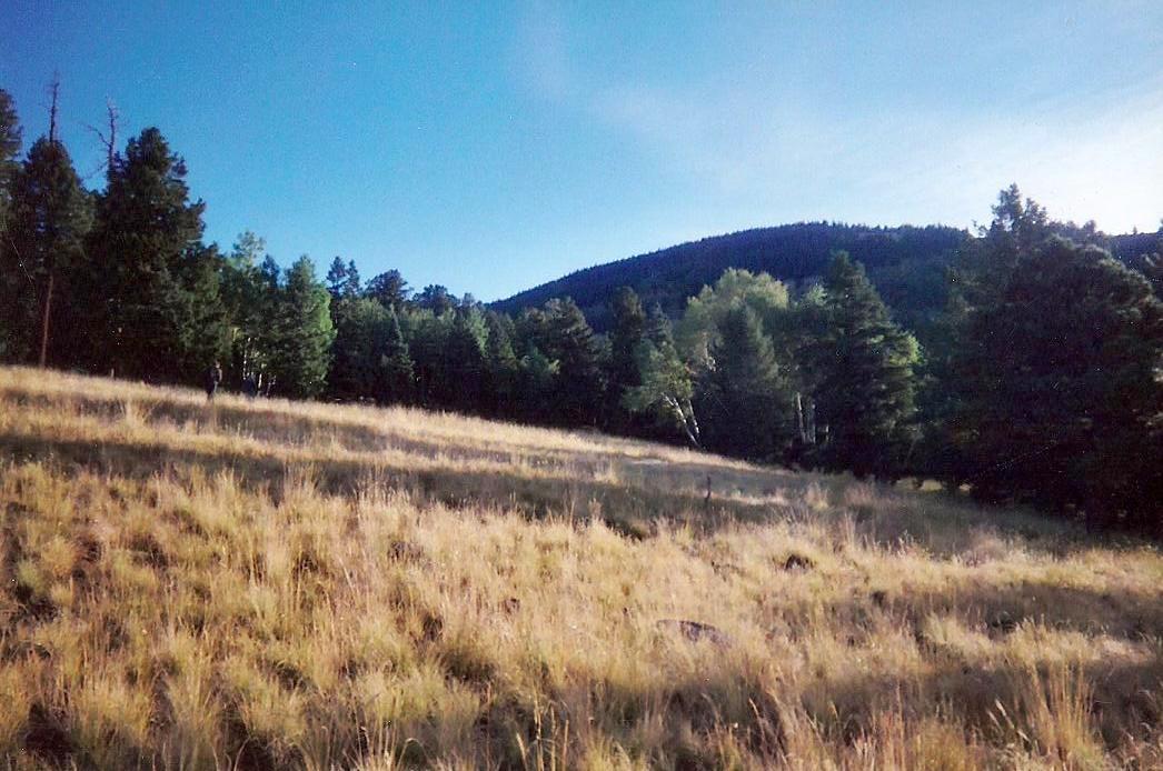
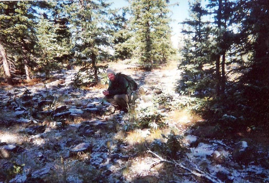
After trudging through the forest, we came to a talus slope, dotted with brush and mountain oak. The talus was steep and slightly loose, and when we entered into the stands of mountain oak, had to deal with the scratches. We gained 600 feet, then the talus ended and we were now on a lovely open meadow. The sun was high enough to give us good light, but it was very cold this high. We walked north up these slopes, coming to a point where the forest thickened. We were now west of the peak, and the mountain road that goes to the top was supposedly directly above us, so we barged directly up the slope to this road. Once at the road, we took a break. It was cold enough so that frost was nearly everywhere. We still had a little shade, and it was in the mid-30s where we sat. We were making fantastic progress.
There was no fear of meeting anyone up this high. The road is in horrible shape, probably last driven a generation ago. We had no fear of walking "in the open" along the road. This we did, walking north as it bent east, to a point roughly north of the summit. The final segment was cross-country, up easy slopes another 200 vertical feet to gain the broad summit top. We walked the area, looking for the highest point, which wasn't easy to find amid the trees. We found a benchmark and the what we thought was highest area, walking back and forth to be sure. We took a few photos, had a snack, but didn't stay long. Objective done, we got moving back down. We still had a long way out, now in broad daylight.
We exited the summit to the south, meeting the upper road again, followed it briefly, then continued southwest off the slopes, working our way down to the same meadows we had encountered coming up. We walked these down to the talus slope, but now with the light of day to help us, we were able to scout a better route down the talus, following a line slightly east of our ascent that had a lesser slope and more open ground to break up the monotony. We dropped down these slopes to the road we had followed earlier in the morning. Now, the fog was all gone. We had over two miles to cover, and needed to do so without being seen.
We walked west along this road, but had no desire to cross Redondo Meadow in the daylight, given the presence of buildings there. So we angled a little south, followed another road up onto a ridge, a continuation of the one that rings the Redondo Meadow on its south. The road we were on trended south more than we needed, so we cut west through the forest when necessary. The roads helped us in that we could make good time, but we were open to whomever might come upon us, so we never stayed on a road very long. In the forests, we had to move slower to keep on our bearing, but we were more hidden.
In about an hour, we came upon the Preserve's western boundary fence, but we were a half-mile south of where we'd entered many hours earlier. We walked the perimeter road, ready to jump the fence on a moment's notice, and we got a good scare when we saw a truck up ahead. So we approached slowly, saw that it was outside the Preserve and evidently just some locals collecting firewood. Nevertheless, we took a detour into the forest and slowly scooted past them until we were out of sight again. In minutes, we came to our entry point, and hopped back onto legal land. Mission complete, and it felt fantastic ... not only to have climbed Big Redondo Peak, but now to be safely off of the Preserve land.
In camp, we quickly changed, then drove back to M's place for beers. I took a quick shower, and still had time to drive down to Albuquerque to catch my flight home. I was thrilled because my five-year quest to complete the New Mexico county highpoints was now a virtual certainty. I had just one more to go: Santa Fe Baldy, which I climbed two weeks later.
The climb of Redondo Peak was spectacular. The land is gorgeous and pristine. I was relieved to have done it without being caught. My thanks to E and M. It was rushed and admittedly we moved quickly to lessen our time on the property, but if they ever open this peak to the public (e.g. following the road), it would rank as a fantastic day hike. I hope they do someday.
Update. Access conditions have changed over the years and it is the reader's responsibility to discover the most current conditions and requirements. The narrative here does not apply anymore, unless you want to make it harder than it has to be. The good news is that access is now allowed, you just have to figure out how to go about it.
|

|