The Mountains of New Mexico
www.surgent.net |
| Caballo Mountain |
• Highpoint: Los Alamos County • Jemez Mountains • Santa Fe National Forest |
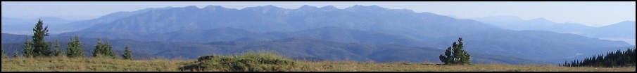
 Caballo Peak from across Guaje Canyon
|
Date: September 25, 2004
• Elevation: 10,496 feet (summit), 10,480 feet (Los Alamos HP)
• Prominence: 900 feet (summit)
• Distance: 14 miles
• Time: 7 hours
• Gain: 3,400 feet
• Conditions: Dry and breezy
• Teammates: Edward Earl
New Mexico
•
PB
Los Alamos the city is one of the United States' leading scientific research centers. It rose in prominence during World War II as the United States was researching ways to develop the nuclear bomb. It was during the war that a county was formed around Los Alamos. The County of Los Alamos surrounds just the city, and is New Mexico's smallest county in area.
The main part of Los Alamos sits atop a series of mesas about two hours northwest of Albuquerque at about 7,000 feet elevation. The western county boundary abuts the Sandoval County line within the Jemez Mountains, with peaks reaching above 10,000 feet. The highest peak within the county's boundaries is the east summit of Pajarito Mountain at 10,360 feet. However, a rounded peak to the north called Caballo Mountain contains land that lie within the county at 10,480 feet, although its summit actually lies inside Sandoval County, at 10,496 feet. It's safe to say the people in charge of drawing the lines in 1945 weren't thinking about the county highpoint.
My five-year project of hiking and climbing all 33 county highpoints in New Mexico was near completion. I was down to three, including this one, plus Redondo Peak in Sandoval County, and Santa Fe Baldy in Santa Fe County. Beth and I made plans to come back here in two weeks when we would climb Santa Fe Baldy. I wanted that to be my final highpoint, something I could celebrate with my wife. So I bought a plane ticket for this weekend, with plans to hike this peak and possibly Redondo Peak. Edward Earl would be my climbing partner.
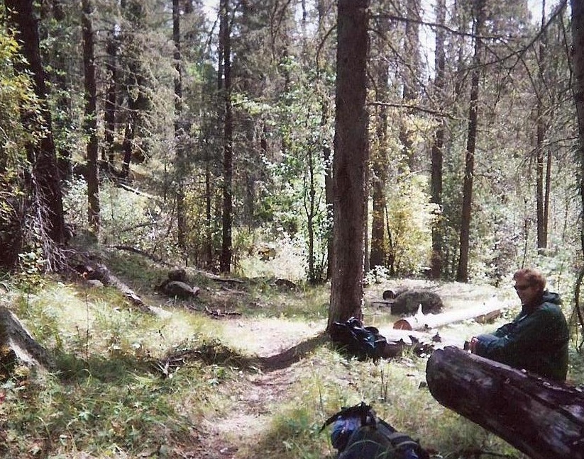
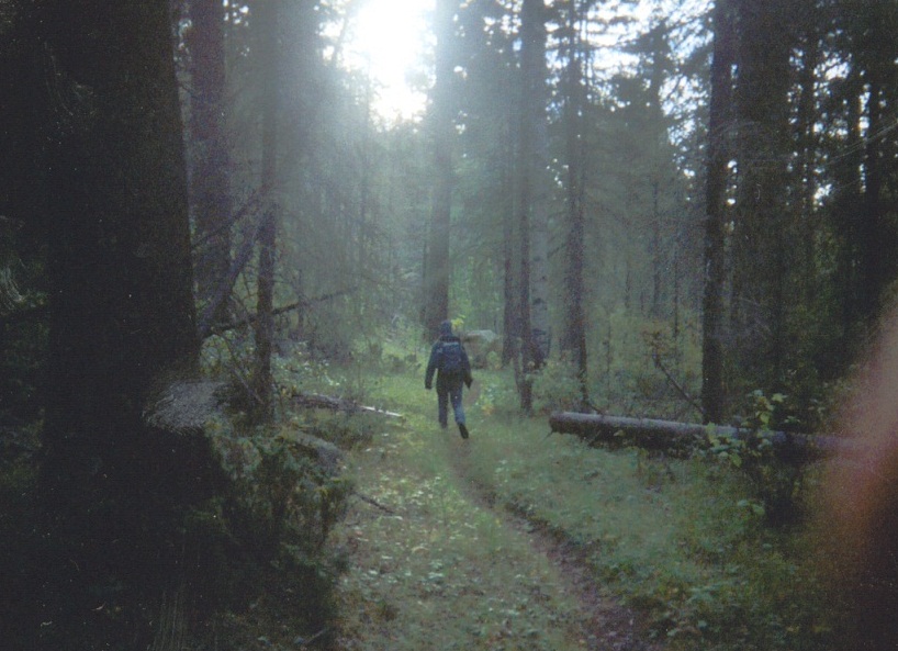
I arrived late yesterday and stayed in Española. Early today, I drove into Los Alamos and to the Pajarito Ski Area, where Edward was camping. It was still dark, and I couldn't see him, so I drove to the trailhead and sure enough, he promptly appeared at 6 a.m., as we had planned. It was still dark, but conditions were calm and mild.
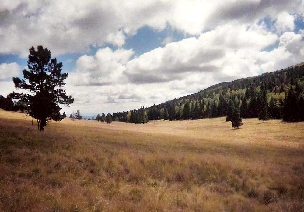
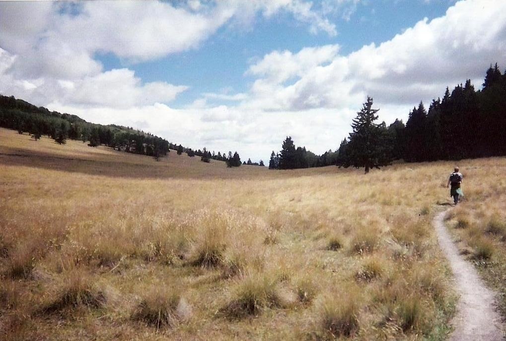
The trailhead is a short ways past the main parking area of the ski complex, on the north side of the road, set back but easy to find, even in the dark. Edward and I started hiking at 6:15 a.m. just as dawn was breaking. We followed Guaje Canyon Trail #282, which is an old road for the first few hundred feet. We stayed left at a Y-junction and hiked level through the trees, gaining a little elevation, then emerging into a beautiful meadow called Cañada Bonita. The trail then went right and re-entered a stand of trees, before shortly coming into the open again at another Y-junction.
We backtracked and re-caught our trail as it trended north in the forest before making a hard right and descending about 200 feet and coming out to a prominent rock promontory. We stopped here to rest, and take in the view of Caballo Mountain, which was directly across the canyon from us to the north. This point was 4 miles from the trailhead, and it had taken us about 90 minutes to get here, so we were moving quickly. The map has an elevation of 9,468 feet here, a net gain of 250 feet from the trailhead (which is just above 9,200 feet). Including the gentle ups and downs of the hike in, the gross gain was still less than 600 feet.
The Guaje Canyon trail makes a hard left turn at this promontory and descends steeply down the north slopes, then swinging down its east-facing slopes. A mile later, we'd dropped almost 800 feet into Guaje Canyon, a verdant canyon of green grasses and huge fir and aspen trees, with a flowing creek. Shortly, we came to the trail junction with Caballo Trail #277. We turned left and started up the steep slopes of Caballo Mountain. This stretch went slow and was steep in places, but route finding was easy, with occasional deadfall blocking our path the only nuisances.
Closer to the top, the grade moderated and soon we came into a meadow south of the summit, with unobstructed views of Los Alamos below and of Santa Fe Baldy on the horizon. The trail grew weak and disappeared amid the tall clumpy grass. A sign mentions a trail junction with the Agua Piedra Trail and that some of this land belongs to the Santa Clara Indian Reservation. Actually, the map showed us to be just south of the Los Alamos-Sandoval County line, which also demarcates the Santa Clara Reservation (north, in Sandoval County) and the Santa Fe National Forest (where we were, in Los Alamos County). We followed the trail into the meadow, then headed into the trees to seek out the county highpoint.
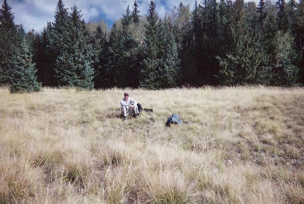
As stated above, the highpoint of Los Alamos County is along its county line south of the summit. We found a very old fence line, mostly on its side, which we surmised to be the county boundary. Newer orange plastic stakes were also along this fence, delineating the National Forest boundary. With that, we knew with reasonable certainty that the fence and stakes were the county line. We tread upon the fence for a few hundred feet, seeking the higher rises. We built a small cairn at the likeliest candidate point, as we judged it.
We also walked 200 feet northeast to the summit at 10,496 feet, which was thickly wooded with no views. Then we went back to the meadow, where we took a lunch break and admired the views. Some thunderheads were developing. Not counting the time we spent searching along the fence line for the county highpoint, our one-way ascent had taken 3.5 hours and covered 7 miles, with the last two coming up from Guaje Canyon, entailing an 1,800-foot gain. Counting the ups and downs of the first portion our one way gain to the summit was more like 2,200 feet. We got moving for the hike out at 10:30 a.m.
The descent into Guaje Canyon went fast, taking 40 minutes. Then, the slog back up the steep switchbacks to the rocky promontory. We made reasonable time and met some bicyclists as we gained the higher ground. Back at Pipeline Road we stopped near some dirt piles (an earthmover was grading the road nearby) and snacked. We peered down into Valle de los Posos, located within the Valles Calderas National Preserve. Redondo Peak stood tall in the distance, while thunder rumbled from points well to the north.
The remaining hike out took another hour, and we were back to our vehicles slightly before 2 p.m., an overall round trip of about 7.5 hours. Including the gain we had to make up going out, our total gross gain for the hike was almost 3,400 feet. The Pajarito Ski Area was full of partiers and live music, as a Blues Festival was going on. We descended into Los Alamos and met up with Mouser Williams, a fellow county highpointer working on his doctorate in Los Alamos.
I was now down to two peaks, and hoped to be successful on one more tomorrow. The next morning, we three would try our luck with Redondo Peak, where the story continues.
|
|