The Mountains of California
• www.surgent.net
|
| Toro Peak |
• Highpoint: Santa Rosa Mountains • Highpoint: Santa Rosa Indian Reservation • Riverside County |
|
Date: May 28, 2008
• Elevation: 8,716 feet
• Prominence: 3,996 feet
• Distance: 4 miles
• Time: 2 hours and 30 minutes
• Gain: 1,100 feet
• Conditions: Breezy and clear
California
•
Main
•
PB
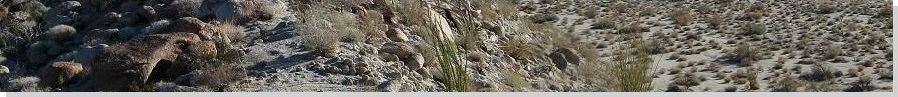
Toro Peak is the highest point of the Santa Rosa Mountains, a compact but towering range south of Palm Desert in Riverside County. It has nearly 4,000 feet of prominence, dwarfed somewhat by larger Mount San Jacinto which overlooks Palm Springs. As viewed from the south in Anza-Borrego Desert State Park, the peak rises fully 8,500 vertical feet above the desert, underscoring its massive size.
Access should be easy, since a rough but drivable dirt road (the Santa Rose Mountain Truck Trail) goes all the way to the summit, where there are towers and a lookout. The peak lies within the Santa Rosa Indian Reservation, but the rez here is just a smattering of square-mile sections in a checkerboard pattern, interspersed with forest property. The road is (usually) open to the public. I did not expect trouble, and certainly not to almost get beat up, which is what happened a year ago.
Last year, I was here after a few days of hiking peaks in Southern California and visiting my brother and his family. I planned to drive close enough so that the hike would go quickly, then get back down to civilization and head home to Arizona. I found the access road off of state route CA-74, drove up a bumpy 12 miles to a flat area below the top, got my boots on and started uphill.
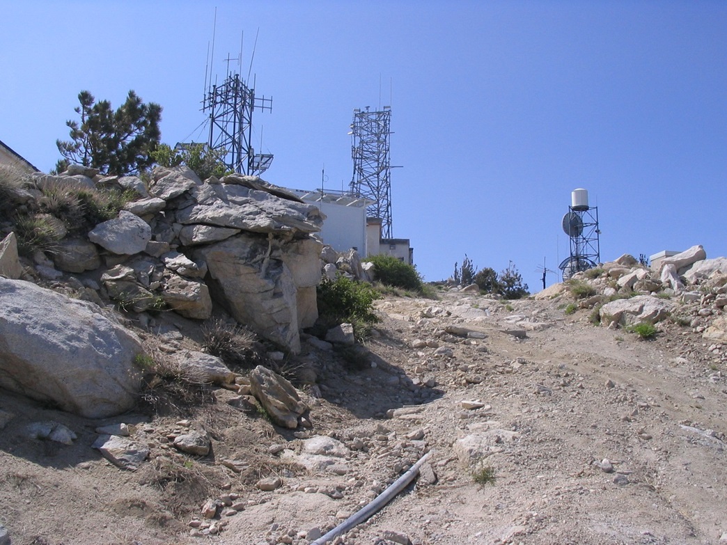
There's a gate at a Y-junction near the flat area. The uphill road goes to the top, and on this day, it was open. There were the usual signs about not lighting fires, plus an overly-worded sign about this being Indian Reservation. I hiked up the road and within about 20 minutes, was near the top. There were work trucks parked every-which-where.
So I hike up to where the workers are working, and one guy, the leader I assume, comes at me about "being on Federal Indian Property". I said I'd be hiking to the top and would be on my way. I've encountered workers on summits before and they never are trouble. Most like the company. But these guys were real pieces of work, no pun intended.
Quickly, this guy and his band of fellow workers surrounded me. The leader, for whatever reason, was really worked up, asking again if I knew this was "Federal Indian Property" and if I had seen the sign at the gate down below. Of course I had seen the sign, but I played dumb and said no, I had not. Then he said that I "better just turn around right now."
There was one of me and seven of them. They surrounded me, within feet of me. The vibe was ugly. The other guys were mainly ornaments, but the leader was spitting mad and seemingly ready to fight me one-on-one. Like he gives a crap this is "Federal Indian Property". I turned and exited. What choice did I have? I was furious. I drove down.
A year later (now), I was back in SoCal, hiking peaks and visiting my brother and the kids. The weather was unseasonably cool, highs in the 80s in the deserts instead of in the 100s. I took advantage of this "cold" spell to hike two peaks in the high desert near Lucerne Valley, Rodman Mountain and Ord Mountain. Then I visited my favorite niece and nephew, then started my drive home, planning to visit Toro Peak again.
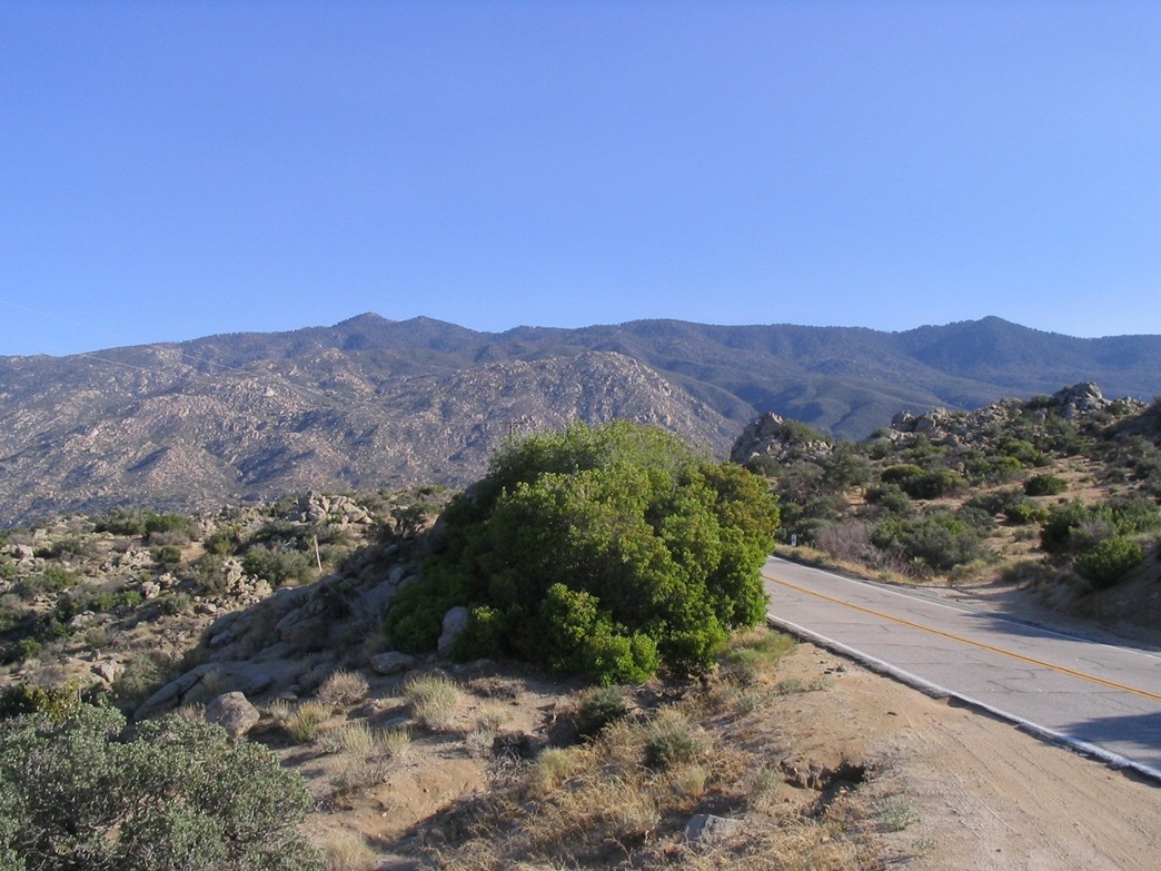
I arrived in the Palm Desert area around noon in pleasant conditions, got food and supplies, and started up the Palms-to-Pines highway (CA-74). From the intersection with CA-111 in Palm Desert, it is 18 miles up CA-74 to the Santa Rosa Mountain Road, marked by a sign mentioning that Santa Rosa Mountain is 10 miles ahead. Toro Peak (unmentioned on the sign) is another 3 or 4 miles farther via the road. The road itself is bumpy, narrow, exposed and sometimes rough, so I drove it slowly in four-wheel drive. It is not a scenic drive. Mainly, I hoped no one was coming the other way.
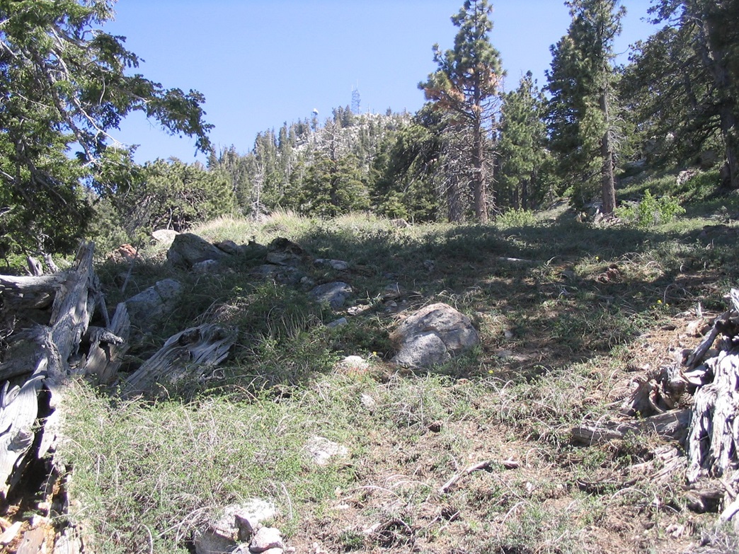
After an hour, I passed the turn-off to Santa Rosa Mountain, and another mile and a half later, I parked in a clearing called "Toro Camp" on the map. This is a campground, but the forest service seems to use it as a place to store cut logs for transport. It was 2 p.m., and I had enough provisions for an overnight camp. I had plans A, B and C for the peak, including possible middle-of-the-night hikes in the moonlight if need be. Nevertheless, I thought to go with plan A first, to hike the road to the top and hope no one was home.
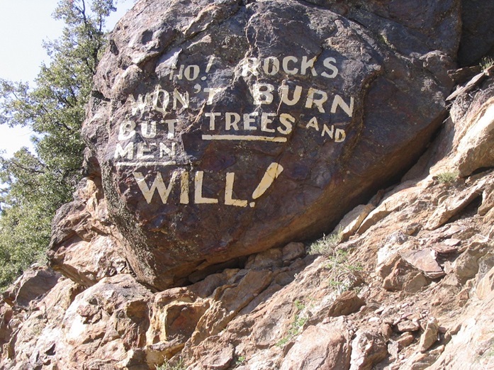
I parked about a mile short of the Y-junction mentioned on my first attempt. The road walk along this stretch was easy and level, and went quickly. In time I came to the Y-junction. On a tree right at the junction, the Forest Service taped a big sign saying "No Entry, Fire Danger". I continued to the gate that spans the road, presumably at the Indian Reservation boundary (up to this point I was within the San Bernardino National Forest). A newer "no trespassing" sign was on the gate, describing the penalties for entrance. I could have conceivably played ignorant on one sign, but not on two. The gate was also open, which suggested there may be someone up there. So I entered with some caution.
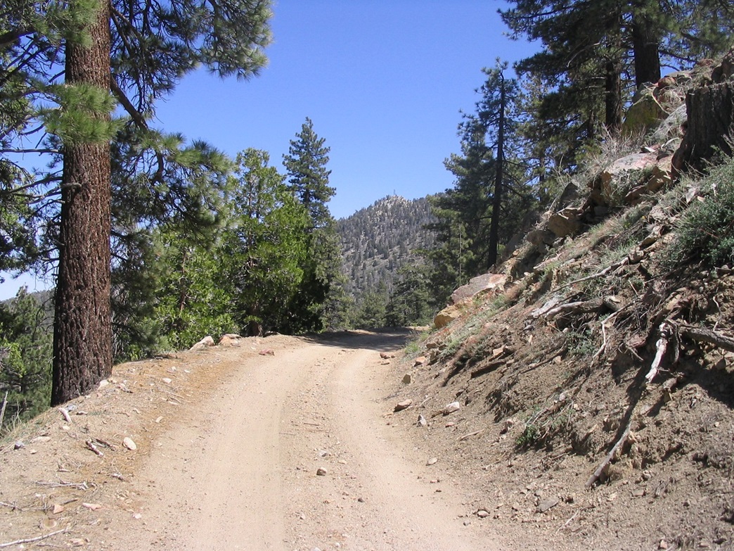
After a few minutes of hiking up the road, I decided to make myself invisible, leaving the road and hiking directly up the slopes. I was at a point where I could see the summit towers about 600 feet up and a half-mile distant. I hiked up the slopes, which was a mix of branches, brush, open areas and rocks, with solid footing. I hid in the big trees, and I could see parts of the road but never saw anyone or any vehicles.
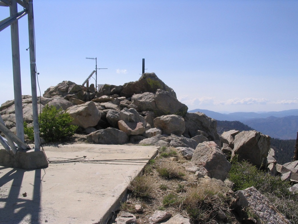
The rocks start in earnest about 200 feet below the summit. From below, the rocks look jumbled and possibly cliffy, but up close it's easy scrambling. I came to the top directly, achieving the summit rocks, careful to observe if there was anyone about. No one was home, but I didn't stay long. I had no desire to meet anyone. A couple of quick photos to document my visit, and I started down. Last year on my "almost-got-beat-up" hike, I went slow and admire the views, especially looking down into the Anza-Borrego region to the southeast. This time, there was no time for views.
For the downhill trip, I felt slightly more confident there was no one up here to hassle me so I started to walk down the road. I passed the area where I had my chat with the tower workers from last year. A little lower down there is one last building, and I could hear a generator buzzing. This is not uncommon to hear, since they are often on timers, but in this case there was the outside chance of someone actually there, keeping in mind the gate below was open when I walked up. Thus, I thought it wise to hide myself again and ducked back into the trees.
The downhill hike went quickly, the pine-needle mat on the slopes making for easy steps all the way down. I came back to the road still inside the prohibited area. As I hiked down on the road, I could see the road coming up and see if anyone might be driving up. If so, it would be easy to just jump into the forest again and hide. But no one came along, and I quickly hiked out past the gate, back on to legal land. The walk back to my truck took another 15 minutes, and my total round-trip was 2.5 hours.
It was getting cold and breezy up here, so I decided against camping here and opted to put in miles back to Arizona. The drive down took an hour, then another hour from there back to Interstate-10 (including stops for photographs). I camped in the desert southwest of Blythe at the Wileys Well BLM campground, south of the giant Chuckwalla Valley State Prison.
With Toro Peak done, I have no reason ever to go back up that road or retry that peak. I cannot comment for sure what the overall access is like. It seems others have had no trouble at all. My attempt last year must have been a fluke, given what I encountered. It feels good to get it done and out of the way.
It is interesting to note that the Desert Peaks Section of the Sierra Club has at times included Toro Peak on its list, and at other times has excluded it due to its cloudy access situation. This is presumably not new: one reference shows that in 1975 the peak was excluded from the list, but then again added back on ... and very recently, excluded again, probably for the very reasons I describe here. It's amusing to note that the DPS instead suggests a hike to the "Toro West" summit, in which one ascends the slope above the gate, ascending to a bump slightly west of the true summit and thereby staying off the restricted property.
|

|