The Mountains of Arizona
• www.surgent.net
|
| Escudilla Mountain |
• White Mountains • Apache-Sitgreaves National Forest • Apache County |
|
Date: July 16, 2005
• Elevation: 10,912 feet
• Prominence: 2,360 feet
• Distance: 7 miles
• Time: 4 hours
• Gain: 1,600 feet
• Conditions: Pleasant but slightly stormy later
Arizona
•
Main
•
AZ P1K
•
PB
•
Interactive map
βð and I were looking for a weekend outing with a hike, preferably something easier than the long grinds we had subjected ourselves to in the past month (most recently, the hot hike up Miller Peak near the Mexican border). Escudilla Mountain fit the bill on all accounts: a big peak at just under 11,000 feet elevation but with an easy trail, and located in the White Mountains in Eastern Arizona, where daytime temperatures would be pleasant.
The monsoon was late this year. It usually comes in in early July but as of mid-July it was still hanging out in Mexico and staying away from the deserts. Without the monsoon to moderate the temperatures, we'd been experiencing one of the hottest stretches of heat I can recall in my years of living in the Phoenix area. Daytime highs were regularly exceeding 112, and getting as high as 118, with night-time lows in the low to mid 90s. So a weekend in the high country was welcome.
We left home Friday afternoon, heading up the Beeline Highway (AZ-87) toward Payson. Traffic was moderate, mostly fellow Phoenicians attempting to escape the heat like us. We had no trouble other than our Subaru running hot on the uphill sections. After a stop in Payson to let the car cool, we journeyed eastward through Show Low and Springerville, and on to our campsite at the Alpine Divide campground about 20 miles south of Springerville along US-191.
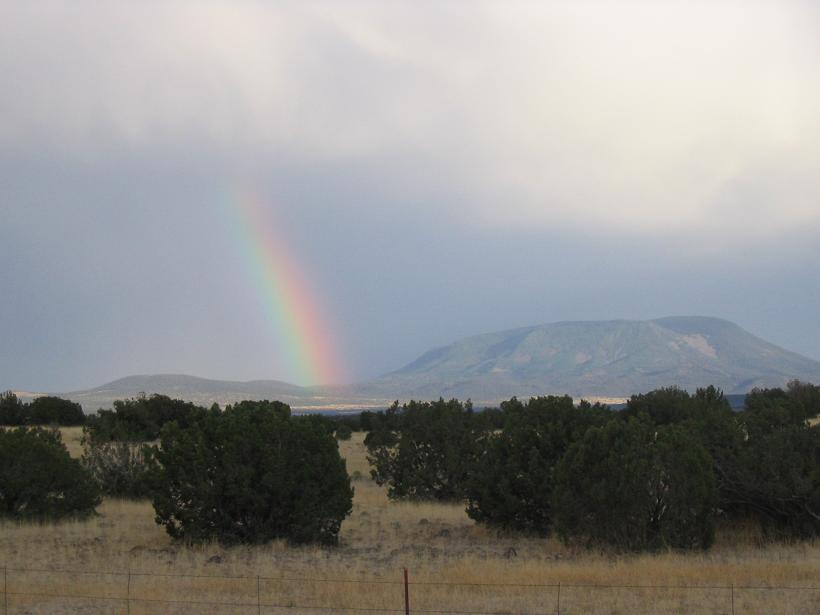
We arrived at 8 p.m. in the dark, and drove through one stretch of rain. We set up the tent and had a meal. The clouds cleared out and we had an excellent night's sleep in the cool temperatures. We awoke early Saturday morning, disassembled camp and made a detour into Alpine to get coffee and grub, before driving to the Escudilla Mountain trailhead. It's relatively close to the main highway, just five miles off of US-191 along Forest Road 56 along excellent gravel roads, not far from Alpine. We arrived at 8 a.m., relaxed a bit, checked out the area, got into battle dress and started the hike.
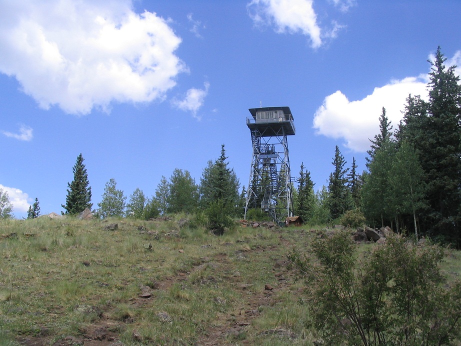
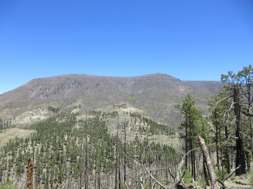
Escudilla Mountain is often considered the third highest mountain in Arizona, after Humphreys Peak and the nearby Mount Baldy, not counting subsidiary peaks of Humphreys and Baldy. There is an active (and very large) lookout tower built on the slightly-lower southern summit, and this tower is visible on the drive in. A good trail leads to this tower, and an easy bushwhack from the tower then leads to the higher northern summit. From the trailhead, we started walking up the fine trail as it entered into a copse of aspen, then switchbacking up the southern slopes, occasionally slightly steep, but overall, very moderate.
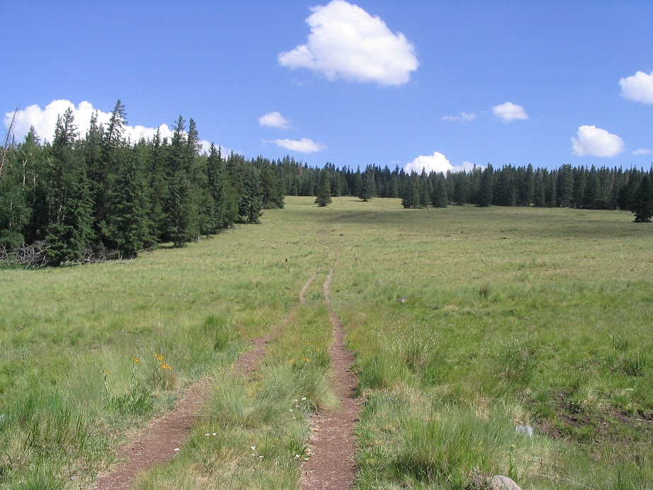
The trail gains steadily to the top of the ridge, by now mostly treeless and with tremendous views of the White Mountains and of magnificent Mount Baldy to the west. At the top of the ridge (called Profanity Ridge), we took a break amid a stand of pine trees. After our break, we continued northbound on the trail as it descended slightly and entered into a big, beautiful meadow. Clouds were starting to build, but nothing threatening for the moment. The trail climbs gently up the far side of the meadow, re-enters the trees, drops again about 60 feet, then starts a short uphill segment to come to the lower summit and lookout tower, set amid an open area where views down onto the valleys below were marvelous. To here, we had gained about 1,600 feet in about two hours. We rewarded ourselves with a break.
The tower stands about 45 feet tall and is active, and we could hear what sounded like a radio coming from above, as well as seeing laundry being hung to dry. We opted to continue on to the north summit first, then return and relax some more at the tower. The trail stays to the right of the tower and continues for another 150 feet before turning right and descending on what appears to be an old abandoned road. However, we did not follow this road. Instead, at the bend we continued on a north-northwest bearing, entering into the forest at a downed tree on which someone had placed a rock.
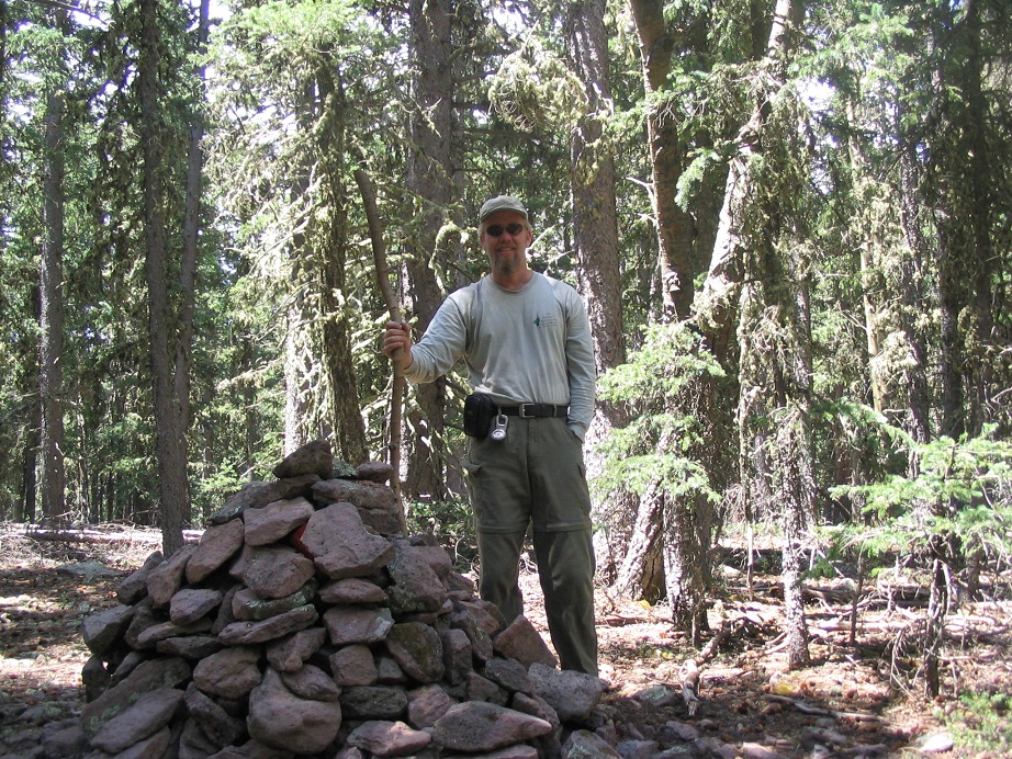
We kept at a consistent bearing, and only a couple of times did I need to use my compass as the ridge narrows after a few hundred yards and it's relatively easy to stay on the ridge crest. We found occasional cairns and occasional paths, but in many instances we made our way through the trees, zig-zagging as needed. We dropped about 80 feet then started up a long, very gentle grade to gain about 120 feet. Finally the trail leveled and after some searching, we found the substantial cairn at (or very near) the summit.
The summit is broad and rounded, heavily forested and offers no views down below. We signed in the register and took a short food and drink break. The weather in our immediate area was calm-ish but we could hear distant booms of thunder, coming mainly from the west. We weren't too concerned (yet) since these mountain-spawned thunderheads tend to drift west, so we figured this cell was moving away from us. Nevertheless, we started back toward the tower and once back there, where we had better views, we could see a large mean-looking cell hanging out over Mount Baldy. We stayed a while at the tower area to chat with another couple as well as a foursome that came up on their horses. However, we opted not to climb the tower.
Our hike out went quickly. We took a short break about half-way, but otherwise made good time downhill. The weather was steadily getting more active, with bigger clouds and thunderheads forming above us but so far, not much direct activity except off to the south and west. We were glad to be heading downhill, off the high ridges and back down to the relative safety of the lower elevations. We egressed about 1 p.m., a 4-hour hike at a leisurely pace. After changing into drier clothes, we drove down the hill and back to Show Low, where we stayed at a cheap hotel and rewarded ourselves with a dinner at Licano's Mexican Food Steakhouse on the south end of town. The next day we drove on back home into hot Phoenix. Another great weekend hike and another sweltering Phoenix afternoon.
|


|