
The Mountains of Arizona
• www.surgent.net
|
| Signal Peak |
• Highpoint: Kofa Mountains • Kofa National Wildlife Refuge • Highpoint: Yuma County |
|
Dates: (1) December 18, 1999; (2) February 1, 2003; (3) April 10, 2005
• Elevation: 4,877 feet
• Prominence: 3,477 feet
• Distance: 4 miles
• Time: 5 hours
• Gain: 2,040 feet
• Conditions: Very nice all three times
• Teammates: Ken in 1999; Bill J., Rick H. and Dean M. in 2005
Arizona
•
Main
•
AZ P1K
•
PB • LoJ
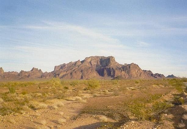
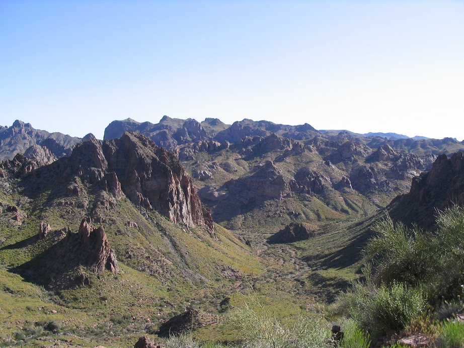
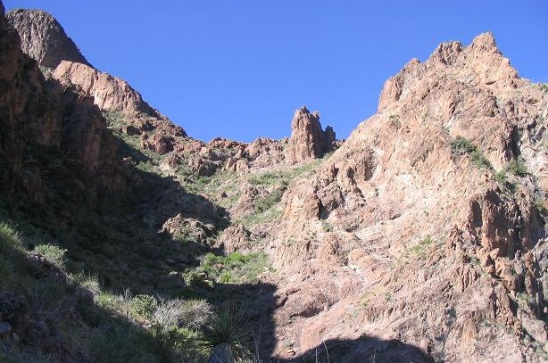
Signal Peak is a steep, rocky and brushy mountain, the highest point in Yuma County and of the Kofa Mountains. It features cliffs and steep rock walls, and looks like a challenge from a distance. However, a primitive yet decent footpath allows access to the summit from the "backside".
I have summitted this mountain three times, in 1999, in 2003 and in 2005. In 1999, we were successful but made the hike much harder than it had to be. We were unaware of any path and somehow battled up steep slopes and class-3 rock to the summit, only then discovering a trail, which we followed out. Even knowing about the trail, the 2003 climb with βð still was a challenge, me getting us off route once. The 2005 climb went well with no off-trail segments.
With the rise of the internet and this peak's elevated profile due to it being a range highpoint, county highpoint, a highly-prominent mountain, and on about twenty different hiking lists, the number of visitors to this peak has increased considerably. What was a meager footpath in 1999 had by 2005 become a more substantial trail. For all I know, by now it may be laid with flagstone and lined with ivory handrails. Still, it's a rugged peak and requires a little more skill than your average trail hike.
First visit, December 1999: Ken and I were both working on the Arizona county highpoints, so we agreed to team up and hike Signal Peak, plus Blue Angels Peak in Imperial County, California. I picked Ken up in Scottsdale early in the morning and headed west along Interstate-10. Passing through Quartzsite and south on US-95 to Palm Canyon Road, we made our way along Kofa Queen Canyon Road into the actual canyon, parking where Ten Ewe Canyon opens up on the right. The drive had been uneventful except where I ran off the road when blinded by the sun, into a patch of soft sand.
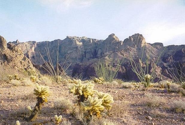
There was no information to go on regarding the route, so Ken and I started the hike hoping for the best. We entered Indian Canyon, notable for the view of Ten Ewe Peak that sits dead-center at the canyon headwall. Signal Peak was currently not visible. We started trending right, aiming for cliffs in the far right "corner" of the canyon. We had steep, loose slopes with thick vegetation, including cactus. We worked our way up to these high cliffs, and found chutes that weren't too technical to clamber up, and soon, we were atop these cliffs.
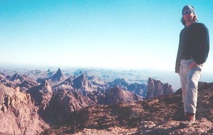
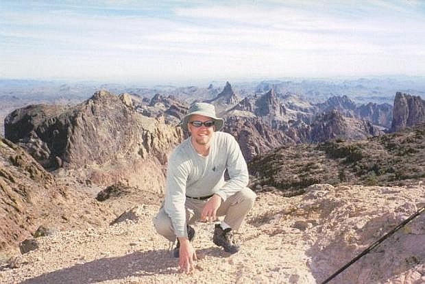
Looking south, we could see a higher summit, which turned out to be the northern (and nearly as high) subsummit of Signal Peak. We descended a little and that's when we discovered the path. This we followed to a saddle, then up behind the northern peak to the top, or so you'd think. Well, we thought the summit was actually farther south where electronic equipment sits. We hiked almost all the way there but then, looking back, saw that the first peak we'd passed was higher, so we backtracked to it and onto its top. However, we had spent four hours on the hike. It was a hard-earned peak, and we were rewarded with million-dollar views in all directions, today being a wonderful, clear blue December Arizona afternoon.
For the hike down, we followed the path and the cairns, which worked a million times better than the route we "pioneered". The descent took 90 minutes, and we were back to my truck in the mid-afternoon. Being close to the solstice, darkness was not too far off. I was able to get us back to the better roads with plenty of daylight to spare. In fact, we drove to the Palm Canyon parking area where Ken made a short hike into Palm Canyon, where California Date Palms survive in a sheltered canyon amid this hot, dry desert. I stayed back at the truck to take a short nap.
Next on our agenda was a hike up Blue Angels Peak. It was dark by the time we drove into Yuma, and we camped for the night at the Algodones Dunes in California, both of us sleeping in the open directly on the sand. It was surprisingly quiet.
I was pleased to make this summit and assumed this would be it forever. I suspect we may be the only people ever to take the route we followed. I don't recommend it.
Second visit, February 1, 2003: I was looking forward to another hike, figuring it shouldn't have been as nasty as what Ken and I did in '99. We left home early in the morning and started our hike around 10 a.m.
Knowing my error from before, βð and I started in among the sandy wash bottom for about 0.3 miles and deliberately did not beeline for the cliffs to the right. Instead I hiked toward the right flank of Ten Ewe Mountain, and found a use-trail that leaves the wash bottoms and starts up the ridge which would eventually lead us to the top. This trail is rugged and loose, but easy to follow, and we took our first break at a noticeable "notch" below Ten Ewe's big cliffs.
After the notch, things get sloppy and narrow, but we made good time and did alright, working our way under a giant "fin" of rock, scampering up to a high saddle below Ten Ewe Peak, and across from a dry waterfall. We followed the trail from this saddle, following the better-looking of two options. This trail worked higher up on Ten Ewe's flanks and I started to suspect we may be off route. Not wanting to turn back, we continued up this route until we had gained onto a ridge directly below Ten Ewe Peak. From here we hiked up one small hill and down the other side, and there, we found the trail we should have been on.
From here to the summit, we walked up more of the steep, rocky slopes. But the going was marked with cairns and it was never as bad as it looked from below. Still, we took things carefully, and eventually had worked up to high saddle below the top. From here, it was an easy walk to the top, where we celebrated. Today was cool with high clouds. βð was pleased but a little miffed at me, since I didn't tell her how rugged this peak would be. But she did well.
Our hike down went well and we had expended about four hours for the whole journey, much better than my first time here. We drove to Yuma and stayed a night at the oldest (so they say) Best Western in the country. There, we learned of the Columbia Shuttle tragedy that had occured earlier this day. We were shocked. It was an odd feeling to have been so cut off from the world for the past 12 hours to not know of the tragedy, but then again, that's part of the deal of being in the wilderness.
Third Visit, April 10, 2005: I learned that Bill J., Rick H. and Dean M. were planning a hike up this peak and I wanted to tag along. I was hankering for a good hike and looked forward to the opportunity to get back into the wilderness. Also, now knowing the route, I hoped we could go up without getting lost, like I had done on my previous two visits. I drove out Saturday afternoon and arrived at the Kofa Wildlife Refuge area about sundown. I had enough time to score a good campspace. There was no moon and the night was dark, but specked by millions of stars. I passed the time listening to the Dodgers-Diamondbacks on the radio. Dodgers won a messy game, 12-10.
I awoke as Rick and Bill were rambling up the road in the early morning. We were expecting to meet Dean, coming in from Las Vegas, but he was nowhere to be seen, so we drove up into the canyon to the trailhead and parked. Shortly Dean rolled up in his new truck and the foursome was set. A father and his son were also hiking the peak. They got an earlier start than us. We were walking into Ten Ewe Canyon about 8:30 a.m.
The hike went well. Rains in recent months had carpeted the mountain in yellow and purple flowers. Great for the eyes, not so much for the schnozz. Rick had climbed the peak three weeks earlier with Dave Covill. He and I together kept everyone on track, and we had no navigation problems. The father and son, ahead of us, got off track and we hoped they'd figure out their error sooner than later. The four of us made it up to the waterfall and were resting when the father and son showed up. Sure enough, they had got cliffed out and had to retreat a bit to get back on route.
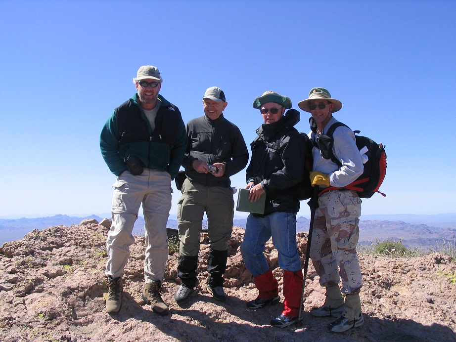
The six of us climbed as a spread-out group, and we all made the top after just over 2 hours from the trailhead. Conditions were stunning, maybe just a bit windy. We took our photos but actually rested a few feet down the east slopes to get out of the wind. On the hike out we checked out the little hill to the north. My gut says Signal Peak is still higher, but the hike up the other knob took all of 10 minutes. We were out to our cars by 1 p.m. My thanks to the team!
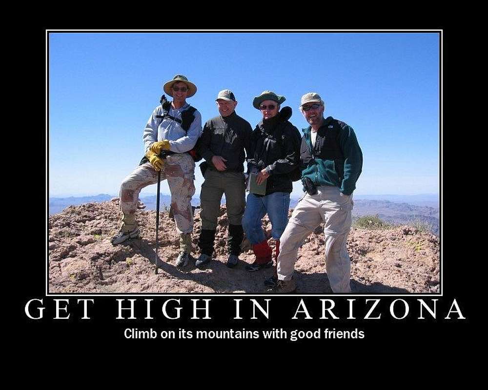
Dean made up this nice image of us at the summit. |


|