
The Mountains of Arizona
• www.surgent.net
|
| Atascosa Lookout |
• Atascosa Mountains • Coronado National Forest • Santa Cruz County |
|
Date: April 22, 2007
• Elevation: 6,249 feet
• Prominence: 329 feet
• Distance: 5 miles
• Time: 4 hours and 30 minutes
• Gain: 1,500 feet
• Conditions: Blue and clear
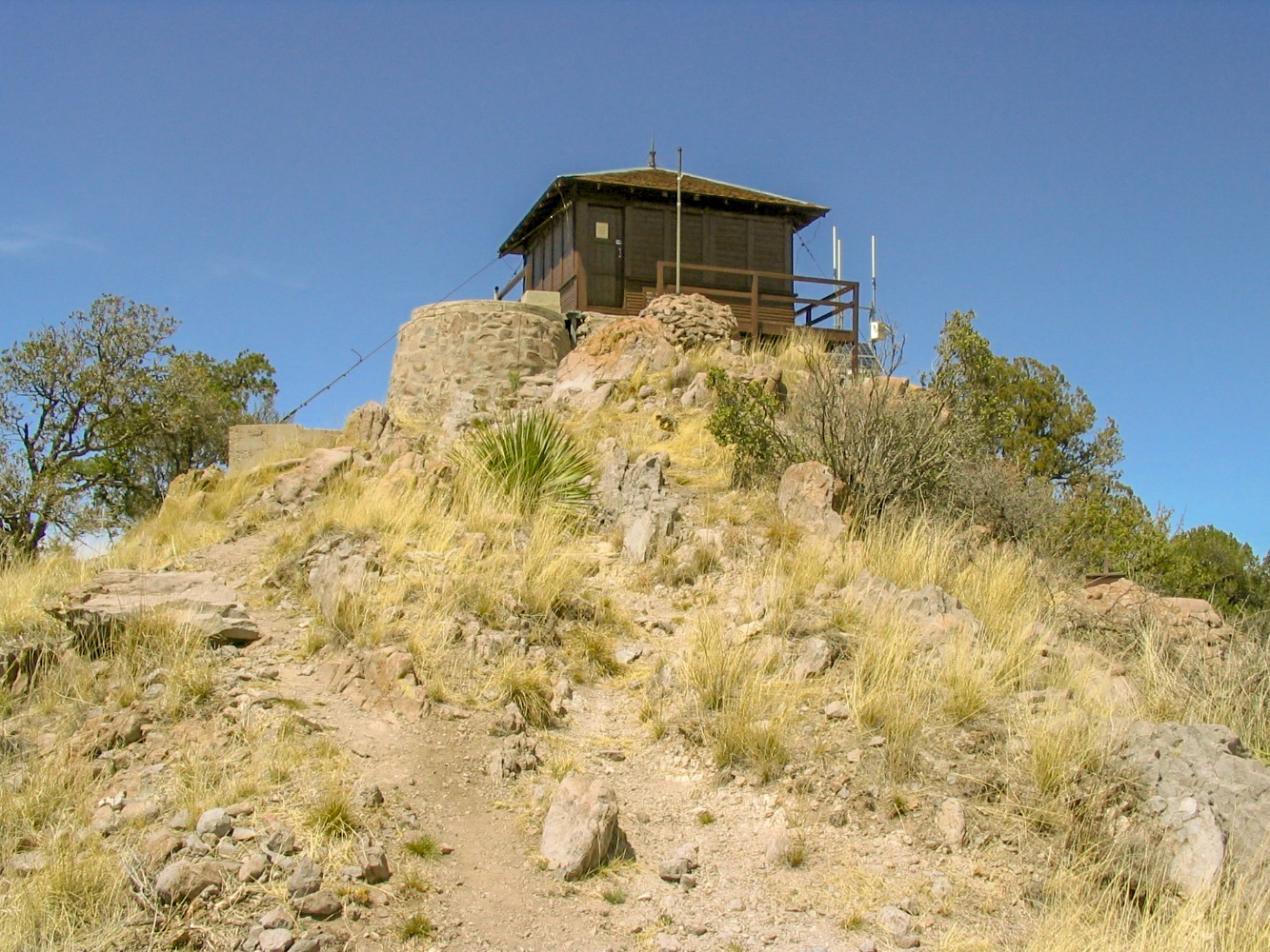
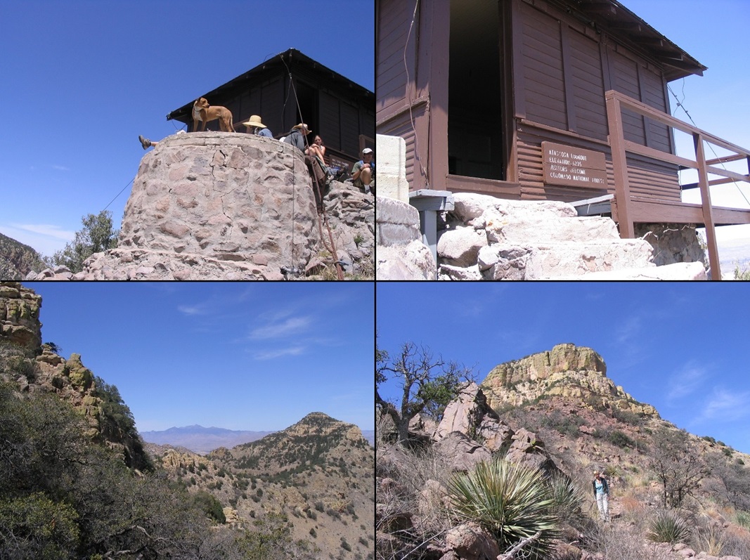
Atascosa Mountain is a major summit in southern Arizona, northwest of Nogales and not too far from the Mexican Border. Atascosa Lookout is a smaller summit south of the main peak. There is (was) a lookout tower atop this peak, even listed on the National Register of Historic Lookouts. However, it burned down in a fire, c. 2010-11.
We planned to hike to the lookout this weekend. I was interested in the main summit, too, but would wait until we got to the lookout before deciding whether to go over and tag the main summit. To the lookout is a fine trail. After that, it's a bushwhack and scramble.
We left the Phoenix area and arrived into the Tucson Mountains Park, where we scored a spot at the Gilbert Ray Campground. That night, a storm blew through. We had strong winds most of the night that jostled and flapped the tent, keeping us awake. I finally gave up at 1:30 a.m. and tried to sleep in the bed of my truck, βð up front in the cab. The next morning, the main storm came through, dropping heavy rain for two hours. The higher mountains were shrouded in snow.
By the time all this activity came and went, it was 10 a.m., and too late to drive to the trailhead and start the hike. We decided to drive into Nogales and get a cheap room for the night. We didn't do much, just being lazy for a day and eating too much good Mexican food. We planned to try the hike again tomorrow.
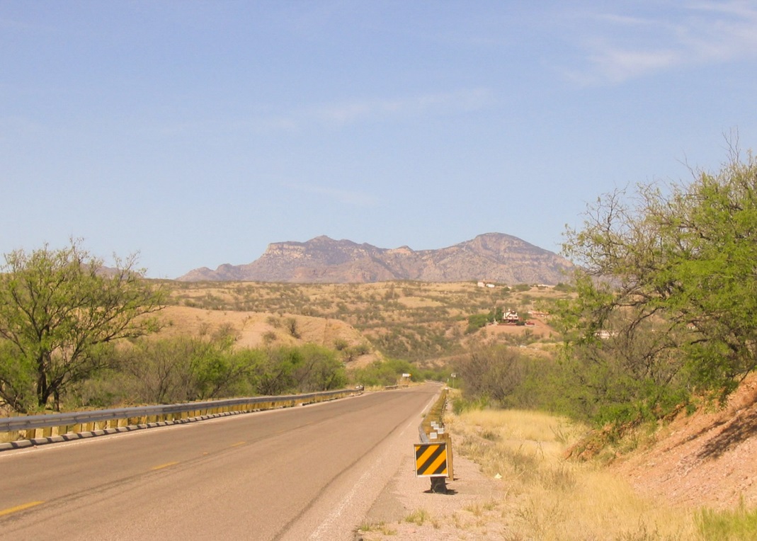
We awoke early Sunday and set out for the trailhead. From Nogales, we went north on Interstate-19 to the Pena Blanca (AZ-289) exit. We went 10 miles toward Pena Blanca Lake, turning off the highway at the 10-mile marker, left onto Forest Road 30 (Ruby Road). On Ruby Road, we went five more miles to the trailhead. A small parking area is on the south side of the road near a lone tree. We pulled in about 10 a.m., talking with some hikers coming out, while I taped up B.'s ankles for our hike in. A whole group of college-age kids then arrived in three vehicles and piled out, so we bided our time and let them go first. We started hiking a little before 11 a.m.
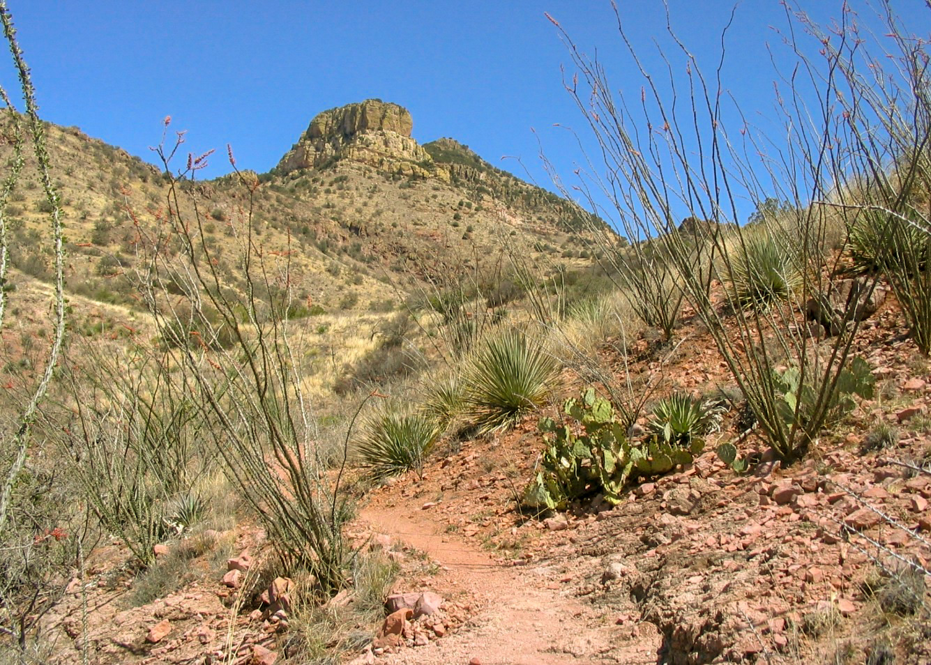
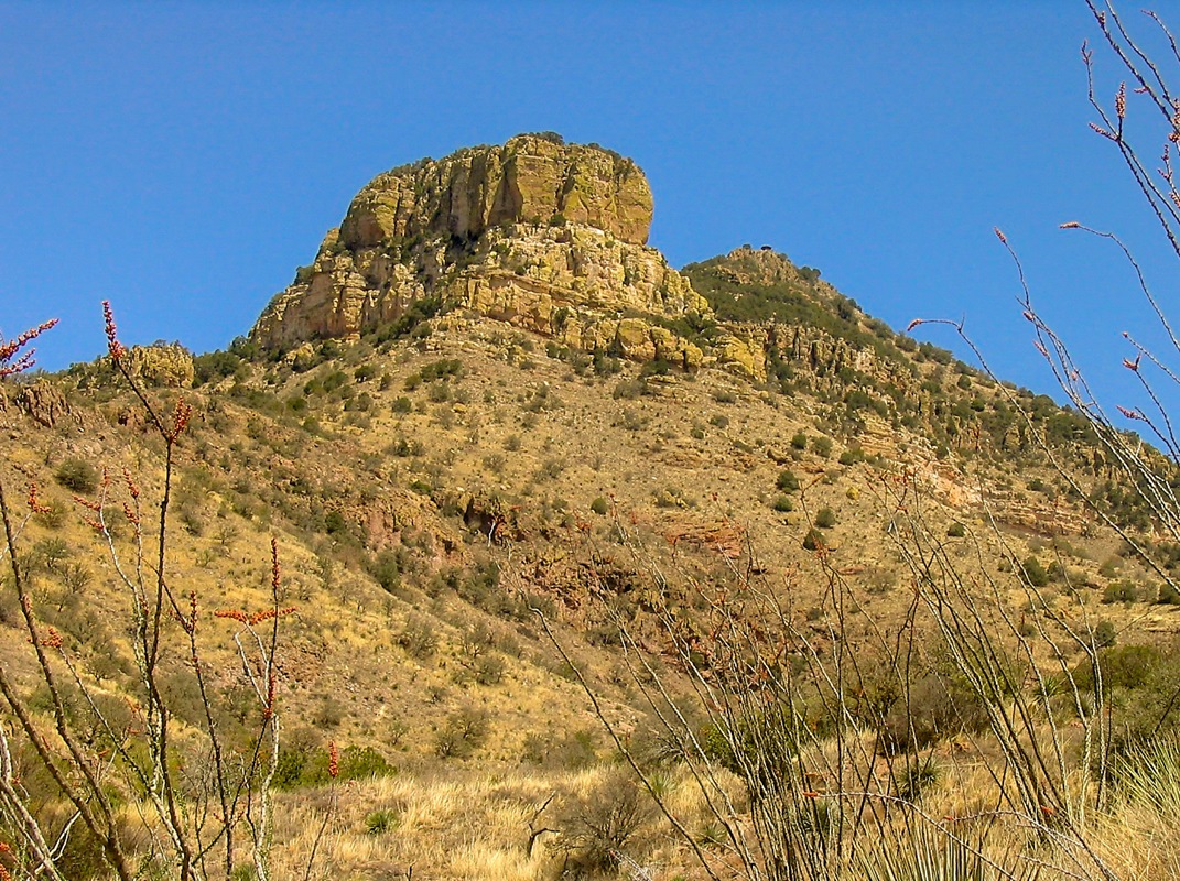
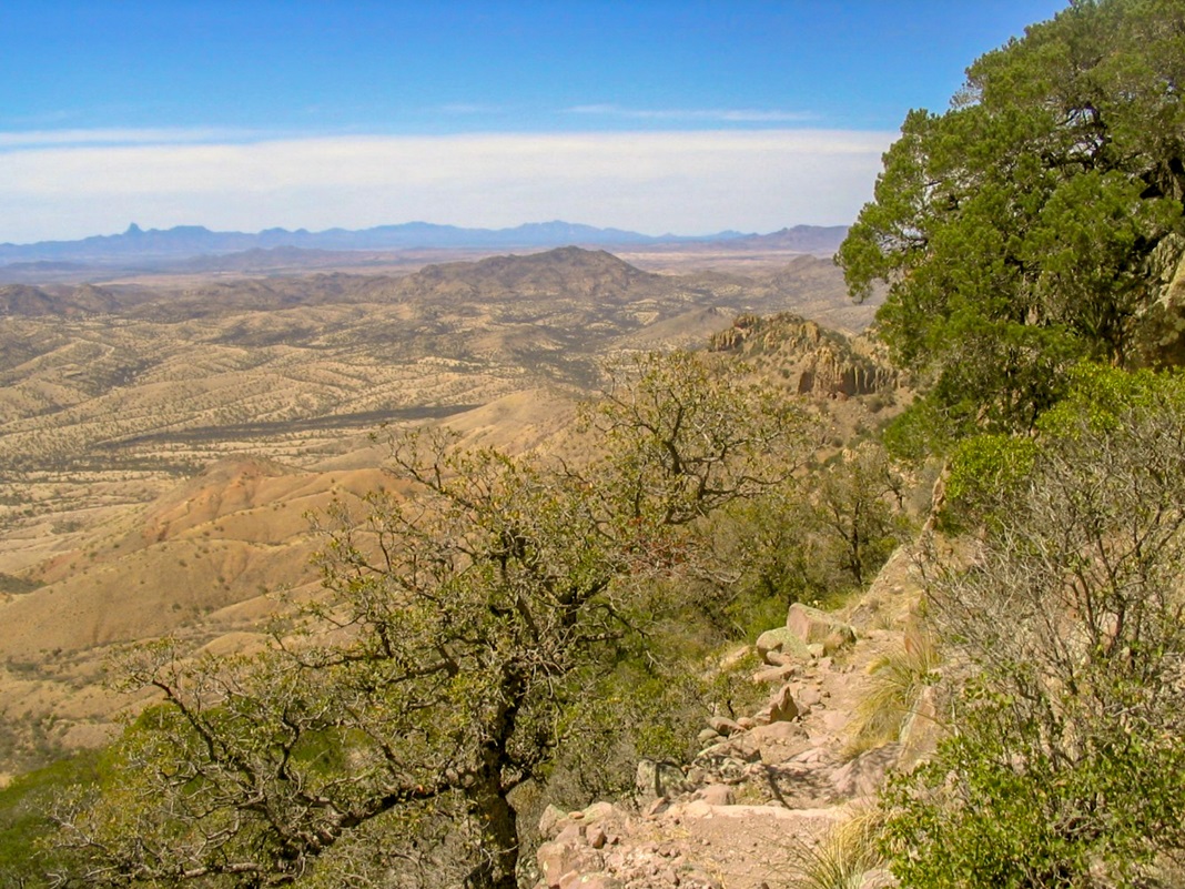
The trail immediately gains moderately up a slope, switchbacking twice, then a long traverse and contouring on the west side of a small knob. A day after the rains, the ocotillo were blooming their pretty red flowers. After the trail turns north, we got our first views of the volcanic tuff cliffs that guard the mountain's upper flanks. Behind the main cliff, we could see the lookout.
We reached a small saddle and passed through a gate, then continued on the trail as it gained at a steady uphill grade, contouring with the ridges and switchbacking only a few times. We took a break after a mile. At this time, a fully armed and armored Border Patrol agent walked past us, automatic weapon across his chest. Hey, nothing new to us: we saw all that and more on Miller Peak two years ago. He said hi, we said hi, and that was that. Just part of hiking in the borderlands.
After our break, we gained to a small saddle, then followed the trail as it bent north again, now on the east flanks of the mountain, in the only place where the cliffs have not formed a rampart around the upper summit. Here, the trail makes many switchbacks up the grassy and wooded slopes. Not long after, it gains the main upper plateau, where we could again see the lookout just a few hundred feet ahead of us.
We took a break here, then hiked the last segment to the top, arriving shortly after 1 p.m. The dozen or so college kids were all there, taking it easy. They seemed pretty cool. We found a spot on the rocks near a concrete footing and had lunch and drinks. When the crowd finally got moving down, we scampered up to the lookout itself and went in. It's kept open for visitors. Inside is a log to sign in, plus old furniture and things like playing cards, a Crest tube of toothpaste, and so on.
We had achieved our goal and felt good. The range highpoint is not far to the north, but it's not a trivial hike. From the lookout, it's a steep scramble into the trees, then a bushwhack to the top. Biut I did not feel comfortable leaving her alone at the lookout. I'd be gone for at least an hour. Thus, I decided to not bother, and save it for a later trip.
Our hike down went well and we had no incidents. We were back to the truck in a couple hours. We exited the area and drove straight home, arriving in the mid-evening.
|


|