The Mountains of Arizona
• www.surgent.net
|
| Ash Benchmark Mountain |
• Natanes Mountains • San Carlos Indian Reservation • Graham County |
|
Date: April 1, 2023
• Elevation: 6,003 feet
• Prominence: 1,073 feet
• Distance: 4.2 miles
• Time: 3 hours
• Gain: 1,310 feet (gross)
• Conditions: Sunny and warm, occasional breeze
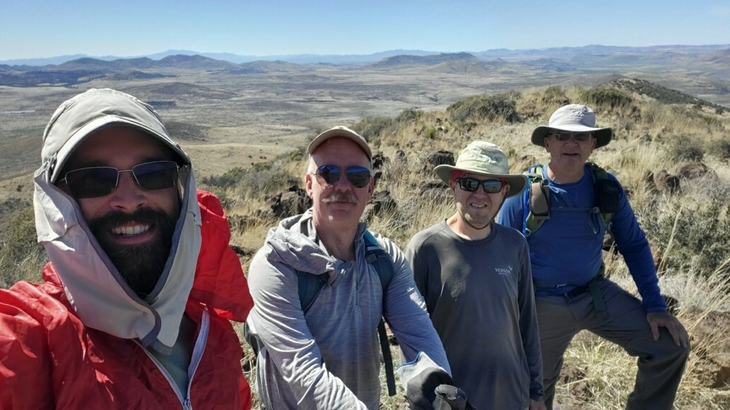
• Teammates: Scott Peavy, Matthias Stender and Adam Walker
Arizona
•
Main
•
AZ P1K
•
PB
•
LoJ
Ash Benchmark Mountain rises on the San Carlos Indian Reservation about an hour southeast of Globe, in Graham County. Access onto the San Carlos lands requires a permit, but other than some well-marked "closed" areas, it appears that just about everything else is open to exploration (within reason). This peak lies about 25 miles in along Point of Pines Road (Indian Route 8), from where it branches off US-70. It's a long loaf-shaped peak with no apparent cliffs or rocky portions. Steepness and brush are its main challenges.
I was to meet Matthias, Scott Peavy and Adam Walker to hike this peak. They were busy hiking a different peak this morning while I kept myself busy tagging a couple nearby foothills. I then drove to where the Ash Creek Ranch road leaves the Point of Pines Road, and parked in a small pullout to wait for the others. I was here nearly an hour, and during that whole time, not one vehicle drove by. It was just me, a few cattle out in the pasture, and wind. I walked the area and napped in the front seat. It is very remote back here, and very very quiet. Completely still and silent, except for the wind in the grass. It's beautiful here and not a place anyone ever goes to.
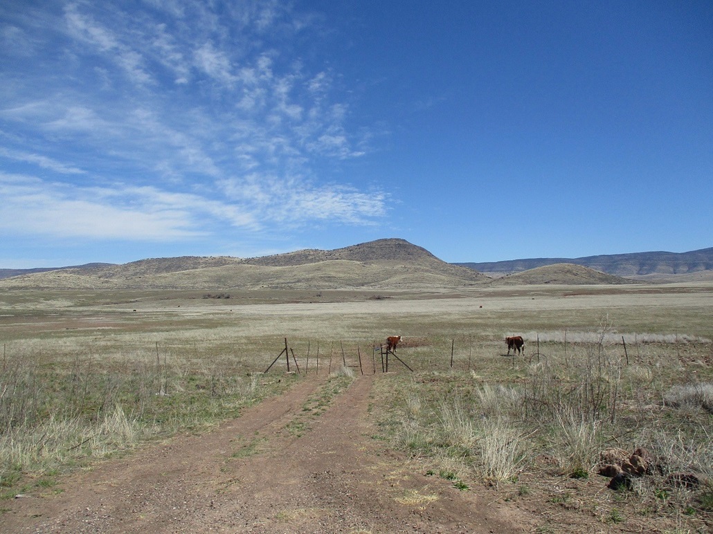
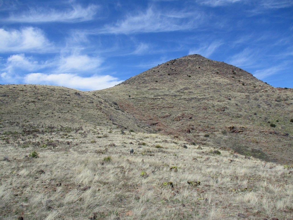
They all rolled up a little after noon. I hadn't seen Scott in a while so it was good to see him. This was my first time meeting Adam, who is well-known on Summitpost as "gimpilator". After handshakes, we drove in about a mile or so along this side road, parking in a pullout just before the road crosses a small bridge and leads into the ranch complex. Ash Benchmark Mountain rose about a mile west of us, a big rounded conical hump of a peak with a few smaller rounded humps for foothills.
We got moving quickly because we were all dressed and ready from out last hikes. Between us and the hills was about a mile of pasture with a small herd of scattered cows (and a bull or two) out grazing. As we walked, they jogged to the side. Most cows just run ahead of you, but these guys moved to the side. The Ash Creek ranchers have trained these cows well.
We had to cross a couple muddy creeks and tanks, and slowly gained elevation, crossing one barbed-wire fence along the way. The ground was grassy but open, with parts covered in woody stalks about two feet high, very flexible and not thorny, but what they were, I don't know.
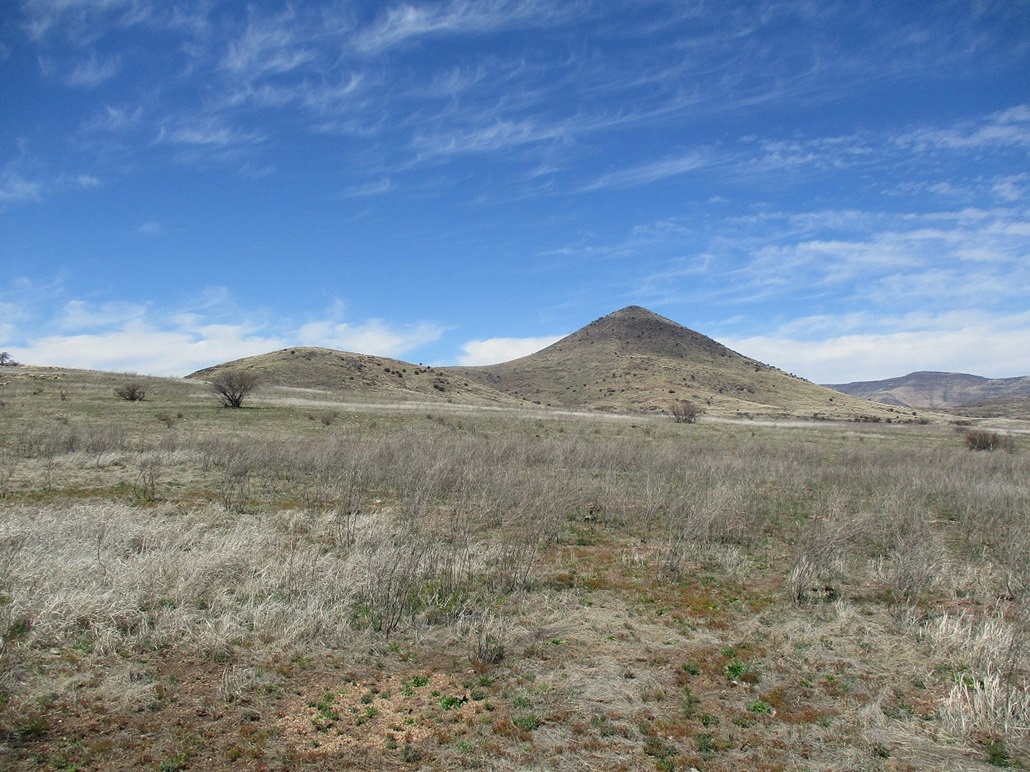
We gained elevation toward the closest of the foothills, electing to go up and over it rather than curl around it. This would result in about an 80-foot drop down the other side, to a saddle below the peak itself. We took a break at this saddle. It had warmed a little, into the 70s. It was pleasant with a breeze at times, and very dry. I was already feeling dehydrated.
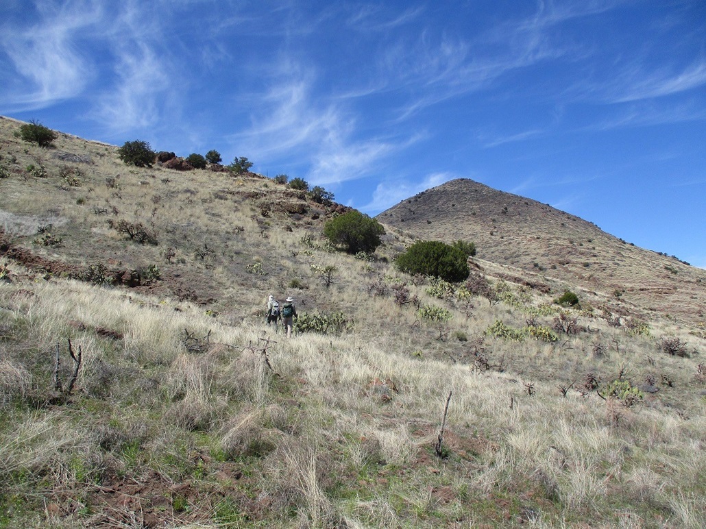
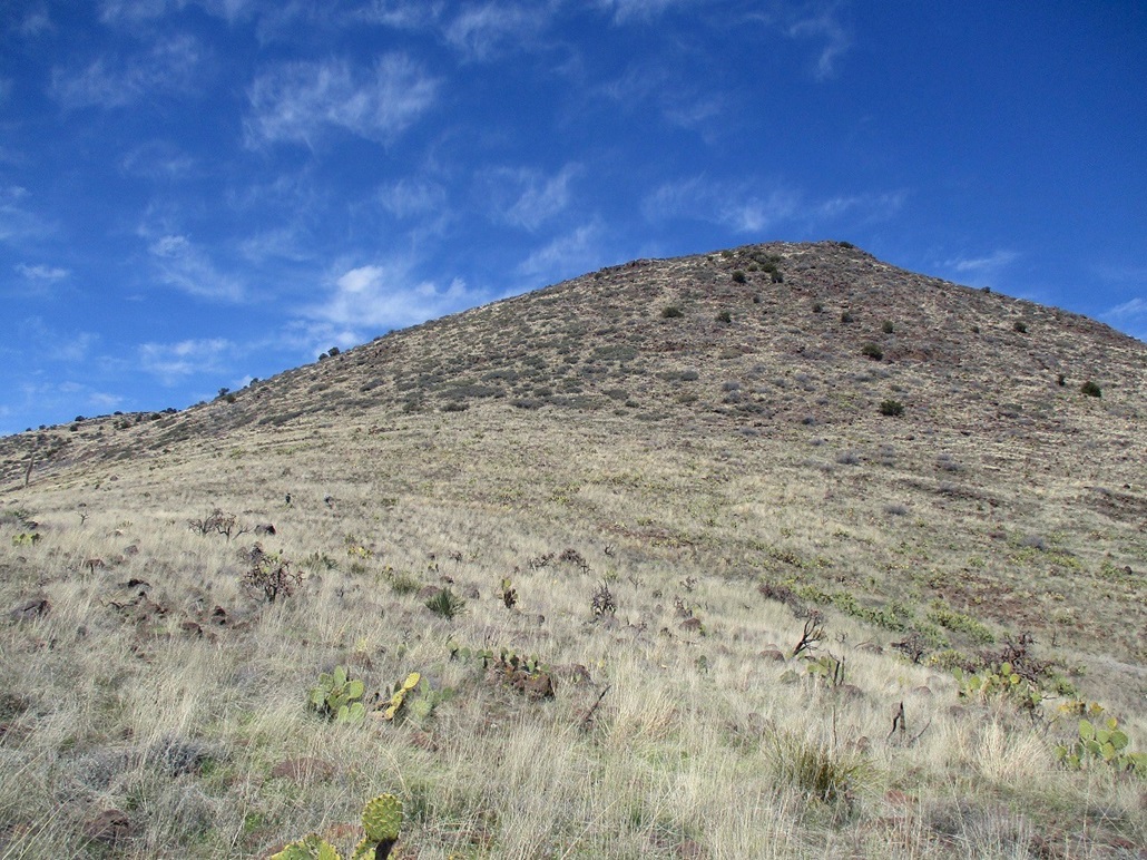
We gained another slope to put us on a long gentle ridge below the main mountain mass. Adam and Matthias, the young bucks, were ahead of Scott and me, the elders, about a hundred yards. They were looking at busting straight upslope. It looked do-able but not like very much fun. Instead, Scott and I agreed to angle up and to the left, intending to catch the main ridge west of the summit, then we'd double back to the top.
This plan worked well. It was steep but not difficult. There were lanes almost the entire way. The brush was thick at times but mostly grass and low scrub. We went from one juniper to the next and soon had come upon the main ridge. We made a right then walked up the easy slopes to the top, where Adam and Matthias were waiting. I didn't time it, but the others said it had taken about 90 minutes from the cars.
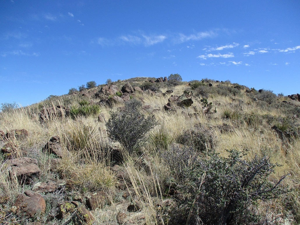
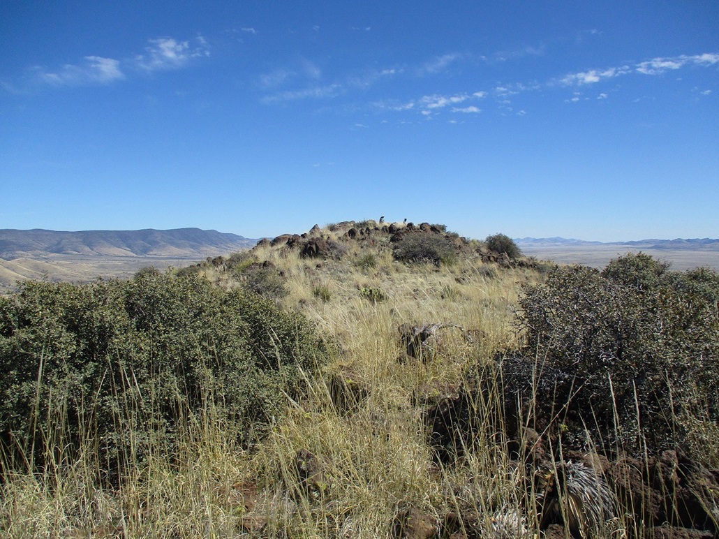
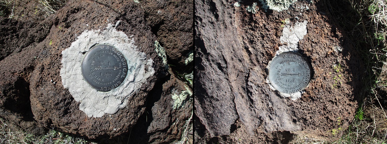
We took a long break here, a chance to relax and look around. There are two reference markers pointing to the alleged Ash Benchmark, but we could not locate the benchmark itself. We found some guy-wires and an old height-of-light wooden pole, where the benchmark likely was located, but if it's there, it's under a pile of rocks and crud. Later, I looked online and it's not listed in the benchmark databases. Thus, is this really "Ash Benchmark" Mountain?
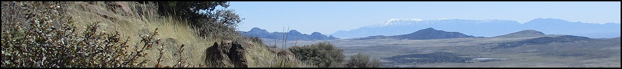
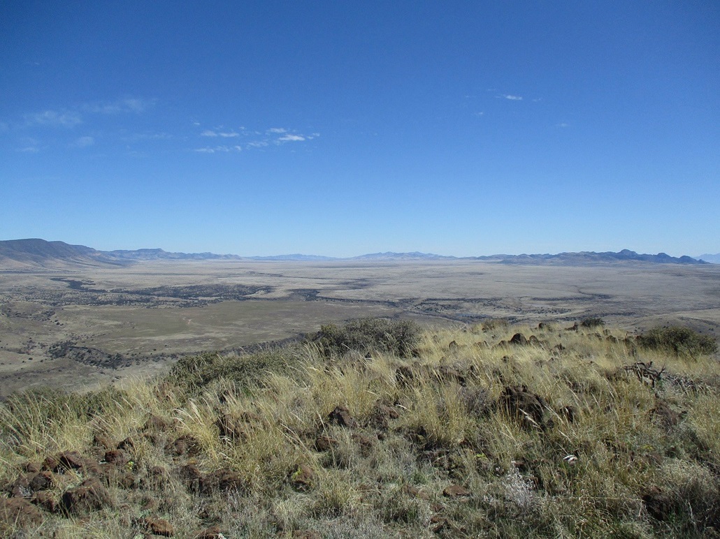
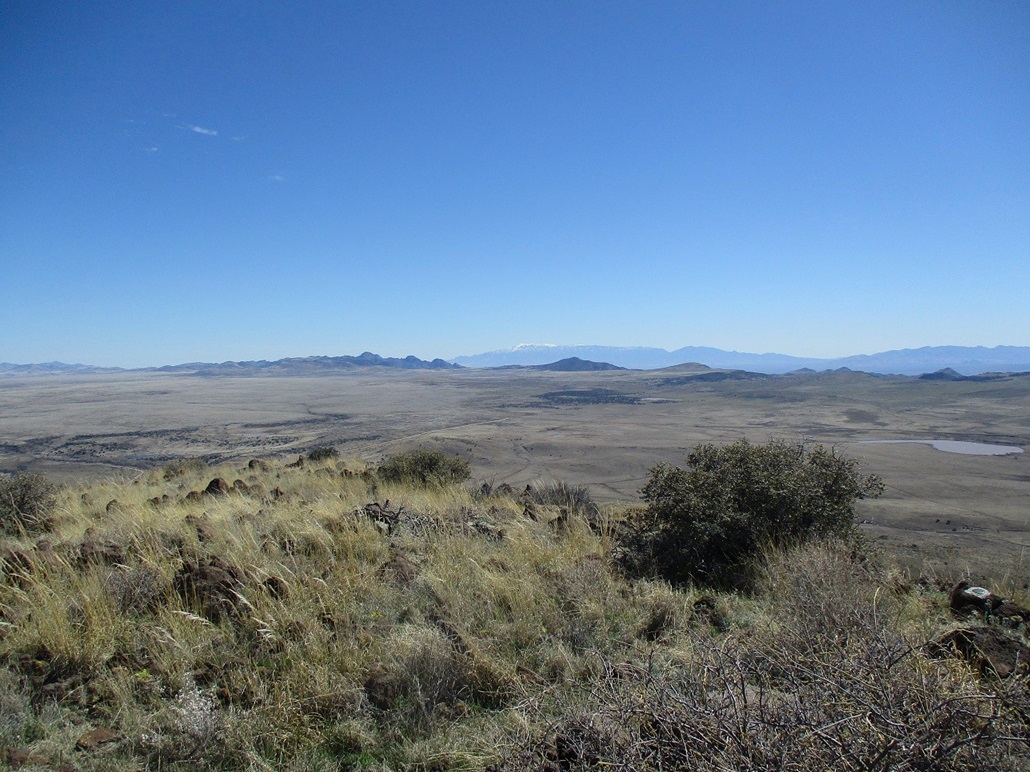
The views were very good up here. The Nantac Rim, a band of cliffs about 1,500-feet high, swept from the northwest to northeast. Way to the east were the Turtle Mountains and Bryce Mountain. Looking southeast was big snow-covered Mount Graham. In all directions were peaks and hills and mesas and canyons. I'd be hard-pressed to identify most by name as many don't have names. We spent about 20 minutes up top.
Going down, Adam was interested about the route Scott and I took so we all followed that route down, saving us the hassle of the steeper slopes they had come up. I guess it was a little looser and sketchier than they were expecting. The downhill hike went well. I took my daily tumble, landing on my butt after a rock rolled out from under me, but I was up quickly. I'm getting good at this.
We exited by going around that lower foothill rather than up and over it again. We had to cross a few arroyos, but the hiking was easy and we made good time. We were back to the cars around 3:30-ish. By now, I was beat. The elevation gain for this peak comes out to about 1,300 feet, and add that to the roughly 1,250 feet I put in on my earlier hikes, I had gained close to 2,500 feet today. The others mentioned feeling tired and dehydrated as well.
We drove out, Scott riding with me, back into Globe where we stopped for snacks and drinks. At this point, Scott got back in with Matthias and Adam, while I took off ahead. I stopped for gas in Superior and within a minute, Matthias pulled in to the same gas station. Gas is cheaper by about 80 cents per gallon here, compared to Phoenix. We said our goodbyes all over again. My drive back home went fine, with more traffic because of people leaving the Renaissance Fair, plus most of the Superstition Freeway being closed. I got the chicken shawarma plate at my favorite nearby Greek restaurant.
It had been a very successful day for all of us. This was just my second time on the Point of Pines Road, and I love the remoteness of it. My hikes had gone well, and I enjoyed hiking with the gang. It was good to meet Adam after reading so many of his reports over the years. The peak itself was enjoyable, not too difficult but requiring some effort. I mostly enjoyed the solitude of the area, plus a good meet-up with the guys.
|

|