The Mountains of New Mexico
www.surgent.net |
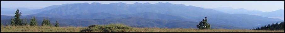
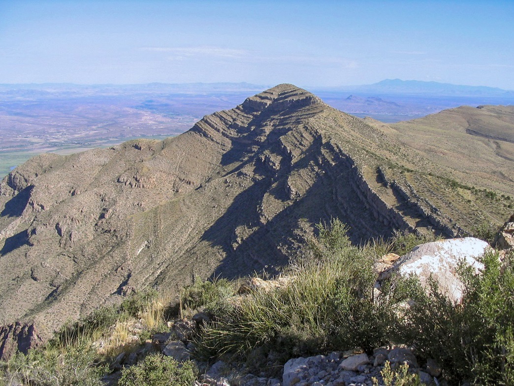
| Timber Mountain |
• Highpoint: Caballo Mountains • Jornada del Muerto Plain • Sierra County |
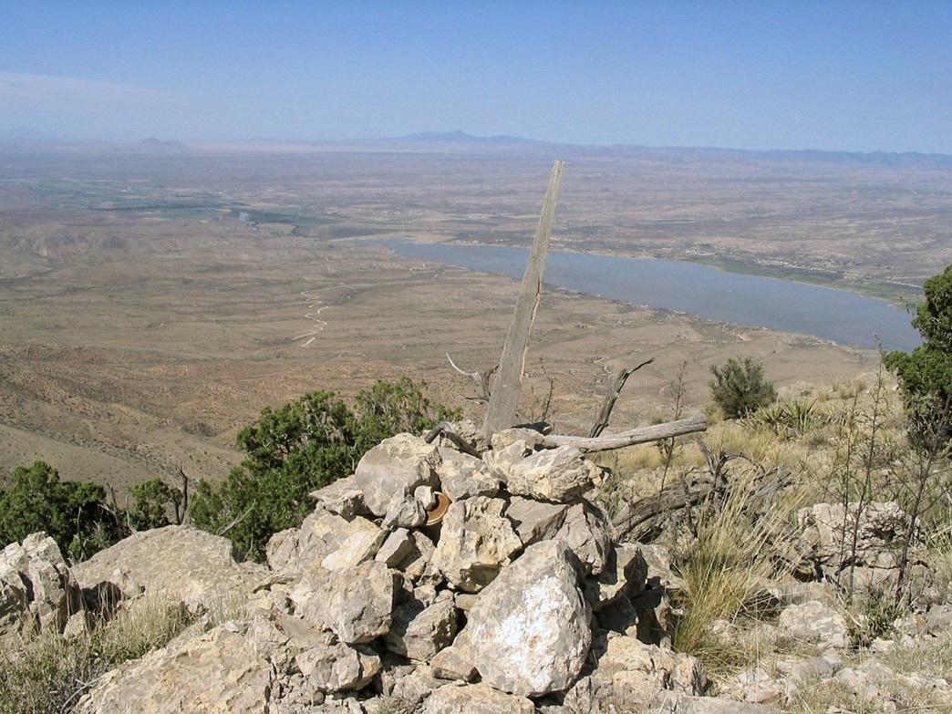
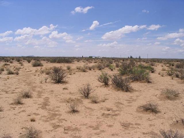
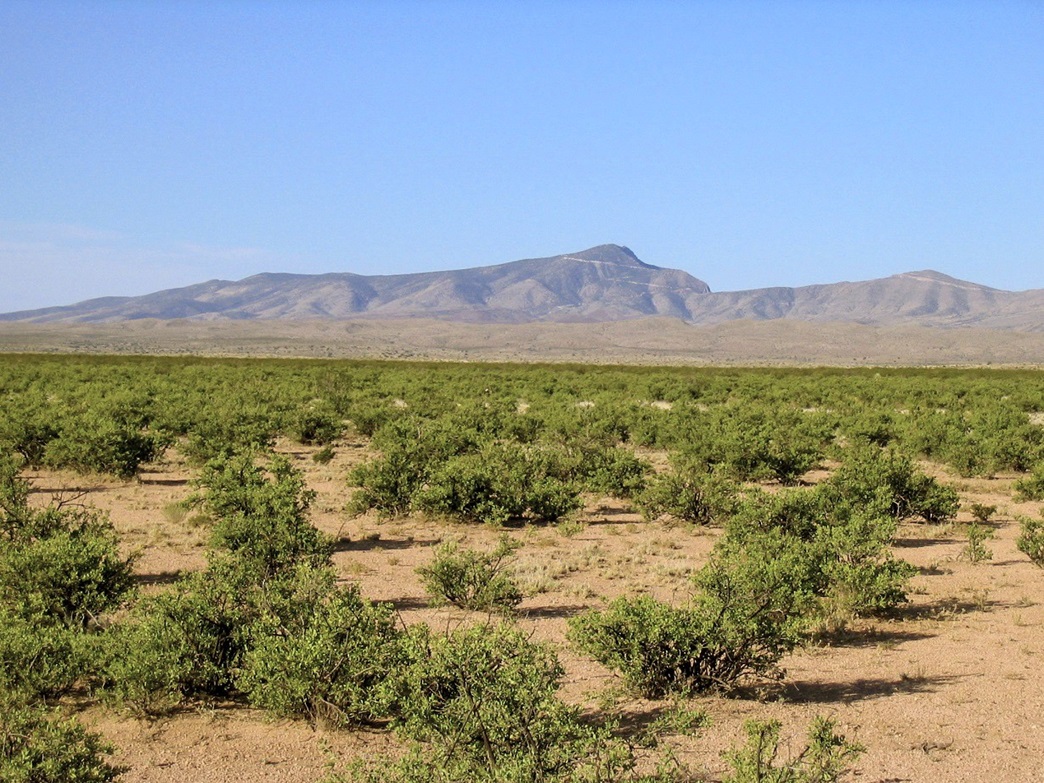 Timber Mountain from the Jornada del Muerto plain
|
Date: July 7, 2007
• Elevation: 7,565 feet
• Prominence: 2,815 feet
• Distance: 3 miles
• Time: 2 hours and 20 minutes
• Gain: 1,480 feet
• Conditions: Very warm and humid
New Mexico
•
PB
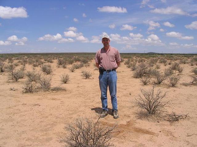
βð and I travelled to Truth or Consequences, New Mexico, for the 4th of July weekend. We had been here a year ago and enjoyed the old hotels, hot springs and interesting hiking and exploration in the mountains and plains east of town. On that trip a year ago, we had scouted the roads toward Timber Mountain, but did not hike it due to time. This time, it was tops on the agenda.
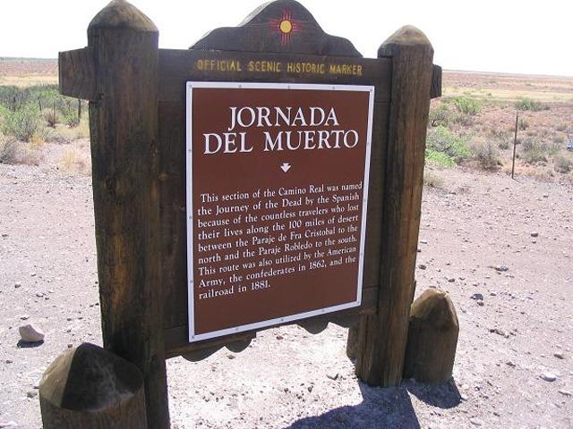
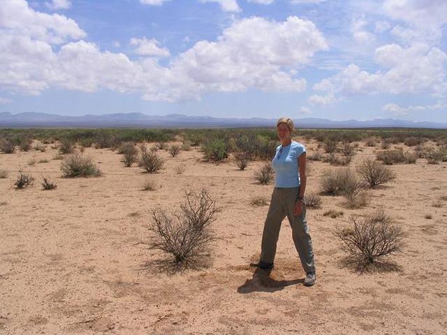
The city of "T or C" (we say "tork") sits in the Rio Grande Valley, fronted by the Caballo and Fra Cristobal Mountains to the east. The mountains are uplifts, with gentle grades on their east slopes and steep cliffs facing west. Farther to the east is the elevated desert plain called the Jornada del Muerto, or "Journey of the Dead". Old-time travelers had to cross this plain to get to their destinations, and many didn't make it, hence the name. Today, it's home to a couple giant ranches (The Pedro Armendariz Ranch to the north covers 300,000+ acres and is owned by Ted Turner) and the future commercial spaceport being put in by billionaire Richard Branson near the locale of Upham to the south. East of the plain are ranges and peaks on the White Sands Missile Range, off limits to the public.
We were here in May 2006, staying two nights at the Charles Hotel in downtown, on the corner of Broadway and Business-25. On that visit, we wanted to explore this future spaceport. Plus, there is a latitude-longitude degree confluence nearby, and we wanted to visit Timber Mountain. In 2006, we drove up highway NM-52 past Elephant Butte Dam, through hills and canyons, and soon, onto the Jornada del Muerto plain. We drove to the highway's end, a T-junction in the tiny community of Engle. Running south and north from here is a good road, some of it paved and the rest all-weather gravel.
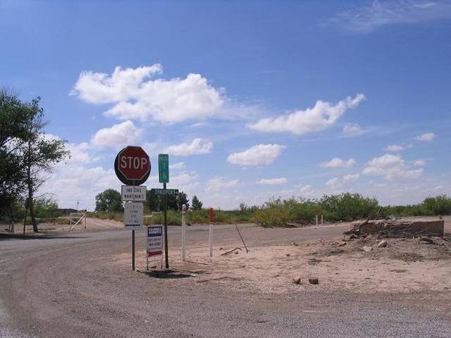
We went south a dozen miles, coming to a Y-junction in the middle of nowhere, with a sign pointing to the Cain Ranch, and a green street sign mentioning "Spaceport" with an arrow. We followed that road, which led into the Cain headquarters. No one was home, other than a overly-friendly border collie who scratched me. We had no luck finding roads that went past the Cain place. Nor the Spaceport. I've never been to a spaceport before, and I really wanted to see one. However, the latitude-longitude confluence at 33 North & 107 West was located nearby, so we visited it.
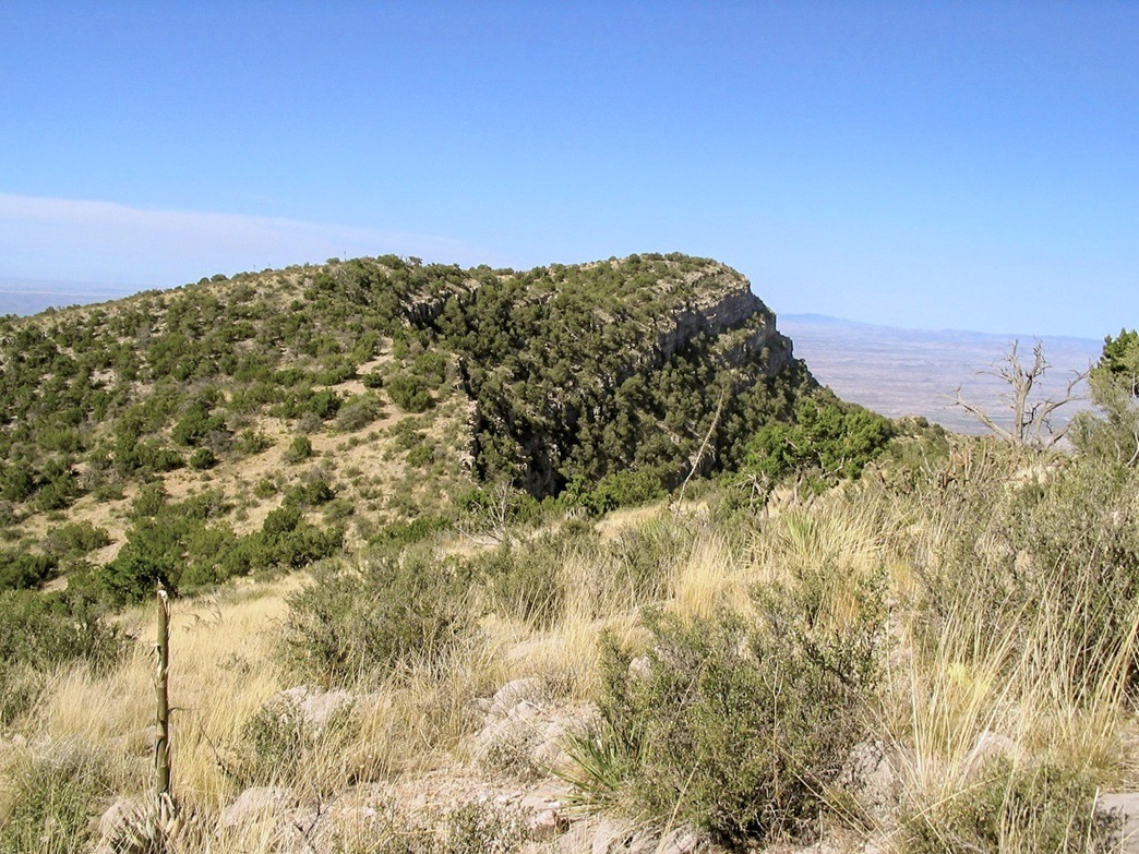
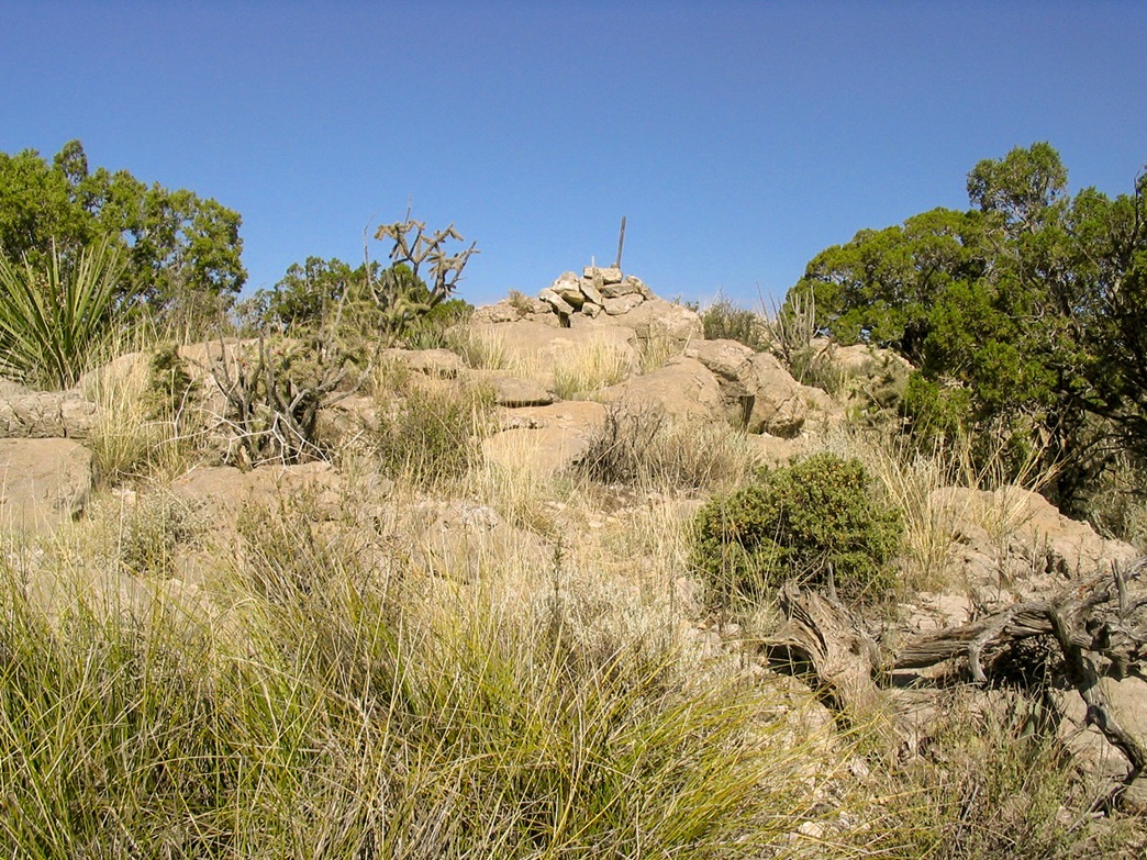
We had no more luck finding anything that looked like a spaceport, so we drove the roads toward Timber Peak and got as far as the peak's north ridge, where we had great views down into the Rio Grande valley. However, it was getting late in the afternoon and a hike to the top probably would have had us coming out these roads in the dark, so we decided to skip the hike and make a return trip, such as now. We left Phoenix friday afternoon after I had finished classes. We decided to take the "high roads" through Payson, the Rim Country and Springerville into New Mexico, then catch Interstate-25 in Socorro down to T or C. The weather was hot, 117 F the day before and about 115 when we left town today, and my truck actually ran hot for the first time ever, according to its gauge. Soon, though, we were higher in elevation, coming into Payson (elevation 5,000 ft) just as a thunderstorm cell came through. This dropped the temperatures into the 70s, a wonderful feeling after weeks of 110s in the desert. We got food and groceries in Payson, then put in lots more miles east, gassing up in Springerville, passing through the remote communities of Quemado, Pie Town and Datil in New Mexico, then coming into exploding fireworks in Magdalena in the dark. We got stopped at a DUI checkpoint, a first for both of us. We asked about the fireworks, why they blowing them up today instead of July 4th. Turns out they had rain on the 4th, and decided to have the celebration two days later. We didn't get into T or C until after 11 p.m. local time. We had to wake the night-guy at the Charles Hotel, who came down to let us in to our room but wasn't too cheery about it. We got our stuff in and had a late night dinner of store-bought sandwiches and pastries before crashing. The plan for today was to get a very early start for the hike so that we could beat the heat of the day, the potential thunderstorms that usually build by noon, and be back in time for more soaking in the baths. We were on the road by 6 a.m. for the short drive up past Elephant Butte and up onto the Jornada del Muerto plain. We didn't go as far as Engle. instead we turned south onto a substantial dirt road at about milepost 10 near a stand of mailboxes. According to the map, this is still on the Armendariz Ranch. In less than a mile we came to a junction with two gates, and took the right gate, proceeding south. Last year, we spent considerable time figuring the road net here, getting lost and following dead ends before getting as far as Timber Peak's base. This time, we knew which roads to stay on and had no trouble at all. Nothing is marked out here, and the maps show the roads incorrectly in places. Generally, we stayed south for about 9 miles to a draw at a ranch sign (The "Rocking S"), passed over a concrete ford, then went right to a small hill with towers, then right again at its base, then left at the first junction afterwards, following the road by sight to Timber Mountain. The roads were very good for the first 14 miles from the paved road, then steadily rockier and narrower as we approached the base of the peak near Ghost Tank. I put the truck into 4-wheel drive for the short but steep uphill grade, getting us another mile up the hill and parking at the same spot we parked last year, a flat area near one of the hairpin turns, with stunning views in all directions, especially of the Rio Grande valley below. To here, we had driven 17 miles from the paved highway, and a total of about 29 from our hotel. The road from here is still good, but we liked this spot for its views and provided for a nice starting point for the hike to the top. βð stayed with the truck, and I took off and made excellent time up the remainder of the road, covering a shade over a mile and coming up to the towers lined along the summit ridge and cliff edges. The true highpoint is located a half-mile south, a rounded top covered in brush, standing about 20 feet higher than the tower summit. Past the towers, I found an old path (possibly an ATV route) that led down steeply below the saddle, about a 140-foot descent. The path continued a few more yards before giving away to the brush near a white post partially hidden by a tree. The rest of the hike was through the low shrubby brush and rock bands, coupled with me trying some paths that led to dead ends and having to double back. Actually I did fine, but took it very slow. Rattlesnakes were on my mind with all the brush and rocks, especially the large flat rocks with nooks for them to hide in. In some places I could not see where my foot was going to land, which is always a bad idea in snake country. I took a stick and beat the area or tossed in little rocks to be sure. The route eventually leads up on top of a small rise, then down and up another 20 feet before coming up to the true summit, marked by two cairns and posts. A register is placed in the westernmost cairn and I signed in, taking time to enjoy the views down the steep west cliffs into the Rio Grande below. I took a break, but in about 10 minutes I started moving down. The hike back went well, going a little quicker as I knew the places to step now, and in short time I was back onto the more open paths and the towers themselves. Then it was just the simple walk down the road to the truck. B. was there, reading and writing. The day was still young and there was no hurry to get moving. I changed into drier clothes then laid out a blanket and took refuge in the shade under my truck, laying down for a little nap. We stayed for another hour, chatting and watching the thunderstorms build. There was nothing happening above us, but off to the north, a gigantic anvil-shaped cell was already fully formed above South Baldy Mountain, while off to the west the Black Range had its own big cells growing. We could see veils of rain, too. My round-trip hike had taken just under 2.5 hours, and adding in the extra hour it was close to 11 a.m. when we finally got moving, driving slowly off the peak then zipping out the remainder of these desert roads back onto pavement and back to T or C. We spent the rest of the day relaxing and watching the storms come into town. Some big mean-looking clouds covered T or C but other than windy gusts, nothing much came of them. We spent another night at the hotel, then the next day drove over the Black Range into Silver City and on to Glenwood, setting us up for a short hike Monday up Brushy Mountain, plus a meeting with the Glenwood community dog. |


|