The Mountains of New Mexico
www.surgent.net |
| Brushy Mountain |
• Highpoint: Big Lue Mountains • Gila National Forest • Grant County |
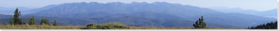
 Brushy Peak stands in the background of grassy meadows
|
Date: July 9, 2007
• Elevation: 7,600 feet
• Prominence: 2,280 feet
• Distance: 4.5 miles
• Time: 1 hour and 40 minutes
• Gain: 940 feet
• Conditions: Warm and very humid
New Mexico
•
PB
This particular Brushy Mountain lies near the Arizona border in western New Mexico, south of the ranching community of Mule Creek. It's an easy mountain to recognize by the presence of a large FAA geodesic radar dome sitting atop the summit. The peak lies in the Gila National Forest at the southern end of the "high country", such that that the land drops dramatically in elevation south towards the deserts.
The presence of the FAA radar dome on the summit means there is a good road to the top, so we knew this would be an easy peak to hike and probably wouldn't require too much time or logistics. We worked this peak into a 4-day mini-vacation we planned for the 4th of July holiday, staying two nights in Truth or Consequences and a night in nearby Glenwood.
After our stay in Torc, we enjoyed a leisurely scenic drive over the Black Range via highway NM-152 into Silver City, then along highway US-180 to Glenwood, arriving in the mid-afternoon. A huge thunderstorm had swallowed up the Mogollon Mountains in veils of rain, and we watched in amazement as lightning hit the ground, one bolt after another, just a short distance off the road, less than a mile in some cases. We had sun and clouds on the road, so we were near the margin of this big cell.
In time we rolled into Glenwood and stayed a night at the neat Crab Apple Cabins in town (beware: no television). The storms never quite reached Glenwood but we had clouds which mitigated the heat. Our penchant for meeting friendly animals came true again as we met a local golden retriever, who sat with us outside our cabin, eagerly accepting pats and ear-rubs.
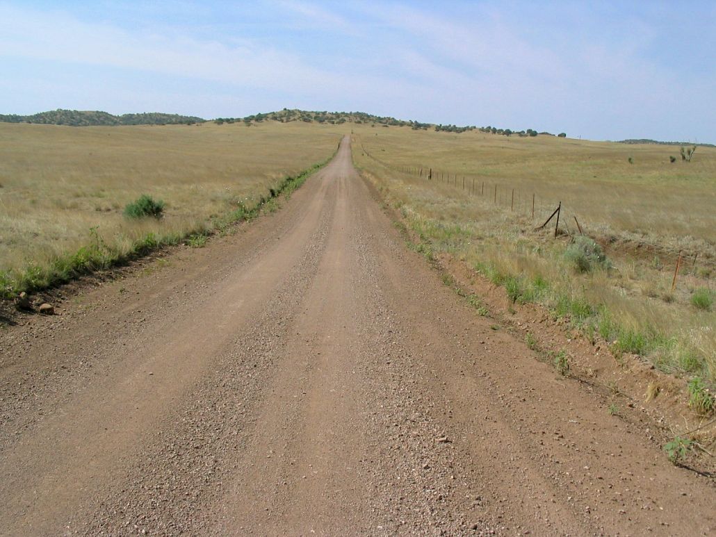
Next morning, we slept in and didn't leave town until 9 a.m. We were not too far from Mule Creek and Brushy Mountain, and figured a hike wouldn't take too long, so we didn't feel compelled to be moving at dawn to beat the storms. The drive to Mule Creek went well, where we turned onto Brushy Mountain Road CMR (County Maintained Road) near the post office. We followed the road south through attractive hilly rangeland, a mix of grassy fields and pinon-juniper woodlands.
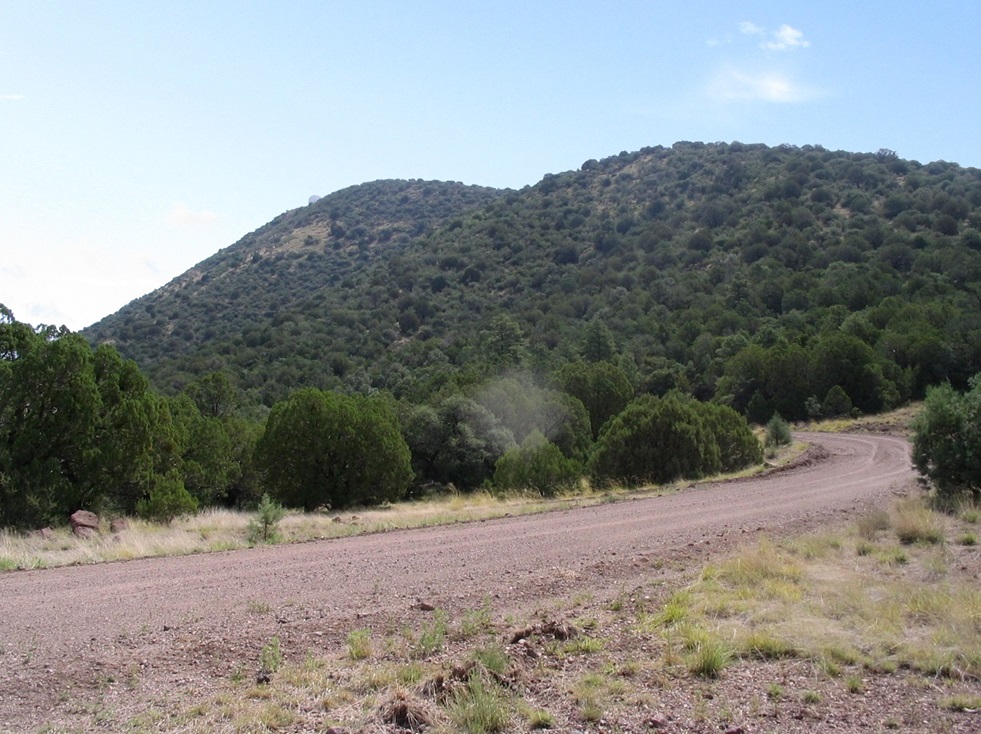
After a handful of miles, the well-tended road emerges into more heavily forested sections of ponderosa pine, passes through a ranch community called Pine Cienega, then comes to a junction with Radar Station Road. We went left, the big dome obvious above us, and parked at a clearing just past a fence line and cattle grate. It was 10:30 a.m. when we parked. I got my boots on, packed some water and was moving within minutes.
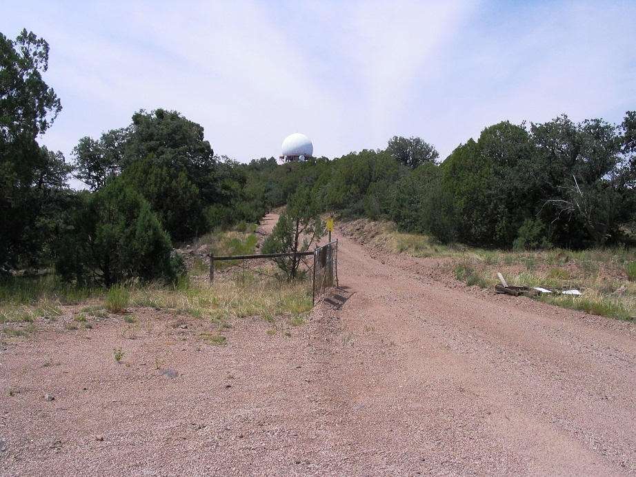
All I did was hike the road to the top. The gradient was never too steep, and the views were lovely, especially looking south. The route stays on the south side of the peak, then swings east before doubling back sharply west at the main ridge crest for the last portion to the top. It then comes to a clearing and turnaround at a gate below the towers. The gate was open and had been so for a long time. The road had been graded and the berms had collected against the opened gate, which suggested to me it probably hadn't been closed for years, especially since the fence to the right was completely collapsed on its side.
There were two signs on the gate, one being the usual FAA warning about tampering with the equipment and the other about contacting an office in Silver City to "coordinate your visit". Other signs on the fence were unreadable and I wasn't about to lift everything up to see what they said. I took a break here, then hiked up the last quarter-mile to the top. The main road makes one last tiny bend near vacant dormitory-style buildings, and ends at a clearing below the main dome.
The top has been graded flat, and the highest point (to me) might have been along a berm slightly beyond a more emphatic "No Trespassing" sign. I walked up to the sign but not past it, so I stepped on nearby berms and returned down the road to the bend. Here, I followed a scanter road near heavy machinery up to a large clearing that looked like a helipad, directly opposite where I had been about five minutes prior. This area looked as high as anything, and I was satisfied enough at this point.
The hike down went quickly. I was back to the truck by noon, a one hour, 40 minute hike total. The views had been nice but the air was hazy with moisture, and storm clouds were starting to build on the Mogollons to the east. We were safe where we were, so we decided to drive back up to the top so βð could check everything out. We drove as far as the gate and stuck around for a few minutes, then descended for the drive home. I used my truck's odometer to gauge the mileage I had walked: 2.1 miles to the gate, then another quarter-mile to the top, for an overall 4.5 mile hike, with 940 feet of gain. It didn't seem that long when I walked it, though.
We returned one more time, in 2011, so I could visit a nearby latitude-longitude confluence, 33 North, 109 West. I doubt I'll never need to drive down this road again, but the general area is beautiful. We have been back a few other times.
|

|