
The Mountains of California
www.surgent.net |
|
Mount San Antonio • Santiago Peak
On one very hot weekend in July 2000, I drove out to Southern California to climb Mount San Antonio (Mount Baldy), then do a mostly-drive-up car-hike of Santiago Peak in Orange County. It was very hot, I almost ran over a man, and I got to visit my two-month-old niece.
Date: July 22, 2000
• Elevation: 10,064 feet
• Prominence: 6,224 feet
• Distance: 11 miles
• Time: 6.5 hours
• Gain: 3,900 feet
• Conditions: Warm up high, hot down below
California
•
Main
•
PB
Mount San Antonio is the highest peak of the San Gabriel Mountains, the wall of mountains north of the San Gabriel Valley and the suburbs of eatern Los Angeles County. The summit lies on the Los Angeles and San Bernardino county line, and is the highest point in Los Angeles County. The peak is more commonly known as Mount Baldy.
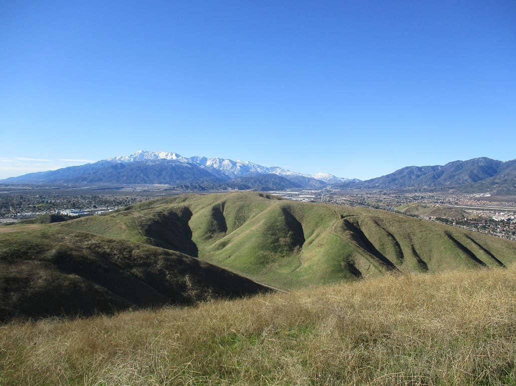
On a clear day, the mountain is magnificent to behold. It is gigantic, rising almost 9,000 vertical feet above the valleys below. If it had snowed recently, it only added to the grandeur. However, most days weren't clear at all. Usually, the smog and haze layers completely blotted out the mountains. All you would see was this ugly light-tan backdrop, not even a faint silhouette of the range.
I grew up in the suburbs below the mountains, but never hiked in the hills, much less to the peak itself, while growing up there. I was a kid, so I did not have the means to go hike there on a whim. Once, my AYSO soccer team coaches decided to skip practice. We were at San Dimas Canyon Park, which is in the foothills. They just up and ran into the hills, we kids following. They were about 20 years old, we kids were about 11 or 12. Best soccer practice ever. As I got older, I didn't hike. There was just too much quality television to watch. I would not start hiking these big SoCal peaks until eight years after having moved away.
For this hot July weekend, I planned to drive to Southern California to visit my brother's family and hike this peak and hopefully nearby Santiago Peak. I left Phoenix during the hottest part of the day, and it stayed ungodly hot the whole way in. Then things got exciting in Palm Springs.
Driving on Interstate-10, I saw a lot of red lights up ahead, cars braking all of a sudden. I slowed, then saw why they were braking: some idiot was standing in the effing freeway! I didn't see this guy until the last moment. I was expecting to see a car wreck to the side, not this. I was going to hit him! I couldn't just swerve like a maniac, given the traffic. Everyone else was braking, some were actually swerving. I braced for the impact. A big truck was on my right. But the guy somehow got out of the way. How he did it, I have no idea. It all happened in a split second, and I fully and totally expected to have his guts all over my hood and windshield.
I was unbelievably grateful that I had not hit this joker. I was grateful I had not swerved into, or been swerved into by, another motorist. I myself could have been in the wreck. I was grateful and furious at the same time. I called 911 to get the CHP on this guy. My adrenaline was through the roof. I don't think I've ever screamed so many F-words in a row so loudly all at once. I still to this day have no idea how I didn't hit him. I arrived to my brother's place at 10 p.m..
The next morning I got a late start, not arriving to the Mount Baldy Ski Area until about 9 a.m., and delayed when I discovered I needed an Adventure Pass, which I had to double back into town to get. This is a popular hike and the approach road was already full of cars so I was forced to park lower. The trailhead is at 6,100 feet elevation, meaning a gain of nearly 4,000 vertical feet to the summit. And it was already getting warm, so I could tell I was in for a big day.
The first leg of the hike follows a service road to the top of the Mount Baldy Ski Area. This road meanders in and out of the folds of the mountains, roughly paralleling the ski runs and the ski-lift, which was not running today. Sometimes they run the ski-lift in summer so people can be "ski-lifted" to the top, where they can roam the highlands for the day. But not today. The walk to the upper ski area took a couple hours and was very tedious and unexciting. I was at 8,000 feet elevation, roughly half way up. I took a break up here amid the buildings.
From the buildings, I went west along access roads and smaller ski lifts until I had left the ski area altogether, now hiking up and over the Devil's Backbone, a stretch of trail along the high ridge with impressive drop-offs and sometimes "skinny" traverses across sections. The trail was sketchy in places and barely etched into the scree hillsides. Unfortunately, there was not much forest cover and it was quite warm. Along the way the trail bypasses Mount Harwood, the main sub-peak of Baldy to its east.
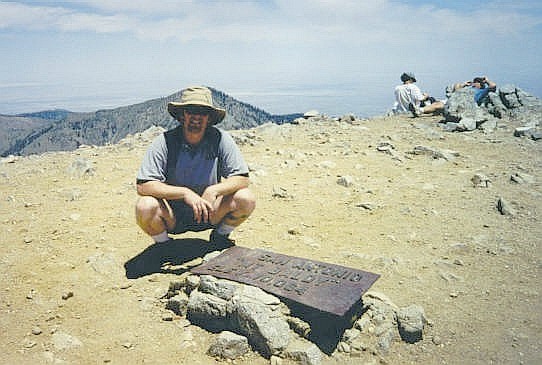
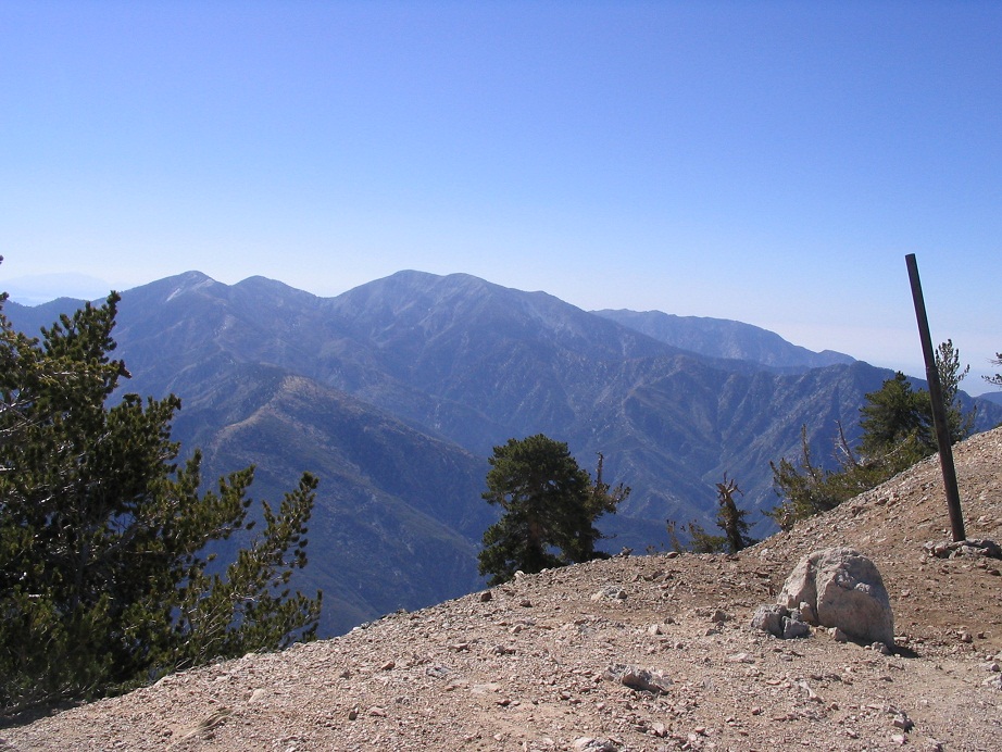
The going here is a combination of level sections, ups and downs, some steep and some lenient. I made good time, eventually worming my way around Mount Harwood and rounding a bend where I had my first high-up views of Mount Baldy. The final portion is a grunt: a steep 800-foot hike up open slopes and trail to the bare summit. I arrived here at 12:20 in the afternoon, noting the large plaque marking the summit. About 20 others were here as well, and I took a pleasurable break off on a side slope to rest, drink and have a bite. The views were stunning, except down into the San Gabriel Valley, where the usual smog and hazy air obscured just about everything down there. After not ever hiking the peak during my growing-up years in SoCal, it felt great to be able to claim this one for myself.
The hike down went well, and I was back to the ski area in about an hour. The heat of the day, even at this high elevation, was really affecting me. Temperatures down below were in the 100s, so I figured mid-80s up here, warm enough to make a big slow guy like me lag moreso than usual. At the ski buildings, a worker showed us where I could refill my water bottles from a spigot behind one building. This helped a lot, as I was running low. Other people up there also filled their bottles. Evidently I was not the only one suffering.
From the buildings, I hiked down the service road to where it came underneath the ski-lift again. Here, I had a decision to make: I could "stay legal" and walk the service road back to my truck, or I could take my chances and walk the sketchy path directly below the ski-lift. The ski-lift option would mean less mileage, like about two miles less. I decided to go "outlaw". No one would bother me along the actual path. The only place I could get into trouble is down below, if there happened to be a worker there and if he happened to give a damn. Plus, I'm pretty good at playing dumb if need be. It comes naturally to me.
The hike down below the ski-lift went quickly. It's mostly a jumble of rocks, with a scant trail running the whole way. I made good time, but as I descended the heat really picked up, probably in the 90s at the base. No one was there to arrest me, so I walked back to my truck, arriving at 3:30 p.m., a 6.5-hour day. The ski-lift hike had worked well, and had cut off a couple miles and probably an hour of hiking. As it was, I was really lagging back at my truck, dehydrated and feeling crappy from the heat. I found a little diner in town to have a few drinks and a meal to recuperate. That helped, and from there I returned into the smoggy basin, to my brother's place in Cucamonga.
That night I went along as a "ride-along", a guest of my brother, a policeman for La Verne. I sat shotgun and rode with him as he made his rounds in town, pulling people over, answering calls, things like that. He even made a felony arrest of a guy who was wanted all over the place. He was pulled over because his vehicle's registration tag had expired. Hell, I wouldn't have noticed. That's why I'm not a cop. It was fascinating.
Date: July 23, 2000
• Elevation: 5,687 feet
• Prominence: 4,387 feet
• Distance: 0.1 mile hike, 25 mile drive
• Time: 3 hours
• Gain: 30 feet
• Conditions: Very hot
PB
Santiago Peak is the highest point of the Santa Ana Mountains that form the border between Orange County and Riverside County. The ridge connecting Santiago Peak with nearby Trabuco Peak forms a smooth saddle shape, begetting the name "Saddleback", which is often used to describe this range as well as used by myriad businesses, streets and locales in both Orange and Riverside counties.
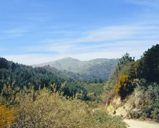
Like most Southern California coastal ranges, the slopes are covered in a thick mat of waist-high manzanita with relatively few big trees. There are hiking routes from both sides, all of them somewhat lengthy. I was here on a very hot day, with temperatures above 100 degrees F on the Riverside County side. A long hike was out of the question. Instead, I was going to "hike by truck" to the summit, following the Indian Truck Trail. I was looking forward to the experience.
Today I would be driving home to Phoenix, so I would work in a drive/hike to Santiago Peak this morning. I got onto southbound Interstate-15 and drove into Lake Elsinore (an old joke — I didn't drive into any lake. I drove into the city called Lake Elsinore). The Indian Truck Trail starts from an exit off of the interstate. It is an unpaved road that goes to the spine of the range. I had no idea how far in I would get, or how rough the roads would be.
Immediately off the freeway, I passed a church with Korean writing on it, then the pavement ended. Now I was on the actual "trail". The road's condition was pretty good. I stayed in first or second gear, rumbling forward at 10 miles per hour, sometimes slower. The road is often narrow with blind turns. A dirt-biker came careening around one corner and skidded to a stop when he saw me. That was my only close call.
To my pleasant surprise, the road was not too shabby almost the whole way up. It seems to be maintained regularly, and I did not need four-wheel drive. In about an hour, I had covered a dozen miles, now at a T-junction on the spine of the range. I went right, and encountered the only rough section, a steep segment with rocks in which I used four-wheel drive to ease past.
With the towers on the peak in sight, I thought about parking and making a short hike to the top, but the heat was intense, even at this elevation. Instead, I drove as far as I could, eventually parking in a flat cleared area nearby the summit towers. My hike, such as it was, took about three minutes. I hiked a small hill and tagged the benchmark.
To the west is Orange County, which was under a haze layer, the omni-present "on shore flow" that comes in off the ocean. It's not quite fog, but it does blot out the blue skies. I never liked this when I lived in Southern California. To the east, the haze and smog blanketed the valleys. The big peaks — Mounts San Antonio, San Jacinto and San Gorgonio — towered over the haze, like islands above a sea, if the sea was a slight brownish tan instead of blue or white.
I didn't stay long. I still had to get down the road, which took another hour. Counting stops and delays, I was at this task for three hours. From here, I drove home to Arizona.
I enjoyed this outing, a chance to see what my truck could do. Maybe some day I'll hike it from the "O.C." side. On a clear day, it's a pretty mountain, but most days, it's hidden behind haze and smog. And I'll bet a shiny quarter not one in twenty Orange County-anians could name the peak if you pointed at it.
|



|