The Mountains of California
• www.surgent.net
|
| Santiago Peak |
• Highpoint: Orange County • Highpoint: Santa Ana Mountains • Cleveland National Forest |
 The top, getting closer |
Date: July 23, 2000
• Elevation: 5,687 feet
• Prominence: 4,387 feet
• Distance: 0.1 mile hike, 25 mile drive
• Time: 3 hours
• Gain: 30 feet
• Conditions: Very hot
California
•
Main
•
PB
Santiago Peak is the highest point of the Santa Ana Mountains that form the border between Orange County and Riverside County. The ridge connecting Santiago Peak with nearby Trabuco Peak forms a smooth saddle shape, begetting the name "Saddleback", which is often used to describe this range as well as used by myriad businesses, streets and locales in both Orange and Riverside counties.
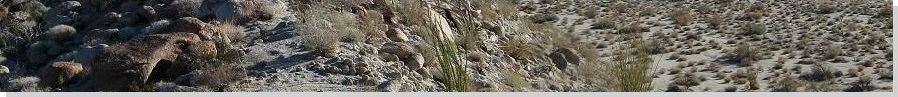
Like most Southern California coastal ranges, the slopes are covered in a thick mat of waist-high manzanita with relatively few big trees. There are hiking routes from both sides, all of them somewhat lengthy. I was here on a very hot day, with temperatures above 100 degrees F on the Riverside County side. A long hike was out of the question. Instead, I was going to "hike by truck" to the summit, following the Indian Truck Trail. I was looking forward to the experience.
I had driven to Southern California this weekend to visit my brother and his family. Yesterday, I had hiked Mount San Antonio, then last night, rode along with my brother, a police officer in La Verne. It was fascinating. He pulled a guy over for expired tags, and the guy had warrants from all over, so he did a felony arrest. Me, I would never have noticed the expired tags. He rode all over town and pulled a few more people over for speeding, plus answering some calls.
Anyway, today I would be driving home to Phoenix, so I would work in a drive/hike to Santiago Peak this morning. I got onto southbound Interstate-15 and drove into Lake Elsinore (an old joke—I didn't drive into any lake. I drove into the city called Lake Elsinore). The Indian Truck Trail starts from an exit off of the interstate. It is an unpaved road that goes to the spine of the range. I had no idea how far in I would get, or how rough the roads would be.
Immediately off the freeway, I passed a church with Korean writing on it, then the pavement ended. Now I was on the actual "trail". The road's condition was pretty good. I stayed in first or second gear, rumbling forward at 10 miles per hour, sometimes slower. The road is often narrow with blind turns. A dirt-biker came careening around one corner and skidded to a stop when he saw me. That was my only close call.
To my pleasant surprise, the road was not too shabby almost the whole way up. It seems to be maintained regularly, and I did not need four-wheel drive. In about an hour, I had covered a dozen miles, now at a T-junction on the spine of the range. I went right, and encountered the only rough section, a steep segment with rocks in which I used four-wheel drive to ease past.
With the towers on the peak in sight, I thought about parking and making a short hike to the top, but the heat was intense, even at this elevation. Instead, I drove as far as I could, eventually parking in a flat cleared area nearby the summit towers. My hike, such as it was, took about three minutes. I hiked a small hill and tagged the benchmark.
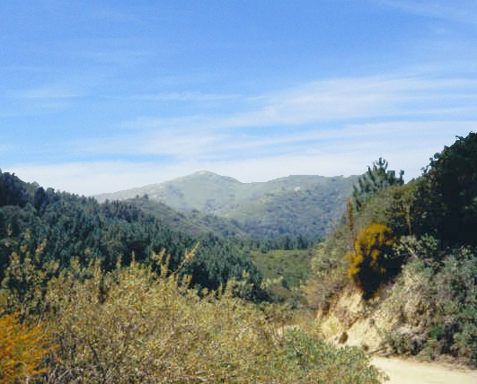
To the west is Orange County, which was under a haze layer, the omni-present "on shore flow" that comes in off the ocean. It's not quite fog, but it does blot out the blue skies. I never liked this when I lived in Southern California. To the east, the haze and smog blanketed the valleys. The big peaks—Mounts San Antonio, San Jacinto and San Gorgonio—towered over the haze, like islands above a sea, if the sea was a slight brownish tan instead of blue or white.
I didn't stay long. I still had to get down the road, which took another hour. Counting stops and delays, I was at this task for three hours. From here, I drove home to Arizona.
I enjoyed this outing, a chance to see what my truck could do. Maybe some day I'll hike it from the "O.C." side. On a clear day, it's a pretty mountain, but most days, it's hidden behind haze and smog. And I'll bet a shiny quarter not one in twenty Orange County-anians could name the peak if you pointed at it.
The Indian Truck Trail is prone to being washed out or damaged, so it's possible that it may be closed at certain points. Some friends of mine told me of a washout, but this was years ago and it may be fixed by now.
|
|