The Mountains of Arizona
www.surgent.net |
|
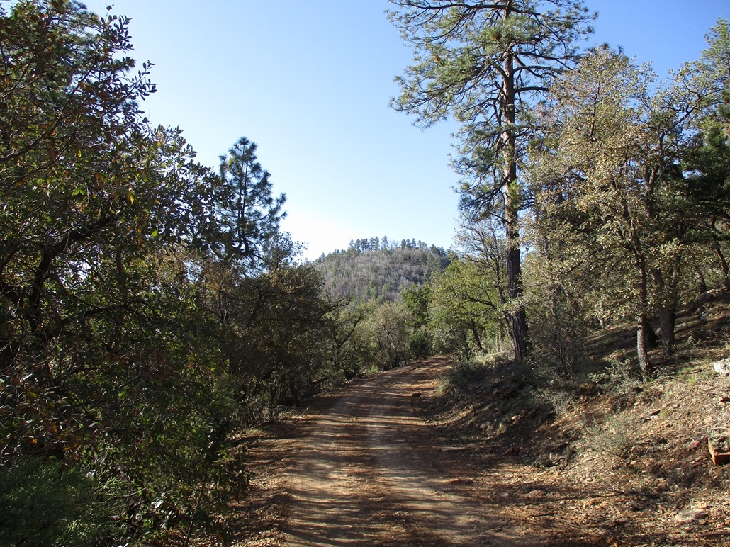
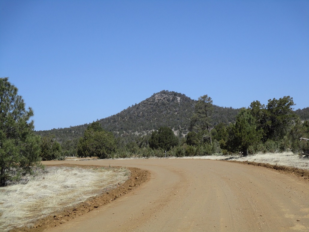
Pine Mountain • Peak 6659 • Peak 6605 Today I would be exploring the Globe-Young Highway, designated as state route AZ-288. This road branches off highway AZ-188 about fifteen miles northwest of Globe, crosses the Salt River, then heads up into the Sierra Ancha mountains, eventually to the isolated town of Young in Pleasant Valley. I've been to Young once, with my wife back in 2006. I've driven parts of this highway a few times since but never farther north than McFadden Lookout. I had five ranked peaks on the agenda, all of them close to the highway so that the hikes would not take long. Three of them are clumped near milepost 301, a couple miles north of McFadden Lookout. Another (Sierra Ancha Peak) is another five or six miles north, then Lucky Benchmark another four or five miles north. The town of Young is about six miles from Lucky Benchmark. I was on the road before 4 a.m.. I was in Globe-Miami a little after 5 a.m., stopping for snacks. I then followed AZ-188 north and northwest to the branch onto AZ-288. It was still dark but the eastern sky was turning from black to purple, dawn just minutes away. The Young Highway is notable as it is just one of two (as far as I know) state highways that are not entirely paved (AZ-88 from Roosevelt Dam to Tortilla Flat being the other). Despite being a state highway, this is not a highway in the usual sense. It is a steep and winding track through the mountains, with steep grades, no shoulders nor guardrails, where going 20 miles per hour is considered "too fast". It is maintained so that its tread is smooth. Regular vehicles can drive on it with no problem, assuming dry conditions and a capable driver.
Date: April 15, 2023
• Elevation: 6,690 feet (Lidar)
• Prominence: 570 feet
• Distance: 3 miles
• Time: 90 minutes
• Gain: 460 feet net, 580 feet gross
• Conditions: Cool with clear skies
Arizona
•
Main
•
PB
•
LoJ
The highway is paved to usual highway standards (properly striped, decent shoulders) for the first few miles beyond the truss bridge spanning the Salt River. As it gains the foothills of the Sierra Ancha, a sign says "pavement ends", but it doesn't. What follows is more asphalt but not striped, usually narrower and not as well maintained, potholes being the main problem. But it is paved, which is good. Then it gets steep and narrow, hugging the slopes as it gains elevation. People with a fear of heights or mountain driving probably should not come here.
I stayed on the highway, to where it does actually lose its pavement near a pass east of Armer Mountain. Then the pavement comes back, until roughly the trailhead for McFadden Horse Mountain, milepost 288 for those keeping score. Here, pavement ends again for good, the next pavement being about 25 miles when descending into Young.
I gained the pass near McFadden Lookout, then drove north another mile or two to FR-609, which makes a hard-left. Two peaks, Pine Mountain and Peak 6659, rise along a common ridge to the west, and Peak 6605 rises on the east side of the highway. All are forested peaks with no views, in what limited information I could find on these peaks.
I eased onto FR-609. It switchbacks down about 80 vertical feet, coming to an open area at a saddle that people have used for camping. The road to here was rough, but the Subaru handled it well as long as I took it very slowly. I parked in this clearing. Pine Mountain was a mile and a half northwest, and Peak 6659 less than a mile from me. FR-609 continues upward and runs across the ridge's nothern flanks. I was close enough to walk and chose not to chance the car on it, me having no idea of its condition. I got properly dressed and packed, and started hiking about 6:30 a.m., sunny and cloudless, temperatures in the mid 40s. It was calm and very pleasant.
I walked up the road, covering a little under a mile to put me near the saddle separating Pine Mountain and Peak 6659. The road is pretty good. I think I could have eased the Forester along it, although a couple of rough spots due to ruts and mud might have caused me trouble. The road drops about 60 feet to where it passes near the saddle.
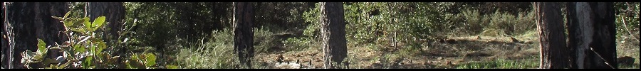
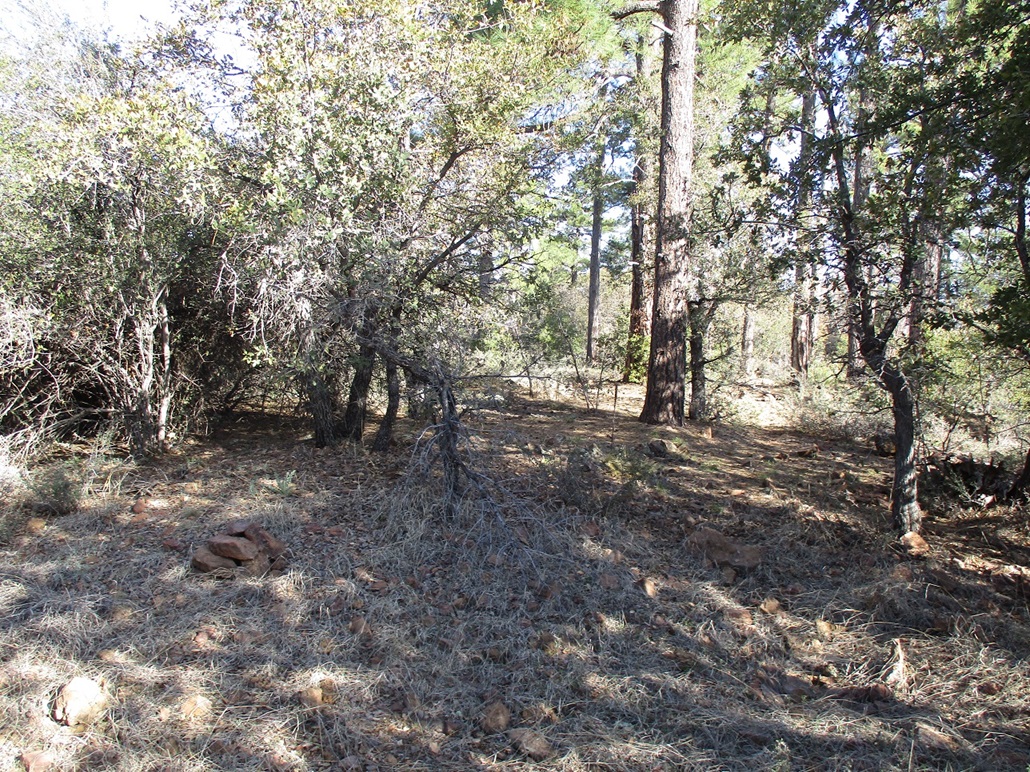
Now it was just a matter of choosing where to leave the road and start up the slopes. It all looked about the same to me. I found a spot that looked friendly and started upward. The slope wasn't too bad. The forest was thick with ponderosa, a lot of gambel oak and plenty of mountain oak. I also had to deal with a lot of downed trees too, which are not the easiest things to get past or around. But otherwise, it was easy uphill hiking. I got to the ridge a little west of Point 6638. I then stayed on the ridge, following it ever upward until it topped out. The forest was thick to where I had no long line-of-sight views, just a lot of trees.
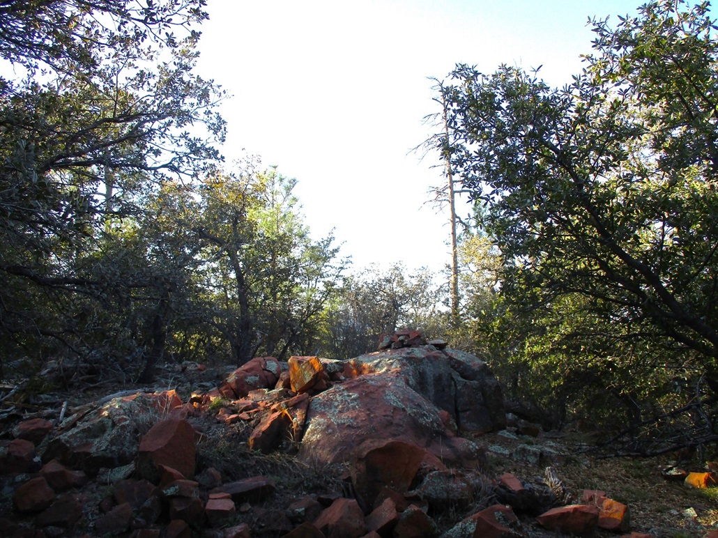
The top features two big rock humps and a third one about fifty feet away. A register sits within a cairn built just a year ago atop the highest of the rock humps. Bob Moore and a pal were here a year ago. I was the first to sign in after them. I walked the area just to be sure I hadn't missed anything, but I never stopped to rest. There were no views.
For the hike down, any northward bearing would put me back on FR-609. I descended off the ridge early, but angled to my right as I descended, going through open lanes as I found them and avoiding the brush and rocks. The thick mat of leaves meant I would "ski" for a couple feet at a time if I wasn't careful. I was back onto the road about a hundred feet west of where I had left it. I then started the walk back out, planning to visit Peak 6659 next.
Elevation: 6,659 feet (Lidar)
• Prominence: 302 feet (Lidar)
• Distance: 0.4 mile
• Time: included in the Pine Mountain hike
• Gain: 260 feet
PB
•
LoJ
Peak 6659 is a barely-ranked hilltop adjoining Pine Mountain. I walked along the road until it reached its highest point on the north slope of the hill, then chose a line and busted straight up to the top. Like on Pine Mountain, it was steep and choked with big trees and brush, but not difficult.
I was on top about fifteen minutes after leaving the road. I found a cairn and register, also placed here by Moore a year ago. I signed in, looked around, and started right back down. There were no views from up here either. I was back to the road in another ten minutes, and back to my car about 8 a.m.. I had been gone just under 90 minutes. I reckon I covered a total of three miles to Pine Mountain and back, and less than a half-mile round trip up and down Peak 6659.
I checked on the Lidar sites afterwards and it showed this peak with an elevation of 6,659 feet. On the map it just shows a 6,640-foot contour, but no spot elevation. Some people just call it by its highest contour (e.g. Peak 6640 or Peak 6640+), others build in half an extra contour (e.g. peak 6660). Since there is no spot elevation to act as a placeholder name, I call it by its Lidar-derived elevation figure. Lidar also shows the saddle between the two peaks being 6,357 feet, and Pine Mountain being 6,690 feet, there being no printed spot elevation on it either.
I got back to my car, and drove up the chunky road back to the main highway. My low-tire-air-pressure icon then lit up. Damn. Did I get a flat? The car was handling like normal. When I got to the flatter area near the main highway, I got out to inspect. All the tires looked okay, no obvious flats. The passenger-rear came in low when I tested its pressure. Probably a slow leak, probably a carry over from last weekend when I was driving to Hickey Mountain.
I got out my air pump, which plugs into the cigarette lighter, but it wouldn't run properly. Well, what do I do now? I have a lousy spare as a failsafe. I gambled a little and figured the tire should be fine for the next few hours, especially since the driving I'm doing is so slow. I was also thinking Young is closer than Globe and since I'm heading that way anyway, maybe they have someplace with an air pump. I left my car where it was and looked over at Peak 6605 across the way.
Elevation: 6,605 feet
• Prominence: 365 feet
• Distance: 1.5 miles
• Time: 1 hour
• Gain: 225 feet
PB
•
LoJ
Like the first two peaks, this one is also covered in heavy foliage, although not as many big pines. I got to the ridge above in about ten minutes, then started following it northish, then northeast, aiming for the 6,605-foot spot elevation shown on the map.
On the ridge, the brush and trees closed in thick and I found that going in a straight line almost impossible, and also difficult to actually see anything to gather my bearings and sense where the highest point may be.
I walked the ridge and in one spot, stood atop a boulder which allowed me some sense of where to go. I could see more trees, but obviously higher, in the distance. I aimed that way, but got stopped often by impassable manzanita, which grows thick up here. You just can't power through manzanita. I'd be obliged to find other ways through the crud.
I ended up doing a long end run past the highpoint, wherever it was. I knew I was beyond it when the slopes all trended downhill. This was deliberate of me. I then would walk back, staying on the ridge as best as possible, and gain the highpoint this way, by brute force.
I wasn't using a GPS, which would have come in real handy here. I knew I was close, though. I could see Pine Mountain at times and knew to keep that at my 12 o'clock. I also would deliberately angle more south to the lip of the ridge, which was slightly less crowded with trees, where I could also regather my bearings.
I would get to what looked like a highpoint, but then peeking through the trees and manzanita, see higher-looking rocks, and go to them. I kept at this for about fifteen minutes until I had exhausted the possibilities. I got to what looked to me to be the highpoint. The grades are so gentle atop the ridge that even with no trees or brush to block views, determining the highest point would have been a challenge. I called it good. If I missed it, I missed it by a couple feet at most. But I don't think I did. I left feeling I "got it".
The hike down went fine, just slow and scratchy. I was back to the road then to my car, having spent an hour on this task. This was not a fun peak at all and one that can be skipped by future visitors. There is no payoff unless you think getting tangled up in manzanita limbs is a payoff.
I inspected the tires. Everything looked okay. The passenger rear one still looked drivable. I'd go slowly, driving north about five miles to the next peak.
Elevation: 6,623 feet
• Prominence: 617 feet
• Distance: 0.5 mile
• Time: 30 minutes
• Gain: 275 feet
PB
•
LoJ
•
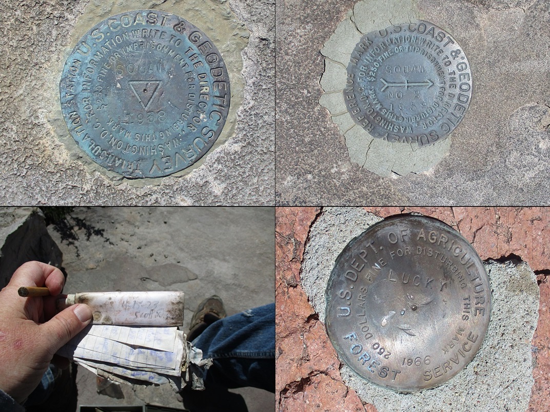
USGS BM Datasheet
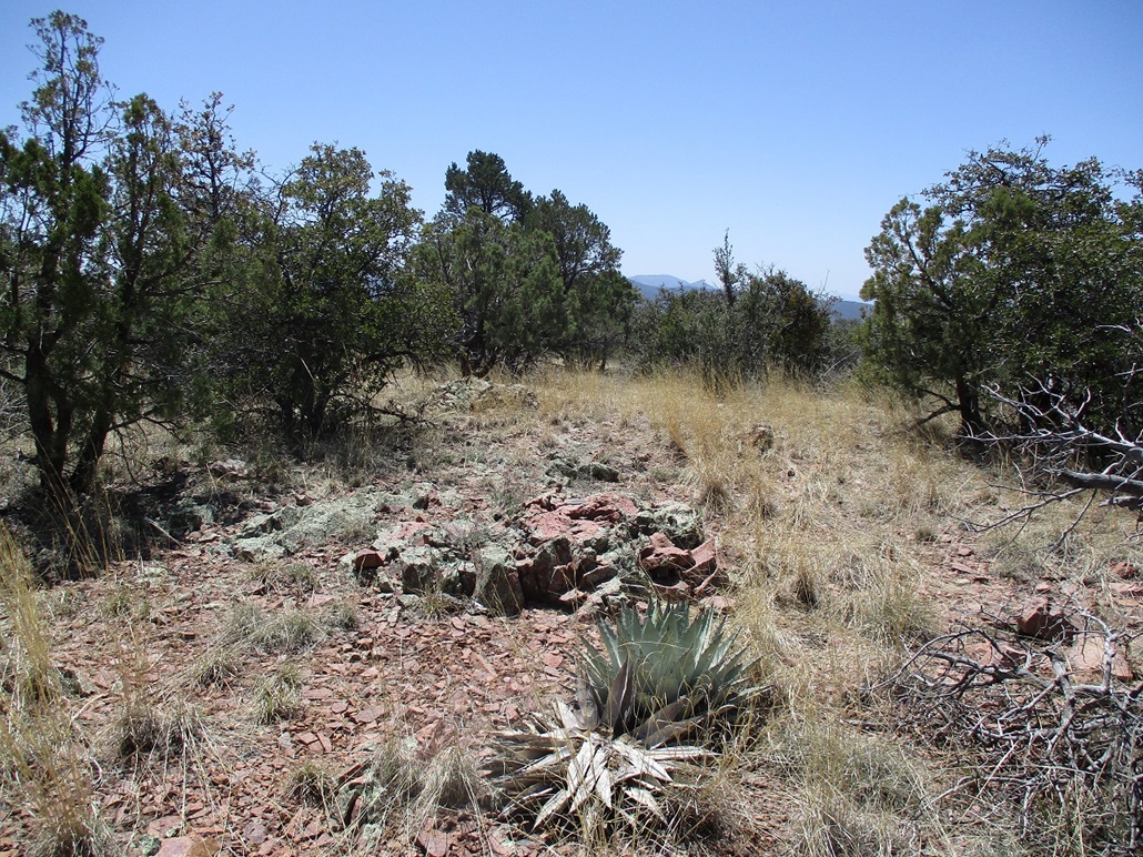
Sierra Ancha Peak is a conical mound of trees and rocks, all by itself, sitting atop the Sierra Ancha Mesa. The name is new. The peak and mesa used to be called Squaw Peak/Mesa, until it was changed in September 2022 (see this link). This new name is clunky, being a singular peak with the same name as the whole range. But that's its new name.
I drove a little past it on its west side, parking in the dirt area where FR-840 branches to the right (east). I did not drive in on this road. From where I parked, the peak was just a quarter-mile away. I walked this road to a big sand-pit "quarry". I walked around its edge, on the peak's west slope. Then I just pushed upwards until I started encountering rocks, then quickly, the top. The climb was steep and mostly within moderate low forest, there being a rough path to help. The one-way hike took just fifteen minutes.
The very top is rocky, the summit being a huge block about 5 feet high and 10 feet long, the highest point being two smaller blocks on the north tip of this big rock. I could have reached up and tagged the highpoint, but I wanted to surmount the thing. There's a small ledge on the north tip. I eased up onto it, then hoisted myself to the top. I took an image of the benchmark and signed into the register. The register was a mess, with gobs of random paper in various states of moldiness, and a plastic baggie with trinkets, evidently a geocache.
I eased down off the block the same way. I'd call it Class 2+ simply because hands are required and some thought on how to place them. Being tall will help a lot.
I hiked down the same way, and was gone just a half hour. This hike had gone well and I was pleased to get one done so quickly and not have to mess with dense forest blocking everything out. I had some really good views from the summit, seeing as far as the Mogollon Rim to the north, and the bigger peaks in the Sierra Ancha to the south.
The datasheet for the benchmark simply calls it by its identifier number, "ES1091". Maybe this is in response to the name change, since restamping the benchmark is not practical.
Back at the car, I took a look at the tires ... looking okay still. I had one more peak to go...
Elevation: 6,525 feet
• Prominence: 445 feet
• Distance: 2 miles
• Time: 45 minutes
• Gain: 490 feet net, 570 feet gross
• Conditions: Warmer now
PB
•
LoJ
About four or five more miles brought me close to a band of hills, one holding "Lucky" benchmark, hence its name. I parked where FR-238 juts off to the left. There is a clearing here, an ad-hoc camping spot. I walked down FR-238 a few feet, then went right onto FR-845. This hike would follow roads and tracks the entire way. After four forested peaks, having an all-road hike was welcome. It was warmer now, but still very pleasant, in the high 60s.
I walked FR-845 as it bends right and up to a saddle. A secondary track then goes left and directly uphill, going up and over two humps along the way, to the summit. The one-way hike covered a mile, and took me 20 minutes. It was not exciting but I enjoyed the brainless walk. The road is pretty rough, only robust Jeeps could handle it.
I signed in to the register, also placed here by Moore and pal a year ago. Like on the others, no one had signed in since they had, until me. Two rock outcrops look equally high so I tagged both, then actually sat and rested for five minutes, having a drink and snack. Views from here were open, generally south and west, a myriad of peaks and hills that are still mostly a mystery to me since it's an area I never get to.
I exited the same way, back to my car after 45 minutes. I was beat by now. It was about noon, and I had climbed five ranked peaks, cumulatively hiking about seven miles with a total gain of close to 2,000 feet. Another inspection of the tires showed no big change. I was about five miles from Young now, so I drove that way, rolling into town about twenty minutes later.
Young lies in a valley ringed by the Sierra Ancha to the south and the Mogollon Rim to the north, and countless foothills in all directions. The valley is called Pleasant Valley and it was the site of a 10-year family feud known as the Pleasant Valley War. It lasted between 1882 to 1892 and about 50 people were killed. These days, Young is a spread-out town of about 500 people. There are some scattered businesses but the only gas station I saw didn't look functional. I drove its main road a few miles, then returned the way I came. It's an interesting place, no doubt due to its isolation.
I had over 60 miles to Globe, 45 of it on AZ-288. Now I'd be driving the entire road southbound. I drove south a few miles and parked at an overlook for one last inspection of the tires. Again, they all looked okay. The passenger rear one still looked okay. It looked low but still drivable.
The next couple hours I spent driving this road, just going real slow and deliberate. I had no traffic southbound. No one tailing me, nor me catching up to anyone. Every couple minutes someone would pass me going northbound. Stretches of the highway are very steep and exposed, with no room for error. I kept my speed between 10-20 miles per hour and at times even that felt fast. In some spots when someone was coming the other way, we had to slow way down to ease past one another. It was a little nerve-wracking but also enjoyable. You can't help but "be in the moment" on a road like this.
I drove all the way out, stopping on the shoulder where AZ-288 reconnects to AZ-188. I inspected the tires once again, and by now, the passenger rear one was really low, almost flat. I got out my air pump, the one that didn't want to work this morning, and ... it worked! The tire was down to 9 psi. The pump got it back up to 32 psi after about ten minutes. I drove into Globe and stopped at the Wal-Mart to look up a tire place on my phone. I found a Big-O a couple miles east and they fit me in and got the tire patched. It had caught a nail and likely had been in the tire for awhile, causing last week's low-pressure issue too. I thanked them for fitting me in and want to give them a little shout-out here on surgent.net.
Even after all this, it was still not yet 4 p.m.. I got back on the highway and drove back to Tempe, arriving back after 90 minutes, a 14-hour, 5-peak, 1-flat tire day.
|


|