
The Mountains of Arizona
www.surgent.net |
|
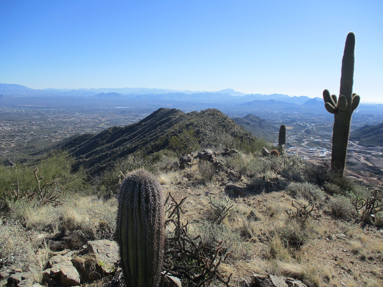
West View Overlook • Fountain Hills Highpoint I wanted to hike a trail in the McDowell Mountains, on the Fountain Hills portion. Fountain Hills has its own McDowell Mountains Preserve, complementing the Scottsdale McDowell Mountains Preserve. I would begin my hike at the Adero Trailhead. I have been here just once before, in 2019. Back then, it was brand new. This little area is going through a construction phase, a lot of new homes going up. My goal today was West View Overlook, the Fountain Hills town highpoint, and a study of the slopes leading up to Peak 3804. I already knew that approaching Peak 3804 from this direction would likely be unsuccessful. But I wanted to scout and see what other options there were. These are things that are not possible to glean from a map alone.
Date: December 21, 2022
• Elevation: 3,098 feet
• Prominence: about 50 feet
• Distance: 3 miles
• Time: 2 hours
• Gain: 750 feet (gross)
• Conditions: Sunny and clear, slight breeze
Arizona
•
Main
•
PB
I followed the Beeline Highway to Shea Boulevard in Fountain Hills, then a couple miles west to Palisades Boulevard, a mile or so to Eagle Ridge Drive, then northwest to its terminus at the Adero Trailhead. The day was sunny and clear, a little cool with a breeze. The lot held about ten cars for now. I started hiking roughly 11 a.m..
The trails begin at an old road, now gated. This is the Promenade Trail. After a bend, a rougher trail goes left uphill, then improves, and shortly, meets the Western Loop Trail. It's a small jumble of trails here, but the junctions are signed. I then proceeded up hill toward the ridge above me. The trail is steep and sometimes rocky, but not difficult. It makes a number of switchbacks to lessen the gradient. I met a hiker coming down. We talked briefly. She was the only hiker I would see today. I was soon on the high ridge, roughly 20 minutes after starting.
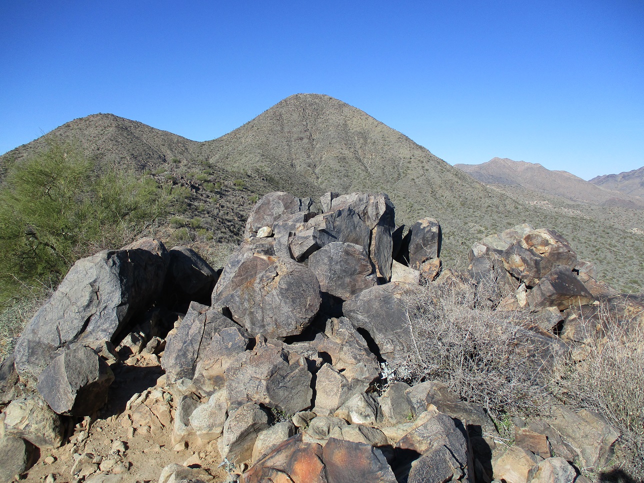
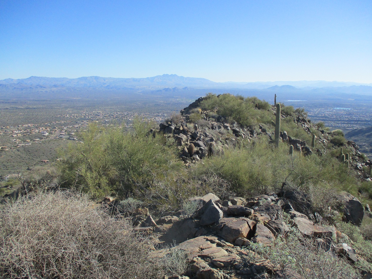
West View Overlook is a bump on the east tip of this ridge. I am unsure why it gets called "West View". A spur trail leads to its summit, with fine views in all directions. I took a few moments to relax and shoot a few images. This bump has just about 50 feet of prominence, but it required roughly 650 feet of elevation gain to get here.
I returned to the main trail at the saddle on the ridge, and got started on the second leg of today's adventure.
Elevation: 3,180 feet
• Prominence: 0 feet
City HPs of Maricopa County
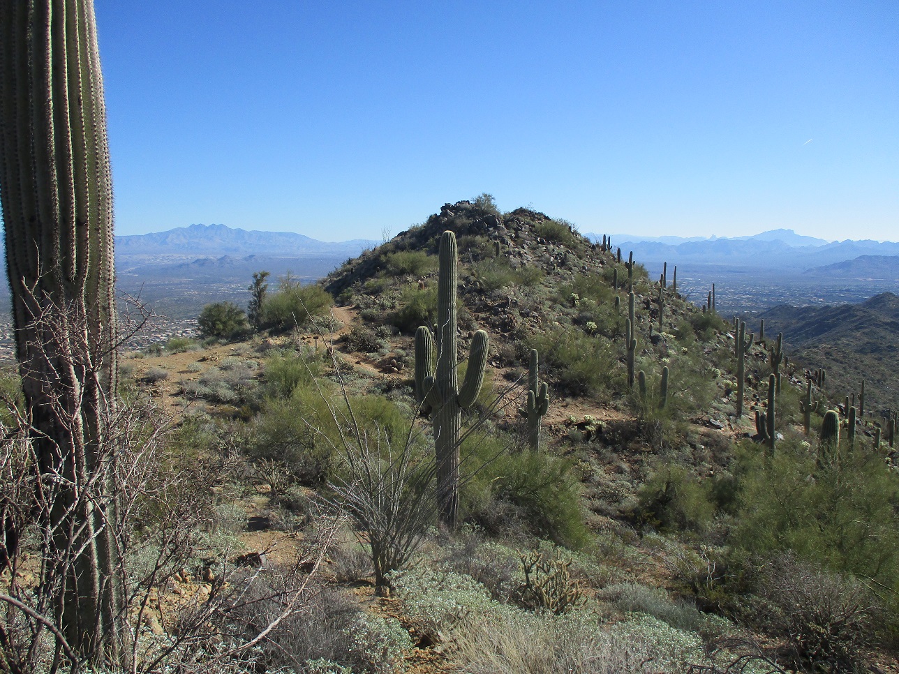
From the saddle, a trail proceeds west and for a couple hundred feet, is a pretty good trail. It gains up a slope and stops at a rock outcrop with heavy brush. Finding a way through the brush and around the rocks took a few minutes, but I got around it relatively unscratched. The remainder of this short hike was up and down a couple more ridgebumps, each with interpolated elevation 3,150 feet. These were more open but rocky, hands used for balance only. More than one big rock teetered on me, which got my attention.
The highpoint of (officially) the Town of Fountain Hills is a point, elevation 3,180 feet, on the east slope of Peak 3804. There is no distinct summit on which it sits, just a fluke of where the boundaries were drawn. I'd have to claim this one "statistically".
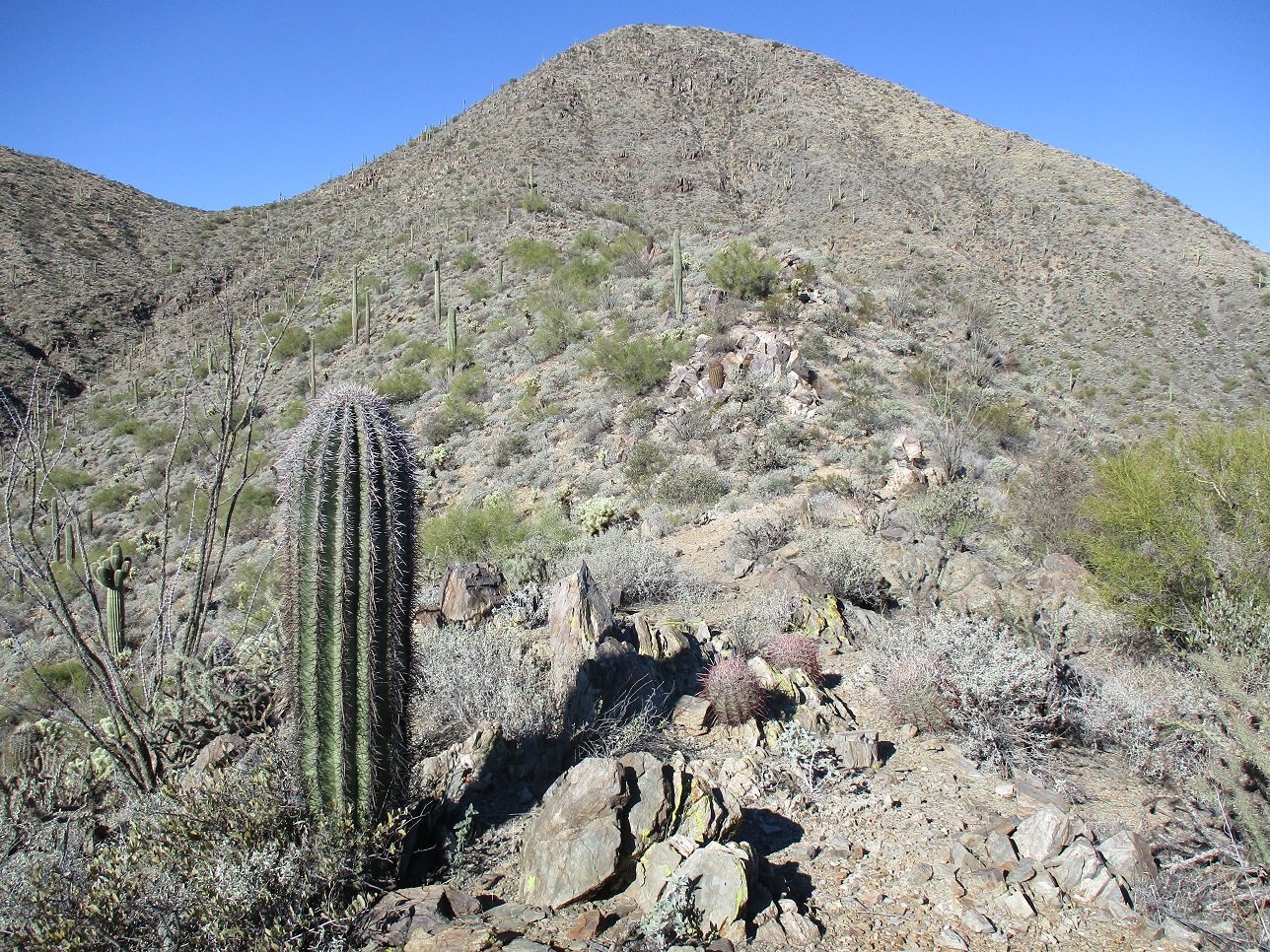
The Andrew/Kinsey Tral runs below and parallel to the ridge I was on, and it makes a hard bend southeast at roughly the city limits. So I used that as a gauge. Once I was roughly abeam of this turn, I then made sure I stuck to the ridge as much as possible, tagging rocks and more rocks. I kept going this way until I was well past the aforementioned turn. I had eyeballed a hill up ahead with a saguaro that has a bunch of small arms on it as my endpoint.
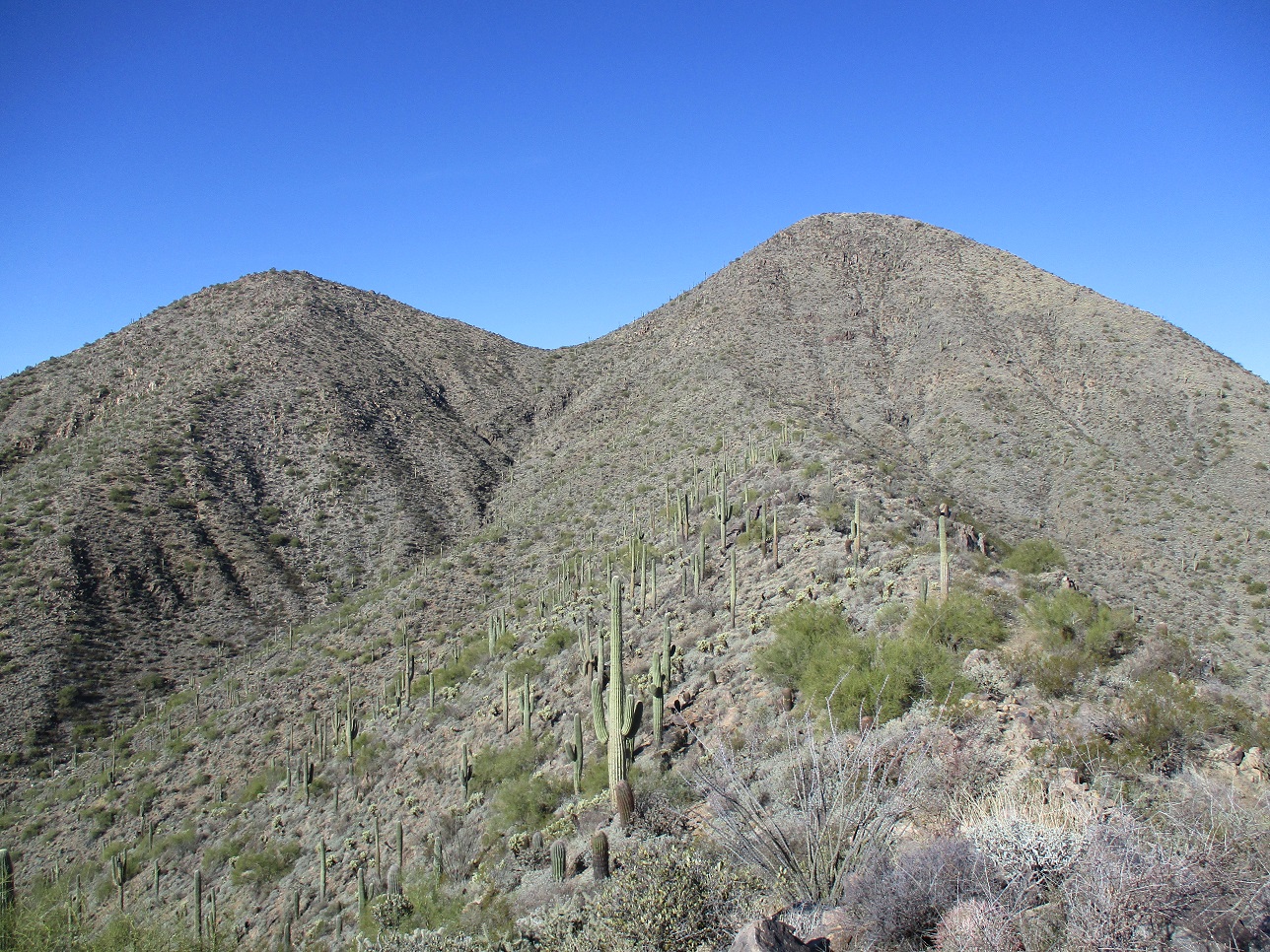
Up here, I studied the slopes up to Peak 3804. From this direction, it would be a fool's errand. Way too steep with small cliffs. However, the ridge to the southeast (my left) looked like a possibility, but not today. Maybe another time.
I turned around and started down, once again staying to the main ridgetop as much as possible, thereby giving this one section double treatment. I have no idea exactly where the city limits run over the ridge, but I guaranteed that I would have walked right over it at some point. I essentially covered myself by doing this for about 500 horizontal feet.
I was back to the saddle in not too long, then down back to my car, the whole round trip taking about two hours, covering 3 miles overall. I got what I came for, so I was pleased about that. The trails here are in great shape, and this trailhead is clean and tidy. I enjoyed my short hike today and will come back, hopefully not taking 3 years between visits.
|


|