The Mountains of Arizona
• www.surgent.net
|
| Mount Tritle |
• Bradshaw Mountains • Prescott National Forest • Yavapai County |
|
Date: August 18, 2019
• Elevation: 7,782 feet
• Prominence: 586 feet
• Distance: 9 miles
• Time: 4 hours, 30 minutes
• Gain: 2,280 feet (gross), 1,640 feet (net)
• Conditions: Sunny with high clouds, warm in the sun
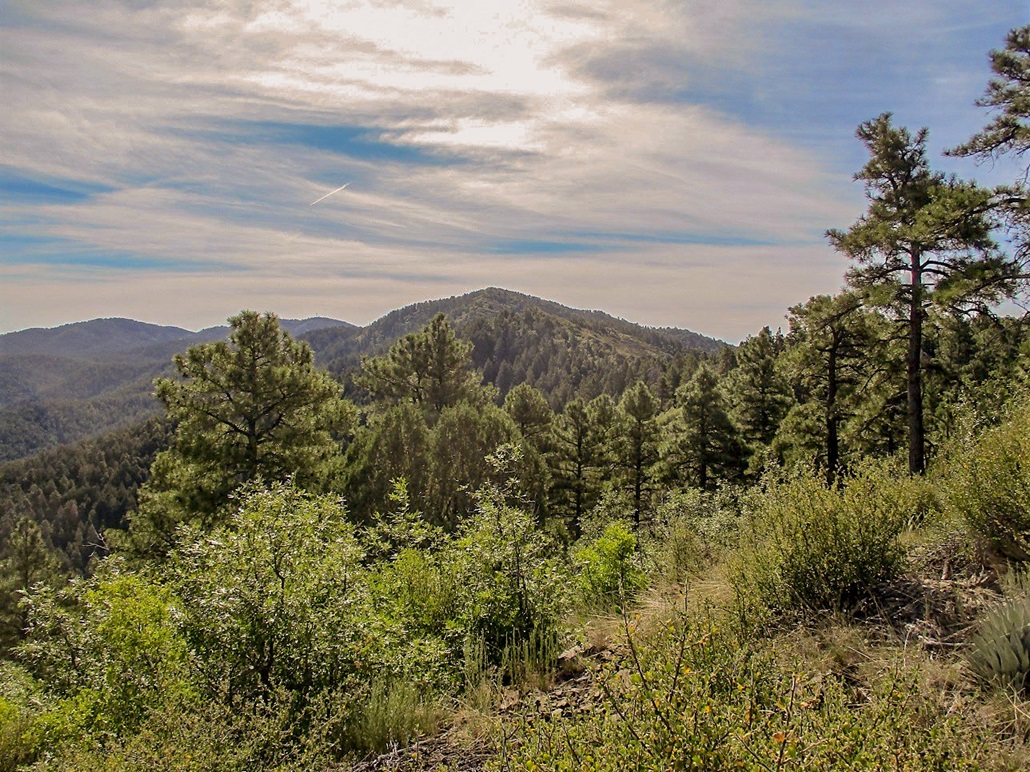
Mount Tritle is the second highest peak in the Bradshaw Mountains, trailing the range highpoint, Mount Union, by about 140 feet. Mount Tritle is about two miles west of Mount Union, with numerous roads and trails that encircle the summit, with a spur road going to the top.
I wanted to get out for a hike, but the deserts are dangerously hot this time of year. I did not want to drive very far, I wanted all trails or roads to avoid bushwhacking, and I wanted something high enough so it would not be so hot. Mount Tritle met all these conditions, so I set out early on a Sunday morning to go hike this peak.
I left Scottsdale at 4 a.m., driving up Interstate-17 to AZ-69, the usual route into Prescott. I then followed Mount Vernon Road into the hills, where it becomes Prescott Forest Road 52, the famous Senator Highway. I drove past the main camping and hiking areas, getting farther into the heart of the range, to where the Senator Highway meets with Walker Road in a tight valley hemmed in by Mounts Union and Tritle.
I initially planned to hike Mount Tritle from the east side, hiking forest roads for a couple miles to the summit. I got to where the Senator Highway makes a right over a cattle grate, one road going off toward Mount Union. I descended down the Senator Highway briefly to where FR-52B juts off to the right. I was not enthusiastic about this approach. I had nowhere to park my car, and the side road had a "no trespassing" sign near it. I would have been fine staying on the road, but I had lost interest to hike in from this side.
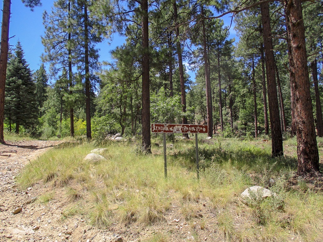
I backtracked north a few miles, then went southwest on Mount Tritle Road (FR-72). This road comes to a T-junction. I went right, then more south, crossing a creek on a concrete ford. I went left at another Y-junction and parked near where FR-72B starts, signed as "Kendall Camp Road No. 65". This sign had been shot up dozens of times. From where FR-72 started off of the Senator Highway, I covered about two miles. The road was good, but 72B was not in good shape. I parked nearby under a huge ponderosa.
I was now going to hike to Mount Tritle following Road and Trail 65 up to the ridge, then along the ridge to the summit, a 9-mile round trip hike, longer than I had planned for. It was 7:30 a.m. by now, still reasonably cool but warming now that the sun was up. I got packed and moving quickly. A father and son on a big quad had driven in this road a few minutes before me.
Proceeding on FR-72B, I moved quickly, partly because I was not sure what I would find. I had no map, so I walked the road, which was mostly level, at a fast pace. I was concerned I had missed a turn somewhere and wanted to know sooner or later if I had messed up. Soon, I came upon the father-son pair. They had parked near a wooden fence. The father knew this area well and confirmed I was on the right roads. He had been up to the ridge before. This was good, as I now had some confirmation I was on the right path, literally.
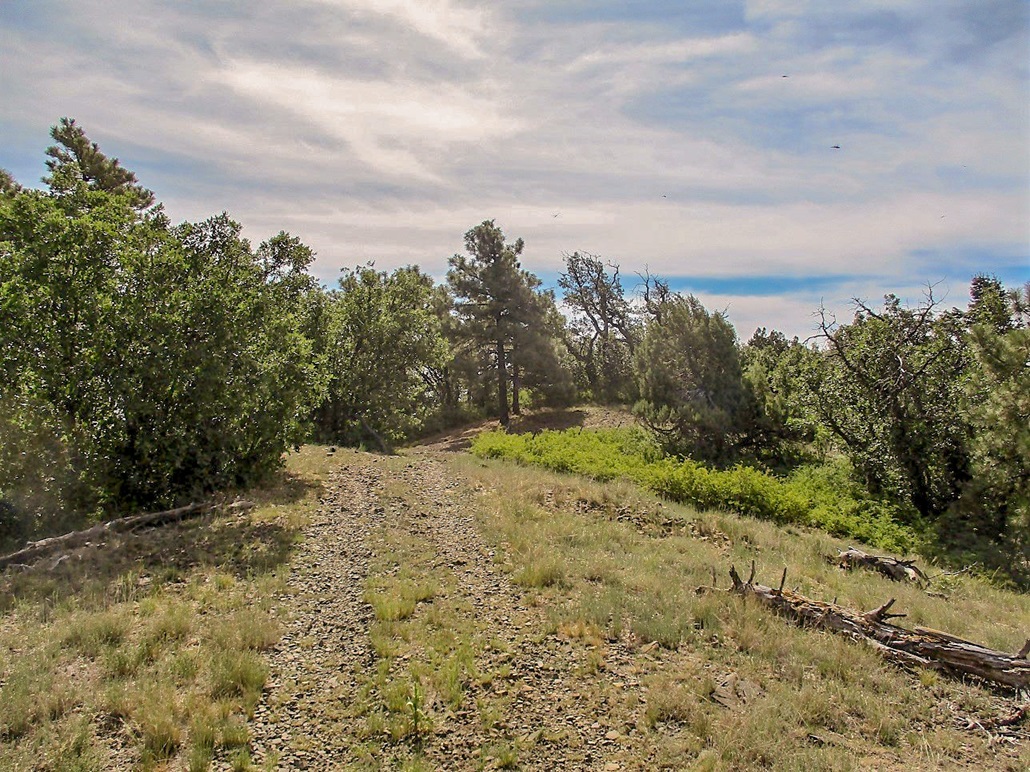
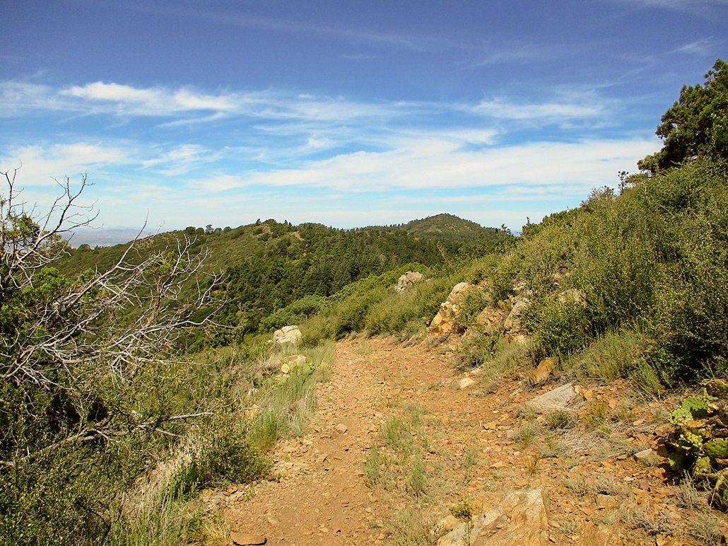
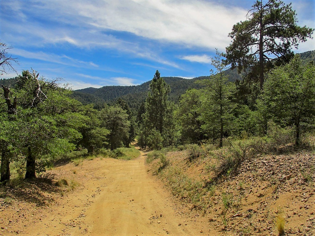
There are a number of side roads and paths that can be confusing. The man said that the Forest had shut many down to guard against overuse. But they were still there, confusing simple folk such as myself. After a mile or so from where I parked, I arrived to the official trailhead, where the road ends and the proper trail starts.
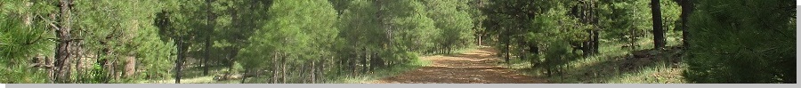
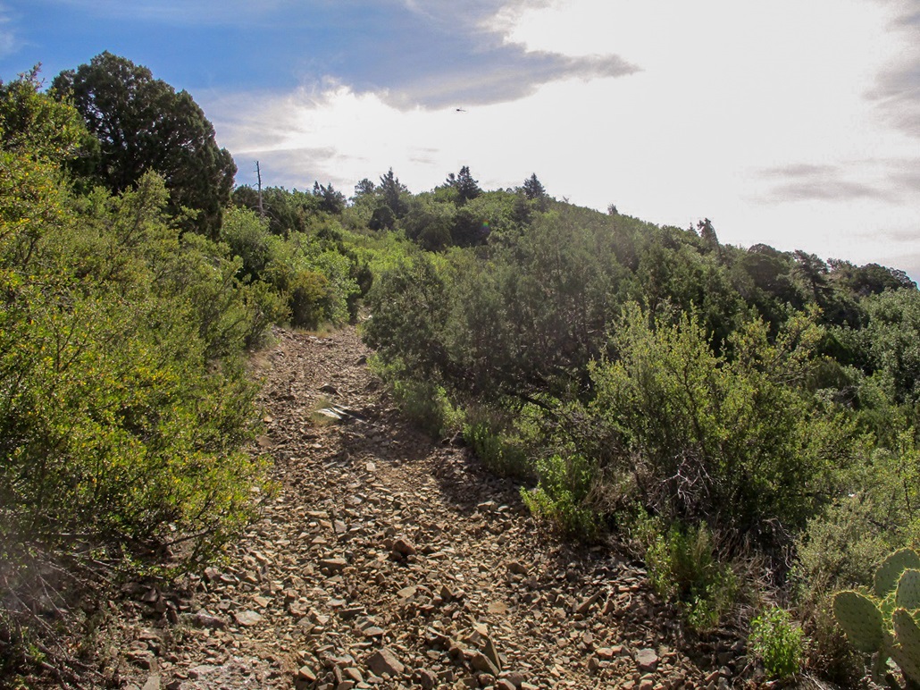
For the next mile, the trail barges up a canyon and then a couple ridges to gain the top-most ridge. This segment was steep and a little sloppy due to loose tread and rocks. However, I had thick forest around me and in the shade, cool temperatures. I made good time, slowed a little by my lack of acclimation to 7,000 feet.
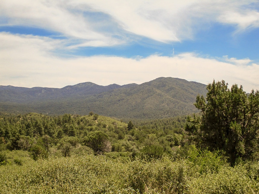
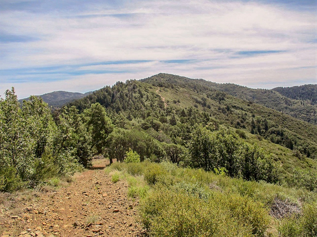
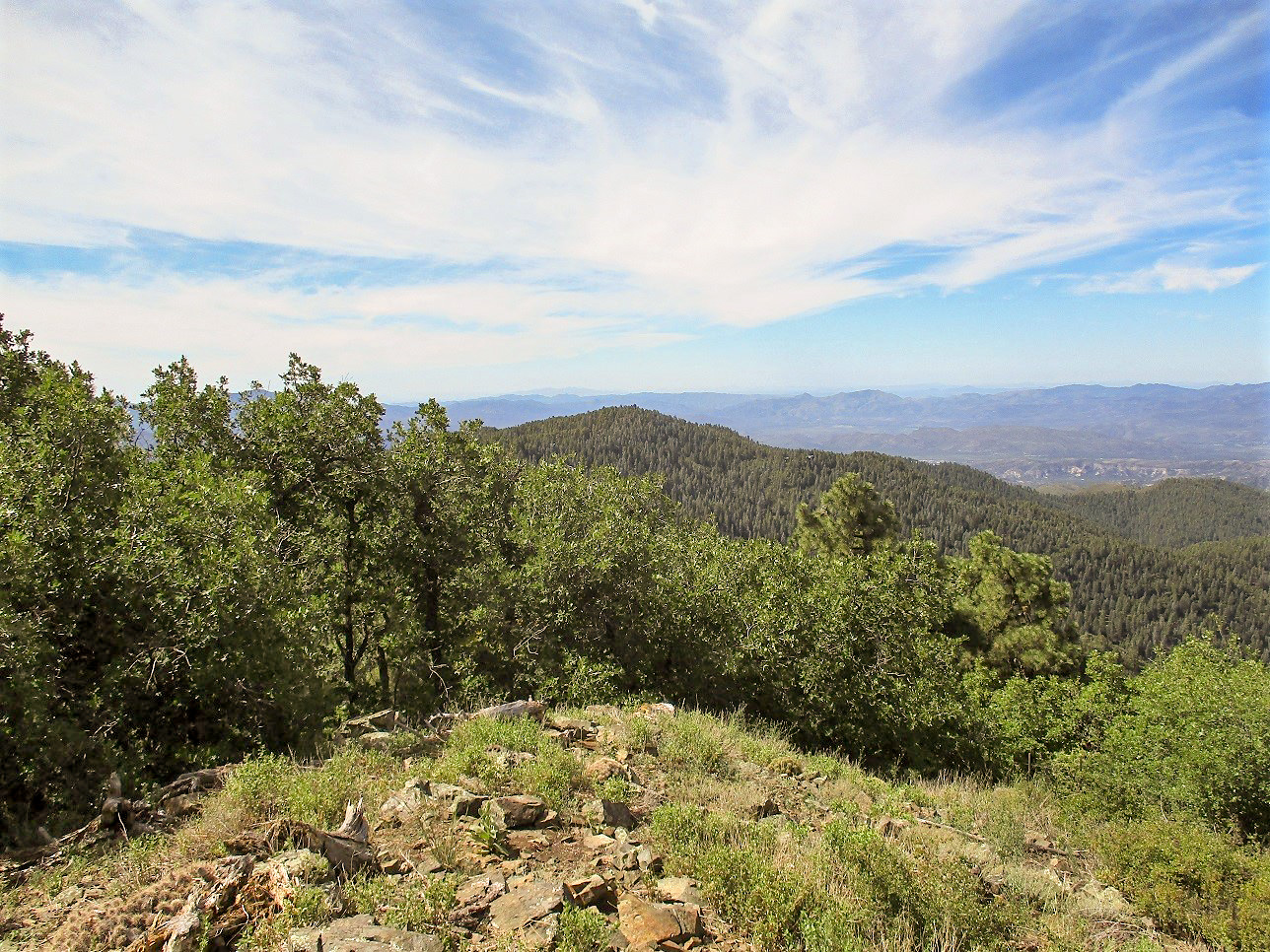
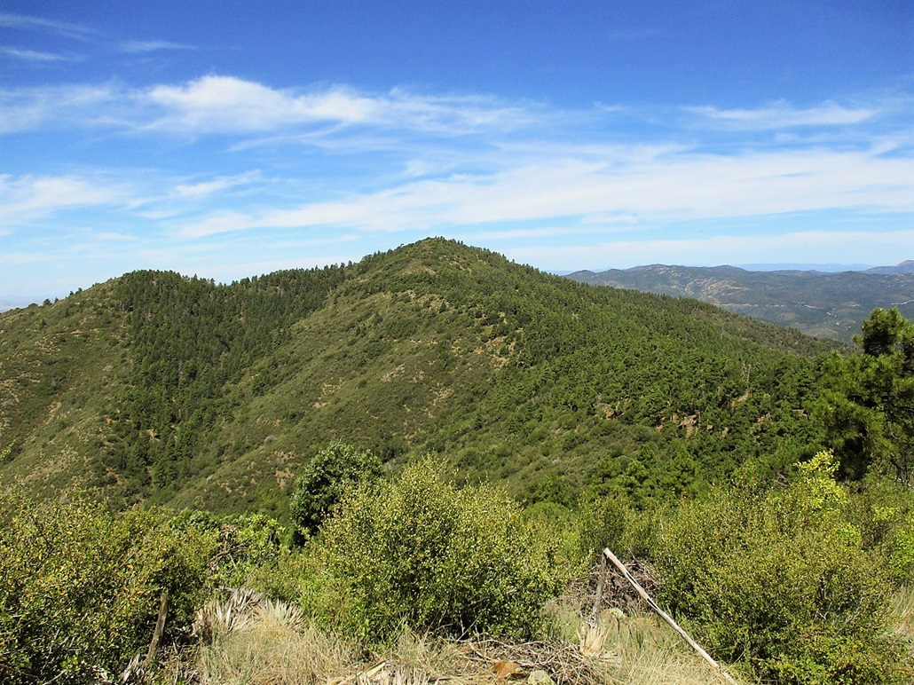
I achieved the main ridge after 90 minutes. I was nearby Maverick Peak, and about two miles from Mount Tritle. I was now on a scanter road that would be my trail to the top. Between me and the peak were two "peaklets", each with about 140 to 180 feet of prominence along this ridge. This meant I would have to climb up, then down, each of these. It was not difficult, but I hated to lose hard-earned elevation each time.
At times, the road is just a jumble of small boulders and scree, ranging from kind-of steep to very steep. These steep segments went fast. Then I would have a few pleasurable minutes of level hiking where I had good views for photographs. Then, I would have to hike down to a saddle, bummed to lose the elevation.
I was doing fine time-wise, just plodding along. However, I had more open terrain and the sun could be quite warm, even though the air temperatures were about the mid 70s. There was rarely a breeze, but when one would pick up, it felt wonderful.
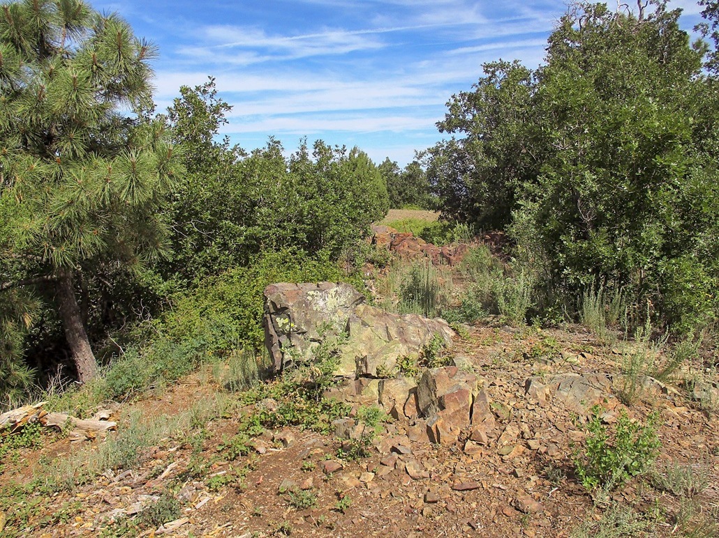
Finally, I was on the final spur track to the summit, this segment being steep and unattractive. It makes a couple bends and then feeds onto a lovely small grassy area, almost like a little park. The actual highest points were some rock piles a little farther back in low brush. I walked to these, signed into the log book inside a massive jar (a geocache). It was 10 a.m., a two-and-a-half hour hike covering 4.5 miles. I was a bit beat with the warmth and the steep trudging, but happy to be here. I spent a few minutes in the shade of a ponderosa having a snack and a drink.
There are a couple other rock jumbles that might be as high as the presumptive summit. One is along side the road, another nearby the main rock pile but in the brush a little more. I tagged these as I started my exit. I was low on liquids, not having planned for a 9-mile hike, so I wanted to be hiking sooner that later.
I followed the same route out, there being no real variations. I scared up a couple horned lizards along the way. Back on the lower roads, I made good time back to my car, arriving back at noon exactly, a 4.5-hour hike. This hike had gone well, and other than being thirsty, I felt good. It was a hearty hike that gave me a good workout.
I drove back into Prescott, going through its downtown then following AZ-89 south down the curvy mountain roads towards Yarnell and Wickenburg. There's a small cafe on this highway at the south end of Prescott that I like to wave at as I drive by.
Back in 1991, I worked briefly for Ryder Truck, going to Arizona and surrounding states to get the trucks and drive them back to Los Angeles. I got in with a crew of seven guys, a real rag-tag bunch of fellows. The leader was a grossly-obese guy named Tony, and his chum Mike, who always wore one-piece coveralls with his name on them like a mechanic would. That was the summer between my two years in graduate school and I just wanted a stupid job to earn some money. That's how I got this job.
Anyway, Tony drove us all in his crappy van into Prescott, where a bunch of trucks were ready for us to pick up. We would have followed Interstate-10 from Los Angeles to US-60 into Aguila, then highway AZ-71 to AZ-89 into Prescott. I remember not having the foggiest clue where we were, as I had no real sense of Arizona's layout back then.
We arrived in Prescott late, and got a meal at this little cafe on the south end. It was every man for himself, as we were not chummy enough to share a check. In time, a few guys paid and left, just hanging alongside the highway. Finally it was just me, mainly because I had used the restroom. When I got back to the table, the waitress was pissed, as Tony and Mike had stiffed her. I was pissed too, so I covered their bills along with mine. It was not expensive, but it revealed just what kind of characters were leading this group.
We got our trucks and drove them back to Los Angeles. I stayed with this crew for a week. In that time, we drove to Boise and back, then to Denver and back. It was along Interstate-70 near Denver that Tony nearly ran us off the highway. We mutinied and basically told him to pull his lard ass over and let one of us drive, or we would bodily compel him to do so. I decided to quit once back in Los Angeles. It was by far the worst job I ever had, if not the nuttiest. The one upside was that it was my first time deep into Arizona (I was with one other crew for 4 days during which we made two runs into Arizona). I liked what I saw and decided I would move here the following year.
This second crew (the Tony and Mike Show) was a real interesting collection. Tony and Mike were just straight-up assholes, lying to us, holding back our per diems, boasting all the women they've "had" (which we knew was a lie). I could write a book about this crew. I was the young guy. I teamed with another younger guy named Les, and we drove together in a two-truck convoy on these runs, just to keep an eye on one another. He was a decent guy. There were two older men, a couple of tough-looking characters. They formed another two-person convoy. (Basically, Tony would tell us where in L.A. to be and by what time. How we got there was our problem).
The seventh guy was a huge biker named Mark, stood about 6-feet-7 and weighed almost 300 pounds, husky as in not fat, just plain big. He had an unkempt beard and wild hair, but was young, early 30s. He cussed like crazy. He could not modulate his voice so he used his yelling voice at all times, which made it impossible for anyone of us to get any sleep in the van while being driven to our pick-up points. But ... he could be tolerable at times, too. As long as you kept the subject matter to the driving and to what Tony and Mike were probably up to, Mark was an agreeable person. But he was easily the most vocal when Tony was pulling stunts on us, and probably would have killed him had it just been those two.
I had enough of that crew by our third run, the Denver run. But I still needed to get back to Los Angeles. On the drive to Denver, while taking a break in Green River, Utah, Tony was telling us how when we get back to L.A., he had a friend just getting out of prison who would be joining our group. That was it — I wanted nothing to do with this new guy, I was sick and tired of Tony, and of this job. I seriously considered abandoning the team in Green River, debating how I would get back to Southern California. I had no money on me, no credit card. It's not a hub for busses. I'd have to hitch my way out. I just needed to tough out this last trip, get back to California, then I could quit and continue living.
So yes, that little cafe has a lot of meaning to me and I like seeing it every time I drive by, which is not often. It is ironic that the cafe gives me a positive feeling. But it was not all bad things with that crew. Like I said, there were a couple of positive outcomes. Whenever people ask me about the worst job I ever had, I have this story to tell them.
The rest of the drive was alright. I stopped at the Hotshots Memorial near Yarnell, made a donation, got some maps and said to myself I have to come back and hike it properly. Once back in the deserts, the temperatures were in the 110s and I was quite ripe once I arrived home. But the hike had gone well as had the day.
|

|