
The Mountains of Arizona
• www.surgent.net
|
| Thompson Peak |
• McDowell Mountains • McDowell Sonoran Preserve • Maricopa County |
|
Date: November 23, 2014
• Elevation: 3,982 feet
• Prominence: 782 feet
• Distance: 9.2 miles
• Time: 4 hours and 40 minutes
• Gain: 1,900 feet (includes ups and downs)
• Conditions: Sunny, breezy and cool
• Teammates: Matthias Stender
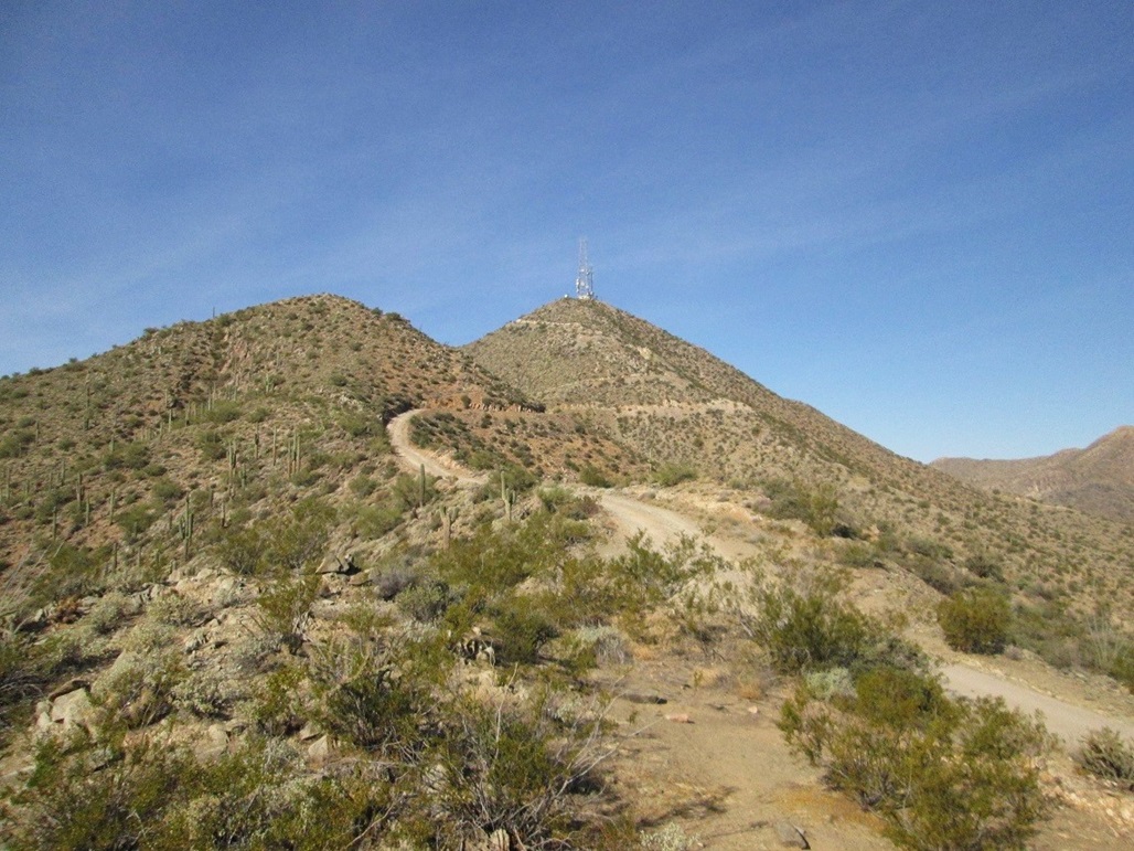
Thompson Peak is a main summit of the McDowell Mountains in northeast Scottsdale, easy to recognize by the communications towers that crown the summit. A steep road leads to the summit and is the logical hiking route. The approach is from the east via Fountain Hills, following trail and then the aforementioned road to the top. The hike runs about 4.7 miles each way with nearly 2,000 feet of net elevation gain, and likely more once all the ups and downs along the way are factored in.
Since it's so close to home, I could plan a hike on short notice, which is how this hike happened. We planned this hike just a day or two in advance, and I met my hiking partner, Matthias, at the trailhead parking area early on this clear, cool Sunday morning. I followed Shea Boulevard east to northbound Pallisade Street in Fountain Hills, then to Golden Eagle Street, which dead-ends at a housing development gate. The trailhead parking is immediately before the gate, on the left. According to my truck's thing that tells miles, I was on Pallisade for 2.9 miles, and on Golden Eagle for 2.8 miles.
I had suggested an early start because I like early starts, but also in case parking was limited, we wouldn't be shut out. I was surprised that I was the first one to roll in at 6:55 a.m., and Mattias was the second, about five minutes later. As we were getting ready, three more vehicles rolled in, so yes, it is a popular trailhead and we made a wise call to get here early. The day was looking to be clear and lovely, with highs in the 70s.
The initial quarter-mile "hike" follows sidewalks through this housing development. Hikers are welcome, and the sidewalk includes bas-relief feather images to mark the trail. We descended a little, then turned onto Desert Tortoise Road, which leads to the actual trail at a gate in the fence demarcating the McDowell Mountains Preserve on the north side, Fountain Hills on the south. There is a $2 self-pay kiosk. We paid our fee, and starting hiking on the Dixie Mine Trail.
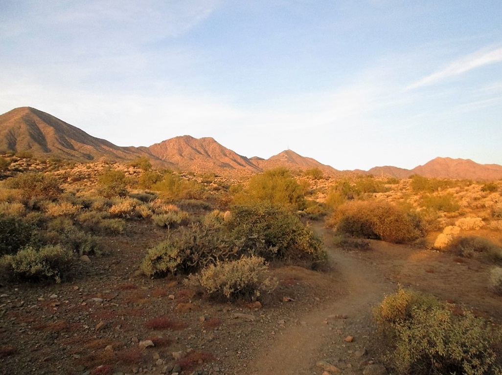
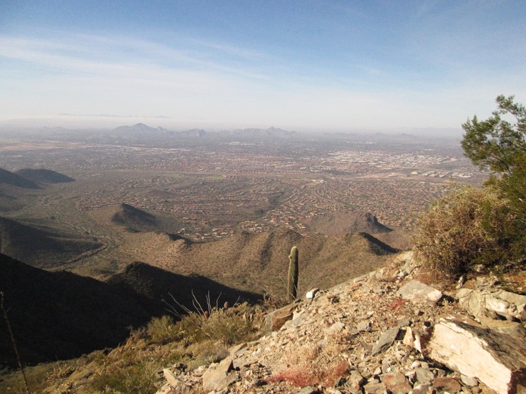
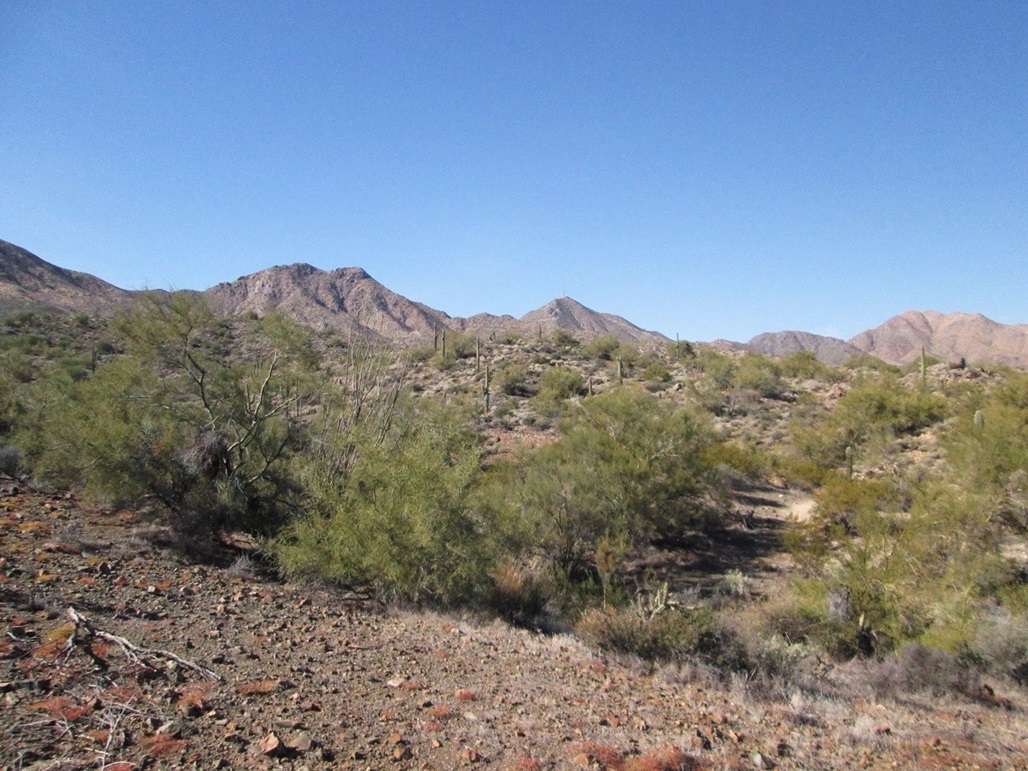
The trail trends north and ever-so-slightly west, going against the grain of the washes emanating from the hills. This meant that the initial mile and a half was a lot of up and down, twenty or thirty feet at a time, gaining little elevation overall. We could see Thompson Peak, McDowell Mountain and East End in one sweep for most of the hike in. The views were excellent, and sections of the trail were like walking through a park, where someone had gone through the trouble of situating all the plants and cactus "just right". In truth, this was all natural, a surprisingly beautiful and robust stretch of Sonoran Desert terrain and flora so close to Phoenix. Saguaro were everywhere, some pushing 40 feet in height. Given how slow they grow, it's reasonable to conclude that some of the bigger ones sprouted out of the ground before Arizona was a territory.
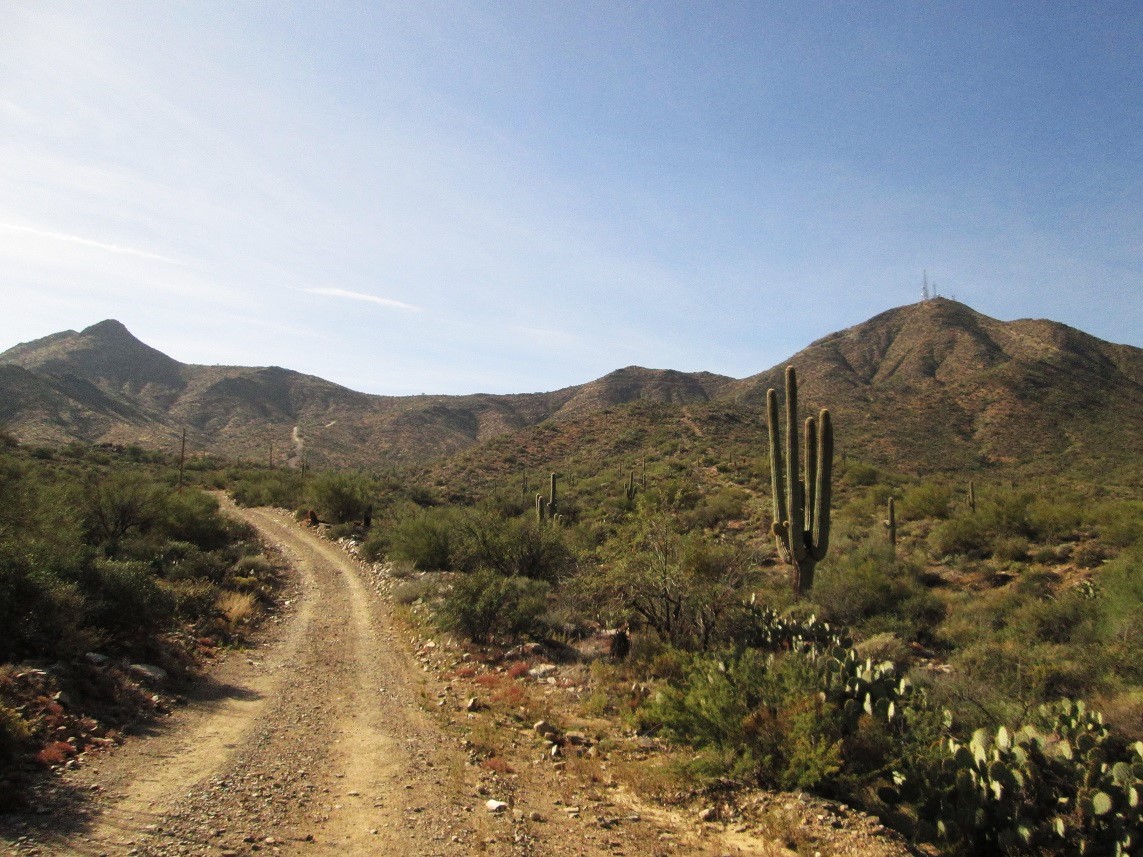
There were a few hikers out among us, some faster teams passing us early on. There are many trails and junctions in this area, so in most cases, we never saw these people again. We were aiming for the Dixie Mine, which is 2.3 miles from the trailhead. The trail meets the summit access road near the mine, which we reached a little over an hour after starting. The mine is apparently a popular destination, but other than to look at it, we had no real interest in walking over to it.
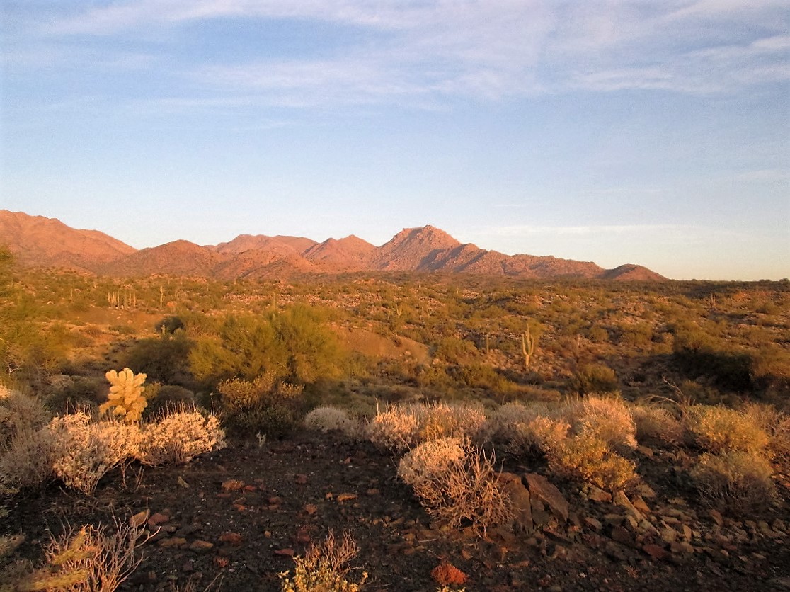
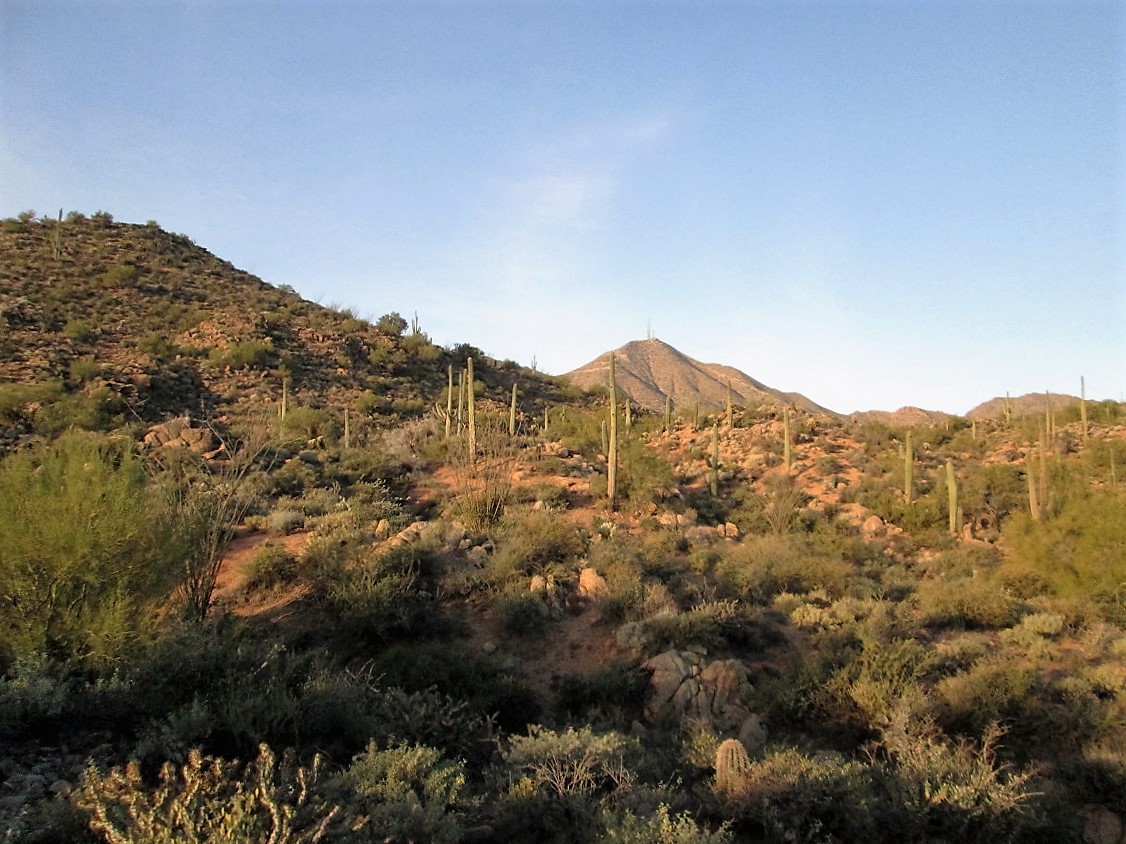
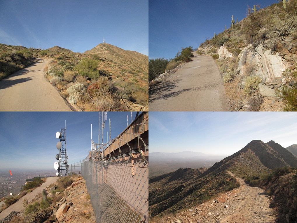
We turned left onto the road and started the road portion of the hike. A sign along the road mentioned the towers being 2.3 miles ahead, meaning we were exactly half way at this point. According to the map, we were at 2,300 feet elevation, about a net 200-foot gain since starting. The summit was another 1,700 feet higher, and we could see the road snake its way toward the ridge and up to the top. The road trends west for about a half-mile, then bends south, aiming for the ridge east of Thompson Peak. By now, we had up-close views of the whole ridge-and-peak system. The main road was clearly visible, and there were other older road-cuts visible on the higher slopes, too.
After nearly three miles of relatively level hiking, we finally starting going uphill, the grade steepening significantly. The road barrels straight up the slope to the ridge, and is steep enough that it is paved in segments, covered in a layer of concrete. From where the road bent south to where it meets the ridge, it gains 800 feet in a mile, which works out to about a 20% average gradient, but remember, most of the gain is toward the end, so some grades may have pushed 30%. For hiking, it was cake, but for a vehicle, it could be rough.
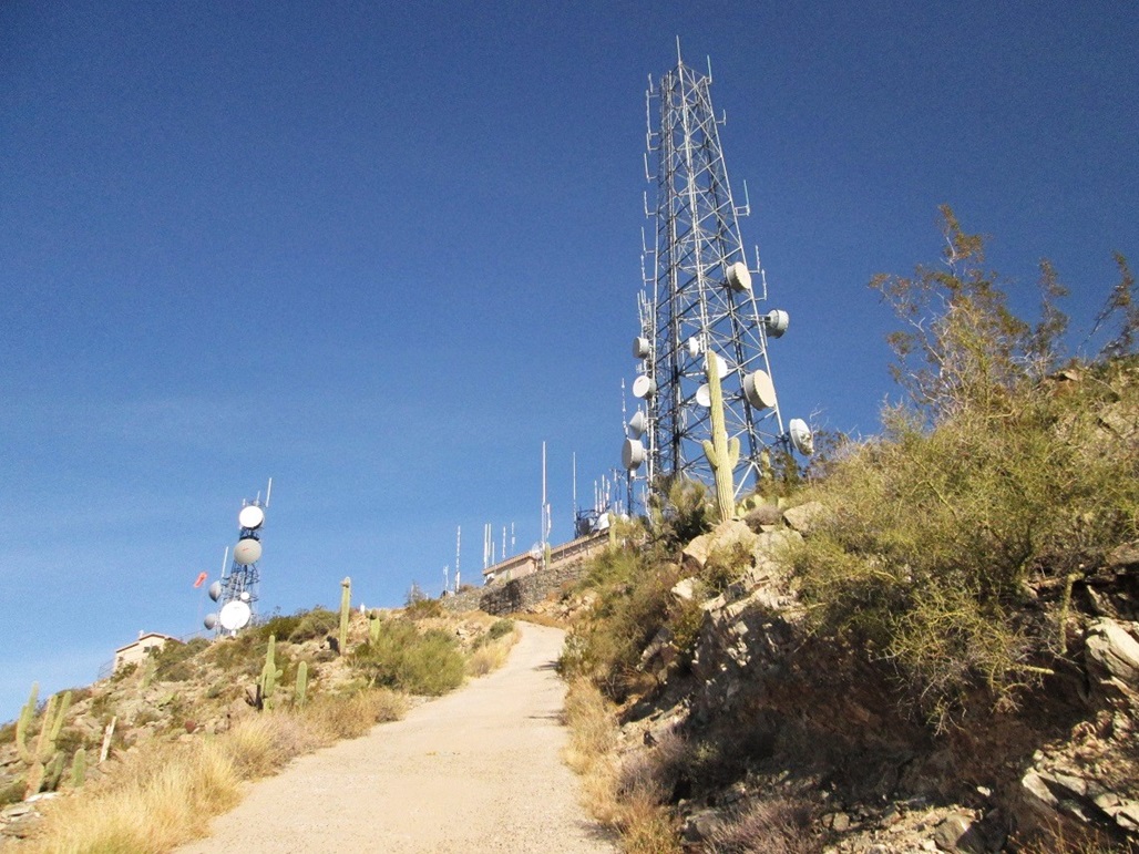
At the ridge, we stopped for a break, and had our first up-high views of Scottsdale. Thompson Peak was just ahead, another 700-800 feet higher. The road levels as it traverses a small bump along the ridge, but then it gets steep again, absurdly so. The pavement starts again, but the road builders thought little of putting in switchbacks. Instead, the road literally shoots straight up the slope, the turns being minimal at best. Although I did not bring along a clinometer nor work out the actual math, I daresay some sections were about a 40% gradient. Even for hiking, it was a little too steep for my comfort.
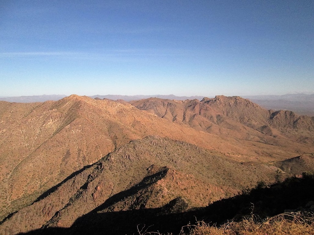
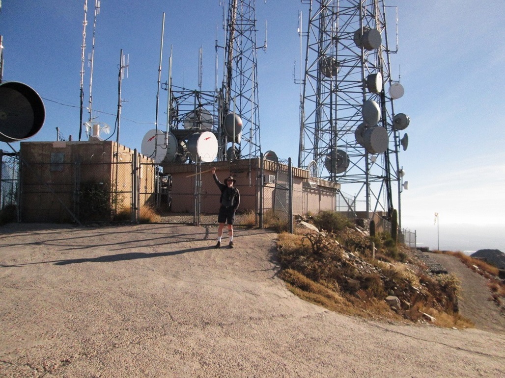
We moved upward at steady pace, following the road to the top, where we came upon the big communications towers. It had taken us 2 hours, 30 minutes to get here, and we spent a few minutes walking the perimeter fence and tagging rocks to claim the highpoint. The top was predictably ugly, but the views all around were fantastic. Although the sky was clear, there was some ground mist that blotted out most of Phoenix and looking the other way, occluded the Superstition and Mazatzal ranges. We could make out the main summits and ridges, and it was all pretty but a tad misty.
We didn't stay long at the top. Instead, we hiked down about 100 vertical feet and took a break on the road. We met a couple guys on their way up, and after our own break, started moving again. Hiking down the road was kind of tricky, given its steepness. I had my staff and Mattias his hiking poles, which were useful in governing our downward movement. The pavement was such that if we fell, there'd be no way to arrest a fall and quite literally, one could "roll" downhill. We didn't want that.
The road was remarkable. I have never seen such a steep tower-access road. It looked steeper than the one on Frenchman Mountain in Las Vegas. The road is narrow and with no shoulders or room for error, and I wouldn't drive it in a million years. Some parts had outward leans to it, to add to the driving terror. In my photos, it's hard to capture steepness, but note that the saguaro and the towers are all true vertical. You'll want a staff or poles, otherwise your knees will pay the price. In this day and age, why not simply helicopter people and things to the top as needed?
What's interesting is that there are other roads up here too. They are inaccessible via vehicle these days and are being absorbed back into the hills. I am guessing they might be old mine roads. None looked like they were worth the trouble to hike.
The hike out went well and we never stopped. We met a few more hikers going to the top, and a few more lower down who were just out for a stroll. We were back to our cars a little before noon, a two-hour hike out, and a four-hour, forty minute day overall.
|


|