The Mountains of Arizona
www.surgent.net |
|
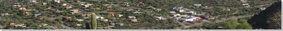
Peak 2711 • Surrey Hill Today, I would visit the Cave Creek Regional Park, a big swath of desert and mountains in Cave Creek, north of the Carefree Highway. This county-run park covers about six square miles and features numerous trails that generally stay low within the canyons and drainages of the surrounding mountains. A study of the satellite images shows that no trails, not even unofficial ones, go to any of the summits. This would be my first visit to the Cave Creek Regional Park. I had a doctor's appointment this morning, just a follow up from a physical in July. I got back to my Tempe place around 11 a.m.. The weather was fantastic: temperatures were still cool, only in the low 60s, with mostly sunny skies and a few clouds on the fringes. Today being Veteran's Day, there were no duties holding me back. I wanted to get out for a couple hours. On this Veteran's Day, I want to extend my appreciation and acknowledgement to my father, who passed away in April of this year. He was a retired Colonel, United States Army, active between 1963 through the mid 1980s. He fought in Viet Nam in 1965-66, stationed near Cao Lanh, along the Mekong where it re-emerges from Cambodia back into Viet Nam. I also want to acknowledge my wife's father and step-father, both generals (brigadier and lieutenant, respectively) in the Army. They too have passed on and I like to think the three of them are having a couple of beers wherever they may be.
Date: November 11, 2022
• Elevation: 2,711 feet
• Prominence: 571 feet
• Distance: 3.8 miles
• Time: 2 hours, 30 minutes
• Gain: 810 feet (gross)
• Conditions: Cool and sunny
Arizona
•
Main
•
PB
•
LoJ
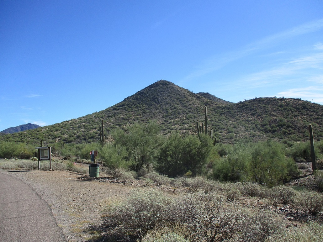
I printed off a map, got my hiking clothes together, and was out the door at 11:30. An hour later, I was rolling into a parking space in the Cave Creek Regional Park ($7 day fee, by the way). There are some good-sized peaks within the park, but because they lack trails, I wasn't overly eager to drive that distance to hassle with off-trail hiking when I have so many scratchier alternatives closer to where I exist in Tempe. Nevertheless, I identified Peak 2711 as a good peak to attempt. A hiking partner of mine, Dan Fleischmann, had climbed it earlier and he offered some suggestions on it. The peak lies close to the parking lot and a good trail runs below to the north.
There weren't many people here, which kind of surprised me given it was a holiday, and how lovely the weather was behaving. I was one of three cars at the Slate Trailhead. I started walking eastbound on the Slate Trail, with the western buttress of Peak 2711 visible, the highpoint being hidden for the time being. Two women passed me hiking out, and these would be the only people I saw all day.
I stayed on the Slate Trail for 0.9 mile (going by the park trailmap), then turned onto the Flume Trail, which bends southeast and mainly stays within a sandy arroyo paralleling Peak 2711. I hiked another 0.3 mile until I was generally east of the summit, which was now visible. I could not tell which bump on the skyline was the highpoint, but there were no unnecessary ridges or obstacles blocking me either. It looked like one big slope to the crest. I followed this route as suggested by Dan. He'd come up from the peak's northwest (closest to the parking lot) and said there were a lot of false summits to get past. He said the southeastern approach might be better.
I chose a line and started up the slope. It was gently-pitched at first, with lanes to follow. There were clumps of cactus in spots, including cholla, but easy to get around. General waist-high brush was everywhere but again, easy to get around. The palo verde grew thick in places and getting around these copses wasn't always possible, forcing me to wiggle, squirm and even crawl through them to mitigate the scratches. I did alright.
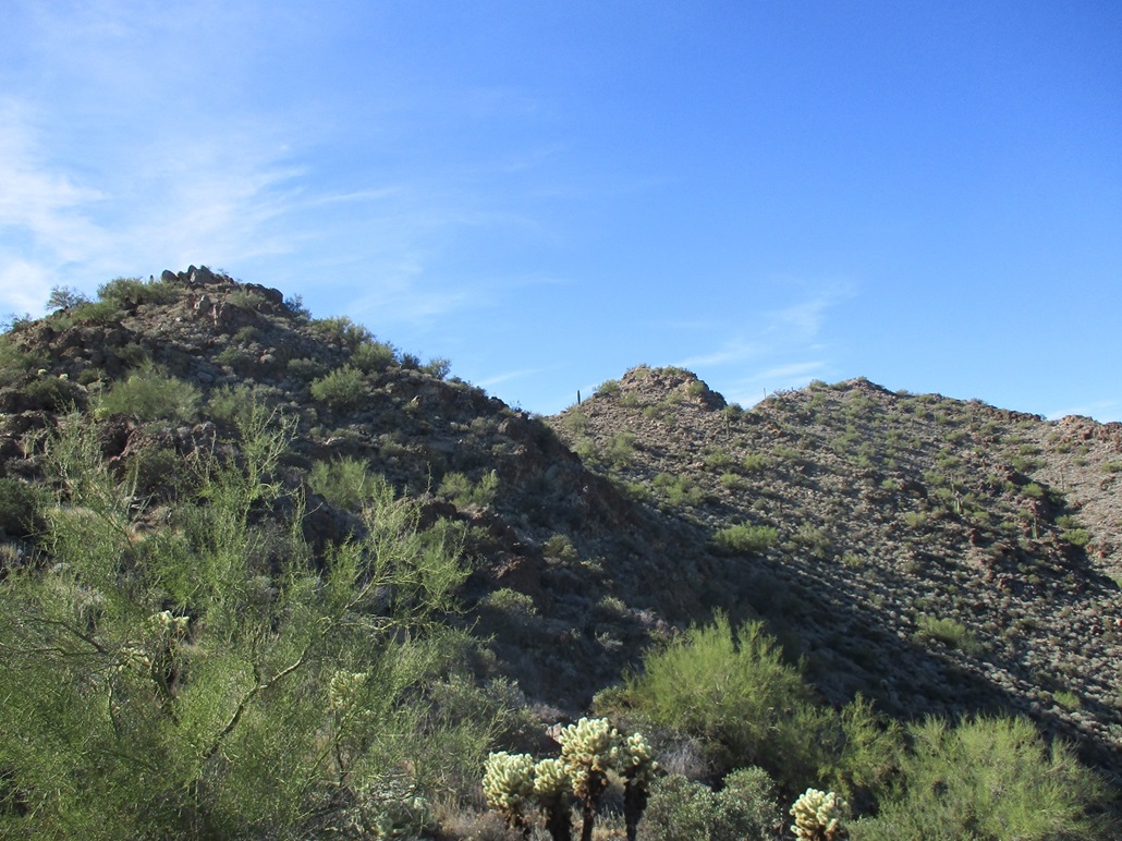
In about twenty minutes I had grunted up about 400 feet to place myself on the top-most ridge. The summit was up ahead, but I could not yet tell for sure which bump was the highpoint. No matter. I needed to go that way anyway to find out. There were at least two notable false summits on the way. I started walking uphill and came to the first false summit, it being a big outcrop of rock. I generally stayed low and to the right (north), following game trails when I found them, and using my own instinct otherwise. There were paths up here, some possibly human-made. Given the were mines on this mountain in days of yore, evidence of footpaths would not surprise me.
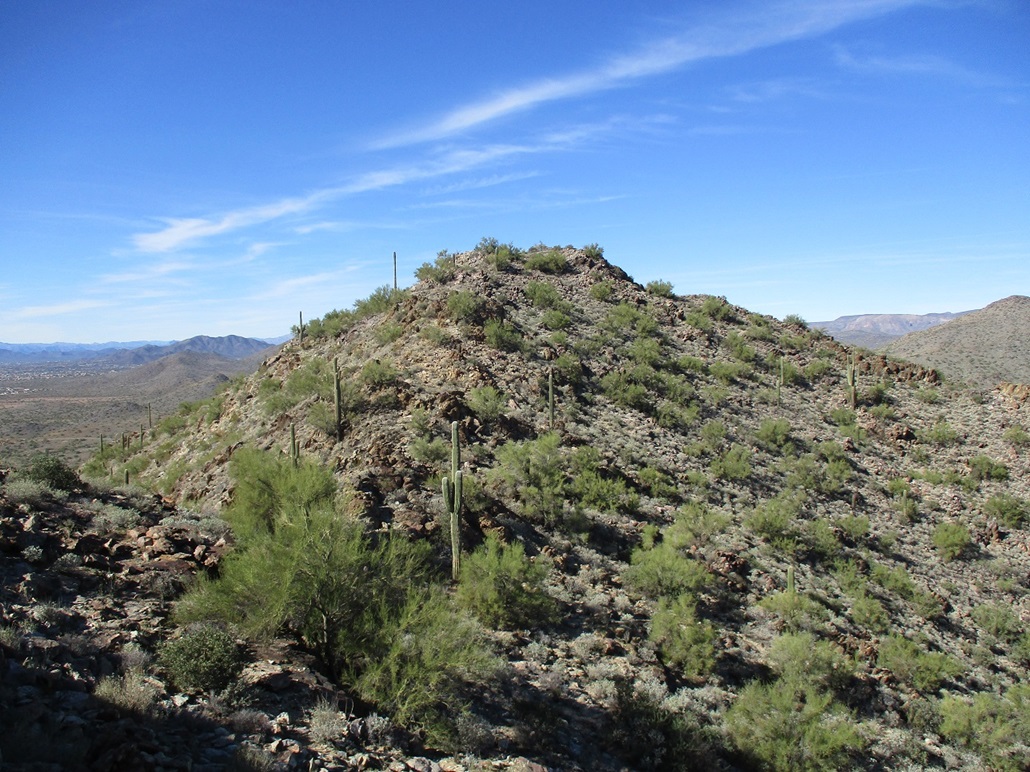
Getting up, around or over these rocky subsummits was not difficult, and at no time did the scrambling ever get more challenging than Class-2. I always found a chute or sequence of ledges to clamber on. What slowed me was the brush, where I had to move slowly and contort to get past. I was finally gaining the highest of these rocky summits. Down low, there was another peak, more conical and rounded than the rocky ones I'd been on, and it looked like it was the highpoint. Up ahead was the highest rocky summit, which I assumed would just be another false summit.
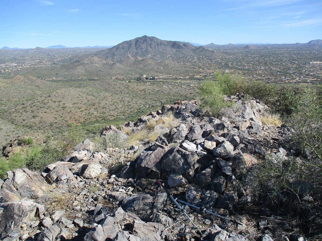
Thus, when I approached it and gained its top, I was very pleasantly surprised to see that this was the summit! That conical peak was easily 30 feet lower. An intervening bump looked to be about 15 feet lower. I was definitively on the highest point. This summit was flat, about 20 feet in diameter, with a small cairn and a stick signifying the summit. I found no register. It had taken me about 75 minutes to get here.
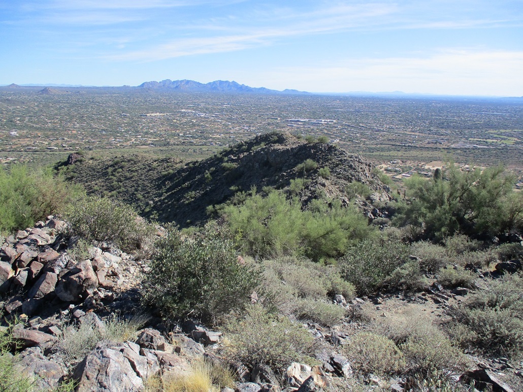
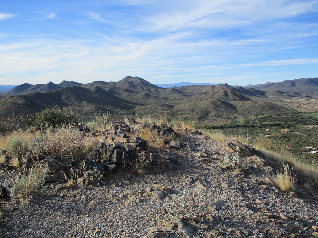
I stopped briefly to sit and have a drink. I snapped a few images, too. The day was clear and almost no humidity. It begat the cool effect of showing distant mountains on the farthest horizons as blueish silhouettes but with distinct edges, and closer-in peaks with detail such as shadows on its ridges. The 6th photo in the left sidebar illustrates what I'm talking about.
I debated whether to just stay on the ridge westbound, but chose to go with what I knew, so I backtracked along the eastern ridge, then down the long slope back to the trail. The egress down off the mountain went well, as I had gravity on my side, and could spot routes through the rock from elevated positions. Once on the trail, I just walked back to my vehicle, the walk out taking about the same as the walk in. I was back to the car at 3:15. The hike had gone well and I was pleased to tag this summit and to have a little scout of the other peaks and trails in this park. Given what Dan told me, I'd say that both approaches are rocky with false summits, so maybe my way wasn't much better.
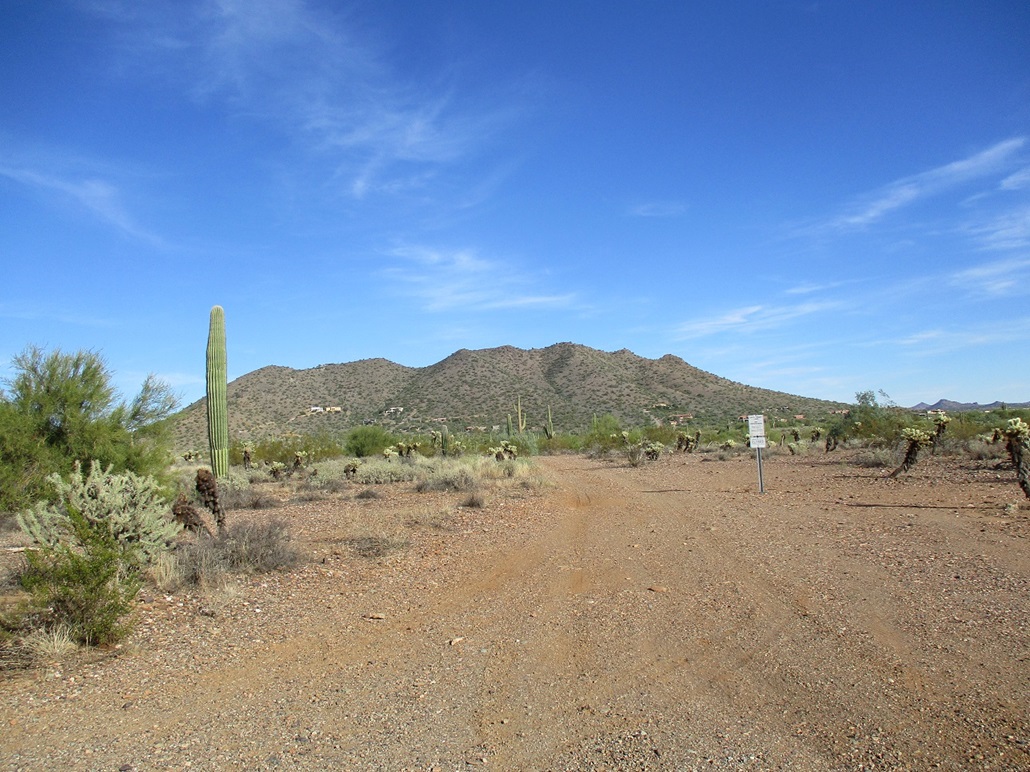
I drove out to the Carefree Highway, then eastbound to Cave Creek Road, then north to situate myself near the small Surrey Hills.
Elevation: 2,531 feet
• Prominence: 411 feet
• Distance: 0.6 mile
• Time: 35 minutes
• Gain: 390 feet
• Conditions: Sunny, cooler
PB
•
LoJ
It didn't take more than 10 minutes to get here. The Surrey Hills lie west of Black Mountain, a tiny batch of hills with its highpoint to the north, and the other main hill to the south. Surrey Road goes past a couple homes and condos, topping out on a cul-de-sac in the saddle between the two hills. From here, the Surrey Trail continues west, popular mainly with mountain bikers. These hills have no official name, so Surrey is an obvious de-facto name to use.
I parked below, along the road marked with small signs saying "trail parking". I then walked up the road, and before I got to the cul-de-sac ending, I hung a right and started up an obvious gully with a neat rock formation at its high saddle. I erred at first by trending too far right. This put me on steep slopes of small scree with terrible footing. Interestingly, there's old water conduit piping laying on the ground. The map shows a mine adit icon, suggesting an old mine, who knows how long ago. This piping was ancient and haggard, having laid there in the sun for decades (a century?).
I backed off this slope and dropped more into the proper drainage, where the slope upward was much friendlier and with surer footing. I was soon at the saddle and the rock formation. I hung a left and within a couple minutes, was on to the highpoint. The hike had gone extremely fast, 15 minutes from the car to here.
The sun was starting to descend in the west, with shadows growing longer. It was cooler, too. I snapped a few images, but didn't stick around. This was a tag-it-and-bail summit, just one to visit and pad my totals. However, I liked it. It was cooler than expected. If I lived in the area and got tired of hiking Black Mountain and looking at the cute women, I would opt for this hill, where solitude would be likely.
I was back to the car quickly, the round trip taking a little over a half hour. Not bad for a second peak for the day. With dusk an hour away, I wanted to get back to Tempe. Traffic was heavy, although not as heavy as one would expect on a Friday, with the holiday mitigating that. I had a good couple hours in the hills, which helped the spirit a lot.
|


|