
The Mountains of Arizona
• www.surgent.net
|
|
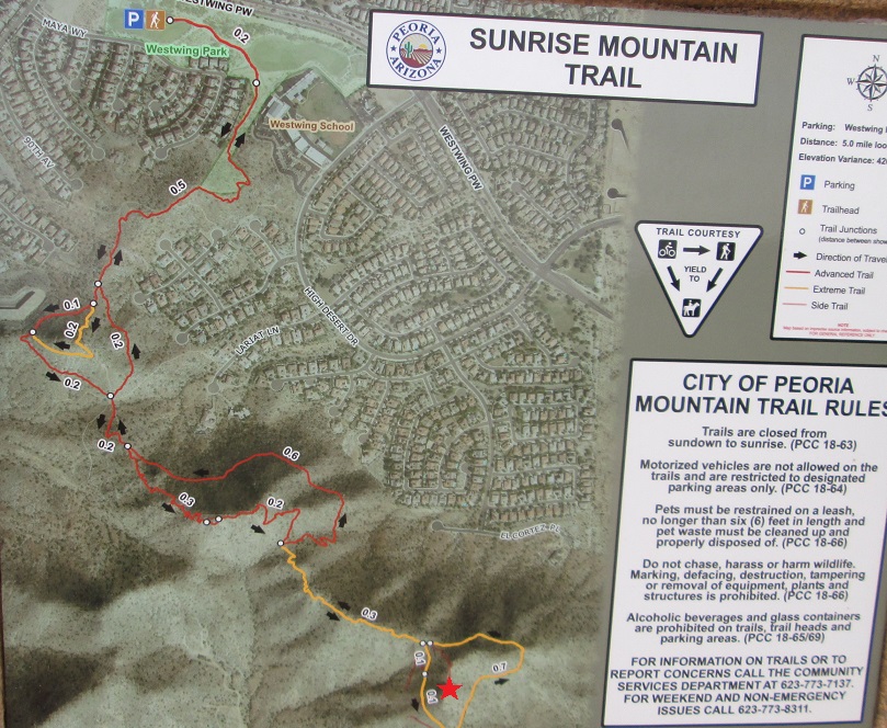
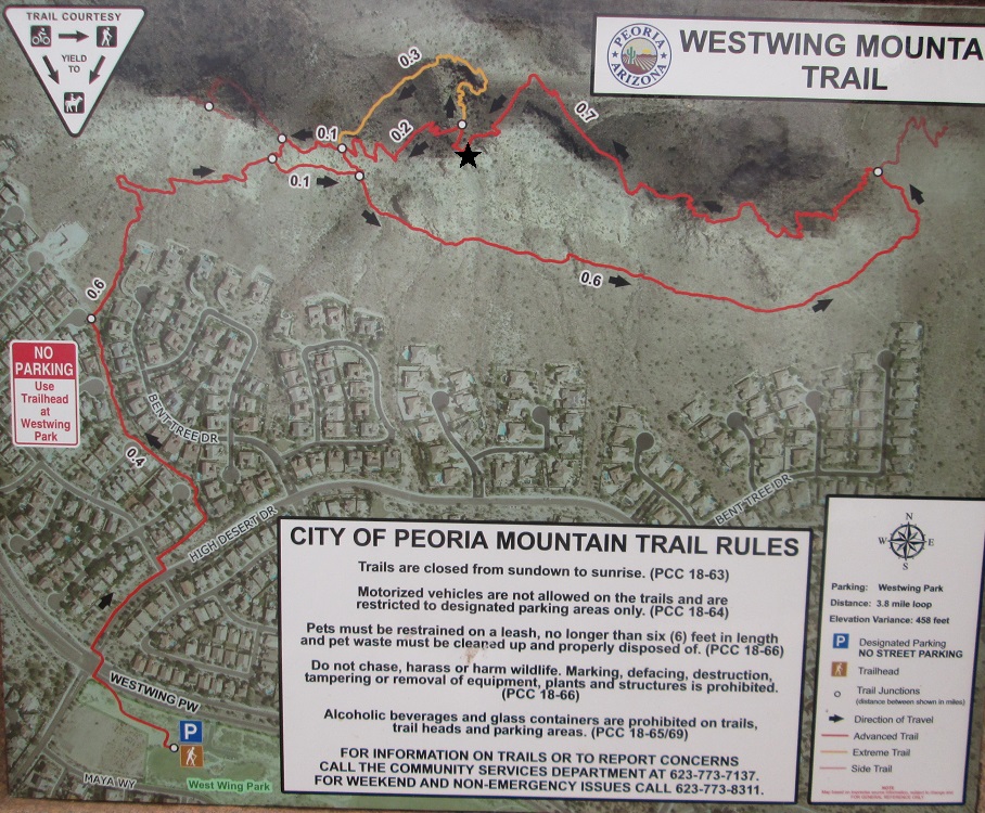
Sunrise Mountain • West Wing Mountain West Wing and Sunrise Mountains are located near one another, in Peoria north of Happy Valley Road. Both are accessible from the same trailhead and are part of the Peoria Mountain Preserve. The city has done a commendable job of providing access and trails as the deserts below become suburban housing. Scott Peavy and I intended to hike another peak, Granite Mountain farther north near Bartlett Dam. We met in Fountain Hills, and drove north along the Beeline Highway to a parking and staging area near Sycamore Creek. It had rained (and snowed higher up) all day yesterday and the day before. Sycamore Creek was flowing very heavily. Unfortunately, the initial portion of the trail is alongside and sometimes within the creek. When it's dry, it presumably is a simple hike. We got about a half-mile in before being forced to stop. There was no going near the water. The mud alongside the flowing water was soft and our trekking poles would sink in about 6 inches. We tried a brushy slope above the creek but quickly gave up. This hike would have to wait another day. We returned to my vehicle and considered options. The recent rains likely made any dirt road soft mud at least for today, and we didn't want to drive three hours anywhere, so I suggested this pair of peaks. It was not a long drive, had fool-proof trails and would give us almost seven miles of hiking. I drove us west along Happy Valley Road to West Wing Parkway, parking in the lot nearby a park.
Date: January 22, 2017
• Elevation: 1,850 feet
• Prominence: 430 feet
• Distance: 4.1 miles
• Time: 3 hours
• Gain: 450 feet
• Conditions: Gray skies, cold with intermittent sun
• Teammates: Scott Peavy
We arrived at the trailhead about 11:30 a.m. and opted to hike these peaks in alphabetical order. From the parking area, the trail goes east toward a school, then up through a narrow ribbon of land lined both sides by houses and their backyards (and occasional barking dogs). Soon, we were above the houses and on the north "foothill" of Sunset Mountain.
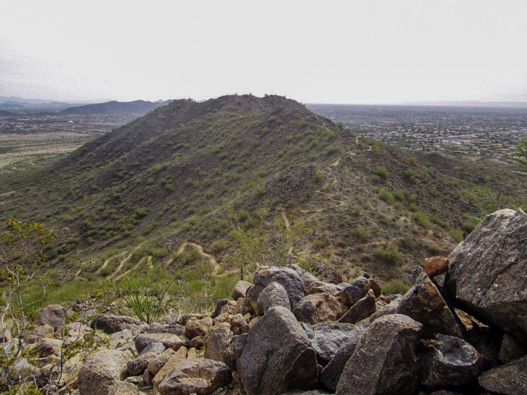
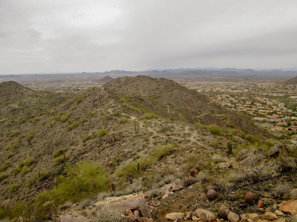
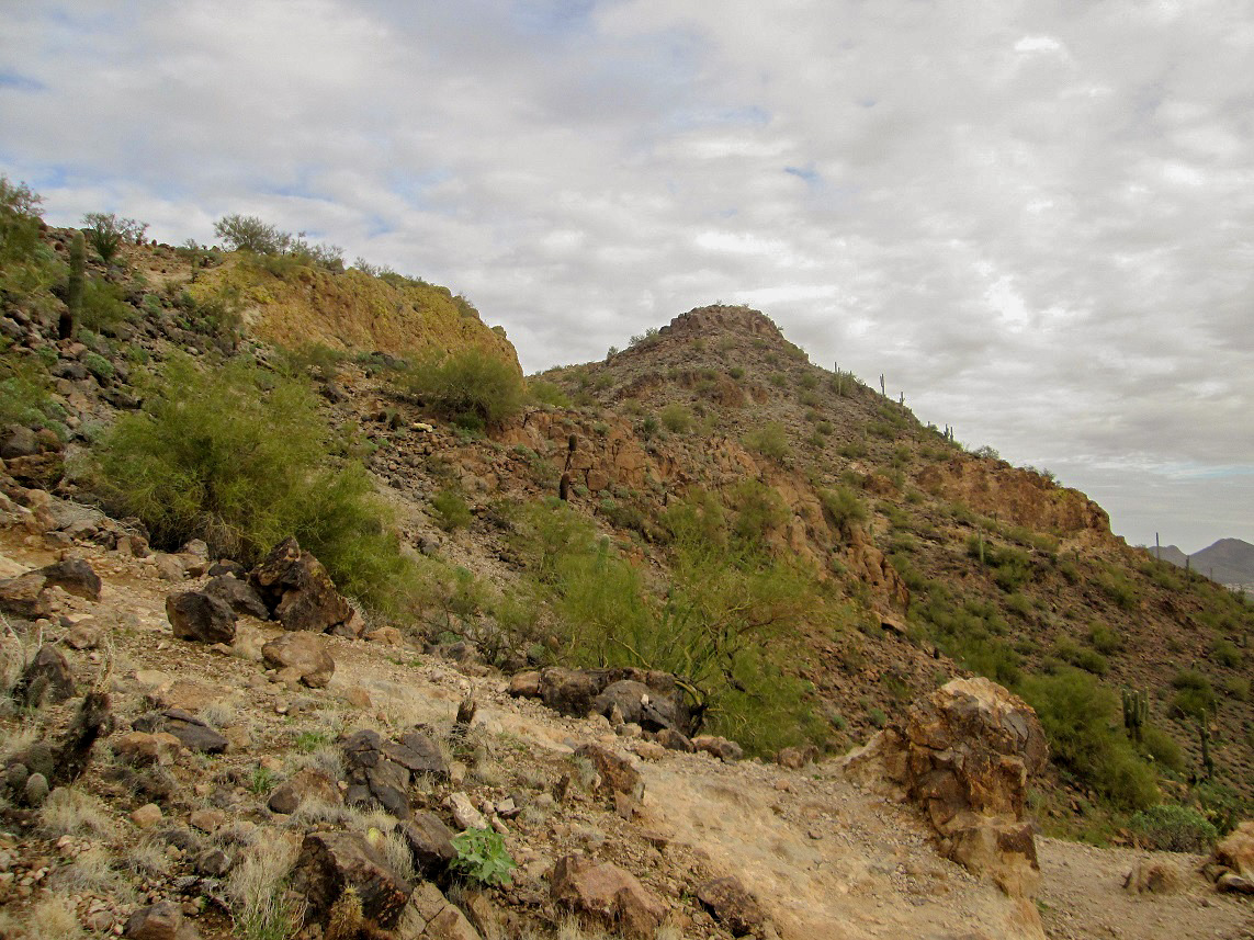
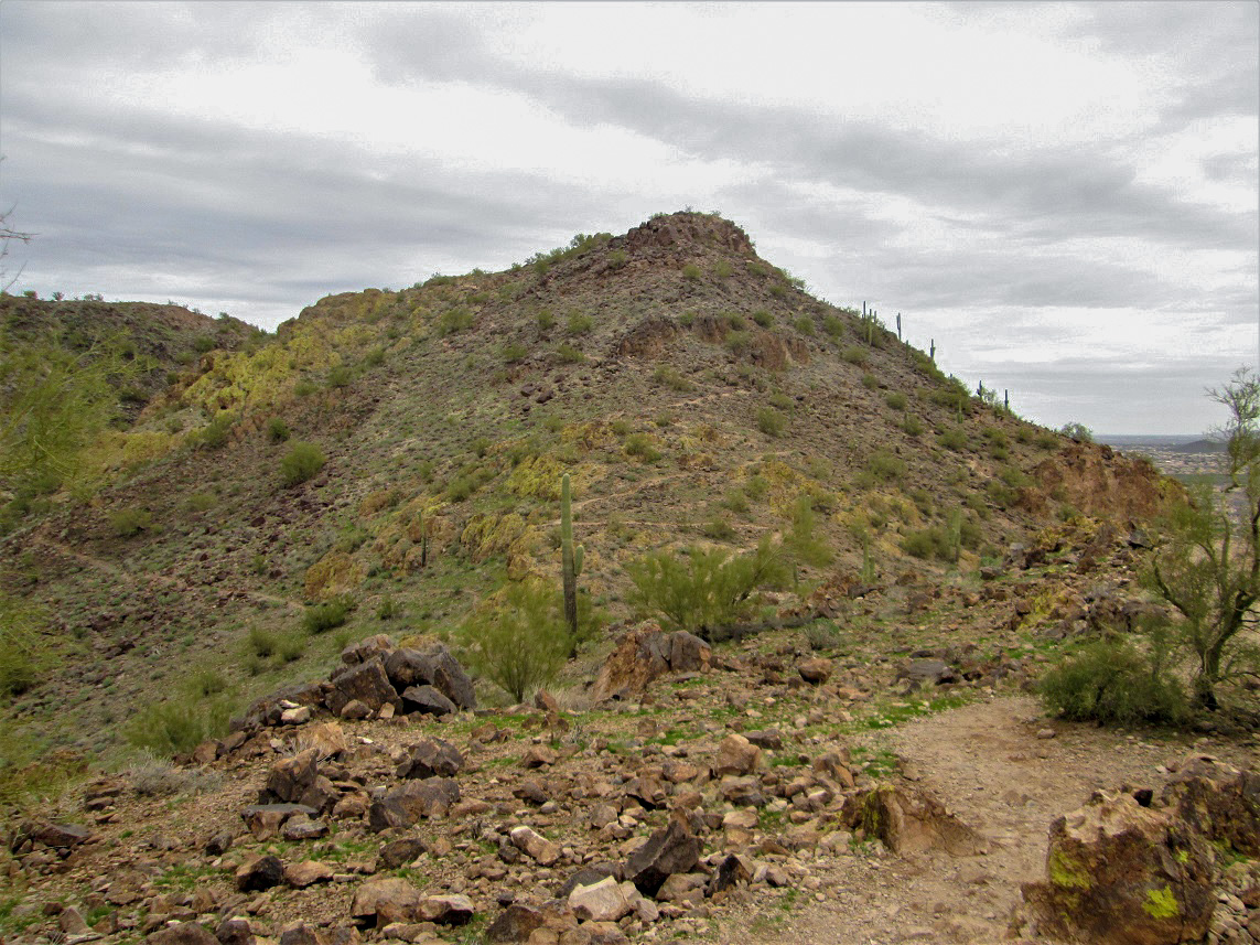
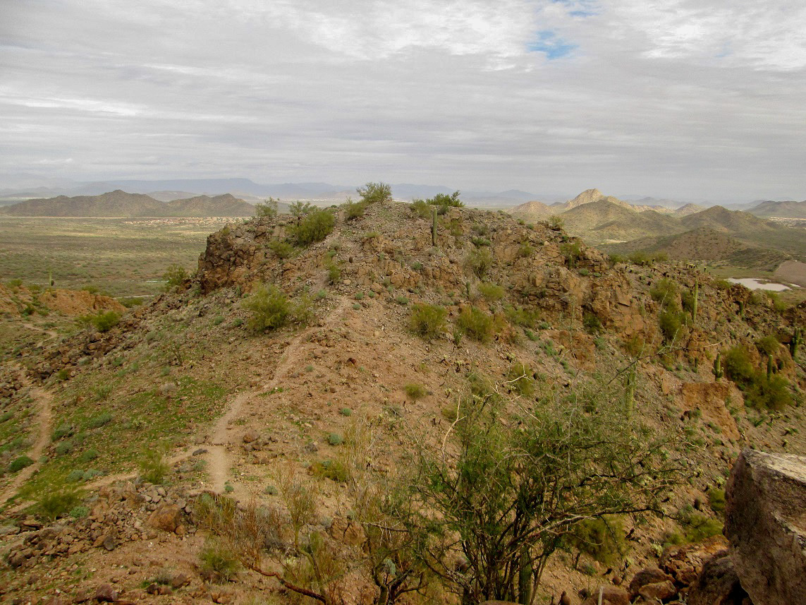
Up ahead was a small summit, then another, then the real top off to the far left (east). We could see trails staying low and some going up and over the bumps. We stayed low and traversed the hillsides at first, then at one junction where the sign had "easy" and "difficult" options, we chose the difficult option. This trail went up toward Peak 1825. It was not difficult at all. Compared to the easy trails, the difficult ones are narrower, that is all.
We topped out on Peak 1825, then descended to a saddle where the easy trail came up to meet our difficult trail. We contined east up another ridge, then a three-way junction, two of the choices being part of a loop, the middle choice being a path to the summit.
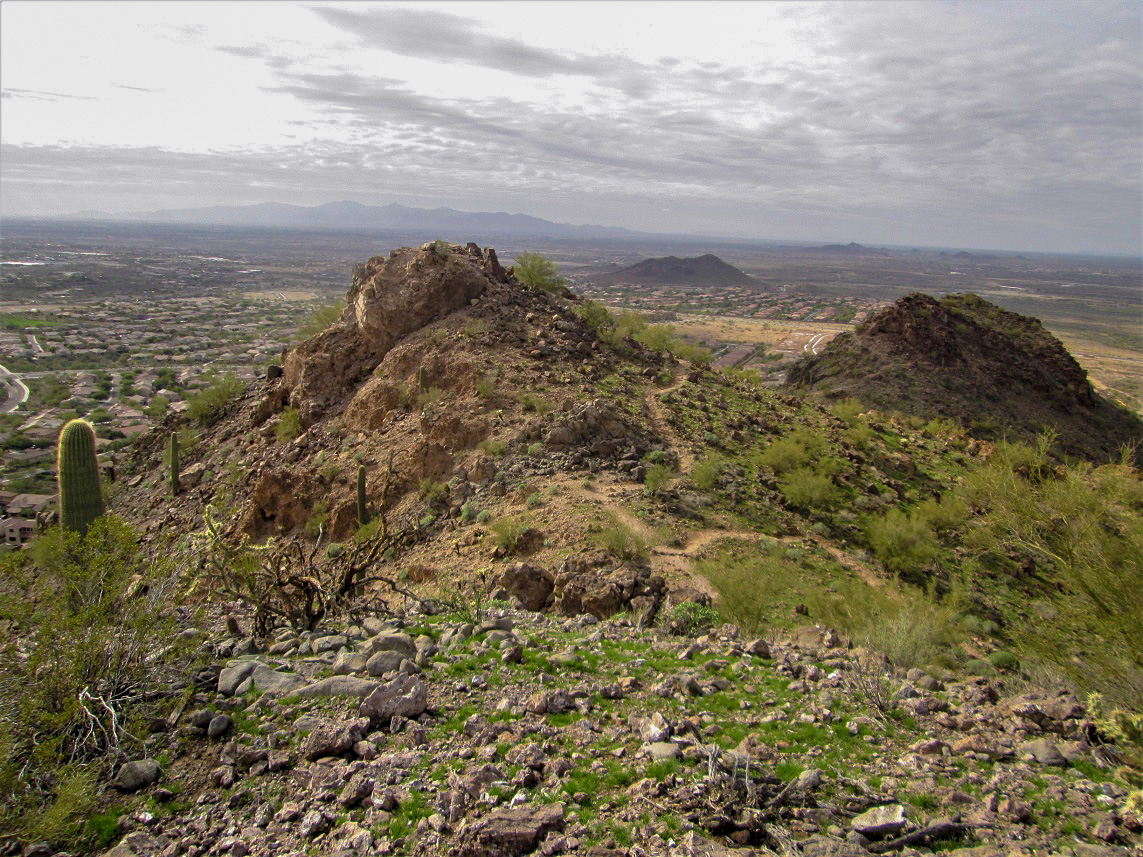
We followed this summit path up, and quickly were on top. Up to now, there had been a fair number of hikers on the trails but most who came this far opted for the loop. We had the summit to ourselves. Someone had stashed a couple of folding chairs up here. Naturally, we unfolded one for photograph purposes.
Going by the mileages on the sign near the trailhead, we had covered 2 miles to get here, with a net 450 feet of gain. Counting the drop off of Peak 1825 (and the necessary regain), we probably added another 100 vertical feet to the climb.
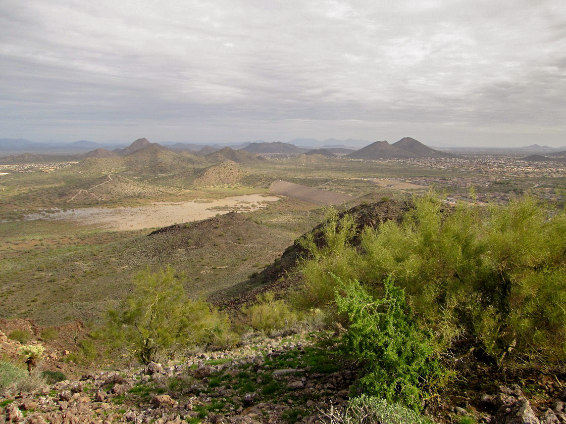
Up here, we had decent views of the surrounding area. It was cold and cloudy with gray skies. The sun would break out for about five minutes then disappear again. We spent about ten minutes up top, then started down, back to the saddle below Peak 1825 where the easy and difficult trails meet. We went down the easy trail, which contoured with the hillside and had more up and down than one might expect.
We were soon back to my vehicle, a round trip of 4.1 miles, the extra 0.1 mile due to the easy variation we took. We had been hiking a little over an hour. Back at my vehicle, we took a break before starting up West Wing Mountain to the north.
Elevation: 1,930 feet
• Prominence: 475 feet
• Distance: 2.6 miles
• Time: 75 minutes
• Gain: 530 feet
• Conditions: Gray skies, cold with intermittent sun
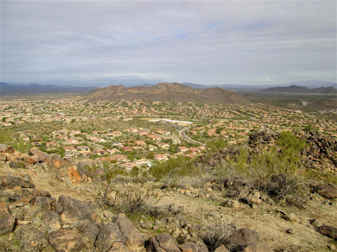
We hiked partly along city streets, then found the trail amid the homes north of West Wing Parkway. The sign said the houses portion of the trail covers 0.4 mile. The trail then makes a right turn and starts upslope, leaving the houses behind. Hiking amid homes with barking dogs, barbeques, and kids riding bikes feels kind of odd.
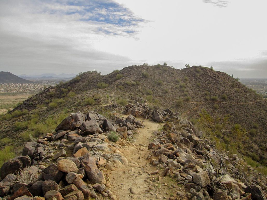
The next segment is a relatively steep but short section, where the trail wiggles up the slope aiming for a saddle below the summit. The trail here is much rockier than what we had on Sunrise Mountain. There were also far fewer people, too. We saw no one until we were nearly to the top, and only two other people total on this hike.
As the trail nears the saddle, it steepens and works up a couple bare rock sections, topping out on a small rock bump, between the main summit to the east, and a smaller peak to the west. We had to drop about 30 feet here to emerge onto the actual saddle. From here, we walked up switchbacks past one summit bump, to where the trail ends atop a second summit bump. These two bumps are about 200 feet apart.
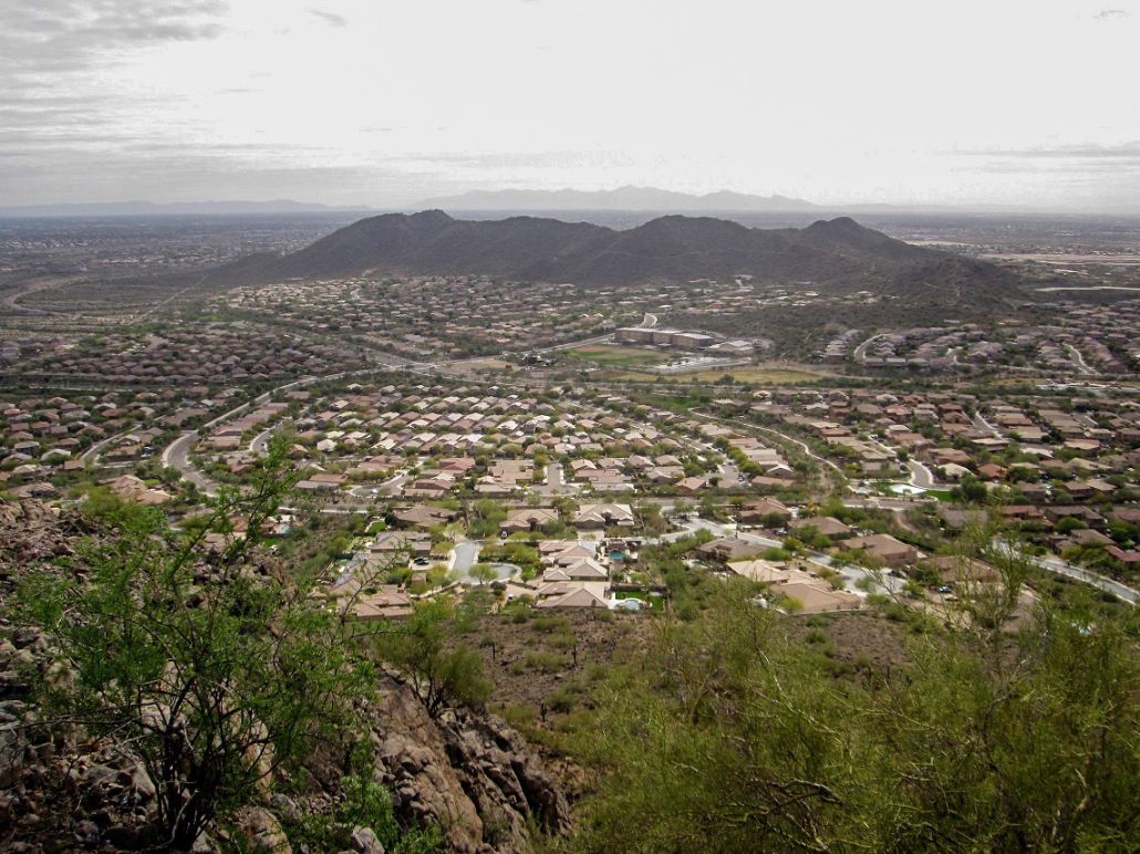
We spent about 5 minutes atop the east bump, looking down at the New River Dam and its meager water. To the north we could see Lake Pleasant and the dam holding its water back. If that dam were to break, the New Water Dam would likely have to contain the rushing water.
We sighted west to the first summit bump, and it looked too close to call. As we hiked out, we ascended this bump and looked back to the eastern one. Again, we could not discern one as being higher. Scott's altimeter gave identical readings for both. If I had to choose, I think the western bump may be higher due to a big rock that might make the difference.
The hike out went quickly, the round trip for this hike barely taking an hour. We had covered 1.3 miles each way with 530 feet of gain. Back to my vehicle, I drove us back to Scottsdale, where Scott got his car. While we were unable to hike our intended peak today, these two smaller summits salvaged the day nicely. Together, they give one a good workout.
|


|