The Mountains of Arizona
www.surgent.net |
|
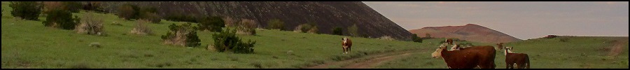
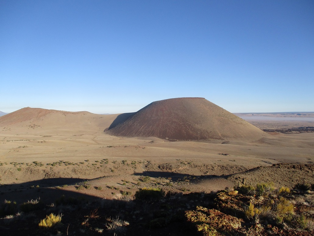
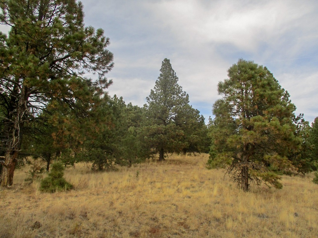
S P Mountain • O'Neill Crater • Antelope Hill I wanted to get out of the Phoenix area for a day or two, eyeballing the hills up around Flagstaff as a destination. It's been over two years since I hiked anything around Flag, so it was time to go back. This time of year, it can be cold and snowy at the high elevations. However, the state has been warm and dry in recent weeks. Temperatures in Flagstaff were topping out about 60 degrees, lows in the high 20s, with clear and calm skies. In particular, I wanted to hike S P Mountain (also known as S P Crater), a nearly-perfect volcanic cone with an accompanying four-mile lava flow, located north of Humphreys Peak. It lies on the plateau north of the big mountains, on land owned by the Babbit Ranch, but a road in from highway US-89 allows access to the general public. The name is an abbreviation for Shit Pot, because it apparently looks like one that sprung a leak.
Date: November 9, 2019
• Elevation: 7,021 feet
• Prominence: 721 feet
• Distance: 2 miles
• Time: 2 hours
• Gain: 800 feet
• Conditions: Clear and calm, cool, with smoky scent in the air
Arizona
•
Main
•
LoJ
•
Interactive map
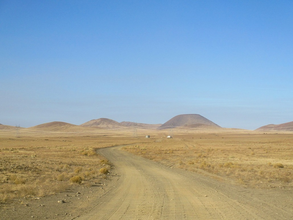
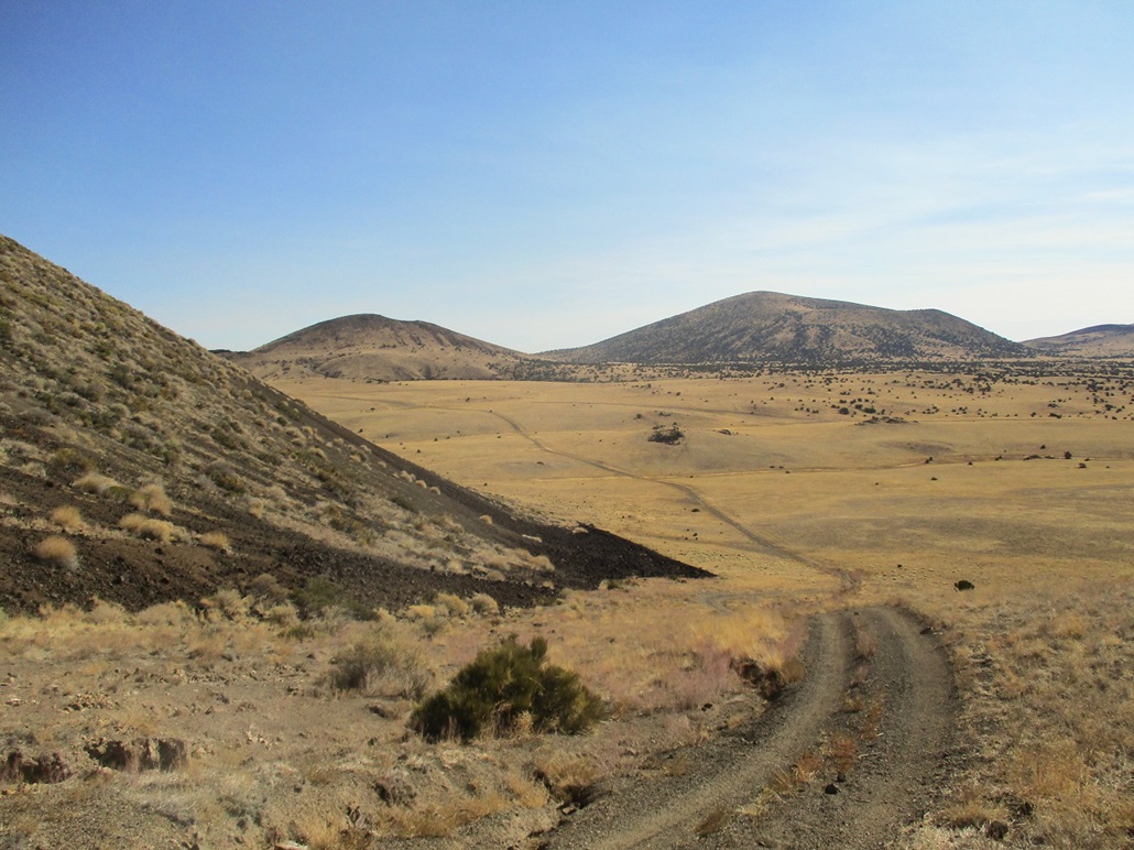
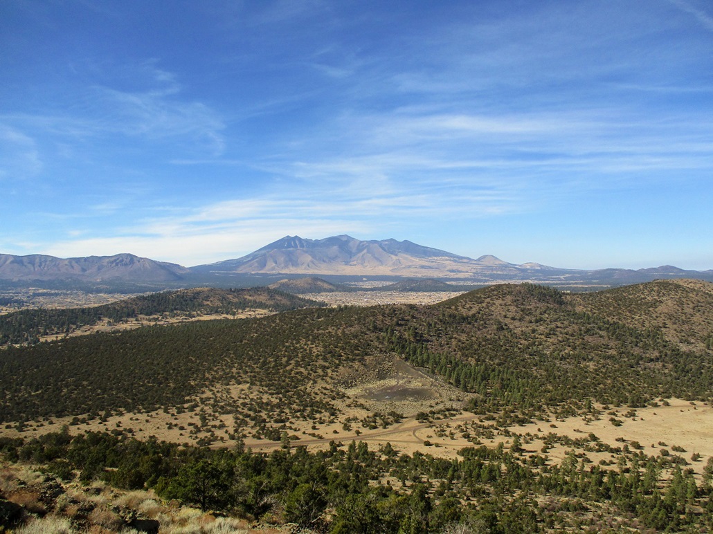
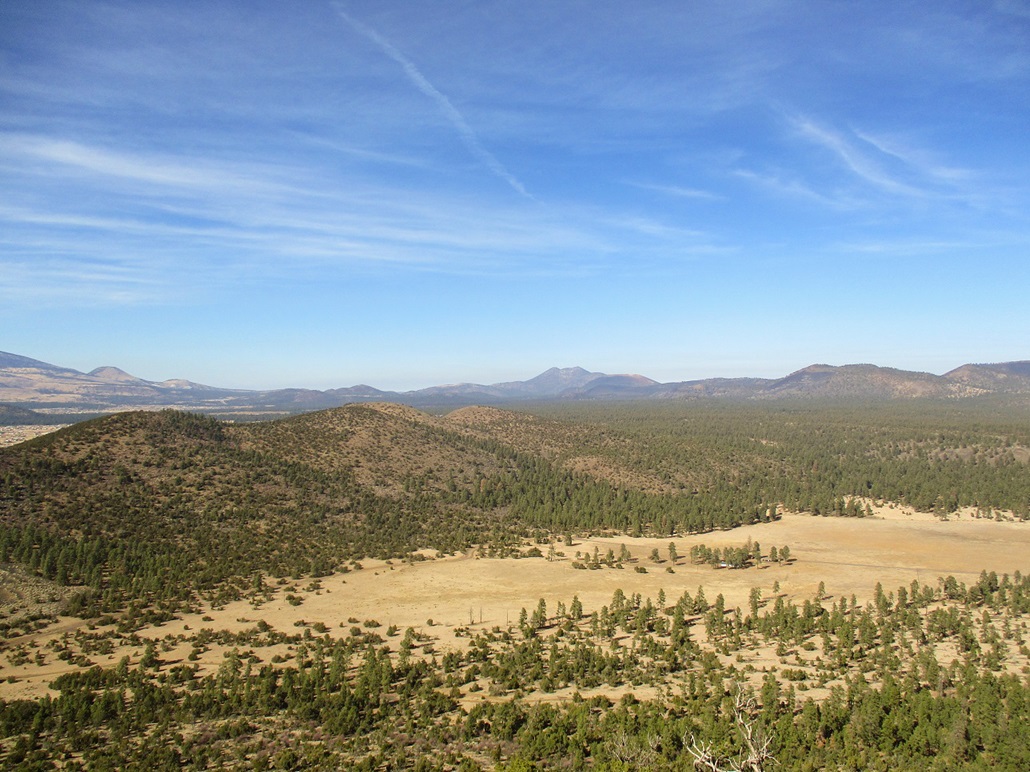
I left Scottsdale about 5:30 a.m. and drove north, arriving into Flagstaff about 7:30 a.m.. I bypassed the main part of the city, got on Interstate-40 to the US-89 exit, then followed that for about 30 miles as it descended toward the Navajo Nation lands. S P Mountain and its various hills essentially lie on the boundary: to the south, the big peaks, to the north, broad mesas and plateaus. Aside from a couple lesser hills, S P Mountain is the largest and the last volcanic feature before leaving the Volcanic Field altogether.
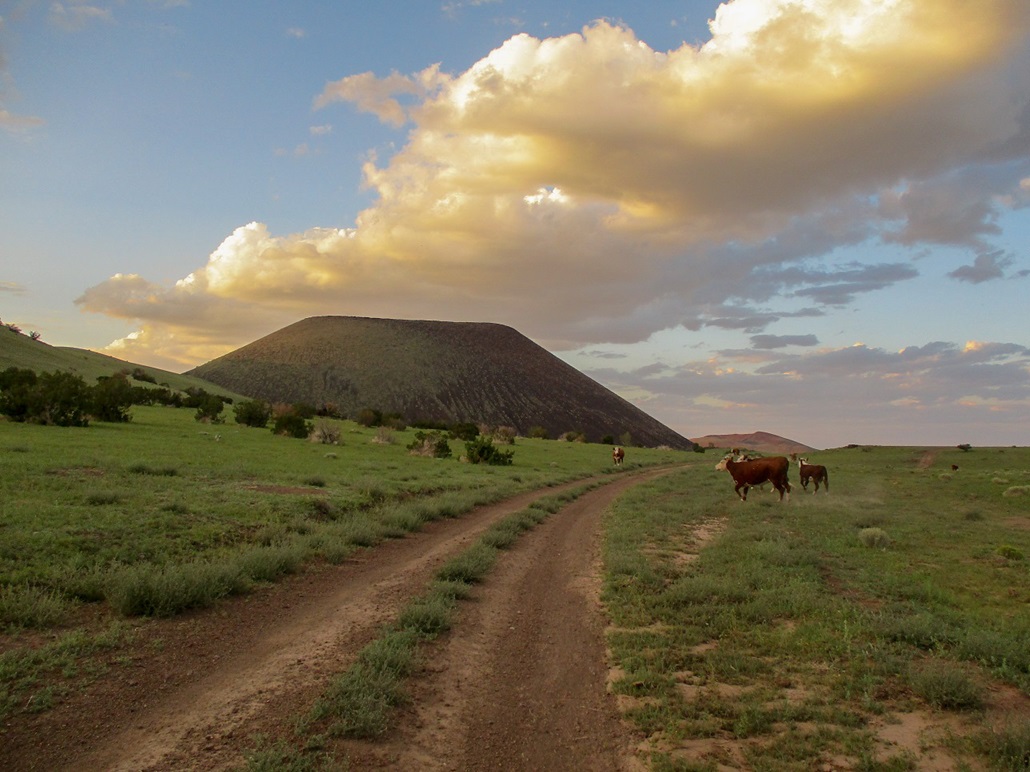
I got onto the access road (milepost 446 on US-89) and drove west on the good road, following the obvious main tracks every time I came to a split. When in doubt, I always chose the one that went toward SP Mountain, which was plainly visible the whole way. I passed a couple herds of cows, some of them laying on the road itself, so I would inch by while they got up ... only to run in the road itself, instead of orthogonally.
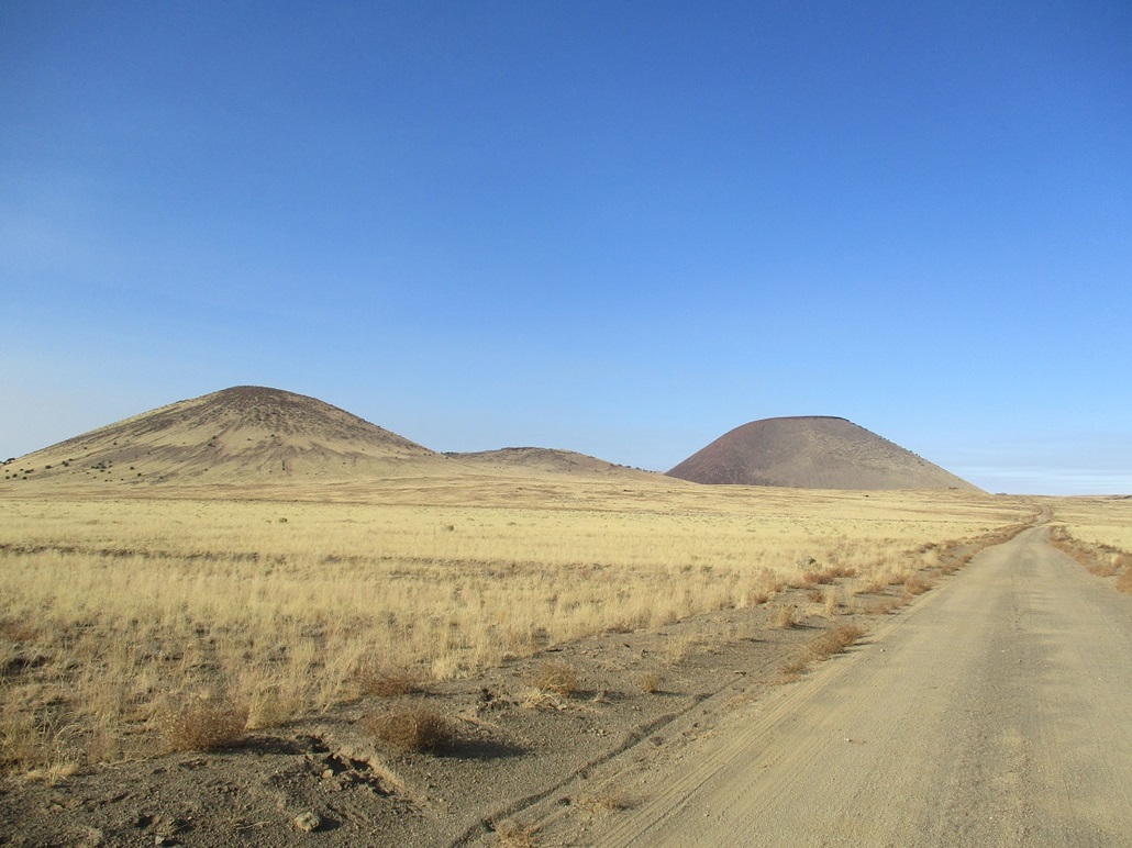
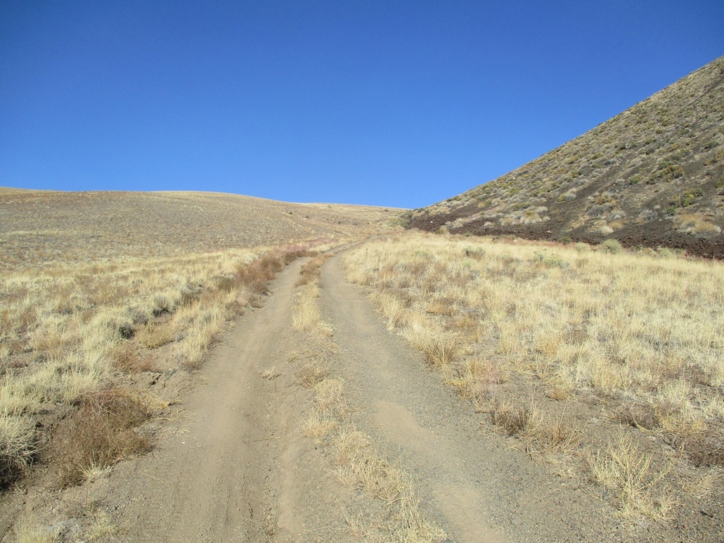
I followed the roads until I was on a lesser track (still a good road, though) that runs under the cone and up over a hilly buttress to the southwest of the cone. I parked in a convenient spot beside the road and started walking soon thereafter, the time 8:30 a.m.. The sky was clear but smoky, due to a prescribed burn somewhere nearby. I was close, the hike would only entail about a mile each way.
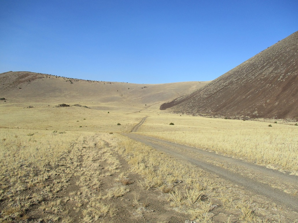
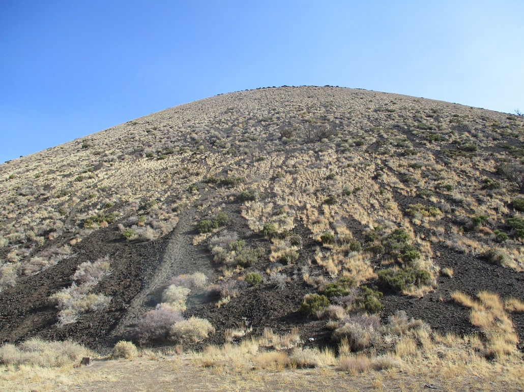
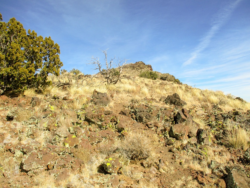
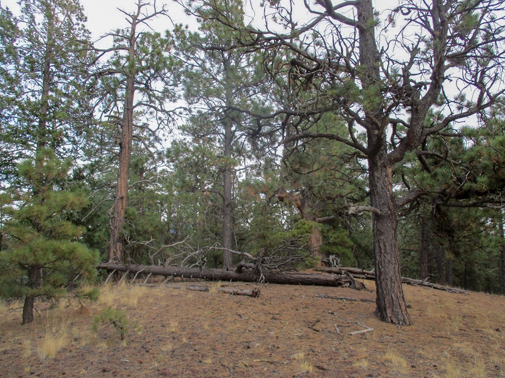
The natural route is to follow the road up this buttress (a strong 4-wheel drive vehicle could get up this). This segment covered about a half mile and about 400 feet of gain, and went fast. Now, I was in the saddle immediately below the darker-colored rubble slopes, all pitched about a 45-degree angle. The top was another 400 feet higher. I found a path and started the uphill grind.
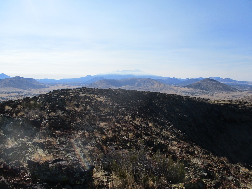
Not surprisingly, this went slow and took a lot of effort. Every step into the kibble-sized rocks would result in sliding back about half my pace length. If I stopped, I would sometimes slide down a couple feet. I had to keep moving if I wanted to avoid losing elevation. The paths interbraid and no one path is best. Most go straight up, which is a bad idea. I would try to zig-zag, angling up for awhile then angling the other way. This portion was a chore, but I got up to the top rim after much effort.
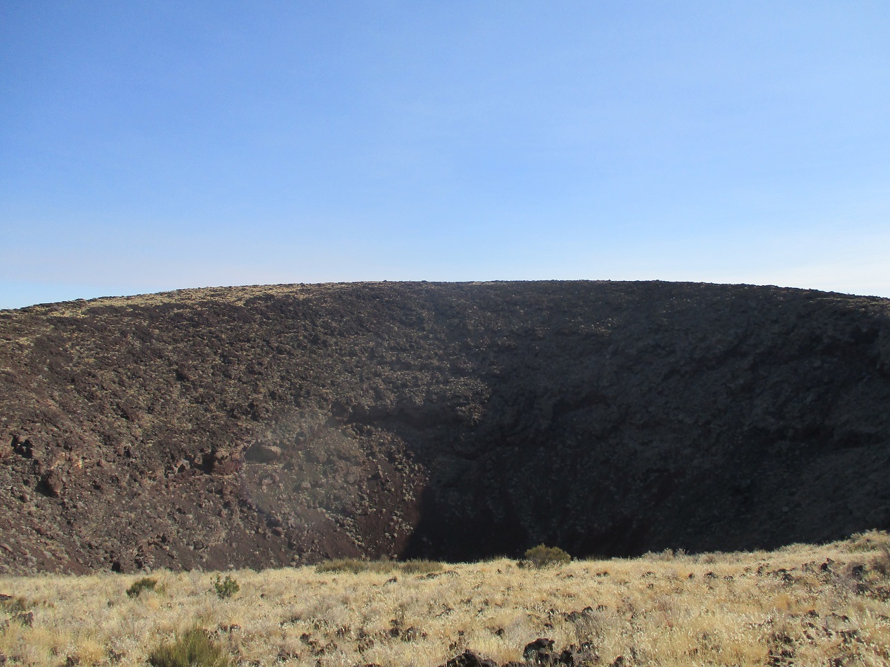
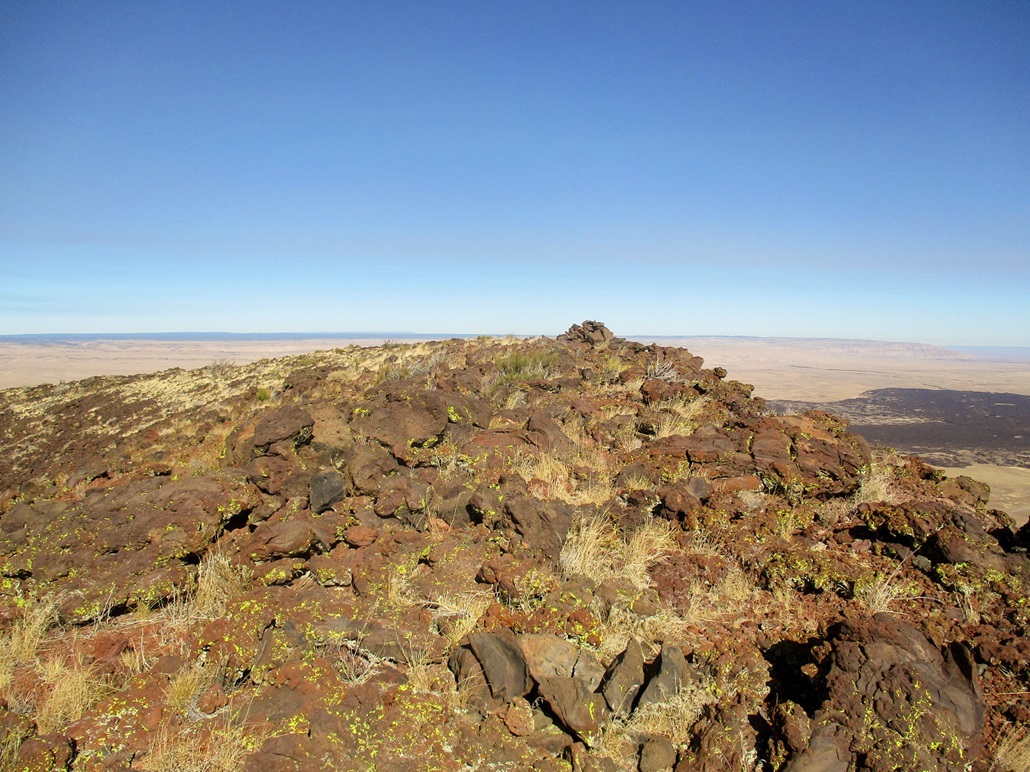
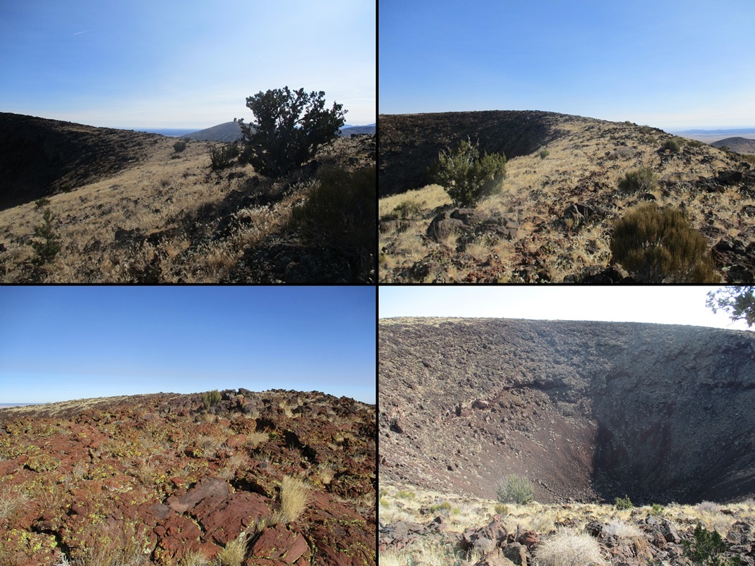
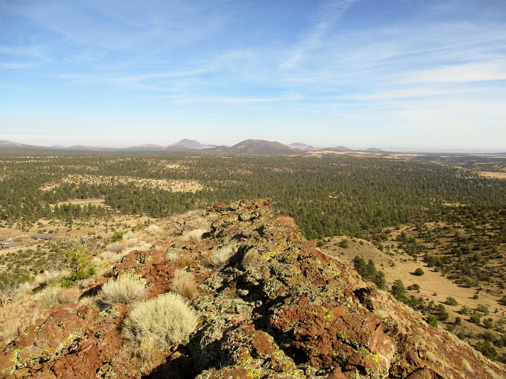
The highest point was directly across from where I stood. The top rim a crown of jagged volcanic boulders, what the smart people call "agglutinate", about twenty feet wide but sometimes just a few feet wide. Between me and the top was a huge depression, the crater of this vent. It looked mean and ominous, a 360-foot deep maw with cliffs and steep, loose slopes. I sensed if someone were to go into the hole, they'd never get out.
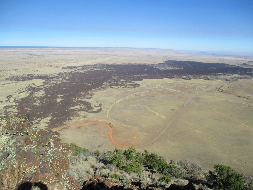
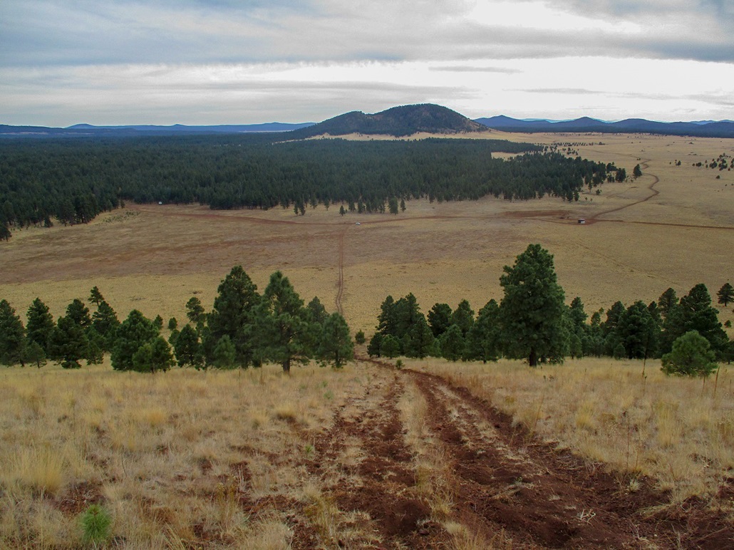
I traversed the rim counter-clockwise, gaining about 60 feet, to the highest point, marked by a cairn and on the only "wide spot" of the whole rim. The views were good but I did not stay here long. Instead, I walked a little more to an overlook where I had better views of the lava flow, which splays north from the base of the cone for about four miles. The flow dates from about 71,000 years ago, so is very young in geological terms. The lava still has the dark color and defined edges set against the grassy rangeland.
Since I had covered about 60 percent of the rim's circumference, I decided to continue in that orientation back to where I started, a complete curcuit of the rim. On the northwest and west edges, it got narrow and very jumbly. I had to use my hands in spots. Falling was not a fear, but loose rocks were. A couple big ones rolled with just the slightest weight.
I descended the rubble slopes, going quicker because I could now slide with the rubble, not work against it. I was back onto the track and to my car at 10:30, a two-hour hike. The day had improved slightly: the smoky haze seemed to lift and reveal the mountains better. I drove back to US-89 and weighed my options for a second hike. I had maps for a handful of mounds on the east side of Humphreys Peak. I chose to hike O'Neill Crater next, mainly because it was easiest to get to from where I was.
I did not see anyone on my hike of S P Mountain, but the log book at the summit showed someone was here three days earlier, and another group three days earlier than them. There were lots of names going back so it appears to be climbed often. The hike was short and strenuous but a lot of fun. The cone itself is perhaps the most symmetrical of any of the surrounding crater vents, and all the years of people coming up here has barely put a dent in the rubble slopes. There is no "beaten" path to depend on.
Elevation: 7,047 feet
• Prominence: 572 feet
• Distance: 2 miles
• Time: 1 hour
• Gain: 625 feet
• Conditions: Warm and calm
PB
•
LoJ
O'Neill Crater is located about five miles east along the Townsend-Winona Road, which conveniently was the intersection I was parked at, along US-89. After about fifteen minutes, I got moving again, heading eastbound on the T-W Road. I came to Hutton Ranch Road and went north for a mile through some residences. Past the last residence, the road makes a right bend and is now back on Coconino Forest land
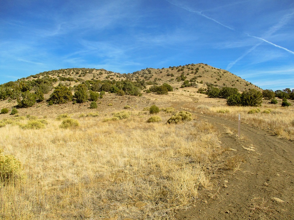
O'Neill Crater rises east of this road, a hill that from this vantage looks like a saddle. The summit can be seen as a rocky point above the left lobe of the hill. It is a crater, and once on top it's easy to see the surrounding crater rim and parts that have worn away or were blown away.
I parked a little up the road behind a large tree, then walked back to a scant track that leads up to the saddle, about a 300-foot gain. The tread is loose and sloppy, looking like ATVs have torn it up over the years. The road-path ends at this high saddle, where there are low rock walls. The map says they're ruins.
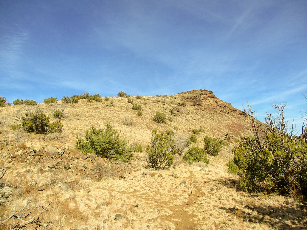
From here, a footpath continues past another small batch of ruins (just measly rock walls about a foot high). The path splits and any choice seemed good, so I followed what looked logical. They all come together again toward the top. Quickly, I was on the top of O'Neill Crater. The summit is a rocky crown of jagged volcanic rock, sharp to the touch and quite colorful.
I spent a few minutes up here, snapping images and listening to dogs bark. There were some shooters in the forest north of the peak. The views were pretty good, this morning's smoky haze having dissipated. I snapped a shot of the "Tufa" benchmark, too. Up here, it is easy to sense the ancient crater rim and how it has eroded and changed over the eons.
I followed the same route down and was back to my car, the round-trip covering two miles and taking an hour exactly. It was an enjoyable short hike, an easy add-on when hiking bigger bumps in the area.
I had one more peak in the area: Turkey Hills Highpoint, which was visible from O'Neill Crater, about three miles southwest. However, I got a little turned around on the roads to get there, and truthfully, wasn't that interested. So I headed west and looked at hiking the Hochderffer Hills. That did not work out either. Where would I go next?
Elevation: 8,243 feet
• Prominence: 463 feet
• Distance: 2 miles
• Time: 1 hour
• Gain: 580 feet
• Conditions: Cloudier, cooling down and a little blustery
Antelope Hill is a completely anonymous, non-distinctive hill in the forest south of Kendrick Peak, about 20 miles northwest of Flagstaff. I had no intention to hike it and had not brought maps for it with me. However, some other plans unraveled and suddenly, I was in the area looking for a Plan B hike. It was 2 p.m. when I got back to my car after hiking O'Neill Crater.
I had plans to hike the Hochderffer Hills, which lie on the other side of Humphreys Peak. From the O'Neill Crater area, it was close to a 40-mile drive to get there, and there was the usual traffic in Flagstaff. It was nearly 3 p.m. when I rolled into the Hochderffer Hills area.
I planned to drive a forest road (151E) that is only open a couple months out of the year, but when I got to it, it was in rough shape. I drove it for a little ways but grew concerned with its softness and irregular tread. I backed off. I could have hiked it from the main road, but I was starting to lose interest in these hills. The sun had disappeared behind some clouds and the temperature was dropping fast, and I did not want to hike in forest in these conditions. I can always come back, so I cancelled my hike here for another time.
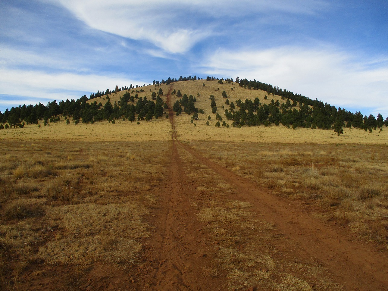
It's now about 3:30 p.m., still early enough to do a short hike somewhere. In my DeLorme Atlas, it identified Antelope Hill nearby and a good forest "boulevard" (Coconino Forest Roads 245 and 171) that leads to it. I decided to drive in and see for myself. I was mildly pleased to see that the side road (FR 781) to it was decent and that the hill itself was mostly open. As I had no map, I would be hiking this entirely on sight and instinct alone.
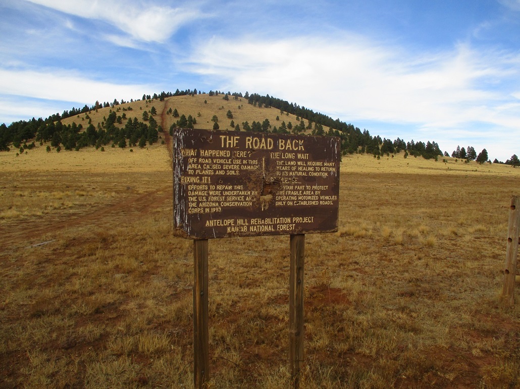
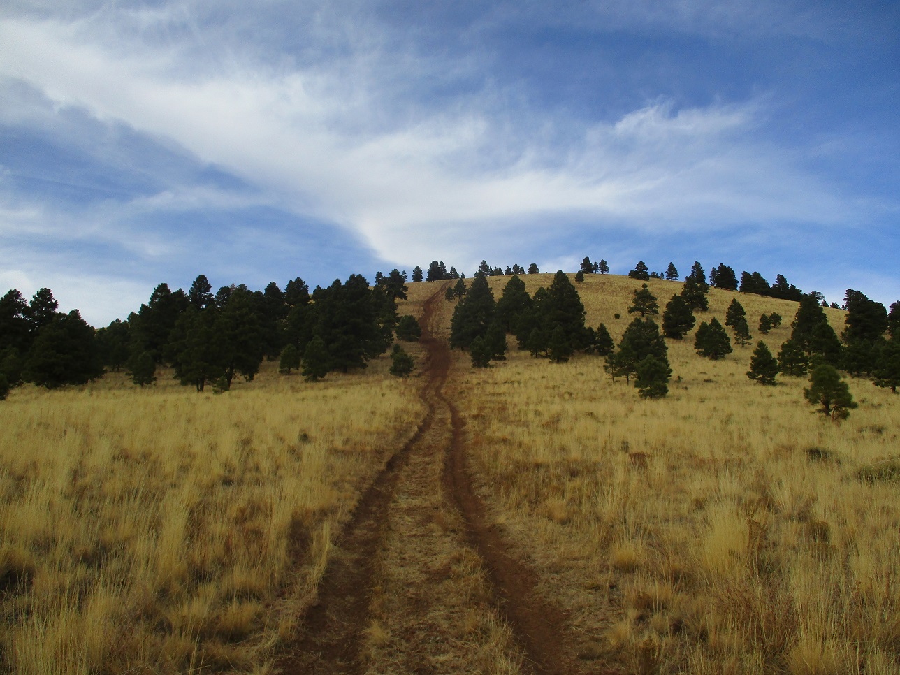
I parked south of the peak, having passed into the Kaibab National Forest. A rough track leads from FR-781 up the south slope to the top of Antelope Hill. The track has been closed to vehicles since 1993 (said a sign), but appears not to be returning to nature very quickly.
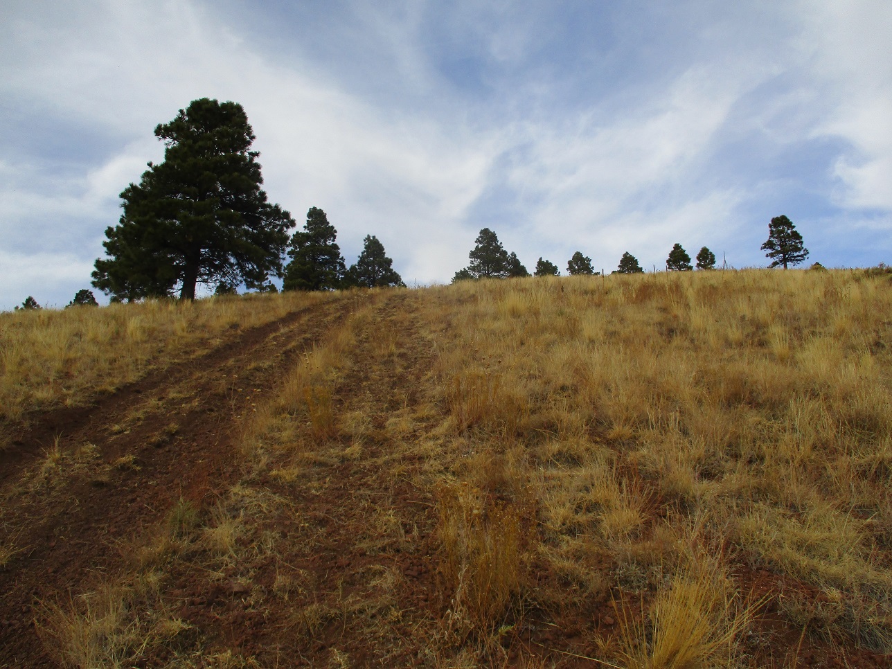
I hiked up the road, which becomes very steep, with loose tread in the roadway. I walked on the grassy slopes beside the road. It was short, though, and I was soon on top. The road ends on a small knob. A meager footpath picks up and swings slightly left. I hiked by sight upslope through light tree cover to the top, where there were no views. To be sure, I walked past the top to inspect if there were higher bumps nearby. I did not see any, and left the way I came. I scored a free headlamp someone had dropped while up here. It still worked, so I picked it up.
The top lies technically inside the Coconino National Forest. The boundary runs slightly west of the top, but some of the road lies within the Kaibab. I was gone for an hour. The weather had got a little unsettled, with clouds and some breezes, with the temperature falling. I drove out, getting back onto FR-171 and following that south to Interstate-40 near Bellemont.
This impromptu hike went well and I was pleased to have something like this available to do without any advance planning whatsoever. Later, I checked online to be sure I had tagged the right point, and I did. There is another hilltop that is just 9 feet lower to the north, but in the trees that way, I never saw it. I also got the chance to note a few more hills in the immediate region for future hikes.
I had a hotel room booked in Flagstaff, so I drove to it and settled in for the evening. I ate at a nearby Sizzler for the first time in probably 30 years. The weather did not deteriorate any further, but it did get cold that night, into the 20s.
I thought about hiking Hochderffer the next morning, but then decided I had a good haul today, with three volcanic mounds added to my vita. So I cancelled that plan and opted instead to hike a trail and butte in the lovely Red Rocks of Sedona. The tale picks up with a hike amid the stunning cliffs to and from Brins Mesa and Butte.
|


|