The Mountains of Arizona
• www.surgent.net
|
| Sitgreaves Mountain |
• San Francisco Volcanic Field • Kaibab National Forest • Coconino County |
|
Date: July 9, 2011
• Elevation: 9,389 feet
• Prominence: 1,949 feet
• Distance: 6 miles
• Time: 4 hours and 20 minutes
• Gain: 2,100 feet
• Conditions: Humid and cool for now
Arizona
•
Main
•
AZ P1K
•
PB
•
Interactive map
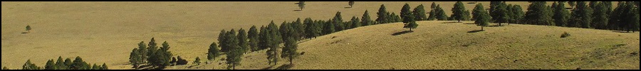
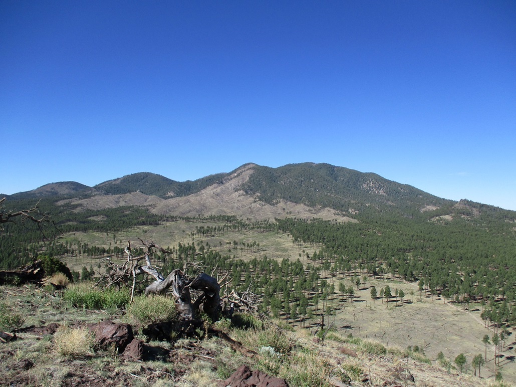
Sitgreaves Mountain is a major summit of the San Francisco Volcanic Field. The peak is about twenty miles west of Flagstaff and about ten miles east of Williams. Along with Bill Williams Mountain, Kendrick Peak and Humphreys Peak, Sitgreaves Mountain is one of the "Big 4" peaks of the San Francisco Volcanic Field. I had climbed the other three peaks years ago, and only now would attempt Sitgreaves Mountain.
Unlike its neighbors, there is no trail to the top of Sitgreaves Mountain. Forest roads get close to the base, but most hiking routes to the top require barging up steep, forested slopes, which can be a chore. And given the many little hills and nubbins (and dense forest), it would be easy to get lost up there. Instead, I looked at a northern approach, which follows a prominent canyon emanating northeast of the summit. I hoped this would mitigate some of the route-finding and grunting up ridges that the other routes entail.
I left Phoenix at 8 p.m. on Friday (yesterday) the 8th. It was 110 degrees yesterday, with humidity, and I wanted no part of sitting in Interstate-17 traffic in the steamy heat, battling everyone else heading up to the high country. Leaving as late as I did, I had no traffic. I was in Flag by 10:30 p.m., got gas and some food, then drove west on Interstate-40 to the Pittman Valley exit (#171).
Off the interstate, I followed County Road 74 for three miles to the pavement's end, where the road is now Kaibab Forest Road 74. I followed this for four more miles to a junction with Spring Valley Road (FR #141). I went right, then pulled into a camp area around 11:30 to catch some sleep. The weather was wonderfully cool. It had rained and the roads were slightly muddy, but the cool temperatures were most welcome. Living in the desert, I had forgotten what "not hot" feels like. It's heaven. I slept well in my truck's bed.
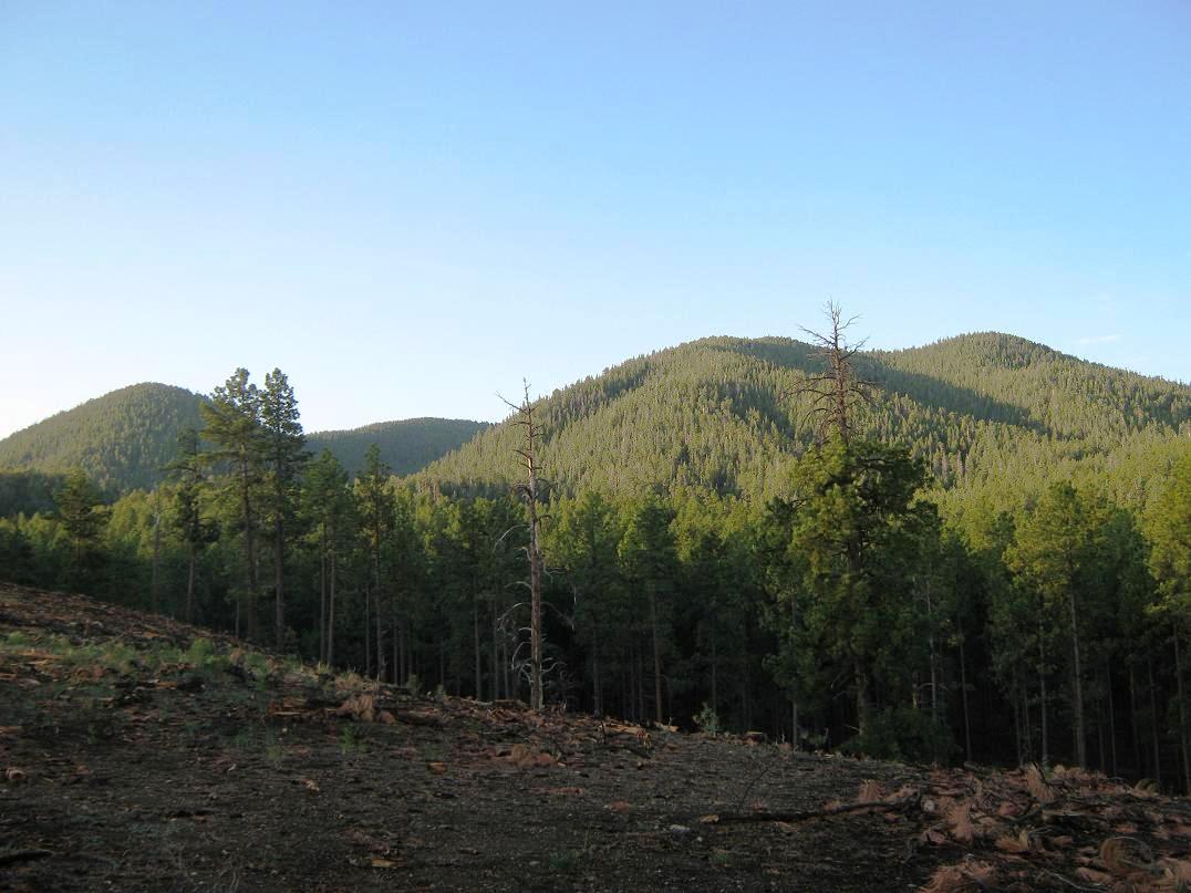
The next morning, I continued east on FR-141 for another mile and a half, coming to a prominent side road past a low-point in the road. I followed this side road about half a mile, parking near a few log piles where the forest people were cutting down dead trees. I was on a ridge about 50 feet above the drainage, the same one that starts high on Sitgreaves, visible to the south. I started hiking at 5:40 a.m., with the sun still low in the east, but the air was moist and there was no breeze. For the time being, I had hazy blue skies and temperatures about 60 degrees. It was evident that storms would build later in the day.
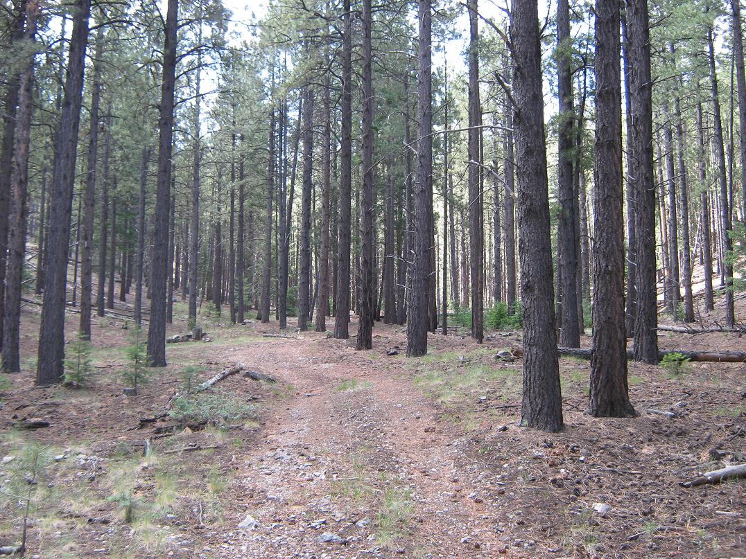
I walked the road to its end, then up open country where the Forest people had felled the trees for thinning. I covered about a half-mile when I spied a very good dirt road in the drainage below me, to my right. How did I miss that road? So I descended to it (losing about 50 feet), and walked it to its end at a large turnaround. A lesser dirt track continued south for another 1,500 feet before turning right up a slope near a rock outcrop. To here, I had walked about 1.2 miles and had gained 400 feet. The road went in a direction I didn't want, so I entered the forest here.
The going went well for the first few hundred yards. The trees --- pine, fir and aspen --- weren't too thick, and undergrowth was light. I stayed in the bottom but often climbed up onto the sidewalls of the canyon to see round the area better. Then the trees closed in. For the next half-mile, the going was slow, with many downed trees, branches, undergrowth and slick logs. There was more aspen here, which grows thickly together. I slowed here to wiggle my way around the obstacles. This stretch wasn't the most fun I've ever had, but I made steady progress.
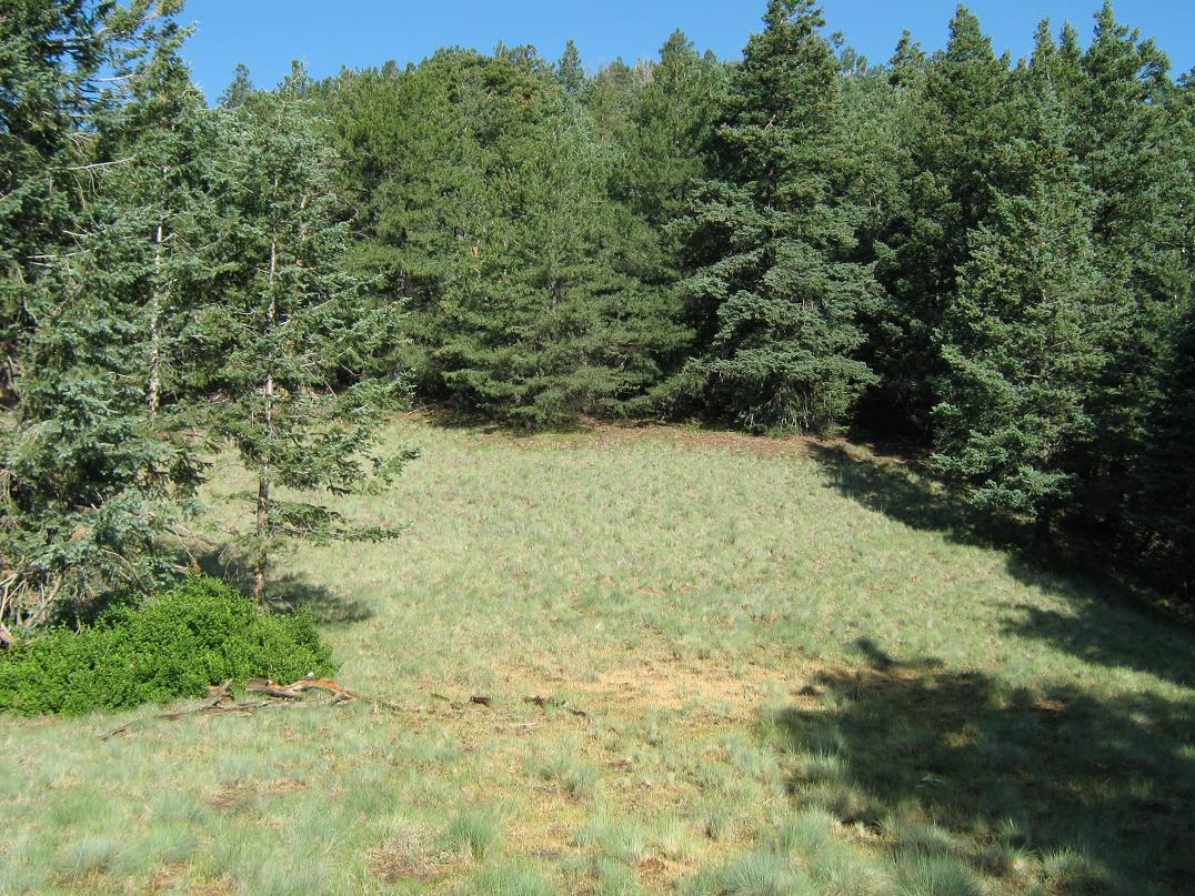
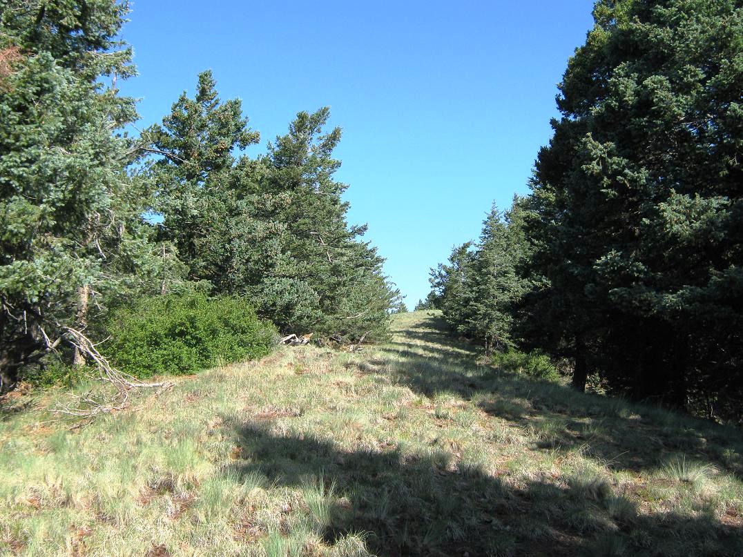
The dense patch ended not long thereafter, and the going was more open. In places, I could make out footprints and even paths. Someone had flagged orange tape on wires in some areas. The navigation was simple. After a few more minutes in the lighter growth, I came out to a steeply-sloping meadow, elevation 8,750 feet. Here, a steep drainage breaks off to the southwest, directly to the summit, while the main drainage stays south, and not as steep.
I walked up a slope between the two (noting some evidence of trail and footprints). This was steep but easy and short. Quickly, I gained 200 feet, which fed me right to the saddle directly east of the summit, elevation 8,990 feet. The saddle is open with a meadow of low grass, a very delightful place (I had come to expect more thick forest). I rested here for snacks.
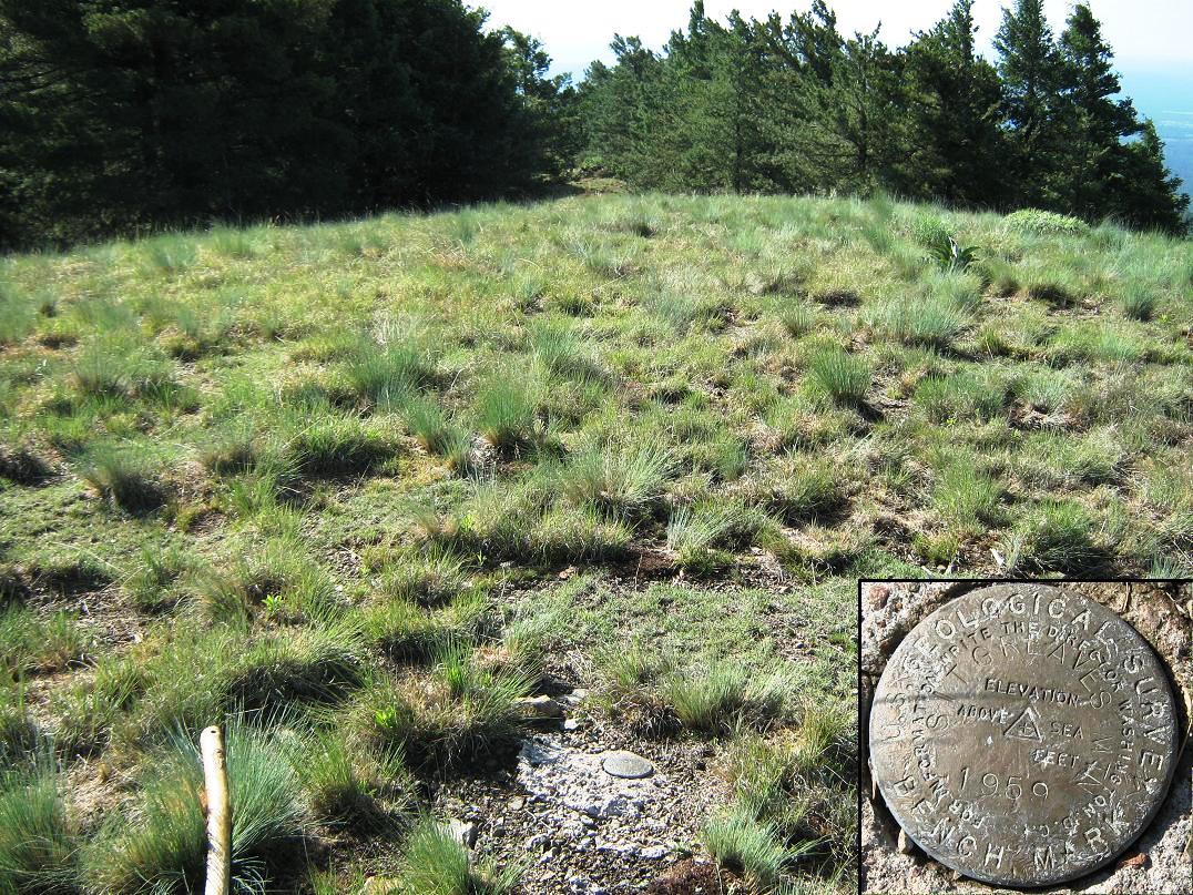
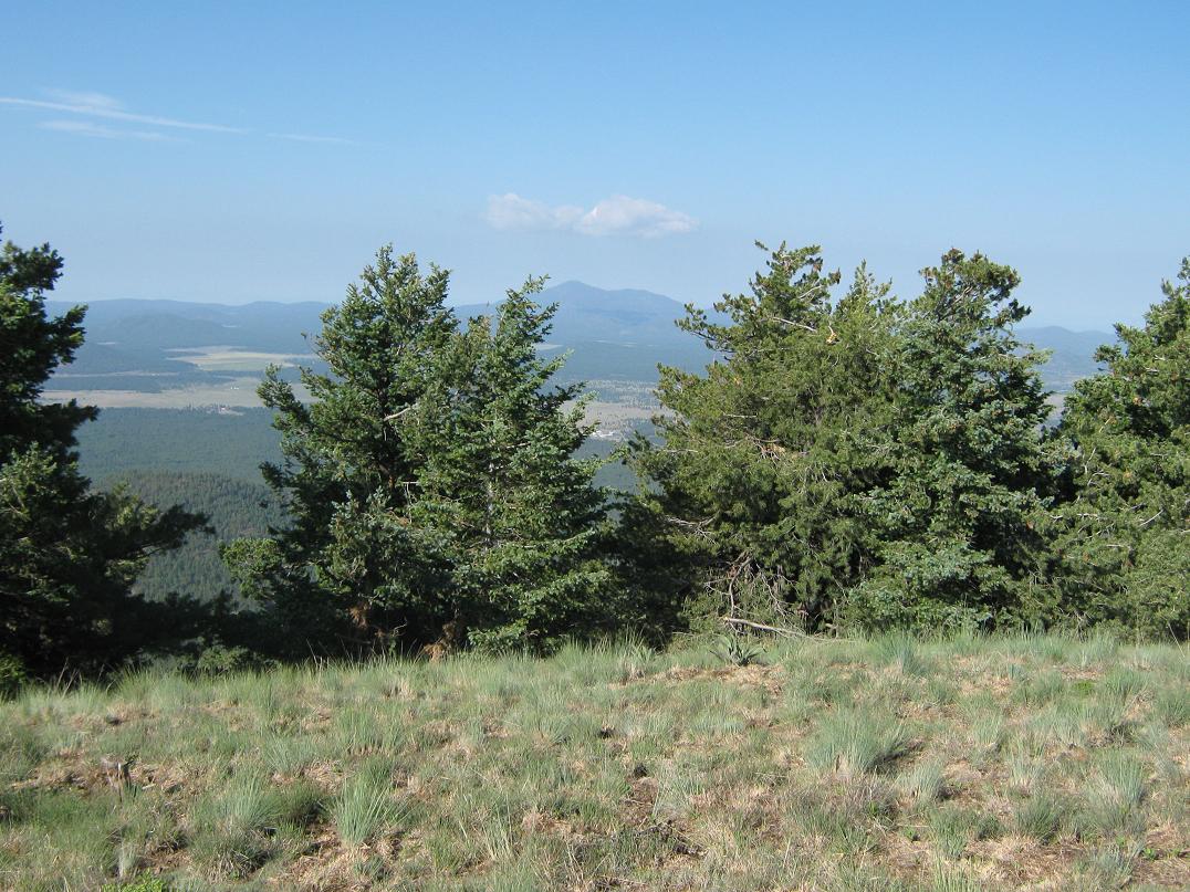
From here to the top was about 400 vertical feet, but it was all up one long grass slope. The first leg was steep but easy to walk, with its tufty grass clumps serving as good "stairs". I aimed for a pair of standing snags. Once at these, the slope moderated, and the final hundred vertical feet was up this easier slope, lined with trees, as though it was a golfing fairway. I arrived to the summit at 8:15 a.m.. The benchmark was set in concrete at the actual top. I took a few photos, relaxed and walked around the area. The sky was still hazy. Bill Williams Mountain had a small thunderhead developing while Humphreys Peak was already covered in clouds, but for the moment, there were no storms here on Sitgreaves. Navigation was never an issue on the ascent.
After about 10 minutes on the top, I decided to get moving. The walk down the grass slope was fast and easy, as the steep slope and solid footing, plus lack of rubbly rocks, meant I could jog down. I was down to the saddle and back to the 8,750-foot meadow in 15 minutes. Then, the thick aspen section slowed me down, but once past that, I had smooth sailing back to the roads. I walked these to about where I entered upon them earlier, ascending back up to the ridge so I could get back to my truck.
This proved to be a little tricky, since there were many sub-ridges due to the drainage braiding. So I walked down some ridges and played a guessing game before getting onto the right one, where my truck was just sitting there. The exit took me 90 minutes, and my whole hike just over 4 hours. I relaxed back at my truck for awhile. Some storm clouds had already developed above Sitgreaves, so I was glad to be down. From here I drove into Williams, then north toward the Grand Canyon.
My adventure continues with a stop at Bedrock City to see Fred, Wilma and the gang, then a hike up Red Butte and later, a chaser at Grandview Lookout.
|

|