
The Mountains of Arizona
• www.surgent.net
|
| Signal Peak |
• Sacaton Mountains • Central Arizona College Campus • Pinal County |
|
Date: December 25, 2021
• Elevation: 2,282 feet
• Prominence: 682 feet
• Distance: 1.6 miles
• Time: 90 minutes
• Gain: 832 feet
• Conditions: Cloudy and humid
Arizona
•
Main
•
PB
•
LoJ
•
USGS BM Datasheet
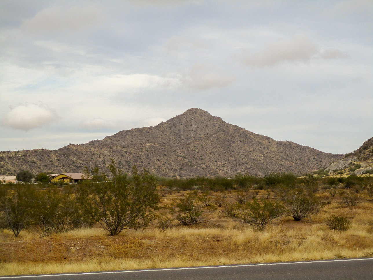
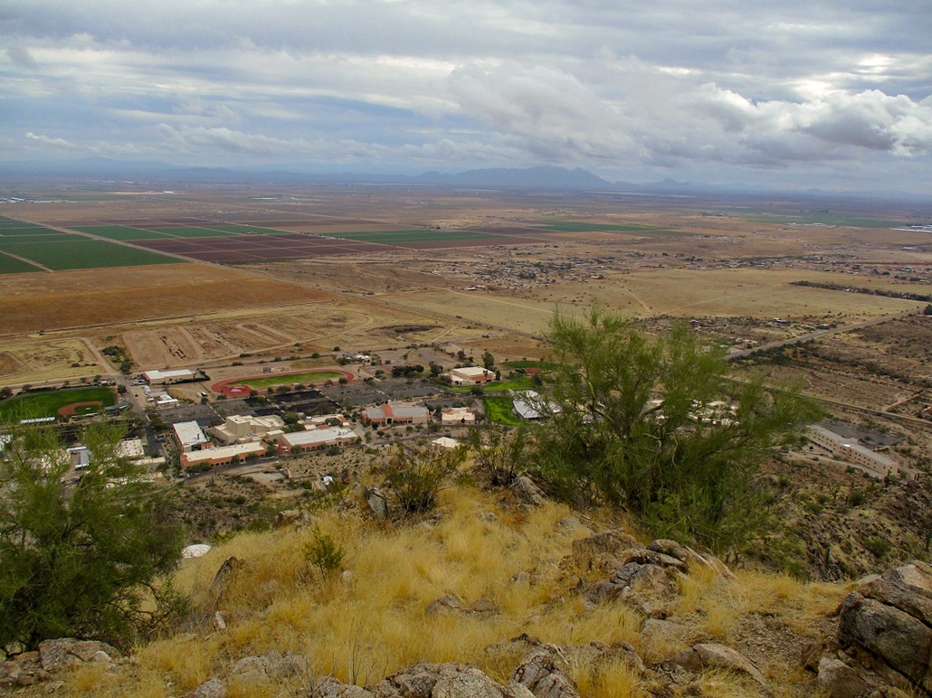
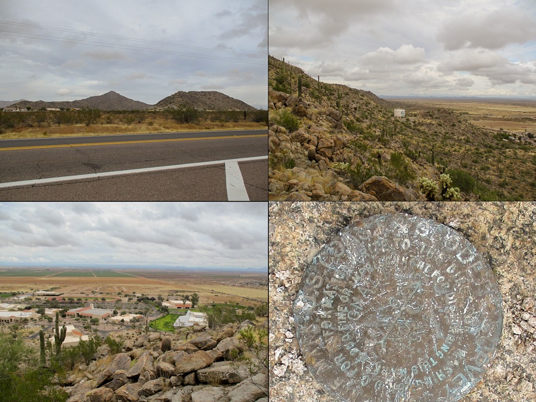
Signal Peak rises above the Central Arizona College campus, which refers to itself as the Signal Peak Campus. The peak is the southernmost "big" peak of the Sacaton Mountains, and lies about a mile south of the Gila River Indian Reservation boundary.
I was here a few years ago to inspect this peak and possibly climb it. I drove onto the campus and explored the roads, and eventually located myself on the north end of campus, the unsexy end where the work trucks are situated. Up ahead on the hillside is a water tank, so I figured that would be a viable route to explore. I hiked up a steep road to this tower, but beyond it, nothing promising. The slope got very steep fast and did not look like the best way.
Today, Christmas Day, was cloudy and gray, a storm having moved through the state yesterday. Today, there were abundant clouds, clearing occasionally for the sun to peek through, but it was not cold, surprisingly. The temperatures were in the low 60s, and with the moist air, it was rather humid.
I left home with plans to hike this peak, then possibly one or two more in the Florence-Coolidge-San Tan Valley area. I followed Interstate-10 south to McCartney Road, then east to Overfield Road, then north to the campus. Being Christmas day, it was completely deserted. I saw one police vehicle slowly driving around. He was probably bored, possibly annoyed to be doing this on Christmas, but also probably pleased to be getting double time too.
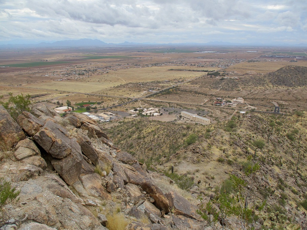
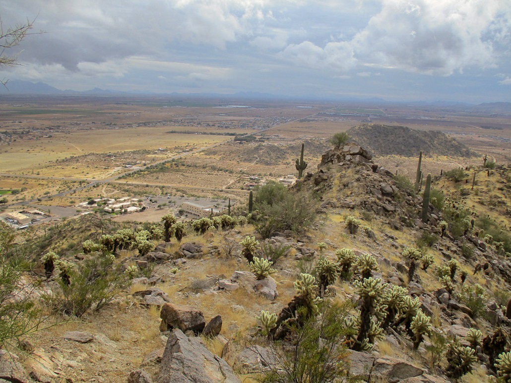
I parked in the student housing lot. There were a couple cars here, so I parked amid them to blend in. This placed me close to the main southeast ridge of the peak. In studying satellite images, there appeared to be a path along this ridge. It seems reasonable to assume people have climbed this peak. It's close to a college and to other homes, surely a few people have climbed it and beaten in a path. That was my thinking.
I walked past the dorm, then along a paved path, and when it felt right, started upslope. A few steps in and I looked down to see a lucky golf ball. Not sure how it got here, and there are no golf courses close by. So I picked it up and put it in my pocket. This was a good omen, as golf balls bring good luck to those who find them.
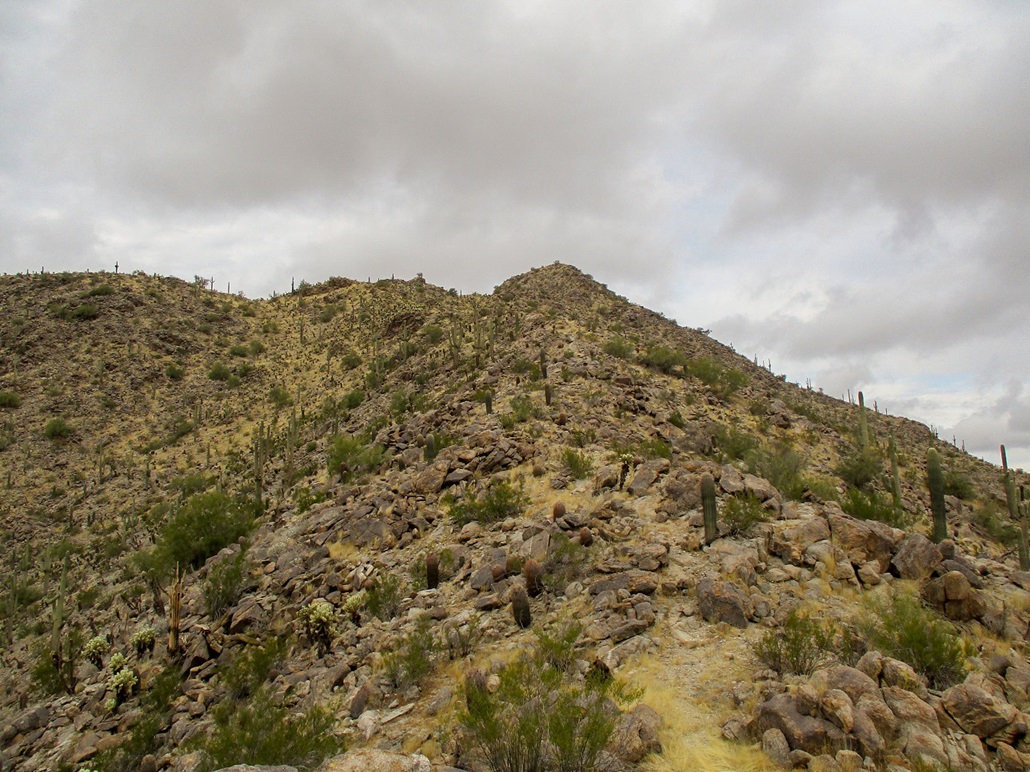
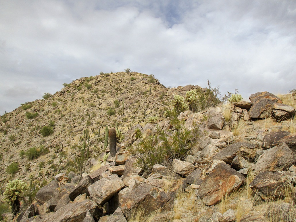
The initial slope was very steep and rocky, but short. I gained about a hundred feet and was soon atop it, now on the ridge itself. And yes, there was a path. It was weak and a little overgrown in grass, but it was definitely a path. The next few minutes went by fast. The path wandered over and mainly right of a few small rock outcrops.
I came to larger rocky barrier, and went right to sidehill it and clamber up it when a chance presented itself. I was soon atop it, about a 20-foot gain. Then the path resumed and I followed it to the next rock barrier, this one much larger.
The path went up then angled right, skirting this barrier below. I lost the path here, but used my own senses as to what to follow. I angled up and near the base of the main rocky mass, then went right and I was past it, now on a higher ridge ... and the path again. By now, the summit was much closer. I went up and down one easy rock outcrop, now in the saddle directly below the top.
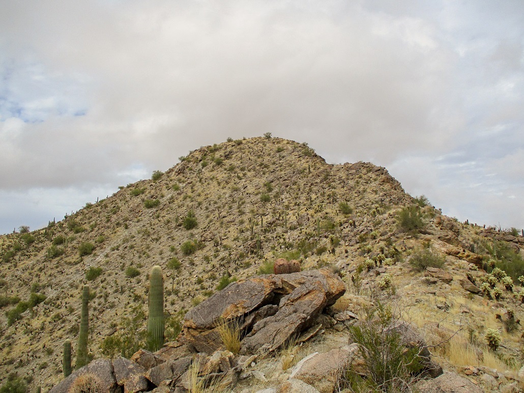
The summit was about 120 feet higher, and in front of me was a rocky slope leading up to a rock prow. I angled left and scooted up loose rocks and large boulders, gaining about 60 feet, to place me above that obstacle. This one segment was perhaps the crux of the climb, mainly because of its steepness and the loose nature of some of the slope.
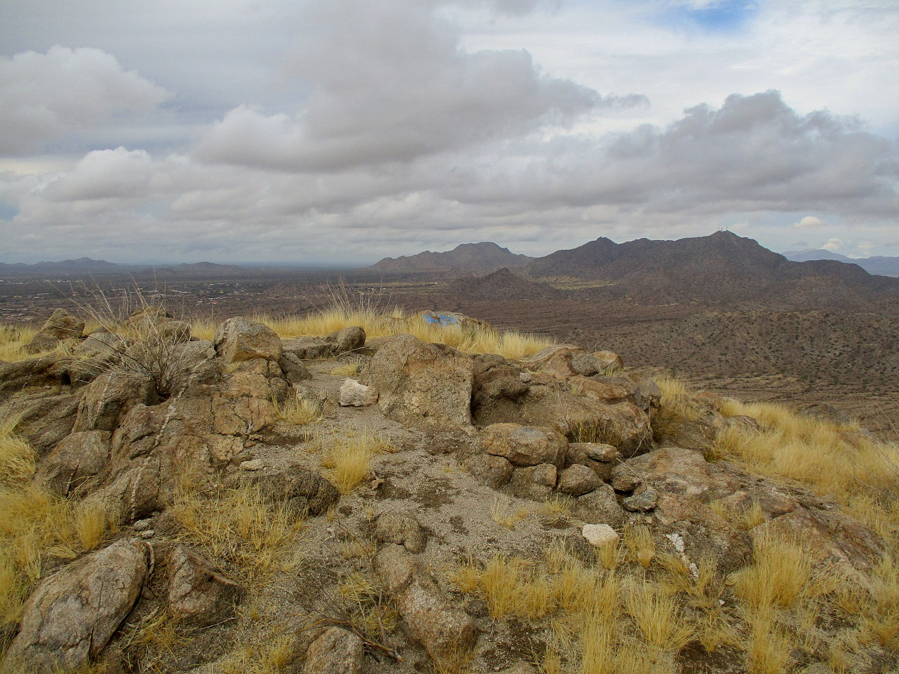
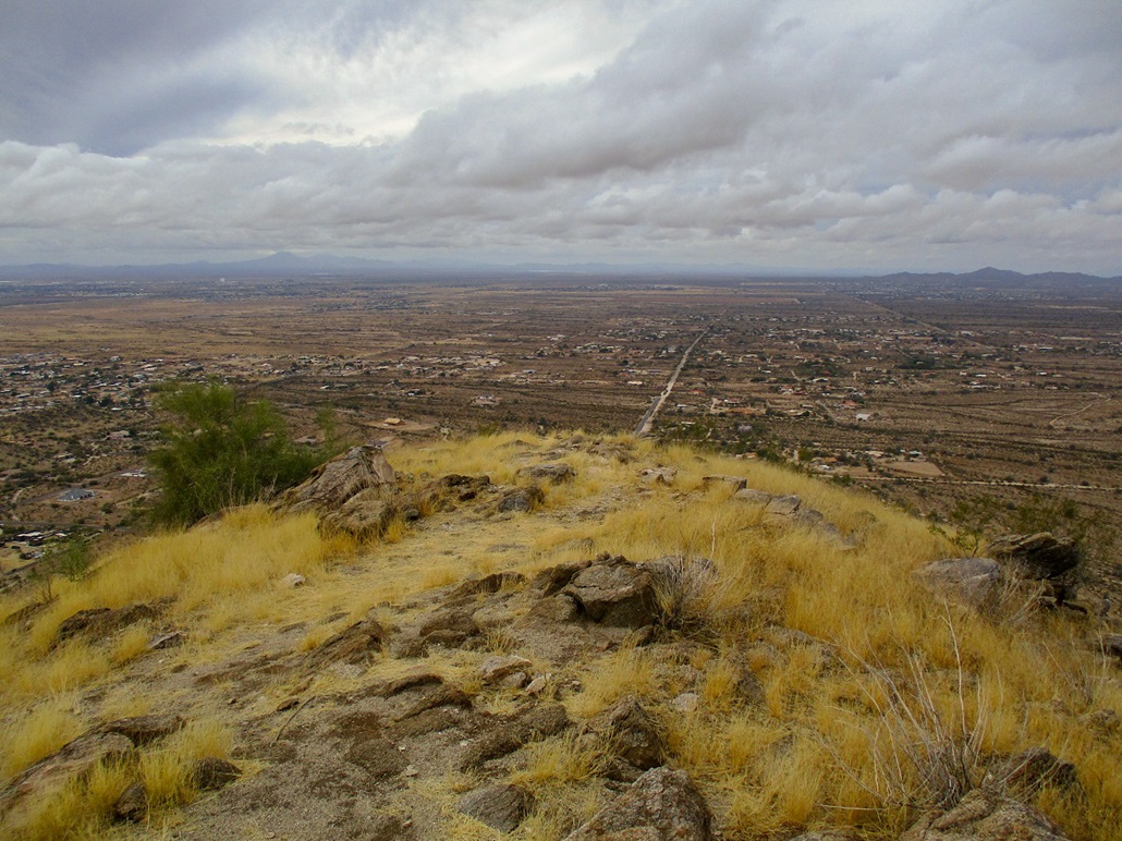
Above me were more rocks and palo verde trees, and I had to use hands a couple times to work up short chutes, but it was not difficult, just a little scratchy. I was on the top quickly, a one-way hike of 0.8 mile, but with a gain of almost 900 feet. The top is a little hump of low rock. I found a reference mark for the benchmark, which the datasheet reports was removed decades ago by "treasure hunters". A couple rocks had spray paint tags on them.
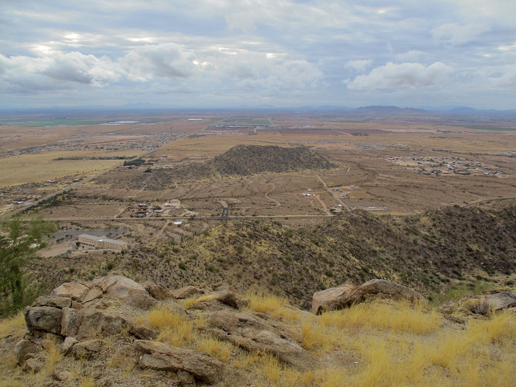
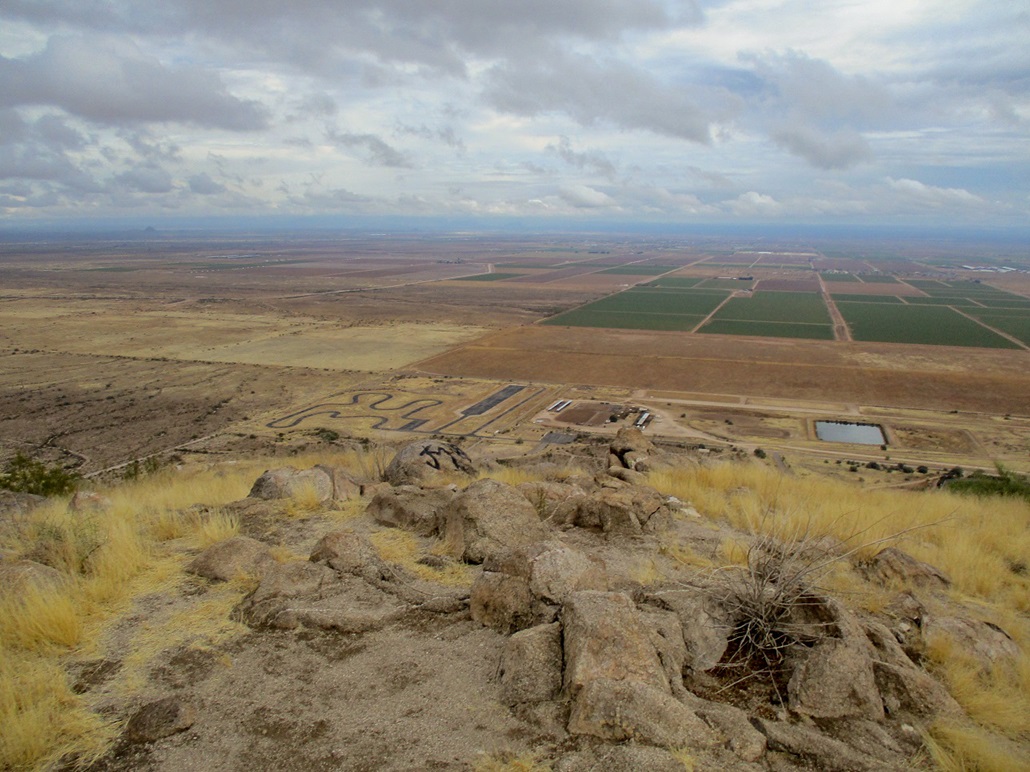
Despite the conditions, the views were good. The clouds did not hang low, so I could see all the peaks around me, and even ones about 30 miles away. I wish I had bluer skies for nicer photos, but I was pleased overall with what I had today. I did not stay long. I wanted down the loose section sooner than later.
The hike down went slow, and I butt-scooted much of the steep loose segments, then walked carefully down the rest. I moved carefully, and was down off the mountain, taking about the same amount of time as I had going up. I credit the lucky golf ball for my success.
The round trip hike had taken me 90 minutes and had gone well. It was rocky but no moves were ever greater than very low Class-3. This peak may not interest more casual hikers, but those up for a little challenge will like this peak.
I left the area by following roads into Coolidge. I hadn't been in Coolidge since I don't know when, maybe once or twice with my wife passing through. Back in 1993, my dad had me go check it out as he was applying for a Chief of Police position they had open. I told him that mom would kill him if they moved there.
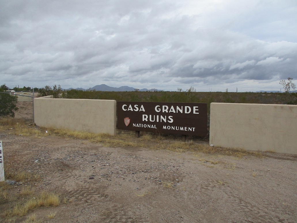
On the north end of town is the Casa Grande National Monument, home to the Big House (i.e. "Casa Grande" in Spanish), a two-story wood and caliche structure built by the Hohokam many centuries ago, perhaps the only multi-story structure they built (at least that are still standing). I was here on that same fact-finding trip in 1993. Today, I just wanted a photo and to step on the monument highpoint, which is on its southeast corner. That took just moments.
I continued through Florence, then up the Hunt Highway. I was looking at a couple small hills in the area, but frankly, wasn't that enthusiastic about what I saw, so I just drove back to my pad. I was pleased to be successful on Signal Hill, and that was sufficient for me, a Christmas gift to myself.
|


|