This is Peak 2199 on Peakbagger and Lists of John. It is part of the Sonoran Desert Preserve and the Sidewinder Trail gets very close to its top. Going by the naming theme for the hills out this way, I dub thee Sidewinder Trail Vista.
This band of hills runs generally from where Carefree Highway and Interstate-17 meet, then southeast for about 10 miles, ending near the Cave Buttes Dam Recreation Area. These hills have no name that I know of. They lie north of the Union Hills. I've hiked two other hills in this unnamed grouping, Tramonto Peak and Ridgeback Overlook. There are many trails here now, a relatively new development. These are fine trails, wide enough for bicyclists, who seem to outnumber hikers, at least what I've seen.
Anyway, I had the day open and the mornings were still tolerable, with temperatures in the 70s. I wanted a hike but not a long drive. My initial goal were a pair of peaks in the Union Hills to the south, Peaks 2111 and 2045, which hem in the old (and new) Cave Buttes Dams.
I was up early and in the area by 5:30 a.m., the day sunny and still pleasant. I first looked at Peak 2045, the eastern of the two peaks. Satellite images show trails all over this hill and it looked like it would go fast. A newer housing development lies south and east of this hill. The most logical starting point would be where Pinnacle Peak Road (named Desert Peak Parkway on the online maps) suddenly "ends" near some ongoing construction.
I rolled in and past the initial set of barriers, then got to a second set where all the construction guys were parking. I decided I would try elsewhere, so I tried the littler avenues with all the homes. However, there are no convenient places to park, no little open spaces or parks where I could park without being too obvious. These are nice homes but crammed close together, and there were many "neighborhood watch" signs. They might be watching me, so I decided to bail. I spent about 20 minutes at this task. I'll return on a later date when the Pinnacle Peak Parkway is built out. I nixed my plans for Peak 2111 as well, and decided to go north about five miles and hike this peak, the one you're reading about.
I went north on Cave Creek Road to Dove Valley Road, then to the Apache Wash Trailhead parking area. It was 6 a.m. and people were already here, hiking, biking and some with horses. I got my stuff together and locked the car, and started hiking at 6:10 a.m.. I studied the map of trails at the kiosk and tried to memorize key items. I decided to follow the trails up and over Ridgeback Overlook, then catch the Sidewinder Trail and get to the summit that way. There are other ways to combine the trails, but I went with this partly because I was already familiar with the portion to Ridgeback.
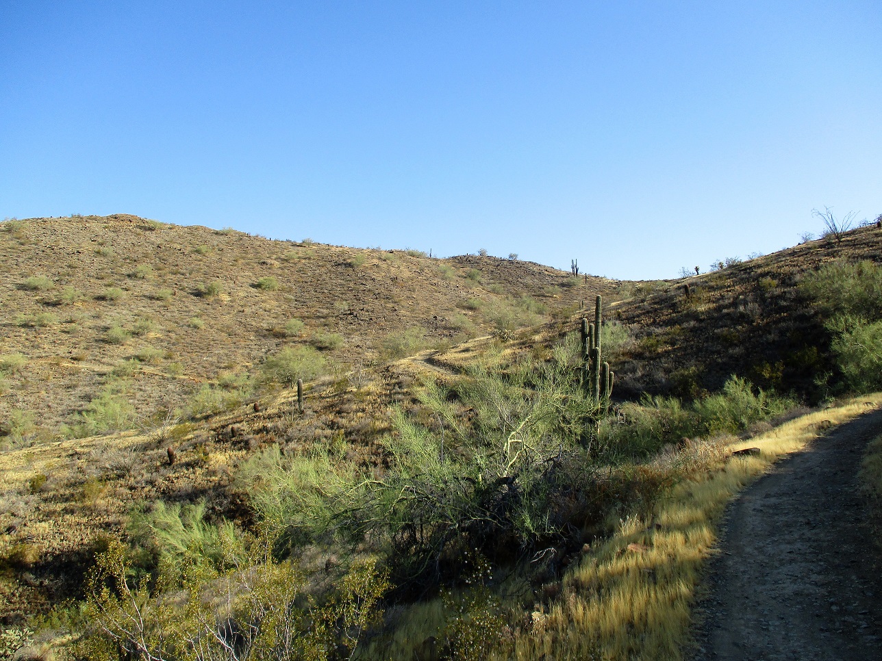
I followed the Ocotillo Trail west for 0.68 miles (going by the figures on their map), then north on the Ridgeback Trail, gaining nearly all the elevation to its summit before dropping down about 170 feet into a broad wash and desert arroyo complex. There were a few hikers out and about. Once coming down the north slopes of Ridgeback, I did not see anyone.
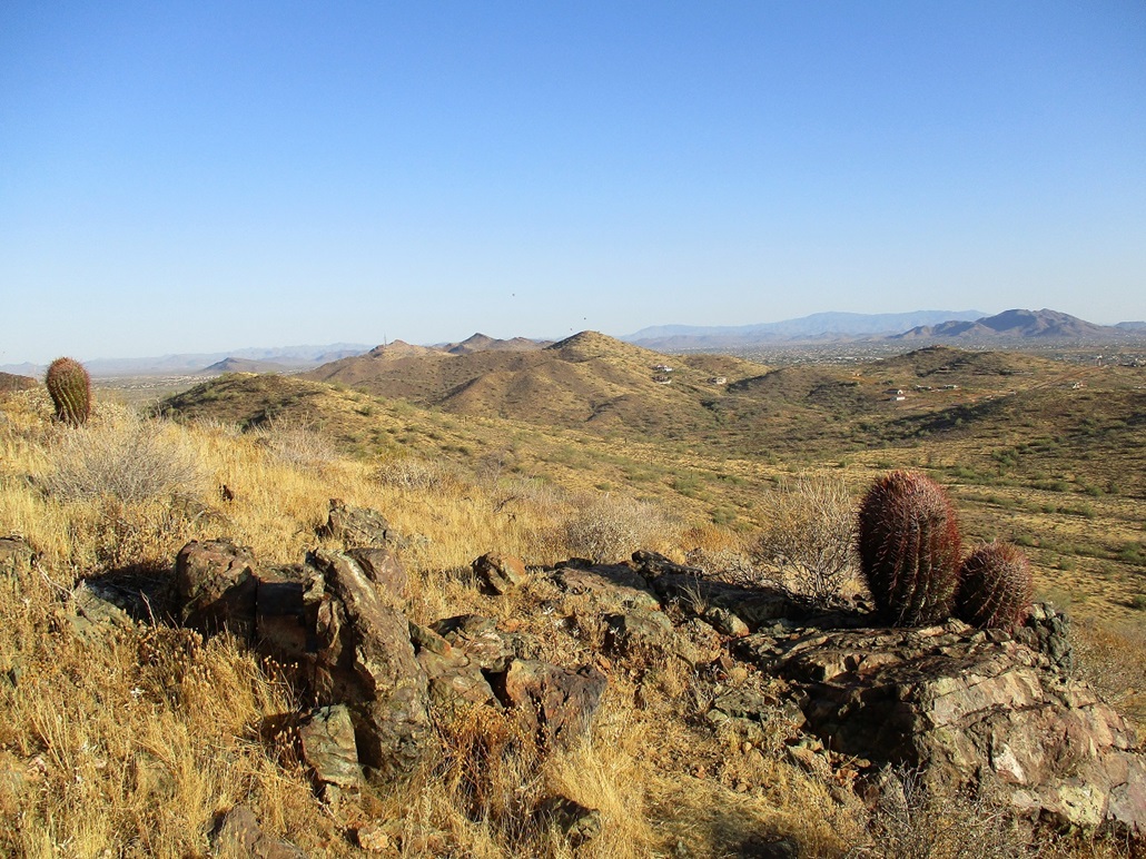
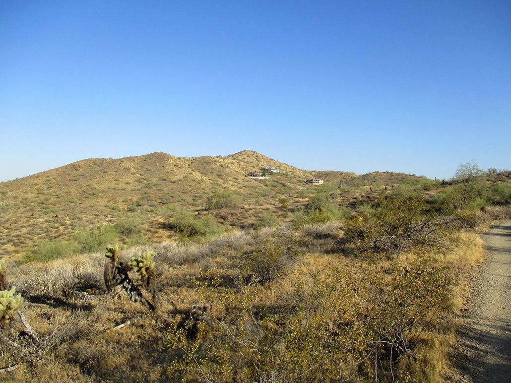
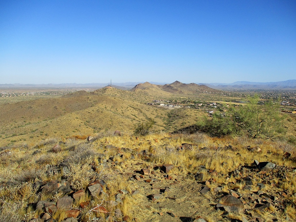
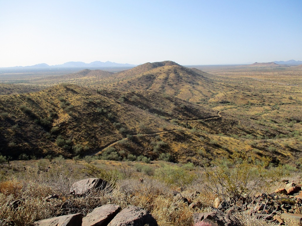
I was on the Ridgeback Trail for 1.55 miles to where it meets the Sidewinder Trail. I then went west and into and out of about three arroyos, with signs put up to warn against bees. The summit was visible, lying above a pricey home built on its east slopes. The trail gained elevation and curled into and out of the folds of the terrain before going up to get near the top.
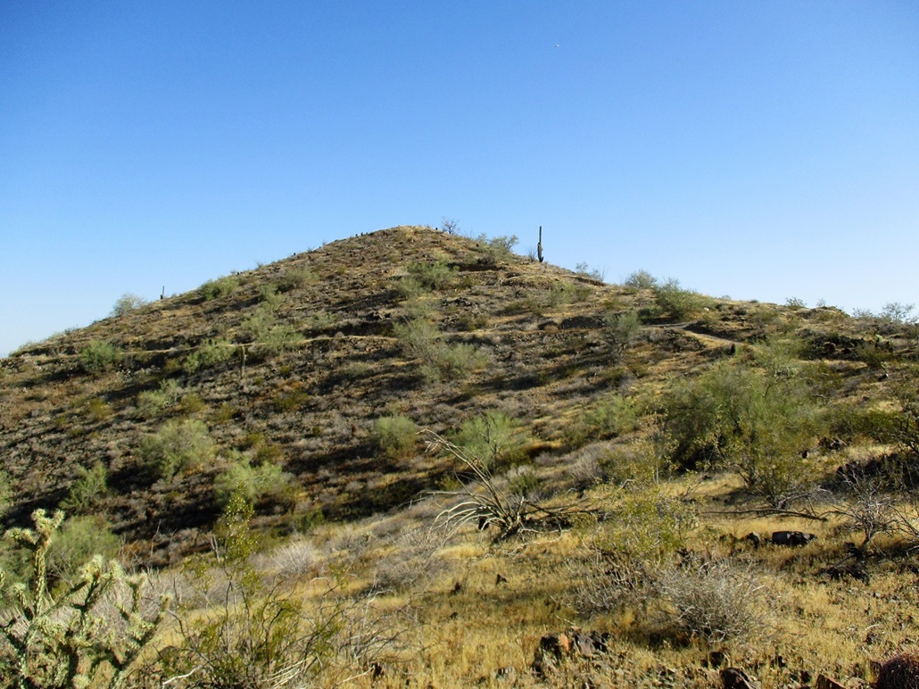
The trail then cuts left and continues on its way. I found a spur trail which gains the final 80 feet or so to the top. I saw a woman slowly inching down the trail, so I waited to let her get down the trickiest parts. We talked briefly, and she warned me it was slippery up there. I then continued on up, gaining the summit at 7:30 a.m.. The final 30 feet was rubbly with loose footing, so I watched myself here. I had to estimate my mileage on this stretch, deciding that 1.1 miles felt about right.
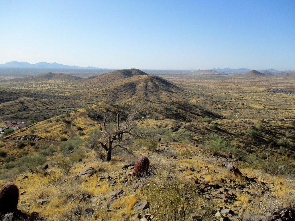
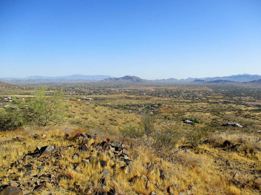
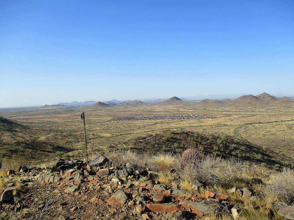
The views were nice, with the sunny day and no humidity to muck things up. I shot a few images but did not stick around. It was already warming up and I wanted to be hiking back down as fast as I could. I was amused by that home on the east slope. It lies just about a hundred feet below, maybe an eighth of a mile away. They can probably hike here any time they want and not break a sweat.
I retraced my route out exactly. The regain up and over Ridgeback was slow-going. By now, temperatures were pushing into the 80s. There was an occasional breeze and it was not too bad, but the sun was intense and made it feel hotter than it really was. I was back to my car at 8:40, hiking about 6.6 miles round trip. The net gain from trailhead to the top was just under 480 feet, but all the drops and regains pushed my totals near a thousand feet. I got a good workout and felt tired, a little hot and very thirsty, but like I got my money's worth.
Today being a workday for everyone else, I had to battle traffic back home. The day's temperature would get to about 105 degrees. I realize that this may be it for the desert bumps for a few months. Soon, even the morning lows will be in the high 90s.
This peak can be reached via other trail segments from the Apache Wash Trailhead, some that bypass Ridgeback and its big gain and drop and regain. There is also a trailhead up on Carefree Highway and some unofficial let-in points from the roads emanating off of the Carefree Highway. I enjoyed the hike and the critters. I saw no bees or snakes but did see a number of lizards and birds. I also saw a lot of bicyclists, especially on the latter half of my hike out.